MOSCOW ALPINISM AND ROCK CLIMBING FEDERATION
Report
On the ascent of the Demchenko CSKA team
To the summit 3652 m. Working name — peak TK MISiS (TK MISiS)
Central Caucasus, Koshtan-krest ridge. (43°4′5.09″ N 43°17′16.41″ E)
via the southern ridge First ascent. Presumably 2A category of difficulty.
Galimzyanov T.R. — Zaryaev V.V.
2016
Ascent participants
- Leader — Galimzyanov Timur Ravilievich. 2nd sports category. Coach: Kuznetsova E.V. Address: 115193, Moscow, Leninsky prospect, 35, apt. 33. gal_timur@yahoo.com, +7 916 433 9820
- Zaryaev Vladimir Valerievich. 2nd sports category1
Route 2A to the summit 3652 m via the southern ridge
Ascent passport
- Central Caucasus, Koshtan-krest ridge, classifier section: 2.5.
- 3652 m (43°4′5.09″ N 43°17′16.41″ E) via the southern ridge
- Proposed — 2A category of difficulty, first ascent
- Route type: rock
- Route height difference: 800 m. Route length: 1500 m. Average slope: main part of the route — 30°; entire route — 20°.
- "Hooks" left on the route: total — 0; including bolted — 0.
- Team's working hours: 3.5 hours (not including descent), 1 day
- Leader: Galimzyanov T.R., 2nd sports category Participants: Zaryaev V.V., 2nd sports category
- Coach: Kuznetsova E.V.
- Approach to the route with overnight stay under Koshtan pass, Ulluuuzna glacier: 07:00, August 3, 2016. Route started: 07:00 August 3, 2016. Summit reached: 10:30, August 3, 2016. Return to base camp: 11:30, August 3, 2016. Descent from the summit: via the ascent route.
- Organization: Moscow Alpinism and Rock Climbing Federation, Demchenko CSKA
- Responsible for the report Galimzyanov Timur Ravilievich. gal_timur@yahoo.com, +7 916 433 9820
General photograph of the summit
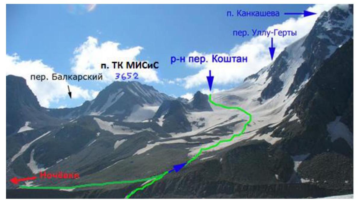
Figure 1. View of the summit 3652 from the glacier. Photograph taken from Alexey Skazik's report.
Photograph of the route profile
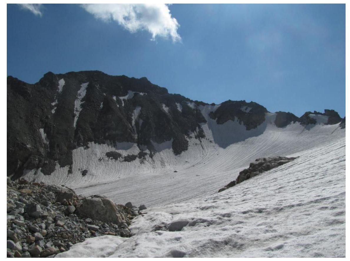
Figure 2. 3652 m. Photo from Ulluuuzna glacier, taken on August 3, 2016. Route via the S ridge (2A).
Figure 3. Map of the area.
Central Caucasus, Koshtan-krest ridge, Gerty glacier
Brief description of the area
"The Koshtan-krest ridge is located to the east of the Koshtantau summit and is a continuation of its Eastern ridge in the neighboring Mizhirgi and Bezengi valleys, Dumala. The ridge closes the Dumala valley to the east and south, and the Tyutyun and Gerty valleys to the north and west. The western part of the ridge lies between the Ullu-Auz and Trud passes with an average height of 4400 m. To the east from the Mira peak, a long, heavily dissected ridge descends with several unnamed summits. The eastern part of the ridge, with a height of 3900–4000 m, stretches from the Trud pass to the east to the Kayashkisuubashi summit. Climbers rarely visit the summits of the ridge, as the approach from the Bezengi alpine camp takes 1–2 days. All the Northern and Southern walls and counterforts of the ridge, routes from 3rd to 5th categories of difficulty, are still waiting for their conquerors. The ascent to the Mira peak via the long, with several rock rises and unnamed summits, Eastern ridge is very interesting, the route is classified as 5th category of difficulty." Description from http://www.kmvline.ru/lib/center/25.php↗ is used.
Approach
From the Bezengi valley up the Dumala valley to overnight stays under the Koshtan pass (1 travel day). Overnight stays are located under the Koshtan pass (from the west), to the right of the right-bank moraine of the Ulluuuzna glacier. The ascent can be logically carried out within the framework of an approach to the Gerty glacier.
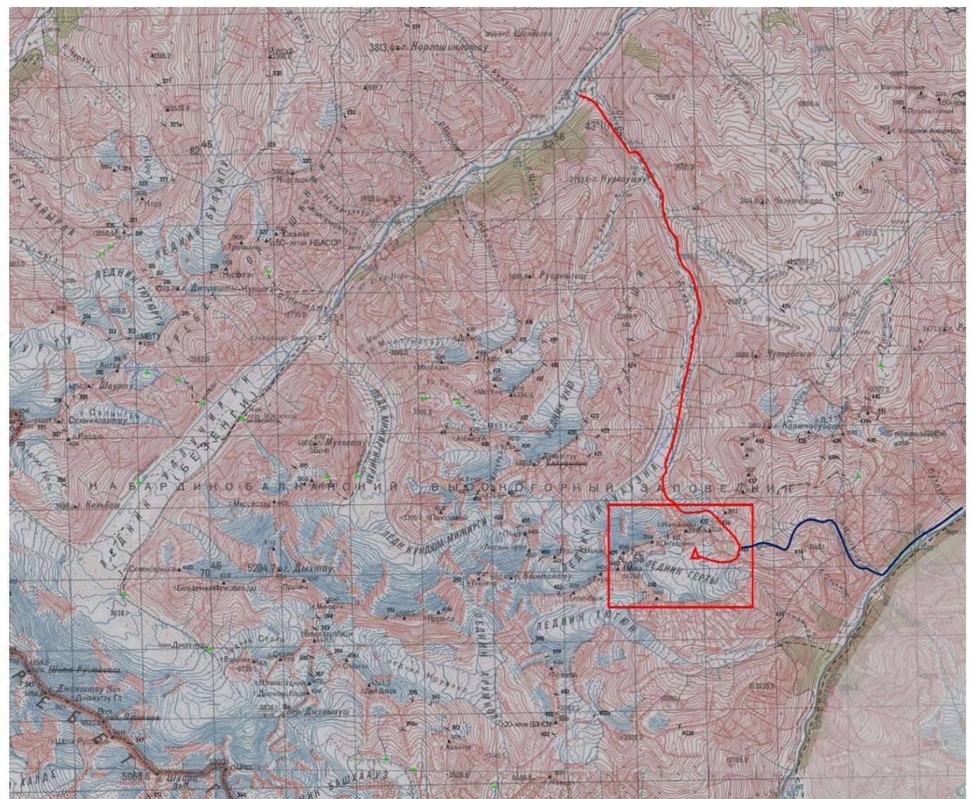
Figure 4. Route map from the Bezengi and Upper Balkaria valleys to the Gerty glacier. The ascent area is marked.
Supplement
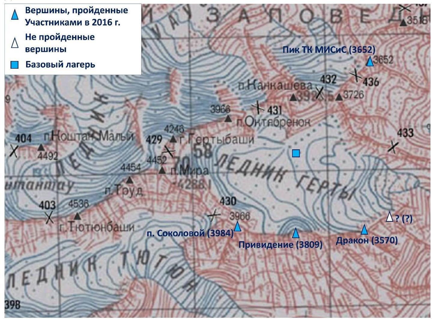
Figure 5. Summits reached as a result of the 2016 trip. Also marked is the summit that was not attempted (see report on the ascent of the Dragon summit).
Technical photograph of the summit
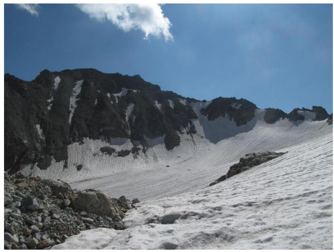
Figure 6. 3652 m. Photo from Ulluuuzna glacier, taken on August 3, 2016. Route via the S ridge (2A).
Description of the route's difficulty sections
| Section # | Length | Slope | Terrain characteristics | Category of difficulty | Number of hooks |
|---|---|---|---|---|---|
| R0–R1 | 200 m | 25° | Snow-ice slope | 1 | 0 |
| R1–R2 | 600 m | 10° | Firn slope | 0 | 0 |
| R2–R3 | 700 m | 30° | Rocky ridge | 2 | 0 |
Brief description of the route passage by sections
Overnight stays are located 1600 m from the slope leading to the snowy-icy Koshtan pass. The route starts from the slope leading to the pass.
R0–R1 Snow-ice slope leading to the pass cirque. Movement in rope teams with simultaneous belay. 2 25° 200 m. R1–R2 Through the cirque, movement towards a pronounced depression in the ridge — Koshtan pass. Pass ascent — firn slope 20–30 m, 30°. 2 10° 600 m. R2–R3 From the pass, left to the st. p. TK MISiS via the rocky ridge. Exit to the ridge bypassing the first sentinel rock to the left upwards, then along the boundary of snow and rocks. Further along the ridge, overcoming short ascents of simple destroyed rocks. The ridge leads to a saddle. The next rocky-scree slope is passed with a bypass of sentinel rocks to the right. The exit to the second part of the ridge occurs along a pronounced destroyed groove. Further 100 m to the summit. Simultaneous movement in rope teams. 2 35° 700 m.
Descent
Descent from the route is carried out via the ascent route.
Route recommendations
The route can be assessed as relatively safe. Belay is organized without particular problems. Key hazardous moments on the route: movement along the rocky ridge consisting of destroyed rocks, many loose rocks.
Route length 1.5 km, height difference 500 m.
Photo illustration of the report

Figure 7. Ascent route marked with a red line.
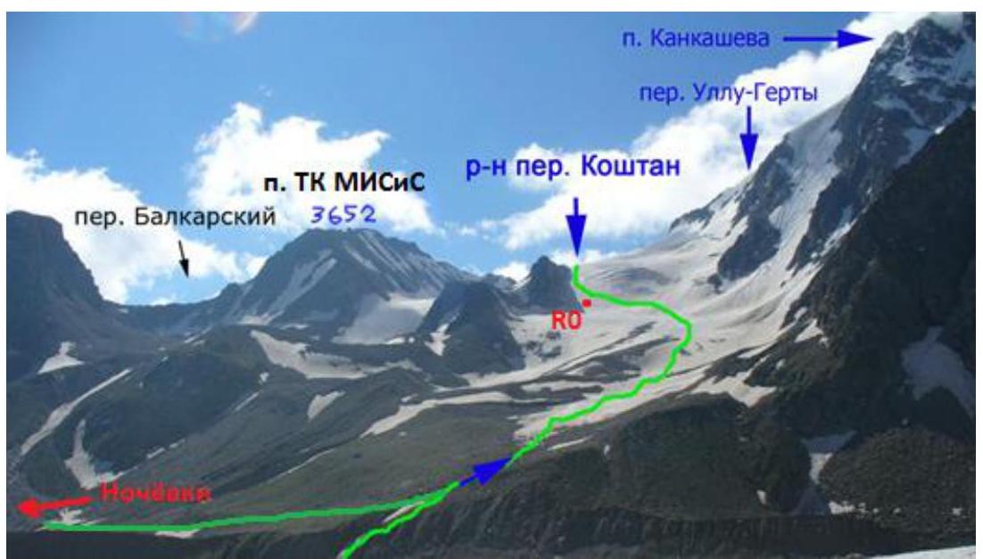
Figure 8. General view of the summit, as well as the snow-ice slope (section R0–R1). Photograph taken from Alexey Skazik's report.
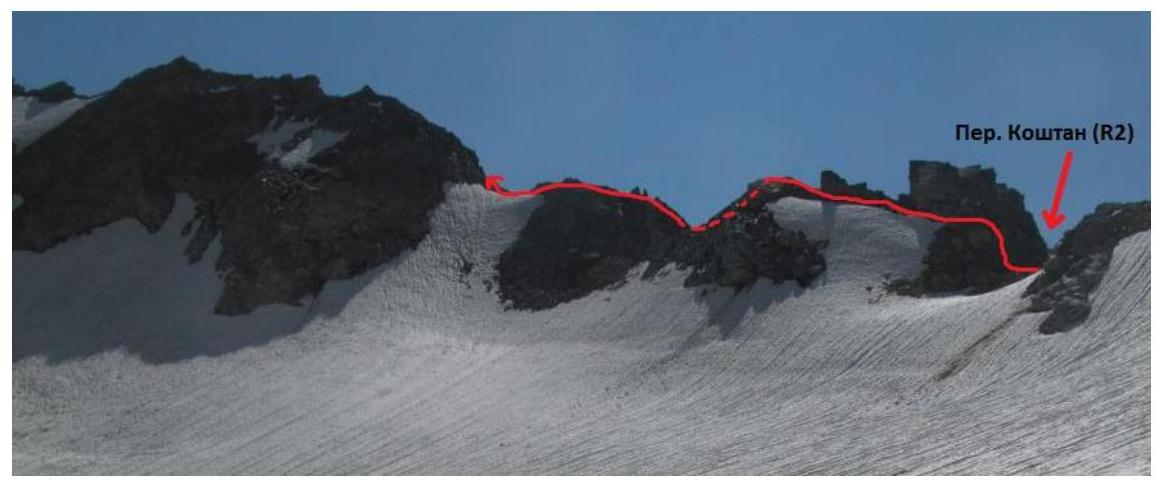
Figure 9. View of the first part of the summit ridge. The exit to the ridge from Koshtan pass is visible.

Figure 10. First part of the ridge. View from the route. The red line indicates the start of the path from Koshtan pass.
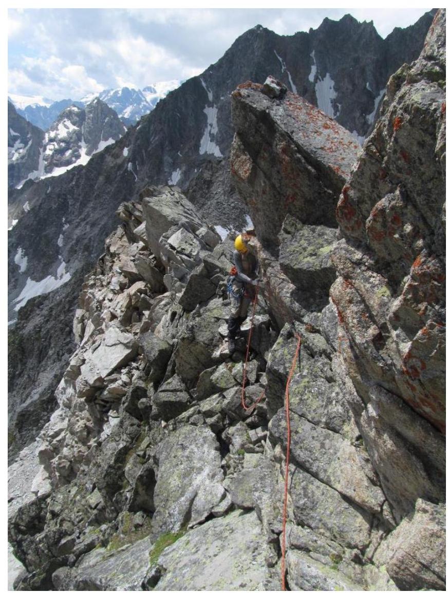
Figure 11. Passage of one of the sections of the first part of the ridge.
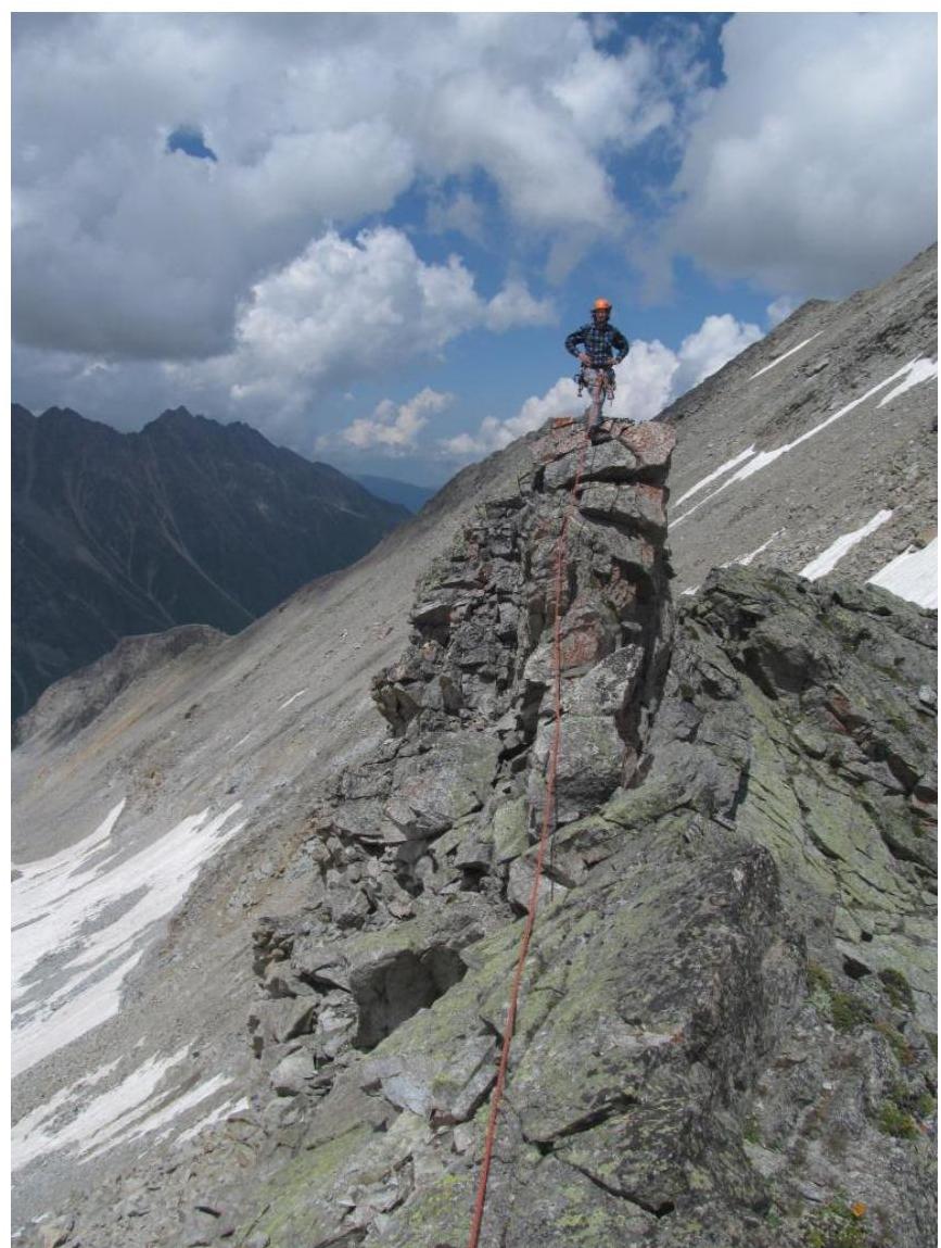
Figure 12. One of the sections of the first part of the ridge.
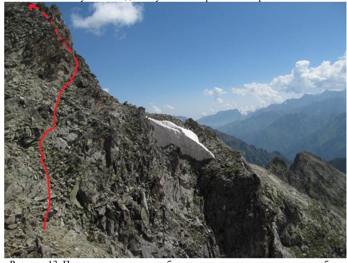
Figure 13. Passage from the depression in the ridge to the second part of the summit ridge.
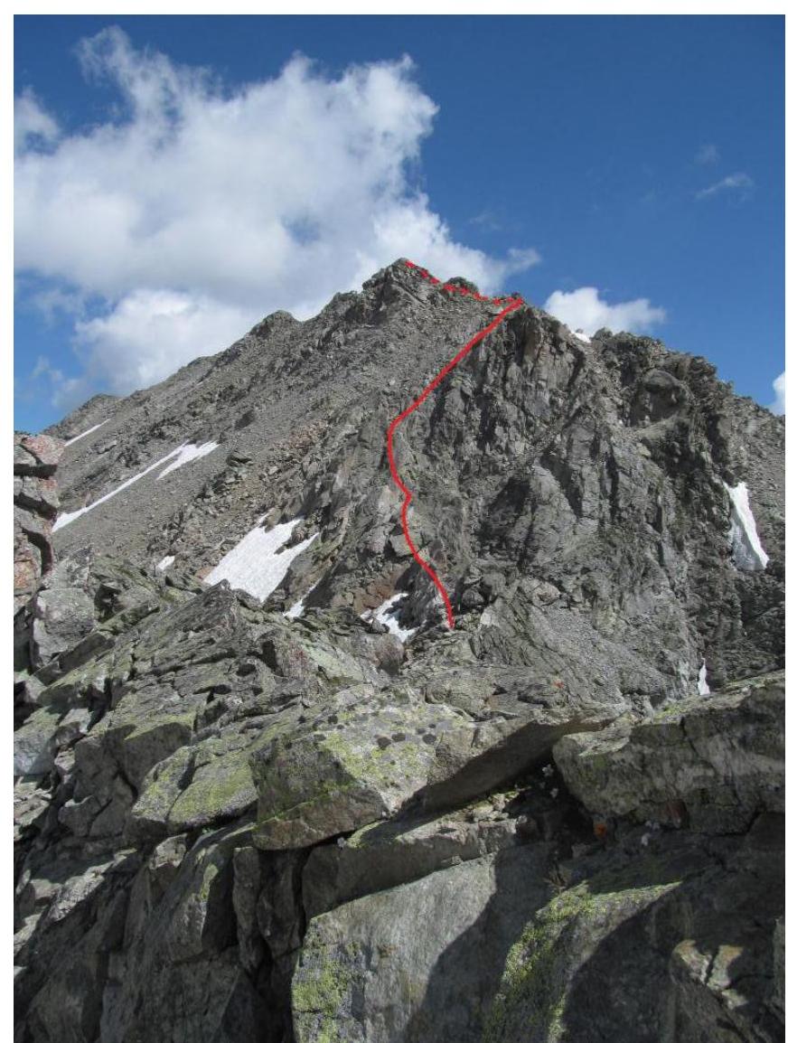
Figure. Second part of the summit ridge. The route is marked with a red line.
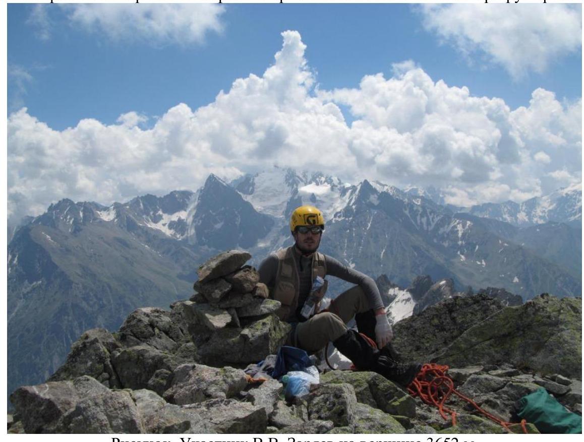
Figure. Participant V.V. Zaryaev on the summit 3652 m.

Figure. Participant V.V. Zaryaev on the summit 3652 m.
Footnotes
-
¹ Actual full name: Nikitin Vladimir Valerievich (Zaryaev — pen name) ↩