Russian Championship 2024 (altitude-technical class)
Report
on the ascent to the summit of Ural (V), 4273 m, via the South-Eastern wall of the Southern counterfort (V. Makarova, 1986) 5B
Combined team of St. Petersburg:
- Nikita V. Donkov — 1st sports category
- Artur A. Matinyan — Master of Sports
- Konstantin A. Orlov — Candidate Master of Sports
Table of Contents
I. Ascent Passport — 3 II. Description of the Ascent — 5
- Characteristics of the Ascent Object — 7
1.1. General photo of the summit — 7 1.2. Photo of the route profile — 8 1.3. Drawn profile of the route — 9
- Route Characteristics — 10
2.1. Technical photograph of the route — 10 2.3. Route diagram in UIAA symbols — 11
- Team Actions Characteristics — 14
3.1. Description of the route passage — 14 3.2. Photo of the team at the summit by the control tour — 16 3.3. Route safety assessment — 17 Photo materials — 18
I. Ascent Passport
| 1. General Information | ||
|---|---|---|
| 1.1 | Full name, sports rank of the leader, instructor | Nikita V. Donkov, 1st sports category |
| 1.2 | Full name, sports rank of participants | Artur A. Matinyan, Master of Sports; Konstantin A. Orlov, Candidate Master of Sports |
| 1.3 | Full name of the coach | Tatyana I. Timoshenko |
| 1.4 | Organization | St. Petersburg Alpine Federation |
| 1.5 | Date of the ascent | October 10–11, 2024 |
| 2. Characteristics of the Ascent Object | ||
| 2.1 | Region | Central Caucasus |
| 2.2 | Valley | – |
| 2.3 | Section number according to the 2013 classification table | 2.5. From Kithlod pass to Gezivtsék pass (north of the Main Caucasus Range) |
| 2.4 | Name and height of the summit | East Ural, 4273 m |
| 2.5 | Geographical coordinates of the summit (latitude/longitude), GPS coordinates | 43.08334097, 43.21170351 |
| 3. Route Characteristics | ||
| 3.1 | Route name | via the South-Eastern wall of the Southern counterfort |
| 3.2 | Proposed difficulty category | 5B |
| 3.3 | Degree of route exploration | – |
| 3.4 | Terrain type of the route | Rocky |
| 3.5 | Elevation gain of the route (altimeter or GPS data) | – |
| 3.6 | Route length (in meters) | 740 m |
| 3.7 | Technical elements of the route | III difficulty category rocks – 50 m, V difficulty category rocks – 500 m, VI difficulty category rocks – 190 m |
| 3.8 | Average steepness of the route, ° | 71° |
| 3.9 | Average steepness of the main part of the route, ° | 80° |
| 3.10 | Descent from the summit | Descent via the ascent path to the saddle on the ridge, then — down the south-western wall |
| 3.11 | Additional route characteristics | No water. Snow possible. |
| 4. Team Actions Characteristics | ||
| 4.1 | Time of movement (team's walking hours, in hours and days) | 11.25 hours, 2 days |
| 4.2 | Overnights | Overnight on R6, on R8, ledges on the ridge R8–R12 |
| 4.3 | Route preparation time | – |
| 4.4 | Departure to the route | October 10, 2024, 7:15 |
| 4.5 | Summit arrival | October 11, 2024, 7:00 |
| 4.6 | Return to the base camp | October 11, 2024, 16:50 |
| 5. Weather Conditions | ||
| 5.1 | Temperature, °C | +5 °C during the day, –5 °C at night |
| 5.2 | Wind speed, m/s | 3–4 m/s |
| 5.3 | Precipitation | Heavy snowfall on the second day |
| 5.4 | Visibility, m | 40–50 meters on the second day |
| 6. Person responsible for the report | ||
| 6.1 | Nikita V. Donkov, donkov1337@gmail.com |
II. Description of the Ascent
The Central Caucasus is the highest and most inaccessible part of the Greater Caucasus mountain system. The Bezengi region, part of this mountain system, occupies a relatively small area between the Tviber pass and the Digor spur. Nevertheless, the high density of peaks exceeding 5000 meters above sea level and walls with a total elevation gain of 1500–2000 meters makes this area one of the most unique mountain regions in the world. North of the Central Range, on the north side of the Bezengi Glacier, lies the system of mountains of the Lateral Range. Six peaks in the area exceed 5000 meters, four of which are located in this range. This is the main sporting mountaineering area of the region, forming a horseshoe around the Mizhirgi glacier cirque. The walls of the area are sharply divided into northern and southern:
- "Northern walls are typically snow-ice and combined, with steep rocky bastions, ice drops, and snow cornices.
- Southern walls are predominantly rocky."
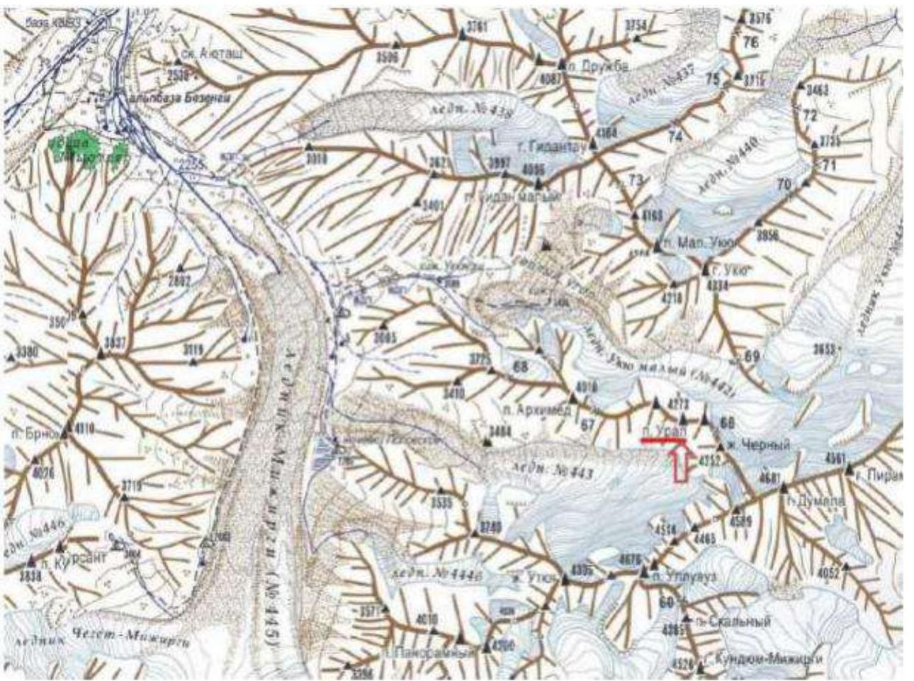
Figure 1. Map-diagram of the ascent area. The route wall is indicated by a red arrow.
The initial bivouac is located in the so-called "third alley" — the next lateral valley after the "Warm Corner" when moving up the Mizhirgi Glacier. From the Bezengi alpine camp, move up along the trail leading to Popovskie bivouac. Before the "Helmet" rock, turn left up onto the trail going along the grassy slopes. After the ascent, the grass will give way to small and medium talus. On the moraine between the walls of Ural and Ulluauz is a safe place for overnight stays. The approach from the Bezengi alpine camp takes 4.5–5 hours. It is possible to stop earlier after exiting the large talus onto a more gentle slope.
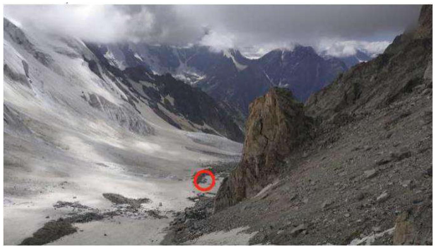
Photo 1. One of the possible overnight locations is marked in red. The photo is taken from the lower part of the route.
1. Characteristics of the Ascent Object
1.1. General photo of the summit
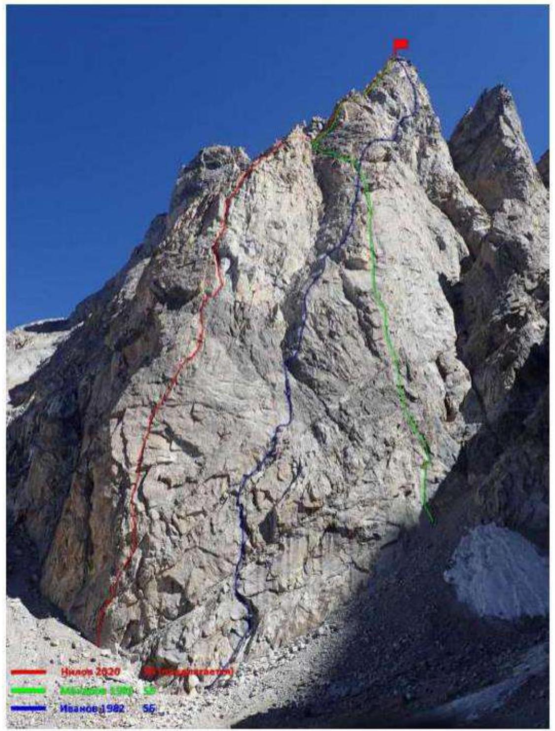
Photo 2. General photo of the summit with adjacent routes.
1.2. Photo of the route profile
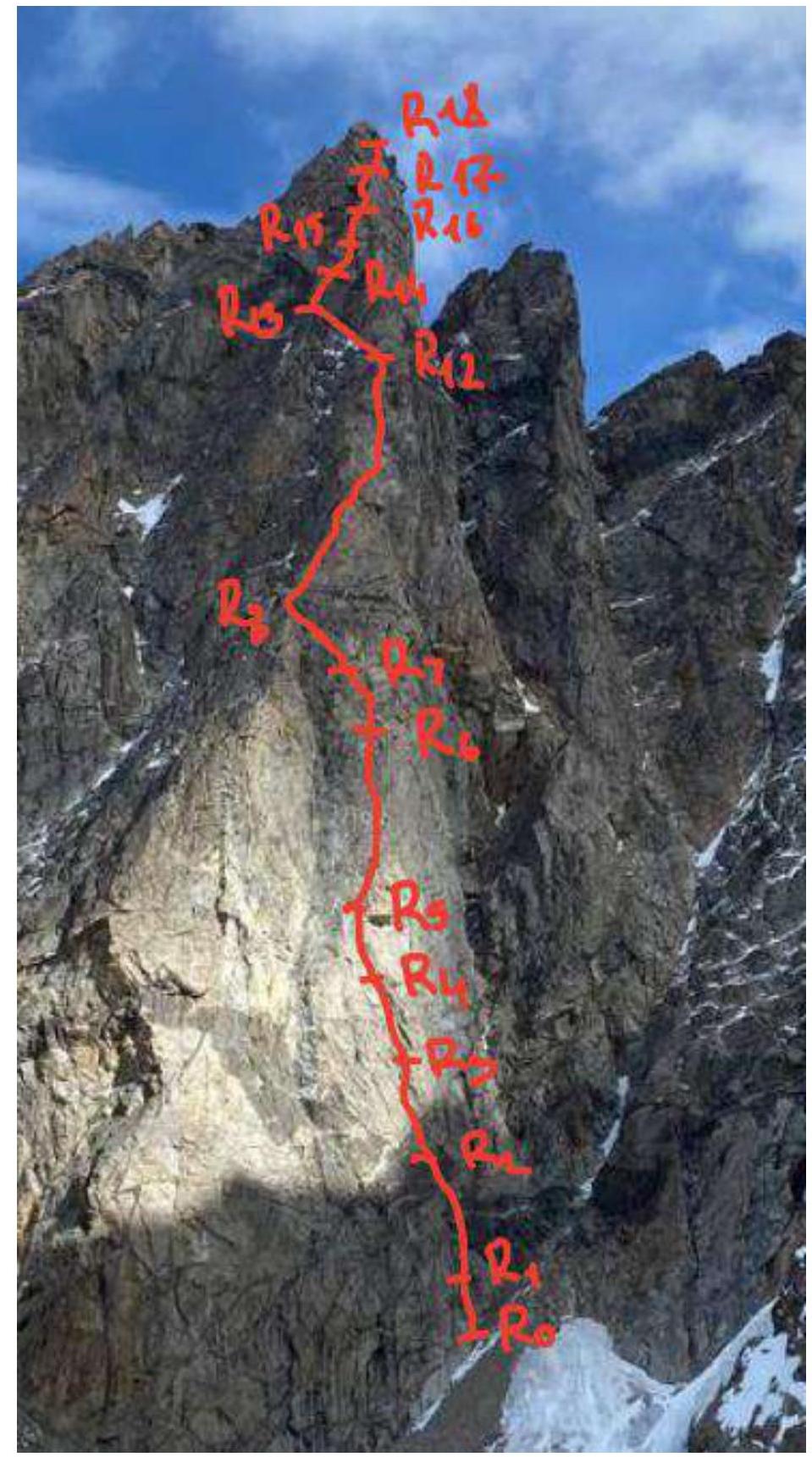
Photo 3. Photo of the route profile.
1.3. Drawn profile of the route
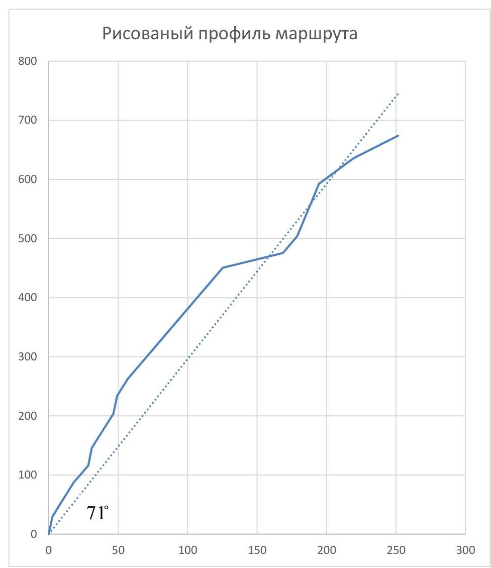
Figure 2. Drawn profile of the route.
2. Route Characteristics
2.1. Technical photograph of the route
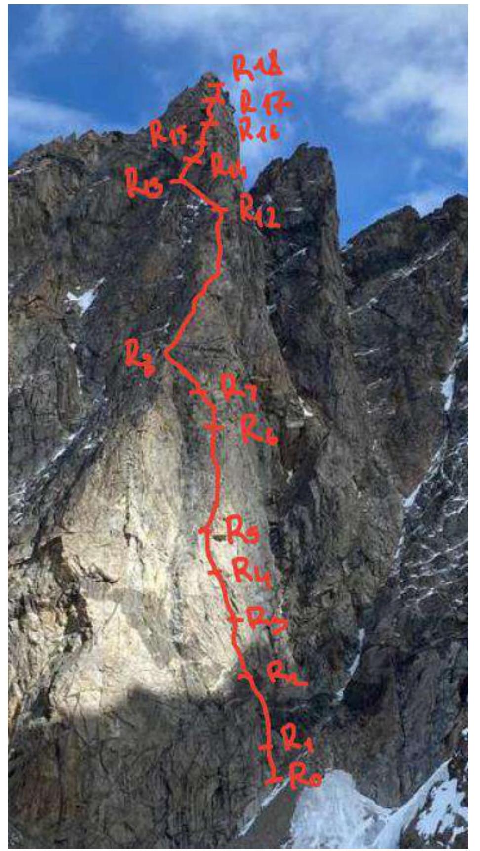
Photo 4. Technical photograph of the route.
2.2. Section numbers correspond to the section numbers on the route diagram in UIAA symbols.
2.3. Route diagram in UIAA symbols
| Section № | Name and number of pitons (∅) | Insurance points, characteristics in symbols | Route line in UIAA symbols | Complexity of the section in UIAA symbols | Section length, m | Steepness, ° | |
|---|---|---|---|---|---|---|---|
| Anchor | Camalot 4 | ||||||
| R17–R18 | 0 | 5 | IV | 50 m | 50° | ||
| R16–R17 | 2 | 5 | IV | 50 m | 60° | ||
| R15–R16 | 2 | 4 | V–VI | 30 m | 80° | ||
| R14–R15 | 1 | 5 | V–VI | 60 m | 80° | ||
| R13–R14 | 2 | 3 | V | 30 m | 70° | ||
| R12–R13 | 0 | 1 | III | 50 m | 30° | ||
| R8–R12 | 7 | 10 | 0 | V | 200 m | 70° | |
| R7–R8 | 1 | 4 | 0 | V | 30 m | 75° | |
| R6–R7 | 2 | 4 | VI | 30 m | 85° | ||
| R5–R6 | 4 | 5 | 0 | V | 60 m | 75° | |
| R4–R5 | 2 | 3 | 0 | VI | 30 m | 85° | |
| R3–R4 | 0 | 5 | V | 30 m | 70° | ||
| R2–R3 | 3 | 4 | V | 30 m | 75° | ||
| R1–R2 | 2 | 3 | V | 30 m | 75° | ||
| R0–R1 | 3 | 4 / 2 | VI | 30 m | 85° |
3. Team Actions Characteristics
3.1. Description of the route passage
| Section № | Description | Photo № |
|---|---|---|
| R0–R1 | Landmark — inner corner in the "black rocks". From the piton left up to the inner corner. After it, left onto a ledge. | Фото 6 |
| R1–R2 | Up under the cornice, which is bypassed on the right. Under the cornice is a driven piton. Exit to the next belt of black rocks. On the way, a station for rappelling will be encountered. | Фото 7 |
| R2–R3 | Straight up under the inner corner with a wide slot. | |
| R3–R4 | Up through the wide crack. "LIVE BLOCKS PRESENT!" Station in a slightly overhanging part. | |
| R4–R5 | Exit from under the overhang onto an inclined ledge. | Фото 8 |
| R5–R6 | From the ledge, right up through a series of walls. Exit under the overhanging rusty wall. Large horizontal ledge for a tent. Located below and to the right of the exit point. | Фото 9 |
| R6–R7 | Climb under the rusty overhang, keeping to the left part. The overhang should remain on the right. Station at a point with a rappelling loop. | |
| R7–R8 | Straight up, then left onto the ridge saddle. There's a place for a tent. | Фото 10 |
| R8–R12 | Move up along the broad ridge consisting of inner corners and walls. Good ledges for tents are encountered. | |
| R12–R13 | Traverse left, to the saddle on the left side of the broad ridge. To the black rocks. | Фото 11 |
| R13–R14 | Up, through a small cornice to a large inner corner. | |
| R14–R15 | Up the inner corner to a small platform on the ridge. | Фото 12 |
| R15–R16 | Down the ridge, under the wall. Traverse left, to the couloir. Then ascent up the wall. Convenient niche for a station. | |
| R16–R17 | Further up the easy rocks — exit into the scree couloir. On the left, under the wall, will be a good place for a tent. | Фото 13 |
| R17–R18 | Bypass the wall on the right, along the destroyed rocks and a small ledge. Exit to the summit. | Фото 14, 15 |
| Descent | Descent via the ascent path to R8. Then move right along the direction of travel. There are loops for descent. |
3.2. Photo of the team before the ascent to the summit
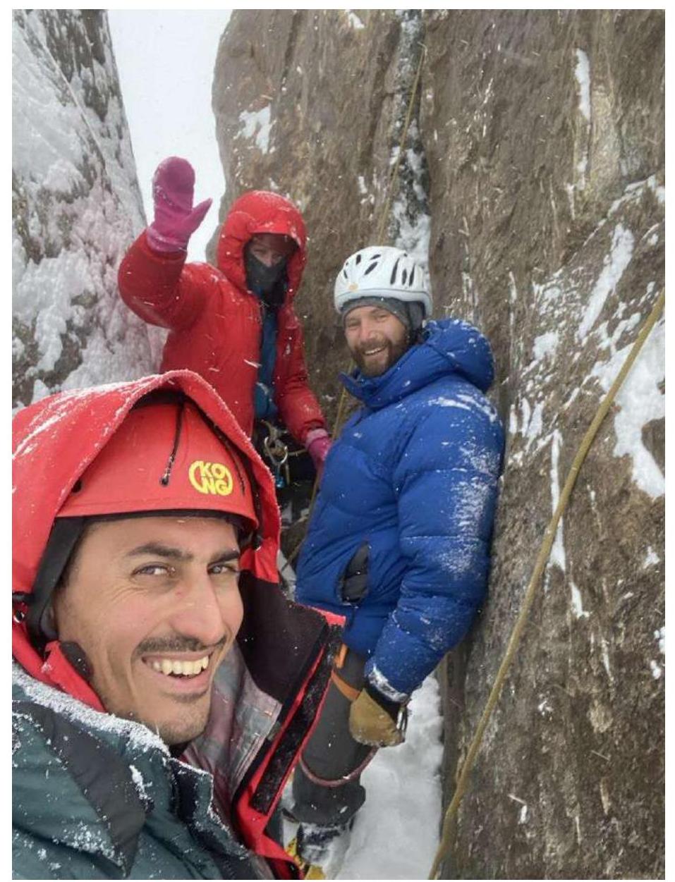
Photo 5. Team under the summit.
3.3. Route safety assessment
The route is largely monolithic throughout, except for a few places.
It is highly not recommended to:
- move along the ridge if another team is descending below the saddle on the ridge.
Consider that:
- everything that falls along the ascent path after the saddle falls along the descent path.
The team's overnight stay on the route is explained by the short daylight hours in October.
Photo materials
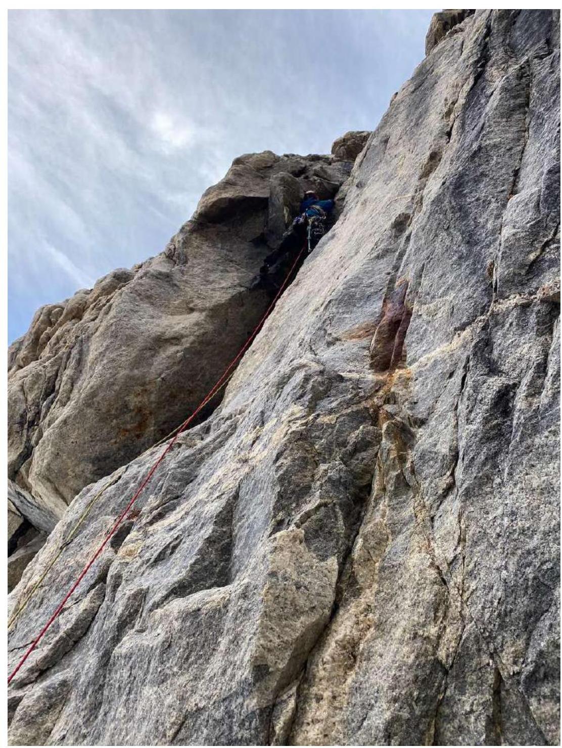
Photo 6. R0–R1. Inner corner. Nikita V. Donkov is leading.
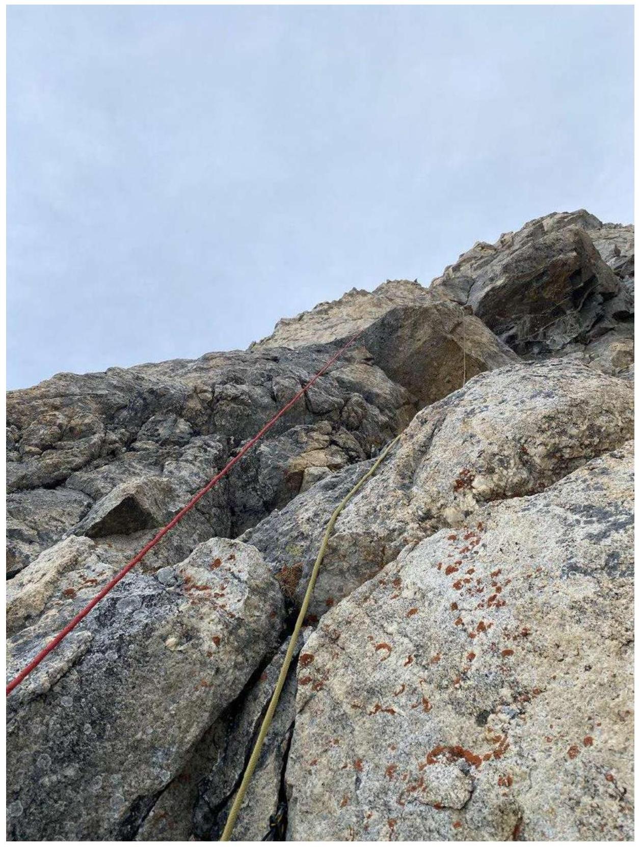
Photo 7. R1–R2. Small cornice.
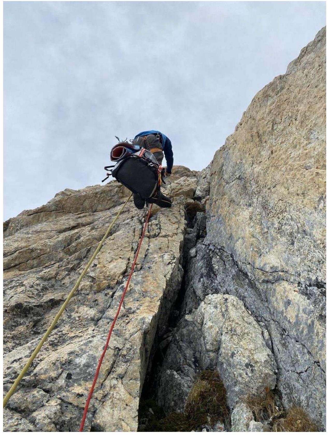
Photo 8. R4–R5. Start of the section. Behind the bend — an inclined ledge.
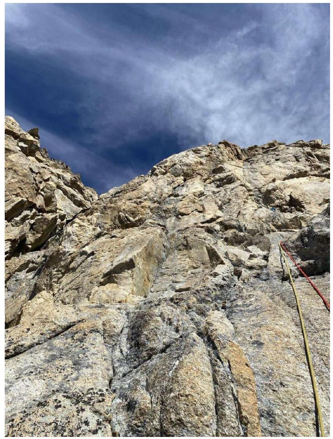
Photo 9. R5–R6. View of the overhanging rusty wall.
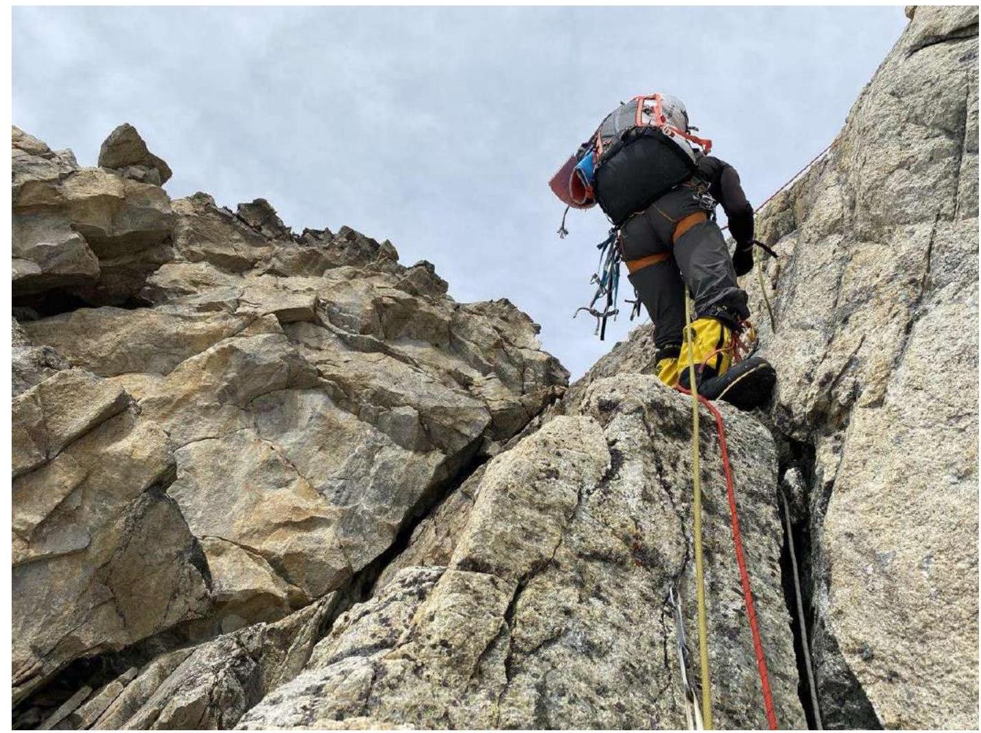
Photo 10. R7–R8. Station before exiting onto the saddle. Konstantin A. Orlov is working as the second.
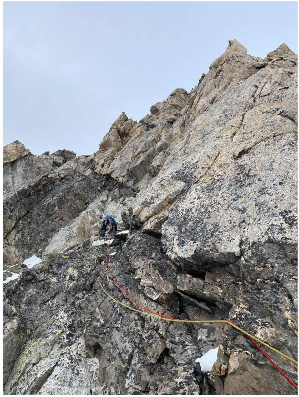
Photo 11. R12–R13. Traverse left to the black rocks.
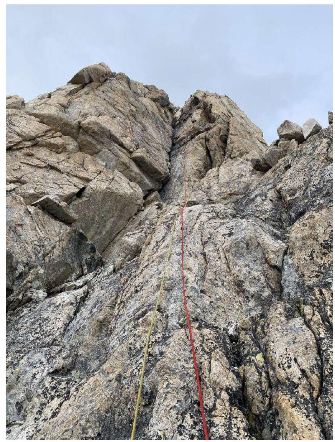
Photo 12. R14–R15. Inner corner with exit onto a sharp ridge.
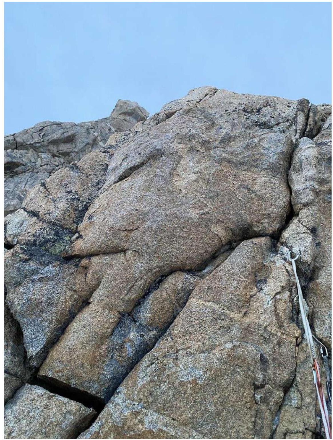
Photo 13. R16–R17. Station before the overnight stay under the summit. The summit is visible against the sky.
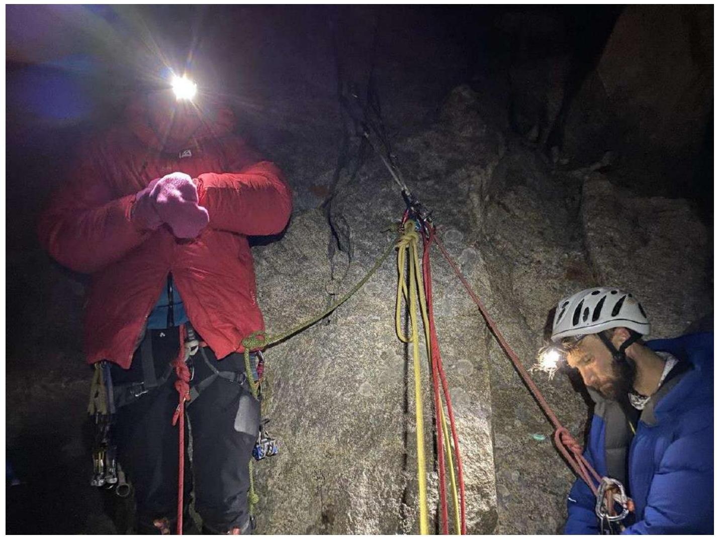
Photo 14. Station 10 meters above the overnight stay.
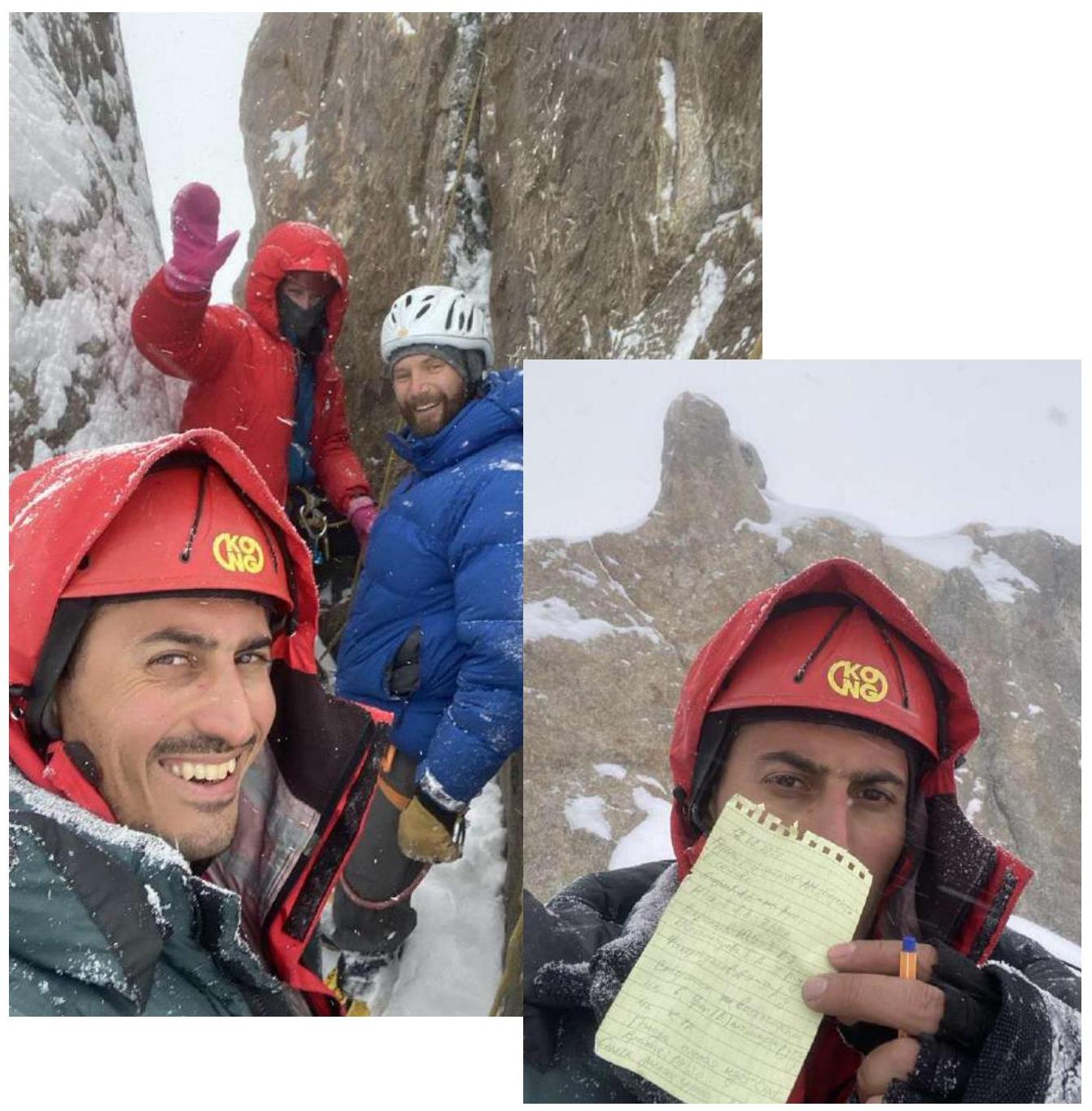
Photo 15. Participants under the summit and Artur A. Matinyan on the summit.