5th cat. diff. free climbing 26.10.82 sect. 519.14

197a 11th Championship of the Caucasus Territorial Administration of Alpine Camps
1982
Rock Climbing Category
Report
On the first ascent to the summit of Vostochny Ural 4150 m above sea level via the SE wall of the S buttress of the team of the All-Union School of Instructors of Mountaineering
Team Leader: Ivanov N.R.
Team Coach: Zhirnov V.V.
Address of team leader Ivanov Nikolay Rufovich: 192242, Leningrad, Budapeshtskaya, 9, bldg. 1, apt. 98.
Team Coach Zhirnov Viktor Vasilievich: 193168, Leningrad, Antonova-Ovseenko, 19, bldg. 4, apt. 83.
Elevations during the ascent were determined as follows:
-
The height difference of the wall was measured twice: the first time - by the team using an altimeter, the second time - a week later - by a representative of KSP also using an altimeter.
-
Elevations of overnight stops were determined visually, focusing on neighboring peaks and the distance covered in meters.
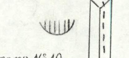
Photo #2. Profile of the wall on the right. The picture was taken from the slope towards Ural (M). Point #5 - 4000 m. At a distance of 100 m from the wall on 28.06.82 at 15:30. Lens - www.alpfederation.ru
3540 m. Photo #3. Profile of the wall on the left. The picture was taken from the slopes of Mt. Ural (V). Point #1 - 3600 m. At a distance of 100 m from the wall on 25.06.82 at 12:25.
Tactical Actions of the Team
During the ascent, the team performed the following tactical and technical actions:
- The lead climber used a double rope - an imported elastic one; without a backpack (all 5 backpacks were packed into 4).
- On sections with 5-6 cat. diff., fixed ropes were used.
- When organizing fixed ropes, the ropes were attached to pitons, which were blocked.
- The lead climber used a standard Czech shock absorber for riggers (type 1 for 250 kg).
- Due to the risk of rocks falling from the ledges (which could potentially cut the rope), all participants moved along the fixed ropes with top-rope protection (the team took 5 ropes, i.e., each person had a rope).
- On less difficult sections, the second rope team moved independently of the first, using the pitons placed by the first team.
- During the ascent, everyone took turns leading.
- Nuts and hexes were widely used, especially in the middle and upper parts of the wall, which speeded up the organization of intermediate belays and the passage of difficult sections using artificial climbing techniques.
- The team followed the route without deviating from the tactical plan.
- Throughout the working day, team members had dry rations and flasks of tea, so the team did not stop or waste time on food, maintaining a high level of performance.
- When stopping for the night, three team members organized the bivouac, while the other two went ahead to prepare the route.
- Ropes were pulled through only once (40 m) - immediately after the second bivouac.
- For the rest of the time, backpacks were carried, attached to the waist belt, which also increased the team's overall speed, without expending much energy (unlike carrying backpacks on the shoulders).
- There were no falls or injuries.
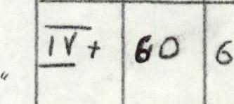
| Section # | Cat. diff. | Pitons | Difficulty | Length (m) | Wall steepness (°) |
|---|---|---|---|---|---|
| R1 | 8 | V+ | 40 | 80 | |
| R2 | 4 | 2 | V+ | 60 | 60 |
| R3 | 5/2 | 1/1 | VI | 20 | 85 |
| R4 | 5 | 1 | V+ | 40 | 75 |
| R5 | 4 | 3 | V- | 60 | 70 |
| R6 | 5 | 4 | V- | 60 | 75 |
| R7 *) | 12/1 | 2/1 | V+ | 80 | 80 |
| R8 | 7/1 | 1 | V+ | 40 | 75 |
| R9 | 10 | 2 | V+ | 80 | 70 |
| R10 | 6/2 | 2 | V+ | 40 | 70 |
| R11 | 4 | 3 | V- | 40 | 60 |
| R12 | 7 | 3/3 | VI | 40 | 85 |
| R13 | 3 | 3 | V+ | 40 | 80 |
| R14 | 1 | 2 | IV+ | 20 | 50 |
| R15 | 2 | 3 | V- | 30 | 55 |
| R16 | 1 | III- | 40 | 30 |
*) Section R7 was traversed at an angle of 30° across steep rocks with a steepness of 80°.
Total data for sections R1-R10 (26.06.82): Climbing hours – 8 Pitons driven – 32 Nuts – 8 (+1)
Total data for sections R11-R16 (27.06.82): Climbing hours – 9 Pitons driven – 48 (+3) Nuts – 13
Total summary data: Total climbing hours – 23 Pitons driven – 83 (+6) Nuts – 33 (+5)


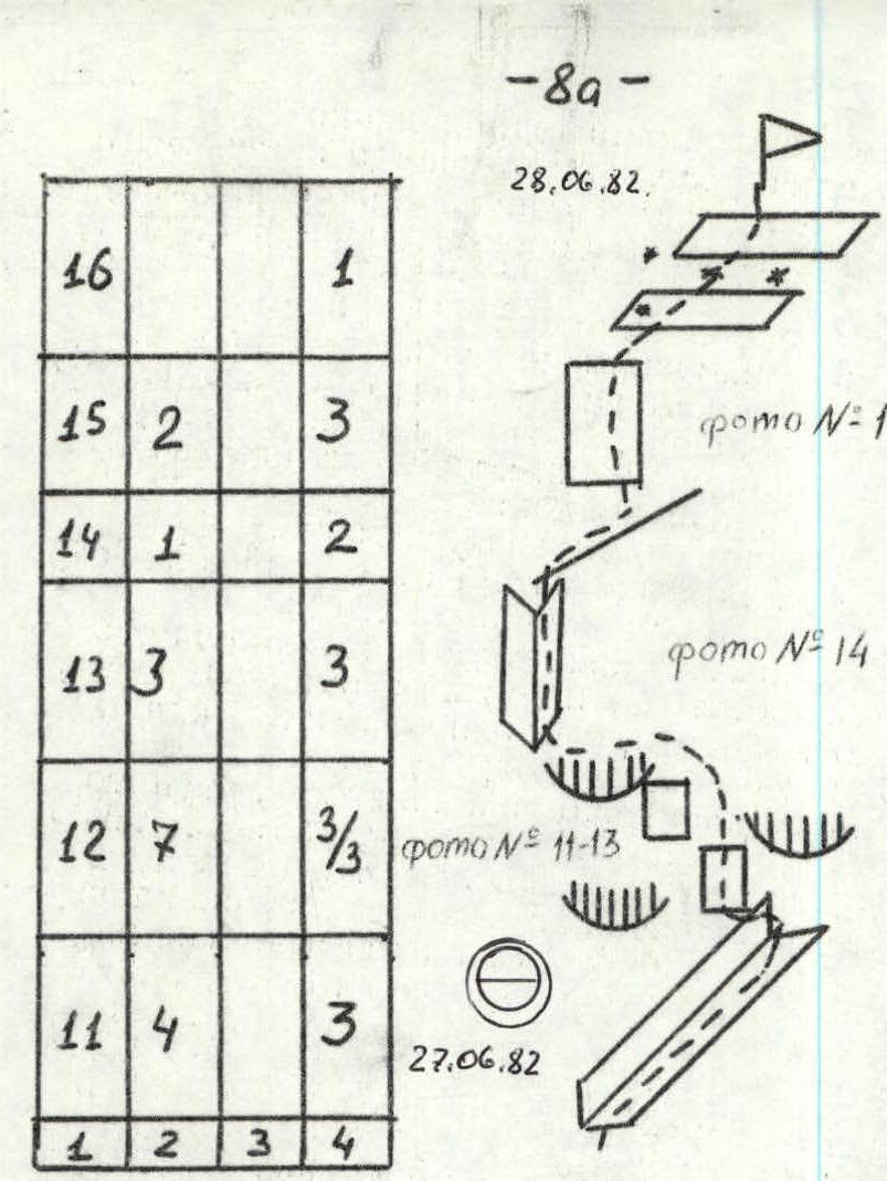
Route Description by Sections
The route starts 15-20 m to the right of a characteristic black inner corner located in the middle of the lower part of the wall, 40 m before the point where the black rock belt touches the snow.
Climb 60 m up monolithic rocks to a system of slabs and ledges that lead left into a wide inner corner (40 m). There are many loose rocks on the ledges. The cracks are dull, and there are few of them.
Climb up the wide inner corner to its steep part, which leads right. Climb 20 m up the left part of the inner corner (climbing is very difficult) and then move to the right side of this corner and climb up (40 m), which turns into a system of slabs and walls (60 m) located on the buttress, which drops off on the right with overhangs.
Under one of the overhangs - the first bivouac. At the bivouac, there is the I control point.
From the bivouac:
- Climb up and right through a system of slabs and walls located on the left side of this buttress (an ice-filled inner corner that leads to the ridge remains on the left);
- Climb under an overhanging 20-meter wall;
- Under a system of overhanging walls, traverse up and right (80 m). There are few cracks, and the holds are hemispherical. Friction is good;
- The traverse leads to a black inner corner.
Climb up the right face (wall 40 m) of this corner and then (80 m) up the right part of this inner corner. At the top, the inner corner becomes less steep. The left side of the corner overhangs. The right side of the corner turns into an outer corner.
Climb 40 m up and right along it;
- Then move left into an inner corner;
- Climb up and right along it for 40 m.
Reach a sloping snow-ice ledge. At the top, there is the second bivouac. The II control point is in a tin can nailed to the wall that limits the ledge on the left. Then climb 40 m up and left through a system of overhanging slabs and walls. Climbing involves using artificial climbing techniques.
Climb along the ridge to a vertical inner corner, which is climbed on the left face (40 m). Then climb 20 m along a sharp ridge to a 40-meter wall, which is climbed on the left part; then climb up gentle slabs covered with snow and ice into a depression before the summit.
The descent is made towards Mt. Maly Ural into the Uko gorge.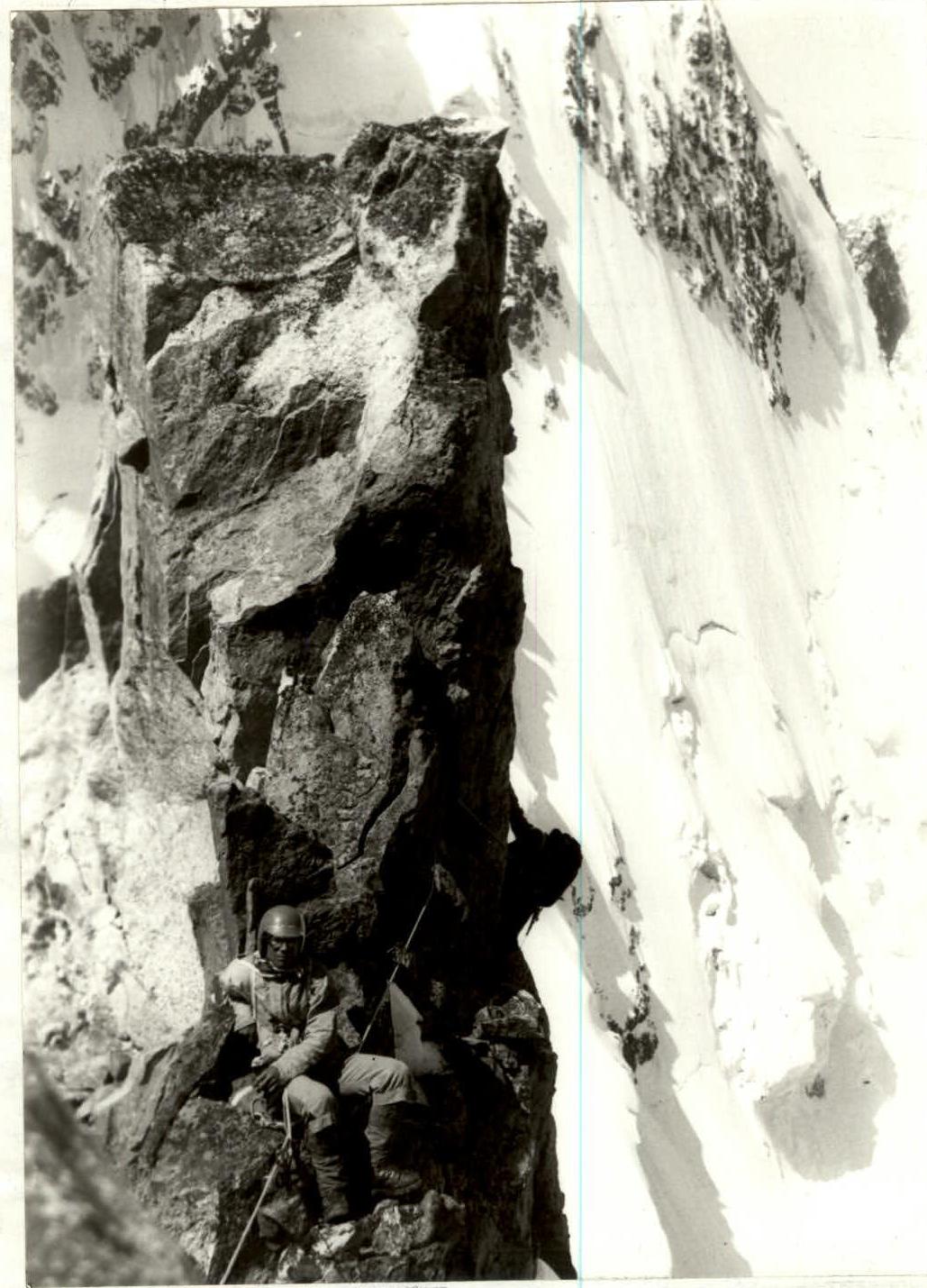
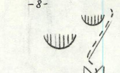
Photo #15. Section #15. The picture was taken on 28.06.82 at 12:00. Lens T-22, 4 cm.