Ascent Passport
I. Ascent class: rock (up to 4250)
-
Ascent area: Caucasus, Bezengi, Northern spur of GKHR
-
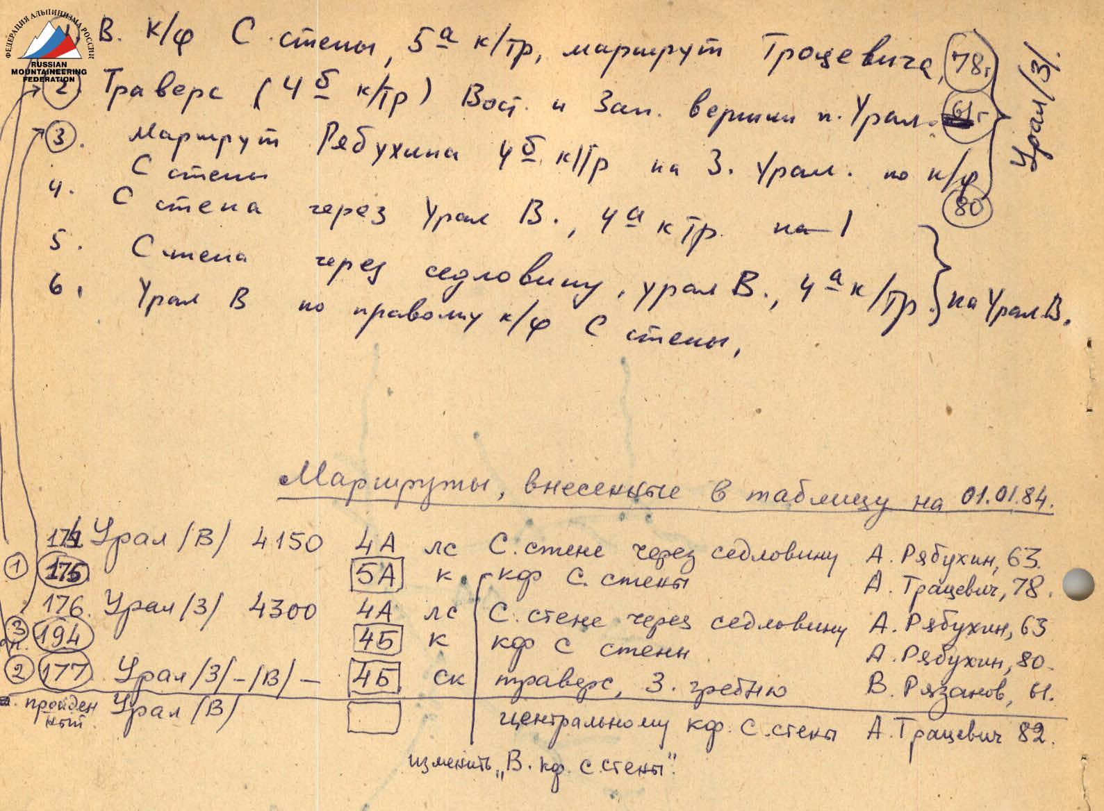
Peak: Ural Vostochny (4150 m) via the right buttress of the North wall
-
Difficulty category: 4B
-
Route character: combined
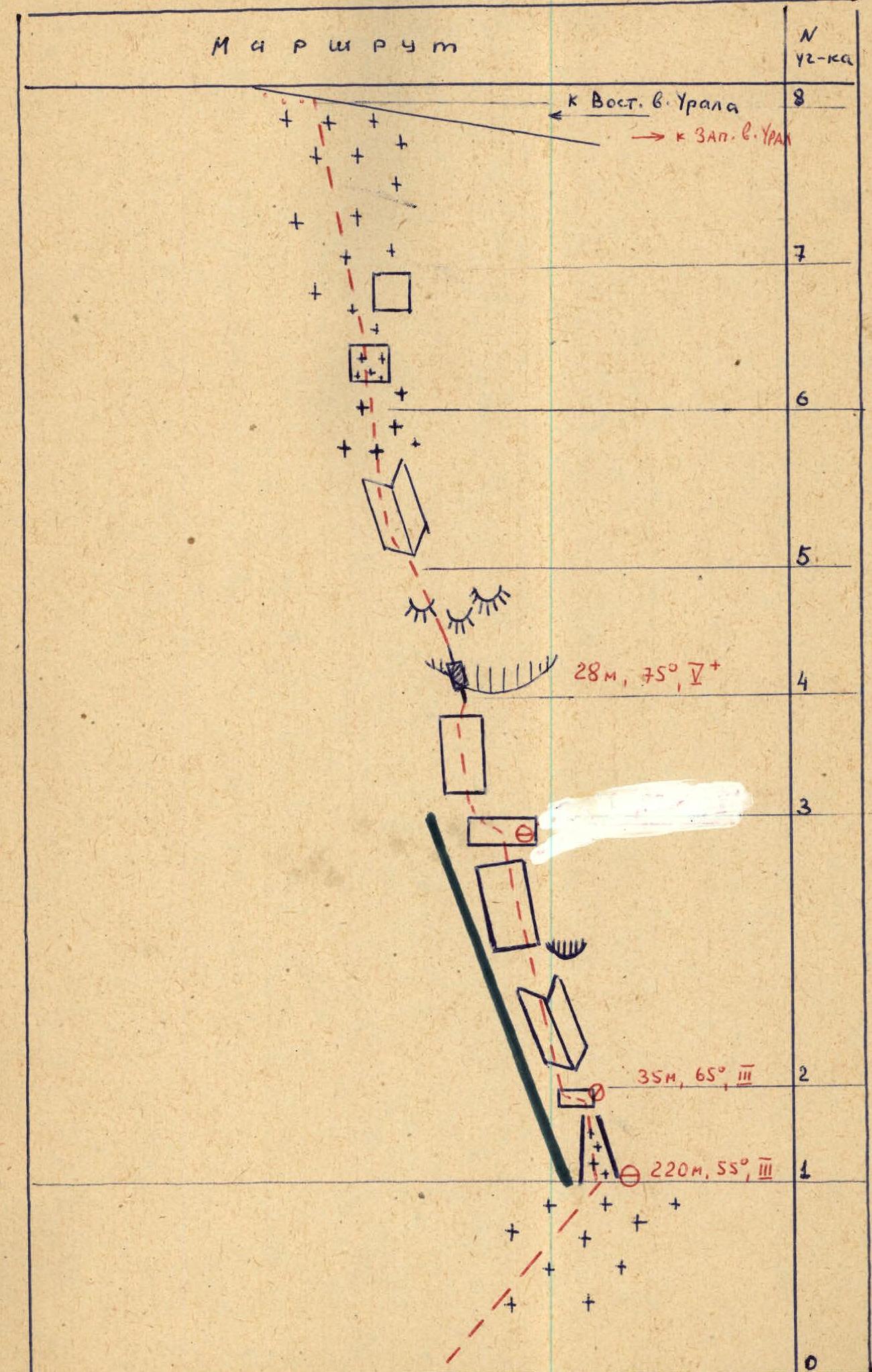
height difference: 550 m average steepness: along the buttress – 55° section length:
- 4th diff. category – 110 m
- 5B diff. category – 30 m
- Pitons driven:
for belaying:
- Rock – 30
- Ice – 26
for creating intermediate belay points: 2
- Total climbing hours: 10 hours
- Number of bivouacs: 0
- Leader: Trasevich A.I. — Master of Sports of the USSR
Team members:
- Urodkov A.A. — Master of Sports of the USSR
- Sdobnikov E.Yu. — Candidate for Master of Sports
- Makarov V.Ya. — Candidate for Master of Sports
- Korolenko A.Ya. — Candidate for Master of Sports
- Tolstoy L.I. — Candidate for Master of Sports
- Team coach: Kudinov Igor Borisovich — Master of Sports of the USSR, Honored Coach of the RSFSR
II. Date of departure and return: July 22, 1982
Brief description of the approach to the route
From the "Bezengi" tourist center, follow the trail to the bridge over the Mizhirgi River, then up the trail on the left bank of the Mizhirgi River. Cross the first stream flowing from the spur via a bridge. Continue up the trail onto the moraine. Traverse the moraine along the trail on its left side. Ascend to a green clearing under the Maly Ukju glacier via grassy slopes and scree (trail) on the left side of the stream (second along the route), where a hut is located.
Then:
- ascend to the depression in the terminal moraine,
- exit onto the Maly Ukju glacier and ascend it to under the right buttress of the North wall of the Eastern peak Ural,
- then ascend to the right and up under the bergschrund.

Map of the ascent area
 |  |
|---|
Main characteristics of the route
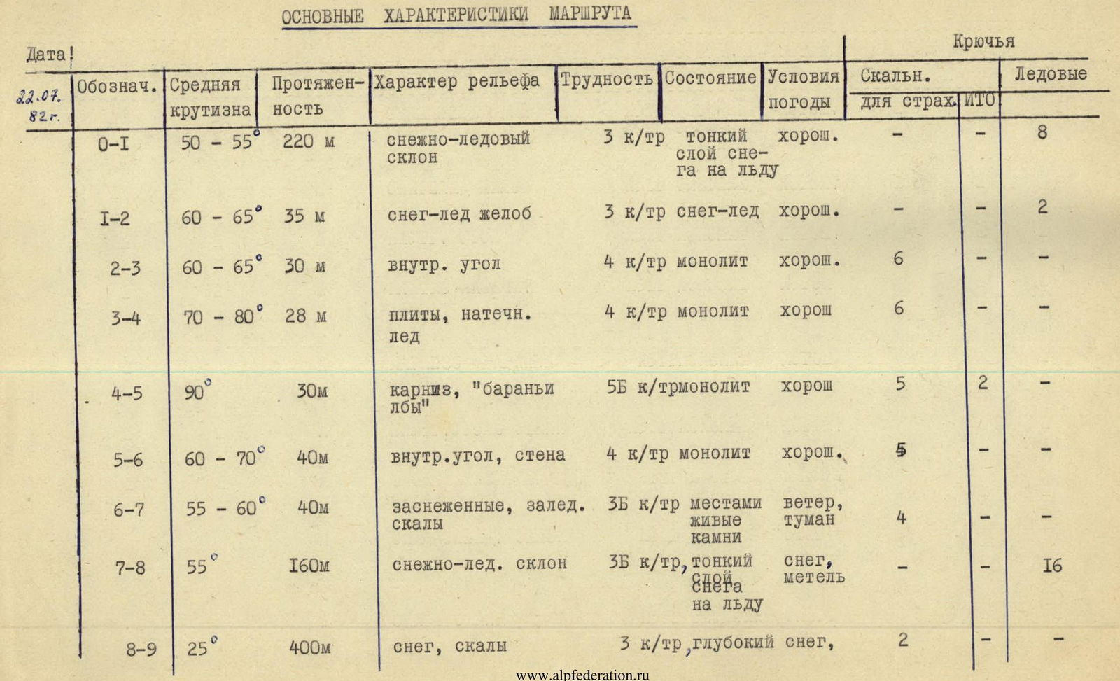
| Date | Marking | Average steepness | Length | Terrain character | Difficulty | Condition | Weather conditions | Rock pitons for belaying | ITP | Ice pitons |
|---|---|---|---|---|---|---|---|---|---|---|
| 22.07.82 г. | O–I | 50–55° | 220 м | snow-ice slope | 3 к/тр | thin layer of snow on ice | good | – | – | 8 |
| I–2 | 60–65° | 35 м | snow-ice groove | 3 к/тр | snow-ice | good | – | – | 2 | |
| 2–3 | 60–65° | 30 м | inner corner | 4 к/тр | monolith | good | 6 | – | – | |
| 3–4 | 70–80° | 28 м | slabs, ice formations | 4 к/тр | monolith | good | 6 | – | – | |
| 4–5 | 90° | 30 м | cornice, "ram's foreheads" | 5Б к/тр | monolith | good | 5 | 2 | – | |
| 5–6 | 60–70° | 40 м | inner corner, wall | 4 к/тр | monolith | good | 5 | – | – | |
| 6–7 | 55–60° | 40 м | snow-covered, icy rocks | 3Б к/тр | loose rocks in places | wind, fog | 4 | – | – | |
| 7–8 | 55° | 160 м | snow-ice slope | 3Б к/тр | thin layer of snow on ice | snow, blizzard | – | – | 16 | |
| 8–9 | 25° | 400 м | snow, rocks | 3 к/тр | deep snow | snow | 2 | – | – |
Schematic diagram of the main part of the route in UIAA symbols