ASCENT DOCUMENT
- Technical climbing category
- Central Caucasus, Krumkol gorge
- Traverse of Tikhonov Peak — Koshtantau with ascent to Tikhonov Peak via the South Face
- Proposed 5B category, first ascent of Tikhonov Peak South Face
- Total elevation gain: 1595 m, total distance: 2310 m, including wall section: 1070 m elevation gain, 1255 m distance. Total distance of 5–6 category sections: 870 m, including 680 m on the wall section, of which 120 m are category 6. Average steepness of the wall section: 60°
- Total pitons used:
Piton type Rock Chocks Ice screws Bolts 118 69 34 - Reused 12 7 - - Wall section only: Piton type Rock Chocks Ice screws Bolts --- :---: :---: :---: :---: 101 57 24 - Reused 12 7 - - - Team's total climbing hours: 32, total days: 3
- Bivouacs: 1st sitting bivouac in a tent on a carved-out platform, 2nd lying bivouac in a tent on the ridge
- Team leader: Igor Pavlovich Krainov, Candidate Master of Sports
Team members:
- Anvar Nurgaleevich Alparov, Candidate Master of Sports
- Igor Pavlovich Kurbatov, Candidate Master of Sports
- Evgeny Yuryevich Sdobnikov, Candidate Master of Sports
- Anatoly Kuzmich Yantsevich, Candidate Master of Sports
- Coach: Honored Coach of the RSFSR, Igor Borisovich Kudinov
- Departure to the route: July 25, 1985 Tikhonov Peak: July 26, 1985 Koshtantau: July 27, 1985 Return: July 28, 1985

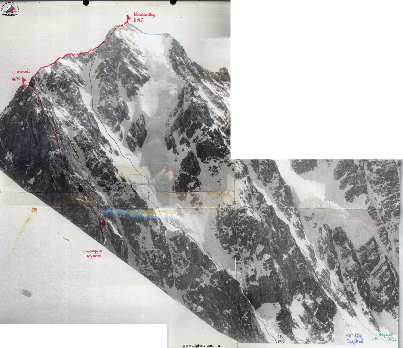
Koshtantau 5145

Photo 1. 24.07.85 16:00, I-50 lens, distance 3 km, height 3000 m

Photo 4. 25.07.85 14:00, Helios-44 lens, distance 4.5 km, height 2700 m
(1) team's route
(2) 4B route, 1935
(3) 5B route, Galustov 1955
(4) 5B route, Naumov 1962

Photo 3. 26.07.85 12:30, Helios-44 lens, distance 1.5 km, height 3800 m
Team's Tactical Actions
When developing the tactical plan for the ascent, it was assumed that the South Face of Tikhonov Peak would be climbed in two days, and the entire route in three days. Based on observations, good bivouac sites on the upper part of the face are only available near the summit, and about 500–600 meters below that, there are no sufficiently convenient locations. Therefore, the plan was made with the goal of quickly traversing the main part of the face.
To achieve this, the team employed a movement and interaction strategy that had proven effective in previous challenging ascents:
- The first climber ascends without a backpack or with an empty backpack
- The weight of the other climbers' backpacks does not exceed 10–11 kg, allowing them to climb via any fixed ropes without hauling their backpacks
- The first climber is constantly belayed with a 12 mm "Elita" rope
- On particularly difficult sections with numerous intermediate anchors, a second rope is used
- Fixed ropes are established
- All other team members climb via the fixed ropes with top or bottom belay through pitons
- The last climber always moves along the fixed ropes with top belay
The light backpacks and the team's excellent physical condition allowed for prompt forwarding of free ropes and pitons.
The lead climber changed 1–2 times a day. On the first day, the leaders were:
- Krainov (R0–R1 icefall passage)
- Sdobnikov (R1–R6)
- Alparov (R5–R7)
On the second day:
- Alparov (R7–R18)
- Sdobnikov (R18–R21)
On the third day:
- Kurbatov (R21–R27)
- Yantsevich (R27–R33)
Daily, around mid-day, the team stopped for a half-hour to organize a snack and tea break.
Communication was regularly maintained with a group in Dykhsu, and after reaching the ridge, with the "Bezengi" Alpine Camp.
The tactical plan was fully executed. There were no falls or injuries during the ascent.
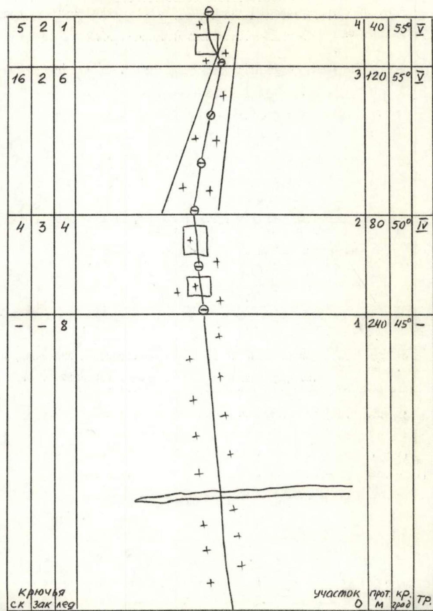
Route diagram in symbols (1:2000 scale)
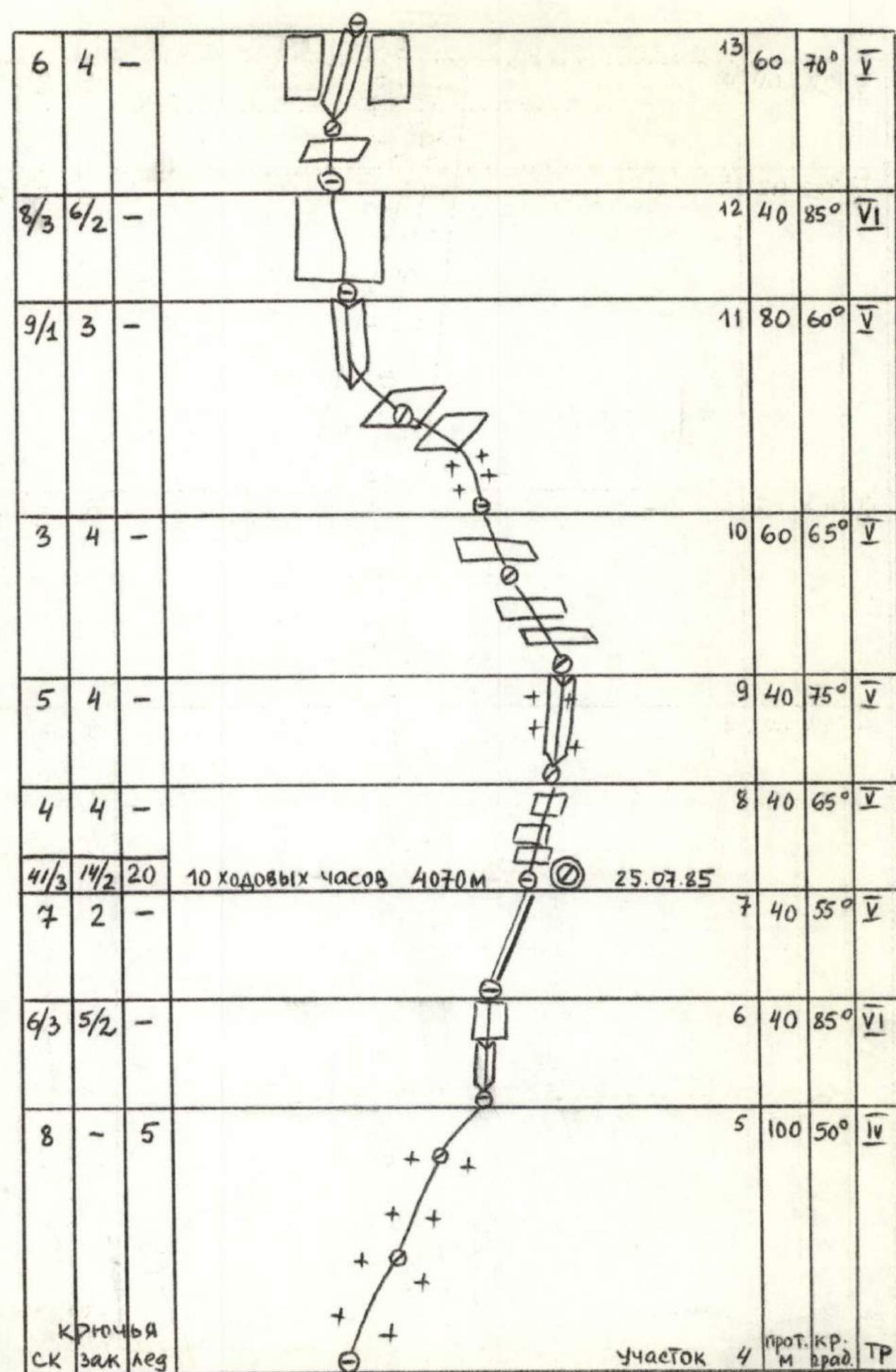
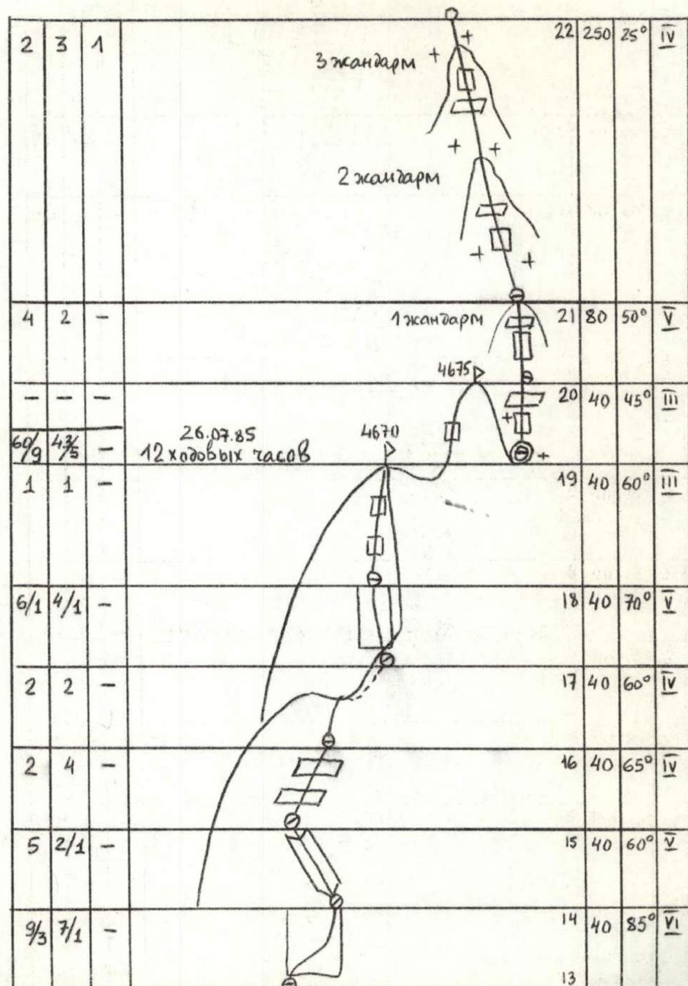
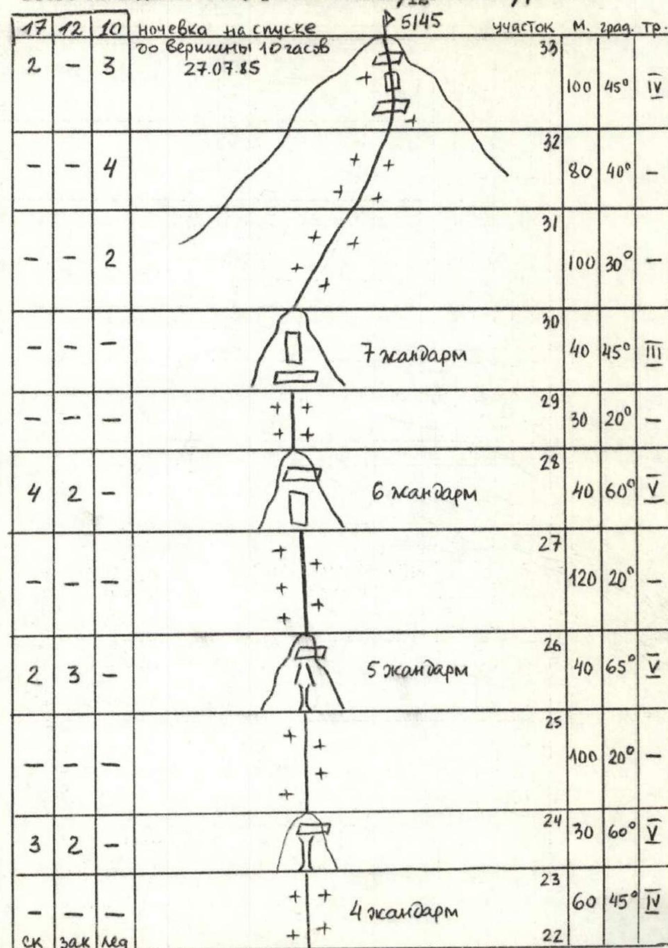 Total 32 climbing hours, 118/12 rock pitons, 57/7 chocks, 24 ice screws
Route Description by Sections
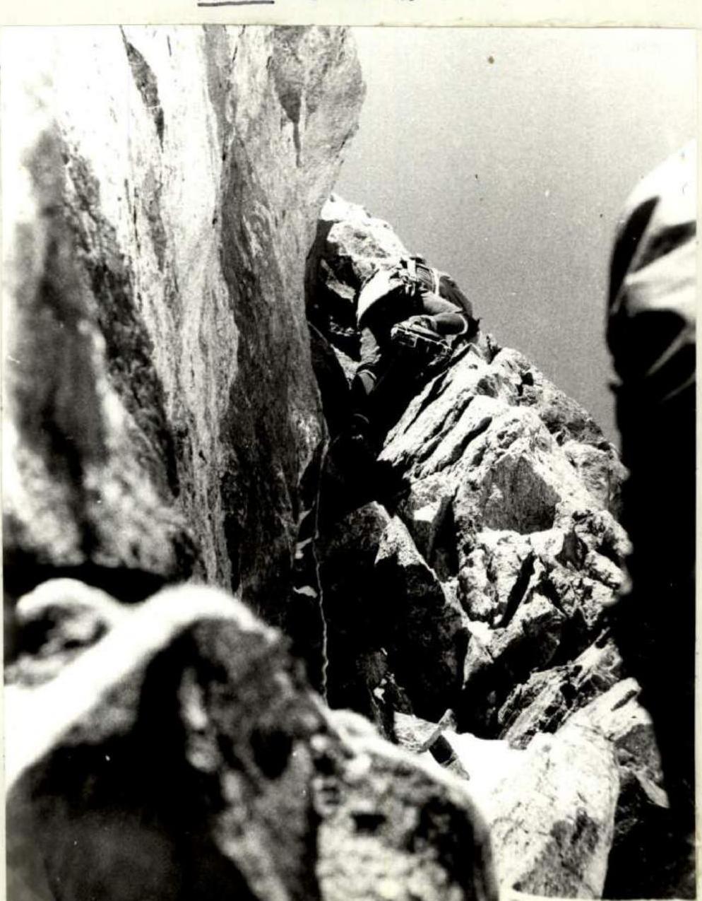
0–1. Steep snowy slope. The bergschrund is crossed via a snowbridge. 1–2. Snow and ice slope with rock outcrops. Small walls. 2–3. Steep icy couloir. Belay initially from the rocks on the right side, then transition to the left. The ice is very thin in places. 3–4. Exit the couloir to the right side via a 20 m wall. 4–5. Up and to the right along the edge of rocks and ice under an overhanging wall. 5–6. Exit from under the overhang via a vertical internal corner (many loose rocks) and then a 10-meter wall. Climbing is very difficult. It's advisable to climb in crampons from this point to the summit of Tikhonov Peak. Intermediate belay points are inconvenient. 6–7. Indistinct ridge with walls. Leads to a small saddle where a platform for a sitting bivouac can be carved out in the ice. 7–8. Steep slabs, few cracks. Some areas have ice buildup. 8–9. Internal corner. The middle 10 meters are vertical and iced over. The lower part is climbed in crampons on friction. 9–10. Slabs with some ice sections. Few cracks, holds are worn. 10–11. 20-meter steep snowy slope, then traverse right along steep slabs for 20 m and exit to a ledge via a vertical internal corner. 11–12. Vertical wall, few cracks and holds. A small overhang (2 m). Climbing is very difficult. 12–13. From a small saddle, climb via the left wall of a vertical internal corner. Loose rocks. 13–14. Vertical wall. The lower 3 meters have no cracks — exit with a partner's shoulder support. Further cracks for belay are inconvenient. Climbing is very difficult. 14–15. Internal corner. Holds are worn. Climbing is done on friction. 15–16. Slabs alternate with 2–3 m walls. Loose rocks. 16–17. Traverse a small ridge to the right side of a steep icy couloir descending to the west face. 17–18. Cross to the left side of the couloir and climb a wall with a slab to reach the pre-summit ridge. Few cracks and holds. The transition from the slab to the wall involves an overhang and a ladder. 18–19. Climb moderately difficult rocks to reach the South Summit of Tikhonov Peak. 19–20. Descend from the South Summit (20 m) and climb a 5 m wall to reach the Main Summit of Tikhonov Peak. 20–33. Ridge from Tikhonov Peak to Koshtantau. Part of the known 5A category route.
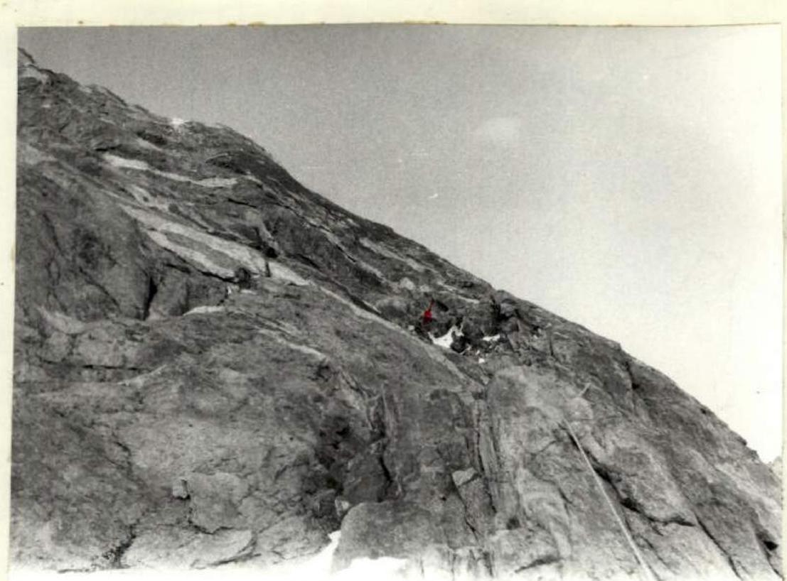
Photo 2. Section 7–8
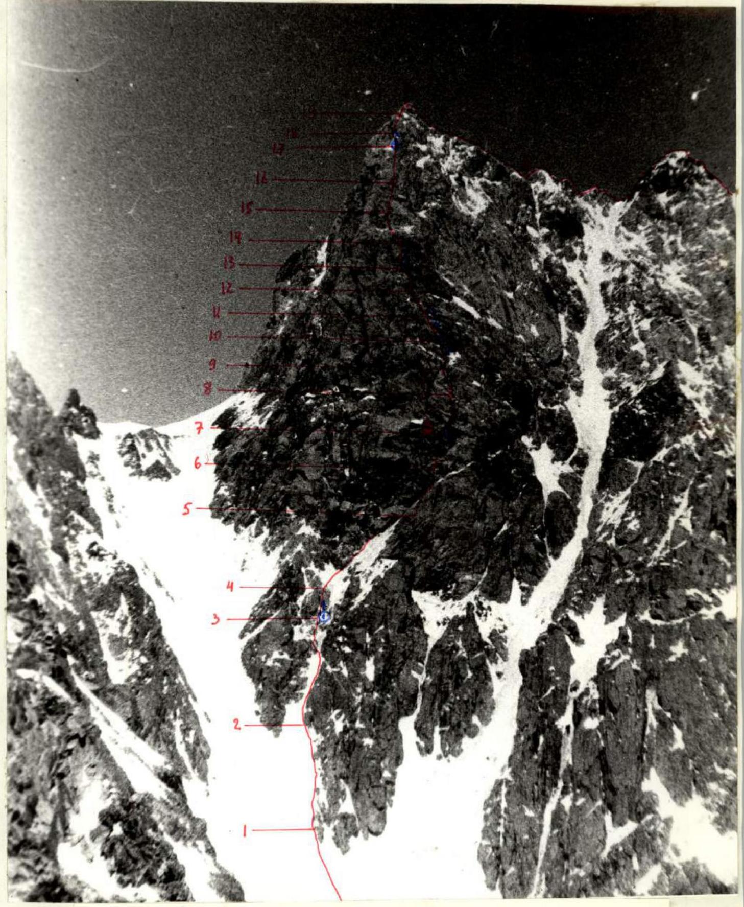
Photograph of the route from the South Ridge of Krumkol Peak. 19.07.85 14:00, I-50 lens, distance 1.5 km, height 3400 m
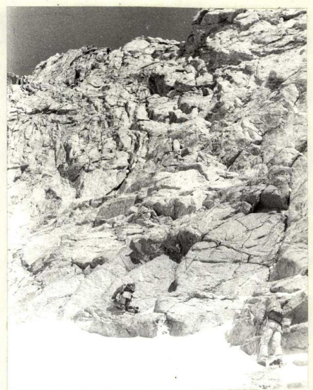
Photo 3. Section 10–11

Photo 5. Section 10–11 (upper part)
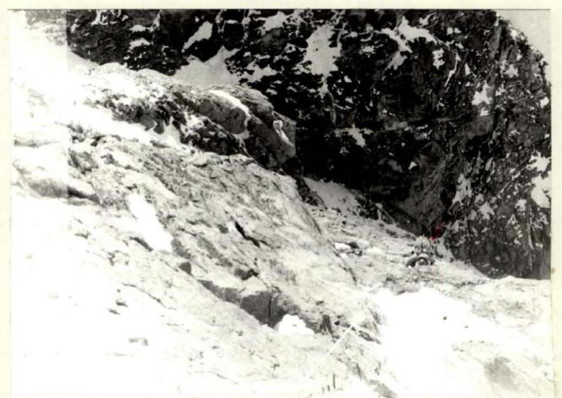
Photo 4. Section 10–11 (view from above)