Pushkin Peak via the North Face
Ascent Log
-
Region: Caucasus, Bezengi gorge, section 2.5
-
Summit: Pushkin Peak 5100 m. Route name: via the North Face
-
Proposed — 5B category of difficulty, variant or combination
-
Route type: combined
-
Route elevation gain: 1900 m. Route length: 2930 m. Length of sections:
- 5th category of difficulty — 780 m
- 6th category of difficulty — 60 m Average steepness:
- main part of the route — 50 degrees
- entire route — 40 degrees
-
Pitons left on the route: total – 8, including bolted pitons – 0 Pitons used on the route:
- stationary bolted pitons – 0, including for ITO – 0
- removable bolted pitons – 0, including for ITO – 0 ITO used – 8
-
Team's working hours on the route – 55 hours, days – 5
-
Team leader — Vladimir Pavlovich Kulikov, 1st sports category
Team members:
- Alexander Valeryevich Tsibanov — 1st sports category
- Andrey Valeryevich Tsibanov — 1st sports category
- Sergey Vasilyevich Bezdetko — 1st sports category
-
Coach: Yuri Sergeyevich Saratov — Master of Sports
-
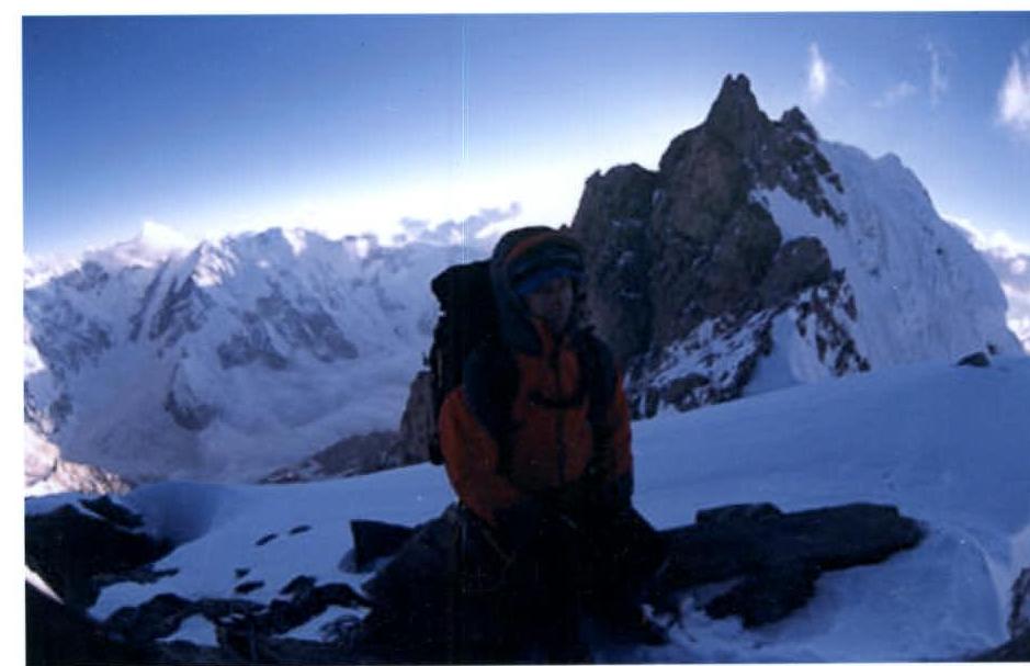
Departure to the route: — July 8, 2005, summit — July 11, 2005, return to base camp — July 13, 2005 Group photo:
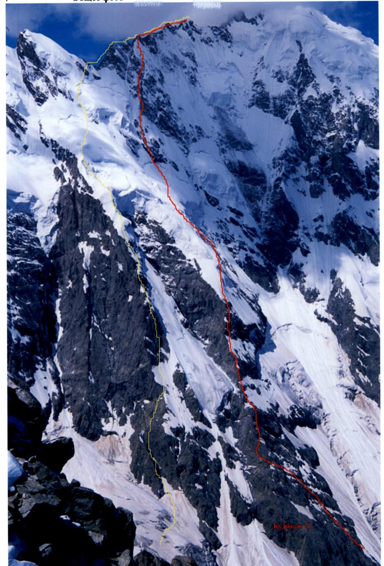
Our route is marked in yellow, to the right — 5B Kudinova 1972. Taken from Panoramic Peak on July 3, 2005.
UIAA Symbol Scheme
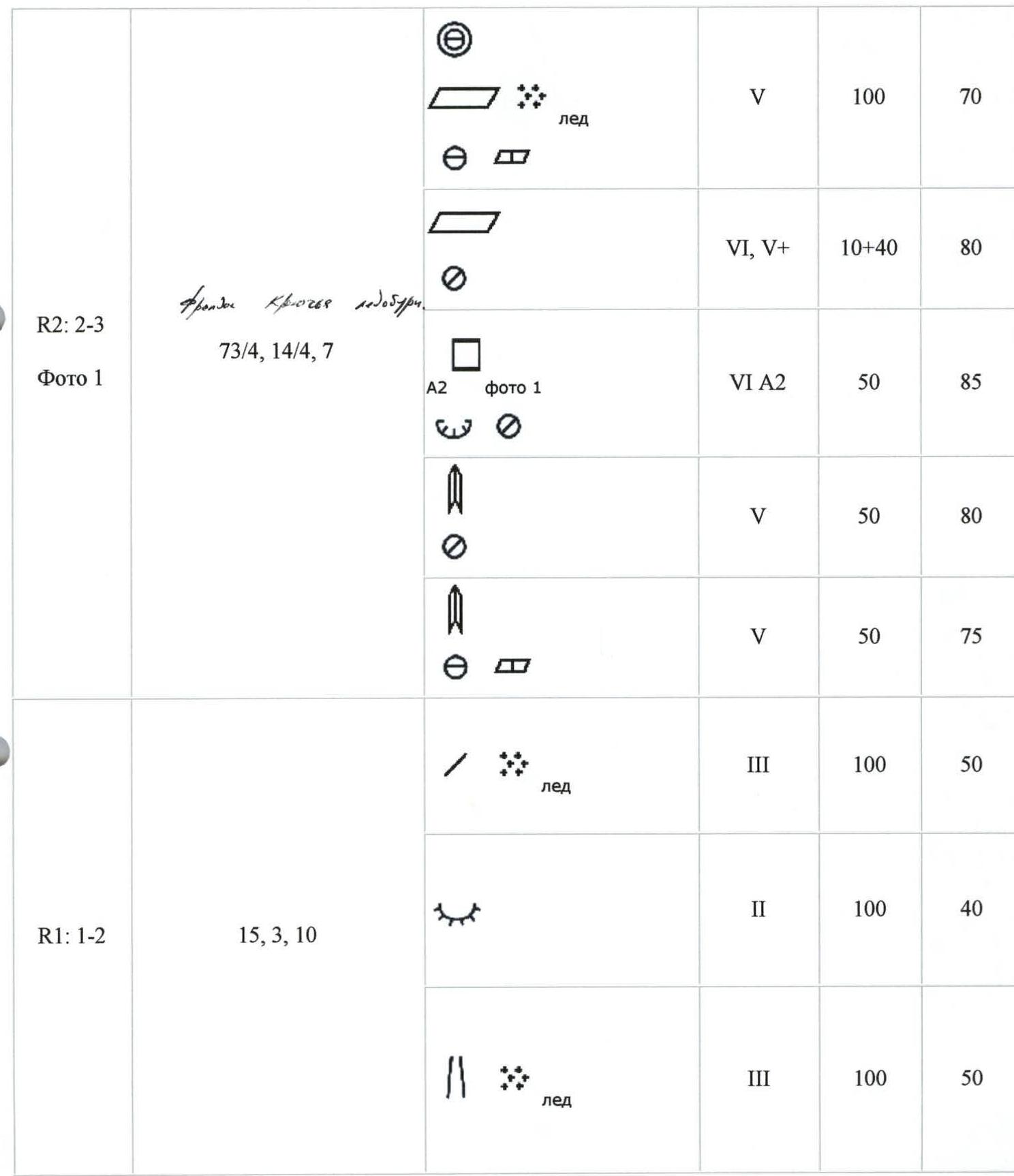
| Section number | Insurance points friends, pitons, ice screws | Section in UIAA symbols | Difficulty | Length | Steepness |
|---|---|---|---|---|---|
| R0: 0–1 | 0/0/0 |  | II | 300 | 30 |
| R1: 1–2 | 15/3/10 | (ice) | III | 100 | 50 |
| (snow) | II | 100 | 40 | ||
| (ice) | III | 100 | 50 | ||
| R2: 2–3 | 73/4, 14/4, 7 | (A2, photo 1) | VI A2 | 50 | 85 |
| (rock) | V | 50 | 80 | ||
| (rock) | V | 50 | 75 | ||
| R3: 3–4 | 17/4/12 | (ice, photo 2) | V | 150 | 70 |
| (rock) | IV | 50 | 50 | ||
| (rock) | V | 50 | 80 | ||
| R4: 4–5 | 0/0/12 |  | III | 100 | 50–30 |
 | IV | 100 | 60 | ||
 | V | 50 | 70 (ice (photo 3)) | ||
 | III | 50 | 50 | ||
| R4: 4–5 | 17/4/12 |  | V | 150 | 70 |
 | IV | 50 | 50 | ||
 | V | 50 | 80 | ||
| R5: 5–6 | 0/0/12 | (square) | V | 60 | 70 |
 | III | 100 | traverse | ||
| (square) | V | 50 | 70 | ||
| (square) | V+ | 50 | 80 | ||
| R6: 6–7 | 7/2/14 | (snow) | III | 30 | 60 |
| (rock) | V | 30 | 80 | ||
| (ice) | V | 30 | 75 | ||
 | IV | 150 | 60 | ||
| R7: 7–8 (Photo 3) | 63/0/0 | (complex, photo 5) | V | 100 | 80 |
| 50 | rappel | ||||
| (slope) | IV | 150 | traverse | ||
| (double traverse) | IV | 100 | 60, traverse | ||
| (square) | IV | 50 | traverse | ||
| (complex) | IV | 100 | 45, traverse | ||
| R8: 8–9 (Photo 3) | 48/2/0 |  | III | 230 | traverse |
| (wave) | IV | 100 | 60, traverse | ||
| (tick) | III | 50 | 50 |
Technical photo:
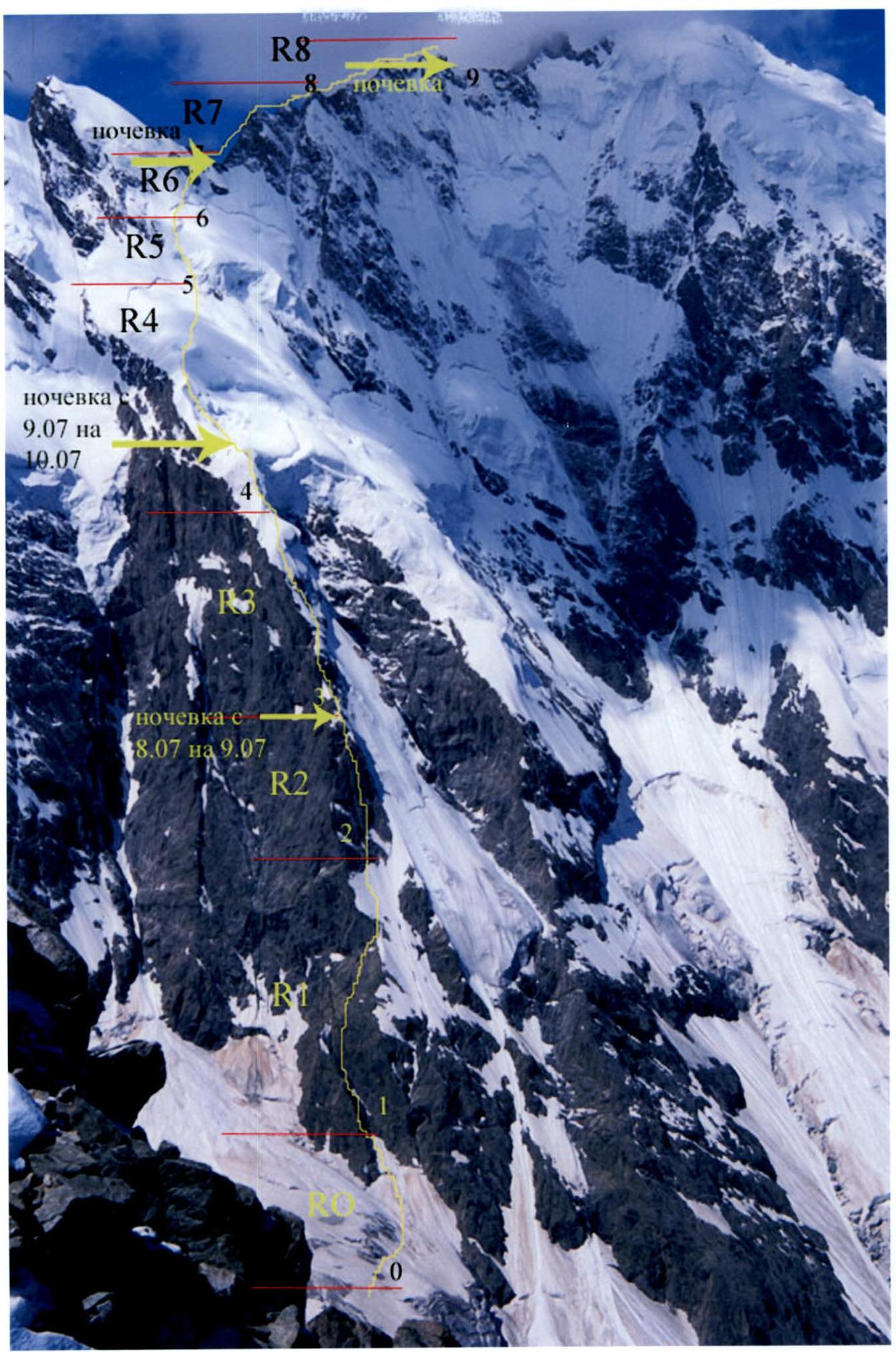 (R8, R7, R6, R5, R4, R2; overnight on July 9–10; overnight on July 8–9)
Technical photos: Photo 1: (sections R1 and R2)
- V category of difficulty 40 m
- IV category of difficulty 10 m
- V category of difficulty 50 m
- V+ category of difficulty 50 m
- V category of difficulty 50 m
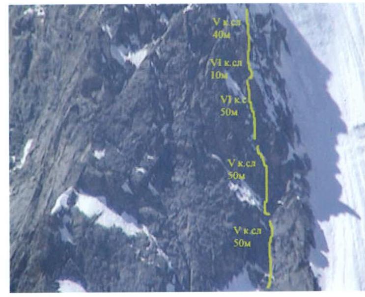
Photo 3:
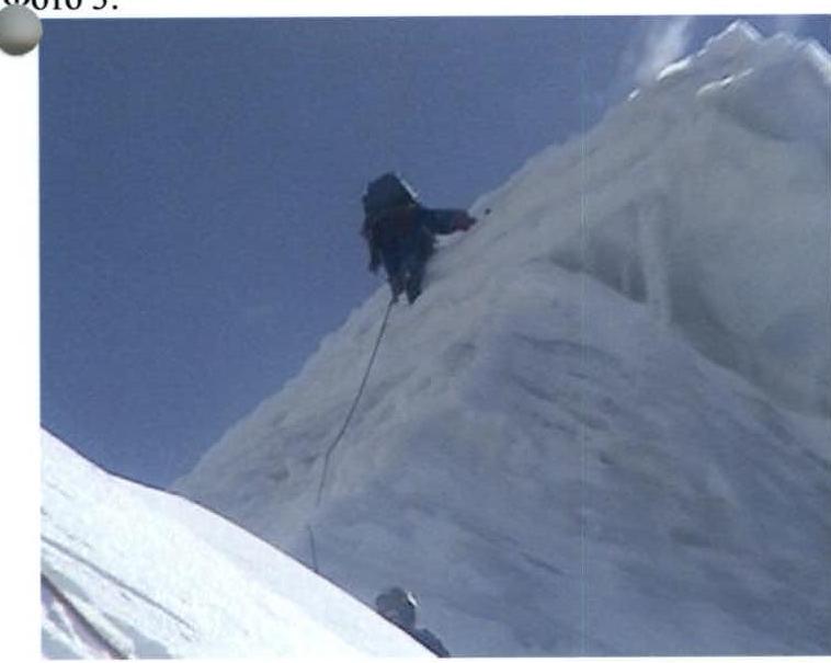
Photo 5:

Photo 2:
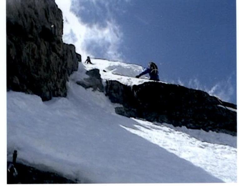
Photo 4:

Photo 6:
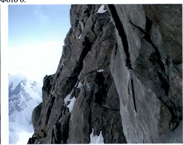
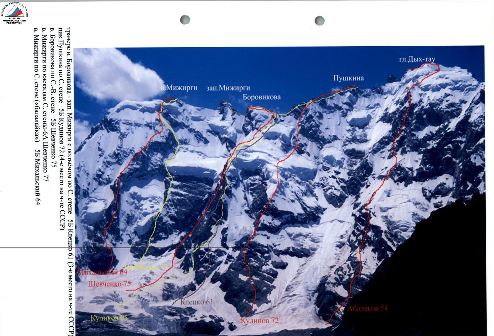
Photo 3. Ridge from Borovikov Peak to Pushkin Peak. Taken from Western Mizhirgi Peak on August 10, 2004
(overnight on July 11–12; overnight on July 10–11)
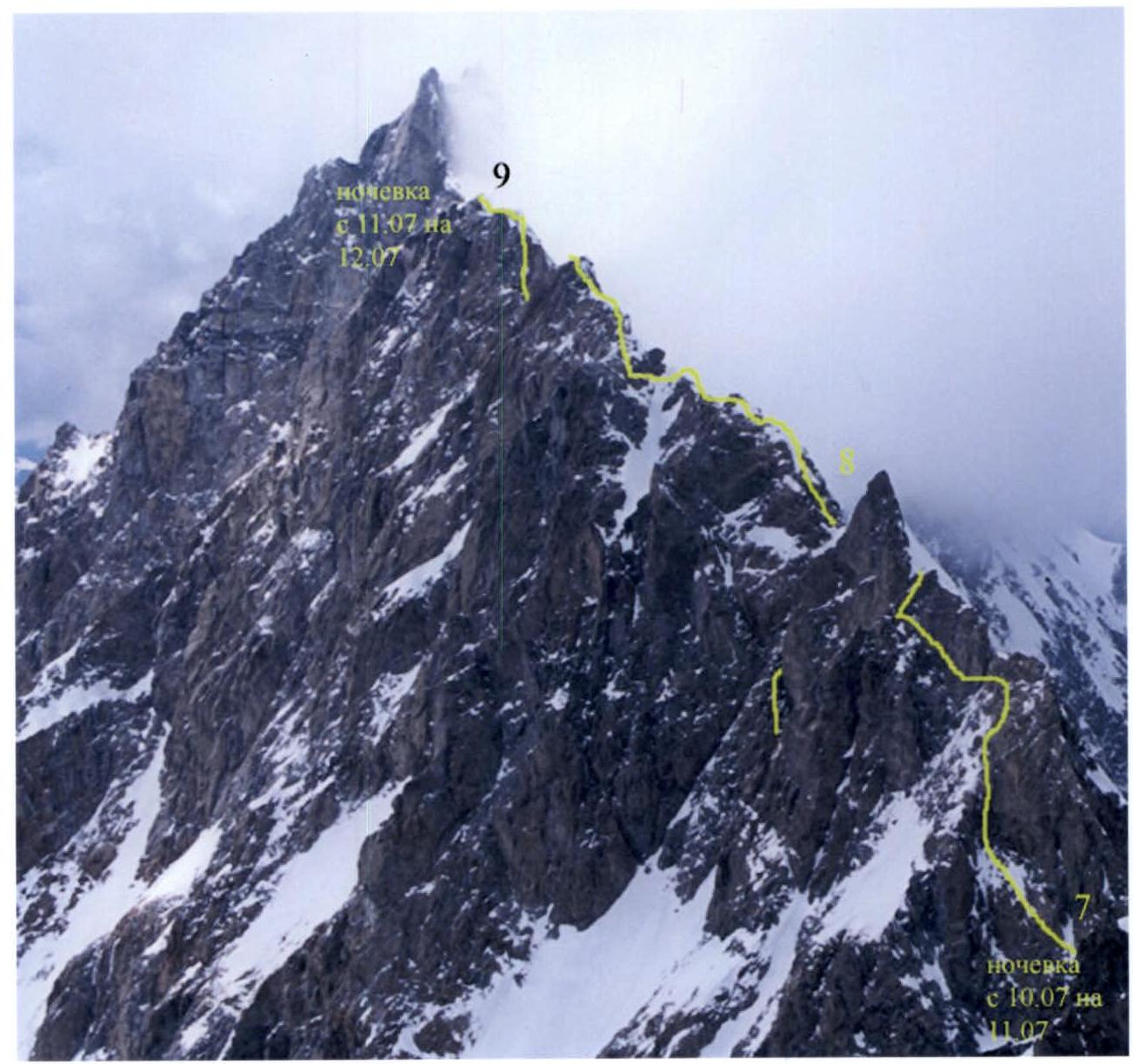
Photo at the summit