Misses-Tau via W wall, 5A (via left skyline of W wall)
From the base to the sites on the glacier bend under the SE ridge base of p. Brno — 2.5–3 hours.
From here:
- along the edge of the 3rd branch of the Mizhirgi glacier (Cheget-Mizhirgi) to the icefall;
- ascent to the upper circus by “ram foreheads” and moraine slopes to the right of the streams.
On the moraine ridge of the upper circus — the initial bivouac site, from the bend — 1.5–2 hours.
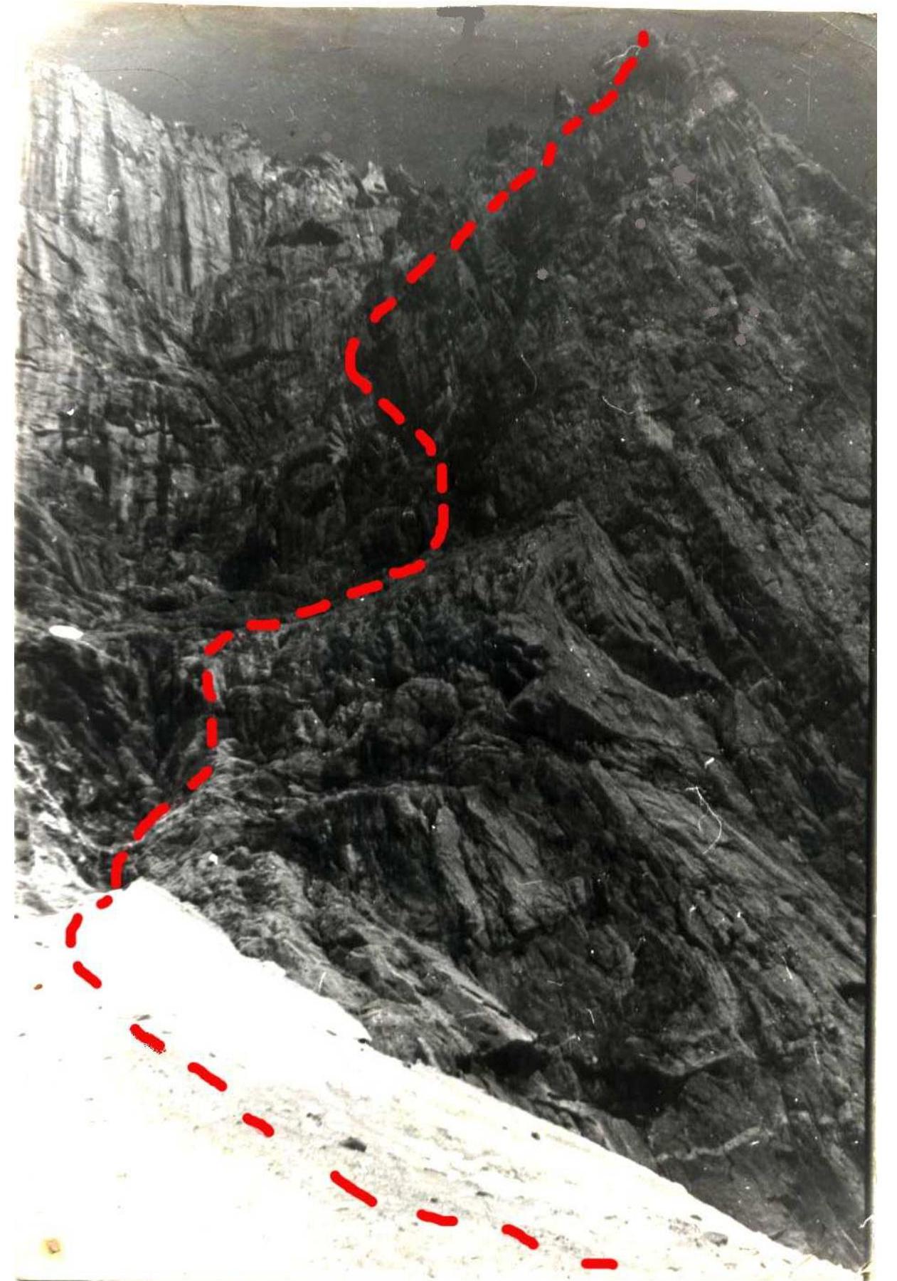
From the bivouac along the moraine slope and snow (ice) exit to the glacier plateau under the E wall. Across the plateau to the left along the rocks to the scree from the wide couloir descending from the square “gendarme” on the saddle between Misses-Tau and Dykh-Tau.
40–50 m to the right of the couloir:
- up along the destroyed rocks (rockfall hazard!) 40 m,
- then along the slabs with shelves 80 m — exit to the lower part of the oblique couloir (shelves), separating the left buttress from the wall.
Further:
- to the right up along the snowy slope 100 m,
- then along the rocks like “ram foreheads” with a small number of holds — exit to the system of shelves going parallel to the couloir.
Along the shelves, crossing not wide (20–40 m) snow-ice couloirs, 350–400 m, then:
- up 40 m along the chimney,
- along complex rocks (possible ice) 20 m,
- along the slope 40 m — exit to the buttress ridge.
The final section:
- along the ridge up 40 m,
- along the snowy slope with rocky islands — exit to the eastern edge of S ridge.
Here is a place for a bivouac. A safe place during a thunderstorm and protected from the wind for an overnight stay — in the bergschrund: pass along the snowy ridge to the saddle and to the right 20 m descend into the bergschrund.
The further path — in accordance with the description 1.