Report
ON ASCENT TO KRUMKOL PEAK VIA THE NORTHERN EDGE (TIMOFEEV ROUTE) 6A CAT. DIFFICULTY BY THE TEAM OF MILITARY UNIT 01355 FROM JULY 21 TO JULY 22, 2020
I. Ascent Report
| 1. General Information | ||
|---|---|---|
| 1.1 | Full Name, Sports Rank of the Leader | Matkin Sergey Vladimirovich, 1st sports rank |
| 1.2 | Full Name, Sports Rank of Participants | Bulakh Boris Borisovich, 1st sports rank; Geleveria Andrey Alexandrovich, 1st sports rank; Makarov Dmitry Olegovich, 1st sports rank |
| 1.3 | Full Name of Coach | Bolkovoi Evgeny Vladimirovich |
| 1.4 | Organization | Moscow Region |
| 2. Characteristics of the Ascent Object | ||
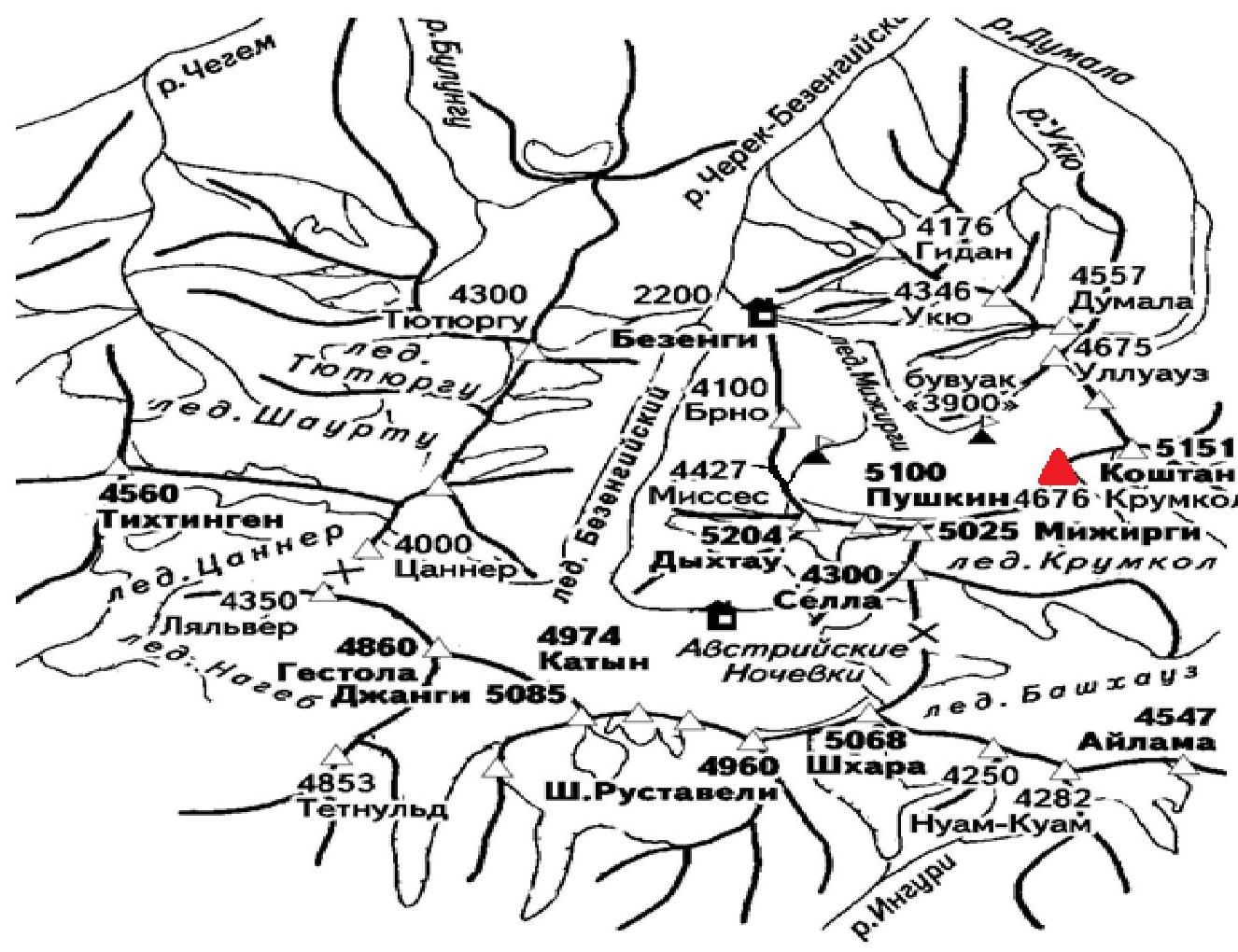
| 2.1 | Region | Central Caucasus |
| 2.2 | Valley | Bezengi |
| 2.3 | Number according to the 2013 Classification Table | 112 |
| 2.4 | Name and Height of the Peak | Krumkol (4688 m) |
| 2.5 | Geographic Coordinates of the Peak (Latitude/Longitude), GPS Coordinates *(1) | - |
| 3. Characteristics of the Route | ||
| 3.1 | Name of the Route | via the Northern Edge |
| 3.2 | Suggested Category of Difficulty | 6А |
| 3.3 | Level of Route Exploration | - |
| 3.4 | Nature of the Route Terrain | Combined |
| 3.5 | Elevation Gain of the Route (Altimeter or GPS data) | 1576 |
| 3.6 | Length of the Route (in meters) | 1685 |
| 3.7 | Technical Elements of the Route (Total length of sections of varying difficulty with terrain type (ice-snow, rock)) | II cat. diff. combination — 170 m. III cat. diff. combination — 30 m. IV cat. diff. combination — 810 m. V cat. diff. combination — 500 m. VI cat. diff. combination — 175 m. |
| 3.8 | Average Steepness of the Route, ° *(2) | 67 |
| 3.9 | Average Steepness of the Main Part of the Route, ° *(2) | 70 |
| 3.10 | Descent from the Summit | Via 4B cat. diff. to Mijirgi glacier |
| 3.11 | Additional Route Characteristics | Water (snow) available. |
| 4. Characteristics of Team Actions | ||
| 4.1 | Time of Movement (Team's Moving Hours, indicated in hours and days) | 29 hours, 2 days |
| 4.2 | Overnight Stays | Site |
| 4.3 | Time Spent on Route Development *(3) | - |
| 4.4 | Start on the Route | 3:00, July 21, 2020 |
| 4.5 | Reach the Summit | 19:00, July 22, 2020 |
| 4.6 | Return to Base Camp | 20:00, July 23, 2020 |
| 5. Weather Conditions *(4) | ||
| 5.1 | Temperature, °C | - |
| 5.2 | Wind Speed, m/s | - |
| 5.3 | Precipitation | - |
| 5.4 | Visibility, m | - |
| 6. Responsible for the Report | ||
| 6.1 | Full Name, e-mail | Matkin Sergey Vladimirovich, skitrab@mail.ru |
*(1) To be filled in ONLY if the peak is not listed in the Electronic Russian Classifier of Mountain Routes *(2) ONLY for routes of 5A category difficulty and higher *(3) If no development was done, a dash is entered *(4) Section to be filled in ONLY when submitting a report for participation in the Russian Championship and ONLY in case of adverse weather conditions. Specific values and duration are indicated
II. Ascent Description
1. Characteristics of the Ascent Object
General photo of the peak
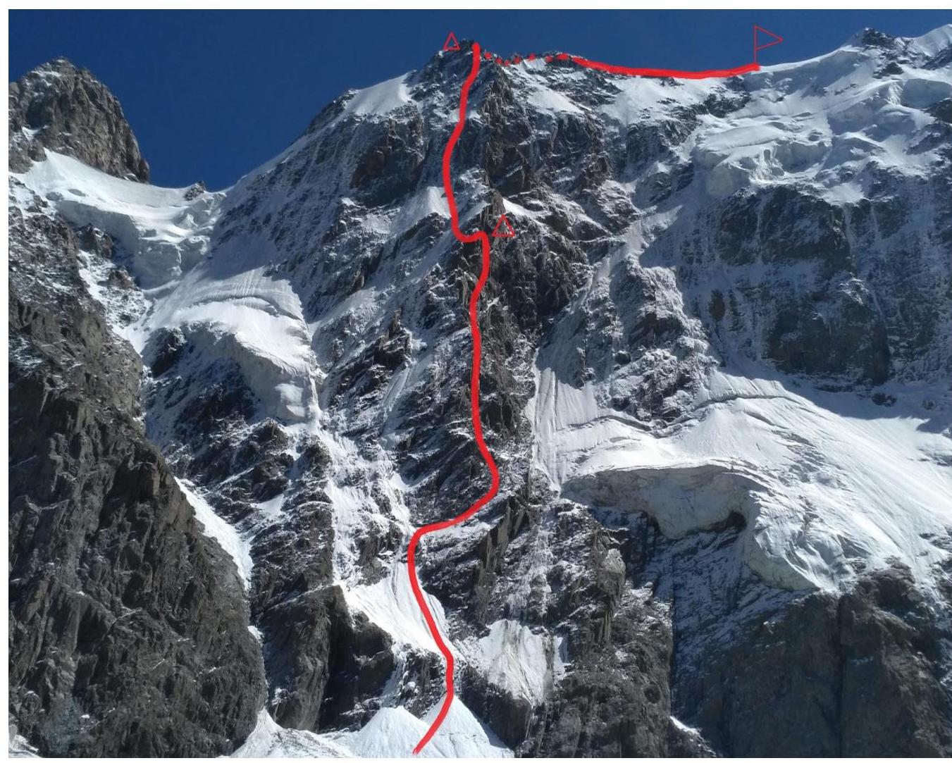
Taken from Mijirgi glacier.
| Date | № sect | Route Profile | L, m | γ° | cat. diff. |
|---|---|---|---|---|---|
| July 22, 2020 | R30–R31 | 4600 m | 70 | 55 | IV |
| R29–R30 | 50 | 70 | IV | ||
| R28–R29 | 50 | 70 | IV | ||
| R27–R28 | 50 | 85 | V | ||
| R26–R27 | 50 | 90 | V | ||
| R25–R26 | 30 | 40 | III | ||
| R24–R25 | 70 | 30 | II | ||
| R23–R24 | 50 | 85 | V | ||
| R22–R23 | 50 | 70 | V | ||
| R21–R22 | 50 | 60 | V | ||
| R20–R21 | 30 | 60 | IV | ||
| R19–R20 | 30 | 85 | VI | ||
| R18–R19 | 50 | 85 | VI | ||
| R17–R18 | 50 | 90 | VI | ||
| R16–R17 | 50 | 60 | IV | ||
| July 21, 2020 | R15–R16 | overnight stay 3998 m | 40 | 70 | IV |
| R14–R15 | 50 | 70 | V | ||
| R13–R14 | 50 | 65 | V | ||
| R12–R13 | 50 | 65 | V | ||
| R11–R12 | 50 | 60 | V | ||
| R10–R11 | 45 | 90 | VI | ||
| R9–R10 | 120 | 70 | IV | ||
| R8–R9 | 50 | 85 | V | ||
| R7–R8 | 100 | 30 | II | ||
| R6–R7 | 100 | 65 | IV | ||
| R5–R6 | 100 | 65 | IV | ||
| R4–R5 | 50 | 60 | IV | ||
| R3–R4 | 50 | 60 | IV | ||
| R2–R3 | 50 | 75 | IV | ||
| R1–R2 | 50 | 70 | IV | ||
| R0–R1 | 3075 m | 50 | 55 | V |
Panorama of the area
 Map diagram of the ascent object
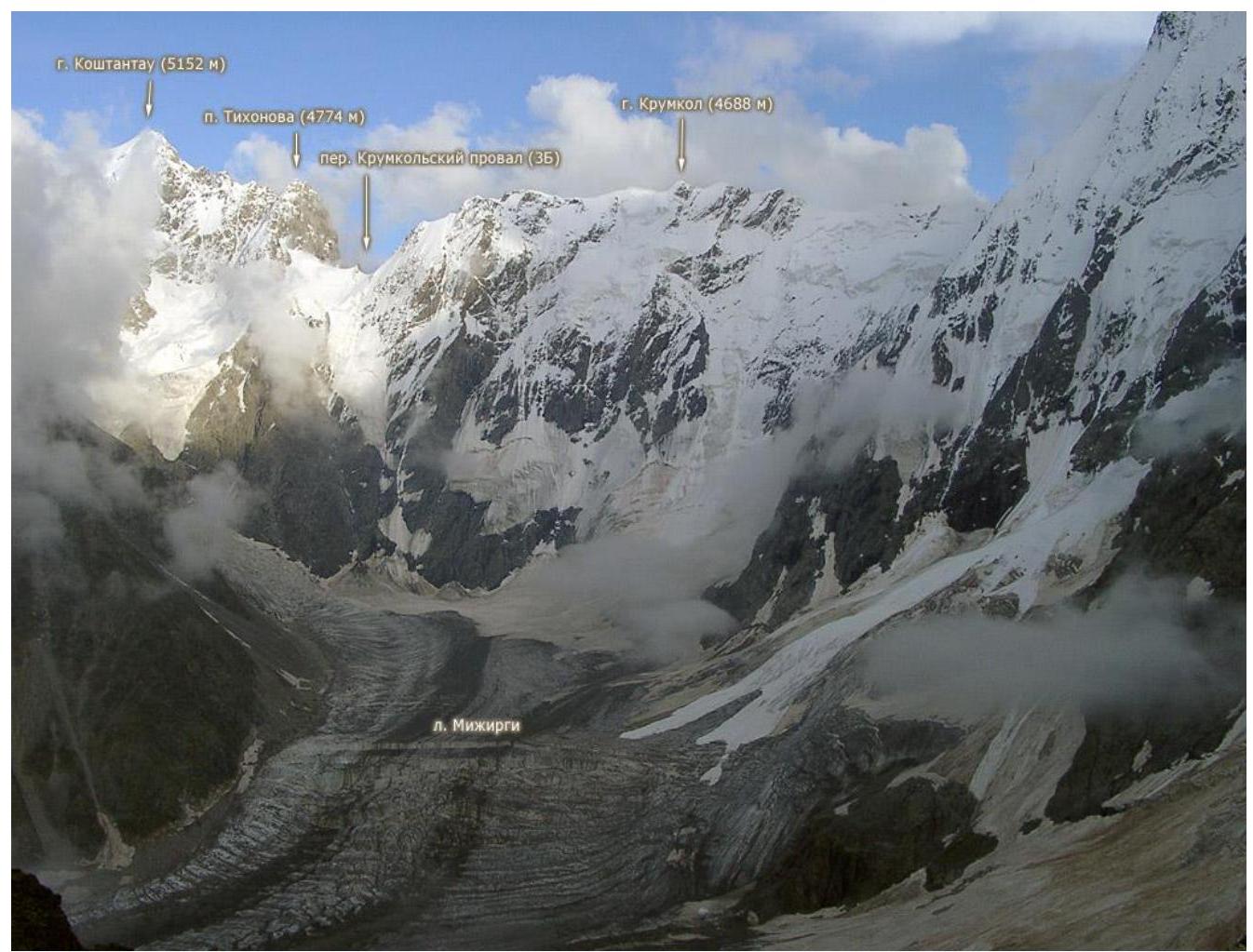
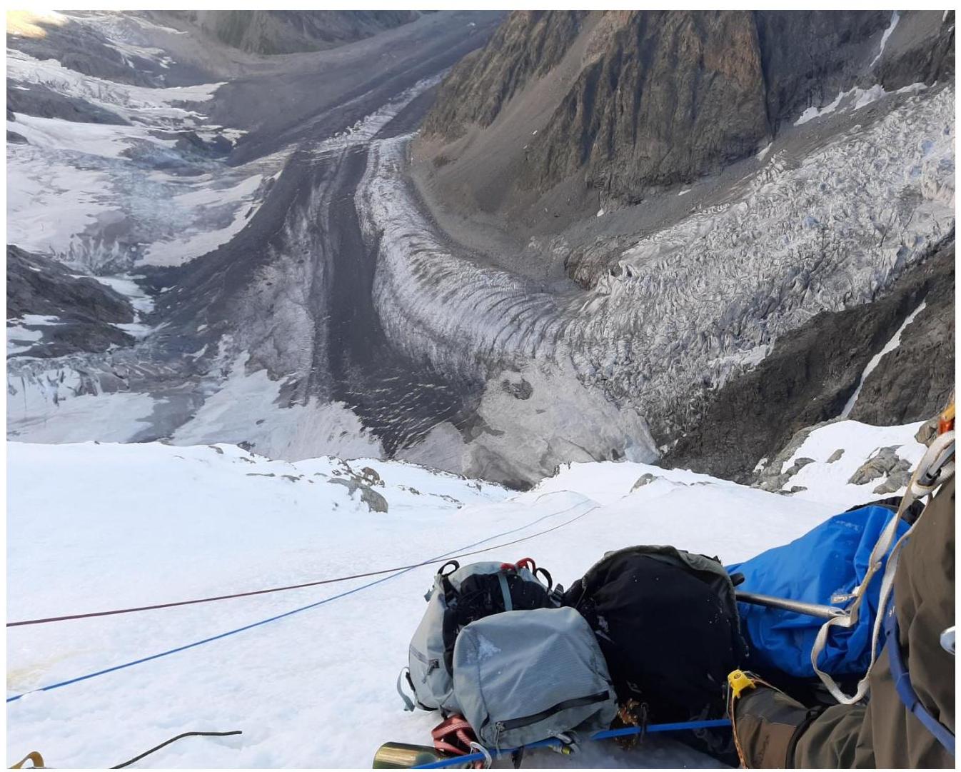
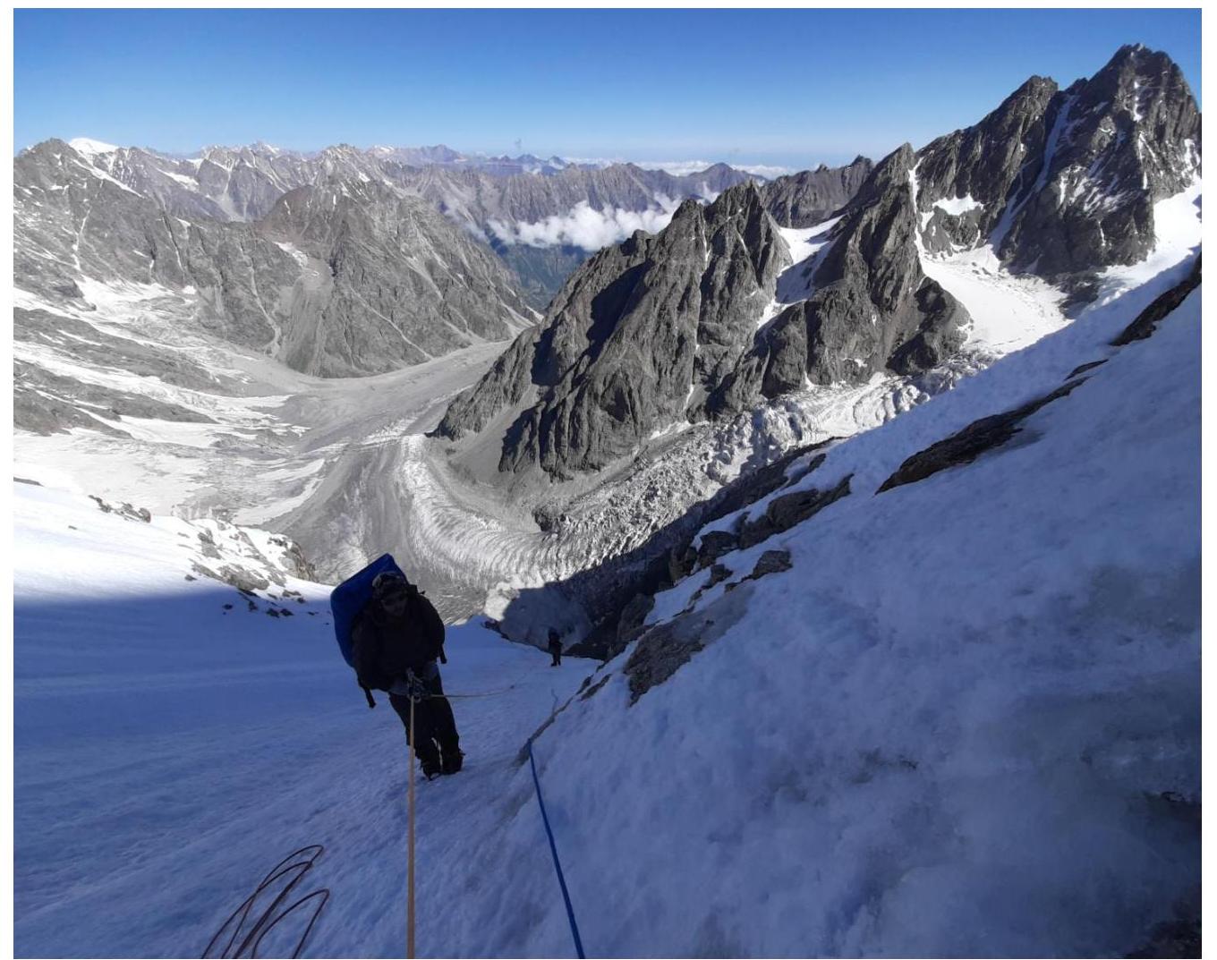
Description of the area The Central Caucasus is the highest and most inaccessible part of the Greater Caucasus mountain system. The Bezengi region, part of this mountain system, occupies a relatively small area between the Tviber pass and the Digor spur. However, the high density of peaks exceeding 5000 meters above sea level and walls with a total elevation gain of 1500–2000 meters makes this region one of the most unique mountain regions in the world.
To the north of the Central Ridge, north of the Bezengi glacier, lies a system of mountains of the Lateral Ridge, with six peaks exceeding 5000 meters above sea level, four of which are located in this ridge. This is the main sports mountaineering massif of the region, forming a horseshoe-shaped cirque around the Mijirgi glacier.
The walls of the region are sharply divided into northern and southern.
- Northern walls are typically snow-ice and combined, with steep rocky bastions, ice drops, and snow cornices.
- Southern walls are predominantly rocky.
The Krumkol peak is located in the Northern massif, in the Mijirgi glacier area.
2. Characteristics of the Route
Route in UIAA symbols
| № sect | UIAA Diagram | L, m | γ° | cat. diff. |
|---|---|---|---|---|
| R30–R31 | 70 | 55 | IV | |
| R29–R30 | 50 | 70 | IV | |
| R28–R29 | 50 | 70 | IV | |
| R27–R28 | 50 | 85 | V | |
| R26–R27 | 50 | 90 | V | |
| R25–R26 | 30 | 40 | III | |
| R24–R25 | 70 | 30 | II | |
| R23–R24 | 50 | 85 | V | |
| R22–R23 | 50 | 70 | V | |
| R21–R22 | 50 | 60 | V | |
| R20–R21 | 30 | 60 | IV | |
| R19–R20 | 30 | 85 | VI | |
| R18–R19 | 50 | 85 | VI | |
| R17–R18 | 50 | 90 | VI | |
| R16–R17 | 50 | 60 | IV | |
| R15–R16 | 40 | 70 | IV | |
| R14–R15 | 50 | 70 | V | |
| R13–R14 | 50 | 65 | V | |
| R12–R13 | 50 | 65 | V | |
| R11–R12 | 50 | 60 | V | |
| R10–R11 | 45 | 90 | VI | |
| R9–R10 | 120 | 70 | IV | |
| R8–R9 | 50 | 85 | V | |
| R7–R8 | 100 | 30 | II | |
| R6–R7 | 100 | 65 | IV | |
| R5–R6 | 100 | 65 | IV | |
| R4–R5 | 50 | 60 | IV | |
| R3–R4 | 50 | 60 | IV | |
| R2–R3 | 50 | 75 | IV | |
| R1–R2 | 50 | 70 | IV | |
| R0–R1 | 50 | 55 | V |
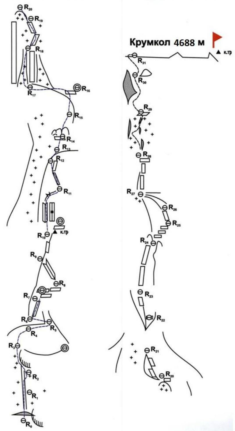
Krumkol 4688 m
3. Characteristics of Team Actions
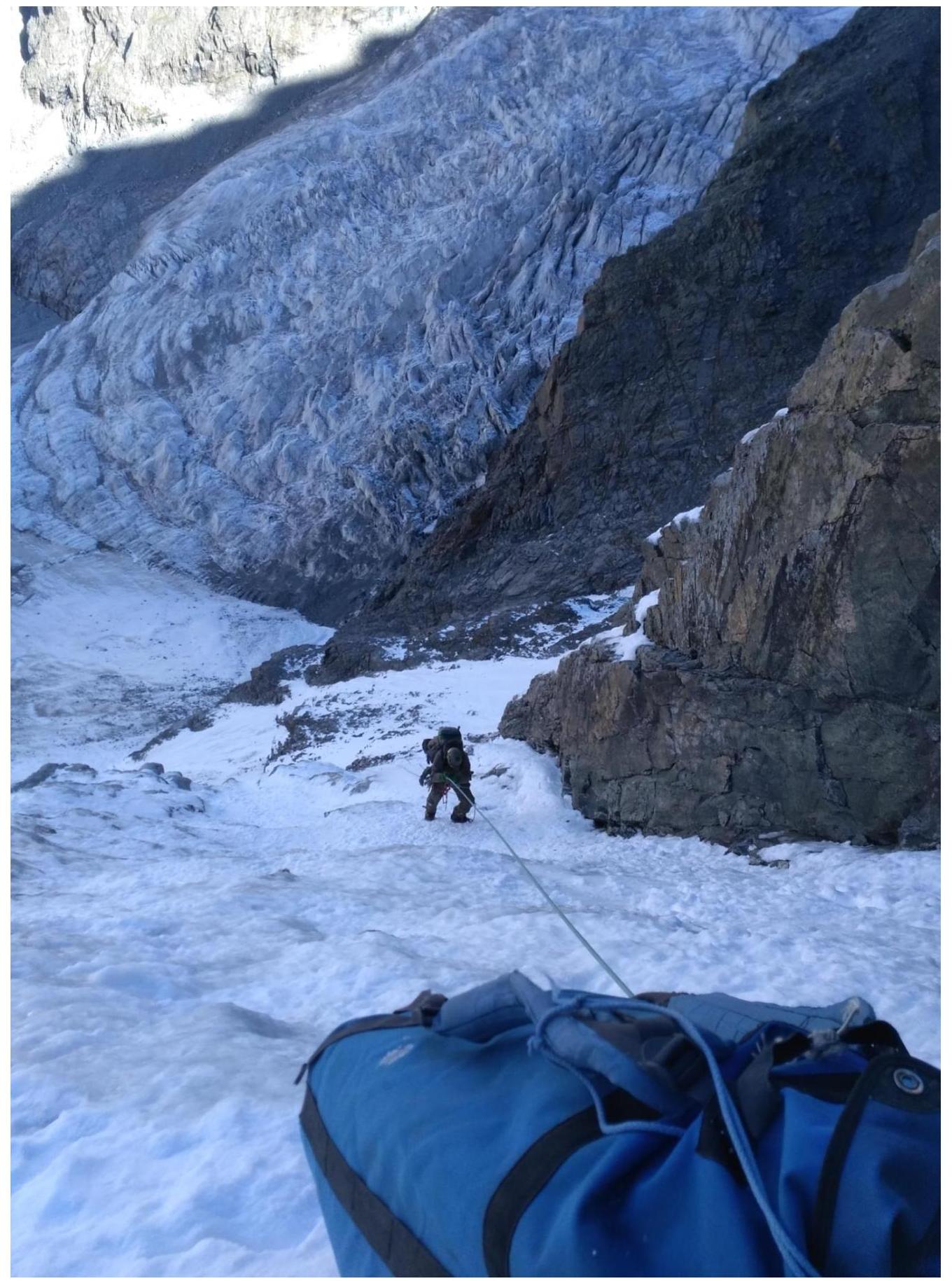
Brief description of the route passage. On July 21, 2020, at 2:30, we left the Krumkol overnight stays and began working on the route at 3:00. The weather was clear and windless. At 12:00, we reached the "Ryabukhin overnight stays", had a snack, and continued. Around 17:00, we reached the "Tammovskie overnight stays". We moved a bit higher and set up an overnight stay at 18:00.
On July 22, at 5:00, we continued moving along the route. The weather was good in the morning. By 10:00, we approached the key section of the route, the so-called "sople". At 18:00, we reached the ridge.
On the ridge:
- We found a good spot for a tent and left some gear.
- We went to the summit.
- We reached the summit in an hour.
The location of the summit tour is illogical, as it is not on the highest point of the peak (the surrounding gendarmes are higher than the summit tour location).
On July 23, at 6:00, we began descending down via the 4B category difficulty route to the northern side. At 15:30, we descended to the "3900" overnight stays. At 20:00, we reached the Bezengi alpine camp.
R4–R5
R5–R6
R6–R7
 R7–R8. Ryabukhin overnight stays
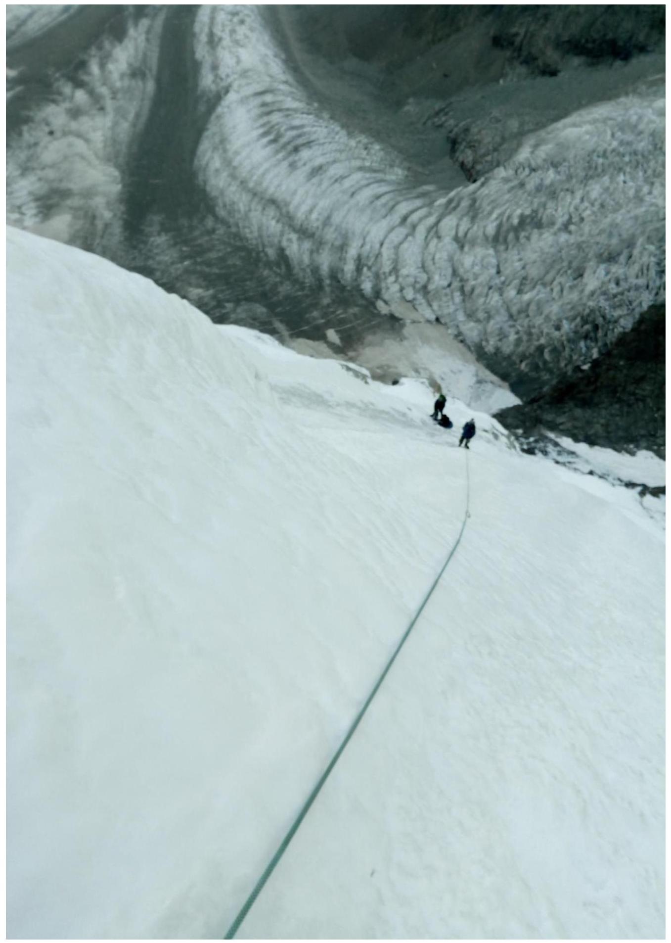
 R9–R10. Before Tammovskie overnight stays
 First overnight stay.
 R12–R13
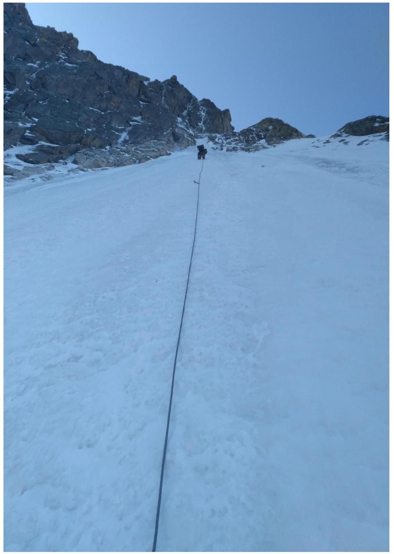
 R15–R16
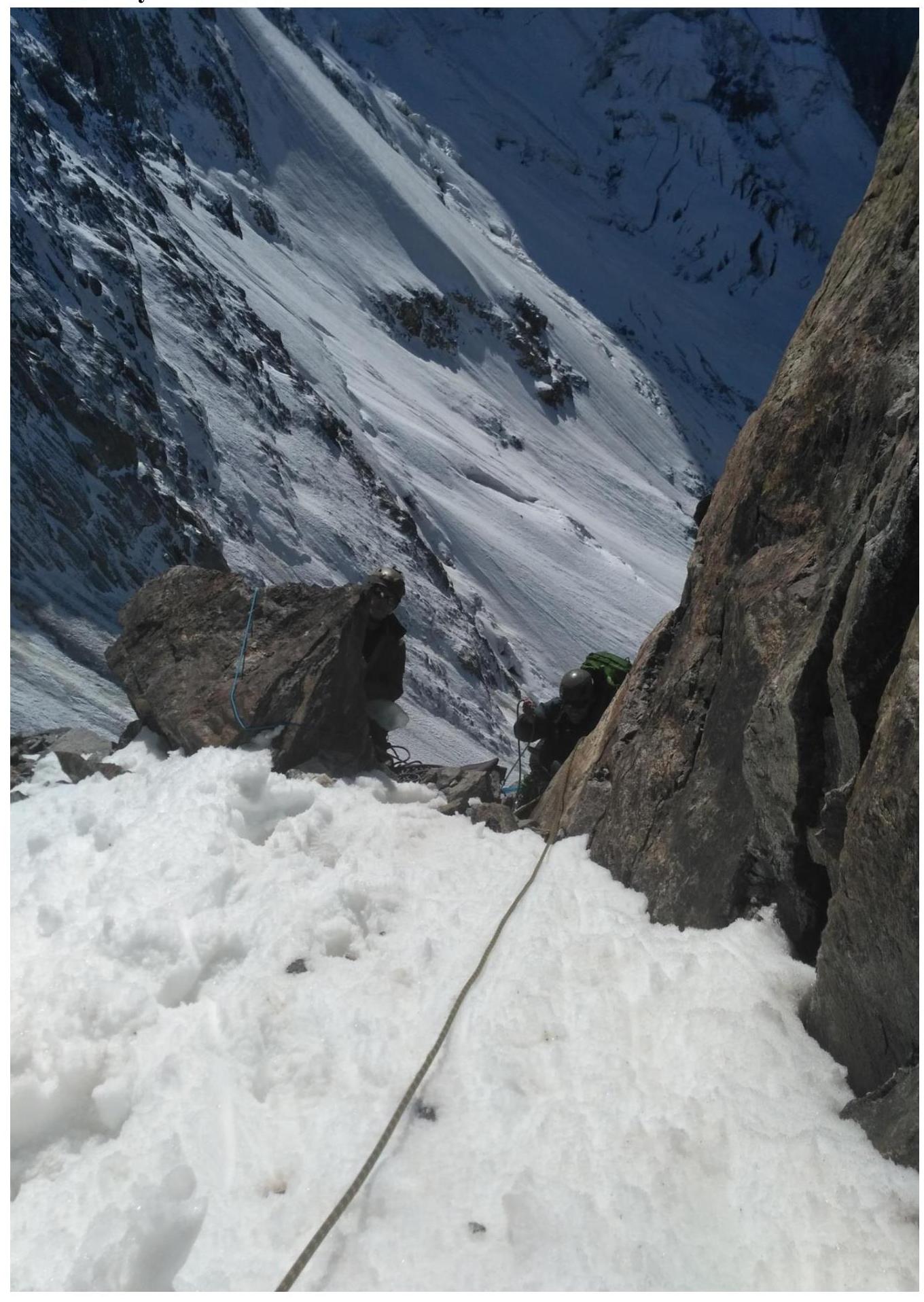
 R17–R18. Under the start of "sople".
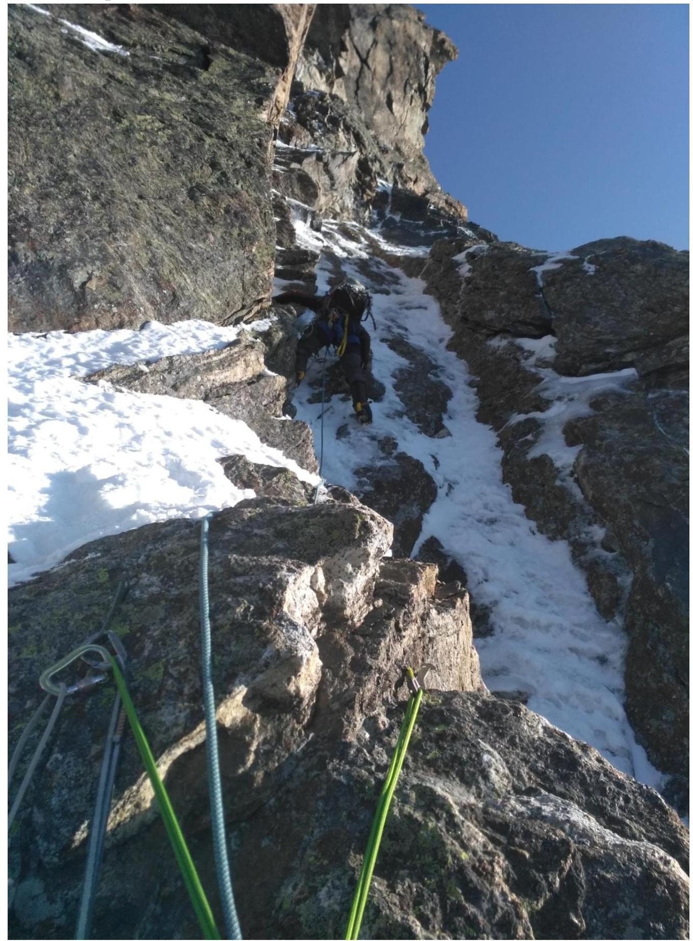
 R17–R18. Key section. "Sople".
R18–R19
 R21–R22
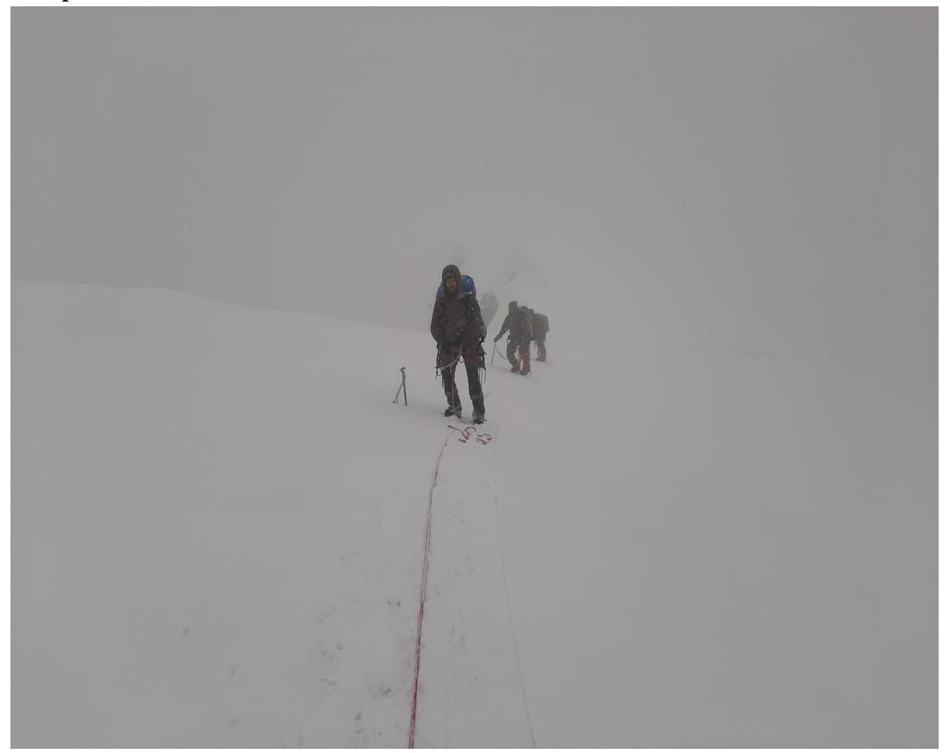
 R30–R31. Exit to the ridge.
 Near the summit.
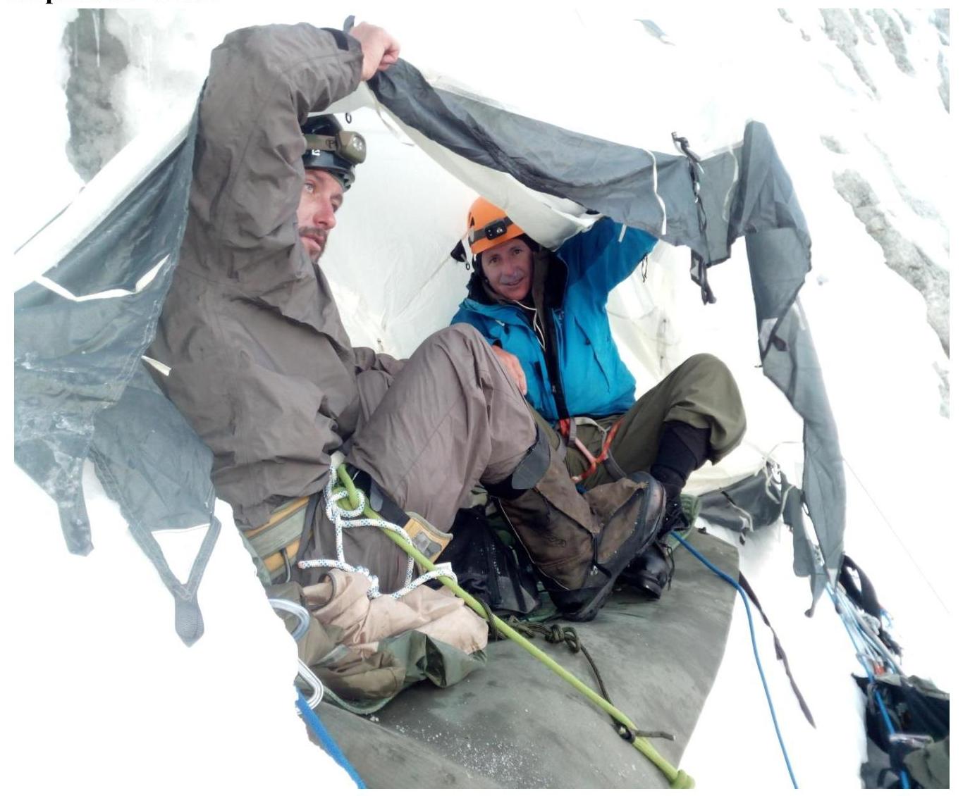
Overnight stay on the ridge.

| № sect | UIAA Diagram | L, m | γ° | cat. diff. | | R15–R16 | | 40 | 70 | IV | | R14–R15 | | 50 | 70 | V | | R13–R14 | | 50 | 65 | V | | R12–R13 | | 50 | 65 | V | | R11–R12 | | 50 | 60 | V | | R10–R11 | | 45 | 90 | VI | | R9–R10 | | 120 | 70 | IV | | R8–R9 | | 50 | 85 | V | | R7–R8 | | 100 | 30 | II | | R6–R7 | | 100 | 65 | IV | | R5–R6 | | 100 | 65 | IV | | R4–R5 | | 50 | 60 | IV | | R3–R4 | | 50 | 60 | IV | | R2–R3 | | 50 | 75 | IV | | R1–R2 | | 50 | 70 | IV | | R0–R1 | | 50 | 55 | V |
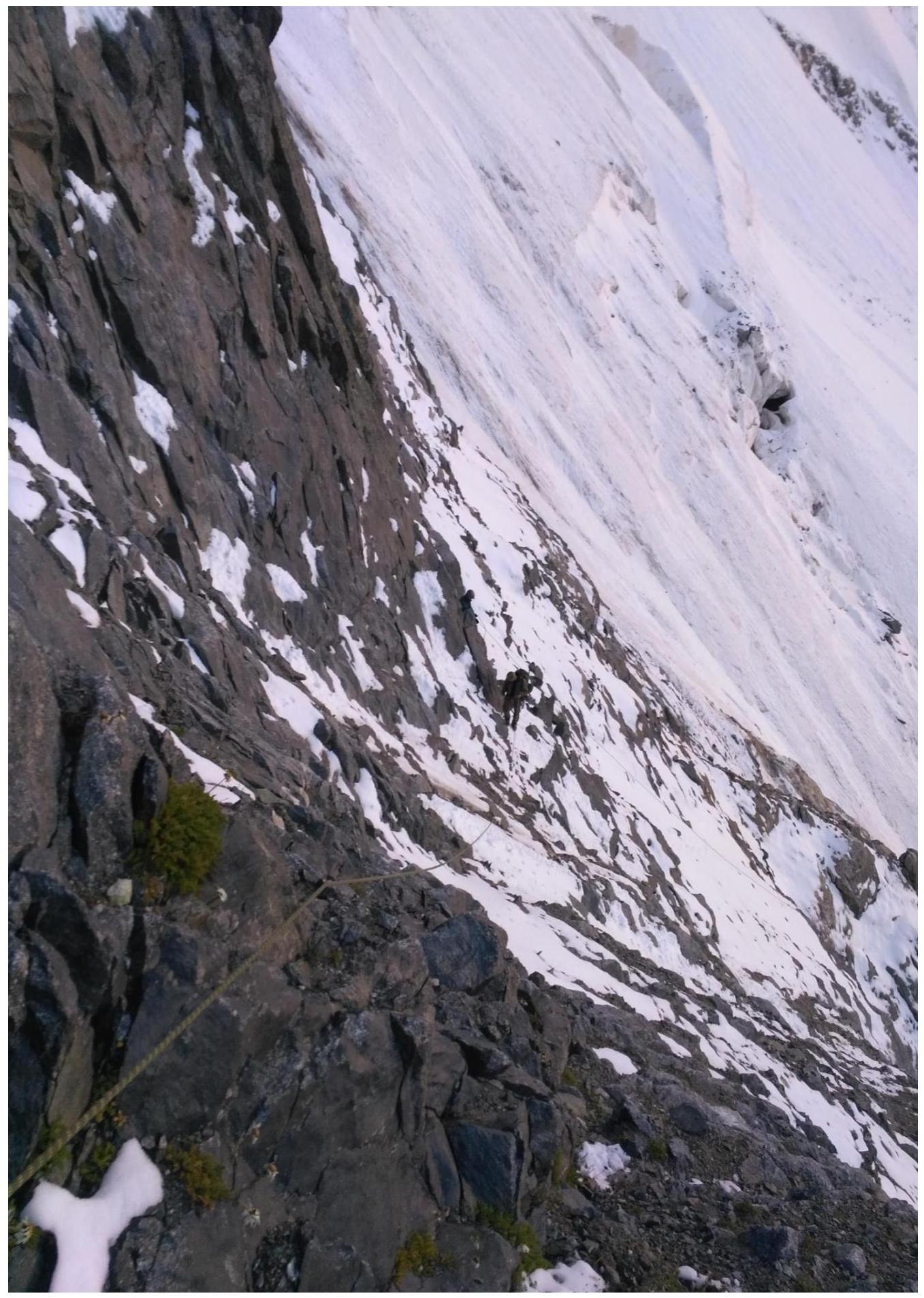
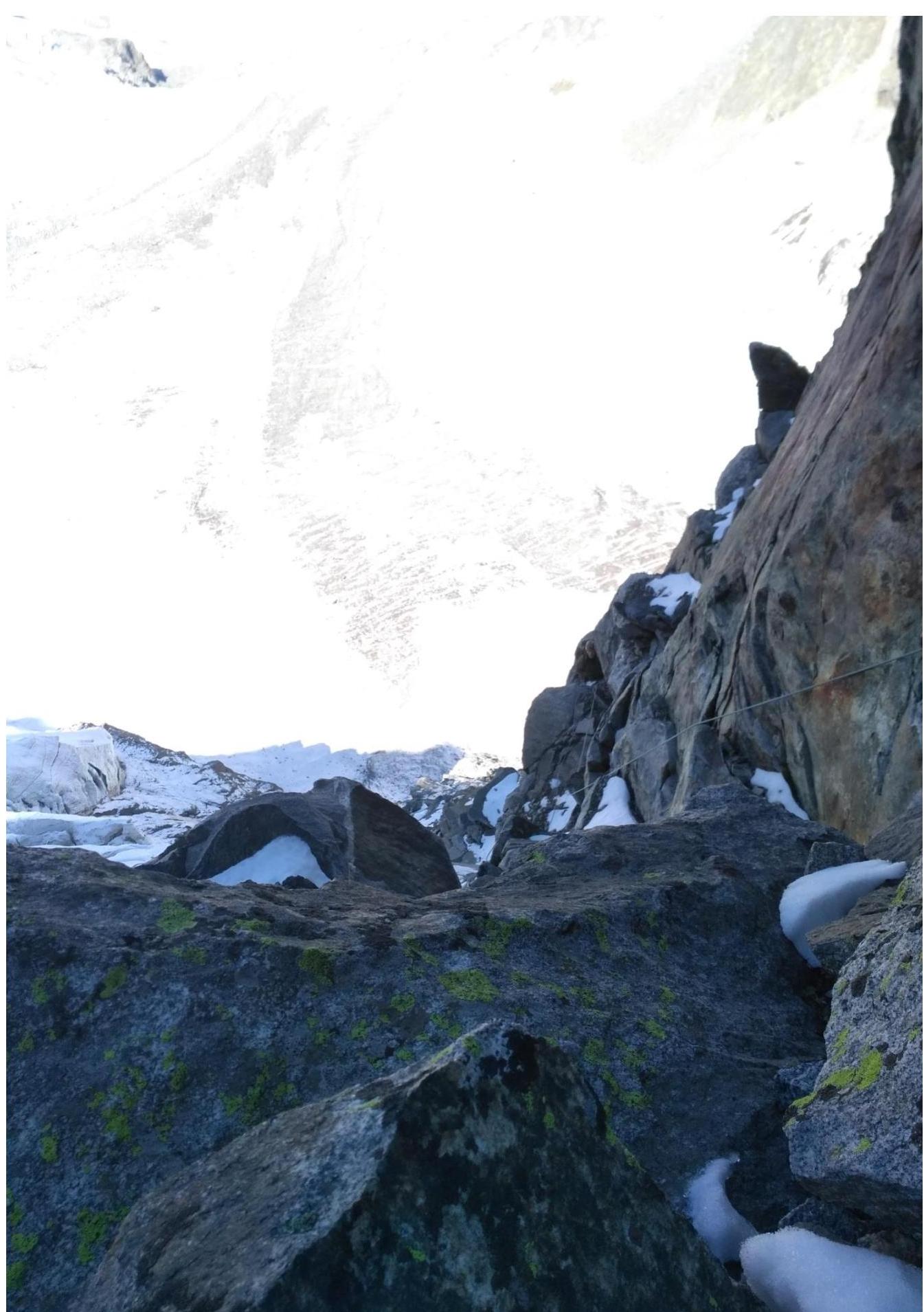
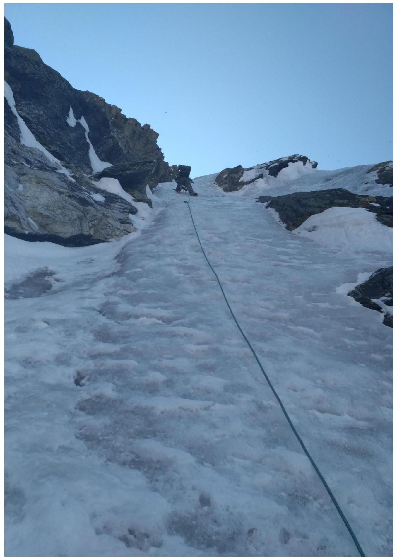
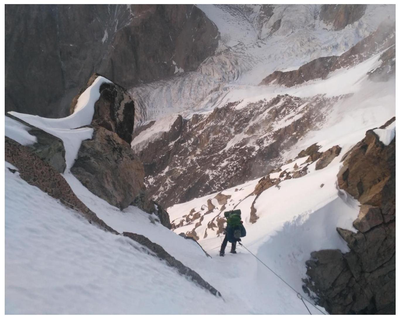
The initial bivouac is located at the "Krumkol overnight stays" on the right-bank moraine of the Kundryum-Mijirgi glacier, 200 meters from the start of the ascent to the second step of the Kundryum-Mijirgi glacier. It takes 15 minutes to walk from the overnight stays to the route. The start of the route (overcoming the bergschrund) is near a rocky outcrop. Then, up the snow-ice slope to the second rocky island. The island is bypassed via a crescent-shaped snowfield to the rocks at the lower part of the edge. Up the rocks to the right, through two snowfields, and then via a chimney to a platform between the wall and a large boulder ("Ryabukhin overnight stays"). This is essentially a departure from the edge to the 1st "mirror". The 2nd "mirror" is visible ahead. Above the platform, to the left, is a wall leading to the edge. The ascent is via a crack starting 5 meters behind the overnight stay. The wall leads to the 1st shoulder of the edge. 20 meters up and to the right, under the edge, is the "Kudinov overnight stay". The section can also be passed directly along the edge without stopping at the "Ryabukhin overnight stays". Further movement is along the edge, straight up to a sheer wall. On the wall, in a niche, is a control tour. Slightly below the tour, to the right, are two platforms, one above the other, each for 2-3 people ("Tammov overnight stays"). The platforms are sheltered by overhanging rocks. The wall is easier to pass on the left side; to do this, descend 20-25 meters to the left and start the ascent there. After passing the wall, you find yourself on an ice slope. Up and to the right - the farther to the right, the safer - via a 15-meter rocky wall and again on ice to the 2nd shoulder. On the shoulder, several good overnight stay locations are possible; the safest is the lower right one. The others are exposed. From the overnight stays, along a snowy ridge and then along an ice slope under the 2nd wall. On the wall, slightly to the left of the edge, two large internal corners filled with ice are visible, merging at the top into a common couloir. The ascent is via the left corner, 30-40 meters to the ridge separating the internal corners, and then along the upper corner. In the upper part of the section, on the last rope, it is possible to deviate to the right onto rocks. The wall leads to a shoulder. Further, the path goes along rocks and along the edge or to the left of it. The gendarme is bypassed to the right: first, a small descent, then a traverse along ledges to a large couloir exiting behind the gendarme, and, without entering the couloir, an ascent to a narrow saddle. After the saddle, an ascent along a rocky wall and then along a simpler ridge to a large rocky gendarme. Bypassing it to the right via an internal corner and ledges - exit to the main Eastern ridge of Krumkol peak. The gendarme becomes a shoulder of the ridge. The next gendarme is passed to the right and up, exiting onto its ridge. Further along the rocky ridge, which becomes a wide snowy one. Descent via the 4B category difficulty route.
Route safety assessment. The route is generally safe. The most stonefall-prone areas are at the beginning. Therefore, an early start for groups on the route is recommended. The "starting" part of the route poses a hazard due to potential melting.
There are few convenient overnight stay locations on the wall, except for the "Tammovskie". It is not recommended to rush to ascend higher than the designated overnight stays.
Radio communication is stable throughout the route. Water is available in the form of snow.