
Katyn-Tau, NE ridge – 4B cat. diff.
The initial bivouac is on the Bezengi glacier under the base of the NE counterfort. From the bivouac, cross the bergschrund via an avalanche deposit to the left of the counterfort and move up the snowy slope 400 m to the right of the avalanche chute, then traverse to the right under the rocks of the counterfort and ascend 80 m up a rocky couloir onto the counterfort.
Further:
- Keep to the left slopes
- Move up through simple rocks alternating with snowy sections
- Proceed along the snowy slope to the "cushion"
6–7 hours from the bivouac. An overnight stay can be organized on the "cushion".
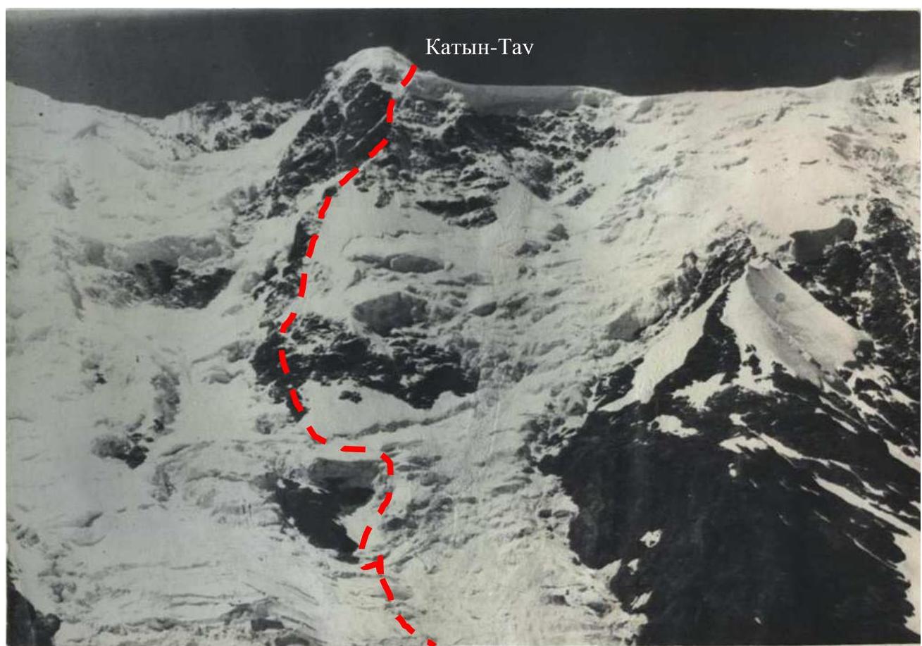
The initial bivouac is on the ridge at the beginning of the right-bank moraine of the Eastern branch of the Bezengi glacier.
From the bivouac:
- Traverse along the moraine ridge to its first depression (200–250 m)
- Descend to the glacier and approach (beware of crevasses!) the base of the NE counterfort
Ascend:
- Via avalanche deposits
- Then up and to the right along the snowy slope between the base of the counterfort and a large rocky outcrop closing the ice fall
Ascent to the ice fall:
- In its most gentle part — via the lower spur
- Then up the ice fall and left up the snowy slope along avalanche chutes to the right slopes of the counterfort
The ascent to the first lower snowy shoulder of the counterfort, 100–120 m, is via rocks of moderate difficulty and a snowy-icy slope. This section of the route, especially near the ice fall, is prone to rockfall and avalanches — and requires fast and early passage.
The path along the ridge passes through simple and moderately difficult rocks in some places, and along a snowy ridge in others, with sharp sections alternating with steep snowy-icy ascents; cornices overhang to the east. The pronounced ridge section of the route ends with a characteristic snowy-icy "knife". 12–14 hours from the initial bivouac to the snowy hollow under the base of the "knife". After the "knife", the ridge ends with massive icy "cushions" (bivouac possible), adjacent to the pre-summit slope. The pre-summit snowy-icy slope should be traversed quickly from left to right towards a chain of rocky outcrops descending from the summit, as it is threatened by massive cornices hanging from the eastern ridge of the summit. The ascent along the slope via the rocky outcrops is over loose, crumbly snow and slate-type rocks. The ascent to the summit via a steep (up to 70°) snowy slope may be blocked by a cornice. 13–15 hours from the hollow under the base of the "knife" to the summit. An overnight stay is possible in a crevasse of the icy summit dome from the southern side.
Descent from the summit to the east, to the right of the ridge, onto a broad saddle — a convenient bivouac site on icy "cushions" north of the ridge line. An icy gendarme on the ridge is bypassed to the south. 2–2.5 hours from Main Dzhangi-Tau to the Eastern summit. Further descent along the NE ridge of East Dzhangi-Tau — see description 6.
Recommended ascent plan:
- Day 1 — approach to the route
- Day 2 — passage of the ridge section of the route to the icy "cushions"
- Day 3 — ascent to the summit and descent to the eastern saddle
- Day 4 — passage of the Eastern summit and descent along the NE ridge
- Day 5 — return to the camp