-
Area: Central Caucasus, Bezengi gorge, section 2.5 of the classification table.
-
Peak name: Ak-Kaya, 3367 m, route: via the Bastion of the left part of the South wall.
-
Proposed - 6A category of difficulty, 2nd ascent.
-
Route character: rock.
-
Route height difference: 520 m. Route length: 730 m. Length of sections: V category of difficulty – 445 m, VI category of difficulty – 130 m. Average steepness:
- main part of the route – 78°,
- entire route – 70°.
-
Hooks left on the route: total — 3 pcs., including bolted — 1 pc. Hooks used on the route:
- removable bolted — 3 pcs., including for ITO — 2. Total ITO used — 16.
-
Team's working hours: 54 h, 6 days.
-
Team leader: Shanalo Valery Pavlovich, MS. Participant: Gorbatenkov Alexey Vladimirovich, 1st sports category.
-
Coach: Tulpanov Sergey Sergeevich, MS USSR.
-
Departure to the route: 9:00, February 19, 2003. Summit reached: 18:00, February 24, 2003. Return to BL: 17:00, February 25, 2003.
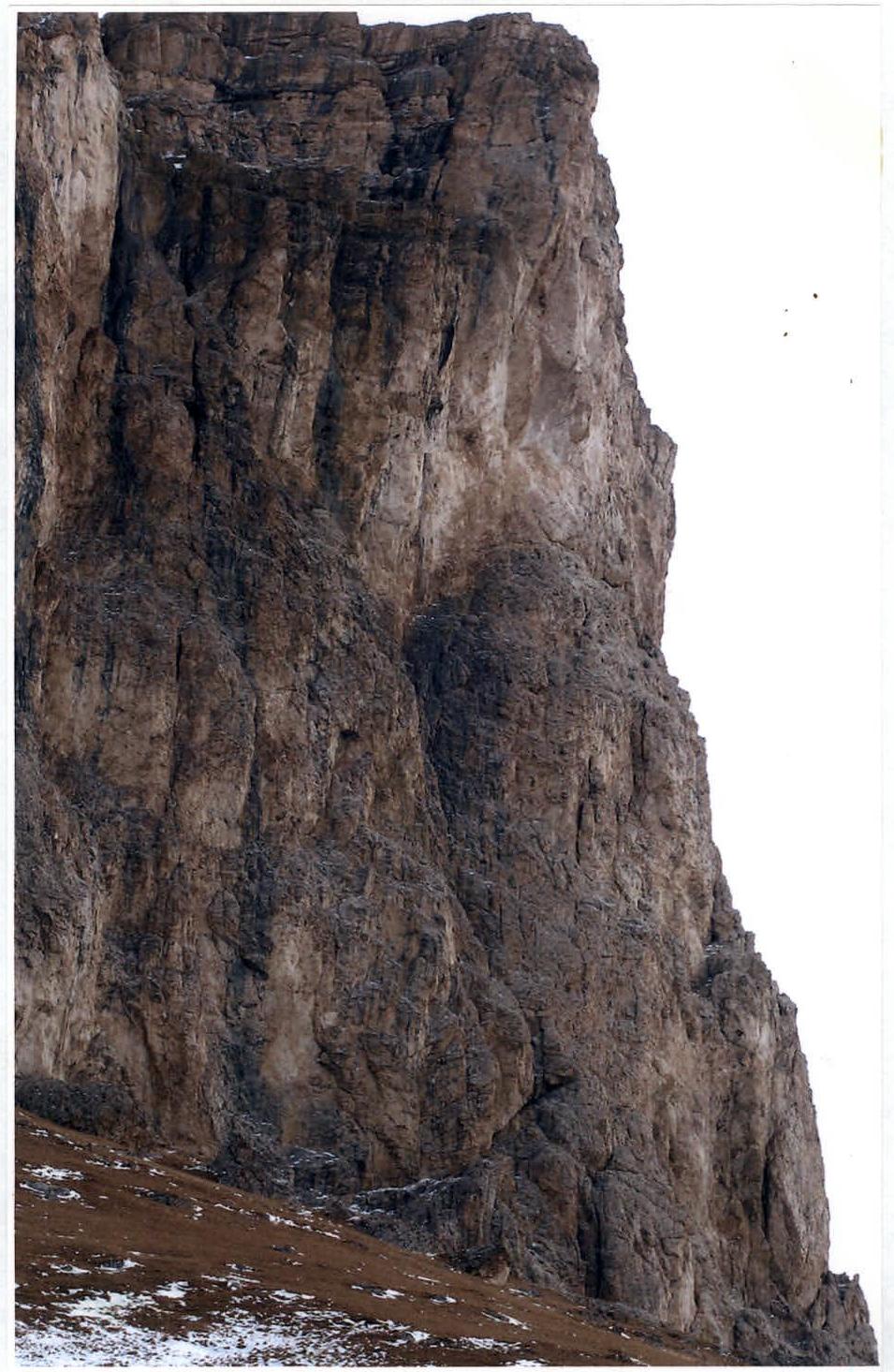
Photo 2. View from the left on the South wall of Ak-Kaya.
Profile of Vasiliev's route 1979 on Ak-Kaya.
 Profile of the route on Ak-Kaya (3367 m)
Route base: 2850 m, average steepness 78°
Profile of the route on Ak-Kaya (3367 m)
Route base: 2850 m, average steepness 78°
| Section | Category of difficulty | Length | Steepness |
|---|---|---|---|
| R27 | H/К | 40 m | 15° |
| R26 | 5 | 30 m | 80° |
| R25 | 5 | 15 m | 80° |
| R24 | 6 | 3 m | 100° |
| R23 | 5 | 20 m | 70° |
| R22 | 5 | 20 m | 85° |
| R21 | 6 | 4 m | 110° |
| R20 | 5 | 20 m | 75° |
| R19 | 5 | 35 m | 75° |
| R18 | 3 | 40 m | 60° |
| R17 | 5 | 50 m | 80° |
| R16 | 5 | 50 m | 80° |
| R15 | 2 | 20 m | 20° |
| R14 | 5 | 40 m | 80° |
| R13 | 5 | 40 m | 80° |
| R12 | 4 | 50 m | 70° |
| R11 | 5 | 40 m | 80° |
| R10 | 6 | 5 m | 100° |
| R9 | 2 | 20 m | 40° |
| R8 | 6 | 40 m | 90° |
| R7 | 6 | 20 m | 85° |
| R6 | 5 | 30 m | 80° |
| R5 | 5 | 50 m | 75° |
| R4 | 1 | 25 m | 30° |
| R3 | 5 | 15 m | 75° |
| R2 | 5 | 10 m | 60° |
| R1 | 6 | 40 m | 90° |
Brief description of the ascent area
The Ak-Kaya peak is located about 5 km from the Bezengi village in the Kabardino-Balkaria republic. The area can be accessed through Nalchik, from there by car to the Bezengi alpine camp or by bus to the Bezengi village. From the village, a dirt road leads towards the peak, which goes through a pass into the Chegem gorge approximately 1 km from the south wall of Ak-Kaya.
The mountain has fairly gentle slopes to the north, but drops off to the south with a steep wall about 500–600 m high, which is of interest for rock climbing. The USSR Championship in the rock climbing class (face-to-face) was held here on August 15, 1979.
The peak is located in the Rocky ridge, running along the Main Caucasian ridge and cut by the Bezengi, Chegem, and Baksan gorges. This ridge has the same structure and rock composition as the Erydag peak in the Eastern Caucasus and the main ridge of the Crimean mountains. The section of the ridge between the Bezengi and Chegem gorges is called Akkaya. There are several other interesting peaks near Ak-Kaya, such as Karakaya, Khungutebe, and others.
In summer, there is likely no water in the area of the wall and on the pass in dry weather.
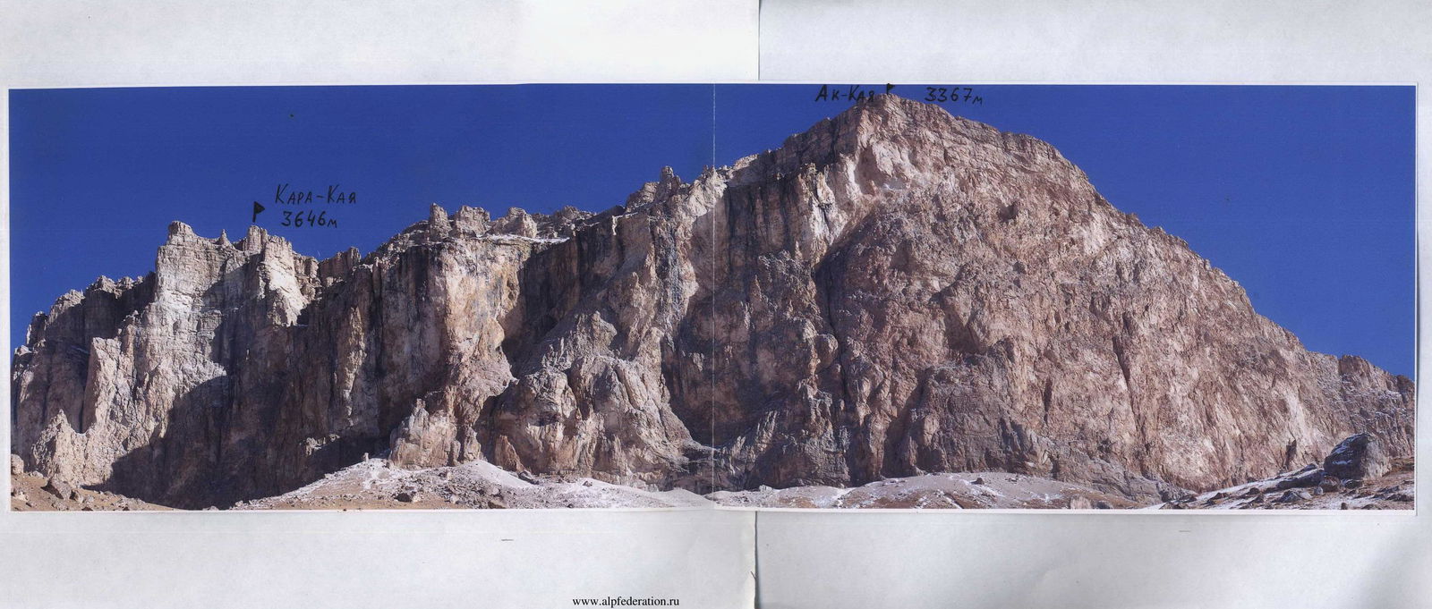
Photo 3. Panorama of the Akkaya ridge.
Kara-Kaya 3646 m
Ak-Kaya 3367 m
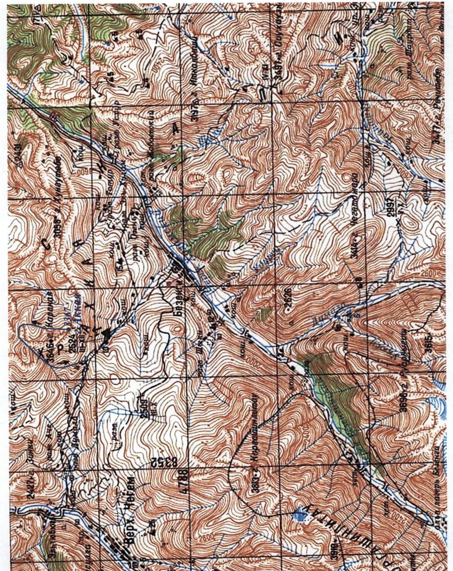
Topographic map of the ascent area. Scale 1:100 000. Blue line — descent route of V. Shanalo's team.
Registration card of a participant in the 2003 Russian Championship in mountaineering (winter class) Baranov Vladimir Yuryevich, Federation of Mountaineering, Rock Climbing, and Ice Climbing of St. Petersburg. Sports category: CMS
| Date | Peak | Route | Cat. diff. | Championships |
|---|---|---|---|---|
| February 7, 1992 | Sel'dy | SW wall | 4A | |
| July 24, 1992 | Dolomity (N) | Right pillar | 4A | |
| February 7, 1994 | Sel'dy | 3rd wall through the shaft | 4B in tandem | |
| August 1, 1962 | Ural | 3-V traverse | 4B | |
| August 3, 1996 | Ukyu | S edge | 4A in tandem | |
| August 8, 1996 | Dzhangi (E) | NE ridge | 4B | |
| August 15, 1996 | Mizhirgi | Along the ridge | 5A | |
| August 16, 1998 | Ural | 3-V traverse | 4B in tandem | |
| August 19, 1998 | Ural (E) | Right pillar, N wall | 5A in tandem | |
| July 25, 1999 | Mises | Pillar | 4B in tandem | |
| July 28, 1999 | Shkhara main | NE ridge | 5A in tandem | |
| August 4, 1999 | Ural (E) | S pillar, SE wall | 5B | |
| July 5, 2001 | Mises | Right pillar, E wall | 5B | |
| July 12, 2001 | Ural (E) | S pillar, SE wall | 5B | |
| July 20, 2001 | Krumkol | N edge | 6A | St. Petersburg Championship |
| April 17, 2002 | Sablya | Right part of the NNE wall | 6A winter, 1st ascent | Russian Championship |
| February 26, 2003 | Ak-Kaya | Left part of the SW wall | 6B winter, 1st ascent | Russian Championship |
Ascent graph on Ak-Kaya (Bezengi gorge) via the Bastion of the left part of the South wall.
| cloudy, –12 °C – –15 °C | sunny, –10 °C – –12 °C | sunny, –5 °C – –7 °C | cloudy, –10 °C – –12 °C | cloudy, –10 °C – –12 °C | sunny, –7 °C – –10 °C | |
|---|---|---|---|---|---|---|
| 700 | ||||||
| 650 | ||||||
| 600 | ||||||
| 550 | ||||||
| 500 | ||||||
| 450 | ||||||
| 400 | ||||||
| 350 | ||||||
| 300 | ||||||
| 250 | ||||||
| 200 | ||||||
| 150 | ||||||
| 100 | ||||||
| 50 | ||||||
| meters of the route completed | Preparation | |||||
| days of ascent | February 19 | February 20 | February 21 | February 22 | February 23 | February 24 |
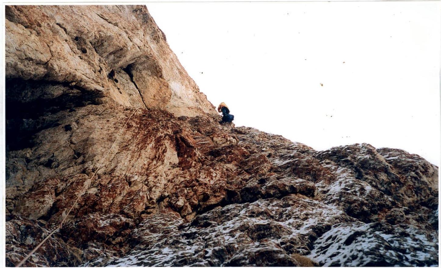
Photo 5. Section R7.
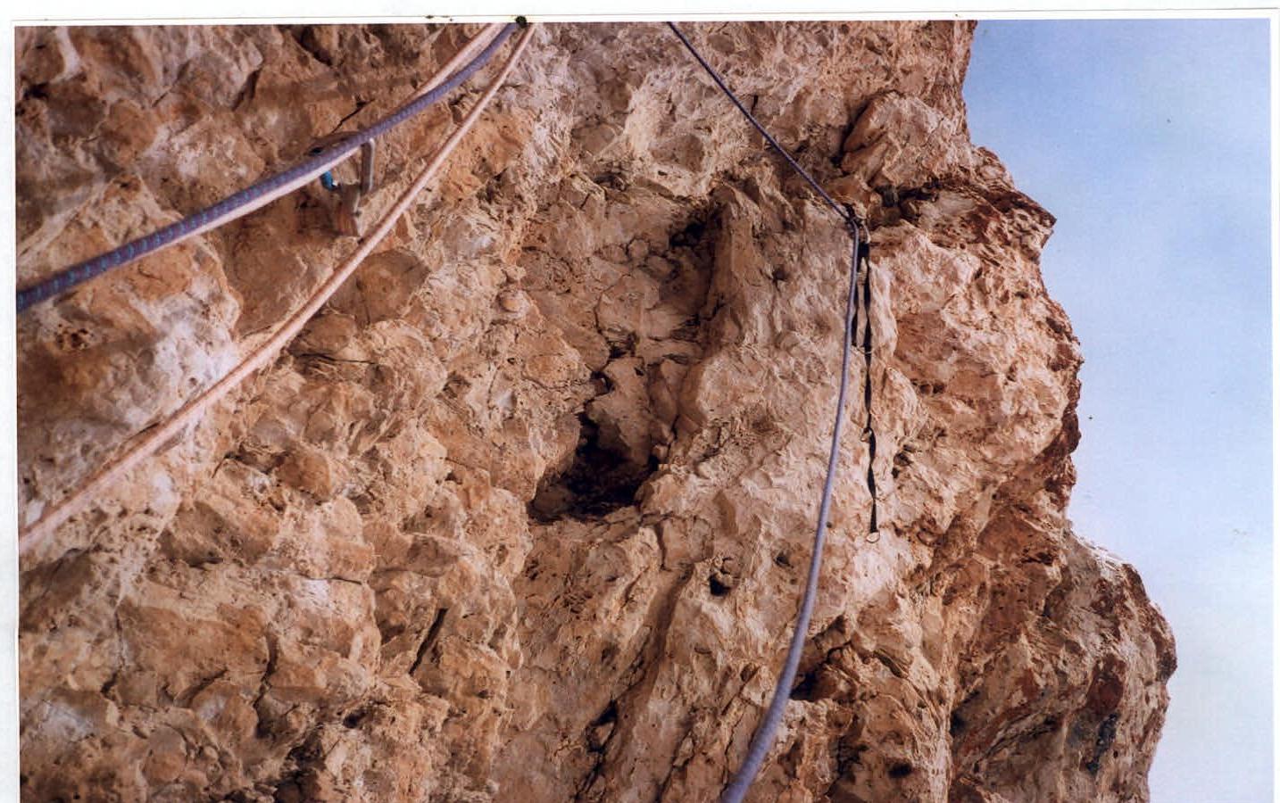
Photo 6. Section R10.
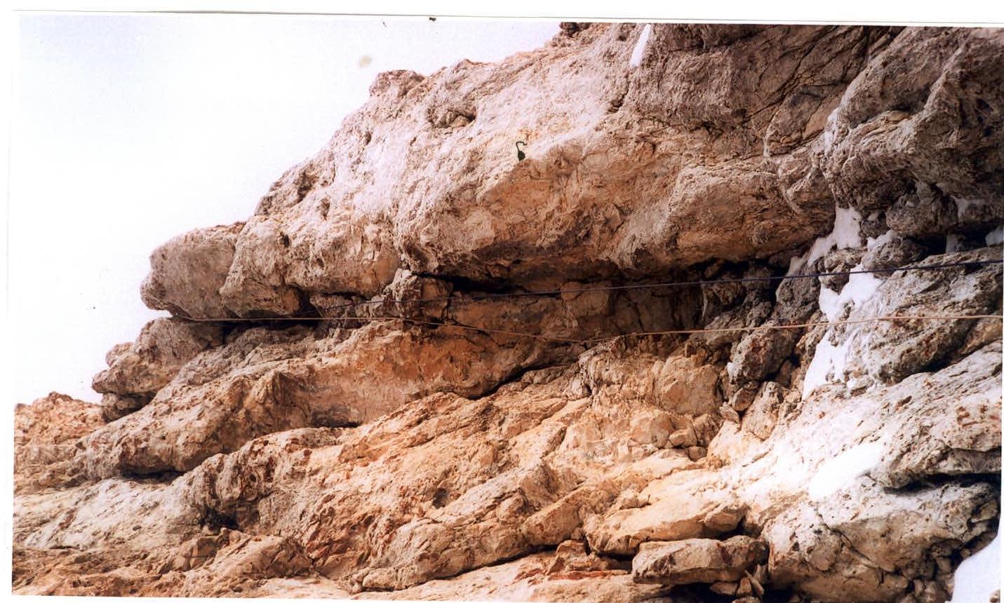
Photo 7. Upper part of section R14.
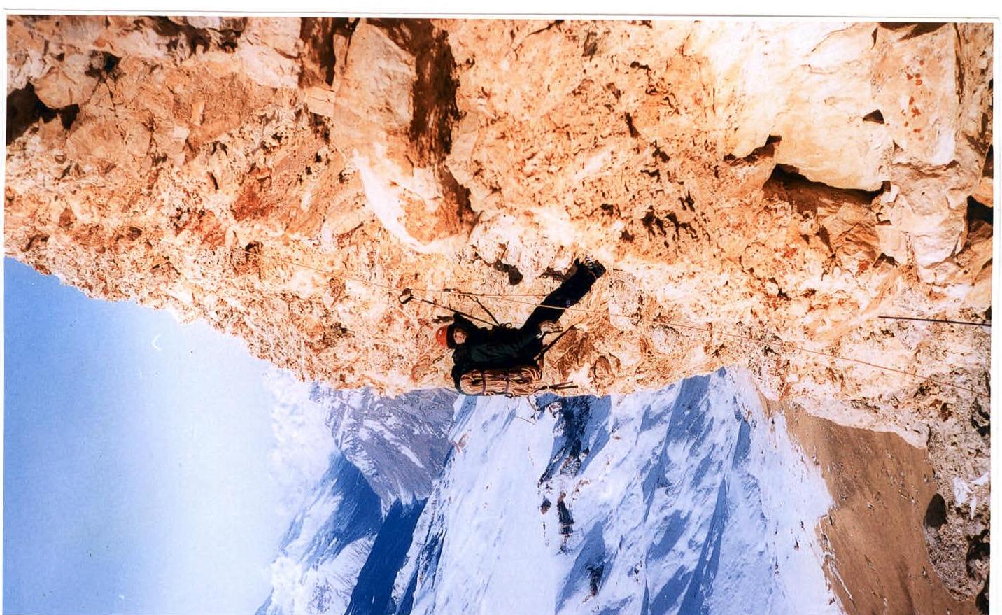
Photo 8. Climbing on a processed rope on section R15.
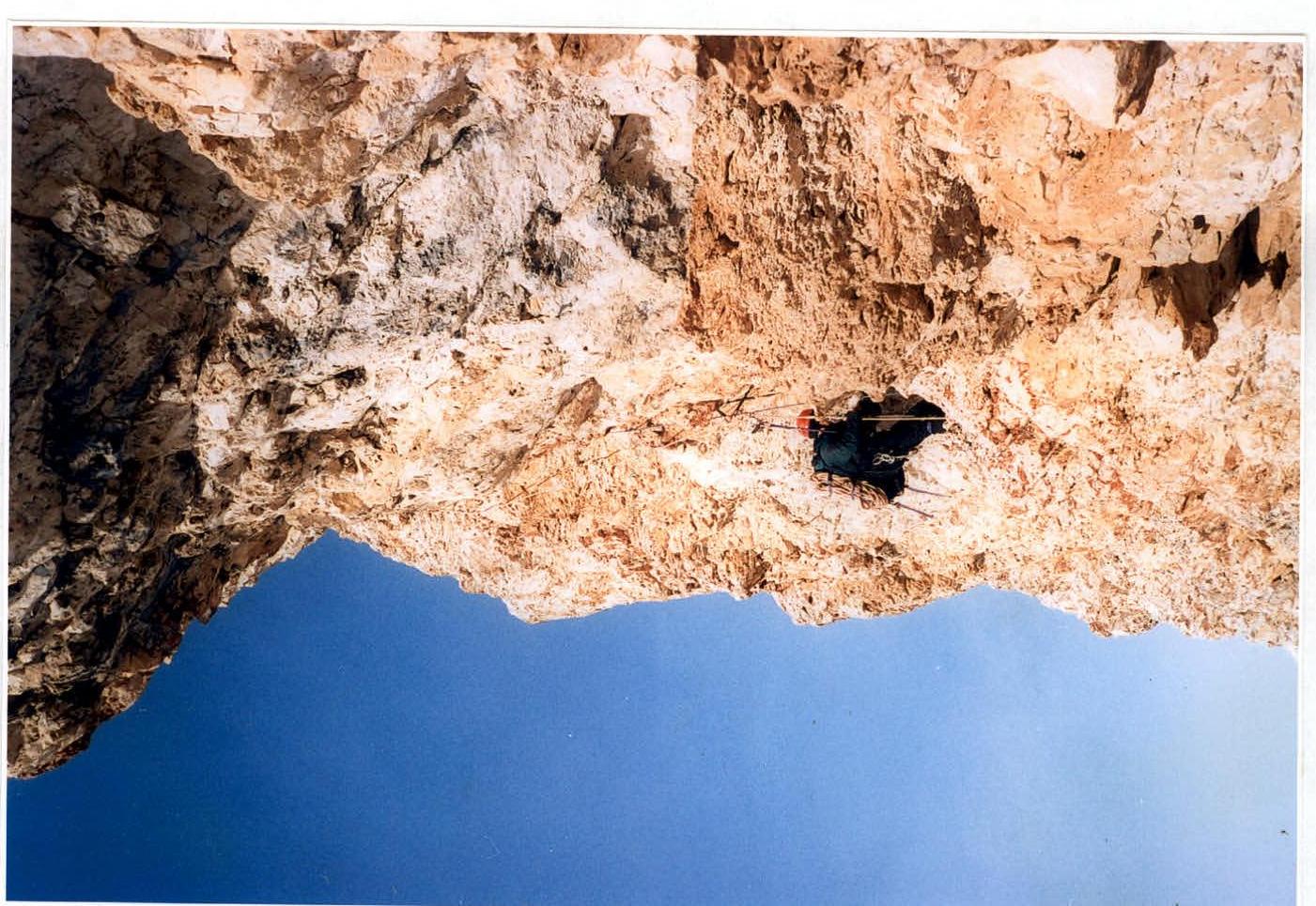
Photo 9. Section R16.
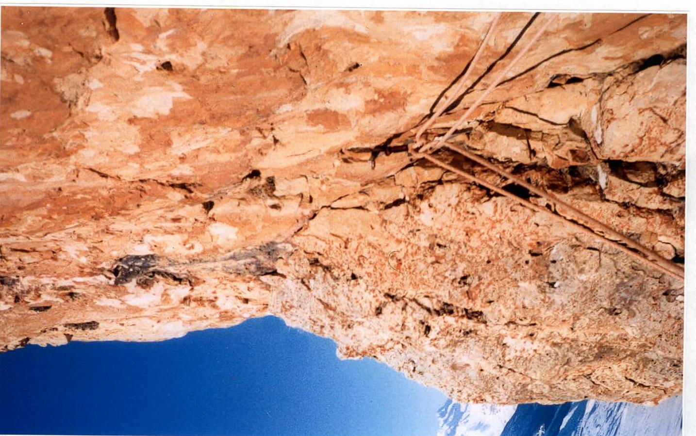
Photo 10. At the beginning of section R17.
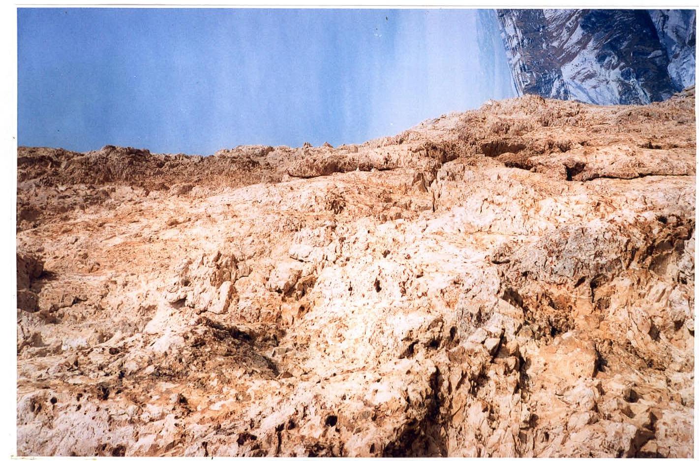
Photo 11. View to the right from the 4th bivouac, February 23, 2003.
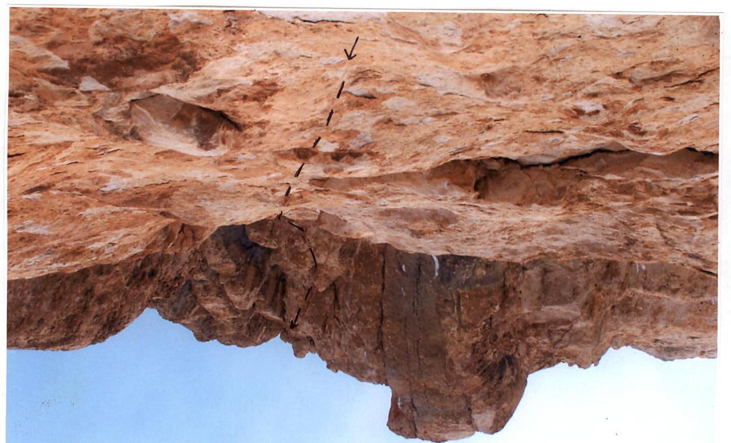
Photo 12. Traversing left on section R23.
Tactical actions of the team
February 18, 2003. Our team, along with Korabelnikov's group and a doctor, established a base camp at an altitude of about 2400 m under the south wall of Ak-Kaya. February 19. Our pair processed three ropes on Vasiliev's route 1979 and descended to the base camp. Alexey Gorbatenkov worked first. We worked on the route for about 5 hours. February 20. We left the base camp with a supply of gas and food for five nights. We processed another two ropes to section R9. We descended to a ledge on section R4 and set up a comfortable lying bivouac. Valery ShamalO worked first. We worked on the route for 10 hours. February 21. We climbed one and a half ropes to the bivouac and processed another one and a half ropes. Gorbatenkov worked first. The bivouac was sitting on a sloping ledge. We worked on the route for 11 hours. February 22. We climbed two ropes to the next comfortable ledge, set up a lying bivouac, and processed another one and a half ropes. Gorbatenkov worked first. We worked on the route for 10 hours. February 23. We climbed one rope to section R18, where we set up a lying bivouac on a narrow ledge. We processed two ropes. We worked alternately first. Time worked on the route was 8 hours. February 24. We reached the summit at 18:00. Gorbatenkov worked first. Time worked on the route was 10 hours.
Throughout the ascent, the second participant climbed on fixed ropes. The first participant's rucksack was pulled up jointly using a safety rope. When climbing on processed ropes, both participants climbed with rucksacks. Most of the time, the first participant was able to work in rock shoes worn over woolen socks and gloves.
- February 25. Return to the base camp.
- February 27. Departure to Nalchik.
The relatively slow passage of the route compared to Vasiliev's group in 1979 is explained by winter conditions (frost, cold rocks), the need to pull the first participant's rucksack, and the lack of a preparatory period in the mountains (ascents of 4–5 category of difficulty immediately before this event).
Two non-removed rock hooks were found on the route - on sections R7–R8, as well as a prepared ledge for a bivouac on section R18 (our 4th bivouac), on a rock bastion to the right of the route.
Safety measures
Throughout the ascent, the team was monitored by a doctor in the base camp, and on February 19, by Korabelnikov's group, which periodically contacted the representatives of the Bezengi alpine base via radio.
On the route, the first participant worked on a double rope, and when the second participant climbed on the perlines, safety was ensured.
Protocol of the discussion of ascents of the expedition of the St. Petersburg FASiL on Ak-Kaya (Central Caucasus, Bezengi gorge, Akkaya ridge).
March 3, 2003, St. Petersburg
Present:
- Korabelnikov K. V., leader of the first ascent on the left part of the SW wall,
- Kofanov S. A., participant in the first ascent on the left part of the SW wall,
- Baranov V. Yu., participant in the first ascent on the left part of the SW wall,
- Nikitin A. B., participant in the first ascent on the left part of the SW wall,
- Shanalo V. P., leader of the ascent on the Bastion of the left part of the SW wall,
- Gorbatenkov A. V., participant in the ascent on the Bastion of the left part of the SW wall,
- Tulpanov S. S., coach of the expedition.
ShamalO V.
While Korabelnikov's group was examining the wall on February 19, Gorbatenkov and I started processing the route. The route is characterized by rocks that have low hardness and strength along almost its entire length, which created additional difficulties in organizing safety and passing sections. The relatively slow passage of the route is explained by winter conditions and a smaller number of participants compared to the first ascenders (necessity to pull the rucksack).
The route was completed according to the planned schedule and without critical situations. I believe the route corresponds to 6A category of difficulty. Among the routes I've done, it's similar in terrain to the route on Erydag "through feathers," and in terms of difficulty to the route on Asan Pogorelova.
Korabelnikov K.
On February 19, after examining the wall from different sides, we decided to take the route to the left of Vasiliev's route, which the ShamalO-Gorbatenkov pair had already started. Another logical option was the route through the huge chimney of the SW wall of the peak. But it's a bit shorter, and there's a large cornice in the upper part, which, judging from binoculars, can't be avoided. We decided to process the wall until we found a safe place to set up a tent.
On our route, as on almost the entire wall, the lower part of the rocks is very steep and, in some places, overhanging. The most difficult section of the route is the light-yellow smooth "bulge" overhanging in the lower part and ending with a cornice. It's not so much due to the steepness of the wall, but the lack of cracks for safety. The rocks in this area are practically unbroken, and the existing cracks are superficial and die out in the monolith at a shallow depth. It took almost 2 days to overcome this section. Overall, I wouldn't say that the rocks on our route are heavily destroyed, except for the upper part. Obviously, the wall is somewhat stronger here than on Vasiliev's route.
The route turned out to be very logical, with no ways to bypass difficult sections from the start.
I believe the route corresponds to 6A category of difficulty. Compared to the route on Sablya peak (Polar Urals), this route, although shorter, is more complex due to the large number of overhanging sections.
Kofanov S.
The route was completed according to the planned schedule. No emergency situations arose. The route corresponds to 6A category of difficulty. Compared to Voronov's route on Erydag, which had the highest rating at the 2002 Russian Championship, this route, although shorter, is more complex in some places due to cornices and a smooth yellow "bulge" that can't be bypassed from the point below it. If you exclude this "bulge" and a series of cornices in the upper part, the routes are very similar in complexity and terrain.
Baranov V.
The route corresponds to 6A category of difficulty. I had never encountered sections of such steepness and low rock strength before. In my opinion, safety was maximally ensured. The bivouac was chosen under an overhanging section, and the ropes were laid to minimize the risk of damage from rockfall. The presence of a doctor in the expedition increased confidence in our abilities.
Gorbatenkov A.
In the summer, we could have climbed faster. Almost every evening, a small cloud descended onto the wall, disappearing at night, and bringing sparse snow that covered the holds. I believe the route corresponds to the declared category of difficulty.
Tulpanov S.
Why did the route climbed under V. ShamalO's leadership turn out to be 100 m longer than Korabelnikov's route with the same height difference?
ShamalO V.
On our route, there were several simple ledges of 2–3 category of difficulty, which are also included in the overall length.
Korabelnikov K.
Our route turned out to be more direct, with the lower part being almost linear.
Tulpanov S.
I believe the expedition successfully accomplished its task. Korabelnikov's route is shorter but has more overhangs and cornices, while Vasiliev's route, climbed by the ShamalO-Gorbatenkov pair, is longer but somewhat easier.
Based on my impressions from 1979, feedback from participants, and photos taken, both routes correspond to 6A category of difficulty.
In my opinion, the overall organization and safety of the expedition were at a high level.
 ShamalO V. P.
Korabelnikov K. V.
Tulpanov S. S.
ShamalO V. P.
Korabelnikov K. V.
Tulpanov S. S.
