
St. Petersburg Climbing Championship 2012
Report
Team UTZ FASIL St. Petersburg on ascending Ak-Kaya peak, B. Vasiliev's route variant (1979) on SW wall, cat. 5B
Contents
Climb Passport – p. 3 Photo with route threads to the summit – p. 4 Photo of the general view of the summit with the route thread – p. 5 Brief overview of the area and climb object – p. 7 Climbing area map – p. 8 Preparation for the climb – p. 9 Safety measures – p. 9 Ascent scheme – p. 10 Route profile – p. 11 Route description by sections – p. 12 Tactical actions of the team – p. 13 Equipment table – p. 15 Route characteristics – p. 16 Route photos – p. 17
Climb Passport
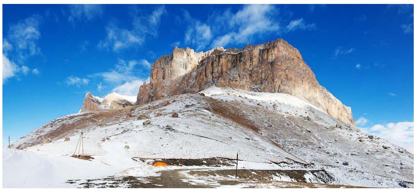
- Caucasus, Bezengi gorge
- Ak-Kaya massif (3400 m), SW wall, B. Vasiliev's route variant
- Route cat. 5B
- Route type: rock
- Height difference 500 m, length 670 m, length of sections with V cat. difficulty – 225 m, length of sections with VI cat. difficulty – 297 m, length of sections with VII cat. difficulty – 32 m, aid climbing – 95 m. Average route steepness – 85°.
- Equipment left on the route: total – 0
Used on the route:
- anchor pitons – 80,
- camalots – 85,
- chocks – 3,
- including artificial protection points – 25.
- Team's total climbing hours: 40 h, 6 days (including 3 days of processing).
- Participants:
- Klimenko Vladimir Vitalievich – 2nd sports category – team leader
- Zalutskaya Maria Evgenievna – 1st sports category – participant
- Solodkiy Anton Valentinovich – 2nd sports category – participant
- Coach:
- Lobachev Evgeniy Aleksandrovich – Candidate Master of Sports
- Time:
Route processing:
- January 2, 2012 12:00–17:00 R0–R1
- January 3, 2012 11:00–17:00 R1–R3
- January 4, 2012 11:00–17:00 R3–R6 Ascent:
- January 5, 2012 11:00–21:00 R6–R12
- January 6, 12:00–19:00 R12–R18 Descent:
- January 7, 2012 12:00–17:00
- Organization: Training Collection of the Alpinism, Rock Climbing, and Ice Climbing Federation of St. Petersburg
Photo with route threads to the summit
Vasiliev's route
Vasiliev's route variant by Klimenko's team
Odeсса team route
Bershov's route
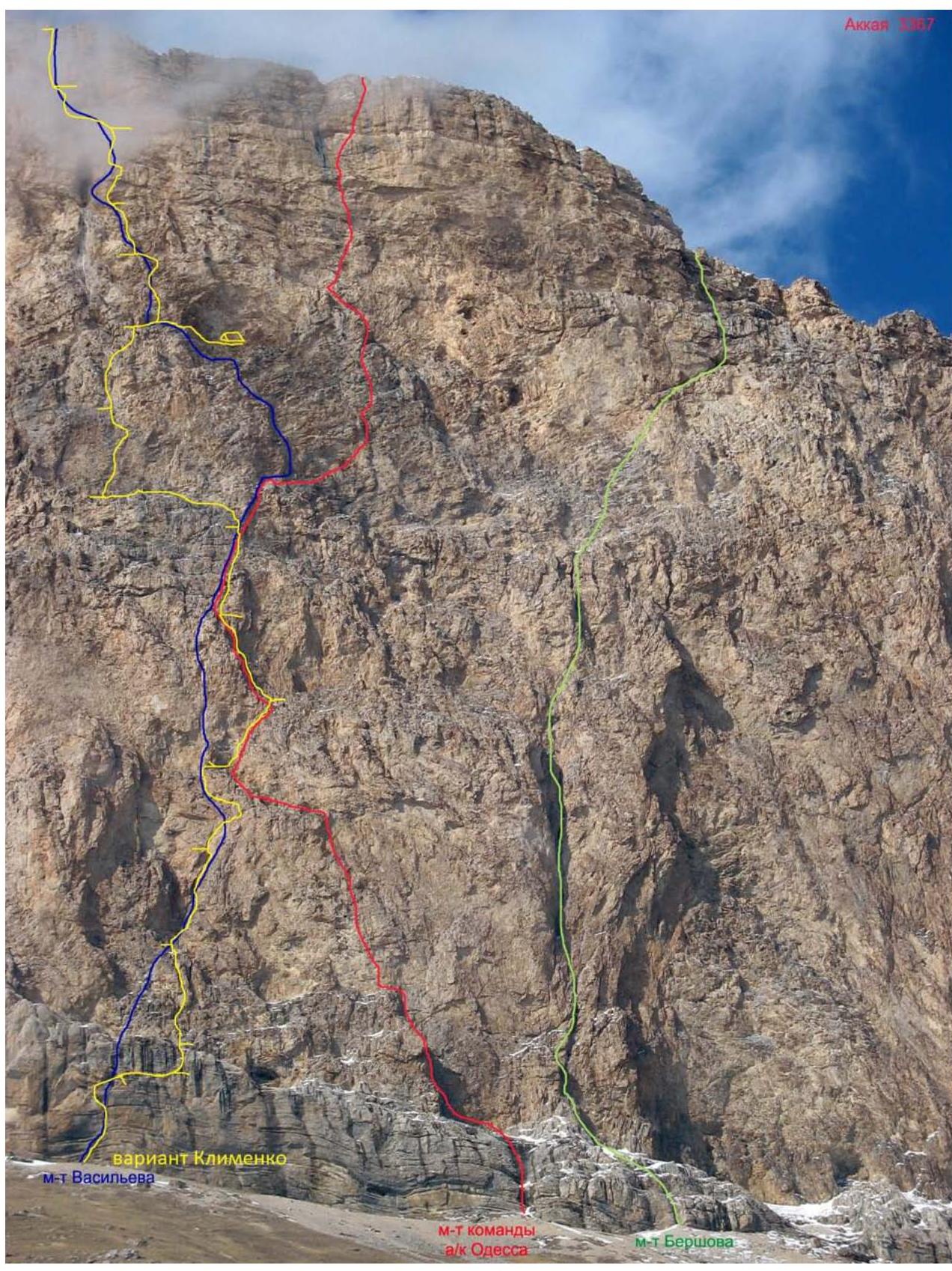
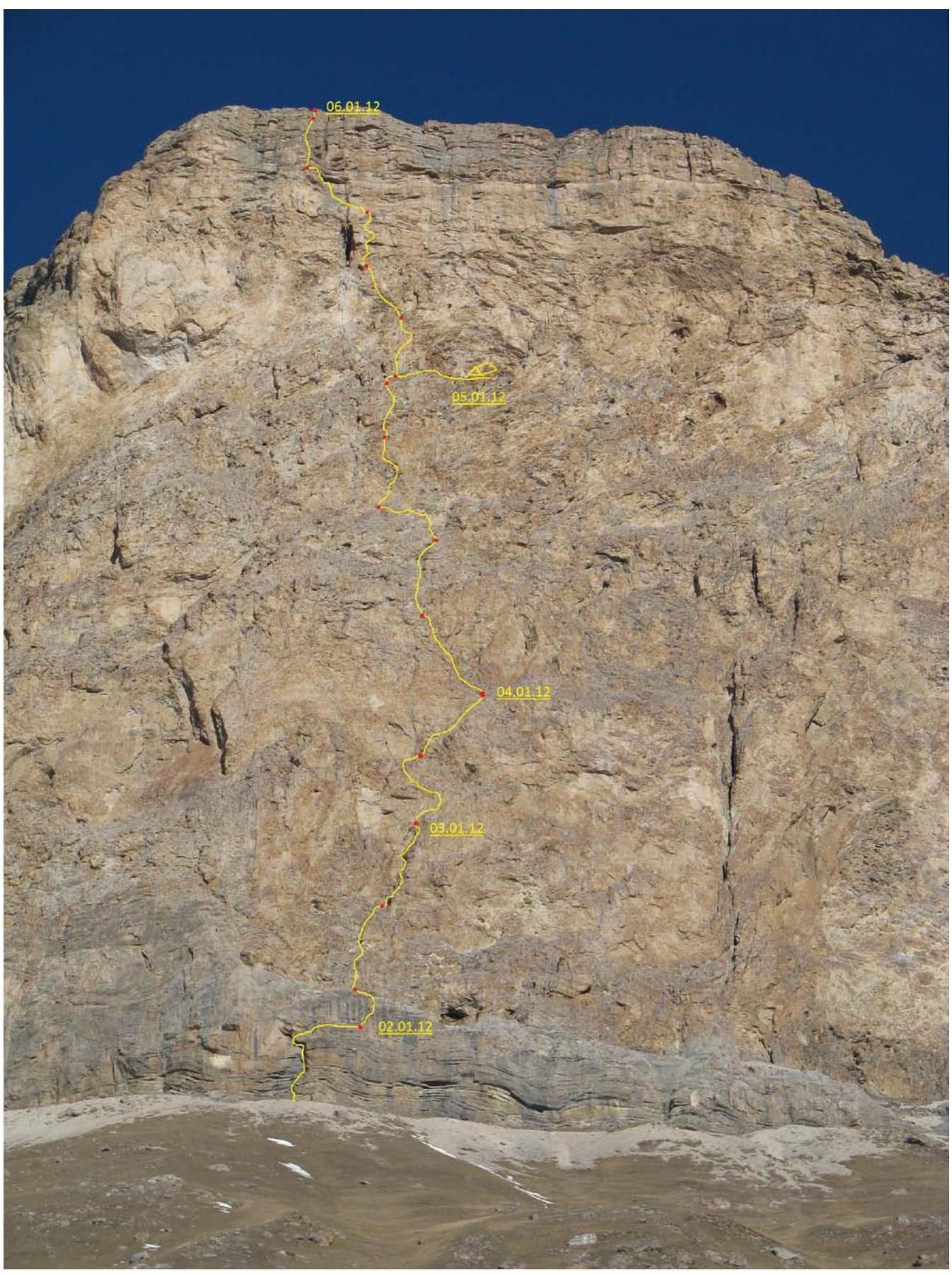
Photo of the general view of the summit with the route thread
Broken down by sections

Photo of the general view of the summit with the route thread
Broken down by days
Brief overview of the area and climb object
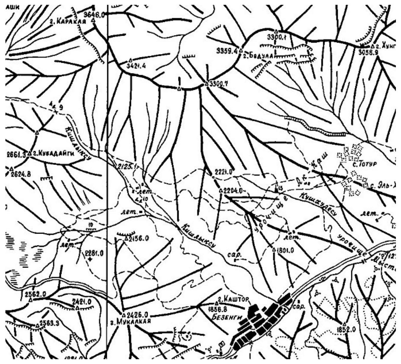
The Ak-Kaya massif is located north of the Main Caucasian Ridge, in one of its spurs in the Bezengi settlement and gorge area. The area was popular in the 1980s as a site for alpine climbing competitions. Easy access and short approaches, along with a strong wall, attracted athletes. Later, the area was forgotten, and ascents here became rare. Most ascents made in the last decade were conducted in winter.
Access and approach to the route are through the Bezengi settlement. In the settlement, you need to look for a turnoff from the main road to the right. The road will wind up the slopes and lead you along the wall to the pass. Tents can be set up:
- 1 km from the pass
- or right under the pass
The approach to the route is straight up, without any trails, to the base of the center of the SW wall.
There is no water on the wall. You have to carry it with you to the route. If the ascent takes several days, you will have to carry a decent water supply.
You need to consider the following:
- The wall has a southern exposure
- It will be very hot in the summer
- Water consumption will increase significantly
Climbing area map
Preparation for the climb
Throughout the year, all team members actively trained and participated in rock climbing competitions, alpine climbing pairs, and team alpine techniques. Before the collection, the team went on rock climbing sessions, where they practiced working in pairs on rock terrain and rescue techniques in the mountains. The team developed a clear tactical plan for the ascent, distributed duties within the group, and received consultations from route pioneer Vasiliev B.P. and other climbers who had climbed in the area before. The team had a full set of modern equipment for the chosen route.
Safety measures
The team's ascent was carried out in accordance with the "Rules for Climbing". Team leader Klimenko V.V. had experience leading ascents of cat. 5A and participating in cat. 5B; other participants had experience with ascents and leading cat. 5B. Senior coach of the collection – Lobachev Evgeniy Aleksandrovich, Candidate Master of Sports of the USSR – instructor-methodologist 2nd category in alpinism. Responsible for safety and issuing instructor – Kiselyov Denis Mikhailovich, Candidate Master of Sports of Russia, instructor-methodologist 3rd category in alpinism. The safe conduct of the ascent was ensured by several factors. All team members were physically, technically, and psychologically prepared for the chosen route, and two had experience climbing in the area. Excellent material support. Modern equipment and gear were available for the ascent and bivouac. The group had a well-stocked first-aid kit. Regular radio communication was maintained throughout the ascent.
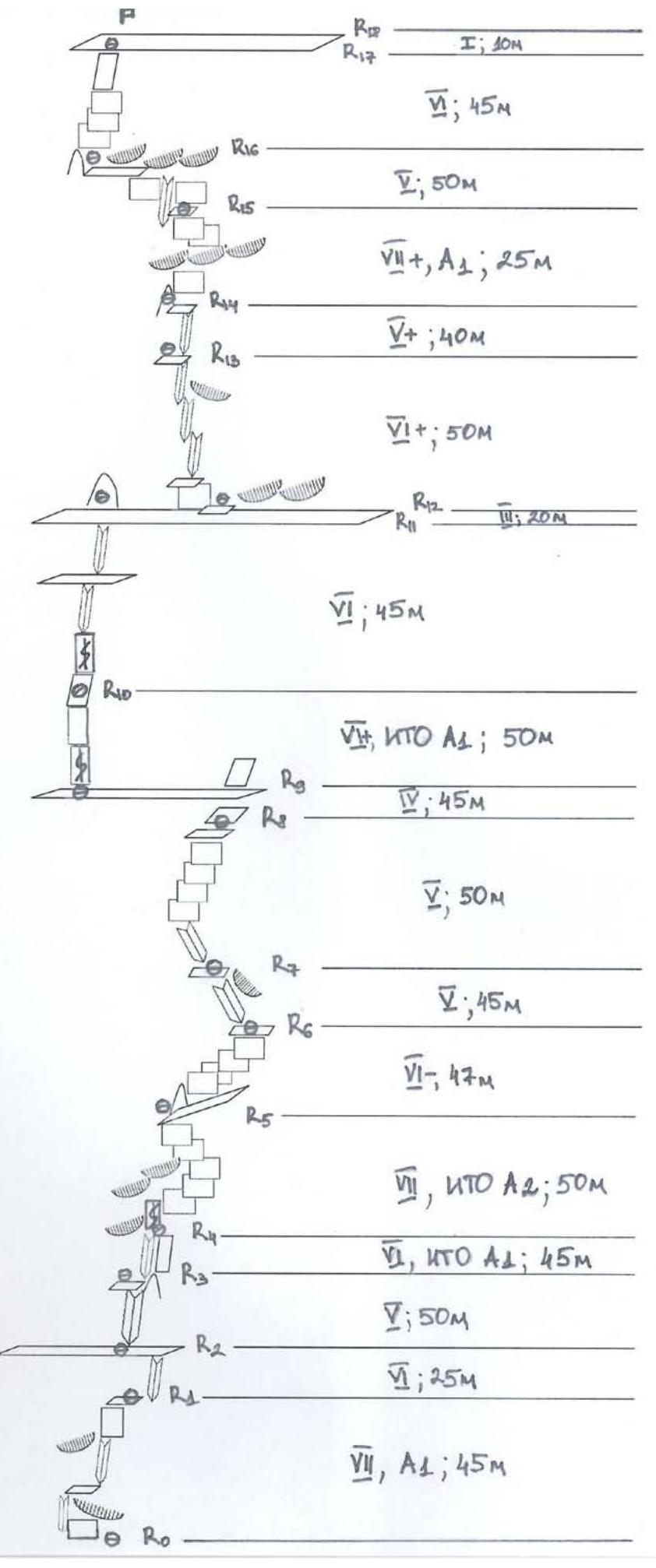
Ascent scheme
Route profile
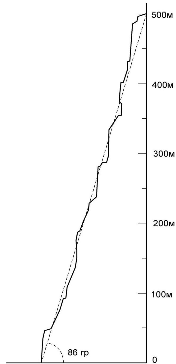 500 m
400 m
300 m
200 m
100 m
86°
0
500 m
400 m
300 m
200 m
100 m
86°
0
Route description by sections
R0–R1: The route starts at the border of light-brown and black rocks, about 50 m to the right of a well-noticeable "white spot" at the base of the wall. Up a large inner corner 20 m (6, aid climbing in winter), then through a cornice up and right 10 m (7, aid climbing in winter) to a ledge. Then right and up an inner corner to a small ledge 15 m (3) (piton and loop). On the first rope, there's a risk of rockfall. 7 (6b), aid climbing A1; 45 m
R1–R2: Then up the inner corner 10 m (6), with an exit to a large scree ledge 15 m (1) (many loose rocks). 6 (5c+), 25 m
R2–R3: Up simple, gentle rocks 15 m (3, piton on the way), then up an inner corner to the right 35 m (5). In the middle of the section, there's sharp quartz rock. 5 (5b), 50 m
R3–R4: Up the right wall of a large inner corner 40 m (6, aid climbing due to heavy snow), exit to a small ledge under an overhang ("piton-carrot with a rope"), which is a heavily destroyed rock fragment. Then 5 m (5) into a crack between the fragment and the wall, station. 5 (5b), aid climbing A1; 45 m
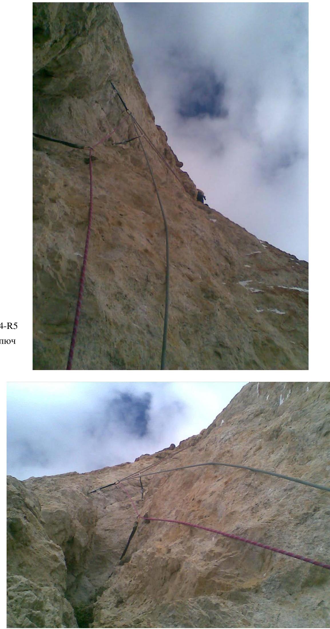
R4–R5: Up the crack between the fragment and the wall to an overhang 5 m (6) (no use of a pre-drilled bolt on the fragment's top), then a horizontal traverse right along the wall 12 m to the next bolt (few points for protection) (climbing 7 with aid climbing A2), from which left and up the wall 15 m (6+). Then right and up gentle, loose rocks to a small flat ledge under an overhang (possible tent setup). 7 (6b), aid climbing A2; 50 m
R5–R6: Right "around the corner" and up the right wall (7 m 6, difficult climbing, heavily destroyed rocks), then right and up, navigating between difficult walls, to a gentle slope. 40 m 6 (5c), 6 47 m (coincides with the "Odessa" team's route)
R6–R7: Left and up an angle-chimney to avoid an overhang. 5 (4c), 45 m (coincides with the "Odessa" team's route)
R7–R8: First left and up an angle 5 m, then up and slightly right, rich and monolithic terrain (many horizontal cracks) 5 (5a), 50 m (coincides with Vasiliev's and Lavrenenko's routes)
R8–R9: Up simple rocks 5 m (4) and exit to a large scree ledge. Along the ledge, traverse left along the wall, the ledge descends a bit, station 40 m (1). 4, 45 m.
R9–R10: Vertically up the center of the wall (left: overhanging crack, right: reddish overhang), initially climbing 10 m (6+), then aid climbing 25 m, and again climbing up a crack 15 m (6+). Hanging station on anchor pitons. 6+ (6a+), aid climbing A1; 50 m.
R10–R11: Vertically up an inner corner 20 m, exit to a small scree ledge, then right and up destroyed rocks 25 m, station on a ledge at the base of a "rocky bald head". 45 m, 6 (5c)
R11–R12: Right, around the corner, along a sloping ledge, station. 20 m, 3. A small ledge for a bivouac is located 25 meters to the right of the station.
R12–R13: Up and slightly right along a wall with protruding reddish fins. Station on a ledge. 6+ (6a), 50 m
R13–R14: Left and up monolithic rocks with rich terrain to a ledge right of the "Big Chimney". 5+ (5c), 40 m
R14–R15: Up and right through a cornice (two pitons with loops: one under the cornice, the second at the exit from under the cornice) aid climbing 5 m. Then slightly right, then up a small inner corner along a monolithic wall, left and up to a ledge (anchor piton in the middle of the wall) 20 m (7+). Station: new bolt. 7+ (6c), aid climbing A1; 25 m
R15–R16: Traverse left, "stepping over" the "Big Chimney", then up the "gray mirror" to an overhang with black streaks. Then traverse left around a bend to a ledge. 5 (4c), 50 m
R16–R17: Vertically up the wall. Station just beyond a bend to avoid rockfall. 6 (5c), 45 m
R17–R18: Exit to the plateau along heavily destroyed rocks. 1, 10 m
Tactical actions of the team
The team had a comprehensive route description. Consultations were received from B. Vasiliev and A. Lonchinskiy. The tactical plan was to complete the ascent with preliminary route processing, one night on the wall, and a night on the summit.
On January 2, 2012, at 9:30, the group left the base camp (Dumala pass) to process the route. Klimenko V. and Solodkiy A. were to climb the first key section and fix the route to the large scree ledge (R0–R3), three ropes, while Zalutskaya M. brought part of the bivouac gear and supplies under the route. Due to bad weather (wind, snow), the first section had to be climbed with aid climbing, and the processing plan couldn't be fulfilled. Having processed R0–R1, the pair descended to the base camp.
On January 3, 2012, at 9:00, Klimenko V. and Solodkiy A. set out for further processing. The weather was unfavorable all day: strong wind, blizzard, low temperature. They managed to process R1–R3. Zalutskaya M. also made a delivery of bivouac gear and part of the supplies to station R3.
On January 4, 2012, at 9:00, Klimenko V. and Solodkiy A. set out for further processing. The weather was still unfavorable in the morning, but by 12:00, it started to improve: the sky cleared, and it warmed up. They managed to process up to station R6 that day.
For the next few days, the weather forecast was favorable. The decision was made to start the ascent.
On January 5, 2012, at 9:00, the group left for the route. At 10:30, they began climbing the fixed ropes. At 12:30, all participants gathered at station R6. Solodkiy A. continued as the lead climber. At 16:00, all participants gathered at station R8.
They tried to climb the next section according to the description (R8–R9, R9–R10), but it seemed rockfall-prone, with heavily destroyed rocks and many loose stones. So, they decided to take a safer, but more difficult route (R8–R9, R9–R10) and reach the ledge R10–R11 not from the right, but from the left.
At 19:00, the lead climber (A. Solodkiy) reached the left edge of the large scree ledge where they planned to bivouac (R11). The scree ledge described in the guide turned out to be a gentle, heavily destroyed rock section where it was challenging to find a spot for a bivouac. Traversing right along the heavily destroyed rocks for a whole rope length, they found a small ledge under an overhang suitable for a tent, where they set up a bivouac. The night was very warm.
The next day (January 6), they started at 12:00. It was warm and sunny. The route was easy to follow to the very summit. Enjoyable climbing on monolithic rocks (a great impression was made by the grotto and the "gray mirror" under the overhang with black streaks on section R15–R16!!!).
They reached the summit in the dark at 19:00. From the summit tour, they retrieved a note left by the "Odeсса" team led by Lavrenenko A.V., who had completed an ascent to Ak-Kaya peak via a cat. 6A route through the center of the wall (first ascent).
They set up a bivouac right on the summit plateau. The night was cold, with a clear sky.
On January 7, 2012, at 12:00, they started moving towards the descent couloir. The descent route involves first moving along the Ak-Kaya-Kara-Kaya ridge (Kara-Kaya peak is bypassed on the right in the direction of travel) to the couloir between Kara-Kaya and Kara-Kaya West peaks. In the couloir, the 3rd category team from the "Polytechnic" club, who had climbed Kara-Kaya West via this couloir (first ascent), had left rappel ropes. Klimenko's group descended using these ropes. They reached the base camp on Dumala pass at 18:00.
Equipment table
| Equipment name | Quantity | Where used |
|---|---|---|
| Main rope 50 m | 4 | R0–R18, descent |
| Processing rope 60 m (dropped down) | 1 | R0–R2 |
| Muffler carabiners | 15 | R0–R18 |
| Non-muffler carabiners | 20 | R0–R18 |
| Short slings (climbing) | 17 | R0–R18 |
| 60 cm loops | 6 | R0–R18 |
| 120 cm station loops | 5 | R0–R18 |
| Loops for cow's tails | 2 | R0–R18 |
| Rock hammer | 2 | R0–R18, descent |
| Crampons | 1 pair | descent |
| Anchor pitons | 16 | R0–R18 |
| Stopper | 15 | practically not used |
| BD camalots | 8 pcs (from "0.3" to "4") + 5 pcs ("0.4, 0.3, 1, 2, 3") | R0–R18 |
| Jumars | 6 | R0–R18 |
| Climbing harnesses | 3 | R0–R18, descent |
| Helmets | 3 | R0–R18, descent |
| Rock climbing boots | 1 pair, size 42 | R0–R18 |
| Boots | 3 pairs | Throughout the route |
| Down jacket | 3 | processing R0–R5, bivouac |
| Down sleeping bag | 2 | bivouac |
| Mats | 2 | bivouac |
| Tent | 1 | bivouac |
| Headlamps | 3 | evenings on the route, bivouac |
| Jet Boil + lightweight gas burner | 1+1 | bivouac |
| 450 g gas cylinder | 2 cylinders | bivouac |
| Lighter | 3 | bivouac |
| Main radio station | 1 pc. Yaesu FT60R | R0–R18 |
| Mobile phone (Megafon) | 2 | bivouac |
| Radios for group communication | 2 | R0–R18 |
| First-aid kit | 1 | used |
| Camera | 1 | Camera was lost on the day of departure, photos taken with mobile phone |
| Watches | 3 | Throughout the route |
| Backpacks | 1 pc. 75 l, 1 pc. 40 l, 1 pc. 8 l (for the first) | Throughout the route |
| Pen/Pencil | 1 | On the summit |
| Food | 4 kg | bivouac |
| Water supply in bottles | 9 liters (6×1.5) | bivouac |
| Warm insoles | 5 pcs | On the route |
| Gaiters | 1 pair (for the first) | On stations and on the summit |
Route characteristics
B. Vasiliev's route on Ak-Kaya peak can be characterized as pleasant, with diverse sections of complex rock climbing. Sections requiring aid climbing are short. As protection on the route, camalots and anchor pitons work well. The route has 3 distinct key sections. In good weather, the route is climbed free, but in winter conditions, aid climbing is necessary (on sections R0–R1, R3–R4, R4–R5, R9–R10, R14–R15, totaling about 95 m). Note that despite low temperatures, there are many loose rocks on the route, requiring extra caution from climbers! The descent is not very technically challenging but is quite long. During the ascent on Ak-Kaya peak via B. Vasiliev's route, cat. 5B, the team concluded that the route is ideal for climbing in dry, sunny weather. The route's line is logical, and finding the start and orienting on the route pose no significant difficulties. The ascent corresponds to cat. 5B difficulty. For the information of subsequent climbers: according to the description, there is no water on the route, but from the summit plateau, a gentle snowy slope leads north this time of year, where you can replenish your water supply.
Route photos
 © G. Rudenko Photography
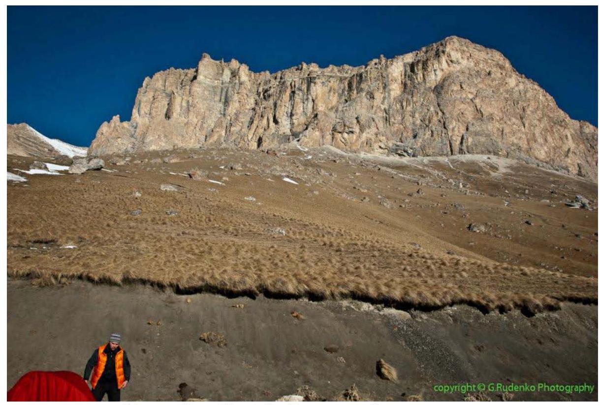
 Kara-Kaya–Ak-Kaya massif, view from the base camp
 Base camp on the pass
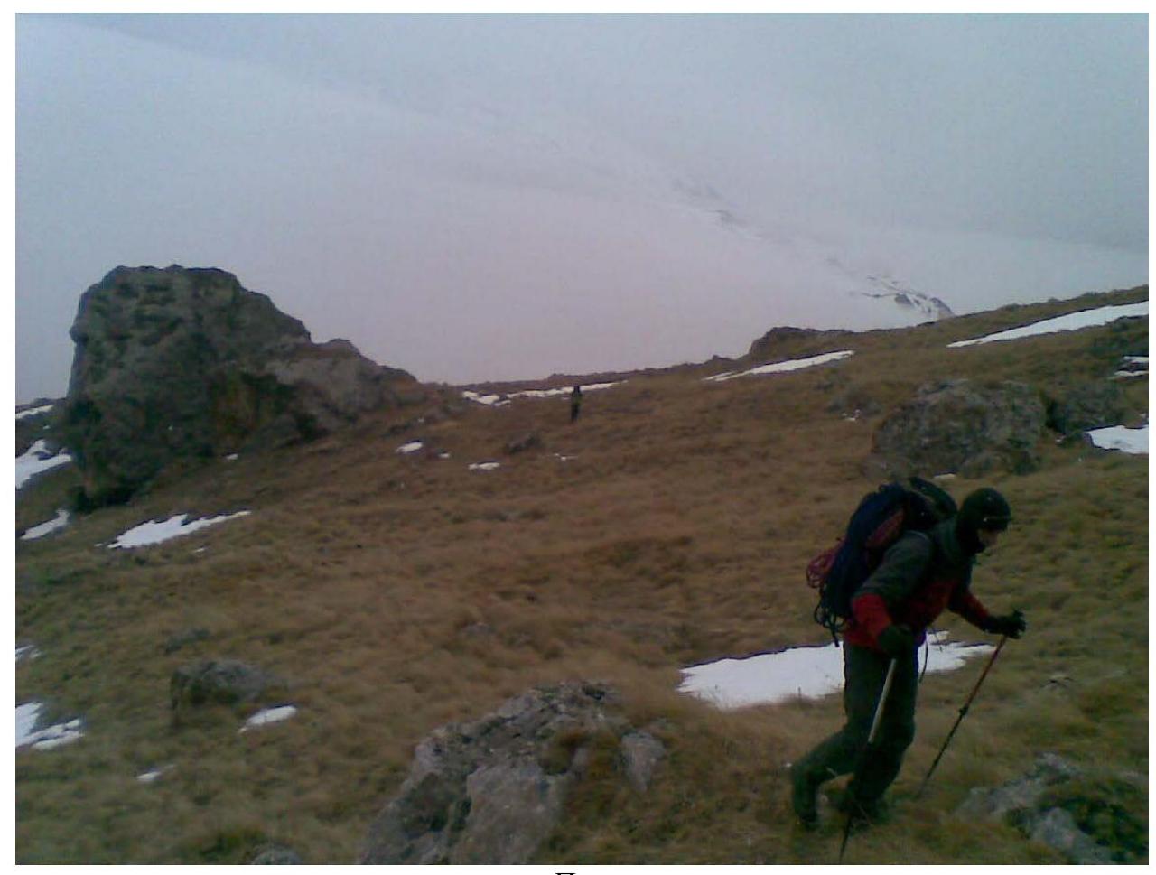
 Approach
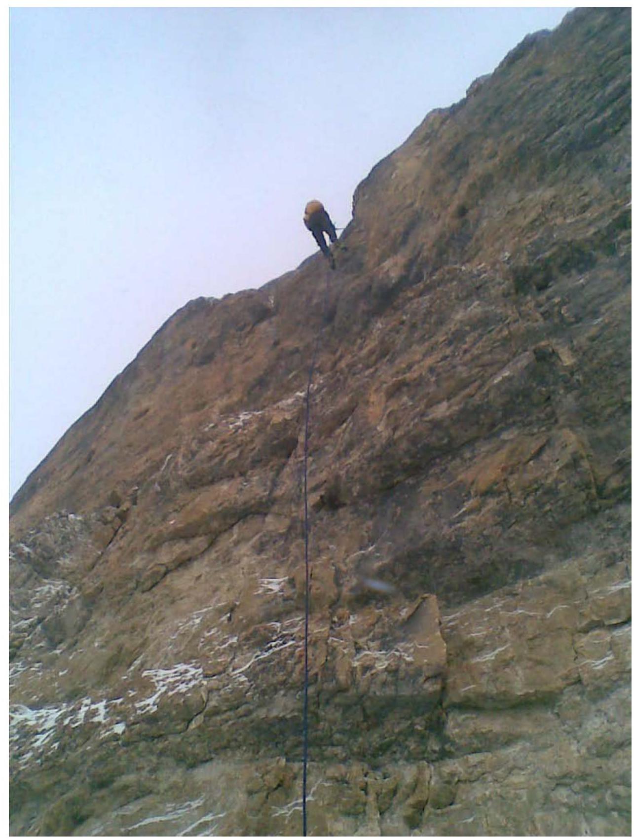
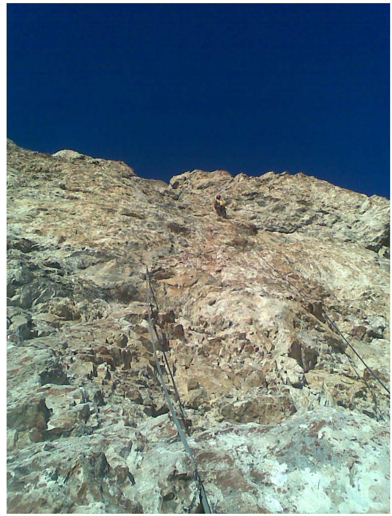
 On the fixed ropes of the first section
 R4–R5, key section
 Reconnaissance (section R8–R9)
 Section (R9–R10)
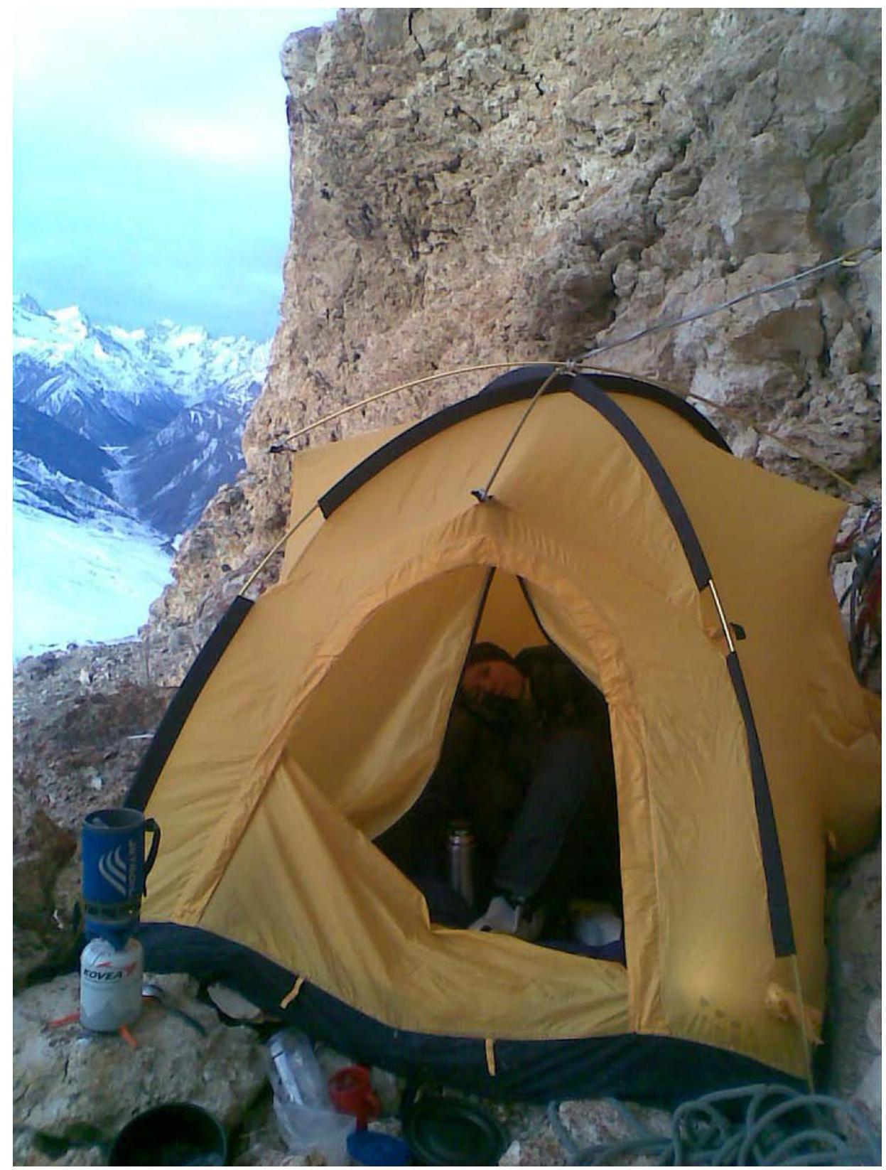
 Bivouac 1 (on the R12 ledge)
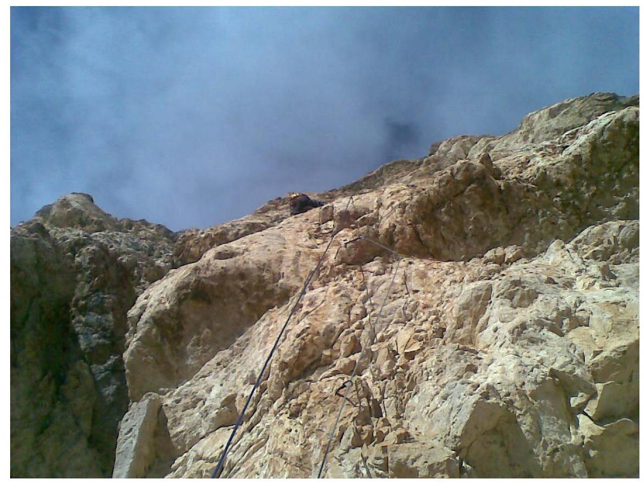
 Key section R15–R16
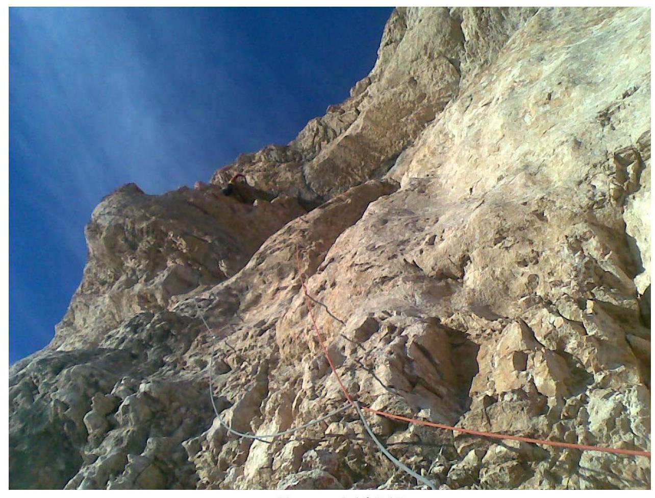
 Section R16–R17
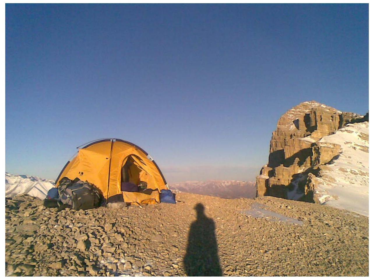
 Bivouac 2 (on the summit)
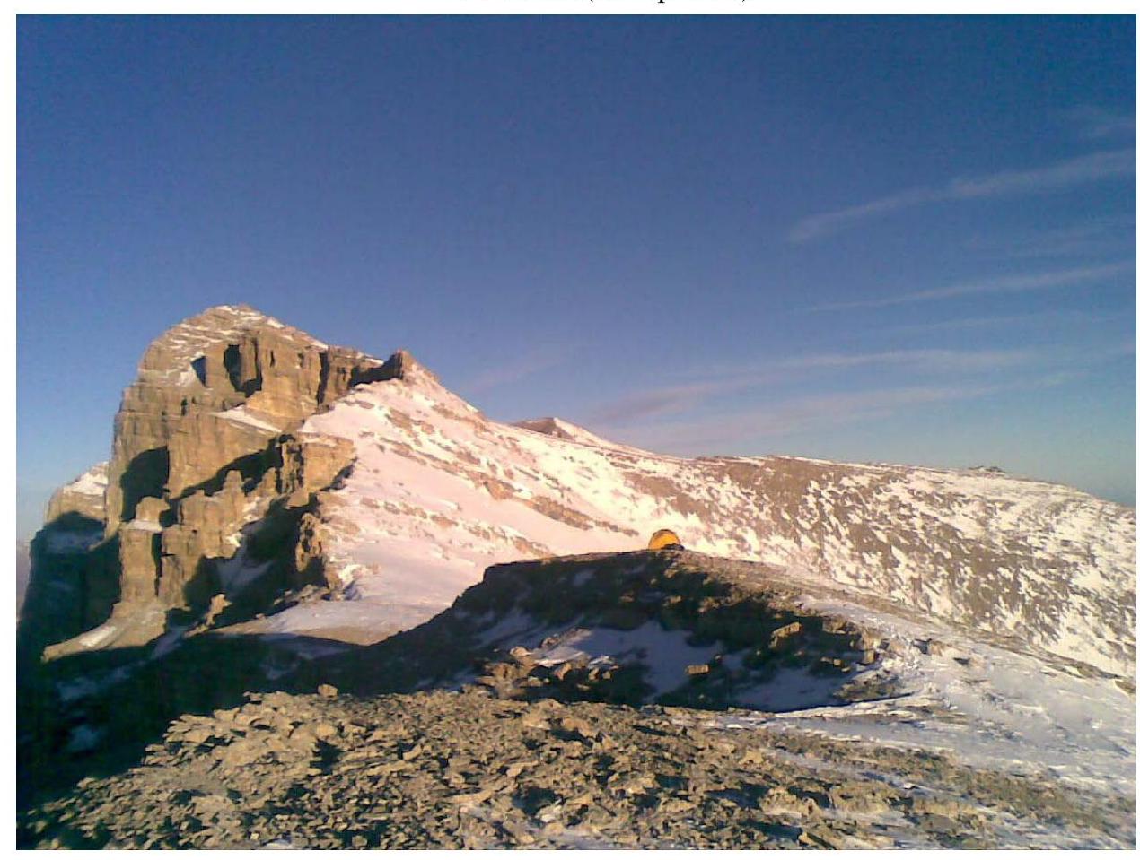
 View of Kara-Kaya from the summit
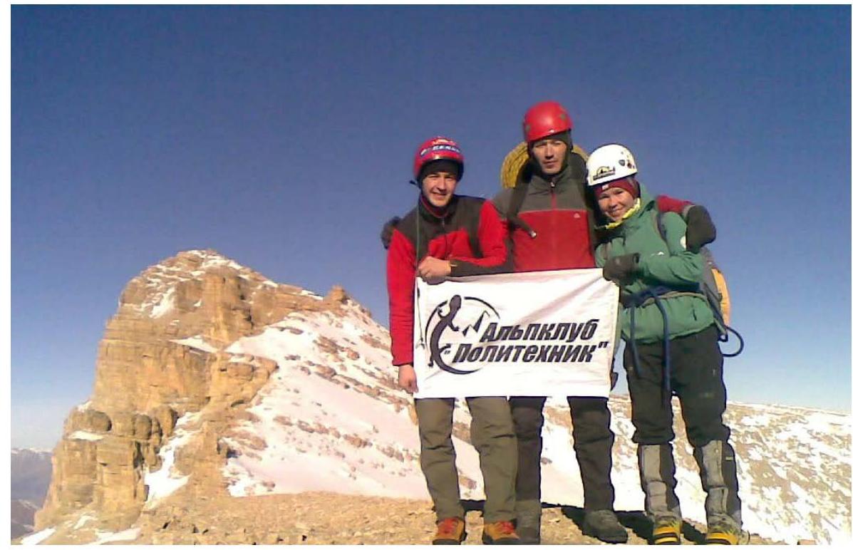
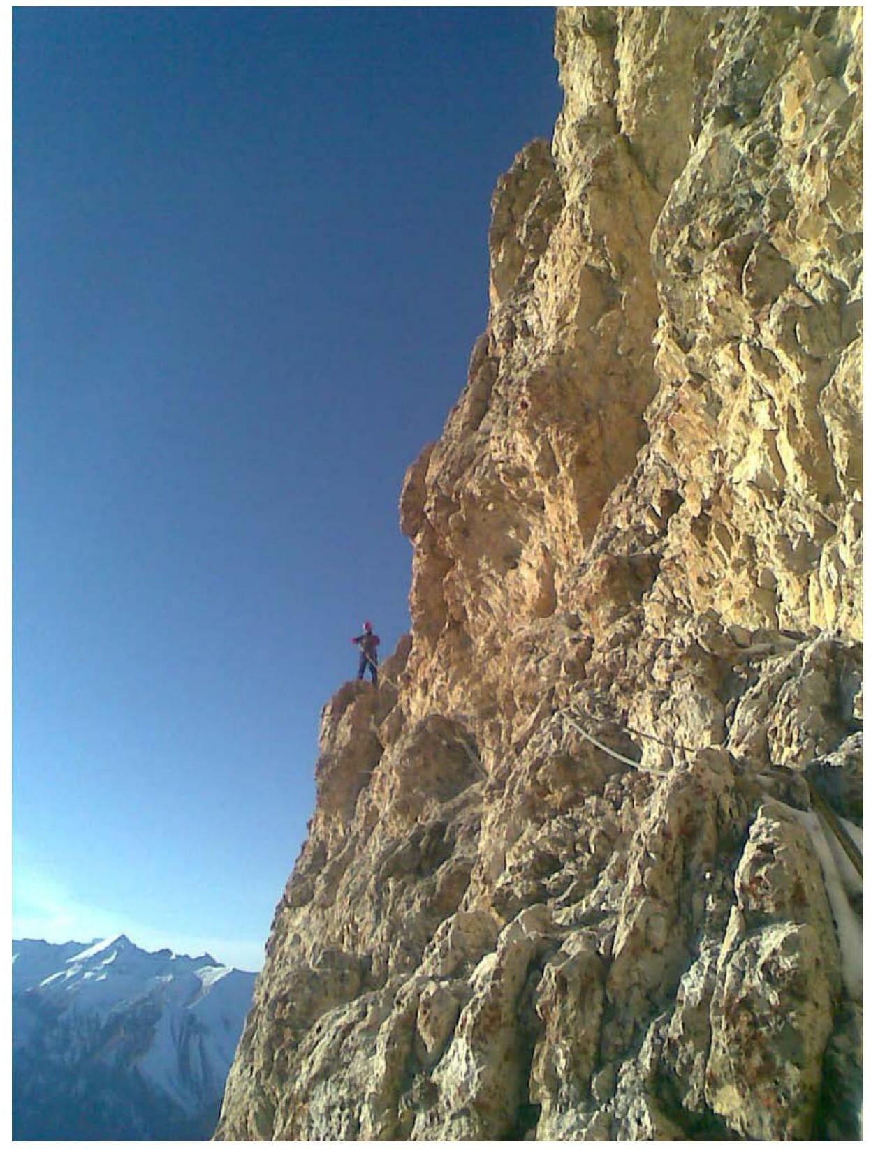
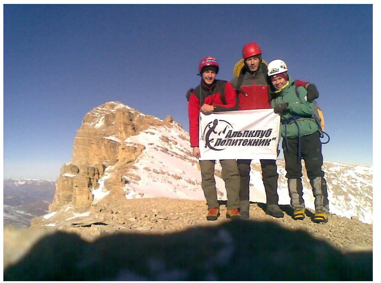
 on Ak-Kaya summit
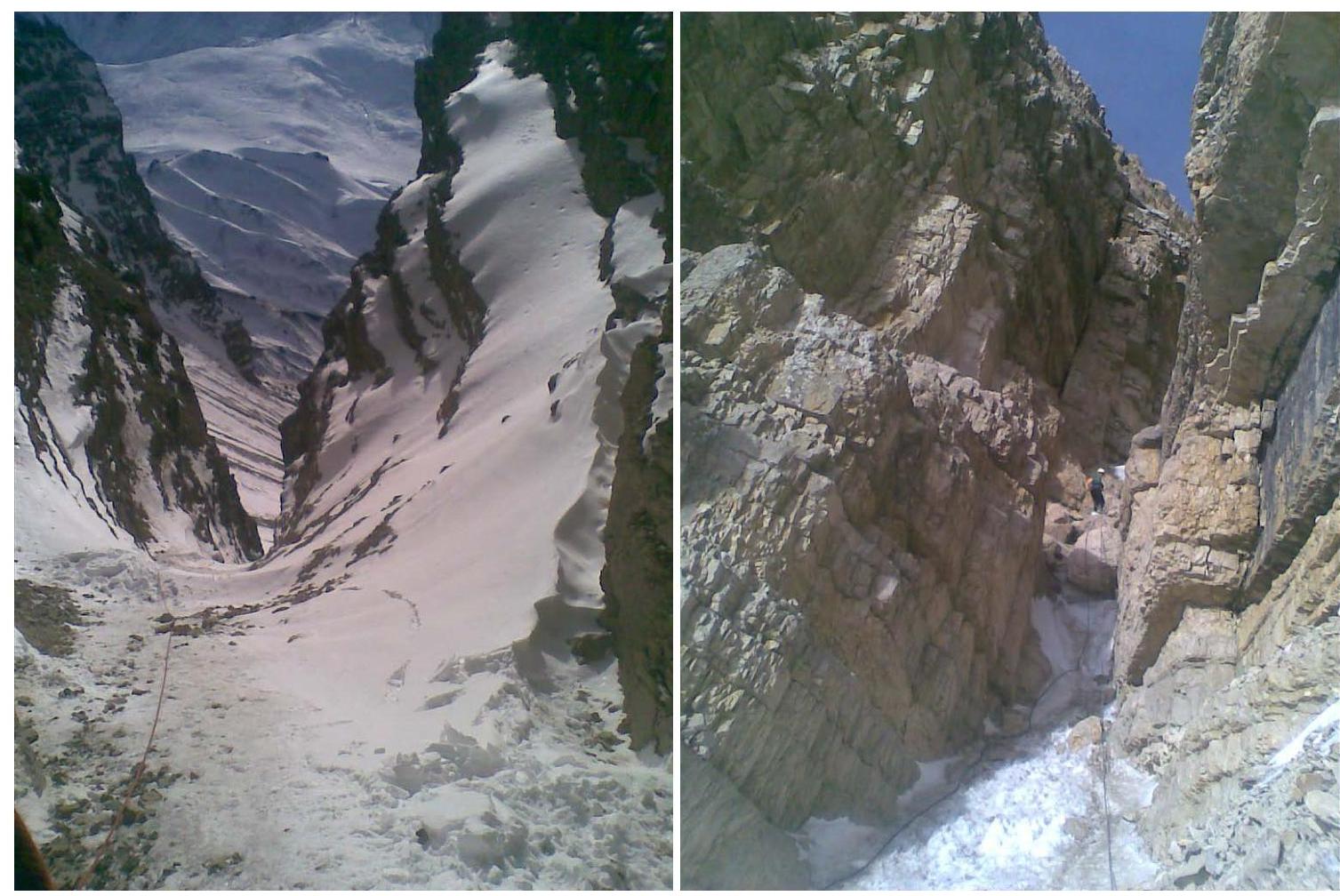
 Descent couloir
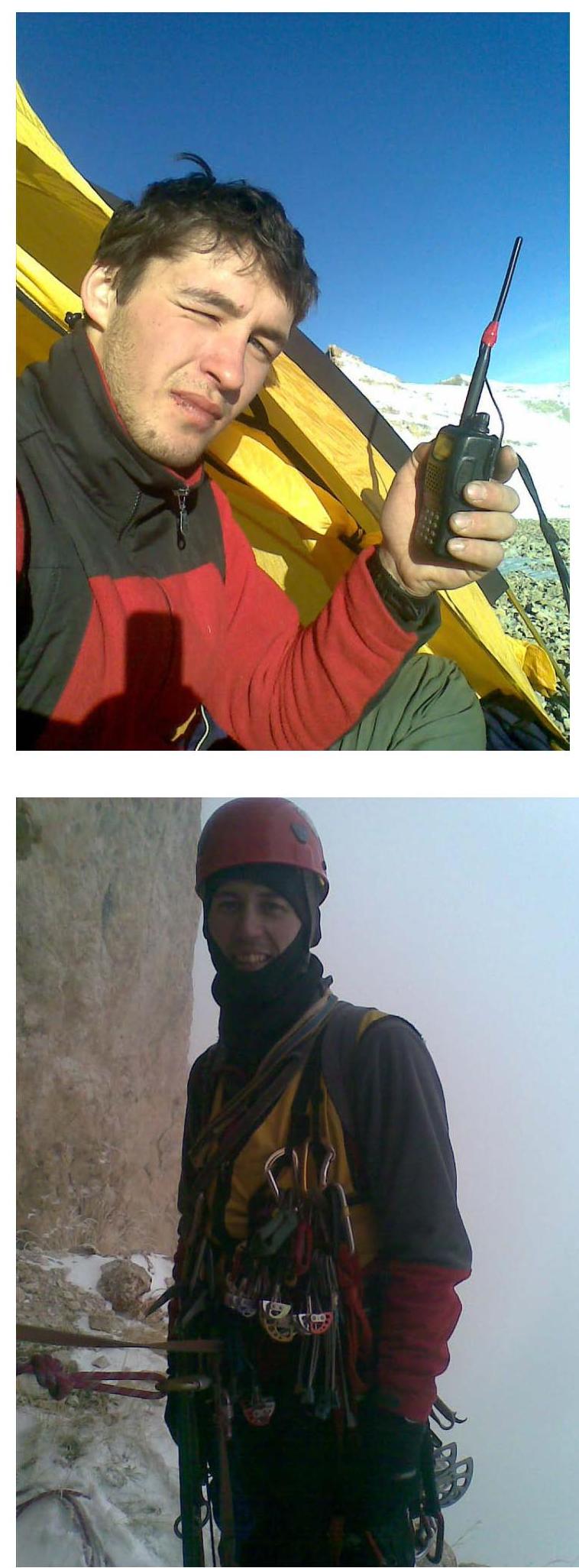
 Team leader Klimenko Vladimir
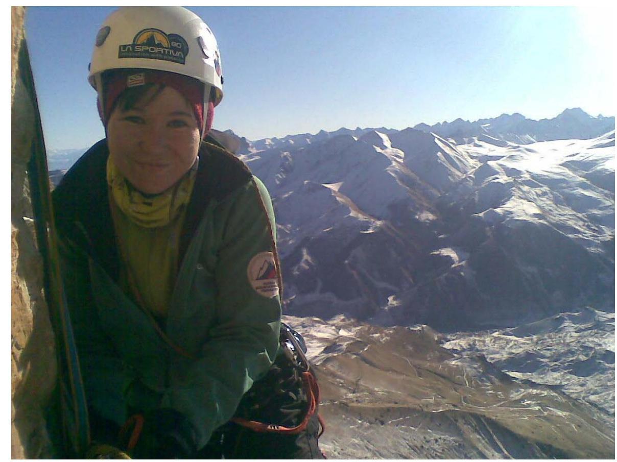
Solodkiy Anton
Team leader Klimenko Vladimir
Solodkiy Anton
Zalutskaya Maria