Fig. 12. The lamp of the couloir on the right side of the Central rib. Then, via simple snow-covered (cornices) rocks of the Eastern ridge, ascend to the summit of Tsurungal. From the bivouac on the wall, 6 hours.
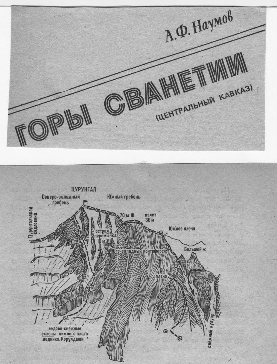
- Tsurungal via the South ridge (combined route, A. Japaridze, category III difficulty, fig. 5, 10, 12).
From the "Aylama" alpine camp, cross the Koruldashi river via a temporary bridge and follow the trail on the right side of the gorge to the first snowy couloir. To the right of the couloir are rock climbing areas. Cross the couloir, turn right and ascend via the trail:
- grassy,
- then rocky-scree slope on the left side of the snowy couloir
to the huts located on the southwest slope of the southern ridge of Tsurungal peak. The huts serve as the initial bivouac. From "Aylama" alpine camp, 3–4 hours.
From the cableway support, ascend rightwards along the gully's chute to a faintly defined rocky ridge, behind which lies a snowy, rockfall-prone couloir. Ascend steep, simple, heavily damaged rocks of the ridge to the shoulder (protection). From the shoulder, via moderately difficult rocks of a 50–60-meter snowy ridge, ascend to a platform. Then, via a 30-meter ice-snow slope (couloir), ascend to a snowy (cornice) traverse of the Southwest buttress, which branches off from the South ridge to the Big gendarme. From the huts, 2.5–3 hours.