- Lakutsa via the West Ridge — slope (the route is combined, category 2B, fig. 20, 22). From the village of Jabiashi upstream along the trail on the left bank of the Tsanner River. Go around the tongue of the Tsanner Glacier and the first stage of the icefall, then descend onto the glacier. Go upstream along the glacier to beneath the second stage of the icefall, which is climbed on the left side. Then traverse the glacier up and to the right and approach the icefall of the Nagebski Glacier. Having climbed the icefall, exit onto the upper plateau of the glacier via a glaciated area (closed crevasses) onto the medial moraine — the Nagebskie Ploshchadki. Bivouac. From the village of Jabiashi 10–14 hours.
From the moraine, traverse the plateau to beneath the right side of the saddle connecting Tetnuld with Gestola (ice falls and avalanches on the right). From the glacier, a 300–400-meter steep broken ice-and-snow slope leads up (overhangs, pitons) to the Adishi Ploshchadki on the saddle. Bivouac. From the plateau 3–4 hours.
From the Adishi Ploshchadki, descend 100–120 m down a steep ice-and-snow slope with a bergschrund in the lower part onto the upper Katyn Plateau. From here, traverse the plateau up and to the right (closed crevasses). Having passed beneath the Southern slopes of the summit of Katyn, traverse the heavily glaciated Northeast branch of the Adishi Glacier and approach the West Ridge — slope of the summit of Lakutsa. From the glacier, a 250–300-meter steep ice-and-snow West Ridge — slope, followed by easy rocks, lead to the summit of Lakutsa. From the Adishi Ploshchadki 3–6 hours.
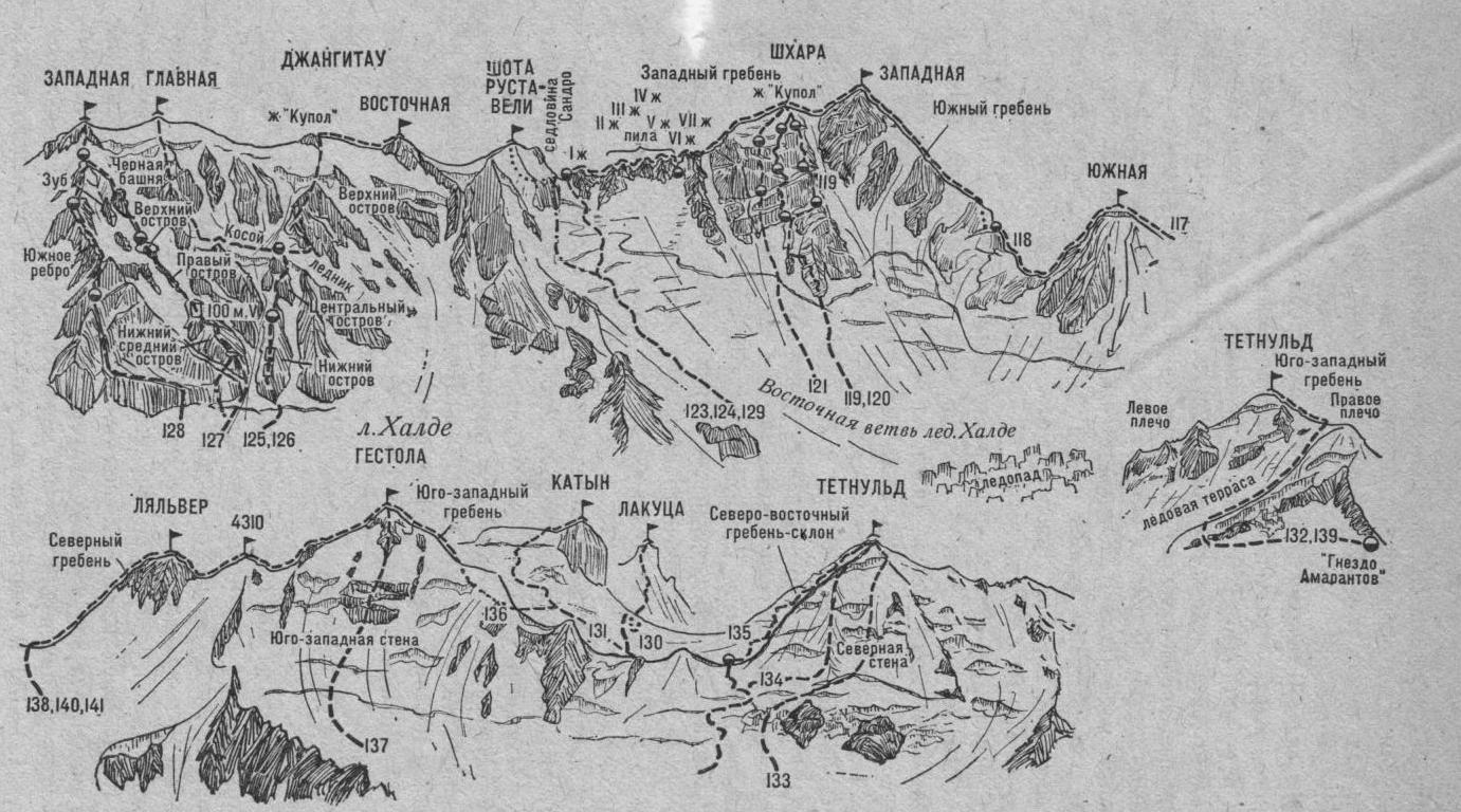
Fig. 22. From Shkhara West to Lalvera and Tetnuld