
Report
On the first ascent to the summit of Tegeneklibashi
via the South Ridge, category 1B (approximately) AM OOO "Alpine Camps Management" "Adyl-Su 2022" December 15, 2022
I. Ascent Passport
| № | 1. General Information | |
|---|---|---|
| 1.1 | Full name, sports rank of the leader | Rastorguev Alexander Alekseevich, Master of Sports |
| 1.2 | Full name, sports rank of participants | Eremeev Vyacheslav Anatolyevich, badge holder. Korneva Olga Sergeevna, novice. |
| 1.3 | Full name of the coach | Rastorguev Alexander Alekseevich |
| 1.4 | Organization | OOO "Alpine Camps Management" |
| 2. Characteristics of the Ascent Object | ||
| 2.1 | Region | Caucasus. From the Chiperaza pass to the Gumači peak |
| 2.2 | Valley | Baksan valley |
| 2.3 | Section number according to the 2013 classification table | 2.4 |
| 2.4 | Name and height of the summit | Tegeneklibashi, 3502 m |
| 2.5 | Geographical coordinates of the summit (latitude/longitude), GPS coordinates | 43.165/42.352 |
| 3. Route Characteristics | ||
| 3.1 | Name of the route | Via the South Ridge |
| 3.2 | Proposed category of difficulty | 1B |
| 3.3 | Degree of route development | First ascent* (History unknown) |
| 3.4 | Relief characteristics of the route | Rocky |
| 3.5 | Height difference of the route (GPS data) | 490 m |
| 3.6 | Route length | 980 m |
| 3.7 | Technical elements of the route | 1st category rocks, snow ridge - 850 m, 2nd category rocks - 130 m |
| 3.8 | Descent from the summit | Via the ascent route |
| 3.9 | Additional route characteristics | The pre-summit ridge in winter has snow cornicing. Access to the ridge at the lower and upper parts may be avalanche-prone when snowy. |
| 4. Team Actions Characteristics | ||
| 4.1 | Time of movement | 1 day, 10 hours from Tegenekli settlement and back, including 3 hours of ascent |
| 4.2 | Overnight stays | None |
| 4.3 | Access to the route | December 15, 2022, 6:30-10:55. Approach from Tegenekli settlement to the start of the South Ridge. |
| 4.4 | Reaching the summit | December 15, 2022, 13:55 |
| 4.5 | Return to the base camp | December 15, 2022, 20:10, Tegenekli settlement |
| 5. Report Responsible | ||
| 5.1 | Full name, e-mail | Rastorguev A. A., ra@ualp.ru |
*The history of route ascents is unknown. The route is not listed in the Classifier, so it is considered a "first ascent".
II. Ascent Description
1. Ascent Object Characteristics
1.1. General Photo of the Summit
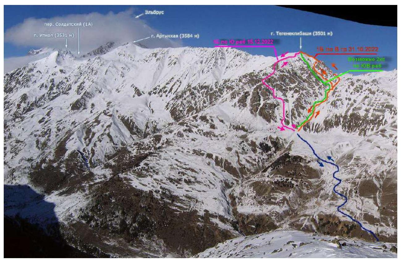
Fig. 1. Possible routes with approach from Tegenekli settlement (based on Golubev M.'s photo https://caucatalog.ru/ ↗).
1.2. Photopanorama of the Area
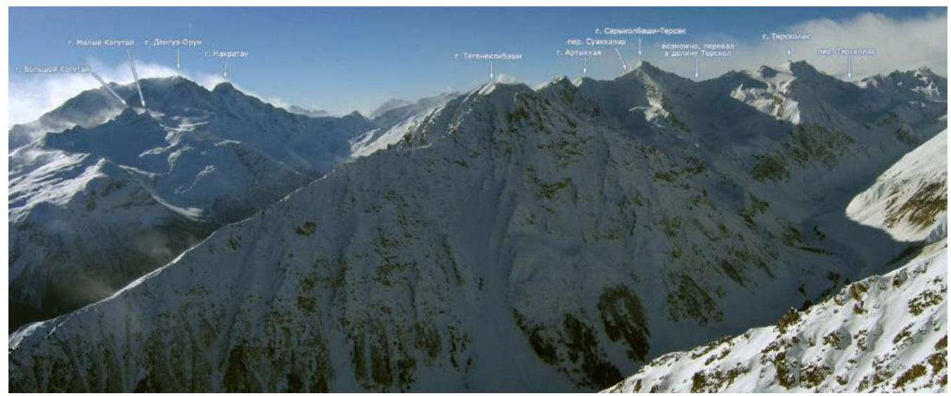
Fig. 2. Photopanorama of the area (Golubev M.'s photo https://caucatalog.ru/ ↗)
1.3. Photo of the Route Profile
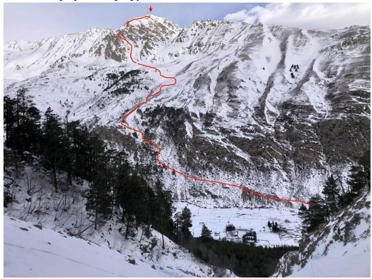
Fig. 3. Approach path and view of the main part of the route (Fedorovich E. A.'s photo)
1.4. Geographical Location of the Area
The ascent object - Tegeneklibashi peak (3502 m) is located in the Caucasus mountains in the upper part of the Baksan valley. The rocky Tegenekli ridge is an eastern spur of Elbrus mountain and is situated northwest of Tegenekli settlement (Elbrus district, Kabardino-Balkar Republic). Its length is 15 km.
The semantics of the locality name dates back to the Balkar tegenek - "thorn", "prickly shrub". This part of the valley is overgrown with thorny bushes:
- barberry
- wild rose
- sea buckthorn
- juniper
¹
The approach to the route can be conveniently started from Tegenekli settlement. Cross the second bridge from the bottom of the valley into the settlement and approach the southern slopes of the valley. Cross the high-voltage power line near the transformer substation and turn left - up onto a good, sometimes steep path leading to the high-altitude pastures. Cross a stream in the direction of a grassy shoulder above a large rocky outcrop. On the shoulder, turn right - up to crampons. Then, follow paths, grassy slopes, adhering to the stream bed:
- up
- left onto a plateau in the direction of the clearly defined south ridge of Tegeneklibashi peak.
From the start of the path to the ridge at the beginning of the route, it takes 4-5 hours of walking time with light backpacks.
2. Route Characteristics
2.1. Technical Photo of the Route
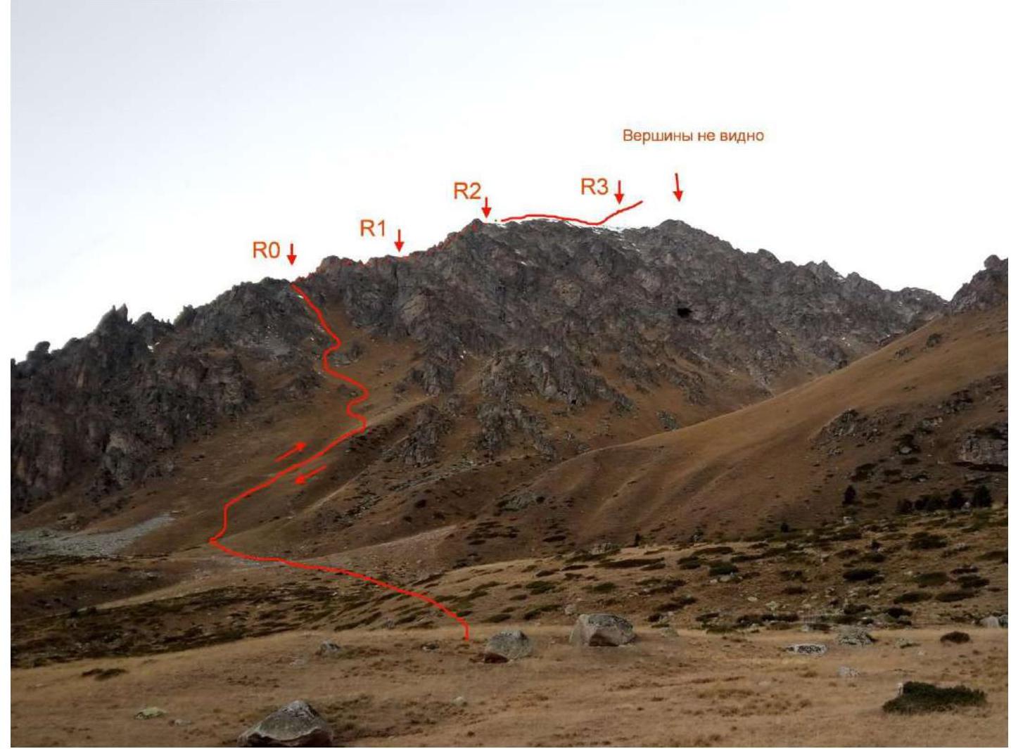
Fig. 4. Technical photo of the first half of the route. 2.2. Technical Characteristics of Route Sections
| Section | Relief Characteristics | Category of Difficulty | Length, m | Type and Number of Hooks |
|---|---|---|---|---|
| R0-R1 | Grassi and scree ledges | 1 | 200 | - |
| R1-R2 | Scree couloir with rock outcrops and inner angle | 1 | 100 | - |
| R2-R3 | Rocks, walls, ledges, and inner angle | 2 | 50 | loop, 2 stoppers |
| R3-R4 | Rocky wall, ledges, inner angle | 1 | 100 | station and point on loops |
| R4-R5 | Rocky ridge | 2 | 40 | - |
| R5-R6 | Snow and firn, or simple rocky ridge | 1 | 300 | - |
2.3. Technical Photos of the Route by Sections.
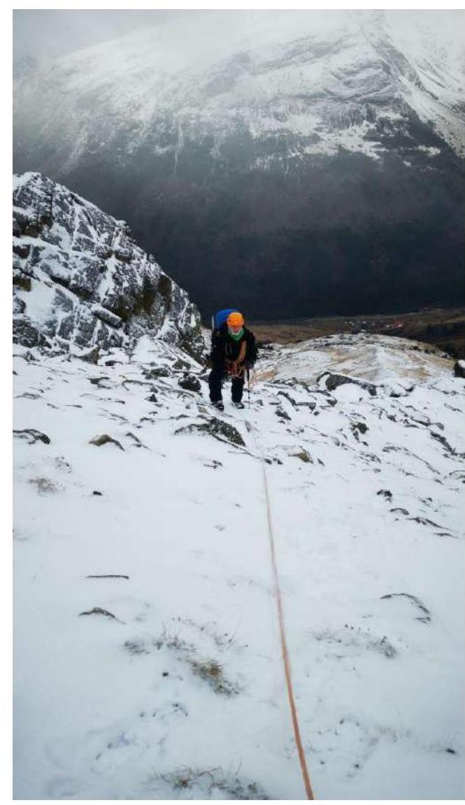
Fig. 5. On section R0-R1.
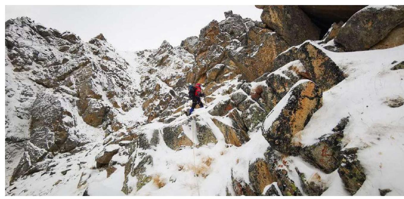
Fig. 6. On section R1-R2.
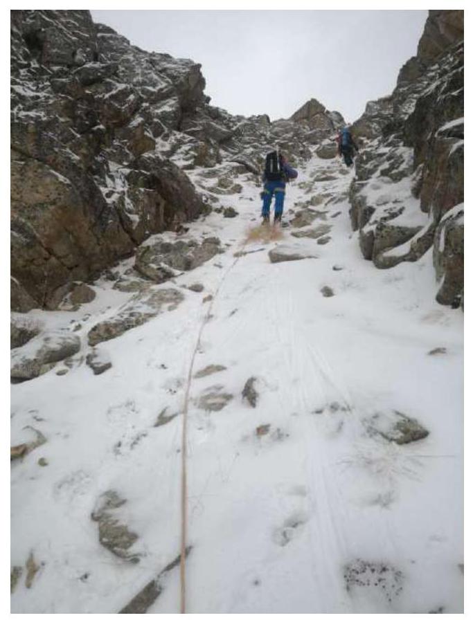
Fig. 7. On section R2-R3.
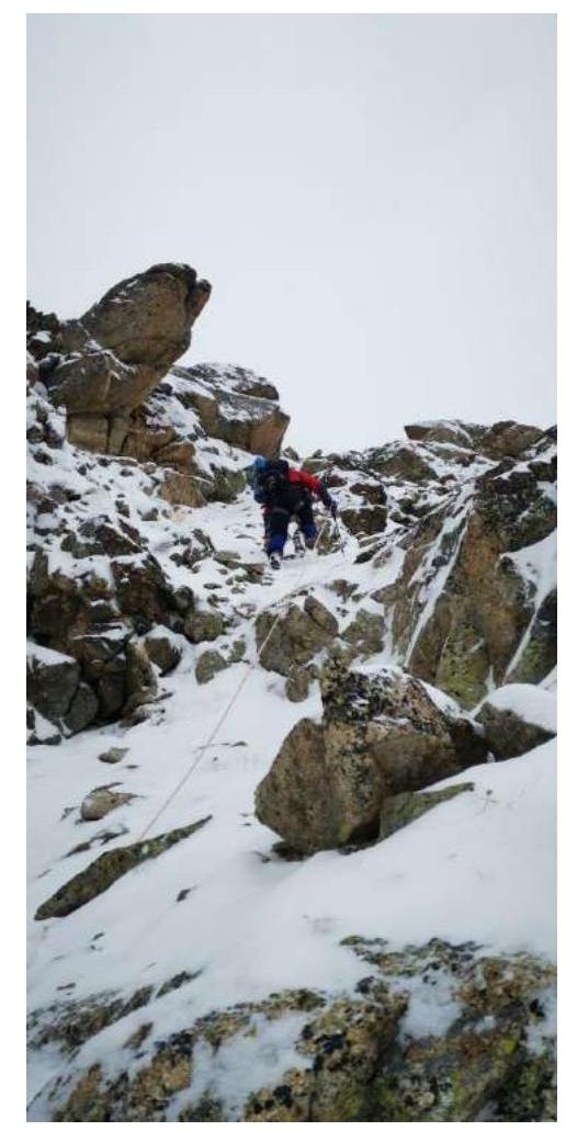
Fig. 8. On section R3-R4.
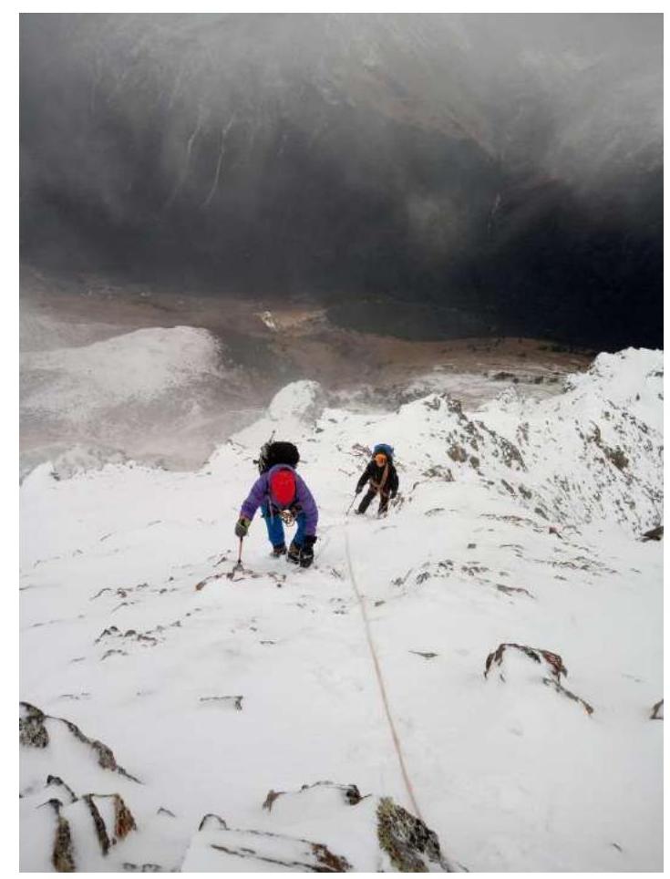
Fig. 9. R4-R5. View from above.
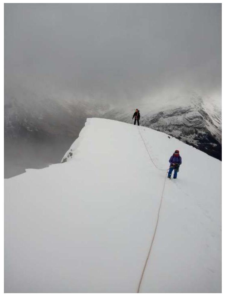
Fig. 10. Pre-summit ridge. Section R5-R6.
3. Team Actions Characteristics
3.1. Brief Description of Route Passage.
| Section | Description | Photo Number |
|---|---|---|
| R0-R1 | Start of the route on a not clearly defined saddle on a grassy ledge under a rock, which can be bypassed on the left. From the saddle, right up, left of the ridge, along grassy and scree ledges. Simultaneous movement in a rope team with belay through the relief. | Fig. 5 |
| R1-R2 | Along a scree couloir with rock outcrops and an inner angle, exit under rocky walls left of the ridge. Simultaneous movement in rope teams with belay through the relief. | Fig. 6 |
| R2-R3 | Along rocky walls, ledges, and an inner angle, exit right onto a shoulder on a gentle ridge. Station on a rocky outcrop. Alternating movement with own intermediate belay points. | Fig. 7 |
| R3-R4 | Along an inner angle, exit right to left onto the ridge through a small snow cornice. Alternating movement with own intermediate belay points. Key section of the route. | Fig. 8 |
| R4-R5 | Along a rocky and scree (in winter, snowy) ridge to a firn pre-summit ascent. Simultaneous movement of rope teams. Belay through the relief. | Fig. 9 |
| R5-R6 | Along a simple rocky (in winter, snowy with cornices) ridge - exit to the summit. Belay through the relief. | Fig. 10 |
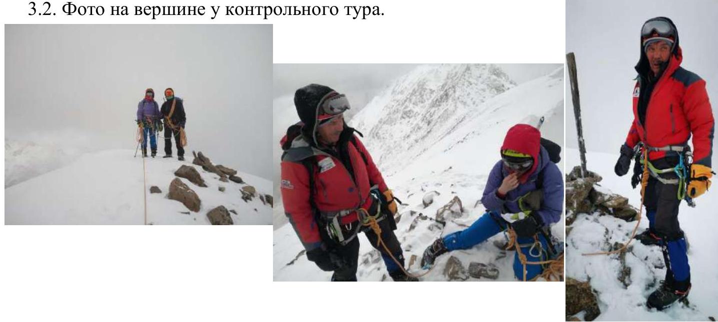
3.2. Photo at the Summit with a Control Tour.
3.3. Route Safety Assessment.
The ridge route may be hazardous during thunderstorms. No random rockfall was observed during the route passage. Grassi slopes on the approach to the route in summer, as well as couloirs and slopes on the descent from the route, may be avalanche-prone during heavy snowfall and spring snowmelt. A steep grassy slope on the approach when ascending directly to the ridge and descending from it is recommended to be traversed in crampons at any time of the year.
Radio communication with the Ministry of Emergency Situations and MTS mobile communication work throughout the route.
3.4. Descent from the Summit.
Descent from the summit via the ascent route until its start under the rock on the ridge. Then, left down along the ascent path, descend onto a plateau and left down onto a trail to Tegenekli settlement. From the summit to the settlement, it takes 3-3.5 hours.
The route corresponds to category 1B difficulty year-round. Recommended for training groups at the NP-1 stage as a first ascent of category 1B.
Compiled and formatted by Rastorguev A. A. +7 918 460-55-66, ra@ualp.ru
The report includes photographs by:
- Eremeev V. A.
- Rastorguev A. A.
- Fedorovich E. A.
Comments
Sign in to leave a comment