Appendix No. 1 to the Unified Requirements for a Classification Report
Report Form for Routes 1B–3B Category of Difficulty
REPORT ON THE FIRST ASCENT TO THE SUMMIT OF MUKAL VIA THE ROUTE OF 2B CATEGORY OF DIFFICULTY BY THE TEAM OF MAK "Freeline" Pyatigorsk, June 12, 2021
I. Climbing Passport
| No. | 1. General Information | |
|---|---|---|
| 1.1 | Full Name, sports rank of the leader | Popov M.L. CMS |
| 1.2 | Full Name, sports rank of the participants | Khlyshch G.A. 2nd sports rank, Lustina S.V. 2nd sports rank, Kovalev R.A. 2nd sports rank |
| 1.3 | Full Name of the coach | Motienko N.I. CMS |
| 1.4 | Organization | MAK "Freeline" |
| 2. Characteristics of the Climbing Object | ||
| 2.1 | Region | Caucasus, Kabardino-Balkaria |
| 2.2 | Valley | Kyrtyk River Valley |
| 2.3 | Section number according to the 2013 Classification Table | 2.4 |
| 2.4 | Name and height of the summit | Mukal 3899 m |
| 2.5 | Geographical coordinates of the summit (latitude/longitude), GPS coordinates *(1) | 43.32294° N, 42.64839° E |
| 3. Characteristics of the Route | ||
| 3.1 | Name of the route | Mukal via the northern wall |
| 3.2 | Proposed category of difficulty | 2B |
| 3.3 | Degree of route exploration | First ascent |
| 3.4 | Character of the route terrain | Snow-ice |
| 3.5 | Height difference of the route (altimeter or GPS data) | 650 m |
| 3.6 | Route length (in meters) | 900 m |
| 3.7 | Technical elements of the route (total length of sections of various difficulty categories with indication of terrain character (ice-snow, rock)) | Category I (snow) — 50 m. Category II (snow, ice) — 250 m. Category III (snow, ice) — 380 m. Category IV (snow, ice) — 220 m. Category V — 0 m. Movement on a closed glacier — 0 m |
| 3.8 | Descent from the summit | Via the route of 2A category of difficulty along the north-eastern ridge |
| 3.9 | Additional characteristics of the route | |
| 4. Characteristics of the Team's Actions | ||
| 4.1 | Time of movement (team's walking hours, in hours and days) | 5 hours 30 minutes |
| 4.2 | Overnight stays | No |
| 4.3 | Start of the route | 7:00, June 12, 2021 |
| 4.4 | Summit ascent | 12:30, June 12, 2021 |
| 4.5 | Return to the base camp | 15:00, June 12, 2021 |
| 5. Person responsible for the report | ||
| 5.1 | Full Name, e-mail | Popov Mikhail Lvovich, mikl_popov@inbox.ru, 89282657130 |
1. Characteristics of the Climbing Object
General photo of the 2B category of difficulty route on the northern wall
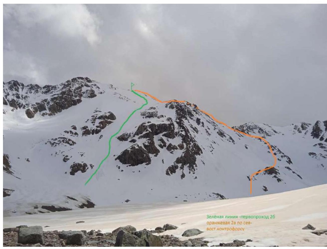
Green line — team's ascent route
Orange — route of 2A category of difficulty along the North-Eastern ridge
Photo of the route profile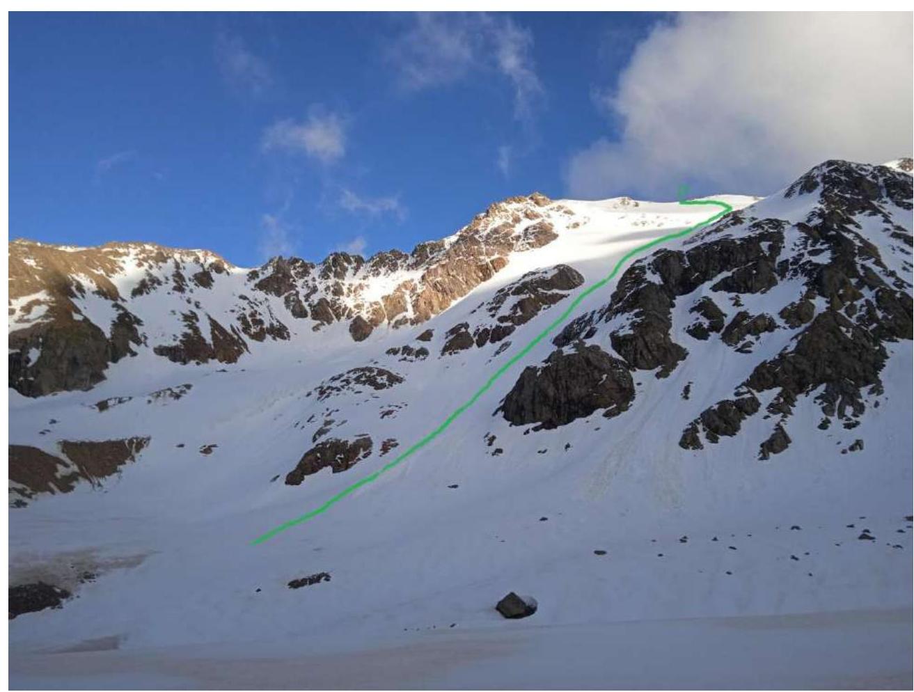
Photopanorama of the area. Shot from the Mukal River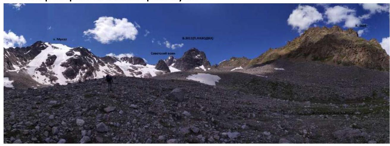
Brief overview of the climbing area and description of the approach
The climbing area is located in the part of the Lateral Ridge of the Central Caucasus, stretching from the summit of Irik (4046 m) to the summit of Mukal (3899 m). The climbing object — Mukal summit — is located in the ridge next to the Kezgen summit.
From the village of Verkhniy Baksan along a dirt road to the Kyrtyk River valley to the last corral at the confluence of the Kyrtyk and Mkara rivers (15 km). The road from the village of Verkhniy Baksan is passable for vehicles like Lada "Niva" and UAZ "Patriot". Then across a bridge over the Mkara River and along its orographic right bank, on a marked trail up to the edge of the "hanging valley" (3 km). Then to the left on a marked trail, bypassing peak 3428. At a convenient location, cross the Mukal River and move up along the scree along the ridge connecting peak 3428 and peak Nakhodka. After some time, the slope becomes gentler and turns into wide sandy fields. At the beginning of the glacier — a lake, here are overnight stays. From the cars — 2 hours.
There is no mobile connection in the valley. Border permits are not required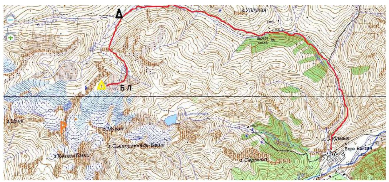
2. Characteristics of the Route
Technical photo of the route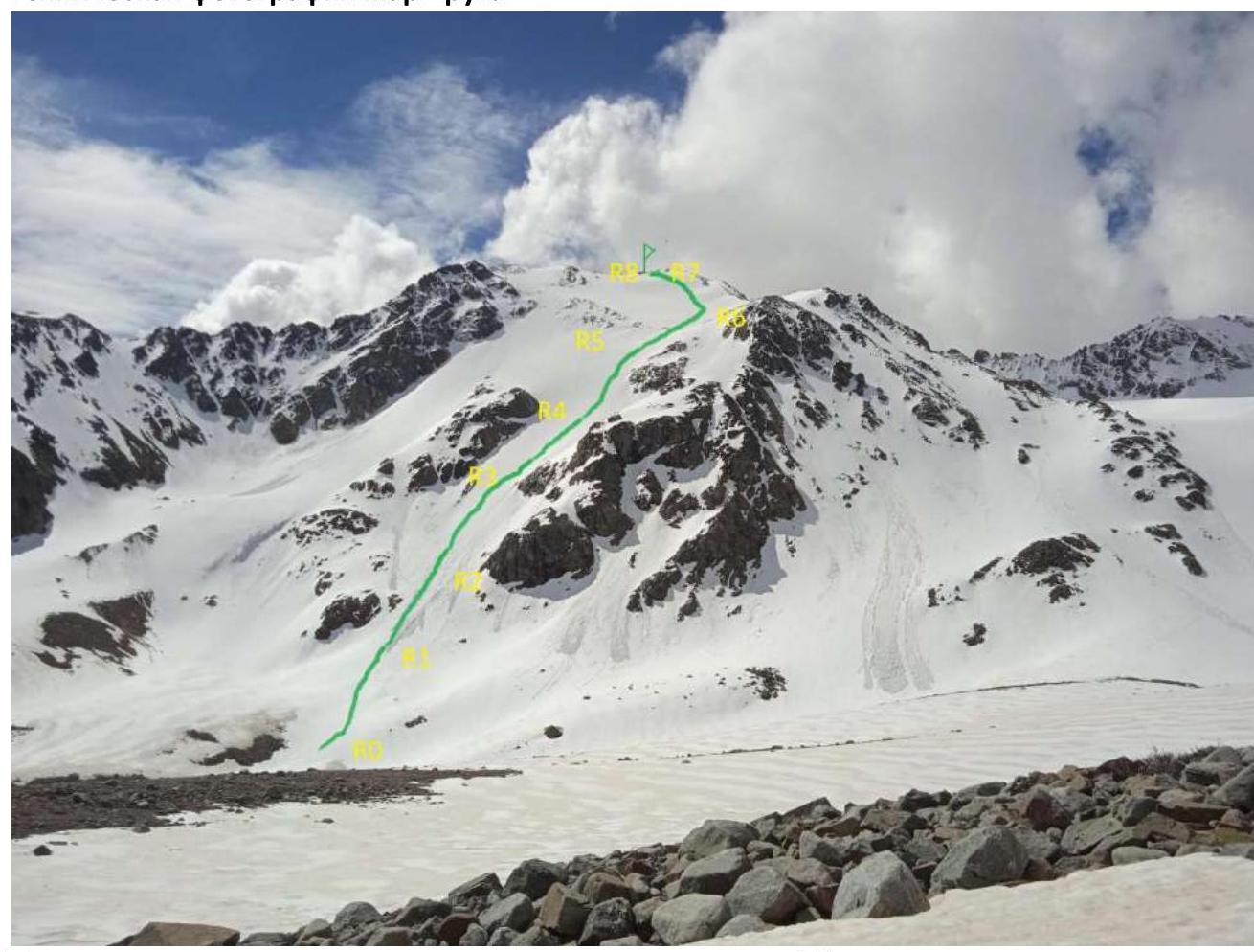
Technical characteristics of the sections of the 2B category of difficulty route
| Section No. | Character of the terrain | Category of difficulty | Length, m | Type and number of pitons |
|---|---|---|---|---|
| R0–R1 | Snow slope | 2 | 150 | 0 |
| R1–R2 | Snow, ice | 3+ | 150 | 3 |
| R2–R3 | Ice, snow | 4+ | 100 | 5 |
| R3–R4 | Snow | 3 | 80 | 0 |
| R4–R5 | Snow, ice | 4+ | 120 | 6 |
| R5–R6 | Snow | 2+ | 100 | 0 |
| R6–R7 | Snow, ice | 3+ | 150 | 5 |
| R7–R8 | Scree slope | 1 | 50 | 0 |
3. Characteristics of the Team's Actions
| Section No. | Description | Photo No. |
|---|---|---|
| R0–R1 | On a snow slope 150 m 20–55° to the first belt of rocks | 1 |
| R1–R2 | The steepness of the slope increases to 30–35°. 150 m 3+ to the second belt of rocks | 2 |
| R2–R3 | Along a snow-ice slope along rocks on the right side 100 m 40–45° 4+ to a flattening | 3 |
| R3–R4 | On a snow slope 30° up towards a rocky ridge on the right 80 m 3 | 4 |
| R4–R5 | 120 m 40–45° up the slope to a flattening | 5 |
| R5–R6 | On a snow slope towards the pre-summit ridge 100 m 30° 2+ | 6 |
| R6–R7 | Not reaching the ridge, turn left and on a snow-ice slope 150 m 35° 3 | 6 |
| R7–R8 | On a simple scree slope 50 m 1 to the summit | 7 |
Photo No. 1 R0–R1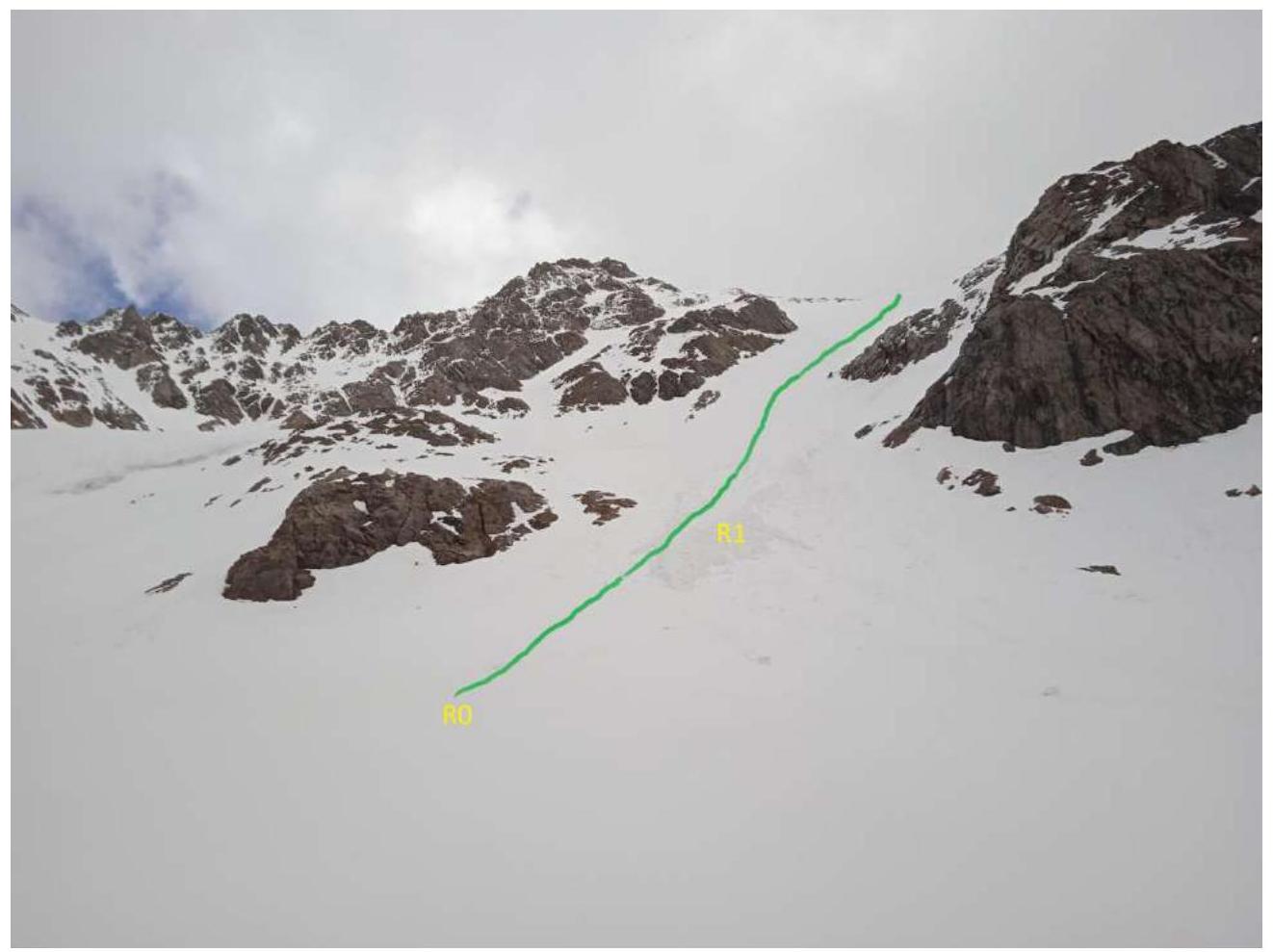
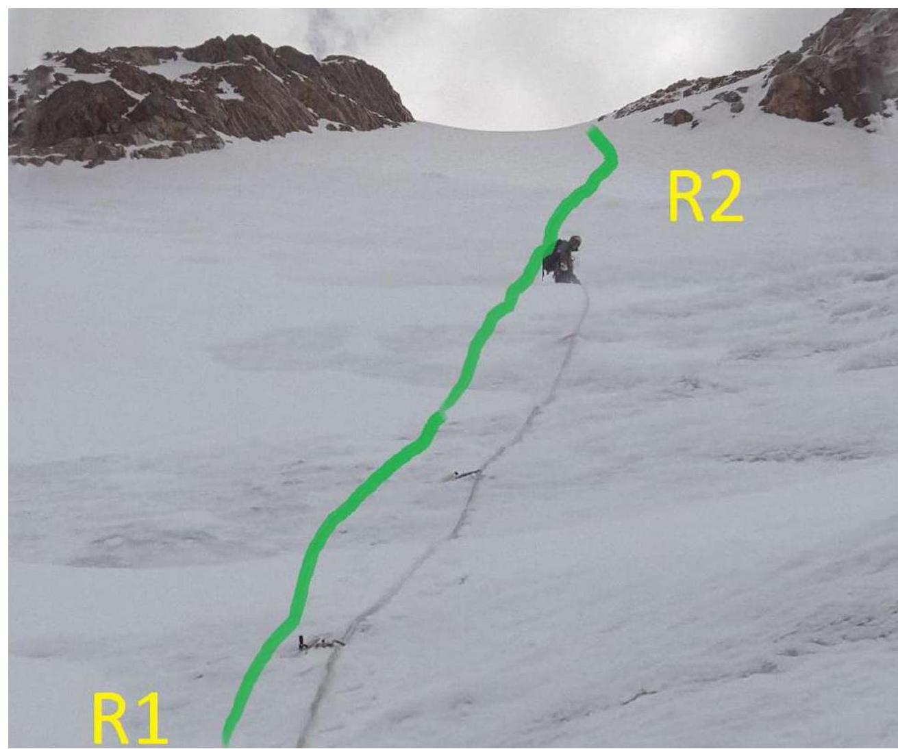
R1–R2, photo No. 2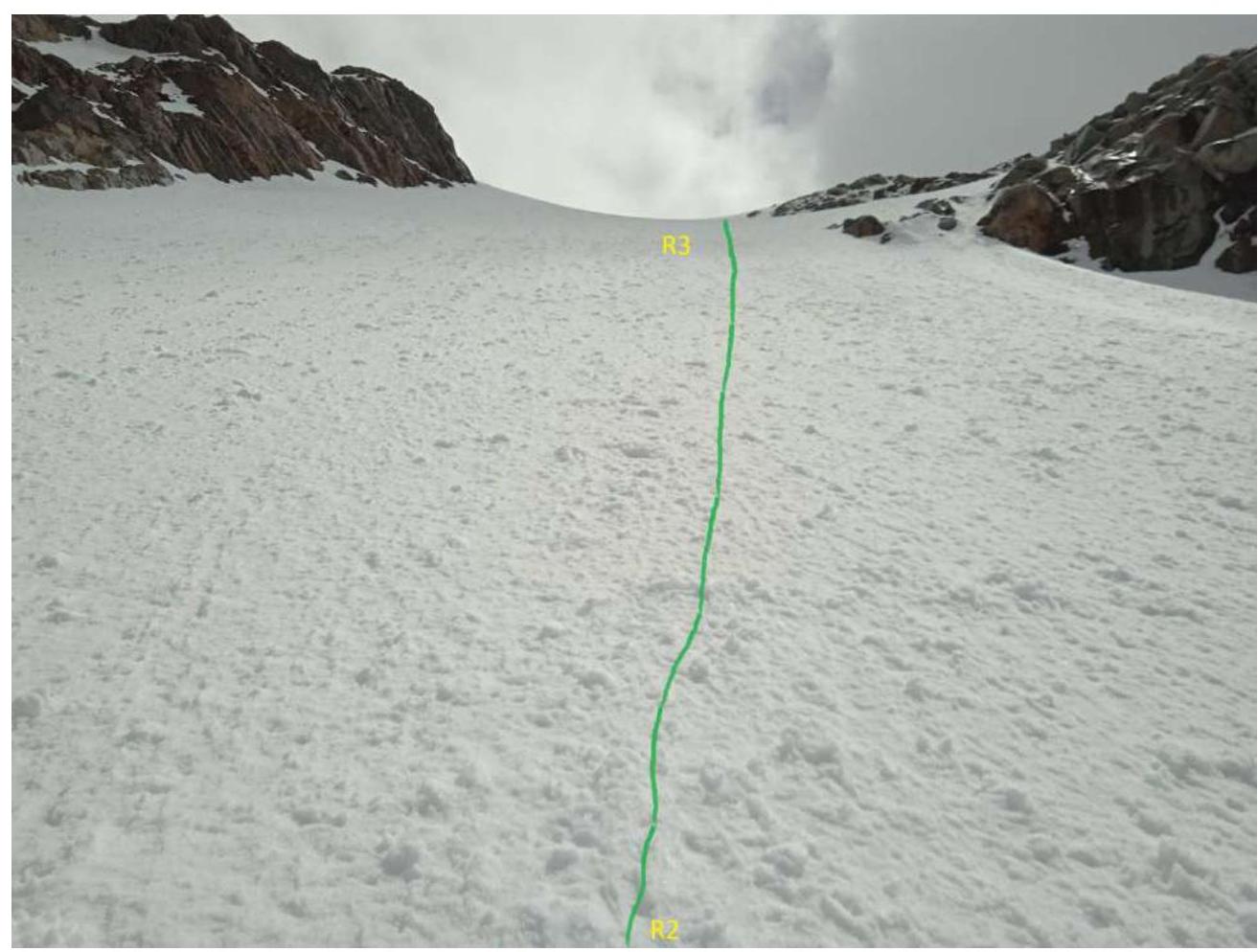
R2–R3, photo No. 3
R3–R4, photo No. 4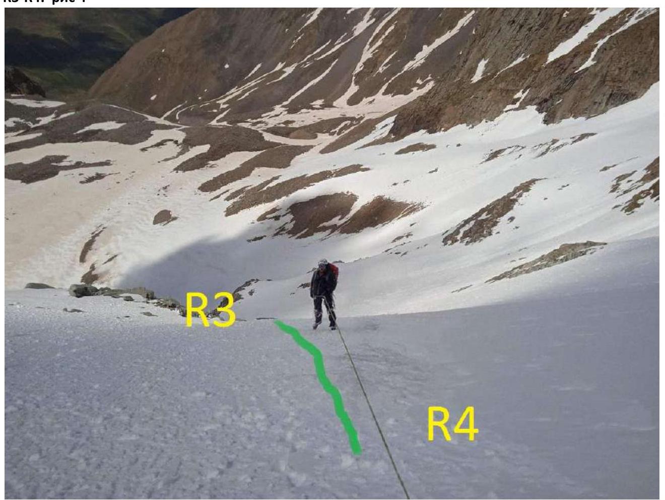 R4–R5 (photo No. 5)
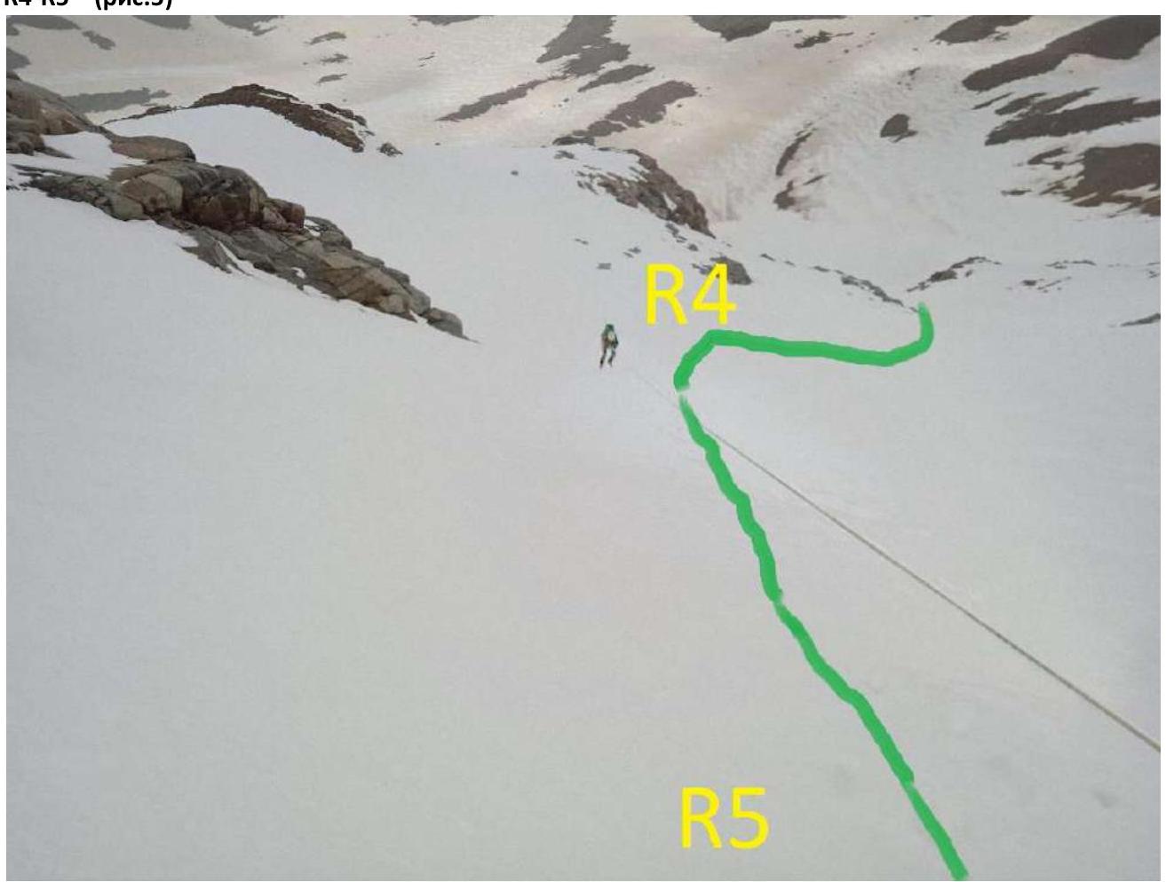 R5–R6, R6–R7, photo No. 6
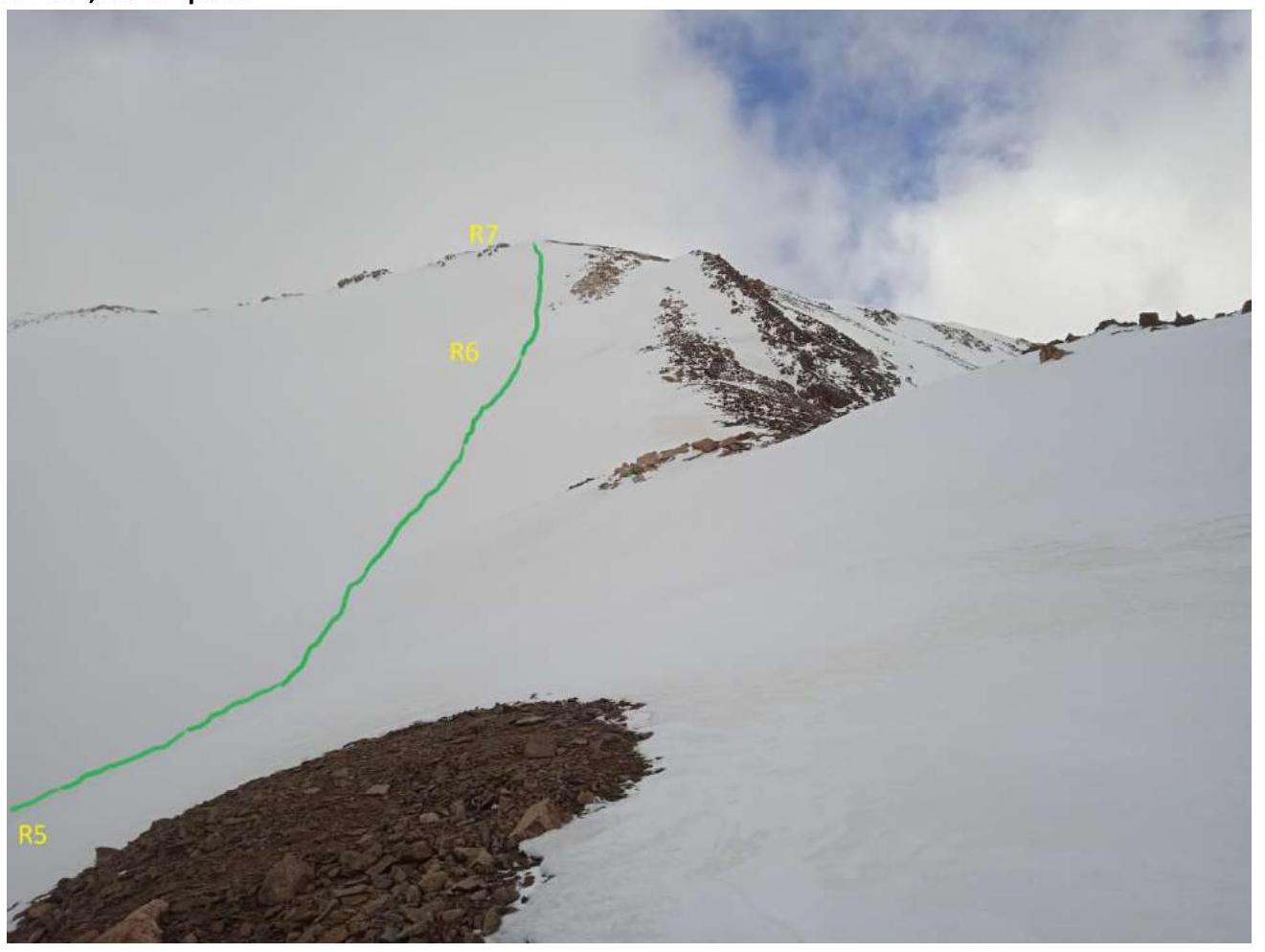
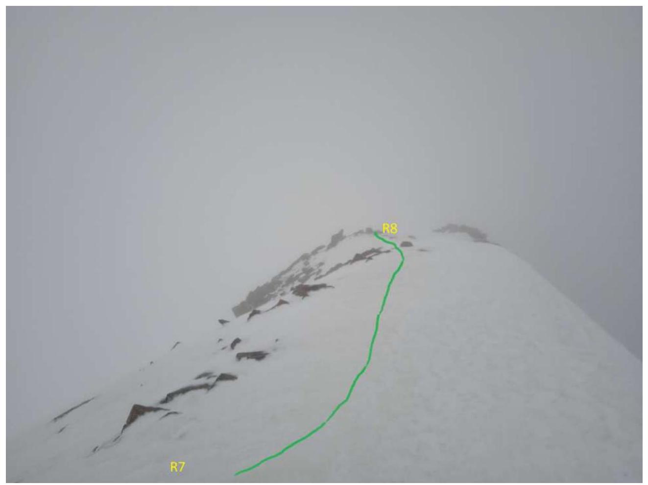
R7–R8, photo No. 7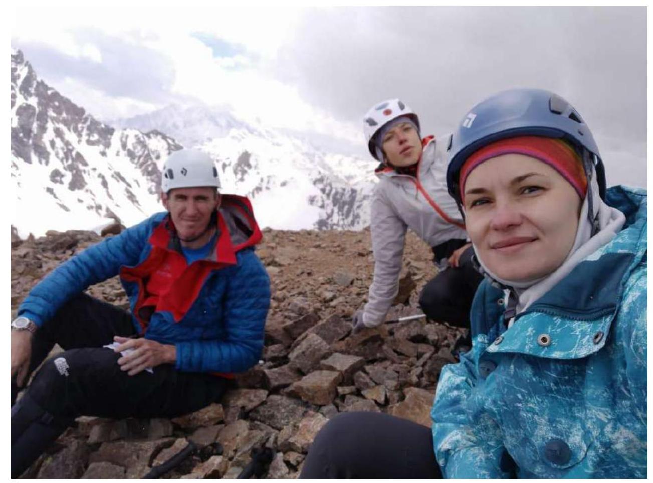
Photo at the summit
Conclusions and Recommendations
The route is logical and safe in terms of rockfall and avalanches. In our opinion, it corresponds to the 2B category of difficulty. We compared it with a similar route on the Kurmychi summit. It is convenient for educational and sports ascents. We recommend it for ascent in the second half of summer and autumn. The approach from the camp to the start of the route takes 30 minutes.