Appendix No. 1 to the Unified Requirements for Classification Report
Report Form for Routes of 1B–3B Category of Difficulty
Report
ON THE FIRST ASCENT TO THE SUMMIT KEZGEN VIA ROUTE 2A CATEGORY OF DIFFICULTY
BY THE TEAM OF MAC "Freeline" Pyatigorsk
11.06.2021
I. Ascent Passport
| No. | 1. General Information | |
|---|---|---|
| 1.1 | Full Name, sports rank of the leader | Popov M.L., CMS |
| 1.2 | Full Name, sports rank of the participants | Kovalev R.A., 2nd sports rank; Donskov V.A., 2nd sports rank; Grigorova E.V., 2nd sports rank |
| 1.3 | Full Name of the coach | Motienko N.I., CMS |
| 1.4 | Organization | MAC "Freeline" |
| 2. Characteristics of the Ascent Object | ||
| 2.1 | Region | Caucasus, KBR |
| 2.2 | Valley | Kyrtyk River Valley |
| 2.3 | Section number according to the 2013 Classification Table | 2.4 |
| 2.4 | Name and height of the summit | Kezgen 4011 |
| 2.5 | Geographical coordinates of the summit (latitude/longitude), GPS coordinates (1) | 43.31456 N 42.62821 E |
| 3. Route Characteristics | ||
| 3.1 | Route name | p. Kezgen via the northern ridge |
| 3.2 | Proposed category of difficulty | 2A |
| 3.3 | Degree of route exploration | first ascent |
| 3.4 | Relief character of the route | combined |
| 3.5 | Elevation gain of the route (altimeter or GPS data) | 351 |
| 3.6 | Route length (in meters) | 570 m |
| 3.7 | Technical elements of the route (total length of sections with different categories of difficulty, indicating the relief character (ice-snow, rock)) | I cat. diff. (rocks) — 30 m. II cat. diff. combination — 400 m. III cat. diff. rocks, ice — 140 m. IV cat. diff. rocks — 0 m. V cat. diff. — 0 m. Movement on closed glacier — 1100 m |
| 3.8 | Descent from the summit | Via the ascent route |
| 3.9 | Additional route characteristics | |
| 4. Characteristics of the Team's Actions | ||
| 4.1 | Time of movement (team's walking hours, in hours and days) | 5 hours |
| 4.2 | Overnight stays | no |
| 4.3 | Start of the route | 7:00 11.06.2021 |
| 4.4 | Reach the summit | 12:00 11.06.2021 |
| 4.5 | Return to the base camp | 14:00 11.06.2021 |
| 5. Person Responsible for the Report | ||
| 5.1 | Full Name, e-mail | Popov Mikhail Lvovich, mikl_popov@inbox.ru, 89282657130 |
1. Characteristics of the Ascent Object
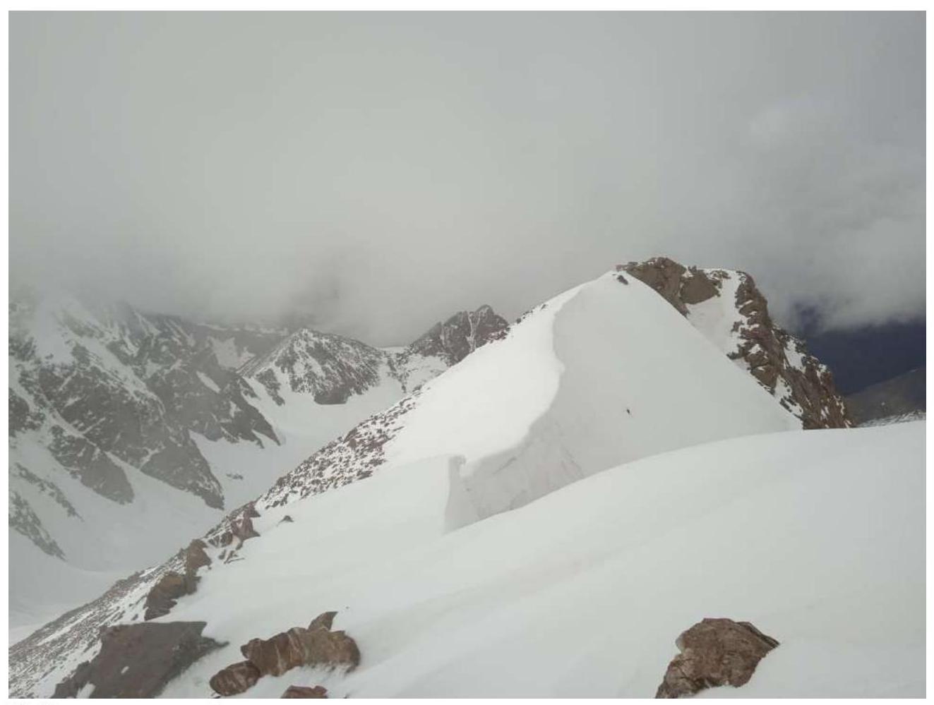
General photo of the summit p. Kezgen from p. Nakhodka
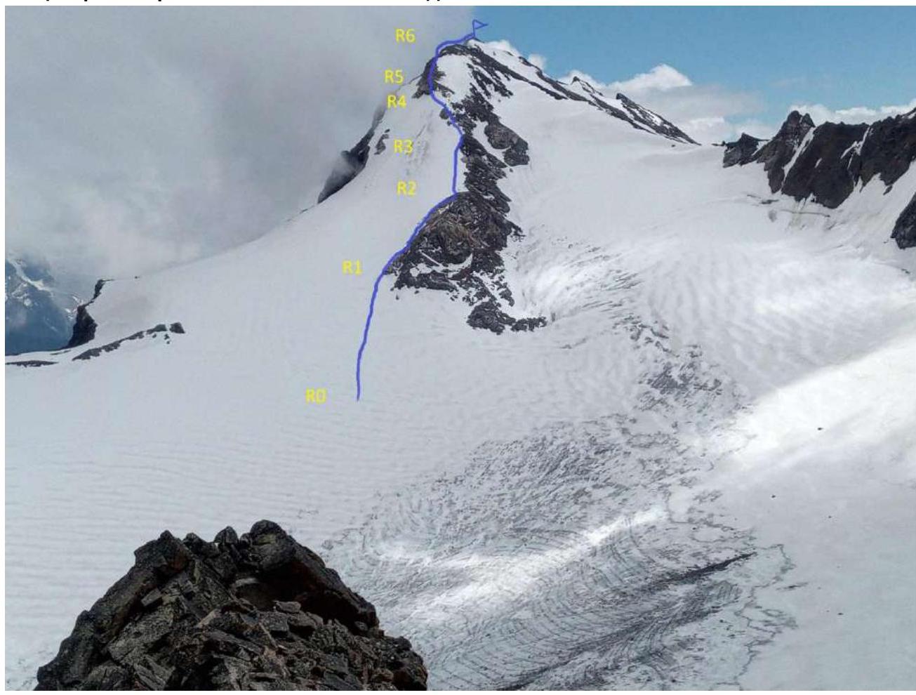
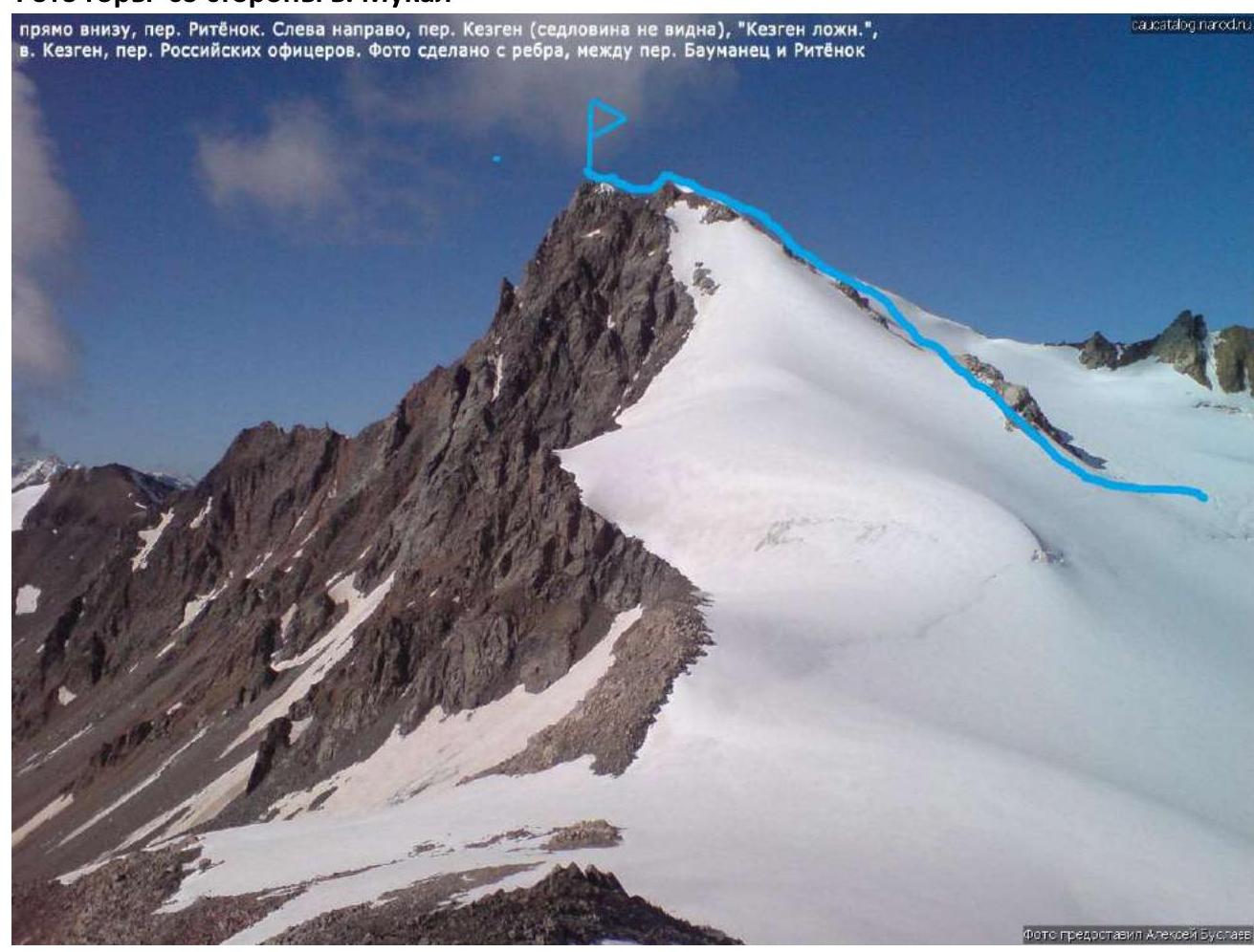
Photo of the mountain from the side of v. Mukal
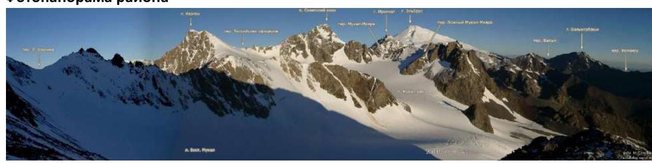
Photopanorama of the area
Brief overview of the ascent area and approach description
The ascent area is located in the part of the Lateral Ridge of the Central Caucasus, stretching from the summit Irik (4046 m) to the summit Mukal (3899 m). The ascent object — summit Kezgen (4011) is located in the ridge, which is a continuation of the eastern spur of Elbrus. A small eastern spur of Kezgen ends with the summit Kubasanti.
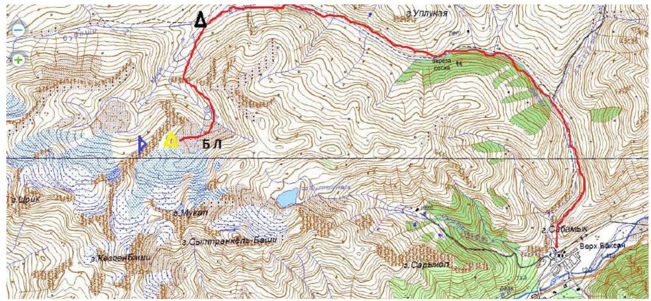
From the village Verkhny Baksan along a dirt road to the valley of the river Kyrtyk to the last koshi in the gorge at the confluence of the rivers Kyrtyk and Mkyara (15 km). The road from the village Verkhny Baksan is passable for vehicles like Lada "Niva" and UAZ "Patriot".
Further:
- Across the bridge over the river Mkyara
- Along its orographic right bank, along a marked trail up to the edge of the "hanging valley" (3 km)
- To the left along a marked trail, bypassing p. 3428
- Cross the river Mukal at a convenient location
- Move up along the scree along the ridge connecting v. 3428 and p. Nakhodka
After some time, the slope becomes gentler and turns into wide sandy fields. We choose a clearing, the closest to the summit Nakhodka, for a bivouac. From the cars — 2–3 hours.
There is no mobile connection in the gorge. Border passes are not required!
2. Route Characteristics
Technical photograph of the route
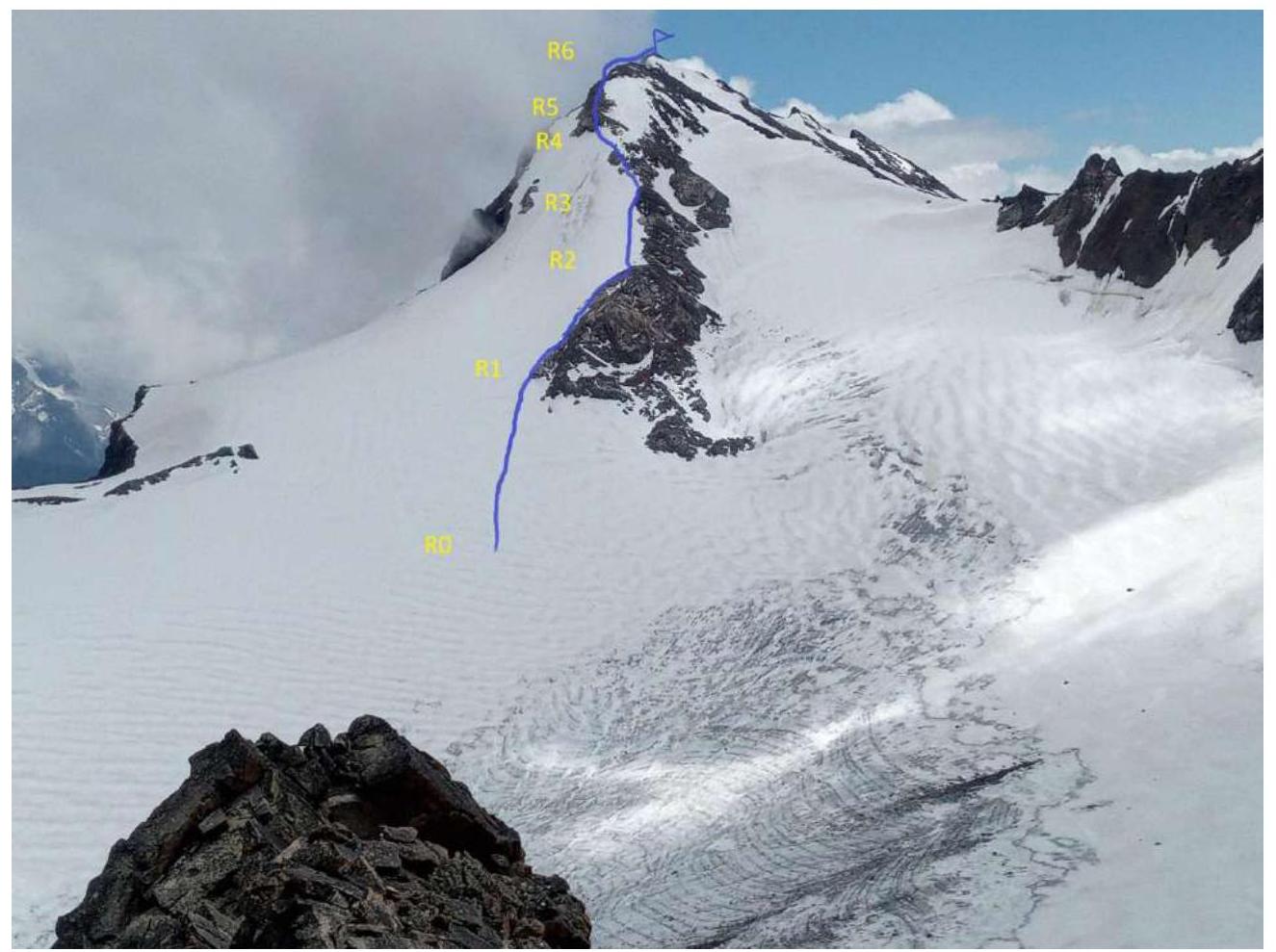
Technical characteristics of the route sections 2A cat. diff.
| Section No. | Relief Character | Category of Difficulty | Length, m | Type and Number of Pitons |
|---|---|---|---|---|
| R0–R1 | Snow. ice | 2; 3 | 150 | 2 ice |
| R1–R2 | Rocky ridge | 2 | 100 | 2 |
| R2–R3 | Rocky ridge, ice | 2; 1 | 70; 30 | 1 |
| R3–R4 | Smooth rocks | 3 | 70 | 2 |
| R4–R5 | Rocks | 3 | 20 | 3 |
| R5–R6 | Rocky ridge | 2 | 50 | 1 |
| R6–R7 | Rocky ridge, snow | 2 | 80 | 2 |
3. Characteristics of the Team's Actions
| Section No. | Description | Photo Number |
|---|---|---|
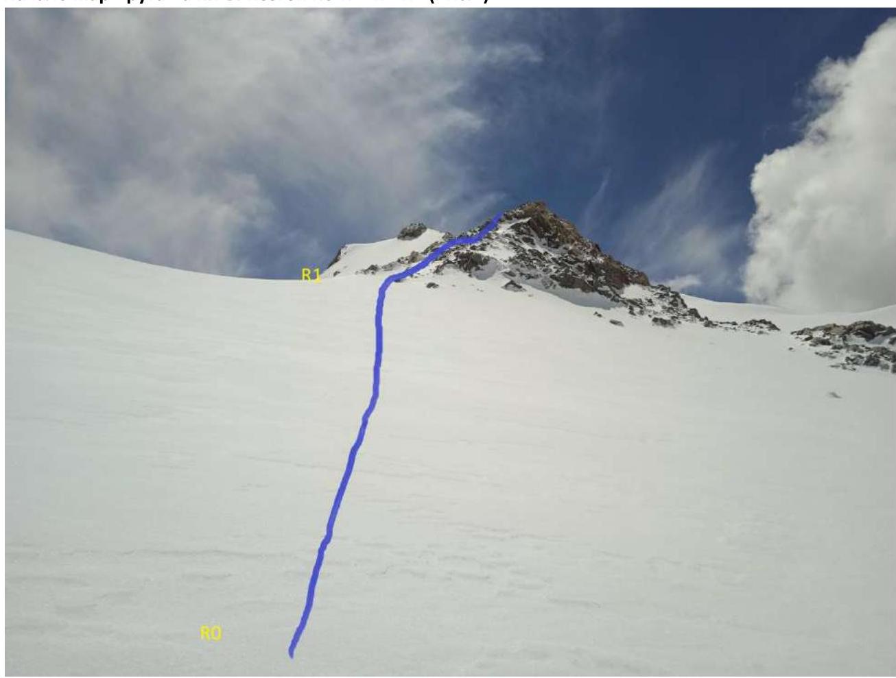
| R0–R1 | Up the glacier in the direction of the beginning of the rocky ridge — a total of 150 m. The first 100 m — 20°, then up to 40°. | 1 |
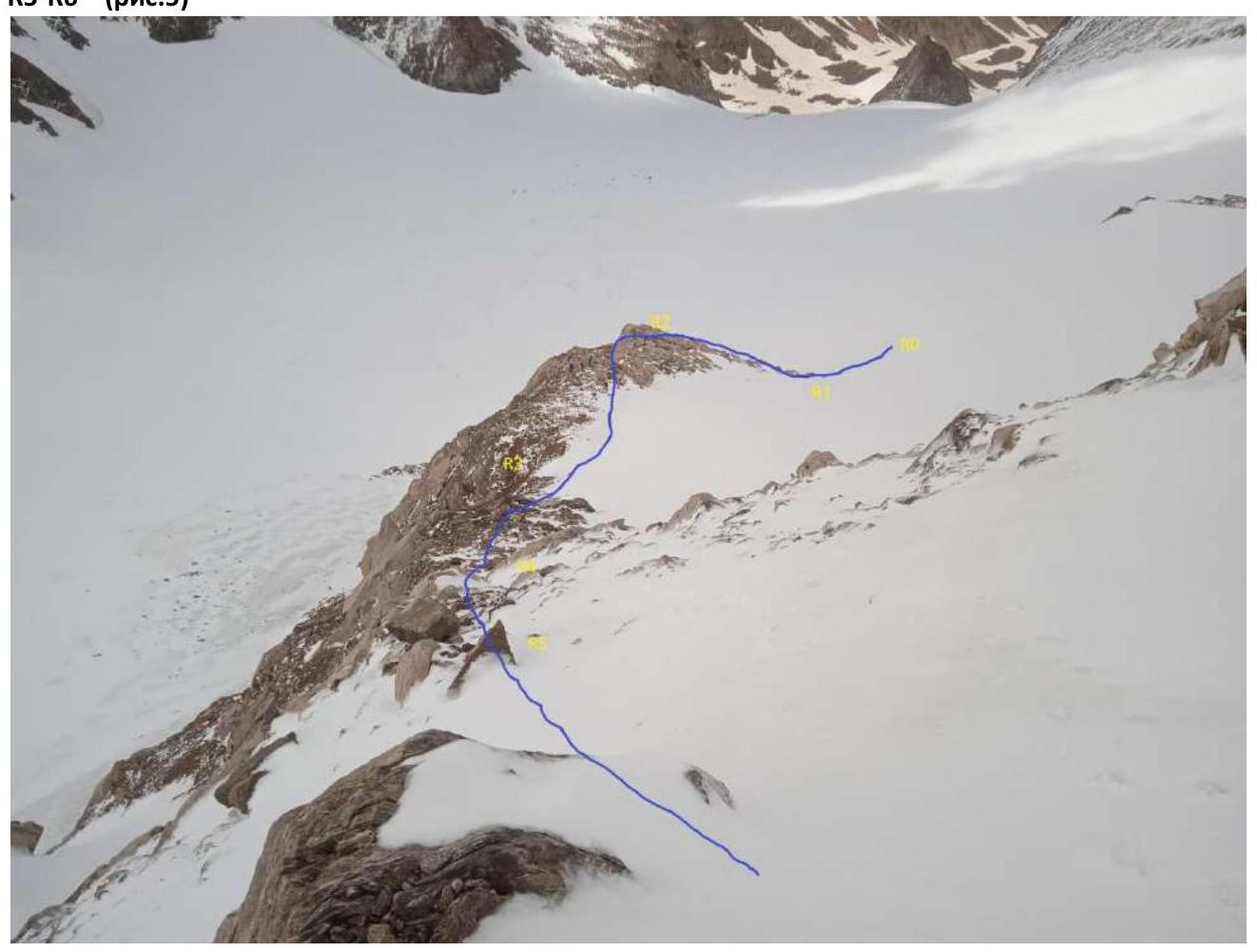
| R1–R2 | Along the smooth rocks of the ridge 100 m 40° 2nd cat. diff. | 2 |
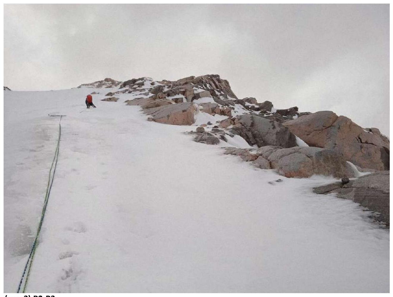
| R2–R3 | Further, the slope becomes gentler to 30°. On ice and rocks 70 m 2nd cat. diff. and 30 m 10° 1st cat. diff. | 3 |
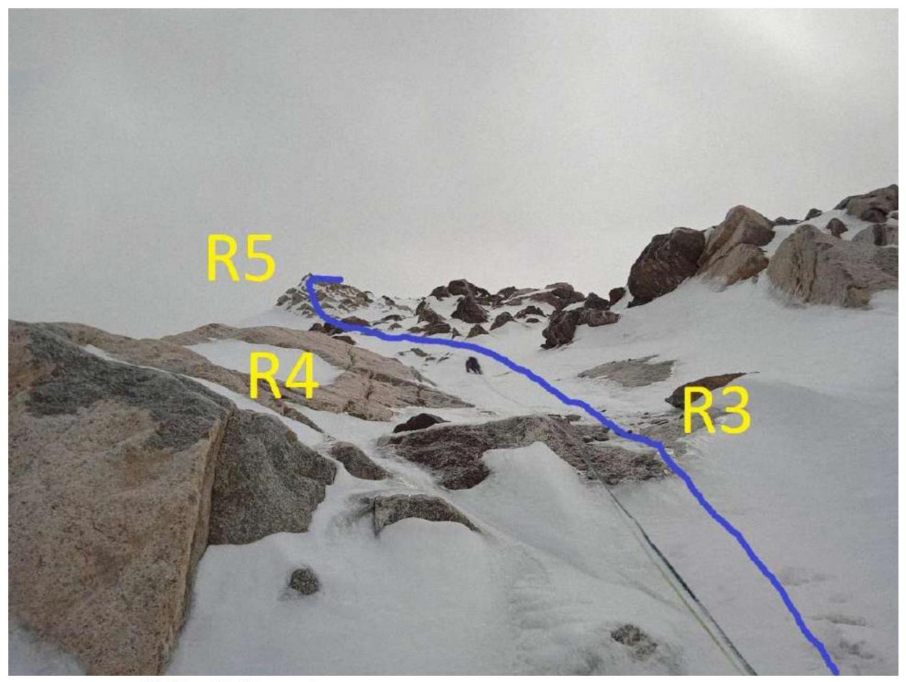
| R3–R4 | The steepness of the ridge increases to 45° on rocks 3rd cat. diff. 70 m to the wall. | 4 |
| R4–R5 | Along the wall 50–55° 20 m 3rd cat. diff. to the flattening. | 4,5 |
| R5–R6 | Along the wide ridge 30° 50 m 2nd cat. diff. to the narrowing of the ridge. | 5 |
| R6–R7 | Along the narrow ridge, sticking to the right side 80 m to the summit. 20° 2nd cat. diff. | 6,7 |
Start of the route 2B cat. diff. v. Kezgen R0–R1, R1–R2 (Fig. 1)
 R1–R2 (Fig. 2)
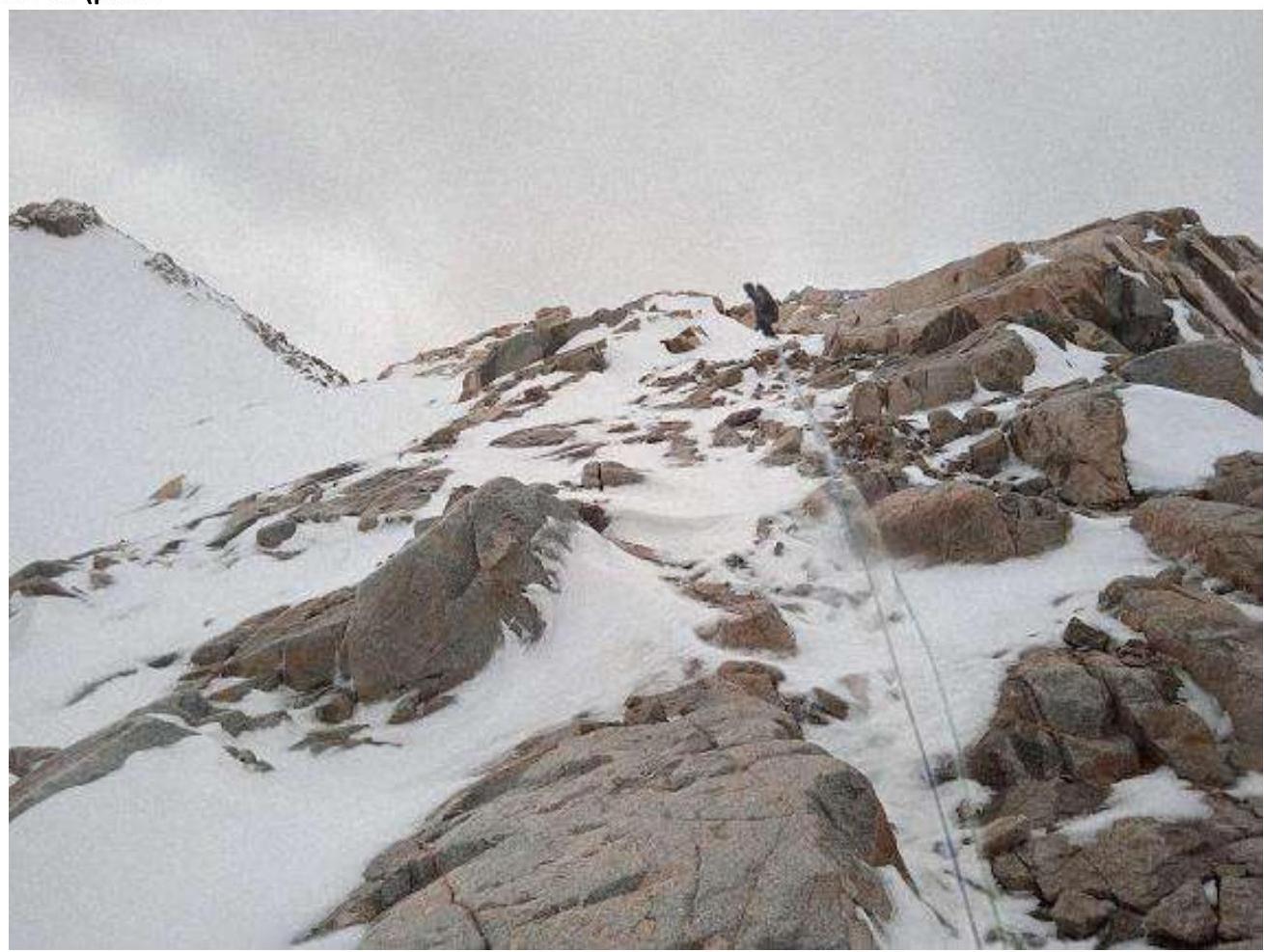 (Fig. 3) R2–R3
R3–R4; R4–R5 (Fig. 4)
 R5–R6 (Fig. 5)
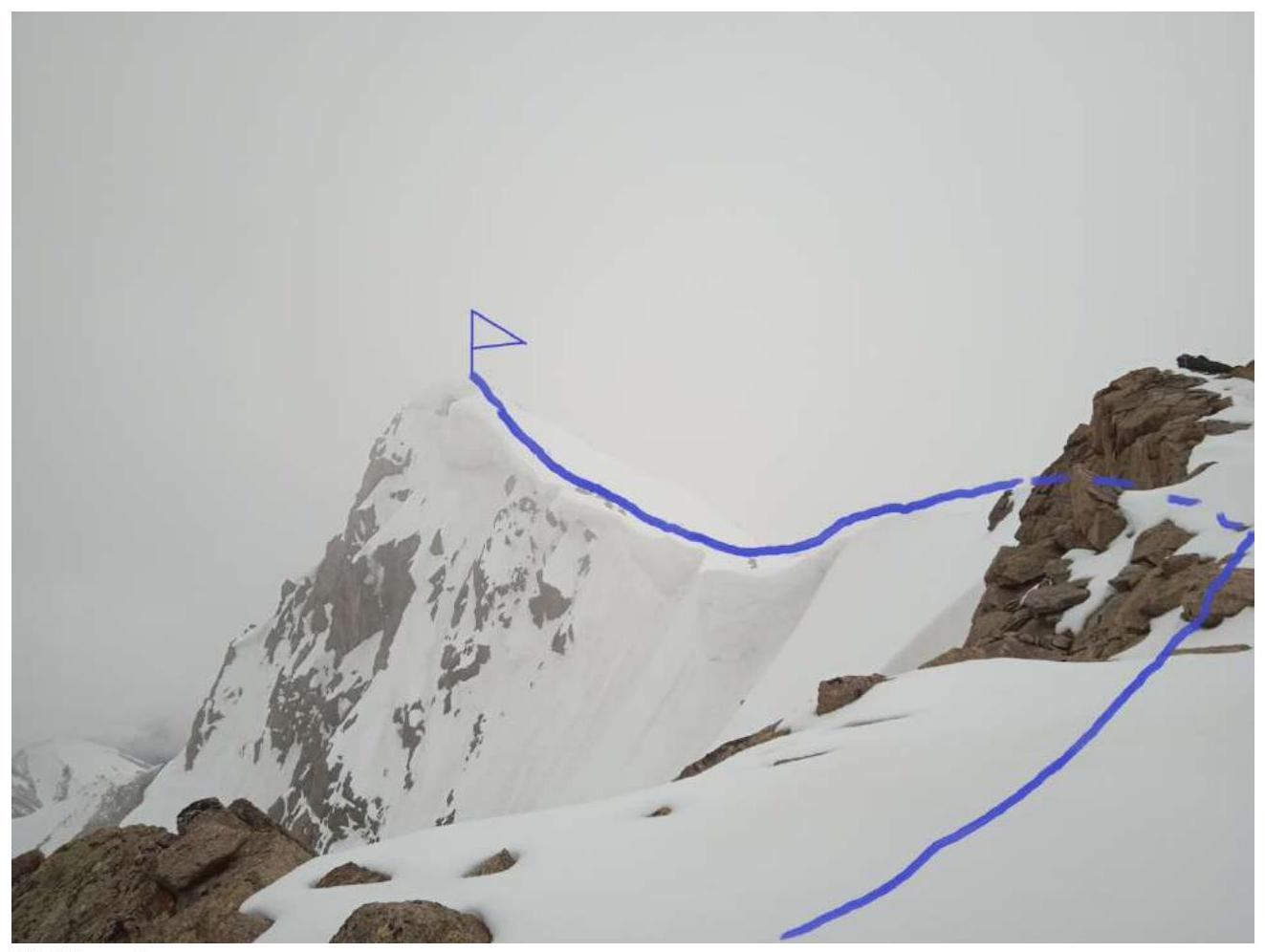
R6–R7 (Fig. 6)
R6–R7 view from above (Fig. 7)
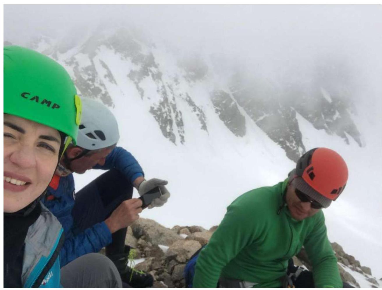
On the summit
Conclusions and Recommendations
The route is logical and safe in terms of rockfall. In our opinion, it corresponds to a strong 2A. Compared with the routes to v. Kurmichi and Maly Donguzorun 2A cat. diff. Quite monolithic, rocks are smoothed. In the first half of summer, it is snowy, rocks are icy.
Recommended for making educational and sports ascents by a group of 4–6 people.