
Report
On the ascent to the summit of Elbrus West via the Western slope through Utyug for the category of complexity by the team of the "Maximum" Sports and Alpine Club of Pyatigorsk State University for the period from June 20 to 28, 2020.
I. Climbing Report Passport
| № | General Information | |
|---|---|---|
| 1.1 | Full name, sports rank of the leader | Svitovoy Kirill Viktorovich, 1st sports rank |
| 1.2 | Full name, sports rank of participants | Filatov Maxim Yuryevich, 2nd sports rank Mamonova Elena, 2nd sports rank |
| 1.3 | Full name, sports rank of observer | Vikhlyaev Vladislav Valeryevich, 2nd sports rank |
| 1.4 | Full name of coach | Damianiди Ivan Georgievich, Grebenyuk Alexander Viktorovich |
| 1.5 | Organization | SAK "Maximum" PSU |
| 2. Characteristics of the ascent object | ||
| 2.1 | Region | North Caucasus, Karachay-Cherkess Republic, Karachayevsky district |
| 2.2 | Valley | Bitiktebekol |
| 2.3 | Number according to the classification table | 2.4. From Chiperazau pass to Gumachi peak |
| 2.4 | Name and height of the summit | Elbrus, western summit, 5642 m |
| 3. Route characteristics | ||
| 3.1 | Route name | Via western slope through Utyug |
| 3.2 | Proposed category of complexity | 3A |
| 3.3 | Degree of route development | - |
| 3.4 | Relief character of the route | Ice-snow |
| 3.5 | Height difference of the route (altimeter or GPS data) | 2142 m |
| 3.6 | Route length (in meters) | 5430 m |
| 3.7 | Technical elements of the route (total length of sections of various complexity categories with indication of relief character (ice-snow, rocky)) | 1st cat. comb. — 3800 m. 2nd cat. ice — 200 m. 3rd cat. ice — 150 m. 4th cat. ice — 80 m. Movement on a closed glacier — 1200 m. Descent on ropes — 3 ropes, 120 m |
| 3.8 | Descent from the summit | Via the ascent route, to Bitiktebekol valley |
| 3.9 | Additional route characteristics | Water on the route in the form of snow and ice |
| 4. Characteristics of the team's actions | ||
| 4.1 | Time of movement (team's walking hours, in hours and days) | 39 hours (7 walking days) from BL to BL |
| 4.2 | Overnights | BL (2650 m) — Djily-Suu meadow L1 (3500 m) — scree site on moraine L2 (3900 m) — site under Utyug rock L3 (4500 m) — hollow in ice crevasse |
| 4.3 | Departure to the route | 6:30, June 20, 2020 |
| 4.4 | Summit ascent | 6:40, June 27, 2020 |
| 4.5 | Return to base camp | 11:40, June 28, 2020 |
| 5. Responsible for the report | ||
| 5.1 | Full name, e-mail | Svitovoy Kirill Viktorovich, svikir@yandex.ru |
II. Ascent Description
1. Characteristics of the Ascent Object
The route to the western summit of Elbrus via the western slope passes through the territory of Karachayevsky district of Karachay-Cherkess Republic and starts from the mountain aul Khurzuk, which is located at the confluence of the Kuban and Ullu-Khurzuk rivers.
From the settlement, a rough dirt road about 18 km long goes up the valley of the Ullu-Khurzuk river and then along the Bitiktebekol stream valley, ending at a small thermal mineral water resort Djily-Suu at the western slopes of Elbrus. Here, at an altitude of 2650 m, the Base Camp (BC) is located. The journey to BC from the aul takes 1.5–2 hours. The approach to the start of the route takes about 3 hours along the Bitiktebekol stream bed.
L1 is located at an altitude of 3500 m on rocky sites in front of the scree ridge leading to the base of Utyug, a giant nunatak between the Bitiktebe and Kyukyurtly glaciers. This is the beginning of the route.
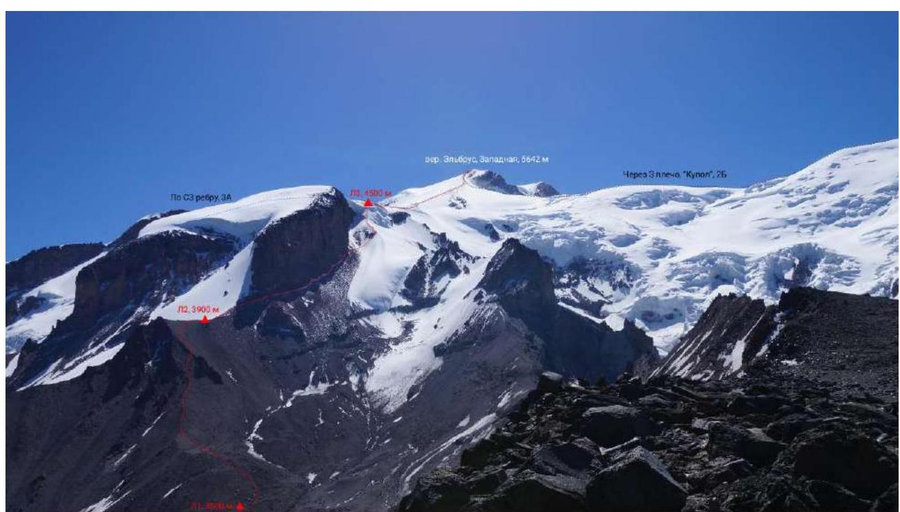
Fig. 1.1. General photo of the summit, our and neighboring classified routes (photo from the area of Kolcevoy pass on June 28, 2020)
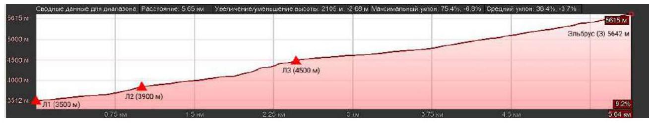
Fig. 1.2. Route profile
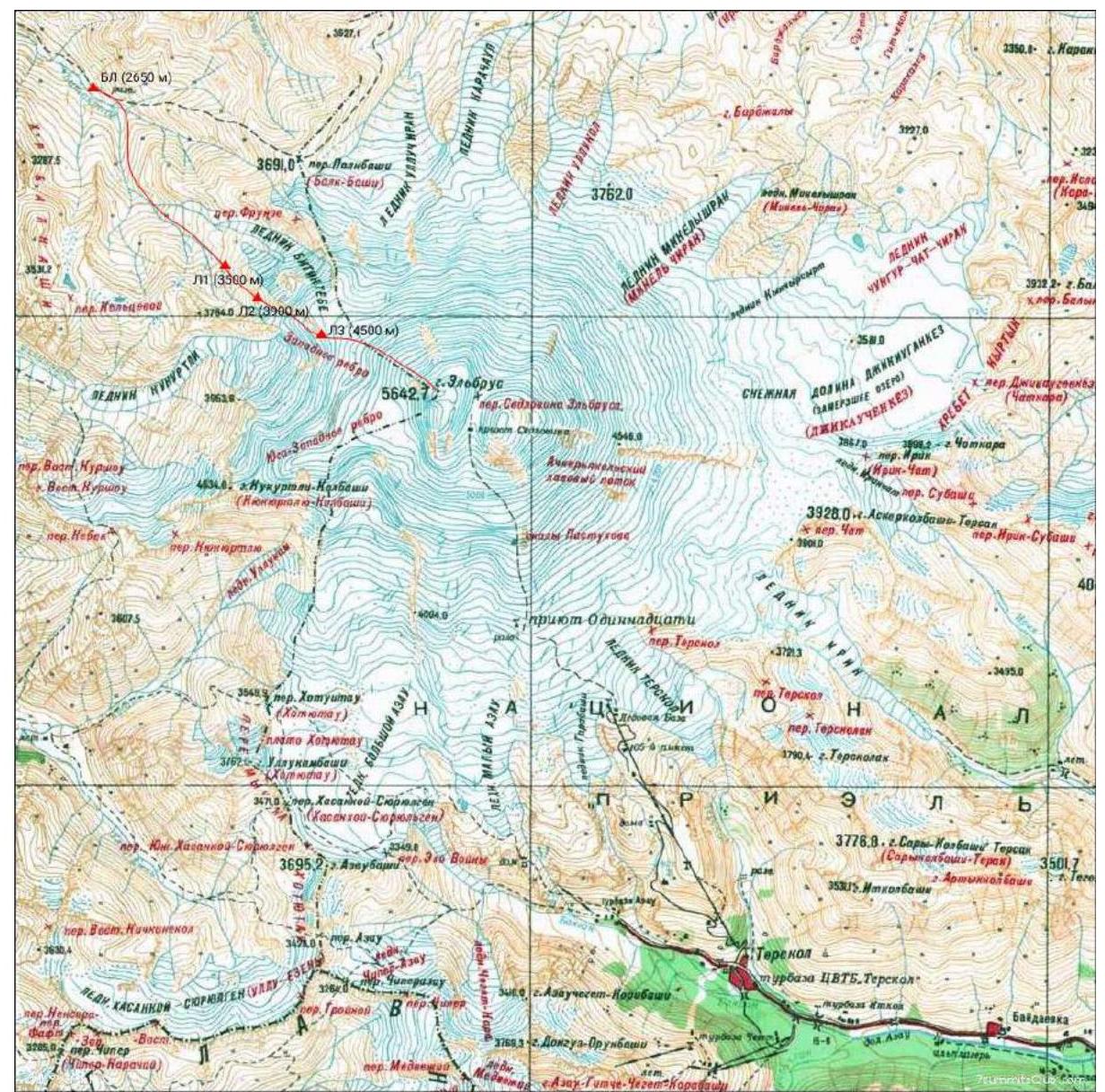
Fig. 1.3. Area map with approximate route thread
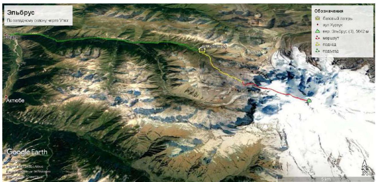
Fig. 1.4. Route map with approach and route
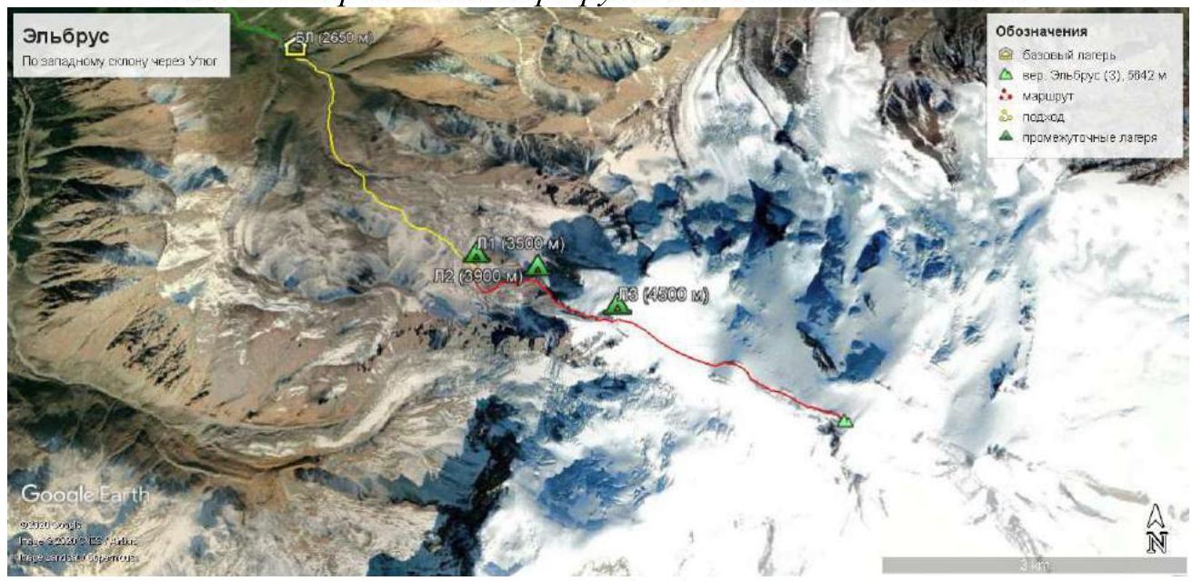
Fig. 1.5. Route map with approach and camp locations
2. Route Characteristics
| № sect. | Relief character | cat. diff. | Slope steepness, ° | Length, m | Type and quantity of pitons |
|---|---|---|---|---|---|
| 1 | Rocky-scree | 1 | 10–30 | 1100 | - |
| 2 | Rocky-scree | 1 | 15–30 | 1000 | - |
| 3 | Snow-ice | 3 | 30–40 | 150 | 4 ice screws |
| 4 | Snow-ice | 2 | 20–30 | 200 | - |
| 5 | Snow-ice | 4 | 40–70 | 80 | 5 ice screws |
| 6 | Snow-ice | 1 | 0–10 | 1200 | - |
| 7 | Snow-ice | 1 | 10–30 | 1700 | - |
Technical characteristics of route sections
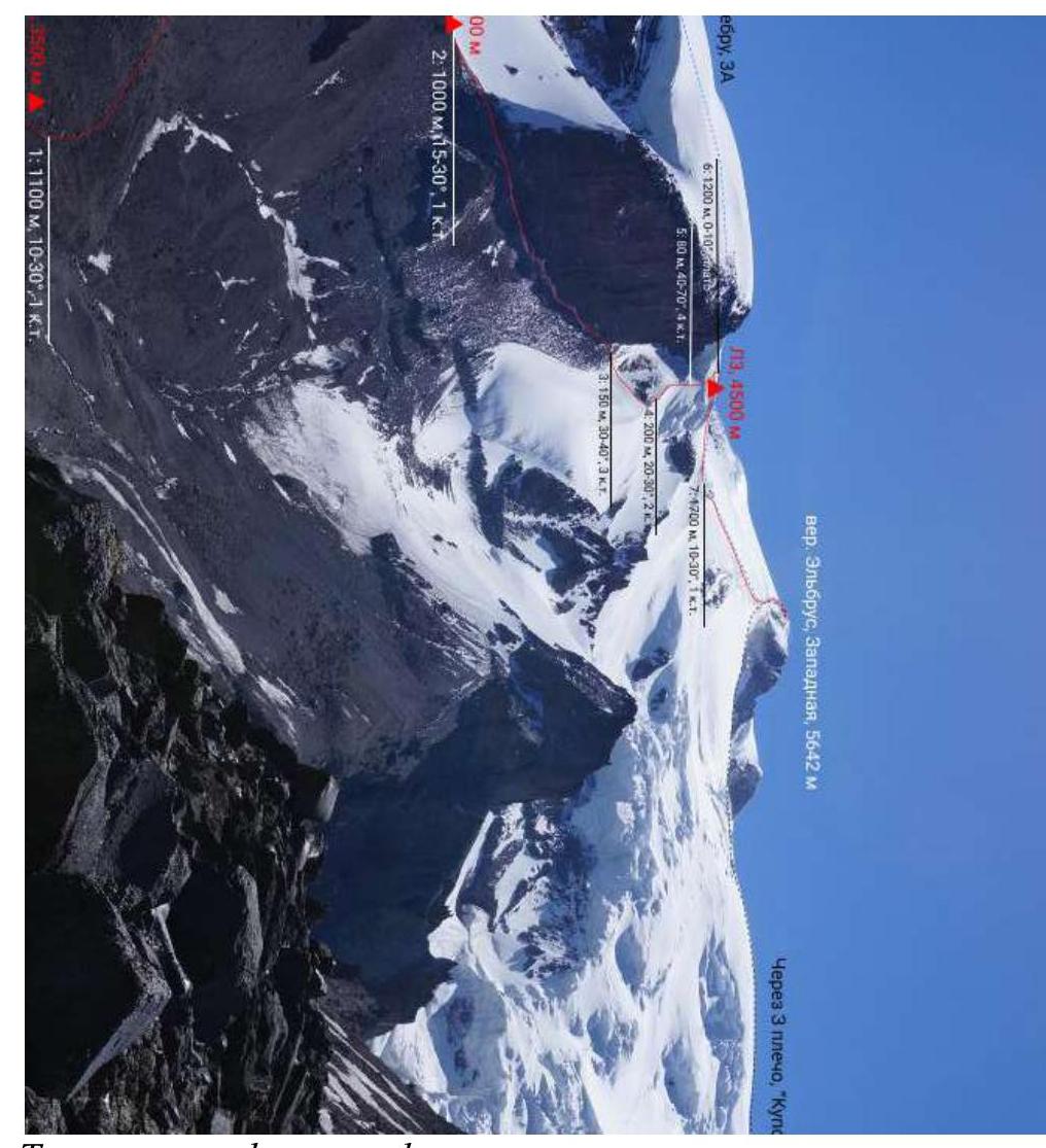
Fig. 2.1. Technical photo of the route
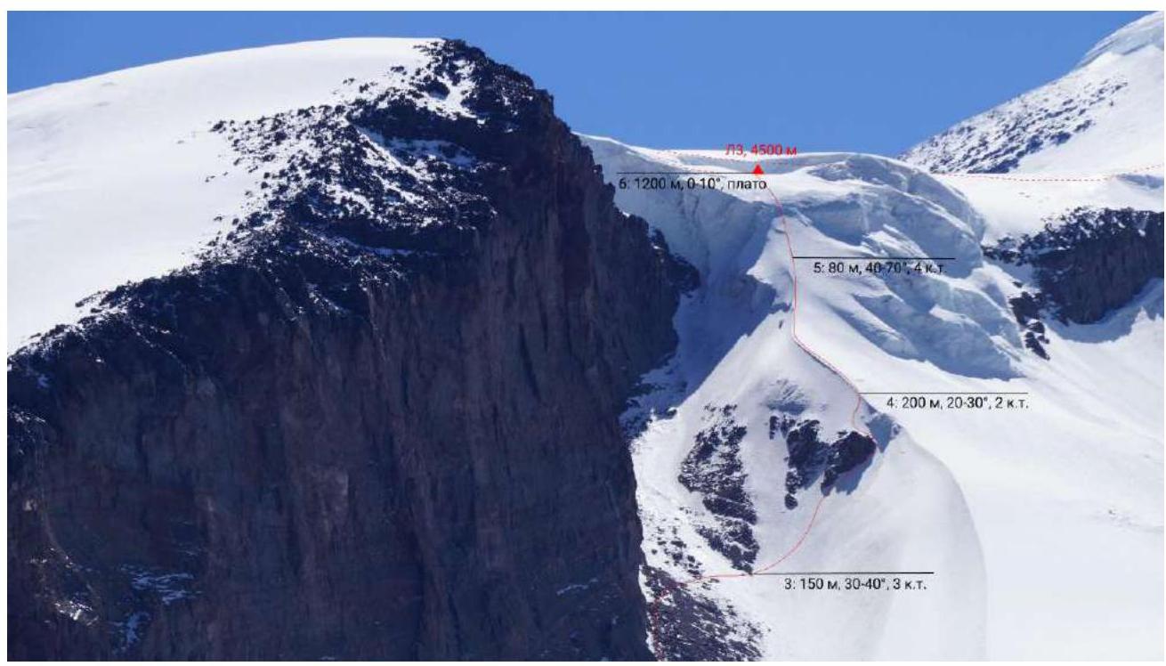
Fig. 2.2. Technical photo of the key route section
3. Characteristics of the Team's Actions
From L1 (3500 m) along the scree slope, along an indistinct rocky trail along the ridge, we ascended to the L2 sites (3900 m), which are located 100 m from the base of the Utyug rock wall (R1). Then, under the Utyug wall, we traversed the scree slope for about 1 km and reached the glacier (R2). Along the snow-ice ascent (movement in a rope team), bypassing a small nunatak, we ascended to the glacier (R3), belaying through ice screws.

Photo 3.1. Beginning of R3 and nunatak (30°)
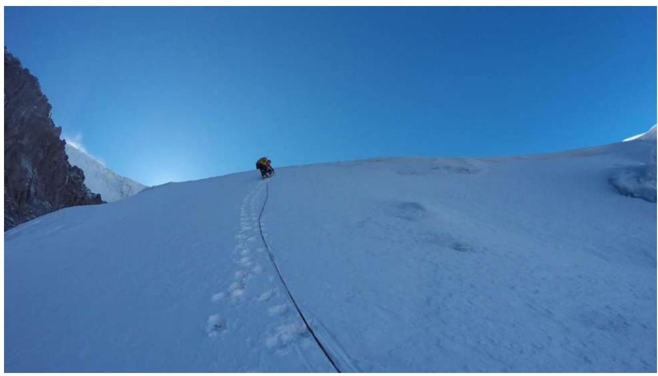
Photo 3.2. Upper part of R3 (40°). Then along a pronounced snow-ice ridge, we ascended to the base of a steep snow-ice ascent to the western plateau (R4).
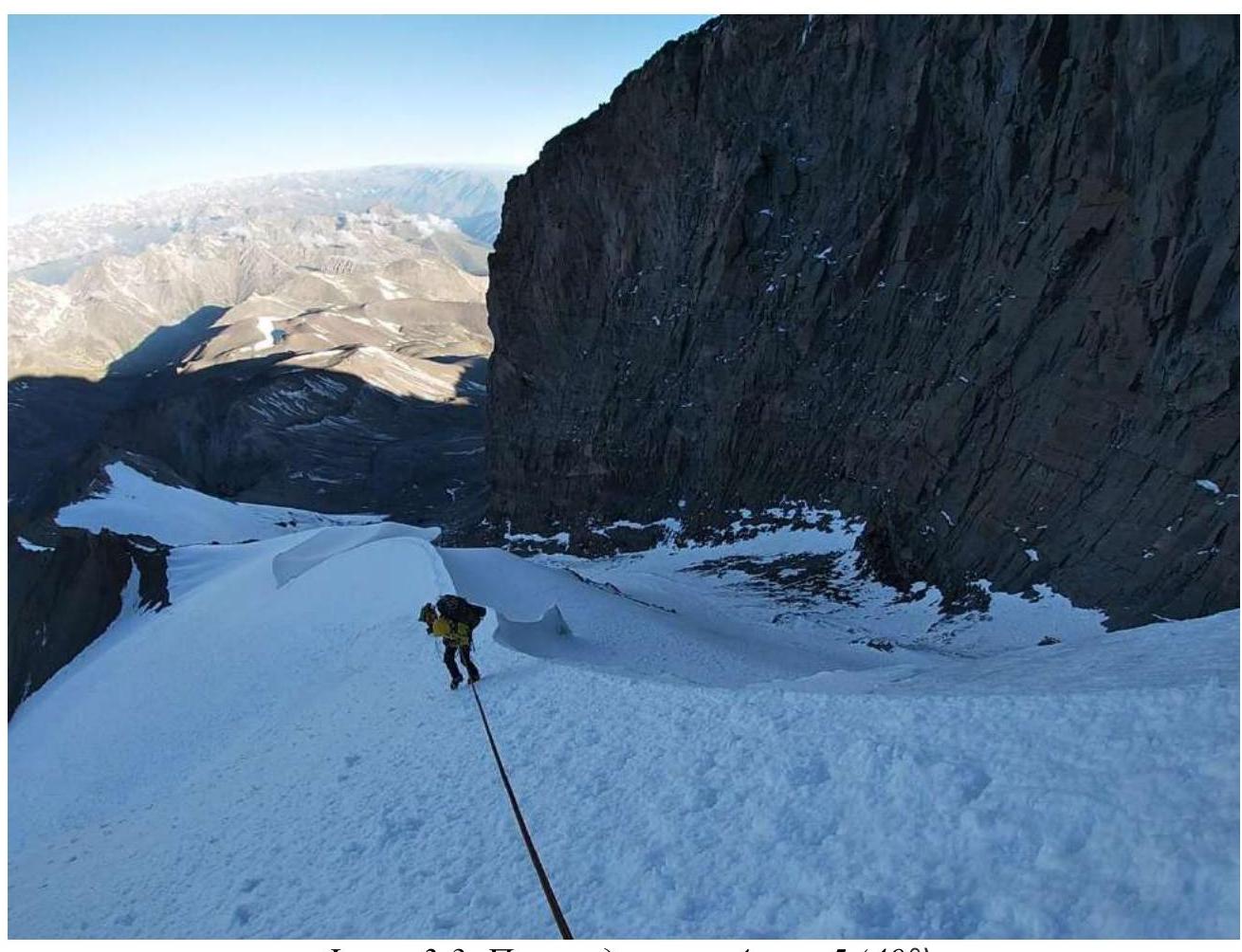
Photo 3.3. Transition from R4 to R5 (40°)
The leader passed the ascent with lower belay and set 100 m of rope, by which the other participants ascended (R5).

Photo 3.4. Ascent on ropes to L3 (60–70°)
In a snow-ice hollow, in the upper crevasse of the icefall, before exiting to the Western plateau, L3 was set up (4500 m).
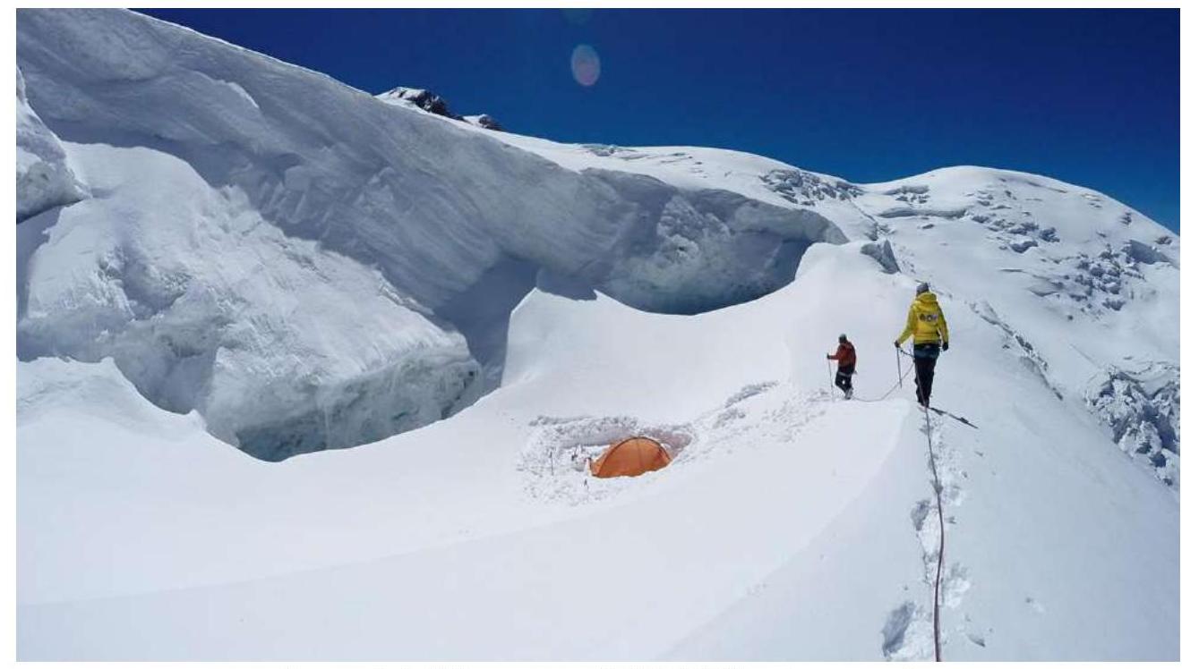
Photo 3.5. Assault L3 (4500 m) in the hollow
Then, an acclimatization exit was made through the western plateau (R6) to an altitude of 5000 m (R7).
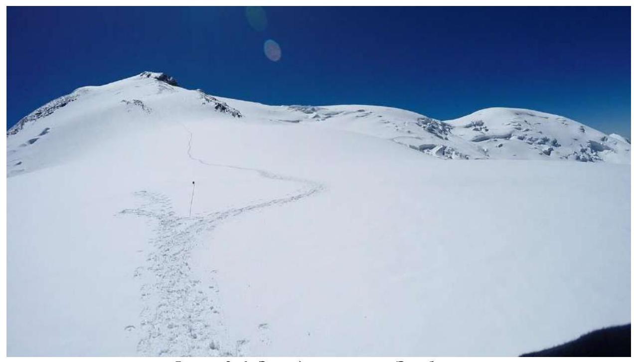
Photo 3.6. Western plateau of Elbrus
The next day (in about 8 hours), the group ascended to the western summit of Elbrus and returned to the assault camp. The next morning, the group descended along the key section of the route on ropes (120 m), using pre-prepared Abalakov's knots and expendable cordelette, and then returned to BC along the ascent route.
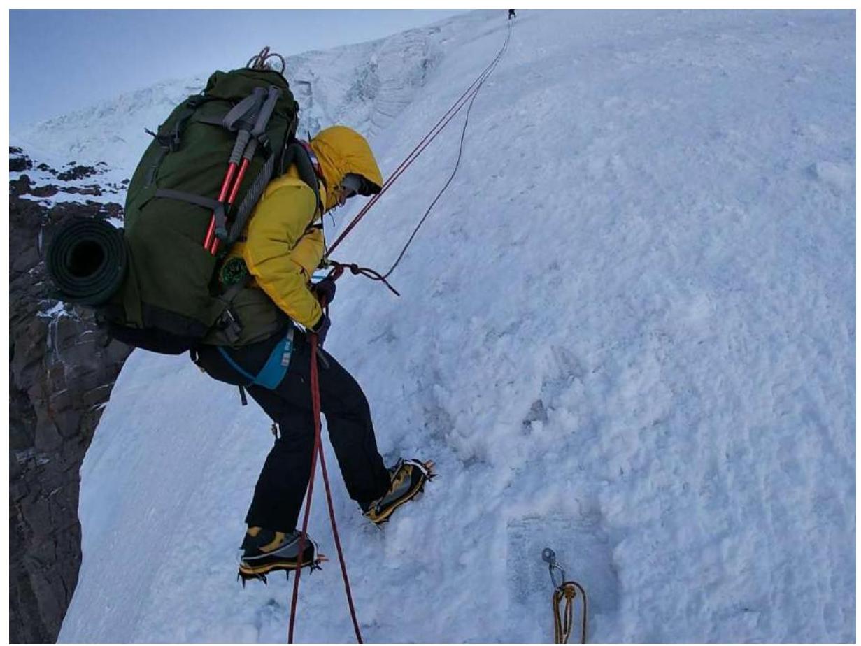
Photo 3.7. Descent on ropes at R5 (50–60°)
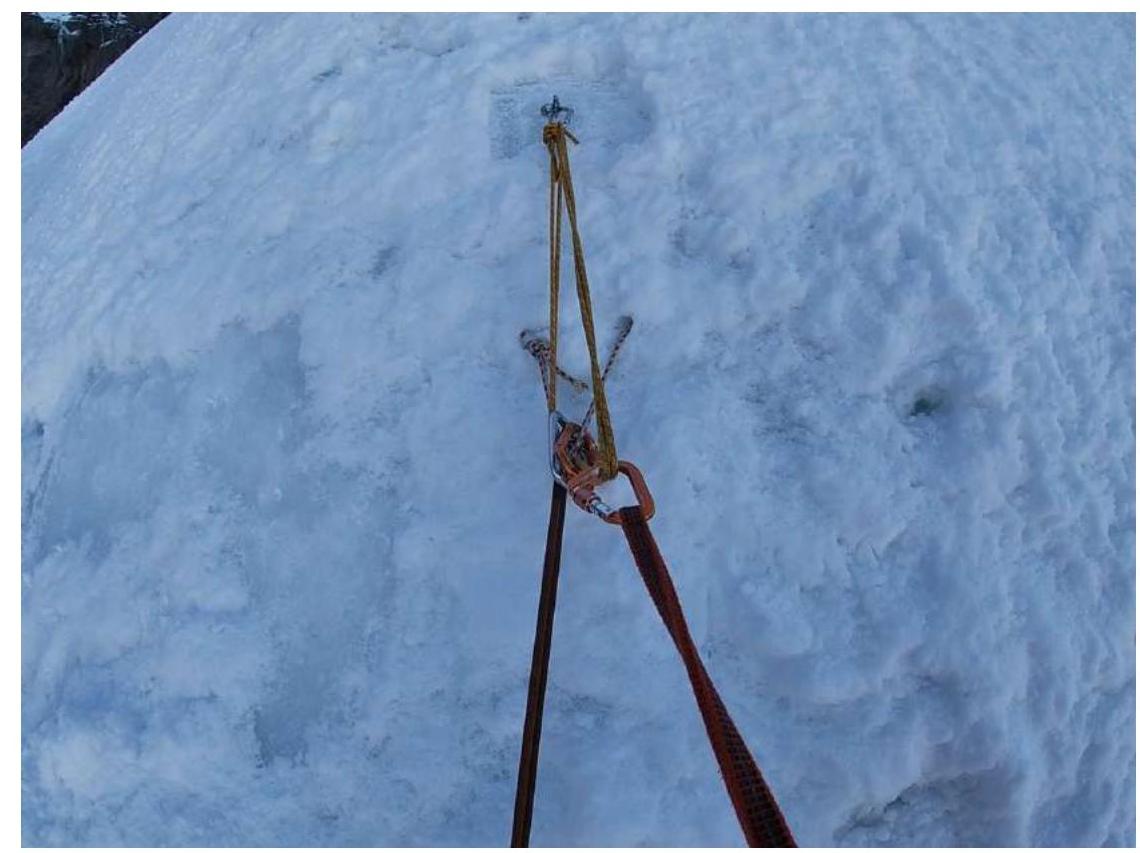
Photo 3.8. Knot with backup through ice screw
| № sect. | Description | Photo number |
|---|---|---|
| 3 | The group moves straight up, bypassing the nunatak to the right. Slope steepness up to 40°. Parallel movement in rope teams with belay through ice screws. | 1 |
| 3 | The upper part of the section is the steepest. Belay through ice screws, moving in parallel. | 2 |
| 4 / 5 | Transition from R4 to R5. Then the slope steepness increases sharply. | 3 |
| 5 | Steep ice ascent 7–8 m wide between crevasses in the icefall. Ascent to L3 on pre-prepared ropes. Key section of the route. | 4 |
| 5 / 6 | L3 in the hollow at the ice crevasse before exiting to the plateau. Ice wall is vertical, without overhangs. The camp is reliably protected from the wind. | 5 |
| 6 | Western plateau of Elbrus. Closed glacier, there are crevasses. In the photo — trail on the plateau with a marked danger zone. | 6 |
| 5 | Descent on ropes at the key section with upper belay through ice screw. | 7 |
| 5 | Descent knot with additional belay through ice screw. | 8 |
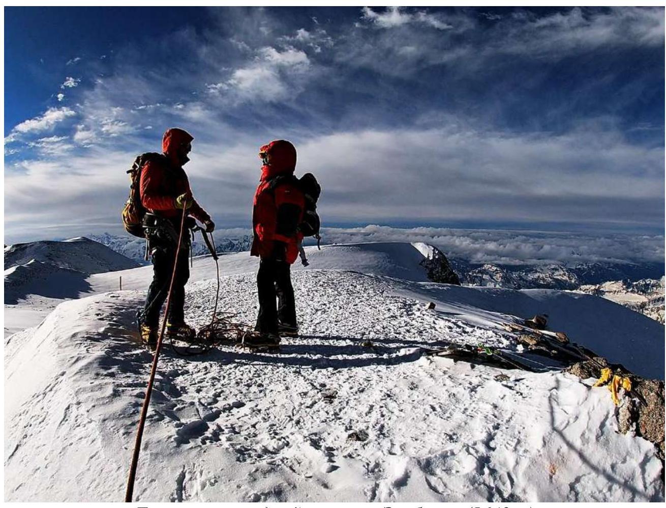
Group on the western summit of Elbrus (5642 m)
Traversing the slope under Utyug rock should be done early in the morning, as there is a serious risk of rock and ice falls. This should be considered both during ascent and descent. The key section of the route is located in the icefall and may change significantly.
The Western plateau is a closed glacier with crevasse zones. In poor visibility, orientation on the plateau can be difficult due to its large size and lack of distinct landmarks.
The Western slope is primarily affected by weather changes on the mountain, where western winds prevail:
- In summer, frequent thunderstorms are a hazard;
- In the off-season — hurricane-force winds, unobstructed by neighboring mountain ranges.
Cellular communication on the route is practically absent, except for the summit area.
Descent from the summit is convenient:
- Along the ascent route;
- By traversing through the summit via a simpler southern route (1B);
- Along the western ridge to the Khotyutau saddle ("Dome"), and then — to Azau (2B), which implies climbing the entire bivouac to the summit height or near it.
The route is the most technically and physically challenging of all the main classified routes to Elbrus summits, including the traverse of both summits. It is somewhat more complicated than the route to Kazbek from the Maili glacier (2B), and comparable to the route to Tetnuld along the SW ridge (2B), but more extensive.
Taking into account the altitude, the group requests to classify the route as 3A category of difficulty.
Comments
Sign in to leave a comment