Passport
-
Combined class.
-
Caucasus, Ullukhursuk gorge in KCR (Lateral Ridge to the north of MRR).
-
Mount Elbrus (West) via the North-West ridge.
-
Proposed — 4A category of difficulty, first ascent ("pp").
-
Elevation gain: camp №1 4100 m — summit 5642 m = 1542 meters.
Distance: 6550 meters. Average slope: 50–55°.
-
Use of protection gear: 33 pieces.
Use of ice screws: 20 pieces.
-
Climbing hours: from camp №1 to camp №2 via fixed ropes 7–8 hours; from camp №2 to the summit 8–9 hours.
-
Overnights: in camp №1, in camp №2, possible on the route if there is a bivouac.
-
Leader: Shvyrev Andrey Glebovich — Candidate Master of Sports, 1st category alpine instructor, certificate №556. Participants:
- Vorobyov Pavel Yuryevich — 2nd sports category.
- Shkilyov Vitaly Vladimirovich — 2nd sports category.
-
Coach: Shvyrev Andrey Glebovich.
-
Route entry:
- August 27, 2003 — establishment of camp №1 at 4100 m;
- August 28–29, 2003 — fixing ropes, establishment of camp №2 at 4600 m, exit to the plateau, descent to camp №1;
- August 30, 2003 — rest day;
- August 31, 2003 — ascent to camp №2;
- September 1, 2003 — exit from camp №2 at 3:00 — summit at 11:15.
-
Organization: Ushba Mountaineering Club, Stavropol city.
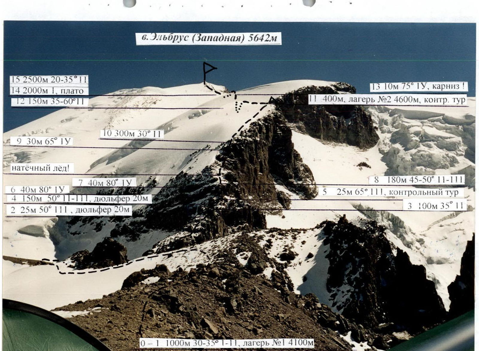
Technical photograph of the route to the summit of Elbrus (West) 5642 m (approximately 4A category of difficulty)
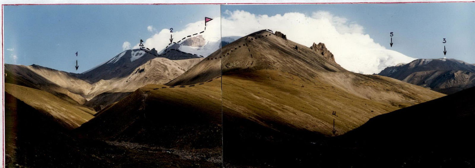
Photograph of the general view of Mt. Elbrus (West) 5642 m with the route marked. The photo was taken from the base camp of MC "Ushba" at 2750 m. 1 — Pallbashi Pass (Balk-Bashi), leading to the Kyzylkol gorge. 2 — North-West ridge to Mt. Elbrus (3). 3 — Mt. Kukurtli-Kolbashi 4634 m. 4 — BitikTebe river. 5 — South-West ridge to Mt. Elbrus (3).
- Mt. Elbrus (3) 5642 m.
- first camp on the Ushba MC route.
- first ascent route via the North-West ridge to Mt. Elbrus (3).
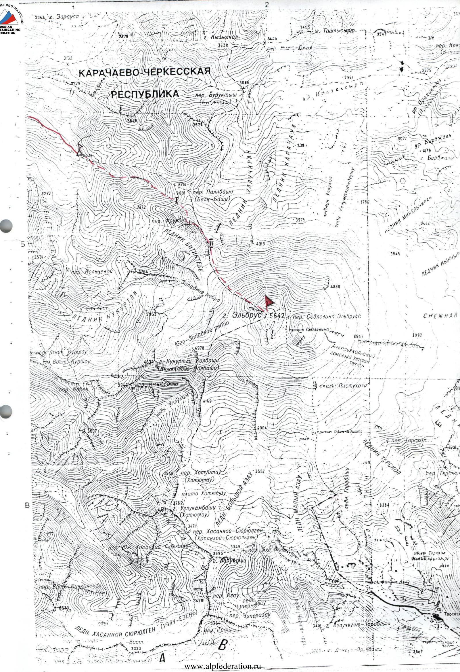
Map-scheme of the ascent area to Mt. Elbrus (West) via the North-West ridge (approximately 4A category of difficulty)
Δ — base camp.
I — camp №1.
III — camp №2.
↘ — route.
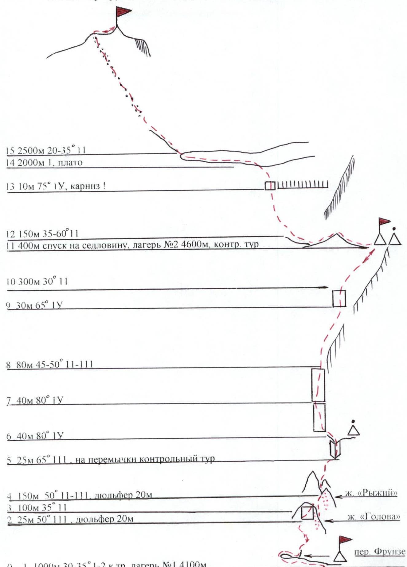
Scheme of the route to Mt. Elbrus (West) 5642 m via the NW ridge
Description of the route passage
From the base camp, located at an altitude of 2750 m, follow a well-defined ridge to reach the first camp. Camp №1 is located at an altitude of 4100 m, and from here the route to Mt. Elbrus (West) via the North-West ridge begins. From camp №1, follow the ridge, passing the Frunze Pass, to ascend to the first "Golova" pinnacle located at the beginning of the North-West ridge. The ascent goes through rocks, with some névé ice, and along a wall to reach the pinnacle. From the pinnacle, rappel 20 m to a col. From the col, ascend through rocks to the second "Ryji" pinnacle. The pinnacle is bypassed on the right — rappel 20 m, ascent to the ridge 30 m. Further, through rocks and an internal corner, reach a col under the walls. On the col is control cairn №1. It should be noted that the movement on this section of the route is through rocks of volcanic origin, which are heavily eroded, and névé ice is encountered.
Further, the route involves climbing complex rocks with névé ice. After the rocks, ascend through a section with ice, rocks, and névé. A wall with complex climbing is encountered.
After the wall:
- exit to an ice-névé slope,
- leading to camp №2 at an altitude of 4600 m.
In camp №2 is control cairn №2.
This section is key on the route. This section of the ridge cannot be bypassed either from the left or the right. It is necessary to fix ropes.
After camp №2, follow the ridge, descending to a saddle. Further, ascend through a névé slope, to the left of a large cornice. The cornice is bypassed on the left along a steep wall. After the wall, exit to a plateau. Across the plateau, approach the pre-summit ridge.
On the plateau:
- many hidden crevasses.
On the pre-summit ridge:
- rocks
- scree
- snow
- ice
- many open and hidden crevasses.
Schedule of the Ushba Mountaineering Club on the first ascent of the route to Mt. Elbrus (West) via the North-West ridge:
- August 26, 2003 — arrival and establishment of the base camp at 2750 m;
- August 27, 2003 — establishment of camp №1 at 4100 m;
- August 28–29, 2003 — fixing ropes, establishment of camp №2 at 4600 m, exit to the plateau, descent to camp №1 (weather unstable, strong wind, snow);
- August 30, 2003 — rest day;
- August 31, 2003 — ascent to camp №2;
- September 1, 2003 — summit.
Weather is good. September 2, 2003 — evacuation of camps №1 and №2, descent to the base camp.
Characteristics of the route sections
| R0–R1 | 30–35° | 1000 м | scree, snow, rocks | 1–2 кат. сл. | good | camp №1 | |
| R2–R3 | 50° | 25 м | internal corner | 3 | good | 2 protection gear | "Golova" pinnacle |
| R3–R4 | 35° | 100 м | rocks | 2 | |||
| R4–R5 | 50° | 150 м | rocks | 2–3 | 5 protection gear | "Ryji" pinnacle | |
| R5–R6 | 65° | 25 м | rocks, ice | 3 | 3 protection gear | control cairn №1 | |
| R6–R7 | 80° | 40 м | wall | 4 | 10 protection gear | ||
| R7–R8 | 80° | 40 м | wall | 4 | 9 protection gear, 2 ice screws | ||
| R8–R9 | 45–50° | 180 м | rocks, névé, ice | 2–3 | 12 ice screws | ||
| R9–R10 | 65° | 30 м | wall, ice | 4 | 4 protection gear, 4 ice screws | ||
| R10–R11 | 30° | 300 м | snow, névé | 2 | camp №2, control cairn №2 | ||
| R11–R12 | snow, névé | descent to a saddle | |||||
| R12–R13 | 35–60° | 150 м | snow, névé | 2 | |||
| R13–R14 | 75° | 10 м | névé, ice | 4 | 2 ice screws | cornice bypass | |
| R14–R15 | 2000 м | snow, névé | |||||
| R15 | 20–35° | 2500 м | rocks, scree, ice, snow | 1–2 | summit |
Photographs of the route sections
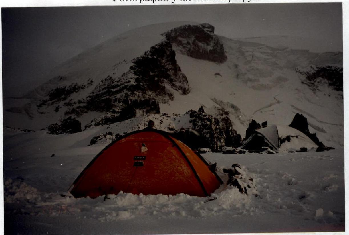
State of the route from August 28 to 30. Camp №1.

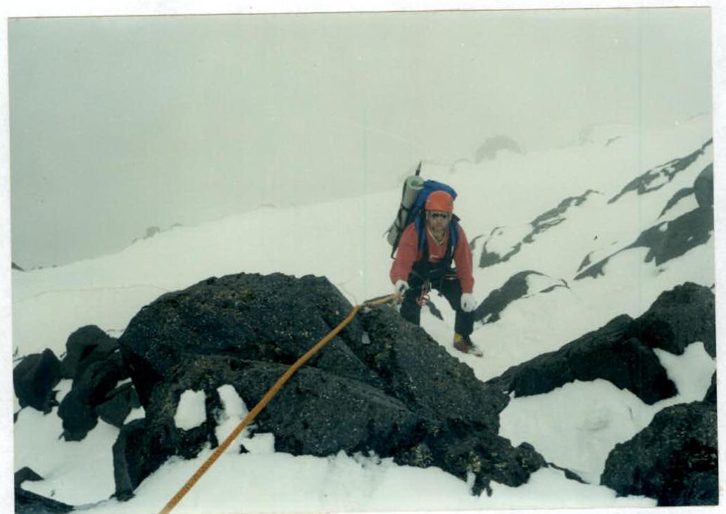
Section №7. Wall.
Section №9. Ropes to camp №2.
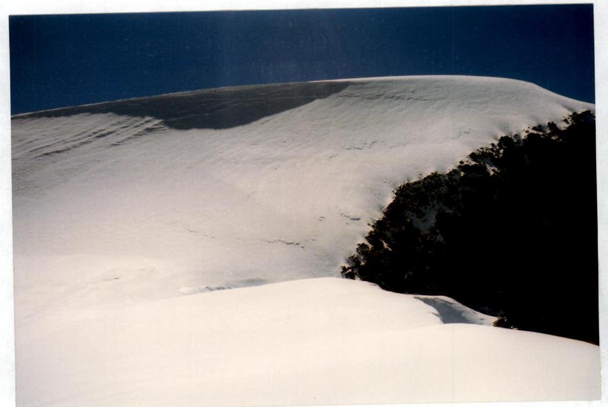
Sections R12–R13. Large cornice. Bypass on the left.
Exit to the plateau. Pre-summit ridge.
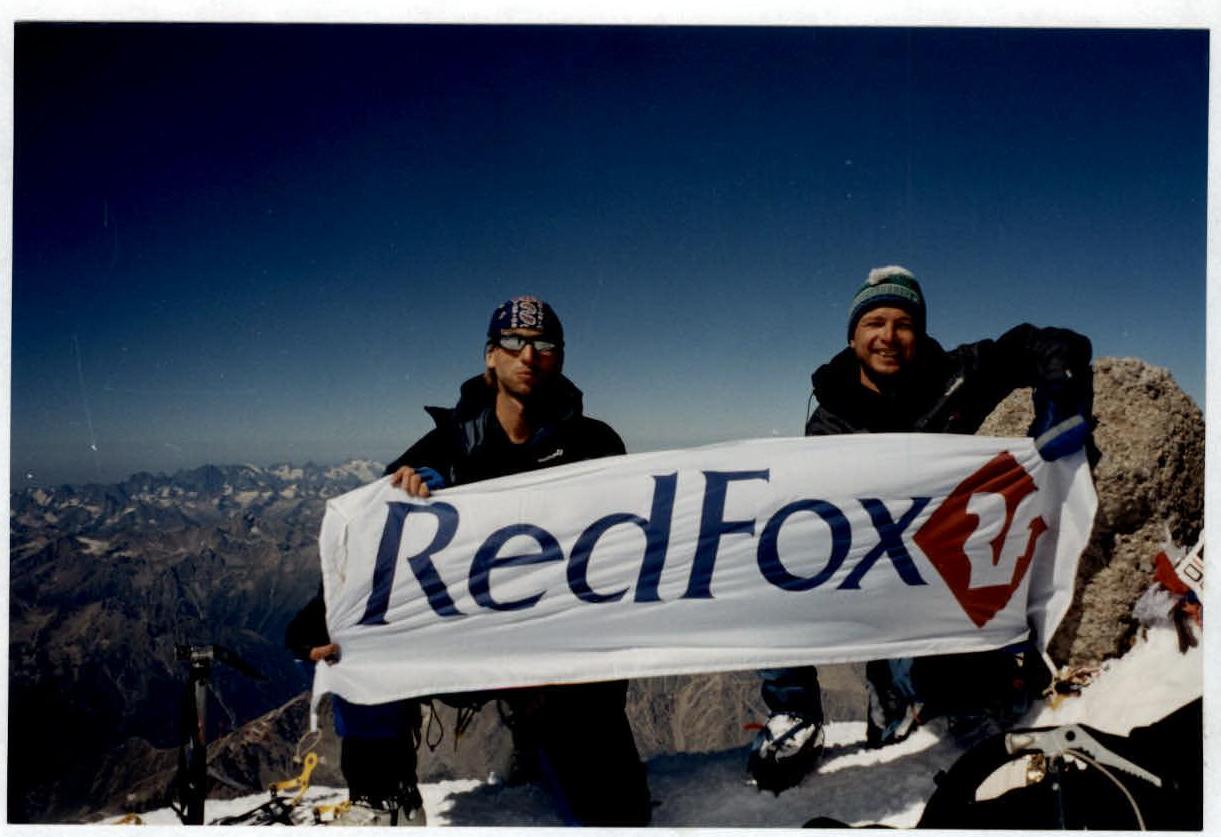
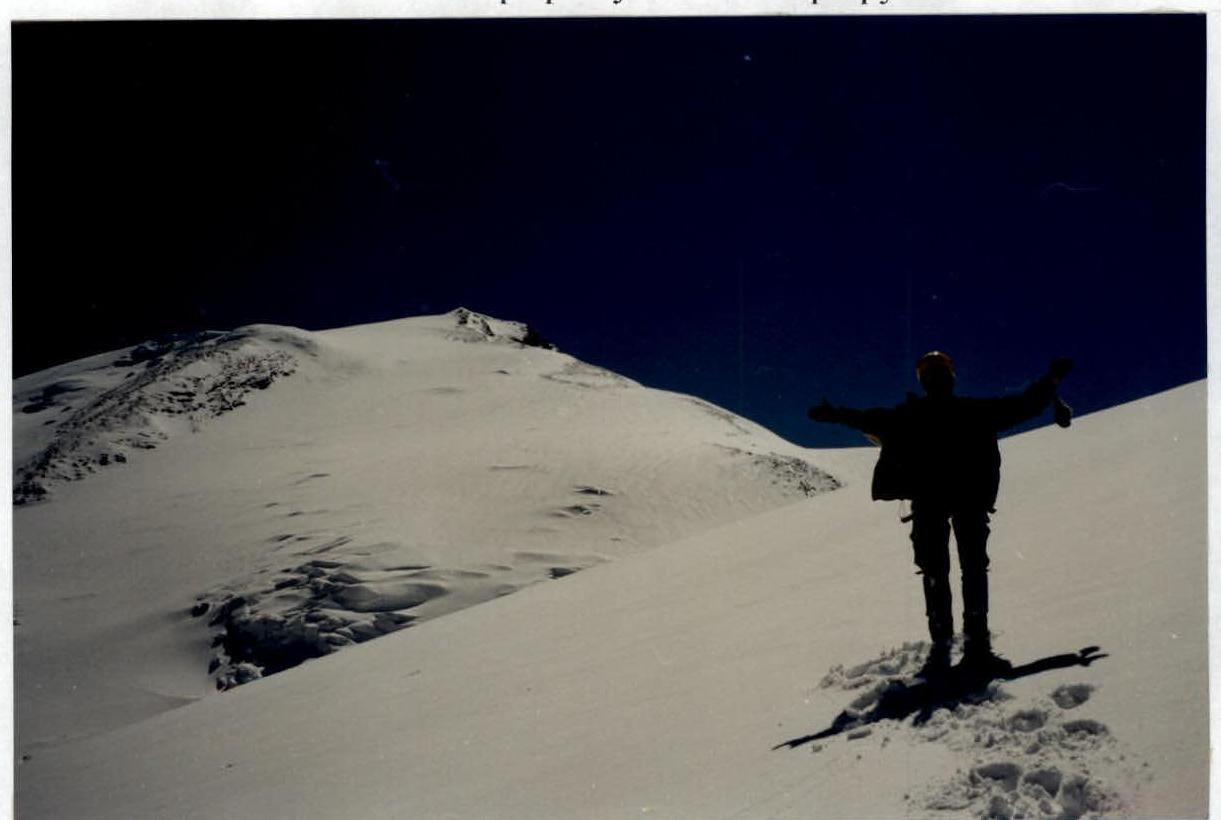
At the summit. Photo by Shvyrev A.G.