Ascent Passport
- Technical class.
- Central Caucasus.
- Peak Chatyn Glavny via the "diamond" on the N face, Myshlyaev's route.
- Complexity category — 6.
- Elevation gain: 830 m, length 1010 m, length of 5–6 sections — 540 m. Average steepness of the route is 65°. Major sections 83°.
- Pitons driven:
| Rock | Bolts | Ice | Chocks |
|---|---|---|---|
| 109 (48+) | 76+ | 16/3 | 50 |
| 56 (27+) | 52+ | 21 |
- — reuse of previously driven pitons.
- Team's travel time: 31.5 hours and 3 days.
- Night bivouacs:
- First on small ledges — uncomfortable.
- Second on a snow-dug platform — comfortable.
- Team leader: Kudryavtsev Valentin Alexandrovich — Candidate Master of Sports.
Team members:
- Fursov Valery Alexandrovich — Candidate Master of Sports
- Derevyanко Vladimir Fedorovich — Candidate Master of Sports
- Kruglovenko Alexander Vasilyevich — Candidate Master of Sports
- Coach — Master of Sports of the USSR Akhtyrsky Oleg Alexandrovich.
- Entered the route — August 7, 1988. Summit — August 9, 1988. Returned — August 9, 1988.

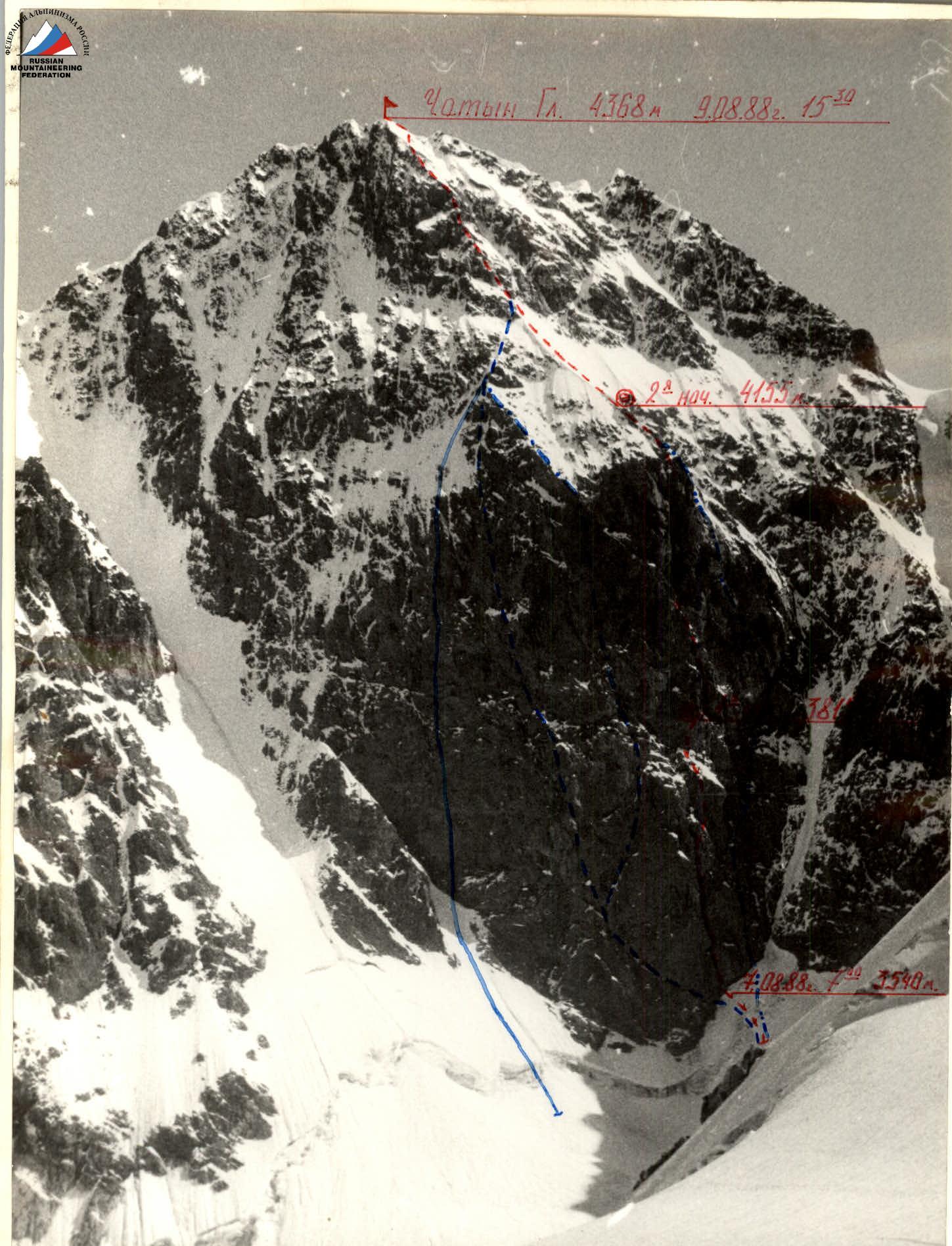
Photo #1. General photo of the summit on August 6, 1988, 16:00. Taken from the Lozhny Chatyn pass. Camera Zenit-EM. Lens — Helios-44M. Focal length 58 mm.
- Bolshovskoy's route 6B
- Snesarev's route 6B
- Chernoslivin's route 6B
- Grakovich's route 6B
- "red" — Myshlyaev's route 6B, taken by the team
In preparation for the route, the team studied reports from previous climbers, received consultations, and concluded that they could complete the route with three overnight stays in 4 days. The first part of the route — the "Diamond" — is distinguished by its great complexity and steepness, with wet and icy rocks. The most challenging section of the route is the upper chimney. For key sections, "hook-legs," "heavenly fingers," and bolt hardware were taken. The team had 4 ropes of 50 m each, ensuring each member could work on a double rope. The first climbers worked with shock absorbers; on the "diamond," with a 3 kg backpack that was removed on key sections and carried by the second; on the "roof," with a lightened backpack. To ensure guaranteed safety, an emergency supply of equipment and food was prepared and distributed among the backpacks.
On the route, the team worked in two teams: Fursov — Kudryavtsev, Derevyanко — Kruglovenko.
The tactical plan was to complete the route in 43 travel hours. The team finished the route in 31.5 travel hours, attributed to the correctly chosen movement scheme (first climber working without a backpack, rotation of first climbers, lifting backpacks attached to the harness). Significant time savings were achieved because almost the entire route was climbed using free climbing. Only in a few cases were "hook-legs" used. "Heavenly fingers" were not used, and no bolt pitons were driven, although almost all bolt pitons used by previous groups as artificial aids were torn out by preceding climbers. Remaining bolt pitons were left in potential bivouac sites and belay points.
For overnight stays, the team had:
- Lightweight non-commercial down gear;
- A bivouac polyethylene tube;
- An economical "Ogonyok" primus stove.
10.5 kg of food was taken, calculated at 500 g per person per day. Each member had an individual "pocket" ration and drink. Hot meals were organized in the morning and evening. Radio communication with the base camp was maintained via a "Lastochka" radio station through a relay group located on the Chatyn pass. There were no radio station failures or missed communication sessions during the ascent.
| Pitons | Ice screws | Bolts | Chocks | Remarks | Grade | Meters | Angle | Section |
|---|---|---|---|---|---|---|---|---|
| 12/7 | - | 8/7 | 2/1 | IV control point | √1 | 50 | 80° | R11 |
| S/3 | - | 6/4 | 3/2 | middle chimney | √1 A2 | 45 | 85° | R10 |
| 6/3 | - | 11/2 | 4/2 | III control point | √1 A3 | 45 | 90° | R9 |
| 6/2 | 3/3 | 2/1 | √2 | 20 | 75° | R8 | ||
| 39/19 | 4/3 | 27/19 | 18/9 | August 7–8, 1988, 13 travel hours, 20° | √2 A2 | 20 | 90° | R7 |
| 4/1 | - | 3/2 | 2 | II control point | √2 A4 | 15 | 60° | R6 |
| 4/2 | - | 4 | 5° | Abalakov's ledge | √1 A2 | 20 | 40° | R6 |
| √1 | 10 | 75° | ||||||
| √1 | 10 | 80° | R5 | |||||
| 11/3 | - | 4/4 | 5/3 | √1 A3 | 50 | 90° | R5 | |
| √1 | R4 | |||||||
| 3/1 | - | 5/2 | 2/2 | I control point | √1 A2 | 40 | 90° | R3 |
| 4/2 | - | 4/3 | 1/1 | lower chimney | √1 A2 | 40 | ||
| 6/4 | - | 6/5 | 3/3 | √1 A2 | 40 | 90° | R1 | |
| 2/0 | 4/3 | 1/0 | - | √2 A1 | 30 | 60° | R0 | |
| √1 | 6 | 90° | R0 |
| C K | A B d | 4 A | 30 KA | K.CA | M | 2 p | R19 | |
|---|---|---|---|---|---|---|---|---|
| 2 | 4 | - | 1 |  | 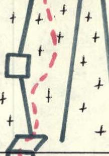 | 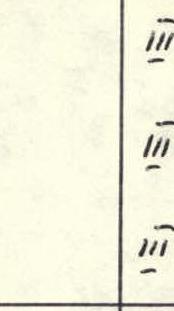 | 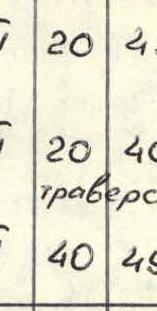 | |
| 3 | - | 2 | 4 |  |  | 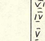 | ||
| 4 | 2 | 4 | 3 |  |  |  | ||
| 5 | 4 | - | 4 |  | 111 | 130 | 45° | |
| 3 | - | 1 | - | Кrbitsa |  |  |  |  |


Description of the route by sections
Section R0–R1: Bergschrund with a 5–6 m wall, followed by a steep ice-firn slope leading to the base of the chimney. Overcome in crampons.
Section R1–R4: Chimney. Go straight up, sometimes switching from one wall to another. The huge plug in the middle of the chimney is overcome "head-on." Then, straight up the chimney until it ends. Widely used artificial aids (AIDs). Climbing is difficult, complicated by wet and icy rocks. Belay points in the chimney are inconvenient, for one or two people.
Section R4–R6: At the end of the chimney, a difficult traverse to the right under an overhang, along a steep, inclined ledge. 1st control point. Then — along steep, smoothed rocks, in a system of internal corners and chimneys — exit to "Abalakov's ledge." Very difficult climbing, wide application of AIDs. Along "Abalakov's ledge" (alternating snow and rocks) to the wall under the overhang. Convenient belay point.
Section R6–R7: Along a difficult 10-meter wall straight up, AIDs, then along inclined slabs and ledges — traverse 15 m to the right. 2nd control point. Bivouac site. Safe overnight stays under the overhanging rock. There are many bolt pitons, allowing for reliable belaying. The artificial platform allows for three people to fit with difficulty, and there is a convenient spot for the fourth 5 m above.
Section R7–R8: From the bivouac site — traverse to the right 10–12 m, then along a steep wall with an overhang in the middle — to the base of the middle chimney. Difficult climbing, wet rocks.
Section R9–R10: Chimney with difficult climbing, use of AIDs. Belay point in the middle of the chimney on an inclined slab. Inconvenient spot, for 2–3 people. 3rd control point.
Section R10–R11: Steep slab-wall like "ram's foreheads." Leads to the base of the upper chimney. Climbing is difficult. 4th control point is located 10–15 m above the base of the chimney, to the left. Possible sitting bivouac site.
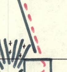
Section R11–R14: Chimney 120 m. Chimney width varies from 20 cm to 2–3 m. The first 15–18 m — very narrow chimney 20–30 cm with no cracks for pitons. Existing old bolts were cut down. Then the chimney widens, and cracks for pitons appear. Widely used AIDs in conjunction with chimney climbing techniques. Belay points in the chimney are inconvenient, hanging. Ropes are hanging, 5–6 m away from the wall. At the point where the chimney splits — traverse to the right along a small ledge and over a 15-meter wall, AIDs, exit to the "diamond" roof.
Section R14–R15: Rock ridge with a steepness of 55–60°, moderately difficult, sometimes turns into a snow ridge. Bivouac. Tent can be set up if the snow ridge is cut down.
Section R15–R16: 130 m of snow slope with moderate steepness, overcome in crampons, with alternating belays through ice axes.
Section R16–R18: Snow-covered steep rocks on the roof, 70–80 m long. Difficult climbing, complicated by weather conditions (thick fog, wet snow).
Section R18–R20: Snow ridge with rock outcrops, 180–200 m long. In the upper part — traverse to the right, exiting onto the western ridge. Along it, 50 m to the left to the summit Chatyn Glavny.
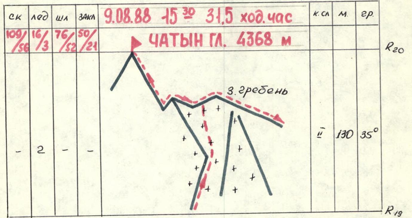
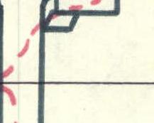
Photo #5. Section R11–R12. First climber working at the beginning of the upper chimney. Taken from section R10. Distance 25–30 m.