Passport
I. Climbing Category
-
Central Caucasus
-
Peak YUZHNAYA USHBA via the West Face, Slesov's route
-
Category 5B, second ascent
-
Elevation gain: 1770 m, route length – 2585 m Length of sections with 5–6 category difficulty – 920 m, average steepness of main sections – 65°
-
Pitons driven: rock, bolt, nut, ice 140, 0, 97, 20 20, 0, 8, 0
-
Team's total climbing hours: 57 h, 5 days
-
Overnight stays: 1, 3, 4 — platforms laid out on rocks 2 — sitting bivouac
-
Team leader: SHEVCHUK ALEKSANDR DENISOVICH — Candidate Master of Sports Team members:
- IVASHCHENKO Aleksey Sergeyevich — Candidate Master of Sports
- MESHKOV Yuriy Borisovich — Candidate Master of Sports
- RETINSKAYA Tatiana Dmitriyevna — Candidate Master of Sports
- CHIRKUNOV Aleksandr Albertovich — Candidate Master of Sports
- Coach: SCHUKIN VLADIMIR IVANOVICH — Master of Sports of the USSR
II. Departure to the route: July 18, 1984 Summit: July 21, 1984 Return: July 22, 1984
General photo of the summit
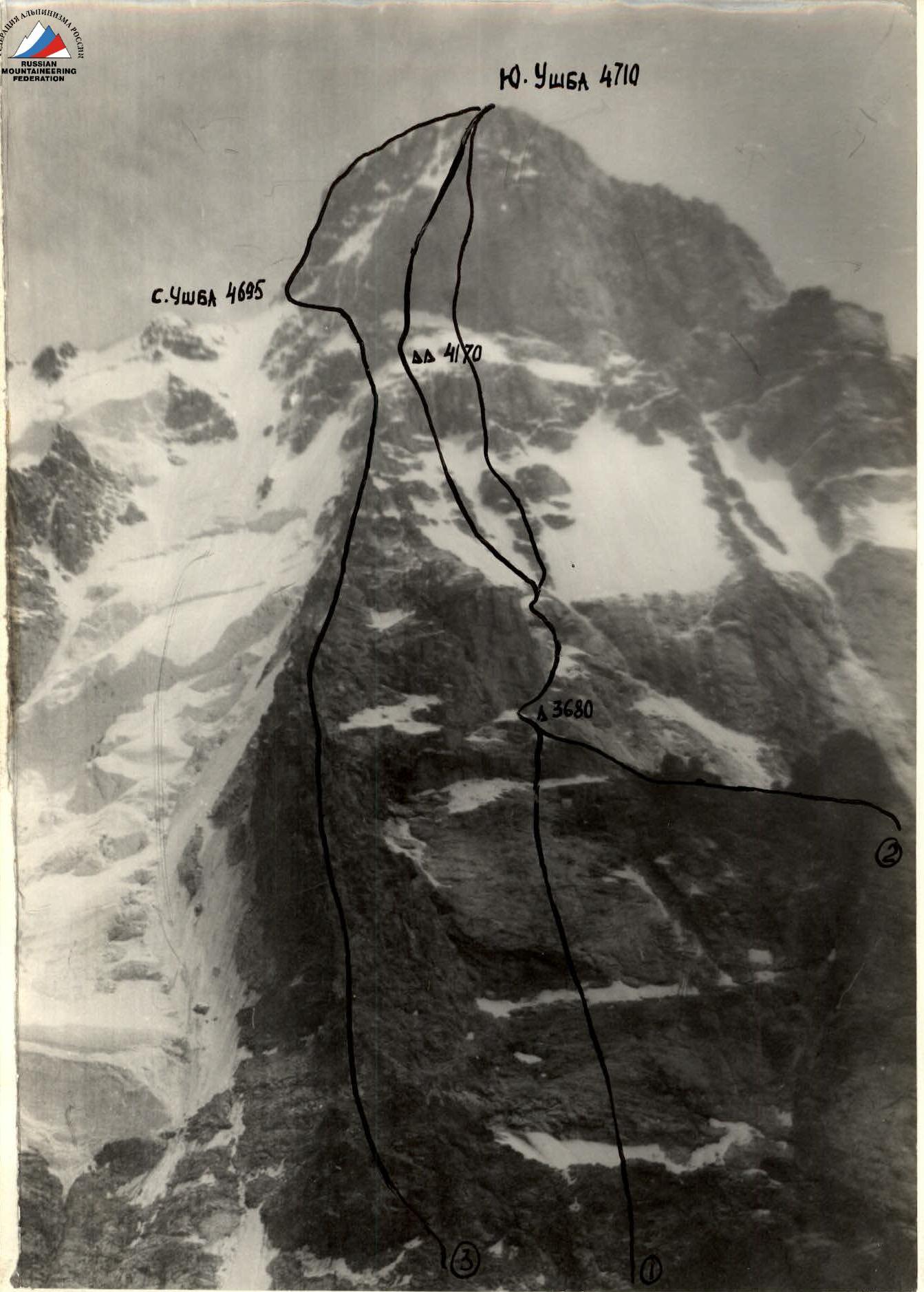
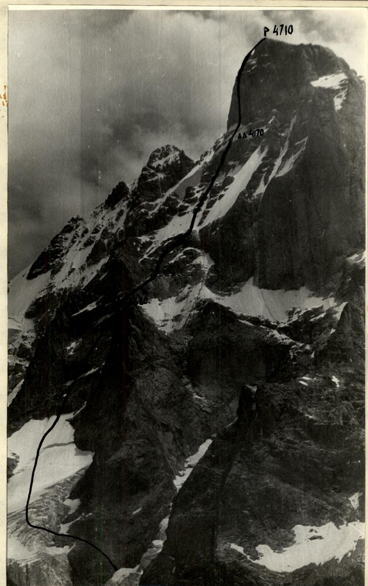
Photo from the Ushbinsky glacier on July 18, 1984. Distance 1.5 km. "Helios-44-2"/56 mm. Shooting point #1. Height 2900 m.
(1) Team's route (2) Artsishevsky's route (3) Zhyvlyuk's route
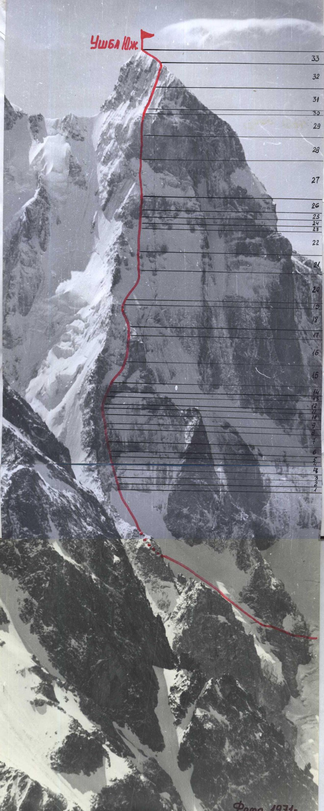
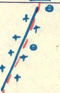
Route profile
Route profile on the right. The photo was taken from under the slopes of Mt. Mazeri on July 18, 1984.
Team's tactical actions
The team's tactical actions are based on consultations received from Yu. Yu. Artsishevsky, M. S. Levin, and observations of the climbing object on July 15–17, 1984.
The West Face has four characteristic sections.
First: a snow-ice ascent, dissected by a rock massif with a steepness of 45°; prone to avalanches and rockfall. Rocks of medium complexity, leading to a hanging glacier, with a snowy slope at the top. Second: the wall. The lower part is heavily destroyed, the upper part is snow-covered. Overall steepness 70°. Leads to under a large "reddish" wall. A bivouac is possible. Third: a snow-ice-rock slope with characteristic rock islands, steepness 50°. Dissected rocks. Stepped rock islands. Prone to avalanches and rockfall. At the top, there is a 100-meter wall. After the wall, there is an ice slope of 45–50°; leading to the key section — a sheer 200-meter wall. Fourth: a sheer wall with a small number of holds and cracks, steepness 90–95°. The most difficult section of the route, ending with rocks leading to the summit.
Passage of sections
Section 1. Passage early in the morning in teams. Movement along a fixed rope on the rock massif and steep sections of the glacier. Transition: rocks — hanging glacier — very carefully. Section 2. Ascent along the center of the wall with an exit under the "reddish" rock. Under the wall, there are large ledges covered with snow and ice. Possibly a bivouac site. Passage along a fixed rope. Section 3. The most dangerous section. Bypassing the "reddish" wall to the right along a ledge. A protected section. Up and to the right along dissected rocks, covered with ice. Pass early in the morning. Organize belay points in protected areas. Approach to rock islands along an ice slope. Danger — rockfall! Rocks of islands are in snow, possible hanging ice. Maximum attention! After the rock islands, there is a 100-meter rock belt. Bivouac at the top of the rock belt. Section 4. The 200-meter wall should be passed only with processing. Movement along the rock relief on a double rope: both the first and subsequent ones, for which the team takes H + 1 rope on the route. Where H is the number of participants. The first goes on a double rope, the second, fourth, and fifth — along the fixed rope with top rope belay. The third — along double fixed ropes. Belay points are chosen in areas protected from rocks. The rope is attached to blocked pitons (two or three).
The key sections of the route are:
- snow-ice ascent leading to rock islands (objectively a rockfall-prone section)
- the wall of the fourth section
Descent from the summit to the "notch" — along the route of category 5A, then to the west with an exit to the base camp.
Movement schedule
July 17, 1984. Departure under the route. Overnight stay on the edge of the moraine. July 18, 1984. Departure and passage of the first and second sections. July 19, 1984. Passage of the third section, overnight stay at the top of the 100-meter rock belt. July 20, 1984. Processing of the wall of the fourth section. July 21, 1984. Passage of the fourth section. Exit to the summit. Overnight stay on descent. July 22, 1984. Descent and return to the base camp. July 23, 1984. Reserve day for bad weather.
| Rock | Nut | Bolt | Ice | Pitons driven / Images | Section description |
|---|---|---|---|---|---|
| 7 | 6 | - | - | 55 pitons | 80 m, 80°, V+ |
| 9 | 8 | - | - | 120 m, 65°, V | |
| 2 | 2 | - | - | 40 m, 65° – V | |
| 2 | 2 | - | - | 40 m, 60°, IV+ | |
| 3 | 2 | - | - | 40 m, 60°, IV+ | |
| - | - | - | - | 300 m, 35°, II | |
| 4 | 6 | - | - | 120 m, 55°, IV | |
| - | - | - | 2 | 300 m, 35°, III | |
| 7 | 4 | - | - | 67 pitons | |
| 7 | 4 | - | - |  | 60 m, 65°, V |
| - | - | - | 5 |  | 100 m, 40°, IV+ |
| 4 | 2 | - | - |  | 30 m, 60°, IV |
| 7 | 4 | - | - |  | 110 m, 60°, IV |
| 9 | 5 | - | - |  | 60 m, 85°, V |
| 2 | 2 | - | - |  | 5 m, 85°, VI |
| 8 | 5 | - | - |  | 130 m, 80°, V |
| 3 | - | - | - |  | 50 m, 60°, IV |
 | |||||
 | |||||
| 52 | 30 | - | - | 137 pitons |  |
| 3 | - | - | 3 |  | 40 m, 50°, V |
| 4 | 4 | - | 1 |  | 20 m, 85°, V |
| 2 | 3 | - | 4 | 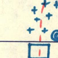 | 80 m, 40°, IV+ |
| 4 | 4 | - | - |  | 80 m, 55°, IV+ |
| 3 | 3 | - | - |  | 25 m, 60°, IV+ |
| 3 | - | - | 1 |  | 15 m, 90°, V |
| 3 | - | - | - |  | 40 m, 60°, IV |
| - | - | - | 4 |  | 25 m, 65°, V |
| 2 | 4 | - | - |  | 65 m, 40°, V |
| - | - | - | - |  | 20 m, 75°, V |
| - | - | - | - | 26 pitons | 200 m, 90°, VI |
| 11 | 7 | - | - | 40 m, 95°, VI | |
| 6 | 2 | - | - | 160 m, 60°, IV+ | |
| - | - | - | - | 170 m, 30°, III |
Route description by sections
The approach to the route goes from the "Berezovaya roshcha" bivouac along the Ushbinsky glacier and further to the hanging glacier at peak Yuzhnaya Ushba. Section R0–R1: 300 m of ice at 35°–40°, simultaneous movement on crampons. In the steeper and more broken upper part of the glacier, movement along a fixed rope. Section R1–R2: rock wall 120 m 55°, alternating movement. Section R2–R3: snow-ice slope 300 m 35°, simultaneous movement on crampons. At the top — along fixed ropes. Section R3–R4: internal corner 40 m 60° wet. Section R4–R5: rock walls 3–5 m 60° wet. Length 40 m. Section R5–R6: wet slabs 40 m 65° with a small number of holds. Section R6–R7: internal corner 120 m 65° with hanging ice. Section R7–R8: smoothed wall 80 m 80° with a small number of holds. Section R8–R9: rock ridge 50 m 60°. Bivouac site. Section R9–R10: bypassing the "reddish rock" to the right along a ledge covered with ice, 130 m 80°. Section R10–R11: chimney 5 m 85°, I.T.O. Section R11–R12: wall 60 m 85° with a small number of holds. Section R12–R13: inclined ledge covered with hanging ice, 110 m 60°. Section R13–R14: "ram's foreheads" 30 m 60°. Section R14–R15: ice 100 m 40°. Section R15–R16: rock walls heavily destroyed, alternating with ice, 60 m 65°. Beginning of rock islands. Section R16–R17: ice 20 m 35°. Section R17–R18: wall covered with ice, 20 m 75°. Section R18–R19: snow-ice ridge 65 m 40°. Section R19–R20: rock wall 25 m 65°. Section R20–R21: destroyed rocks covered with ice, snow-ice ridge 40 m 60°. Section R21–R22: chimney covered with ice, 15 m 90°, I.T.O. Destroyed rocks 25 m 60°. Section R22–R23: smoothed slabs covered with snow and ice, 80 m 55°. Section R23–R24: snow-ice knife 80 m 40°, sitting bivouac. Section R24–R25: heavily destroyed rocks covered with ice, 20 m 85°. Section R25–R26: ice 40 m 50°. Section R26–R27: wall with small ledges in the lower part, hanging ice, 200 m 90°, I.T.O. Section R27–R28: steep rocks with overhanging sections 40 m 95°. Section R28–R29: heavily destroyed rocks covered with ice, 160 m 60°. Section R29–R30: rock ridge 170 m 30°, destroyed rocks, snow, ice.
Descent from the summit along the route of category 5A to 2 hours.