-
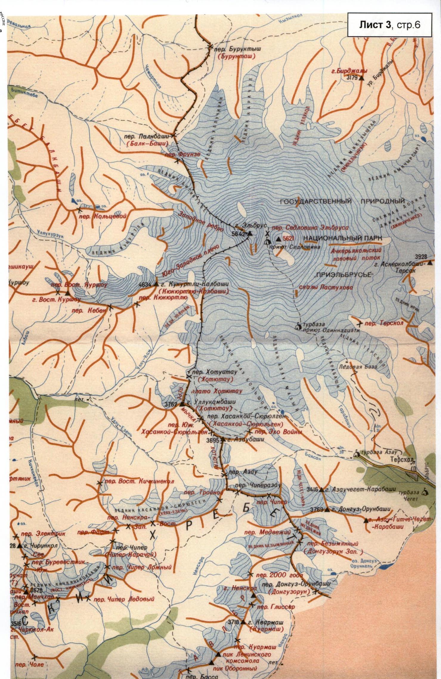
Central Caucasus; Ullukhurzuk gorge; section according to the classification table "from Chiperazaau pass to Gumači summit"
-
Name of the peak: Kyukyurtlyu-Kolbashi (4639 m), name of the route: via the right part of the center of the West Face
-
Proposed - 6B category of difficulty, first ascent
-
Nature of the route: combined
-
Height difference of the route: 890 m (by altimeter); including the wall section: 580 m.
Route length: 1330 m. Length of sections:
- V category of difficulty – 100 m.
- VI category of difficulty – 605 m.
Average steepness:
- main part of the route – 82 degrees
- entire route – 61 degrees
-
Pitons left on the route:
Total: 30, including 27 bolted pitons ("Petzl" crown, without ears)
Pitons used on the route:
- stationary bolted pitons – 27, including artificial holds – 0;
- removable bolted pitons – 30, including artificial holds – 30.
Total artificial holds used:
- pitons – 73;
- chocks – 128;
- skyhooks on terrain and holes – 90;
- bolted pitons – 30.
-
Team's climbing hours: winter 2000 – 47.5 hours, 10 days;
summer 2000 – 63 hours, 9 days
-
Leader: Andrey Viktorovich Andreev — Candidate Master of Sports
Participants:
- Igor Vadimovich Potan'kin — Master of Sports
- Dmitry Alexandrovich Kirsanov — Candidate Master of Sports
- Alexey Nikolaevich Krivitskiy — Candidate Master of Sports
(in winter, Yu.V. Koshelenko — Master of Sports of International Class also participated)
-
Coach: I.V. Potan'kin
-
Departure to the route: July 2, 2000 (preliminary processing was done) Summit: 14:00, July 6, 2000 Return to base camp: July 7, 2000
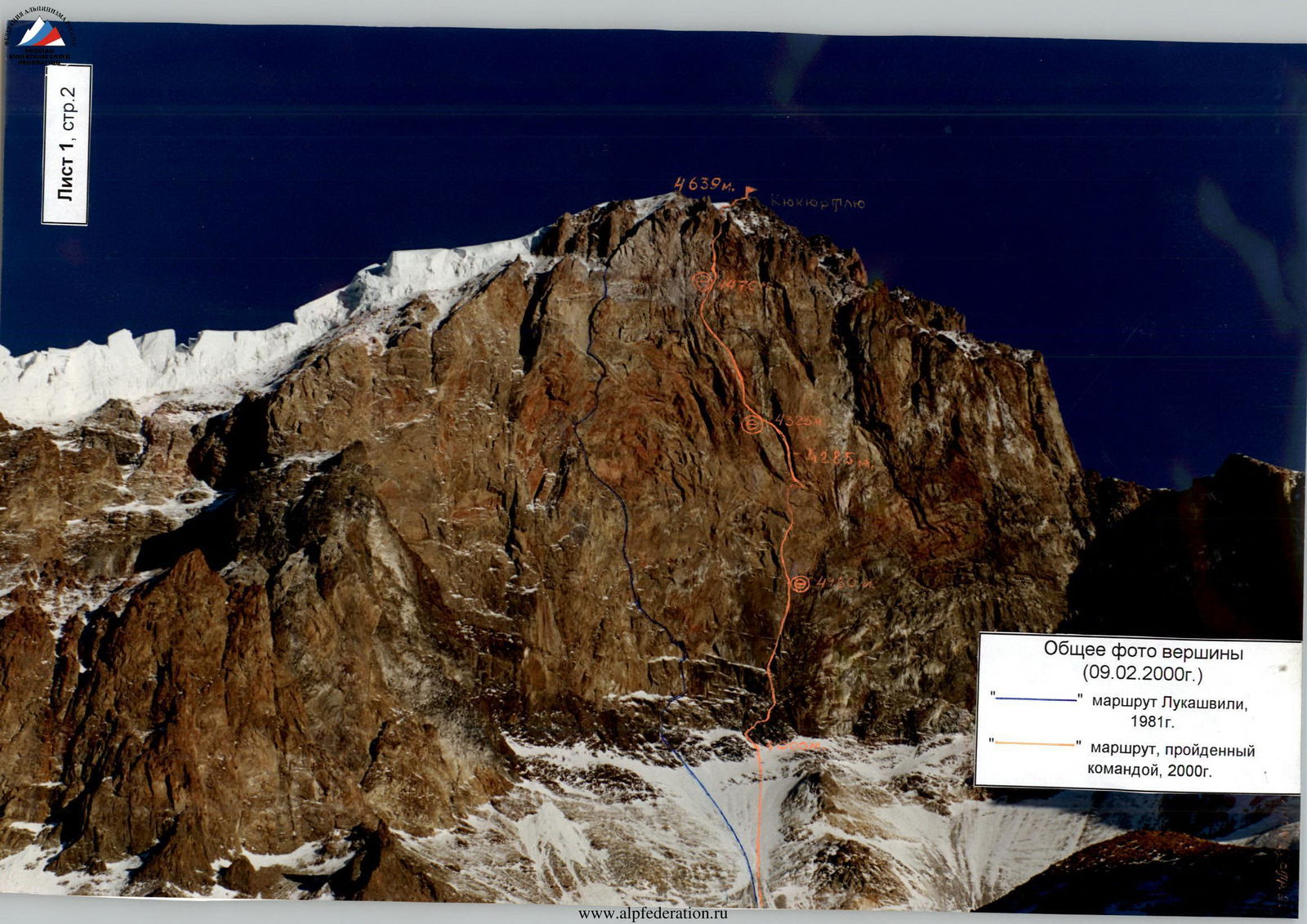
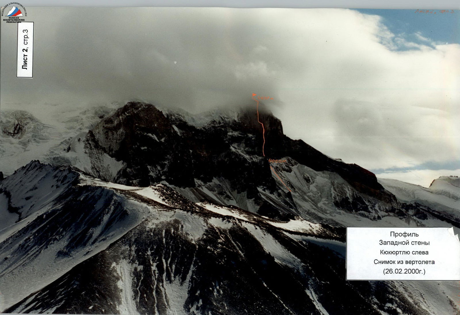
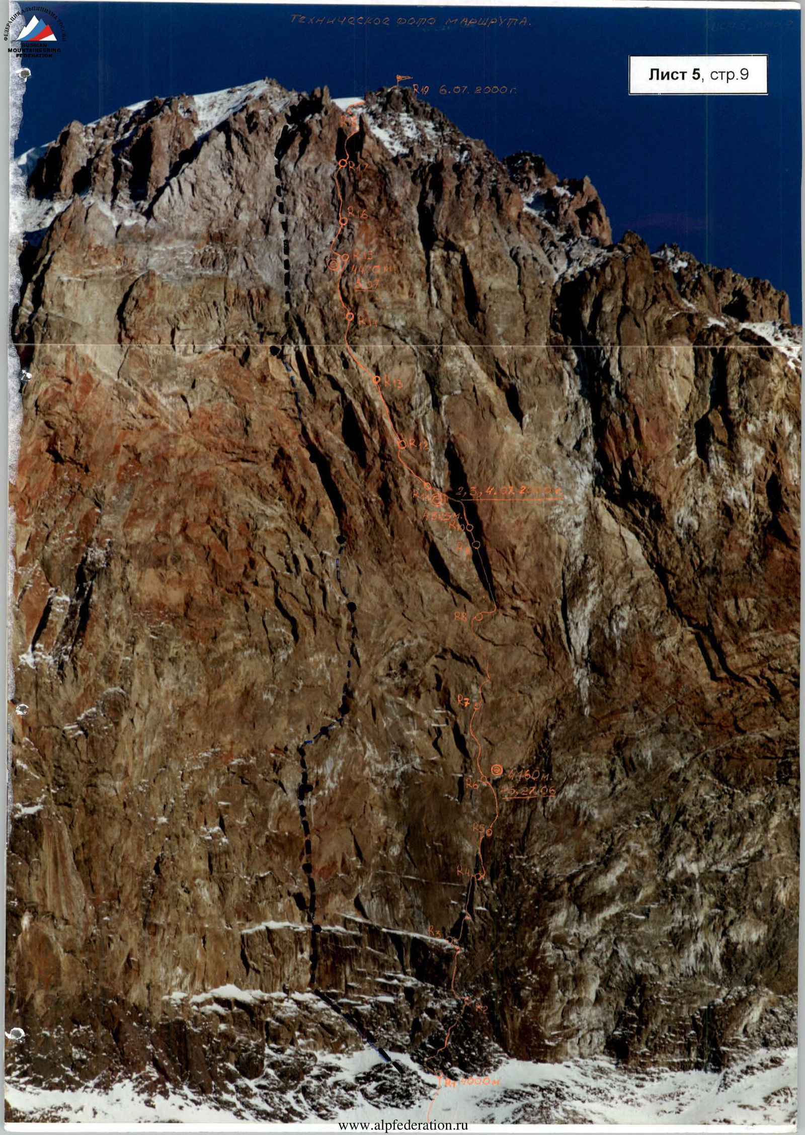
Profile of Kyukyurtlyu West Face from the left Photo from a helicopter (February 26, 2000)
Photopanorama of the area
Photo from a helicopter (February 26, 2000)
Overview of the climbing area
Location. The peak Kyukyurtlyu (Kyukyurtlyu-Kolbashi) is located in the southwestern spur of Elbrus, 4.5 km from the West Summit. The peak and the most convenient approaches are situated within the Karachay-Cherkess Republic of the Russian Federation. The Northwest wall of Kyukyurtlyu is part of the Elbrus massif and is quite remote from the roads, which presents known inconveniences for reaching the foot of the wall on foot.
Approach from Karachay-Cherkessia. From the city of Karachaevsk (1000 m) to the village of Uchkulan (1400 m) — along an asphalted road (55 km);
- Then 5 km along the Ullu-Kam river valley (Kuban) to the village of Hurzuk (1450 m);
- Turn left into the Ullukhurzuk river valley, a right tributary of the Kuban, along a dirt road (15 km) through numerous bridges (about 12);
- After the fork (confluence of rivers) Ullukhurzuk–Bitiktebe (the road to the sulfur springs turns left) the condition of the road along the left bank of Ullukhurzuk worsens, which, gaining height above the river, leads to the last Karachay koshu (2300 m) with glades and pine forest around.
Approach to the base camp:
- From the koshu on foot up the gorge along the left bank of Ullukhurzuk to the turn of the gorge (in the area of Kurshou peak, 3690 m) to the left – 2.0–2.5 hours;
- From here (2500 m) the Elbrus massif with the West Summit opens up, as well as the western shoulder ("Dome") and Kyukyurtlyu peak;
- Further along the valley to the tongue of the Kyukyurtlyu glacier and along its left moraine to the flat areas for campsites in the "pocket" of the moraine in the area of Kebek pass (3000 m);
- There are also good platforms for helicopter delivery to the wall;
- A convenient place for the base camp — the edge of the glacier, spring water, small grassy vegetation;
- From the koshu to the base camp – 4.0–5.0 hours.
There is also a path from the Prielbrusye area of the Kabardino-Balkar Republic. From the Azau glade (Baksan river valley) by cable car to the "Mir" station. Then through the Kotyutau and Kyukyurtlyu passes to the base camp. Total – 2 days.
Approach from the base camp to the route:
- From the base camp up the moraine to the West wall.
- Large-block talus, местами щебёнка, after flattening — a place for a campsite (3600 m).
- From the base camp to the campsite – 1.5–2.0 hours.
Movement from the campsite:
- Move along the firn slope under the wall, the steepness increases from 25 to 45° before entering the couloir at the characteristic bergschrund.
- Movement in crampons.
- From the campsite to the start of the route – 2 hours.
Descent from the summit to the base camp:
- Descent from the summit (via the couloir immediately behind the summit) towards between the Ullukam glacier and the steep lateral ridge from the summit to the Kyukyurtlyu pass — 10 ropes and 5 ropes along the sheer (90–95°) wall to the beginning of the firn slope.
- Then move down and traverse to the right towards the Kyukyurtlyu pass.
- From the pass, traverse to the left, then gradually turning to the right down the snow "cushion" and along the gentle ice slope to the moraine and to the base camp.
- Descent from the summit takes 14–16 hours.
Climbing area. Central Caucasus. The peak is a small elevation of the Southwest shoulder (from Elbrus West Summit), breaking off with a wall. Features:
- remoteness from roads;
- powerful glaciation around;
- cold exposure — the sun hits the wall after 14:00;
- lack of water due to the great steepness of the wall.
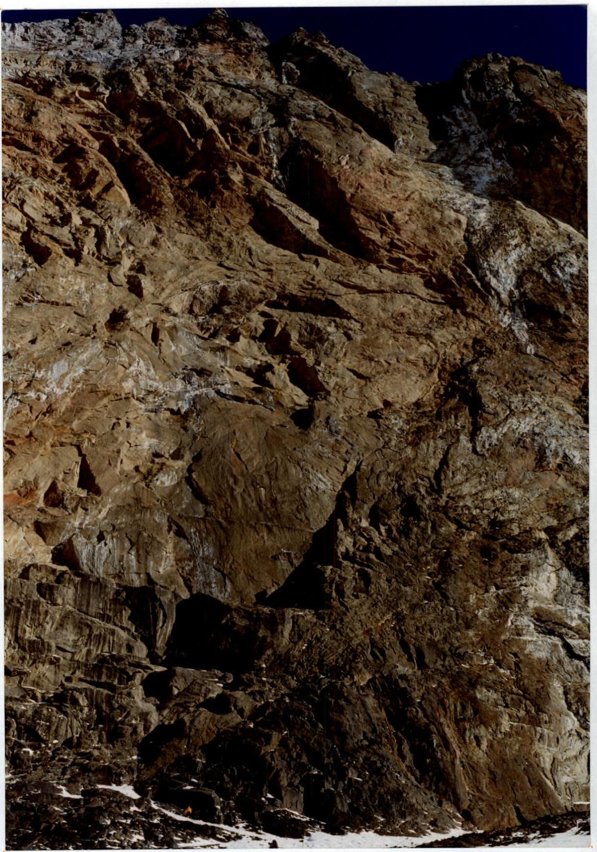
The area is characterized by unstable and harsh weather; after noon, as a rule, cloudiness and snow. The climb is complicated and made psychologically tense by the местами destroyed rocks, especially in the upper part. The wall is composed of volcanic, mainly tuff rocks, of varying hardness.
Route diagram in UIAA symbols. Scale 1:2000
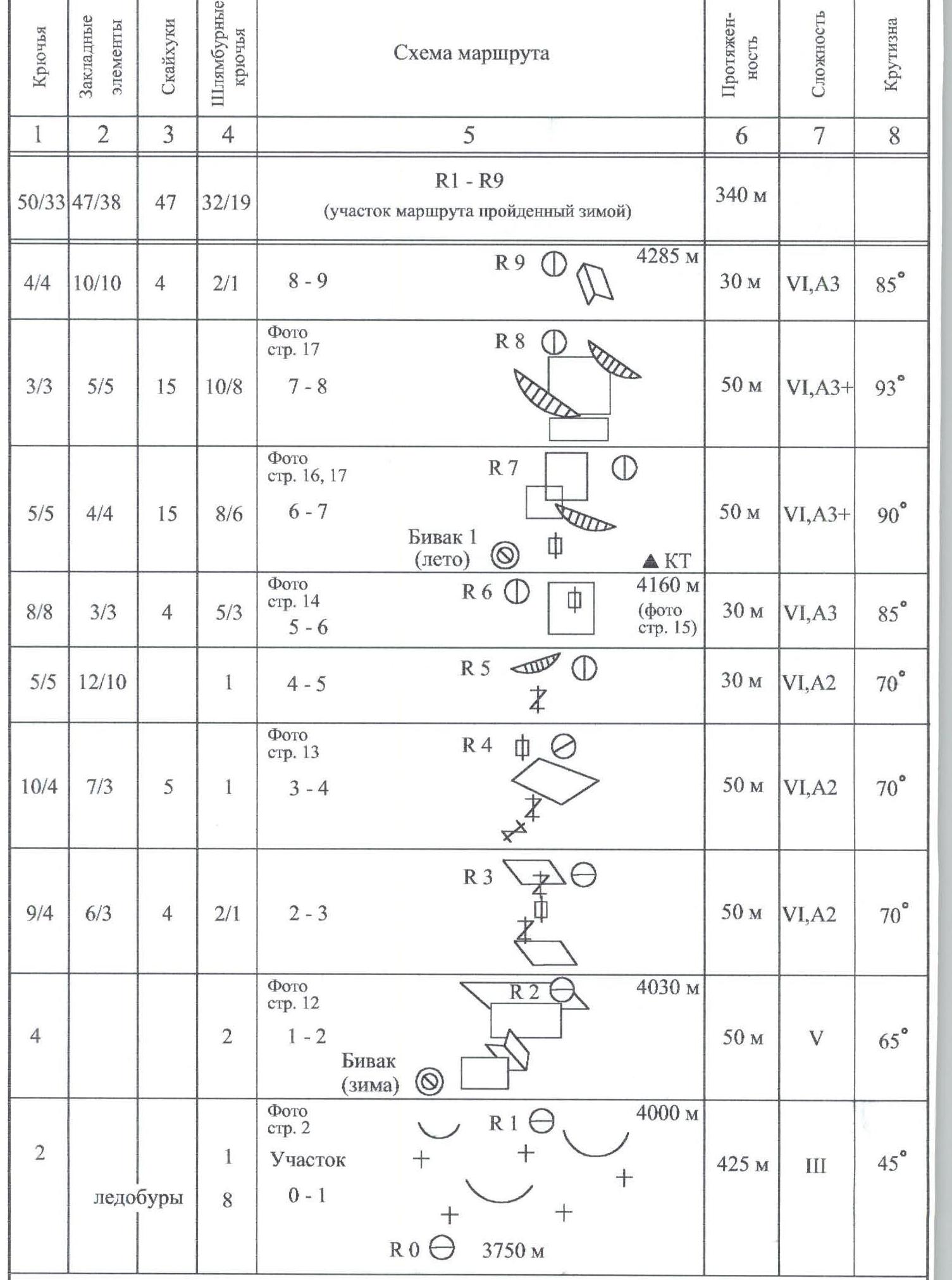 Route diagram in UIAA symbols.
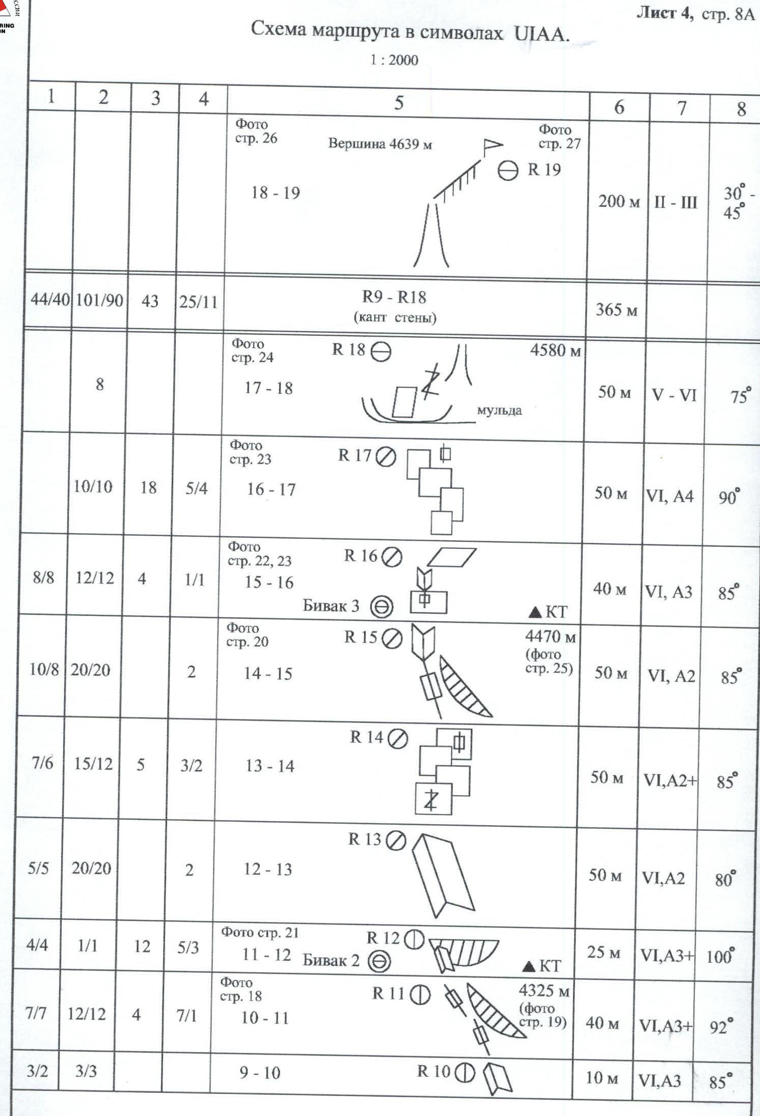
During the first ascent, control cairns were left at the bivouac sites. No note was found on the summit of Kyukyurtlyu. In the control cairn, a note from the Mounttex Alpine Club group about the first ascent was left.
Notes on report requirements
- Each page of the report is presented on a separate sheet. At the same time, the numbering of sheets and pages is in accordance with the "Mandatory requirements for the report…"
- Weather conditions in the ascent schedule are indicated in text for better visibility of the schedule.
- The absence of a note on the summit is explained, apparently, by the presence of a characteristic hole from a lightning strike on the tin can found in the control cairn. There could be no mistake in choosing the summit.
- On sheet 6, the report is presented with additional photographs for a more complete illustration of the route.
- Unfortunately, the photographer (A.N. Krivitskiy) did not appear in the mandatory group photo on the summit.
Ascent leader
A.V. Andreev
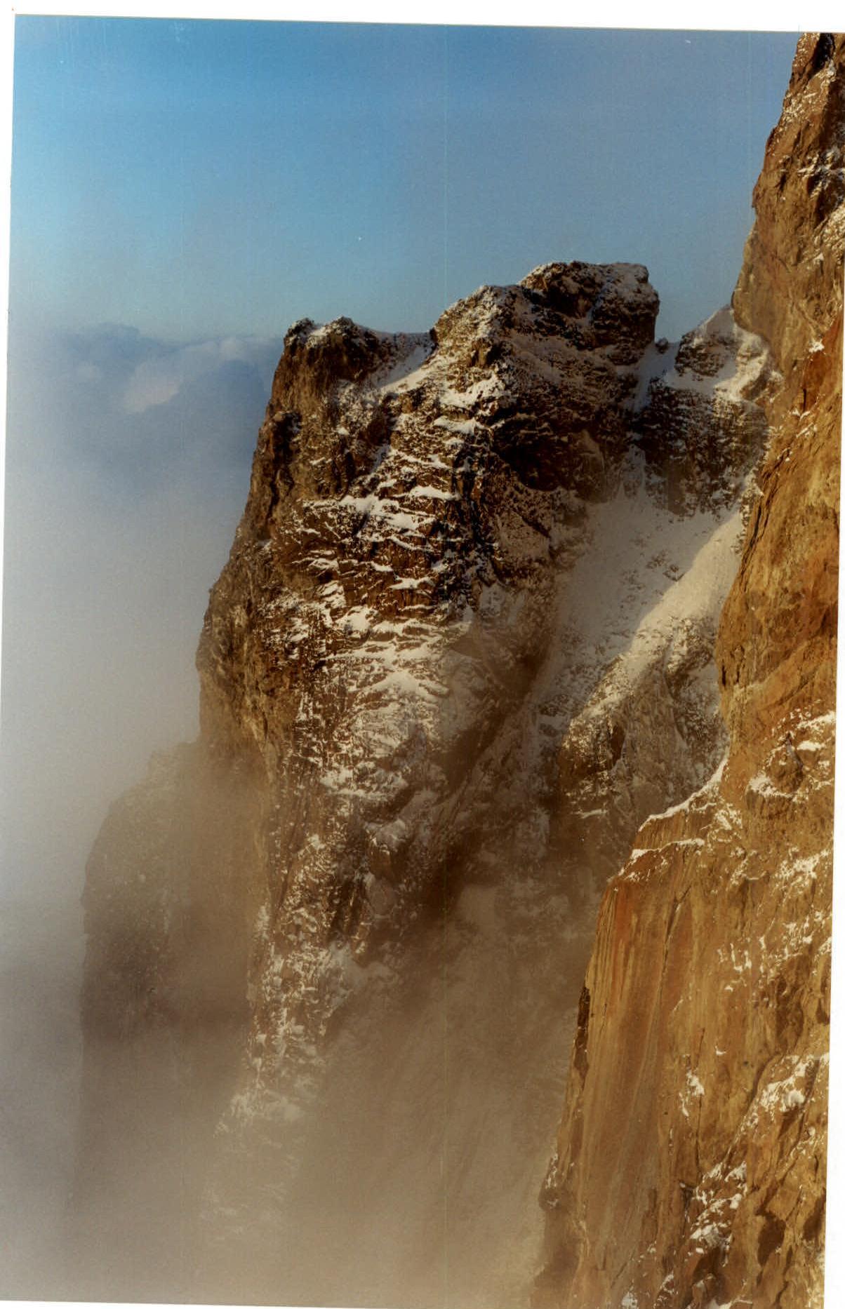
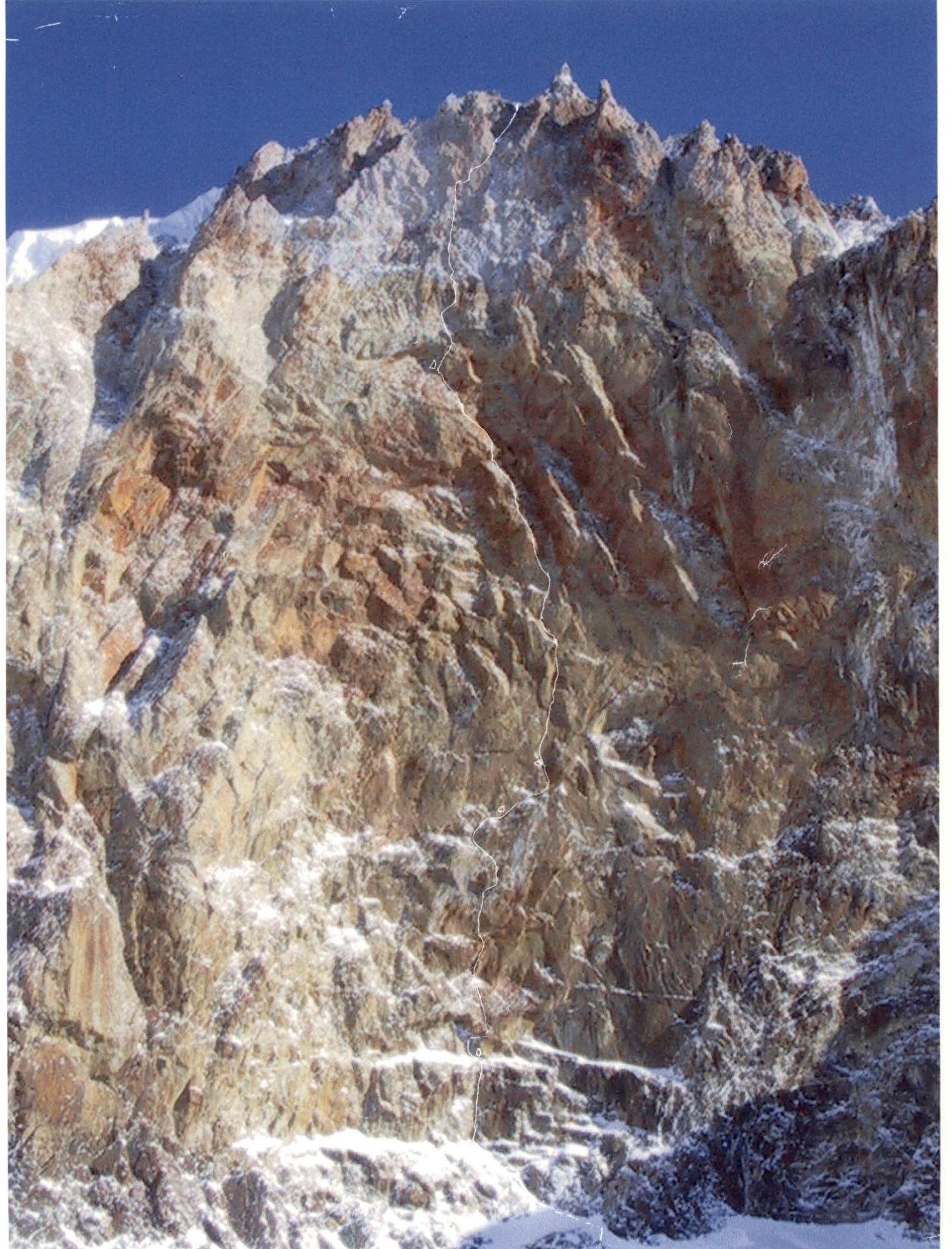
Photo of the profile of Kyukyurtlyu West Face from the right part of the center of the wall. (February 2000)
Work on the R1–R2 section (February 2000)
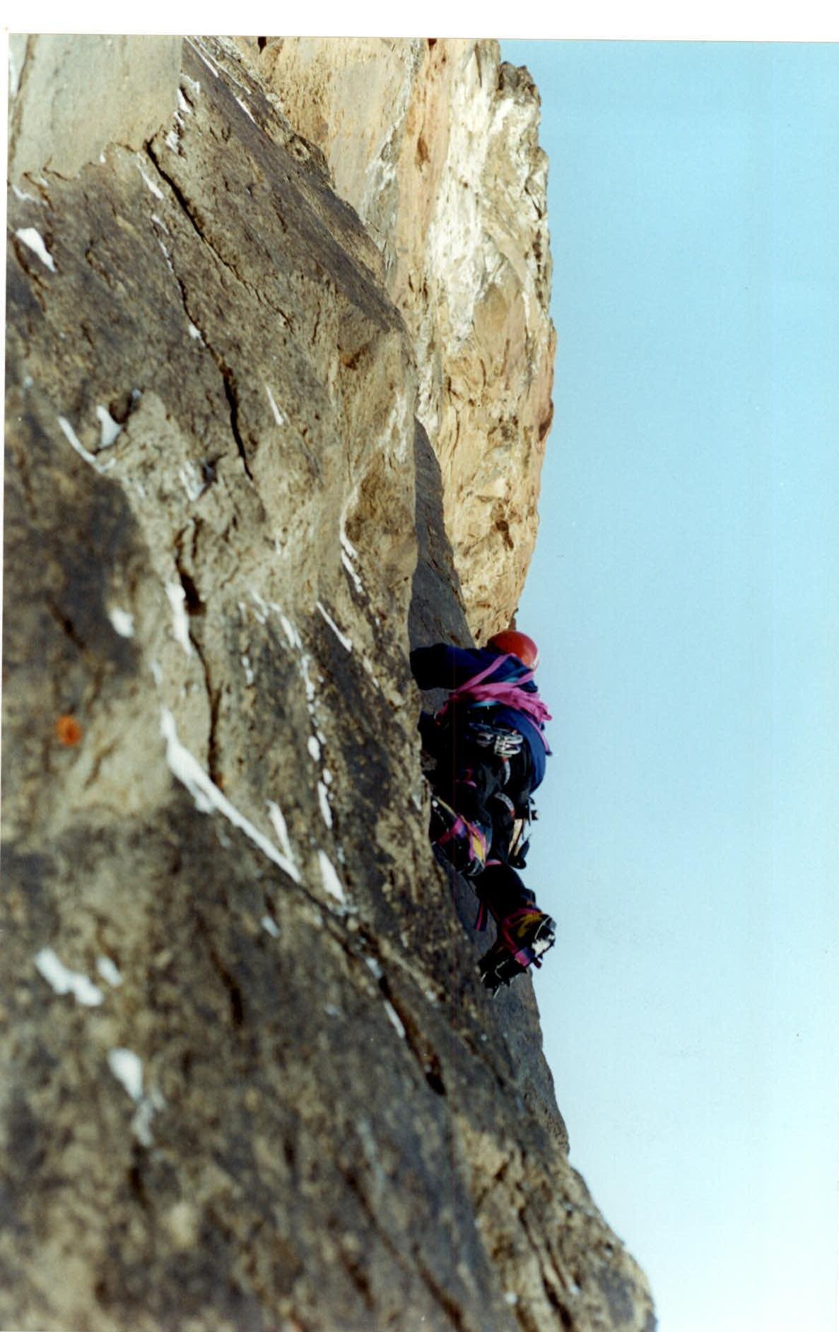
Climbing on the R5–R6 section (February 2000)

Overhanging terrain of sections R6–R8 (June 27, 2000)
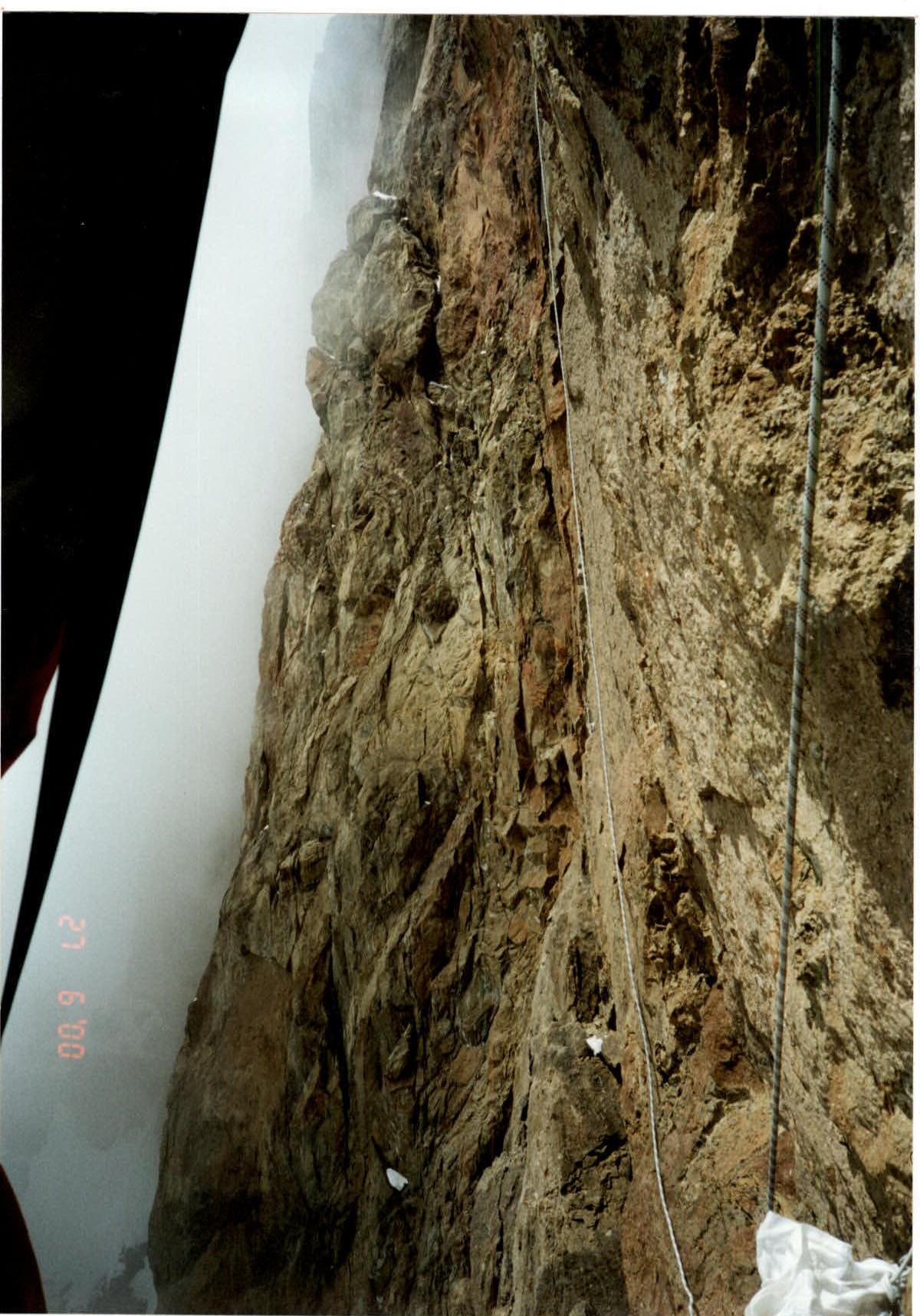
Start of section R6–R7
At the top of the photo (in the middle) — view of the Lukashvili route with a ledge for a bivouac (with snow) (June 27, 2000)

Start of section R14–R15. (July 4, 2000)
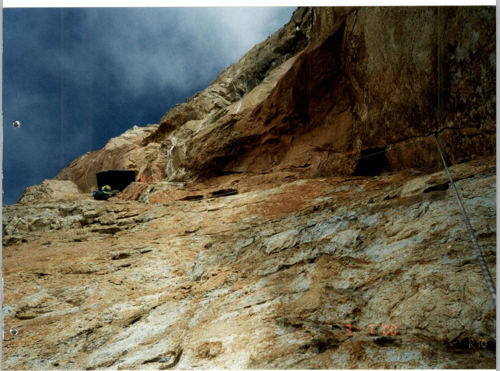
Section R10–R11 (July 3, 2000)
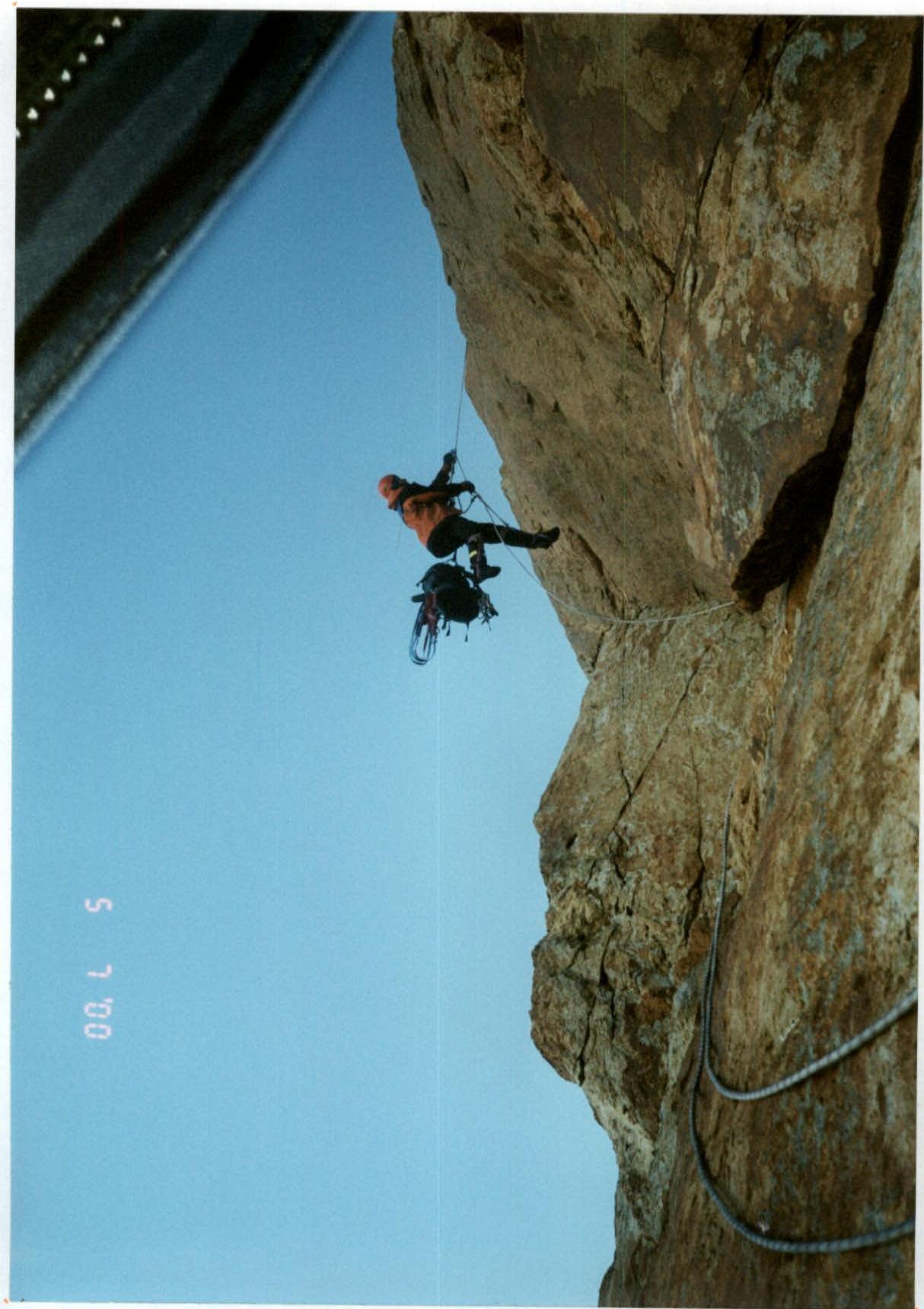
Moving the bivouac from the 4325 m mark to the 4470 m height (July 5, 2000)
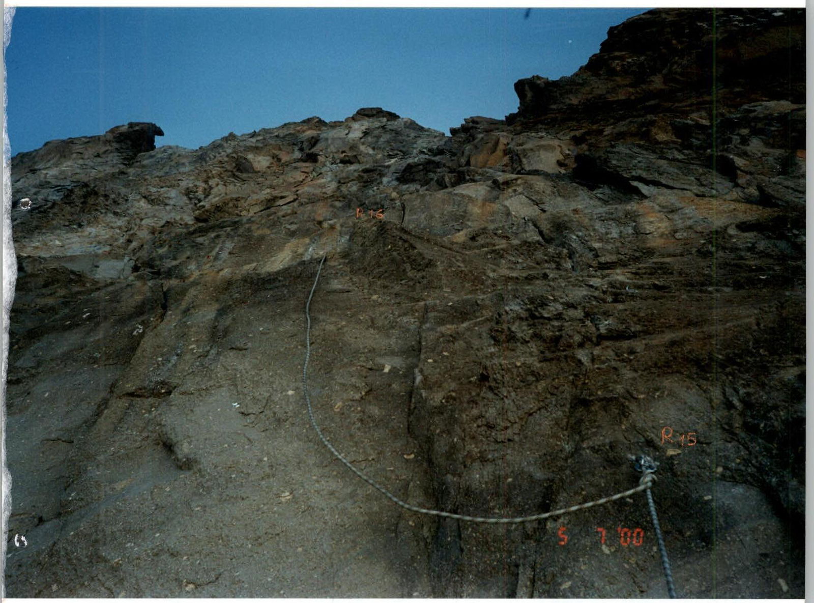
Section R15–R16 (July 5, 2000)
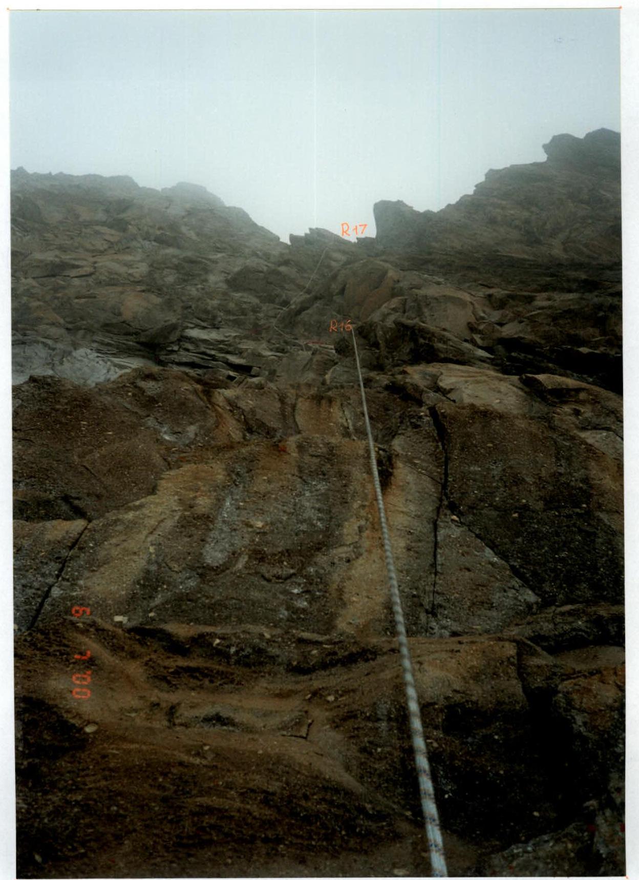
Visible part of section R16–R17 (July 6, 2000)
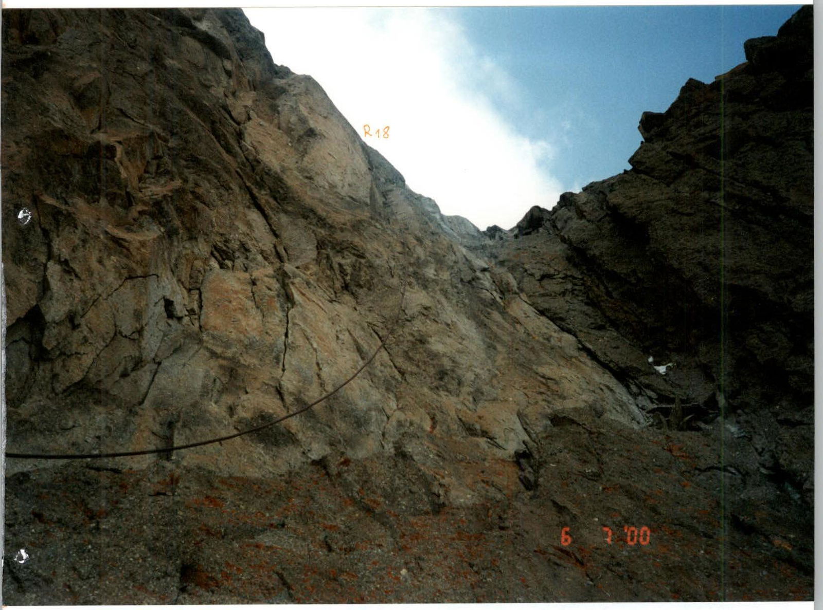
Section R17–R18 (July 6, 2000)