(Donguzorun Lesser Peaks via the Eastern Ridge, cat. 2A)
From the "Av" cafe to the bivouac. From the bivouac, ascend along the talus and simple broken rocks of the pinnacle slope of this peak, to the right of the counterfort, to its eastern shoulder. From the shoulder, move left and proceed along the wide talus ridge to a large snowpatch. Along the ridge (beware of cornices!) on the snowpatch, ascend to the talus, from which, via simple broken rocks and talus, reach the summit of Azau-Gitche-Chegetkar. (1 hour)
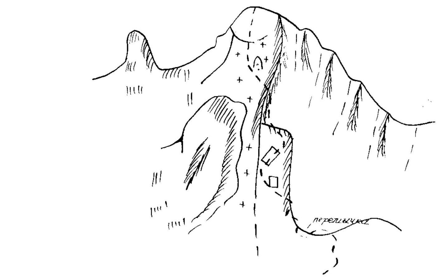
From the summit, move west along the wide snow-covered simple rocky ridge, reaching the first rocky gendarme. Ascend the gendarme via the sharp steep rocky ridge, then descend 10 meters via rappel. Continue along the simple rocky ridge.
The second gendarme is bypassed on the left via strongly broken rocks — the rocks are steep, requiring piton protection. After the gendarme, proceed along the simple rocks of the wide ridge to beneath the third gendarme — a slab-like formation. Bypass the gendarme on the left ("live" rocks, protection required).
Further along the simple broken rocks of the wide ridge, reach beneath the tower of the Big Gendarme of the Eastern Ridge. From the ridge, ascend 5–7 meters up the wall of the gendarme, then traverse it along the steep rocks on the left side ("live" rocks, protection required), and descend 11–12 meters via rappel to the saddle of the talus ridge.
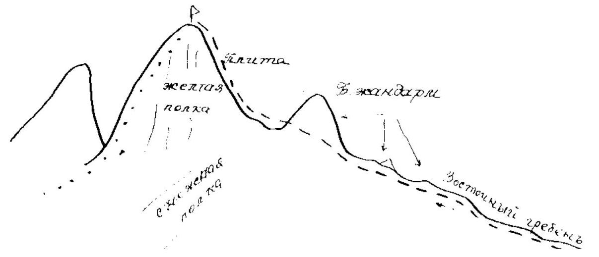
Along the ridge, ascend beneath the rocky giant of the summit. From beneath the giant, traverse left along the yellow rocky ledge to a slab. Up and to the right along the slab (protection required!) to the ridge of the giant. From here, ascend along the simple broken rocks of the ridge to the summit of Donguzorun. From the summit of Azau-Gitche-Chegetkar — 4–5 hours.
Descent from the summit via category IB difficulty from the south, along simple rocks to a slab.
- Down and to the left along the slab to the yellow rocky ledge.
- From the ledge, descend along the talus ridge to a saddle.
- From the saddle, descend along moderately steep talus and further along a couloir.
- Descent to the right-bank moraine.
Mt. Malyy Donguzorun, 3761 m
via the Eastern Ridge, category 2A difficulty route by A. Pushkov, 1975
 Mt. MALYY DONGUZORUN (M), 3761 m.
via the 3rd Ridge, category 2A difficulty route by Z. Grechenin, 1980
 Mt. DONGUZORUN (M), 3761 m.