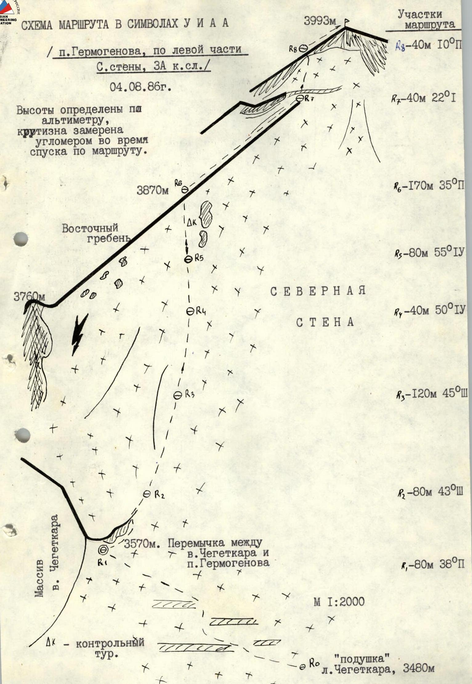
I. Climbing category - technical 2. North spur of the Main Caucasian Range. 3. Peak Germogenova via the left part of the N wall 4. Proposed category: 3A 5. Route description: snow-ice, height difference (from the saddle) - 423 m, average steepness of the wall section - 46° 6. Number of protection points - 36 (ice screws) 7. Total climbing time - 6 hours 8. Team leader: Laptev Alexander Leonidovich, Candidate Master of Sports
Team members:
- Ivanov G.A., Candidate Master of Sports
- Medvedev G.M., 1st sports category
- Volodin V.G., 1st sports category
- Minaev S.A., 1st sports category
- Zakharova N.N., 1st sports category
- Number of bivouacs - one on the moraine of Chegetkara glacier.
- Departure date: July 13, 1980
return date - July 14, 1980
Note: All passport items, except for the 5th, correspond to the data of the first ascenders. Item 5 according to Laptev: height difference - 800 m (from the moraine bivouac), average steepness of the entire route 45° (actual - 40°).
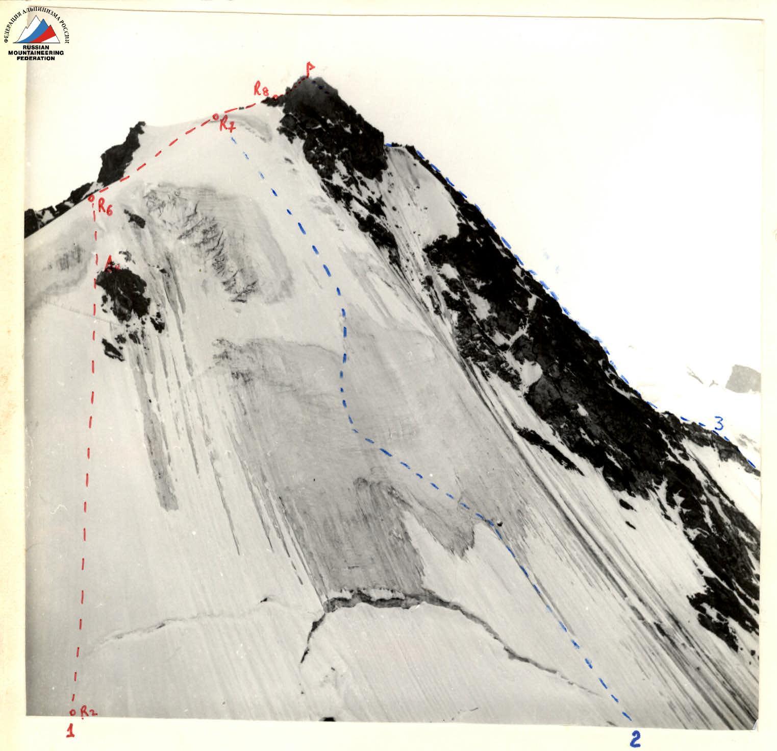
Peak Germogenova
Taken on July II, 1986 at 16:00 from v. Chegetkara. Camera "Lyubitel-166", lens "LOMO T-22", F = 75 mm.
Location of the images:
- 1 - along the left part of the N wall;
- 2 - along the N wall;
- 3 - along the N ridge, 3A category.
Route description
To peak Germogenova (3990 m) via the northern slope
(from the saddle from the peak Chegetkara)
From the camp, move up the road to "Novy Dzhantugan". From here, turn right across the Adylsu river (over a small bridge) to the left-bank moraine of the Kashkatish glacier, then up the trail to a small spring (100 m short of a large gray boulder on the moraine). Turn left onto a steep grassy slope overgrown with bushes, and ascend along the trail to a meadow for overnight stay at "Turi озера" (Tour lakes).
From here, ascend parallel to the northern ridge of p. Germogenova to the Chegetkara glacier. Before the glacier - a bivouac on the scree.
From "Dzhantugan" camp to this bivouac - 2-2.5 hours.
From the bivouac (roped up), move along the Chegetkara glacier to the saddle between the peaks Germogenova and Chegetkara. From here - straight up the snow-ice slope, overcoming a crevasse, to a solitary rocky outcrop, which is bypassed on the left and ascended to its summit. Here is a cairn. From the rocks - straight up to the snowy eastern ridge and along it to the summit.
Steepness of the northern slope:
- in the lower part - 40°,
- in the middle and upper parts - 50°. Length - 500 m.
Protection below - through an ice axe, in the middle and upper parts - through ice screws.
Ascent from the bivouac to the summit takes 6 hours, descent (rappelling) along the ascent route - 2 hours.
For a team of 4 people:
- 8 ice screws (5 of which are for descent)
- 8 m of rope (for descent)
The rest is standard equipment for a 3B category route.
DESCRIPTION COMPILED ON July 14, 1980 by A. LAPTEV
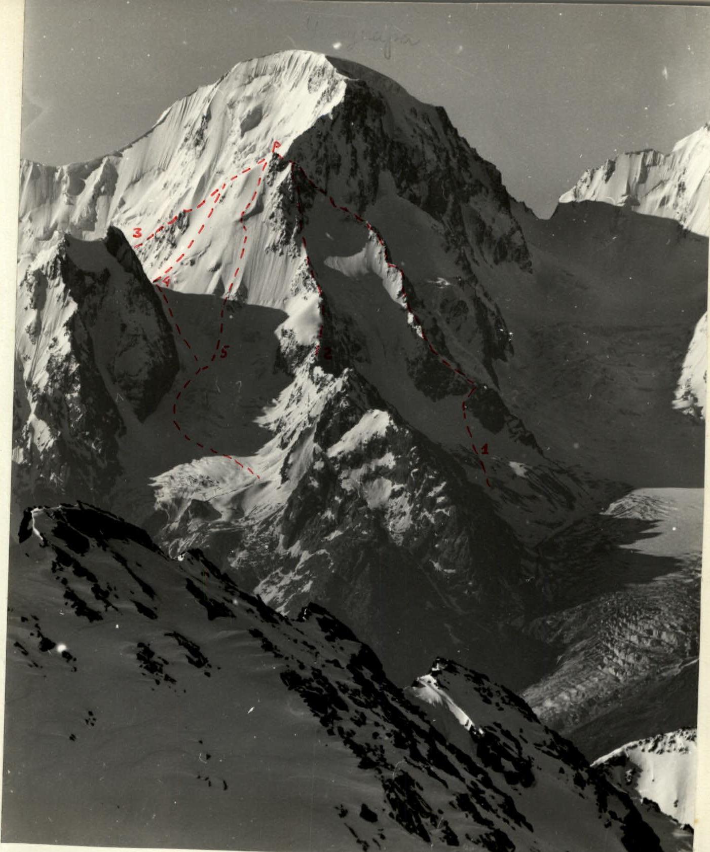
Taken on July 2, 1986 at 8:00 from v. Kezgen. Camera "Salut-S", lens "Tair-33", = 300 mm.
Routes:
1 - along the N ridge, 2B category 2 - along the N ridge, 3A category 3 - along the SE ridge-slope, 3B category 4 - along the left part of the N wall, 2B category 5 - along the N wall, 3B category.
N. Popov, 34 A. Starostin, 51 Garor, 49 A. Laptev, 80 I. Kharinyak, 86
ROUTE SCHEME IN UIAA SYMBOLS (p. Germogenova, via the left part of the N wall, 3A category.)
August 4, 1986
Elevations determined by altimeter, steepness measured with an inclinometer during descent along the route.