Ascent Log
-
Ascent category — combined.
-
Ascent area:
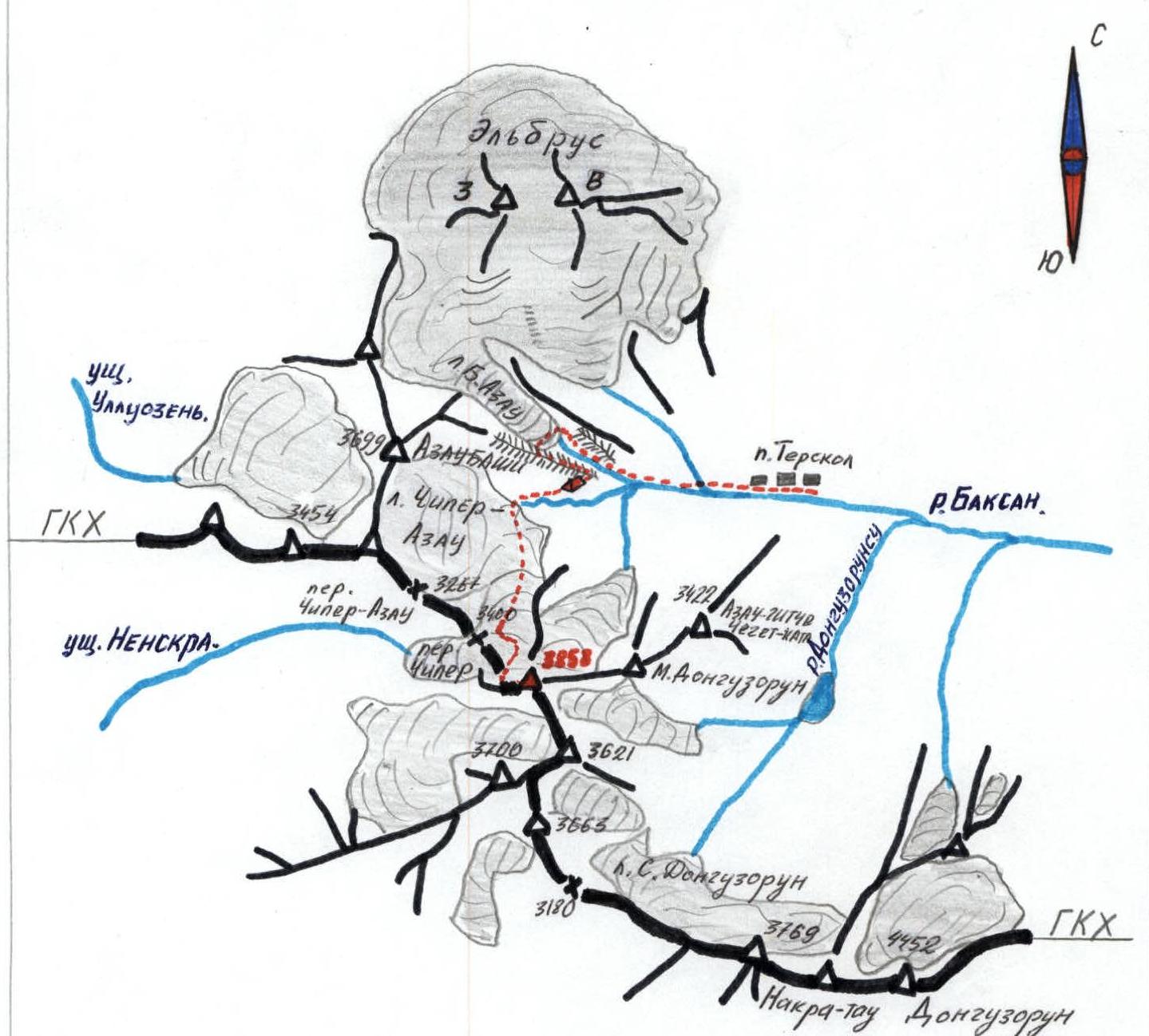
Central Caucasus, Main Caucasian Range, east of Chiper pass, from the side of Chiper-Azau glacier.
-
Peak 3858, via West Ridge, first ascent.
-
Proposed category of difficulty — 3A.
-
Height difference of the route 500 m (from Chiper pass).
-
Number of pitons used 5/0, including 2 ice pitons.
-
Number of climbing hours — 9.
-
No overnight stays on the route. Bivouac at "Sandy Hotel" 2700 m.
-
Leader: Semykin Boris Ivanovich, Candidate Master of Sports.
Participants:
- Smirnova Elena Konstantinovna, Candidate Master of Sports.
- Kryuchkov Igor Nikolaevich, Candidate Master of Sports.
- Budko Vyacheslav Borisovich, 1st sports category.
-
Coach: Semykin Boris Ivanovich.
-
The ascent was made from August 14 to August 16, 1995.
-
Alpinist club "Vertikal", Volgograd city.
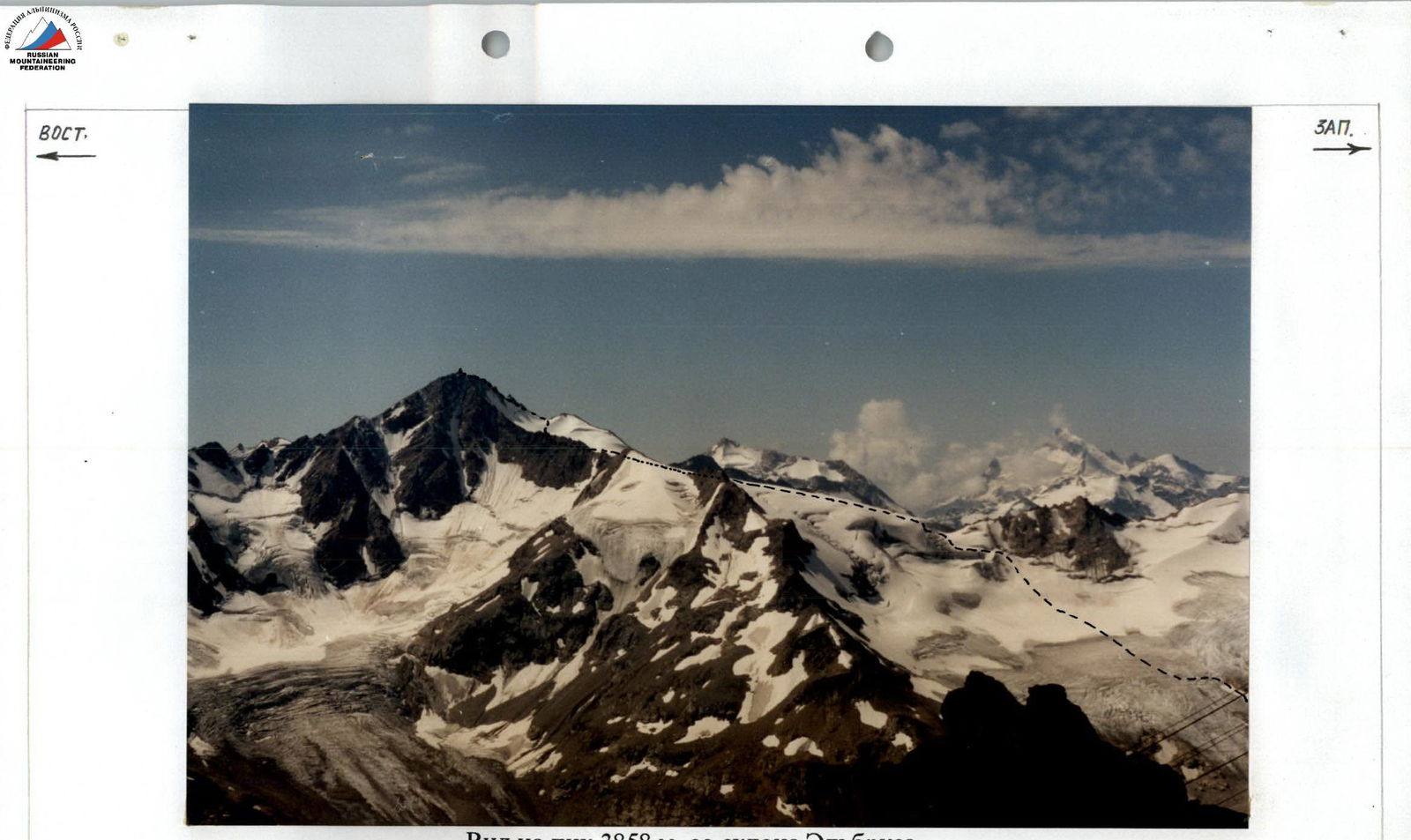
View of Peak 3858 m from the slope of Elbrus.
Approach to the Route
From Terskol settlement, move up the road to Azau clearing, then along the trail on the left (orographically) bank of Azau river. Through the canyon, exit to the lateral moraine of Bolshoy Azau glacier, cross to the right-bank moraine and ascend to the bivouac site "Sandy Hotel" (2700 m).
Route Description
50 m before Chiper pass, turn left and ascend a steep (45–50°, 50 m) snow-ice slope to the upper plateau of the eastern branch of Chiper-Azau glacier. The plateau is bounded from the east and south by the ridges of Peak 3858. Cross the plateau and exit to the snowy saddle of the West Ridge. 3 hours from the initial bivouac.
Further movement goes along the heavily destroyed rocks of the West Ridge under the tower of a gendarme. Bypassing the gendarme on the left, along inclined snowy ledges (pitons used for protection, crampons), exit to the saddle. Then, via an inner corner and small walls, exit to a narrow, gently sloping ridge. Follow the ridge to the summit tower and ascend the destroyed rocks of the tower to the summit.
Descent via the ascent route or along the North Ridge.
Ascent from bivouac 6–7 hours.
Descent 3–4 hours.
Scale 1:1000
Schematic map of the Main Caucasian Range in the area of Chiper-Azau-Donguzorun passes.
Peak 3858
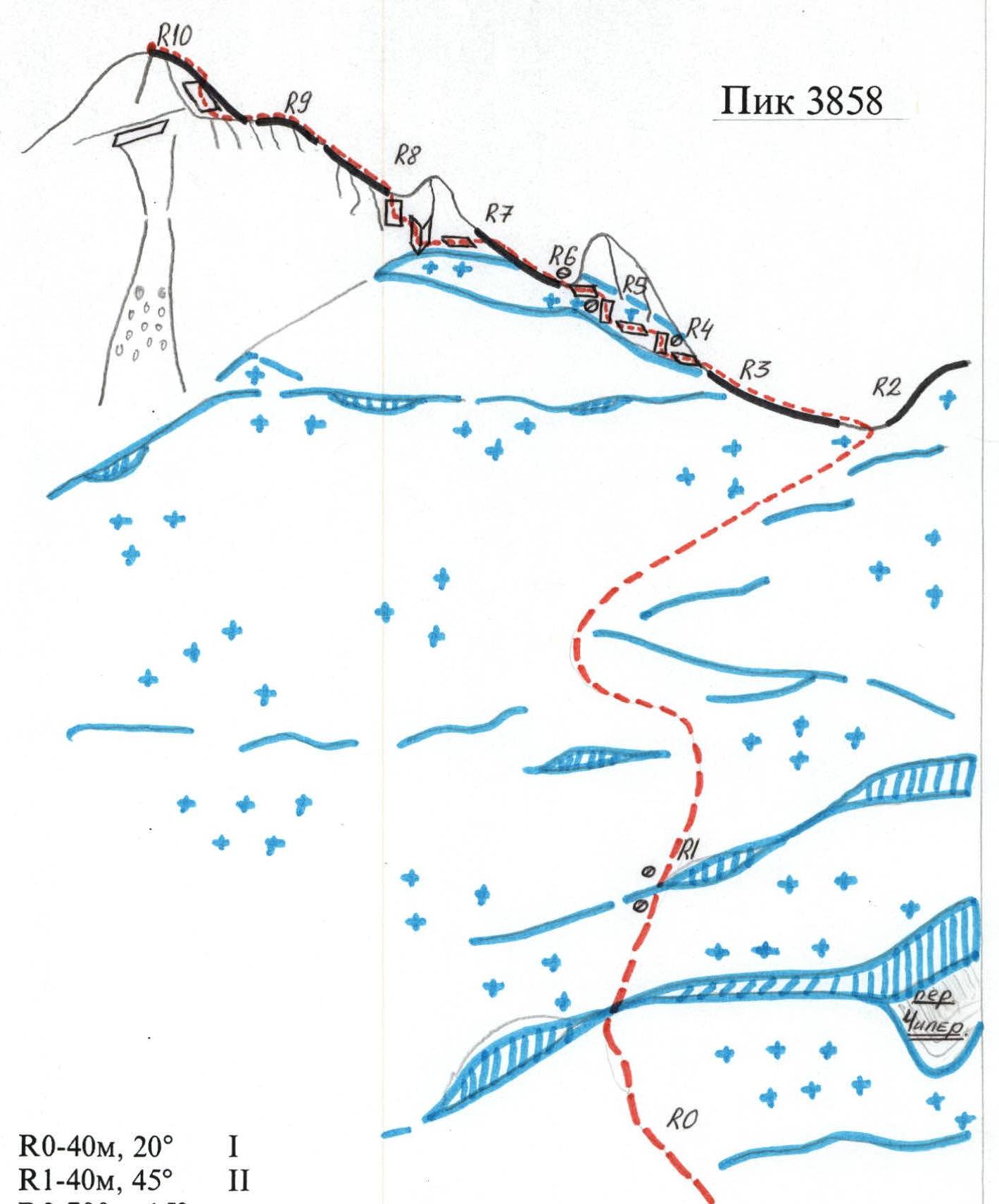
| R0 — 40 m, 20° | 1 |
| R1 — 40 m, 45° | 2 |
| R2 — 700 m, 15° | |
| R3 — 40 m, 25° | 1 |
| R4 — 40 m, 40° | 2+ |
| R5 — 20 m, 45° | 3+ |
| R6 — 20 m, 45° | 2+ |
| R7 — 40 m, 40° | 2+ |
| R8 — 25 m, 60° | 3+ |
| R9 — 80 m, 25° | 2 |
| R10 — 30 m, 45° | 3 |