Ascent Passport:
- Technical climb category.
- Central Caucasus, Prielbrusye.
- Bzhedug, NW wall, direct line.
- Assumed 5A category, First ascent.
- Combined route.
- Height difference: 700 m, route length: 950 m. Length of category complexity sections 5 — 140 m. Average steepness of the route — 50°. Average steepness of the wall — 70°.
- Pitons left on the route: rock — 1.
- Team's travel time: 8 hours.
- Leader: Koshelenko Yu.V. — Master of Sports;
Team members:
- Politiko I.E. — 1st sports category
- Sidorov A.V. — 1st sports category
- Coach: Koshelenko Yu.V.
- Approach to the route August 2, 2003. Summit reached: August 2, 2003. Return to AU SB "Elbrus": August 3, 2003.
- Organization: Rostov Regional Federation of Alpinism and Rock Climbing.
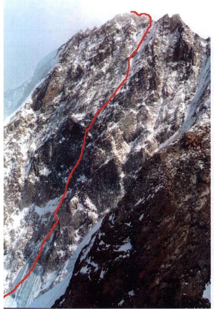
Photograph of the wall with the route thread

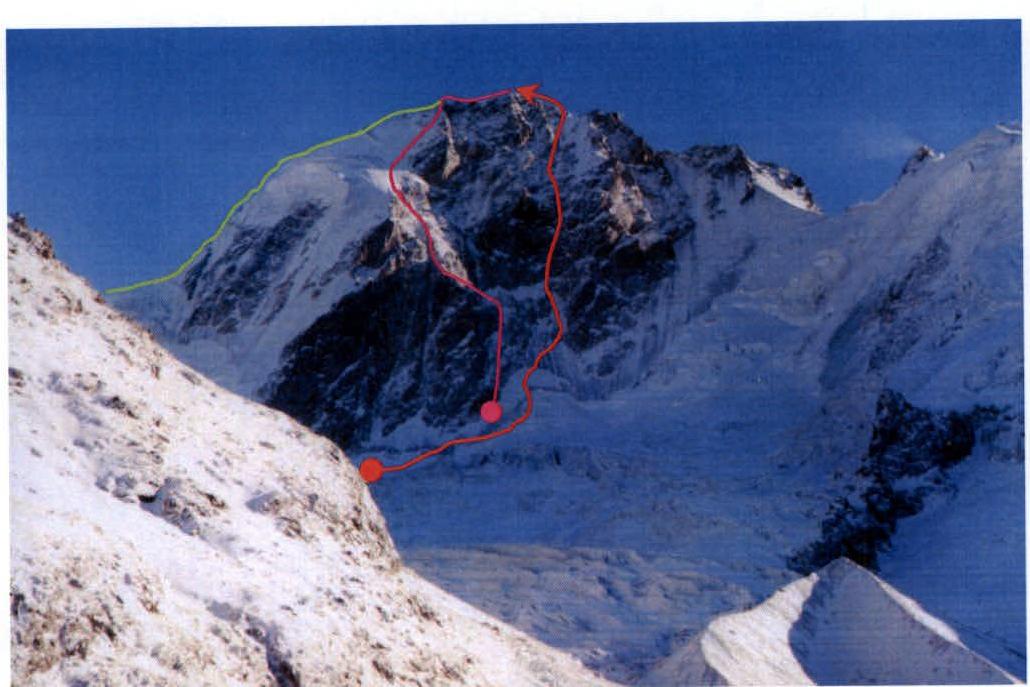 Green — Distel's route on the N ridge 3B, Purple — Romanov's route on the NW wall 4A. Red — team's route.
Photo taken from the slopes above the right bank of Shkheldinsky glacier in winter 2002.
Green — Distel's route on the N ridge 3B, Purple — Romanov's route on the NW wall 4A. Red — team's route.
Photo taken from the slopes above the right bank of Shkheldinsky glacier in winter 2002.
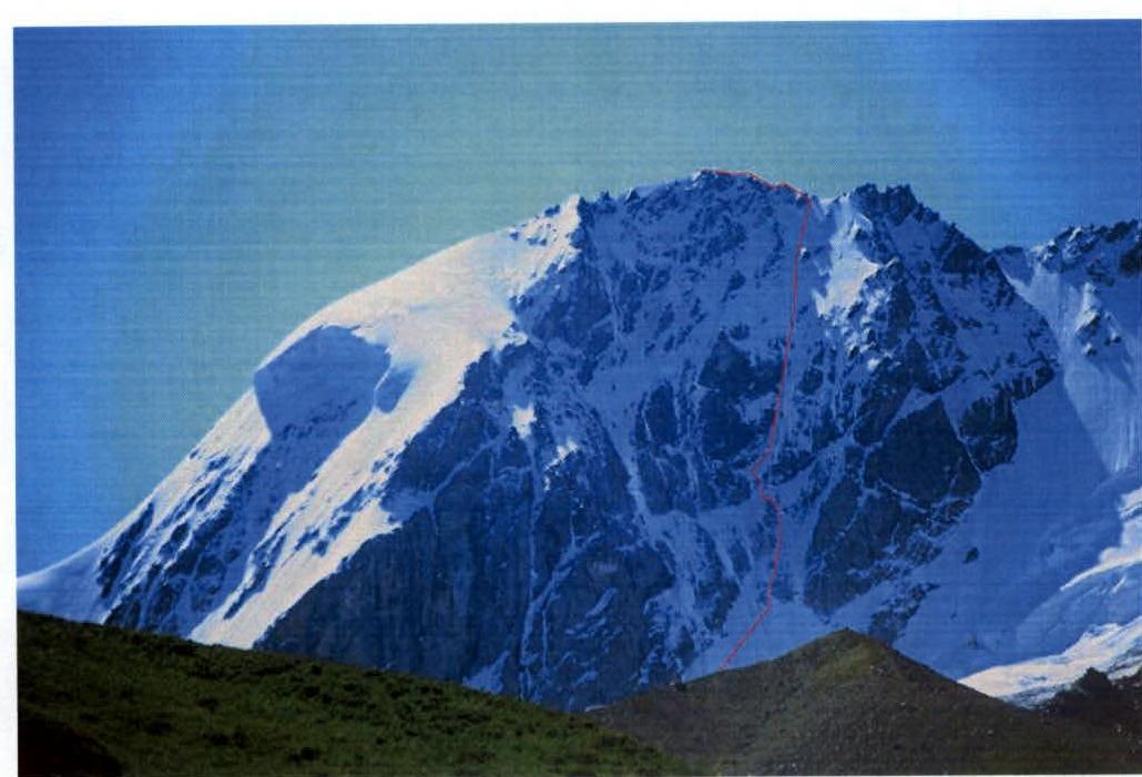 Photo taken from the slopes above the left bank of Shkheldinsky glacier in summer 2003.
Route profile from the left
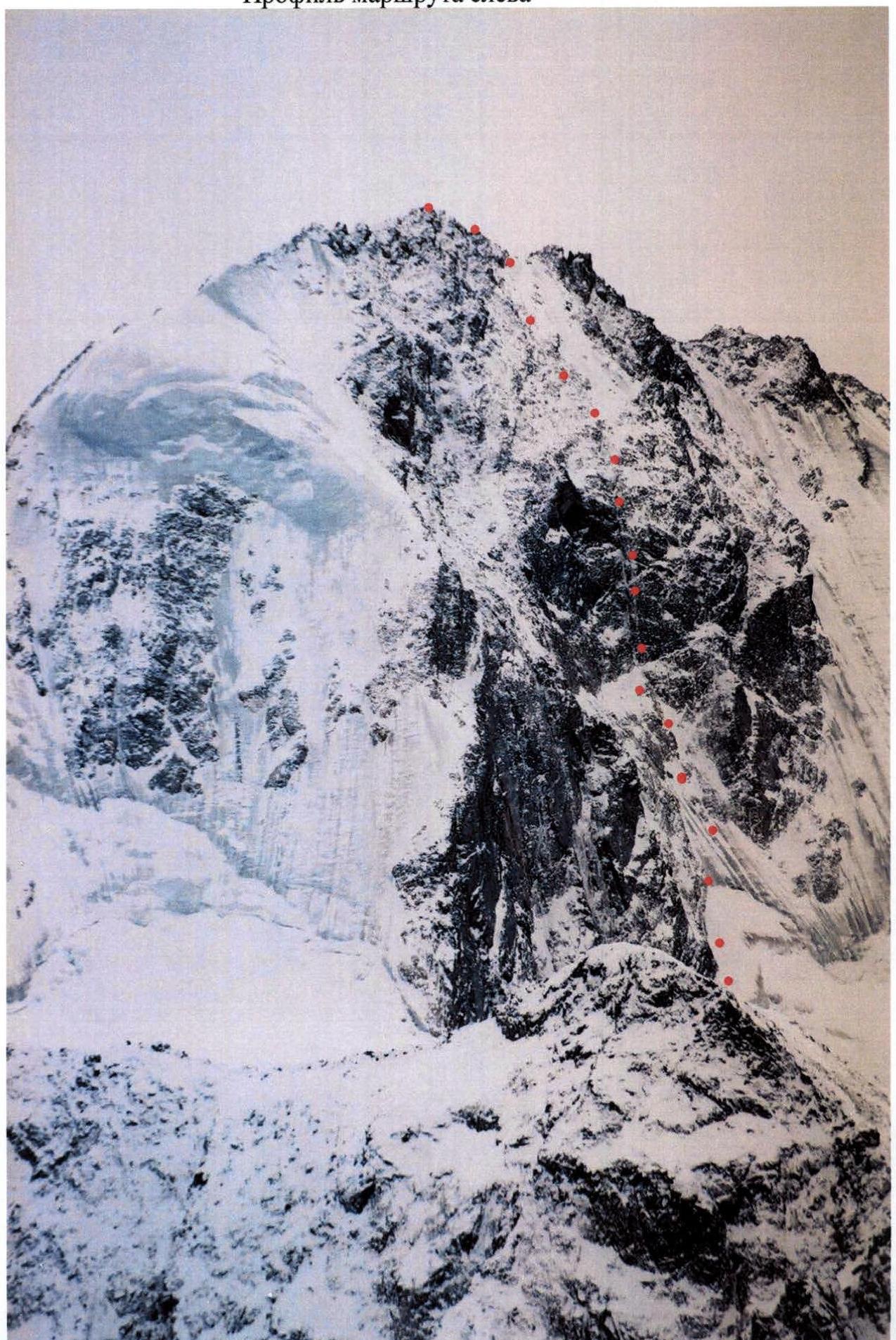
Route profile from the right (photo from Pik Kavkaz)
Description of the Climbing Area
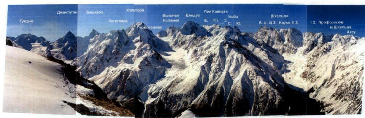
The Main Caucasus ridge stretches, bending multiple times, changing direction from north to south, from the NE ridge of Pik Shchurovsky in the west to the western slopes of Ullukara in the east. In the center of this section of the ridge, the ice cap of Bzhedug peak — 4270 m — rises. East of Bzhedug, on a short section of the ridge, the rocky peak of Volnaya Ispaniya — 4200 m — stands tall. To the west of Bzhedug, the ridge includes peaks: Kavkaza — 4037 m, Vulley, and Zheleznodorozhnikov — 3900 m. To the north, ice and snow slopes descend from almost all sections of the ridge, interrupted by numerous rocky spurs, ridges, and counterforts. Only Volnaya Ispaniya drops off with a rocky cliff onto the upper plateau of the Kashkatash glacier. On the southern side, the ridge rises with steep rocky walls above the Chalaat and Lekzyr glaciers.
Photopanorama of the Climbing Area
Tactical and Technical Actions of the Team
The ascent was made in a team of three, without using fixed ropes. The leader climbed on a double rope (Beal Ice Line), the second and third climbers moved independently with ice axes, each on their own rope, with a small gap, which ensured a speed close to that of a team of two. The Gi-Gi (Kong) device proved very convenient for this tactic, allowing the leader to effectively belay both partners.
All team members climbed with backpacks containing a lightweight bivouac in case of an overnight stay, water, and food. For belaying, ice screws, cams, and rock pitons were used. On the roof, belaying was done through ice axes.
From the Shkhelda alpine camp, the ascent followed the trail on the right slope of the Shkhelda valley, first through the forest, then across grassy slopes; above the glacier tongue, the team reached the surface moraine of the Shkheldinsky glacier and ascended it. Then they crossed the glacier to the left towards the stream flowing from under the Bzhedug glacier and climbed a steep grassy slope on the right bank of the stream to the crest of the right-bank moraine of the Bzhedug glacier. They ascended the glacier and, on its right side, reached the upper plateau of the Bzhedug glacier (the glacier was heavily crevassed). On the plateau, they set up a bivouac.
From the bivouac, avoiding crevasses, they approached the center of the NW wall of Bzhedug. The start of the route is located under a characteristic triangular overhanging rock in the center of the northwest wall. The route follows a system of ice couloirs to the right of this rock.
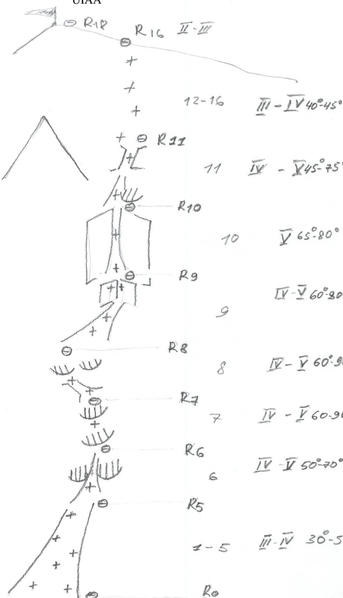
The new route (18 pitches) was completed in 8 hours from the bergschrund to the summit and includes six technically challenging sections (category complexity 5) with a total length of 140 m (R6 — 10 m, R7 — 15 m, R8 — 25 m, R9 — 30 m, R10 — 50 m, and R11 — 10 m). The high ascent speed was primarily due to the good condition of the route (a fairly dense layer of snow and firn on steep rocks) and the adopted climbing tactic. Such conditions are not always present, and in other circumstances, the route may prove much more challenging.
The descent from the summit was made along the northern ridge (via the "trunk") towards the "Technical Intelligentsia" pass.
During the ascent, radio communication was maintained with the Shkhelda rescue team.
Route Description
August 2, 2003. Start of work on the route at 7:00.
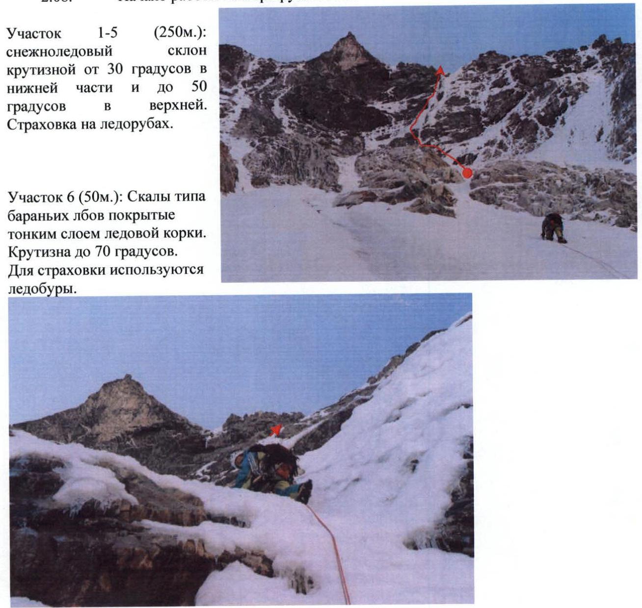
Section R1–R5 (250 m): Snow and ice slope with a steepness from 30° in the lower part to 50° in the upper. Belaying on ice axes.
Section R6 (50 m): Rocks resembling sheep's foreheads, covered with a thin layer of ice crust. Steepness up to 70°. Ice screws used for belaying.
Sections R7–R9 (150 m): Mixed terrain, category complexity 4–5. Steepness 60–80°. Belaying on ice screws and cams. A rock piton was left on section R9 for orientation.
Section R10 (50 m): Rock and ice gully, category complexity 5, steepness 65–80°. Belaying — ice screws and cams.
Section R11 (50 m): Exit onto the roof. The lower 10 m — category complexity 5, 75°, then it becomes less steep, down to 45°. Belaying — ice screws, ice axes.
Sections R12–R16 (250 m): Snow slope 40–45°. Belaying on ice axes. Exit onto the western ridge of Bzhedug.
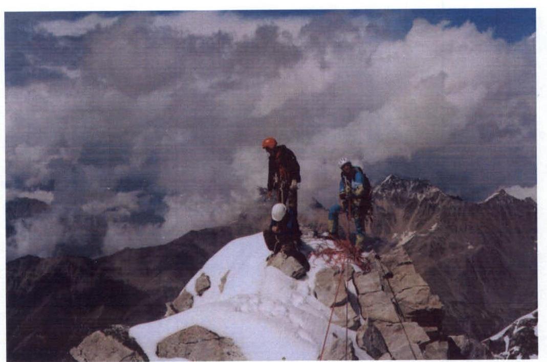
Sections R13–R18 (150 m): Rocky ridge, category complexity 3. On the summit at 15:00. On the summit, a group ascending Bzhedug via the SE ridge (route 2B category) was encountered.
Descent from the summit was made along the northern ridge (L. Distel's route 3B) towards the "Technical Intelligentsia" pass.
19:00 Descent to the upper plateau of the Bzhedug glacier to the bivouac. August 3, 2003. Return to AU SB "Elbrus".
Route Diagram in UIAA Symbols