Report
On the ascent to the peak Treugolnik (3830 m) via the Central-North slope, category III complexity, by the team of Alpcamp "Polytechnic" on July 28, 2022.
I Ascent Passport
| 1. General Information | ||
|---|---|---|
| 1.1 | Leader's Full Name, Sports Rank | Sobolev Alexey Alexandrovich, 1st sports rank |
| 1.2 | Participants' Full Names, Sports Ranks | Sobolev Alexey Alexandrovich, 1st sports rank, Utenov Renat Askarovich, 3rd sports rank, Molodtsova Maria Pavlovna, 3rd sports rank, Shashkov Andrey Borisovich, 3rd sports rank, Romanov James Borisovich, 3rd sports rank, Doroshko Alexander Mikhailovich, 3rd sports rank |
| 1.3 | Coach's Full Name | Sobolev Alexey Alexandrovich, 1st sports rank |
| 1.4 | Organization | Alpcamp "Polytechnic" |
| 2. Characteristics of the Ascent Object | ||
| 2.1 | Region | Central Caucasus, Adyrsu ridge |
| 2.2 | Valley | Adyrsu |
| 2.3 | Section number according to the 2013 classification table | 2.4.1 |
| 2.4 | Peak Name and Height | Treugolnik, 3830 m |
| 3. Route Characteristics | ||
| 3.1 | Route Name | via central-north slope |
| 3.2 | Proposed Category of Complexity | 3A |
| 3.3 | Route Exploration Level | - |
| 3.4 | Route Terrain Character | Combined |
| 3.5 | Route Elevation Gain (altimeter or GPS data) | 530 m |
| 3.6 | Route Length (in meters) | 1090 m |
| 3.7 | Technical elements of the route (total length of sections with different complexity levels, indicating terrain type) | 1/2 cat. complexity rocks, 1 - ice-snow, 1 - ice-snow |
| 3.8 | Descent from the Summit | Via route 1B Treugolnik |
| 3.9 | Additional Route Characteristics | Section R1–R2 must be passed before 6:00 am |
| 4. Team Actions Characteristics | ||
| 4.1 | Travel Time (team's walking hours, in hours and days) | 9.5 hours route (descent to Mestia bivouacs) |
| 4.2 | Bivouacs | - |
| 4.3 | Route Preparation Time | - |
| 4.4 | Route Start | July 28, 2022, 03:52 |
| 4.5 | Summit Ascent | July 28, 2022, 09:00 |
| 4.6 | Return to Camp | July 28, 2022, 14:10 (base camp) |
| 5. Report Responsible Person | ||
| 6.1 | Full Name, e-mail | Molodtsova Maria Pavlovna, msaver@list.ru |
II Ascent Description
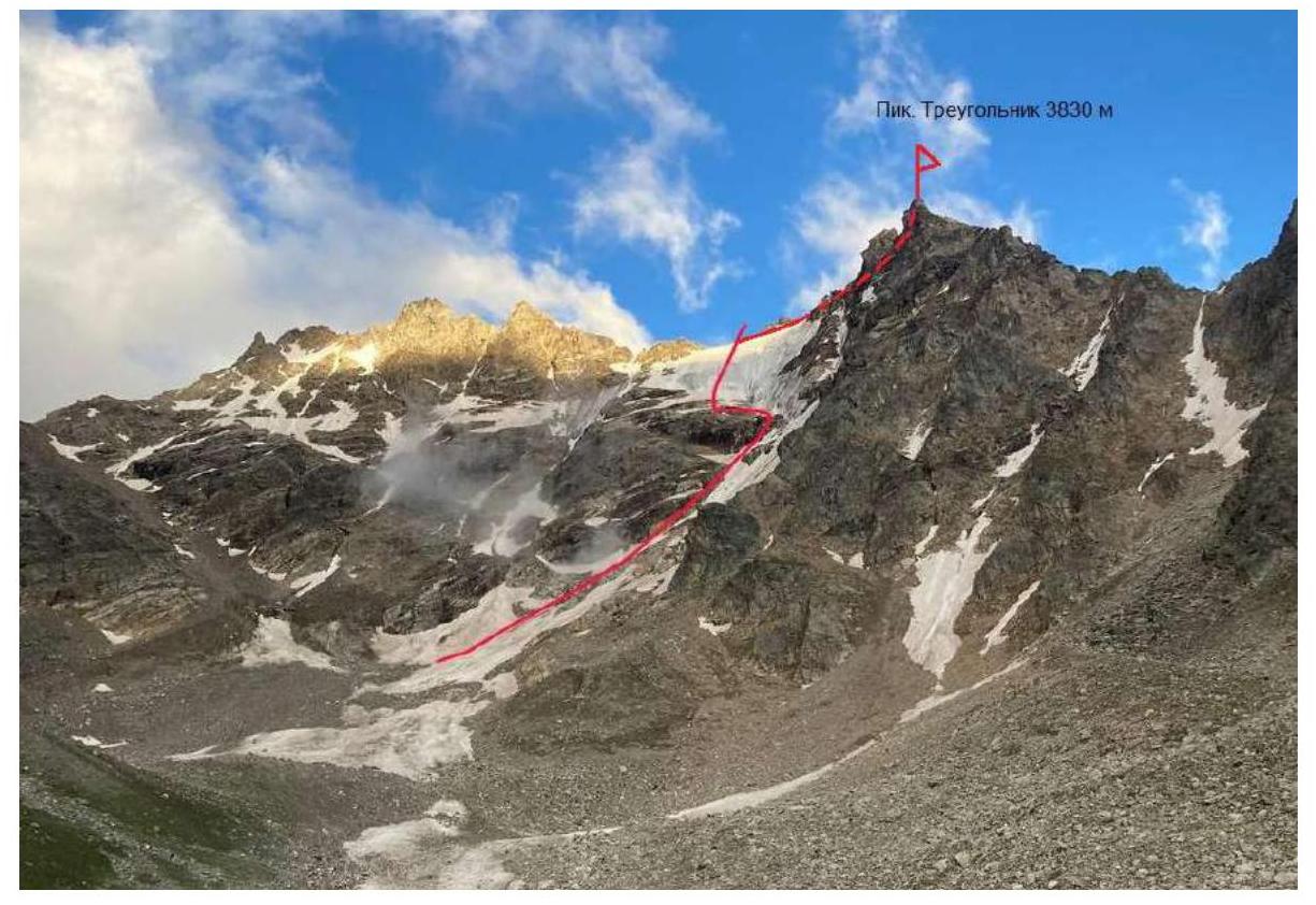
1.1 General photo of Treugolnik peak on 28.07.22.
 Taken from Medvezhii bivouacs
1.2 UIAA Scheme
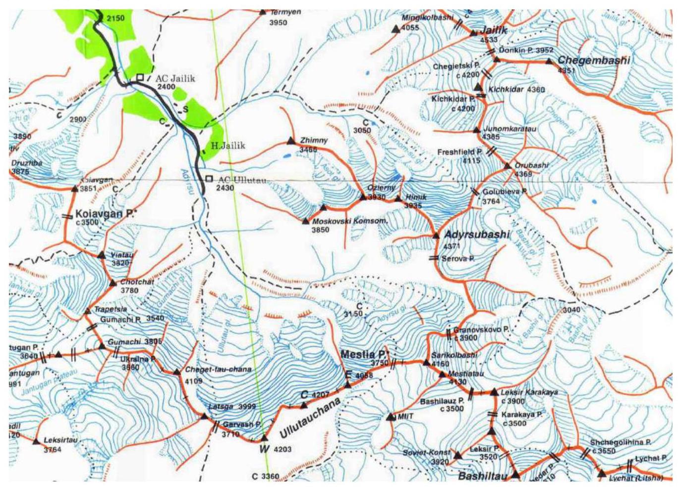
1.3 Area Map
2. Ascent Object Characteristics
2.1 Technical photo of the route
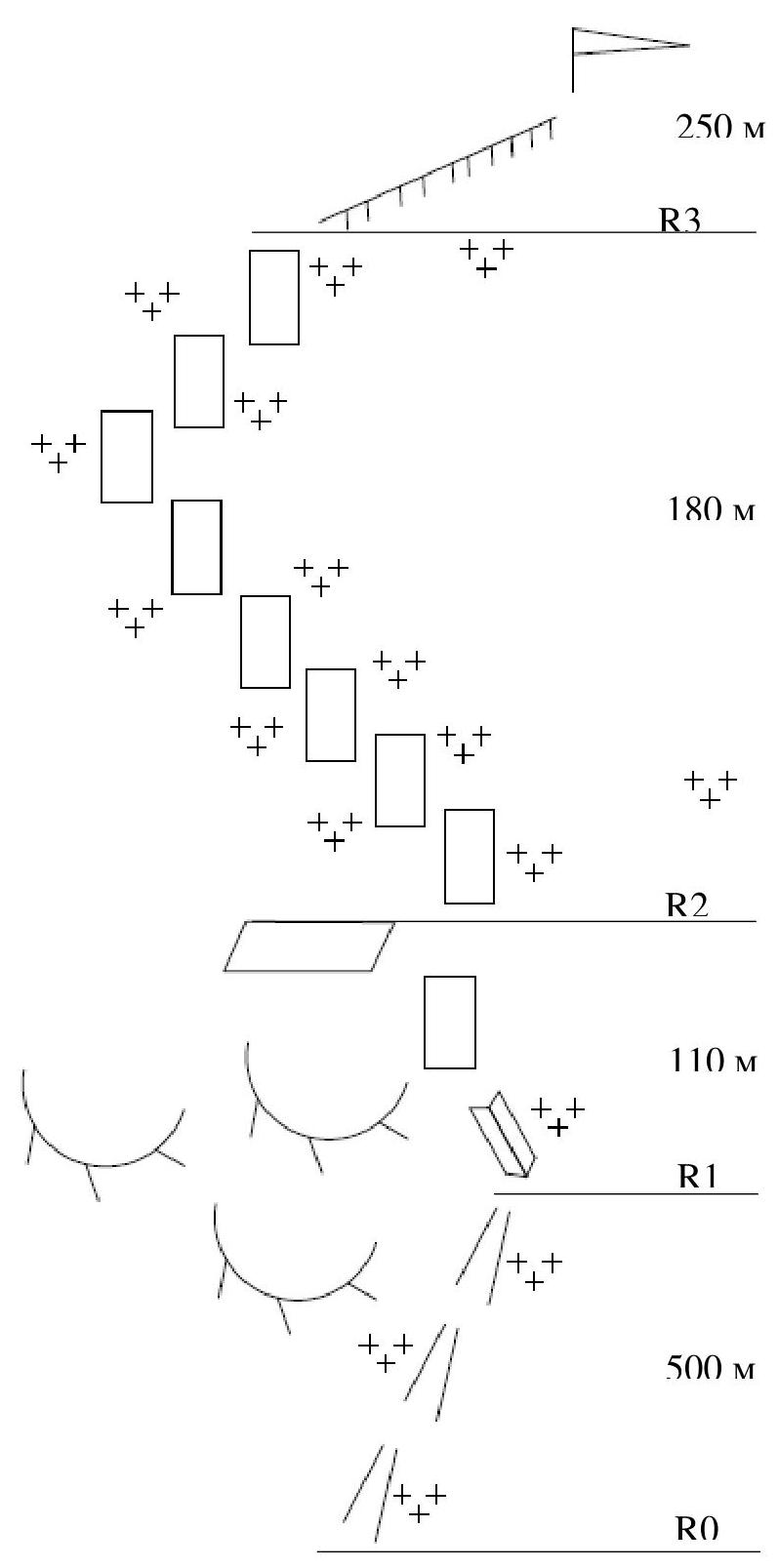
2.2 Technical characteristics of route sections
| Section № | Terrain Character | Category of Complexity | Length, m | Type and Number of Pitons |
|---|---|---|---|---|
| R0–R1 | Approach to the glacier on snow (firn) with a slope of 30–35 degrees | 1 | 550 m | Belay between rocks |
| R1–R2 | Flow ice with a slope of 45–50° | 1 | 110 m | Ice screws 2–3 pcs. |
| R2–R3 | Ice/firn with a slope of 40–45° | 1 | 180 m | Ice screws 10–12 pcs. |
| R3–R4 | Easy climbing on destroyed rocks to reach the summit, bypassing all buttresses on the left | 2 | 250 m | Belay between rocks |
The route is combined - an ice wall consisting of ice of varying steepness, and a traverse along simple destroyed rocks to the summit.
3. Team Actions Characteristics
3.1 Approach to the route
From the "Ullu-tau" tourist base, ascend upwards along the trail from the sports ground. Then move upwards, keeping to the left, along the grassy slope turning into simple destroyed rocks. Reach the plateau, then move upwards, keeping to the right, to the grassy areas under the bivouac sites. From the bivouacs, the entire route is visible. From camp to bivouacs: 1.0–2.0 hours From bivouacs to the start of the route: 1.0–1.5 hours
R0–R1 (500 m, 1) Movement along steep snow to the glacier, under the rocks, keeping to the left, belay on the terrain.
R1–R2 (110 m, 1) Movement along flow ice with a slope of 45–50°, keeping to the left closer to the rocks. Exit to a rock shelf under the ice wall. The section must be passed before 6:00 am, as small stones/ice may start falling from above. Belay with ice screws.
R2–R3 (180 m, 1) Movement along the ice wall with a slope of 40–45°, exit to the ridge. Belay with ice screws.
R3–R4 (120 m, 2) Easy climbing on destroyed rocks, move to the left, descending, bypassing the buttress on the left. Before the summit tower - turn to the right and exit to the summit. Belay on the terrain.
The route is combined - an ice wall consisting of ice of varying steepness, and a traverse along simple destroyed rocks to the summit.
Descent via route 1B cat. complexity Treugolnik (section 2.4.1, №101 in the classifier) to Mestia bivouacs, then to al. Ullu-tau along the trail.
Photos of route sections passage.
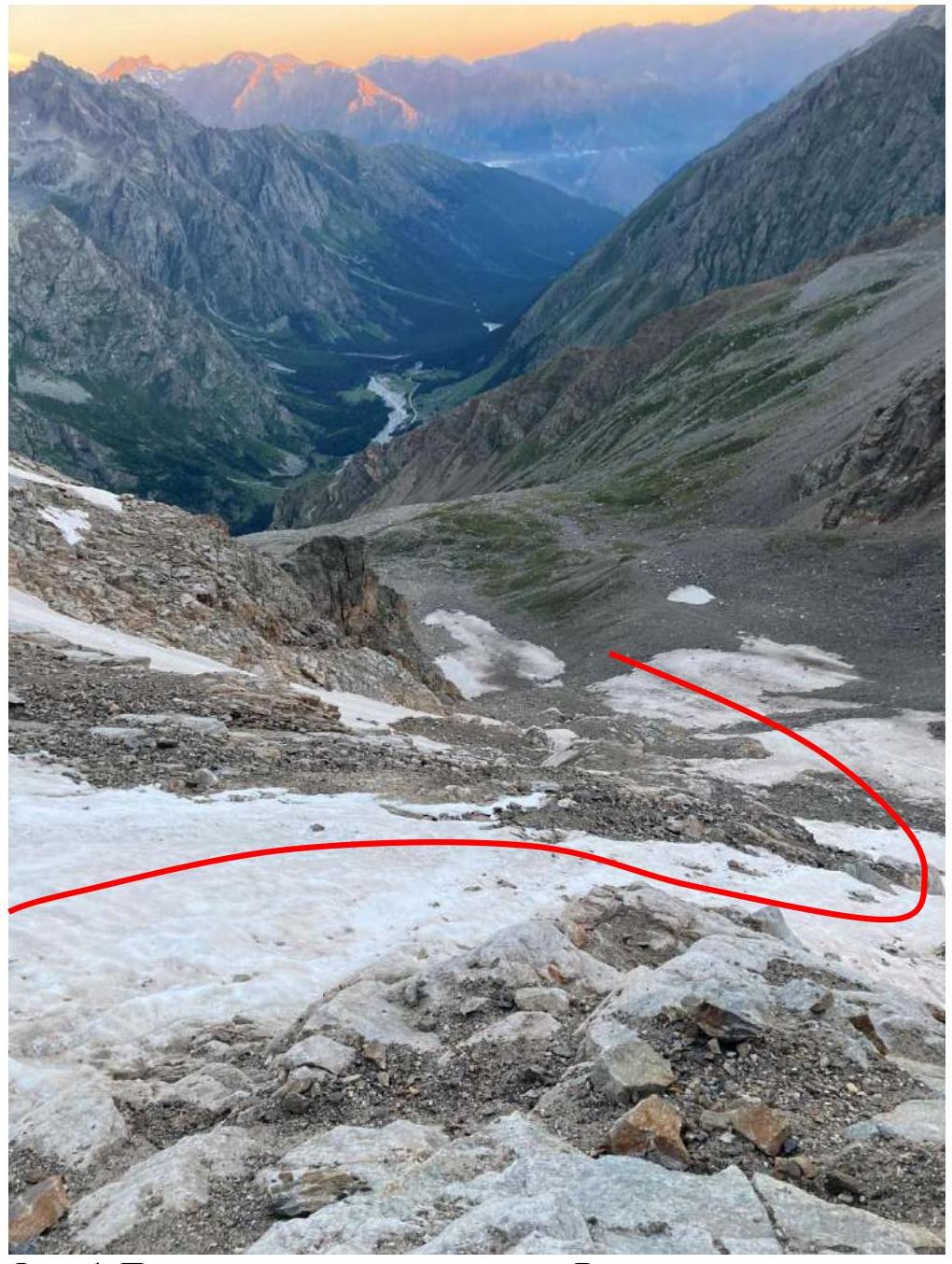
Photo 1. Approach to the glacier on snow. View from above
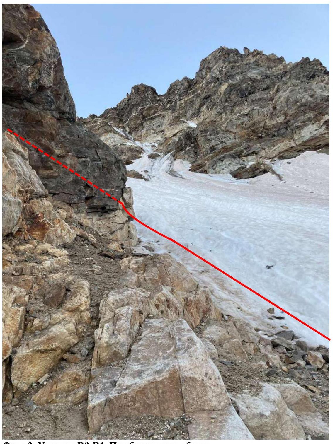
Photo 2. Section R0–R1. Under the "ram's foreheads"
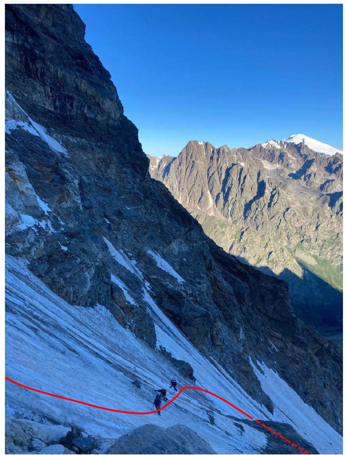
Photo 3. Section R1–R2. Traverse along flow ice
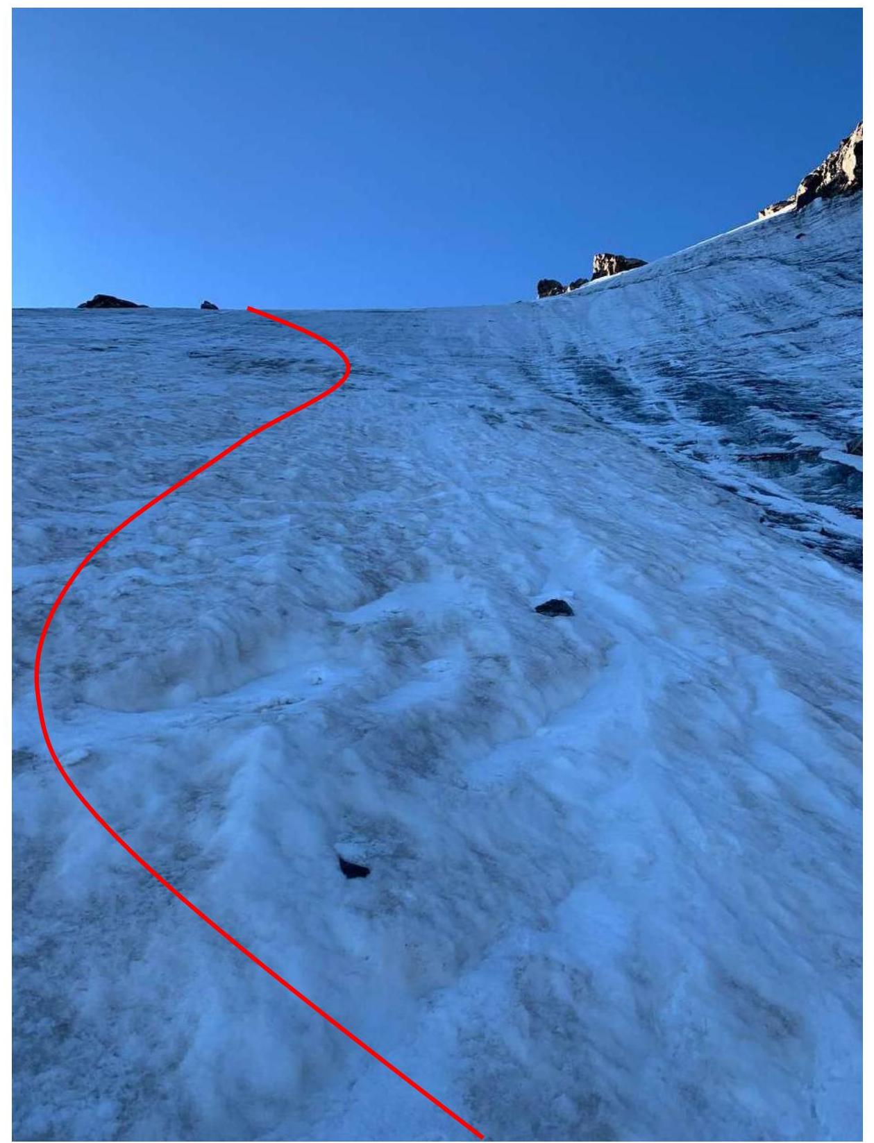
Photo 4. Section R2–R3. Ice wall. View from the shelf
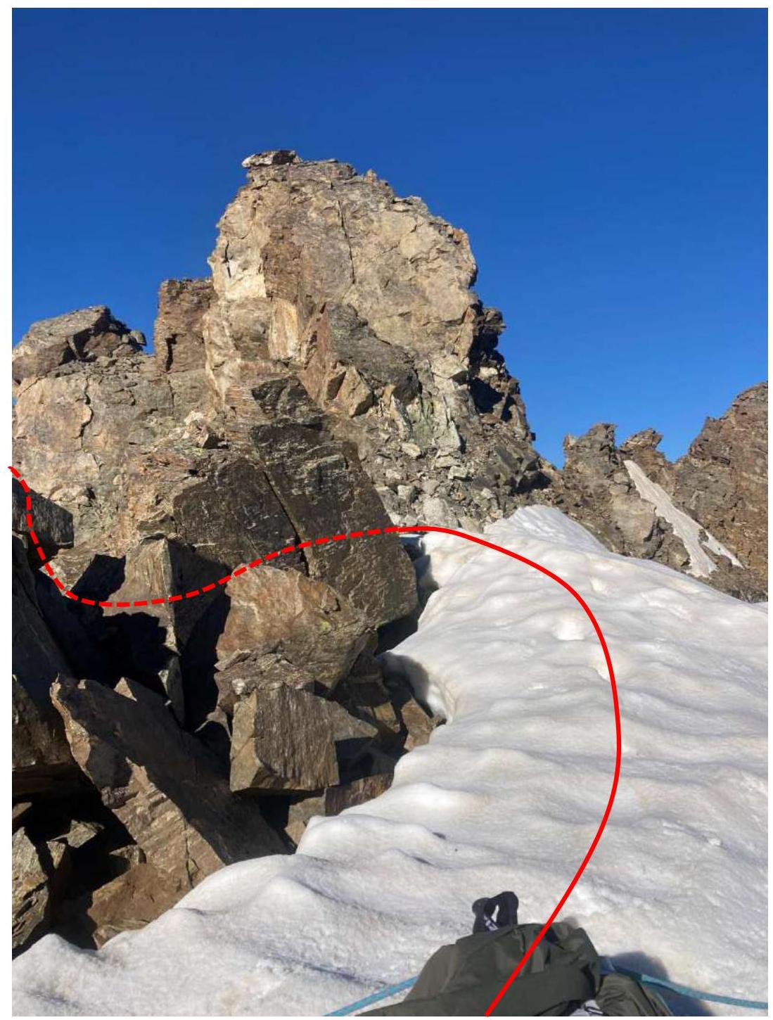
Photo 5. Start of section R3–R4. View of the buttress.
3.2 Photo of the team on the summit.

Team SP-2 Alpcamp "Polytechnic" on July 28, 2022.