REPORT ON THE FIRST ASCENT TO THE SUMMIT TREUGOLNIK 3830 M VIA THE CENTER OF THE SLOPE ROUTE OF 3A CATEGORY OF COMPLEXITY APPROXIMATELY
DOUBLE TEAM CONSISTING OF Y. KOSHElenko, G. CHETVERKIN "ZVEZDOCHKA" July 24, 2022
I. Ascent Passport
| 1. General Information | ||
|---|---|---|
| 1.1 | Full name, sports rank of the leader | Koshelenko Yu.V., MSM |
| 1.2 | Full name, sports rank of participants | Chetverkin G.K., 2nd sports rank |
| 1.3 | Full name of coach | |
| 1.4 | Organization | AB "Ullutau" |
| 2. Characteristics of the Ascent Object | ||
| 2.1 | Area | from v. Gumachi to Kithlod pass (Adyrsu, Lekzyr, Chegem valleys) |
| 2.2 | Valley | |
| 2.3 | Section number according to the classification table of 2013 | 2.4.1 |
| 2.4 | Name and height of the summit | Treugolnik, 3830 m |
| 2.5 | Geographical coordinates of the summit (latitude, longitude), GPS coordinates | 43.207884, 42.833397 |
| 3. Route Characteristics | ||
| 3.1 | Route name | Via the center of the North slope, "Zvezdochka" |
| 3.2 | Proposed category of complexity | 3A |
| 3.3 | Degree of route exploration | first ascent |
| 3.4 | Nature of the route terrain | combined |
| 3.5 | Elevation gain of the route (data from altimeter or GPS) | 700 m |
| 3.6 | Length of the route (in m) | 1500 m main, 400 m |
| 3.7 | Technical elements of the route (total length of sections of various cat. diff., nature of terrain (ice-snow, rocky)) | I/II cat. snow, rocks — 1100 m. III/IV cat. ice, firn — 400 m. |
| 3.8 | Average steepness of the route, (°) | 30/35° |
| 3.9 | Average steepness of the main part of the route, (°) | 45/50° |
| 3.10 | Descent from the summit | Via SE slope, scree, easy. |
| 3.11 | Additional route characteristics | Early start, departure not later than 4:30. |
| 4. Characteristics of the Team's Actions | ||
| 4.1 | Time of movement (team's walking hours, in hours and days) | 8 h. |
| 4.2 | Overnights | |
| 4.3 | Time of route preparation | without preparation |
| 4.4 | Start of the route | July 24, 2022, 3:15 |
| 4.5 | Summit attainment | July 24, 2022, 11:15 |
| 4.6 | Return to the base camp | July 24, 2022, 15:00 |
| 6. Person Responsible for the Report | ||
| 6.1 | Full name, e-mail | Koshelenko Yu.V., ymkosh@gmail.com |
1. Characteristics of the Ascent Object
1.1. General photo of the summit.
2. Route Characteristics
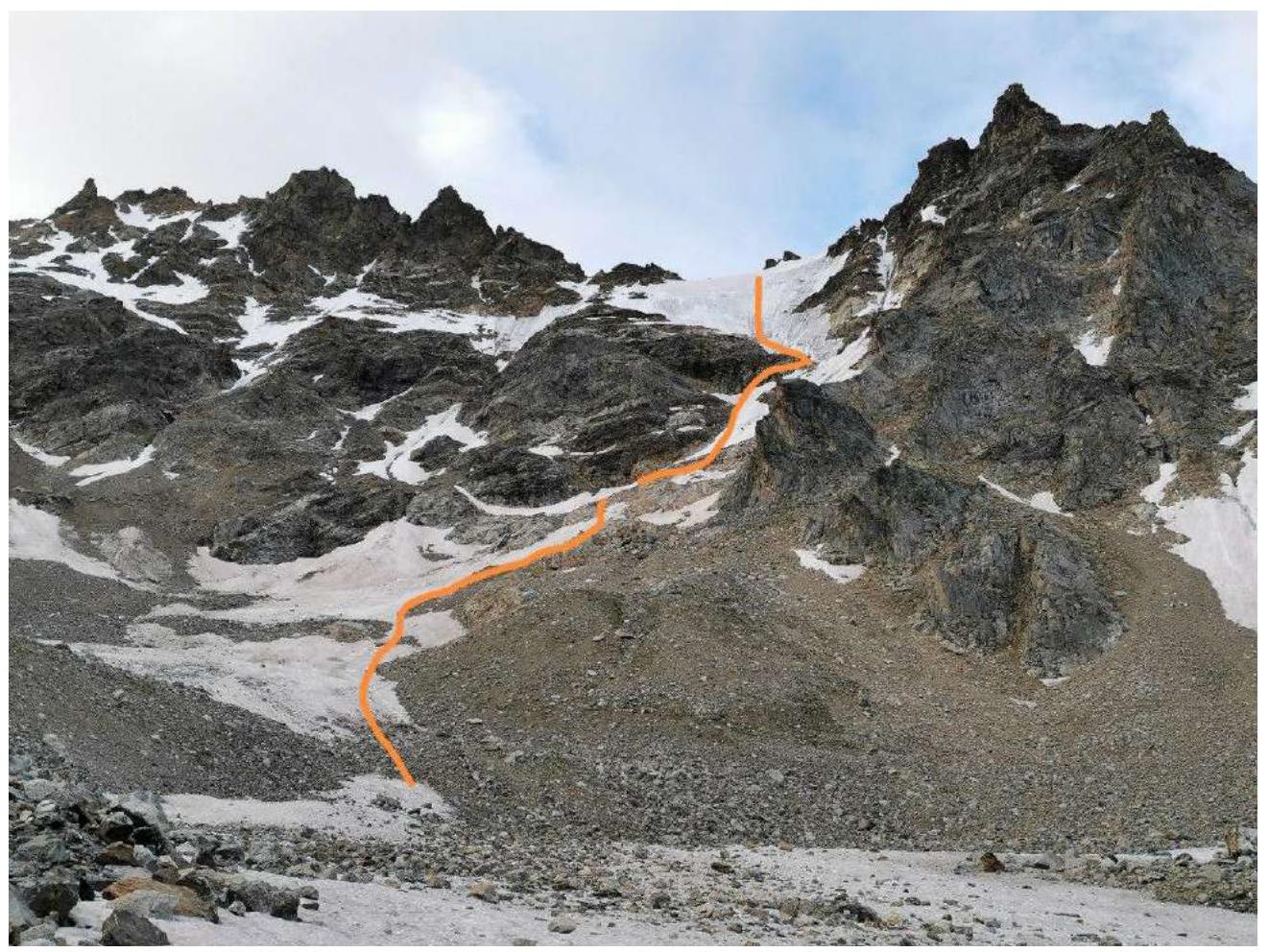
2.1. Technical photograph of the route.
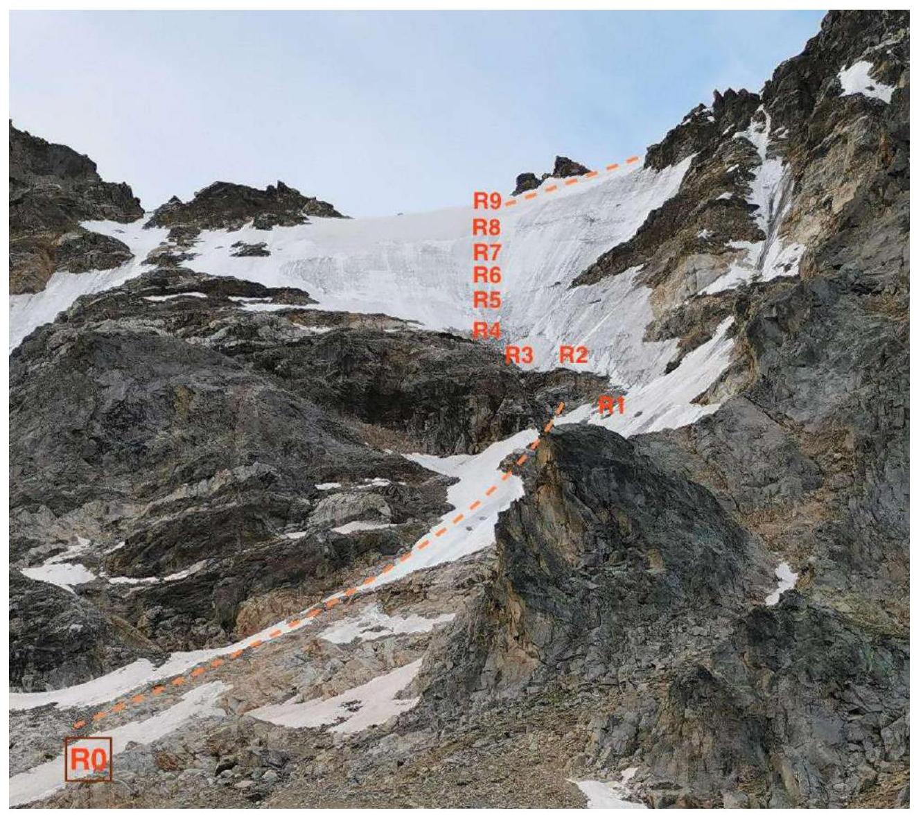
2.2. Photo of the route profile from the right. From the summit of Treugolnik.
3. Characteristics of the Team's Actions
3.1. Route Description
| Section number | Description | Photo number |
|---|---|---|
| R0–R1 | Start of the route — 6:30, at the beginning of the firn slope, to the left of the saddle between the summits Moskovsky Komsomolets and Treugolnik. Movement is simultaneous from left to right along the firn couloirs, pressing against the rocks from above. There are many rockfall traces on the slope; we did not observe any rockfalls early in the morning. | Photo 1 |
| R1–R2 | Up to the left along 50 m of dirty ice, 8:00. From the right buttress, rocks start to fall periodically as the upper part is sunlit. Steepness 40°, cat. diff. 3. | Photo 2 |
| R2–R3 | Traverse to the left, away from the right buttress, pressing against the rocks on the left. 30 m, 35°, cat. diff. 2. | |
| R3–R4 | Mixed section on dirty ice with rocks. 50 m, 50°, cat. diff. 4. At the end of the section, there is a good rock ledge. It is better to pass these three ropes before 8:00. Later, it may be dangerous due to periodic rockfalls from the right buttress, along which 2B Efimov route passes. | Photo 3 |
| R4–R5 | Firn and ice 45°. 40 m, cat. diff. 3. | Photo 4 |
| R5–R8 | 140 m, ice 50°, cat. diff. 3/4. | Photo 5 |
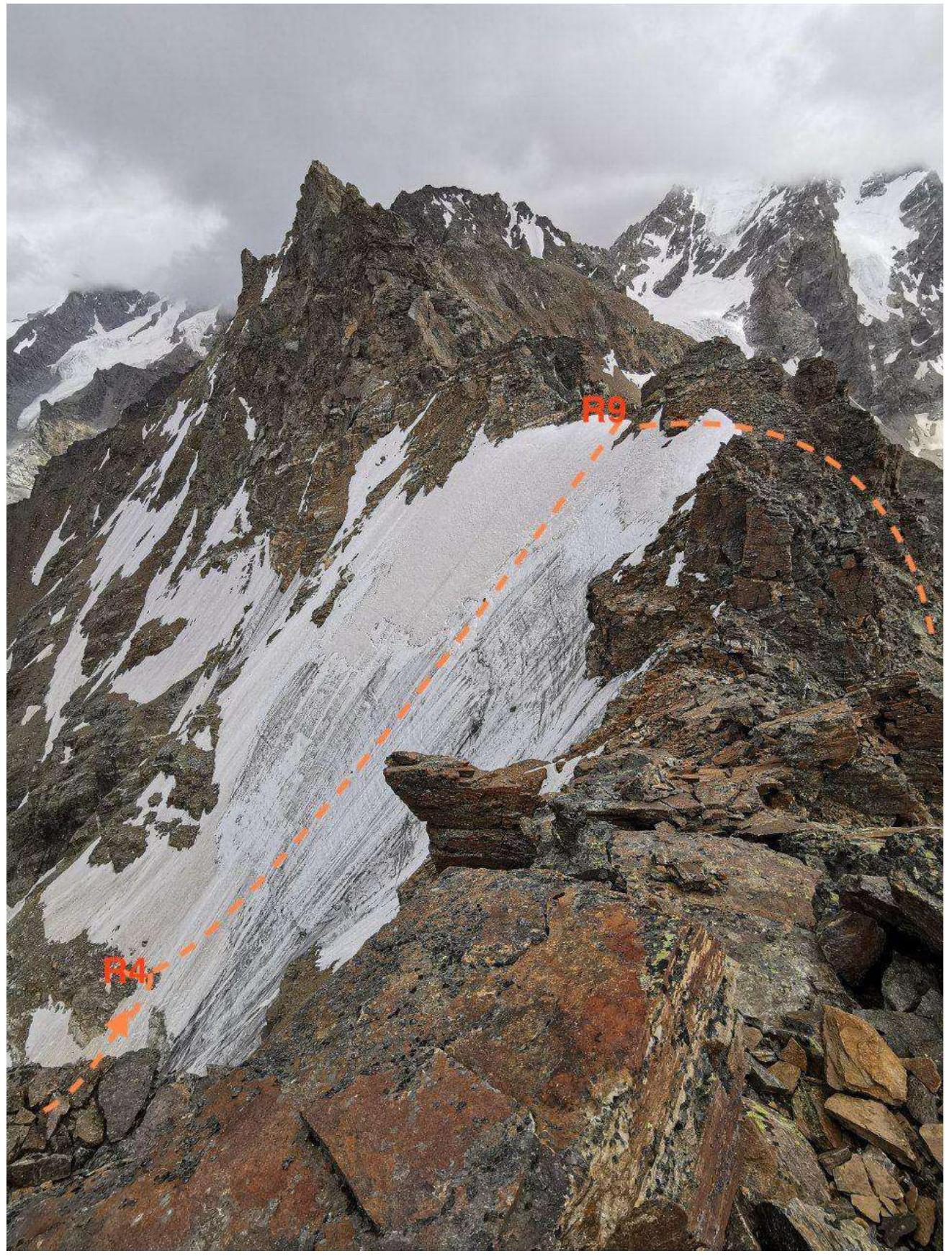
| R8–R9 | 60 m, firn 35°, cat. diff. 2, exit to the ridge. | Photo 6 |
| R9–R10 | Snow ridge, from which there is a deviation to the SE slope along a ledge and further exit along simple scree ledges to the summit of Treugolnik, approach from SW. | Photo 7 Photo 8 |
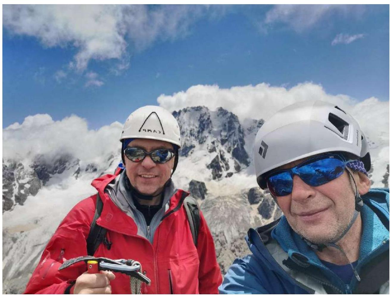
3.2. Photo of the team on the summit with the control tour
3.3. Route Assessment.
The route is an order of magnitude more complex than the popular 2B route to v. Shogentsukova, more extensive, intermediate between Dzhailyk 4A and Shogentsukova, but still not 3B. The ice is of good quality. Recommended for sports groups. Before reaching the ice, one needs to move quickly and simultaneously along a fairly steep snowy slope. Traverse three ropes to the left and up without hindrance. Further, to the ridge, one can move at a relaxed pace. We left Ullutau camp at 3:15 AM; we recommend (if from camp to camp) starting 2 hours earlier to be under the route at dawn.
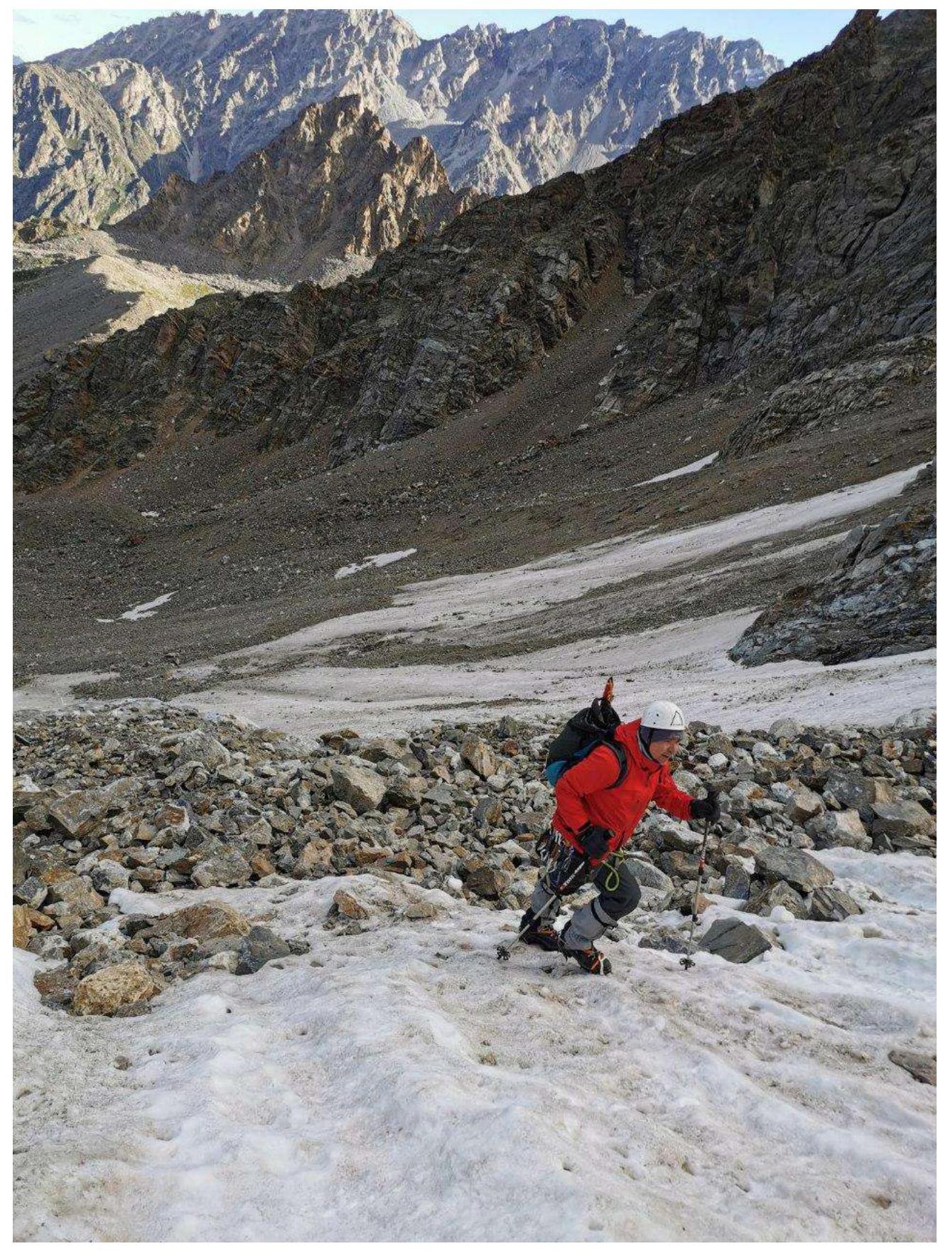
Photo 1. Start of the route.
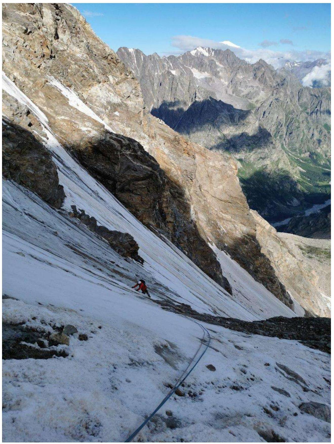
Photo 2. R1–R2
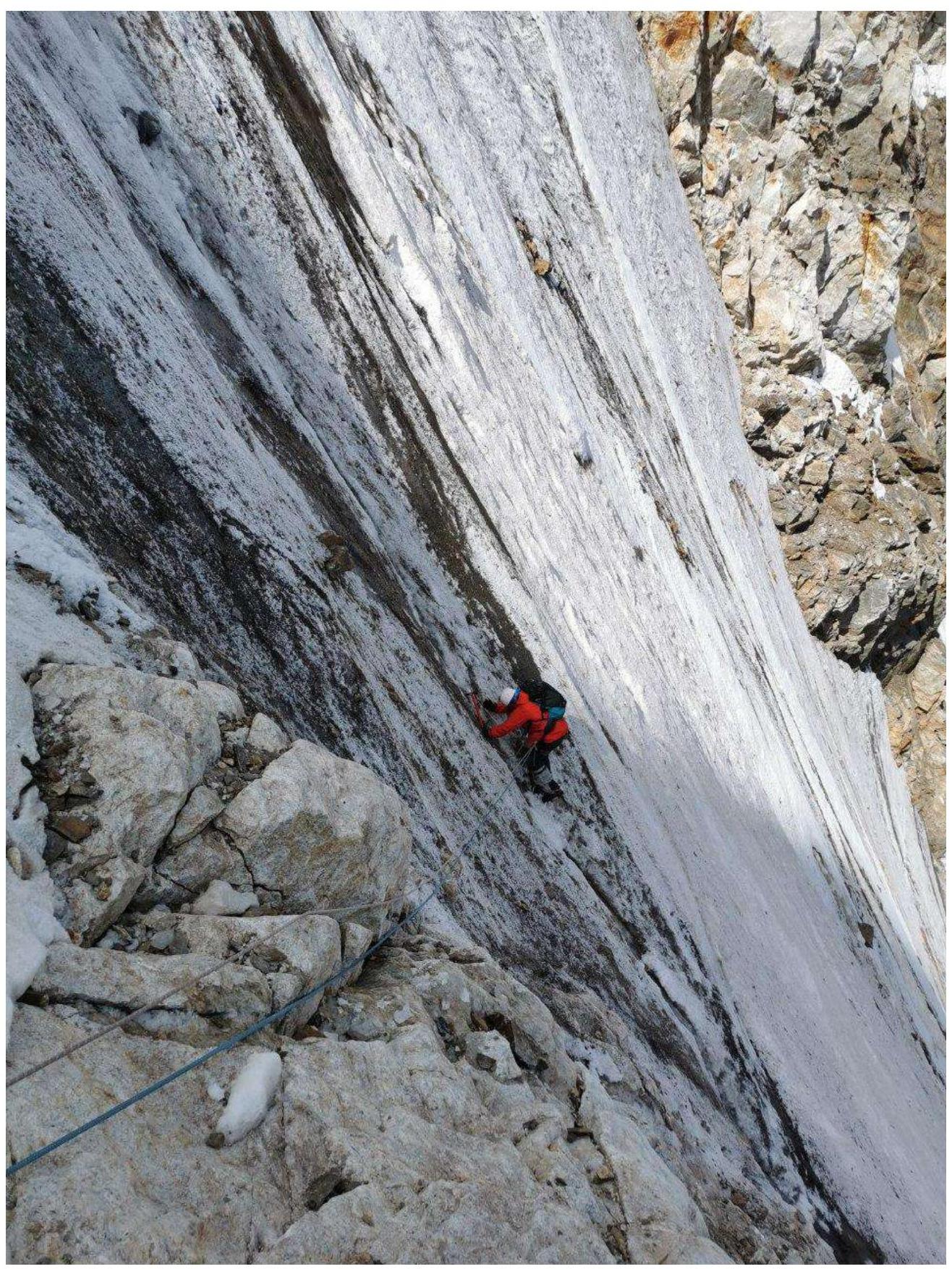
Photo 3. R3–R4
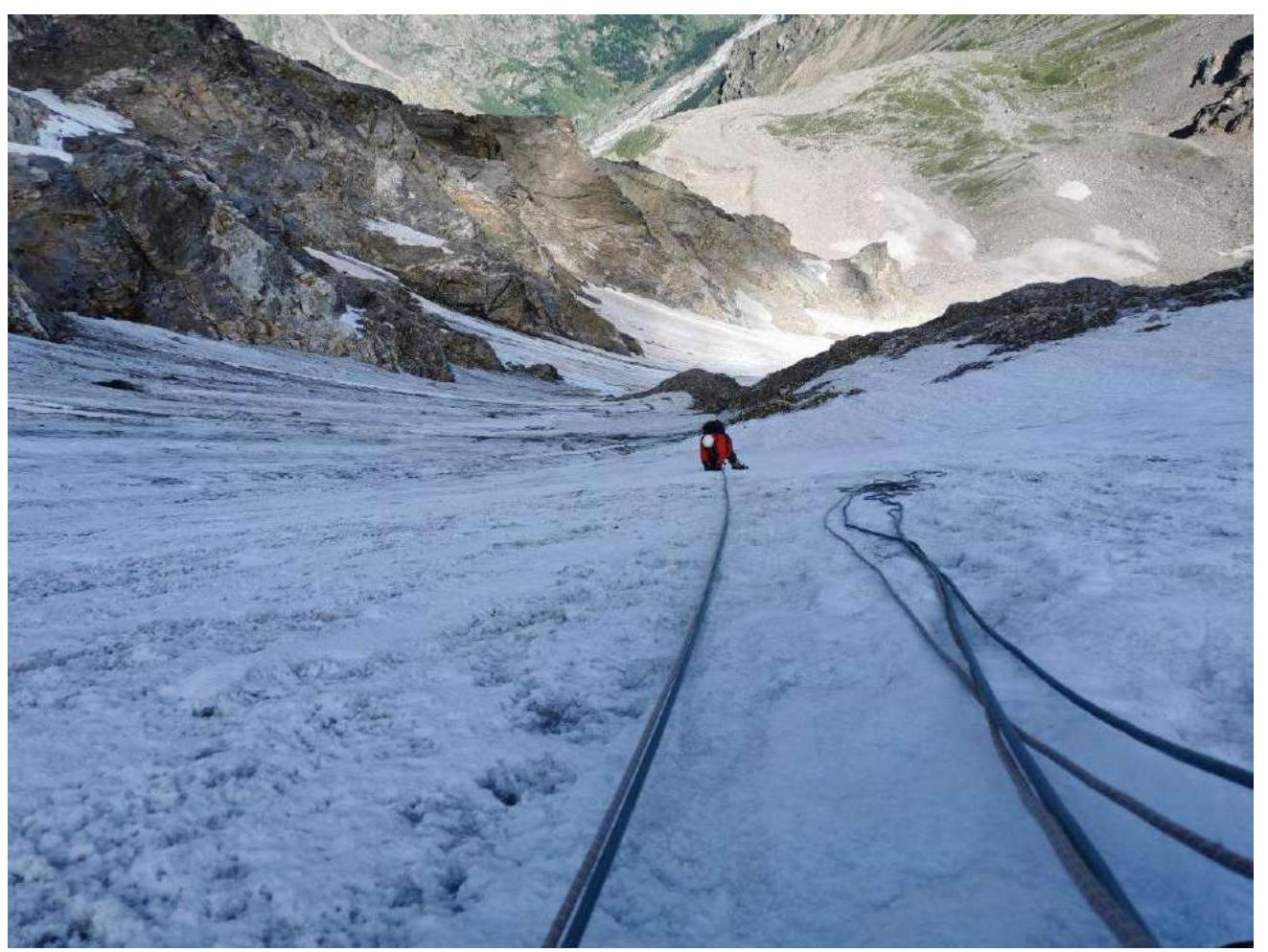
Photo 4. R4–R6
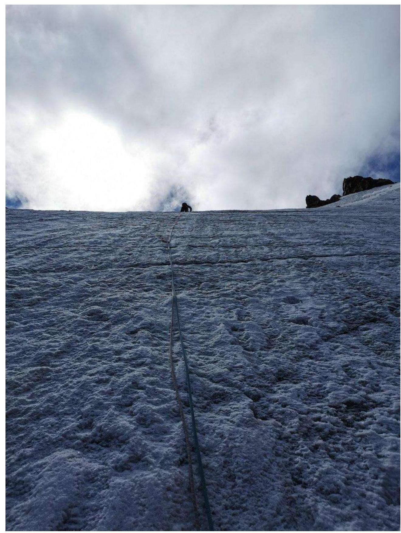
Photo 5. R6–R7.
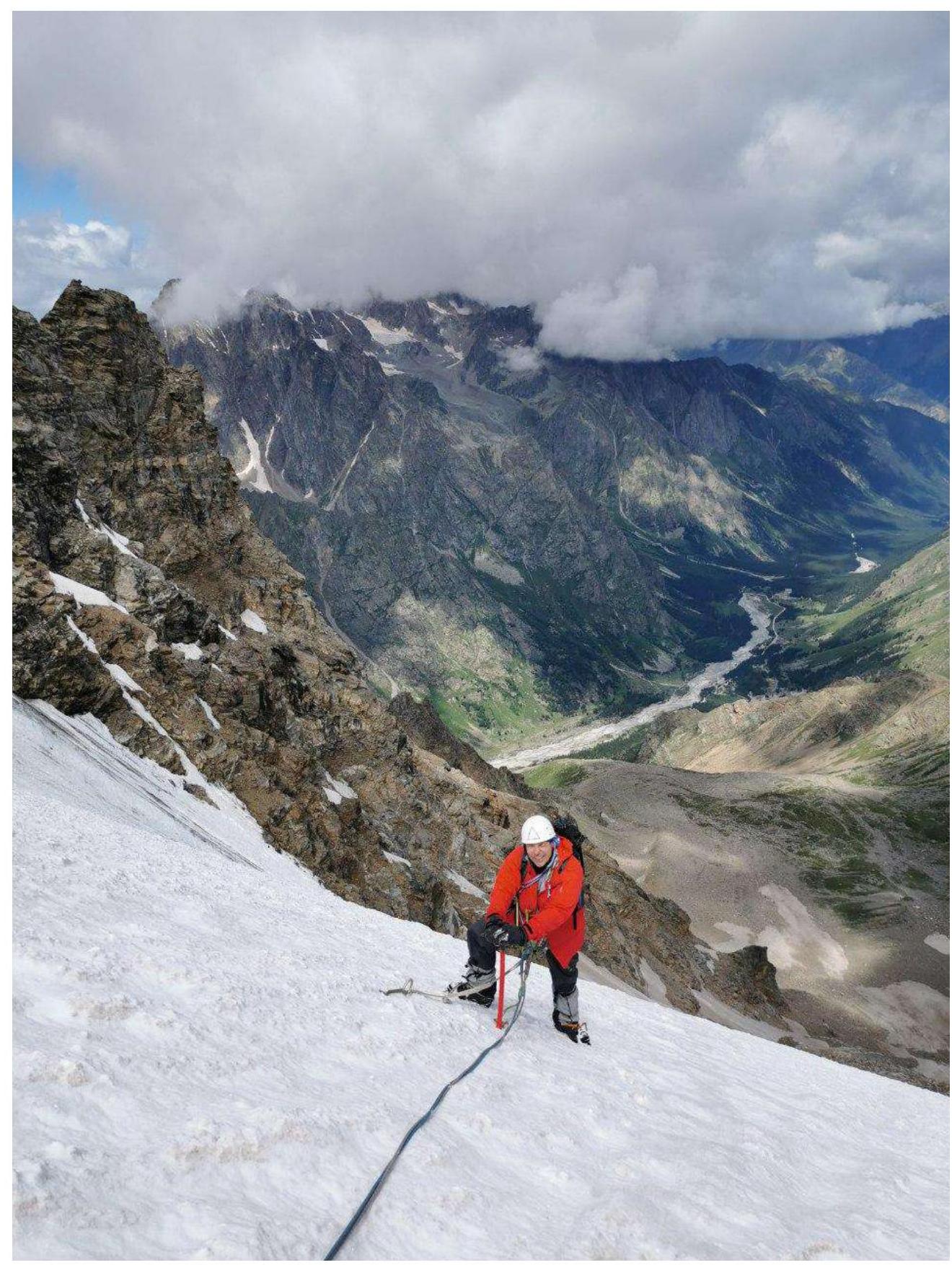
Photo 6. R9

Photo 7. Ridge.
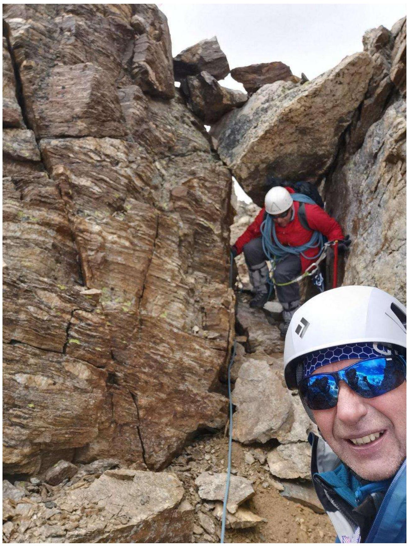
Photo 8. Exit from the ridge along a ledge to the SE slope.

Summit July 24, 2022