Ascent Passport
- Kullumkol gorge (eastern branch of Adyr-su gorge). According to the 2008 classification table 2.4.1.
- Peak Shogentsukova, 4081 m, via the northern slope.
- Proposed — Category III difficulty, first ascent
- Route character — ice and snow
- Height difference of the route: (by altimeter or GPS) Altimeter and GPS are not used. Route length: technical part of the route 210 m, total route length 450 m. Section lengths: Category V difficulty — 4 m (ice wall 70–80° at the beginning of the technical part of the route), Category VI difficulty — 0 m. Average steepness: main part of the route — 48°; total route — 32°.
- "Streams" (pitons) left on the route:
All ice screws (10 pieces) are removed.
- Team's walking hours: 9 hours 30 minutes, 2 days (including approach to the bivouac)
- Leader: Zhigir Sergey Petrovich, Candidate Master of Sports
Participants:
- Kalashnikov Alexander Vladislavovich, 1st sports rank
- Popenko Vladimir Dmitrievich, 1st sports rank
- Coach: Zhigir Sergey Petrovich, Candidate Master of Sports
- Departure from Base Camp to bivouac: 12:30, August 12, 2012.
Route started: at 7:30, August 13, 2012. Reached the summit: 13:00, August 13, 2012. Return to bivouac: 17:00, August 13, 2012. Return to Base Camp: 20:30, August 13, 2012. Descent from the summit: via the northern ridge to the saddle between Peak Shogentsukova and Tyutyu-Vostochnaya, then to the Zapadny Djailyk glacier. Descent via the ascent route with self-arrest using ice screws is possible.
-
Organization: AUSB "Ullutau"
-
Responsible for the report: Kalashnikov Alexander. Email address: alekrise@gmail.com. Phone numbers in Kiev:
- 38-067-5058642 (mobile)
- 38-044-2960714 (landline) (38 — international code of Ukraine)
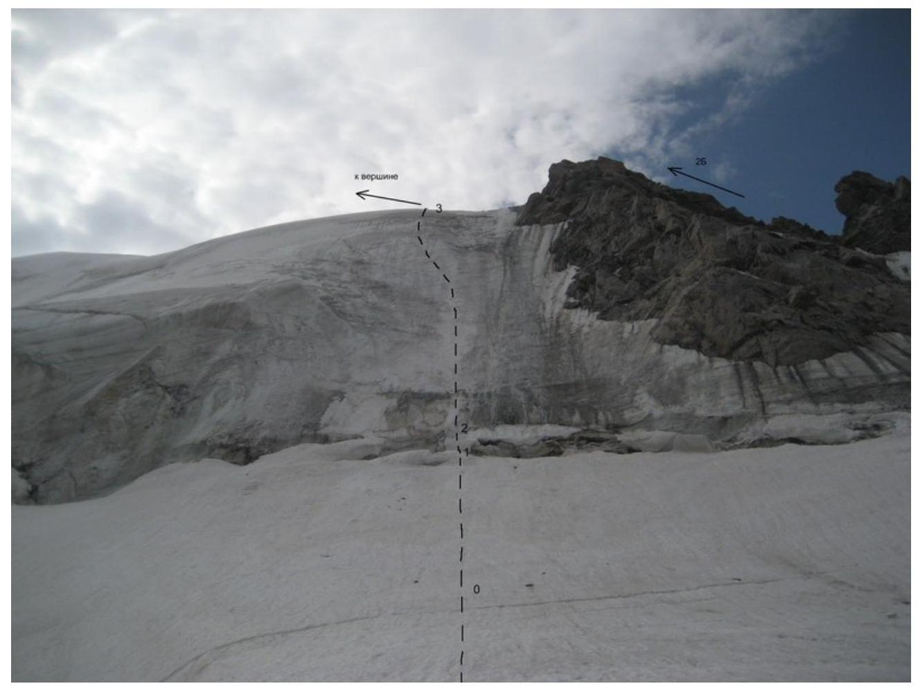
The image on the right shows the Category 2B route on Peak Shogentsukova via the Southern ridge. August 13, 2012
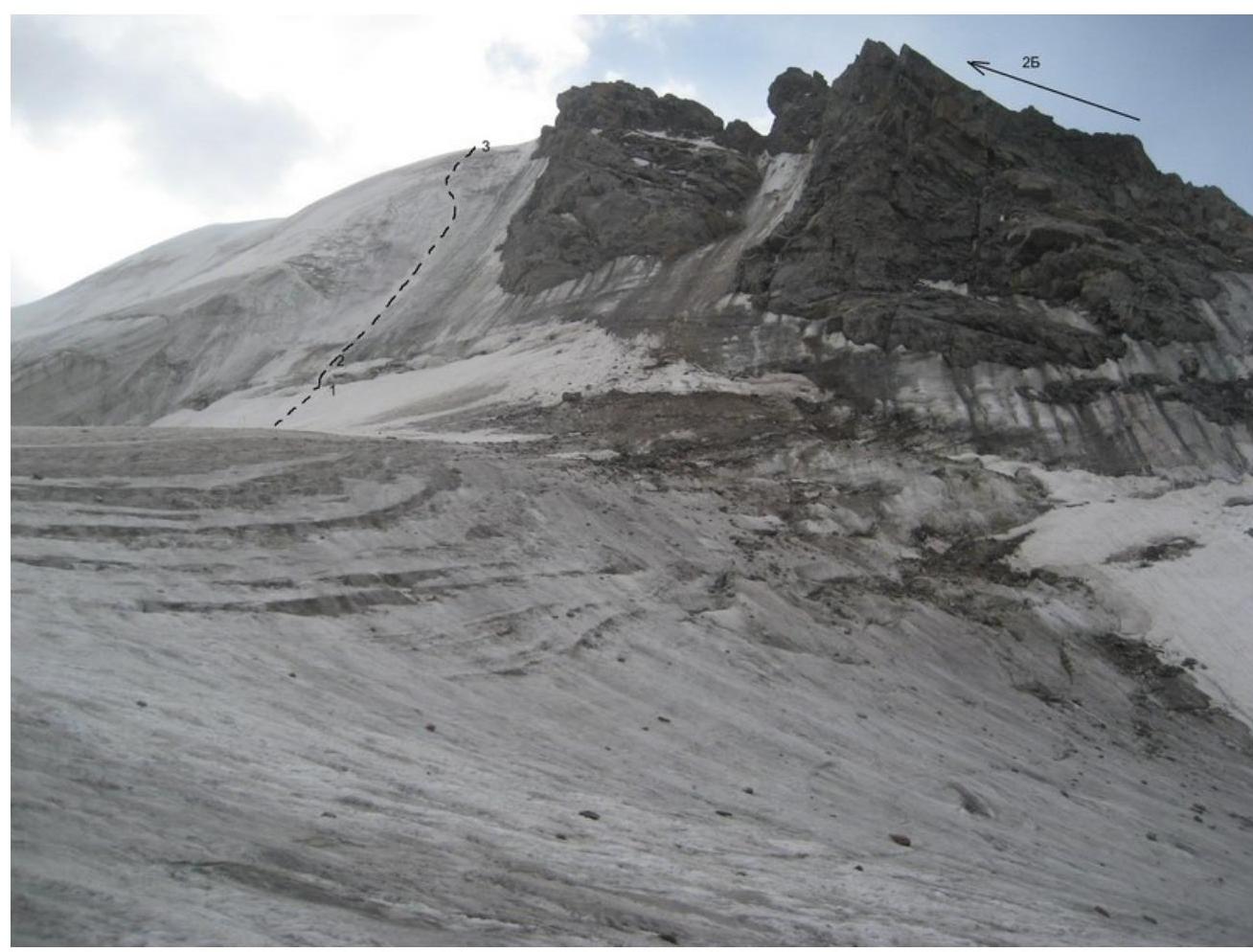
View of the route from below on the right. August 13, 2012
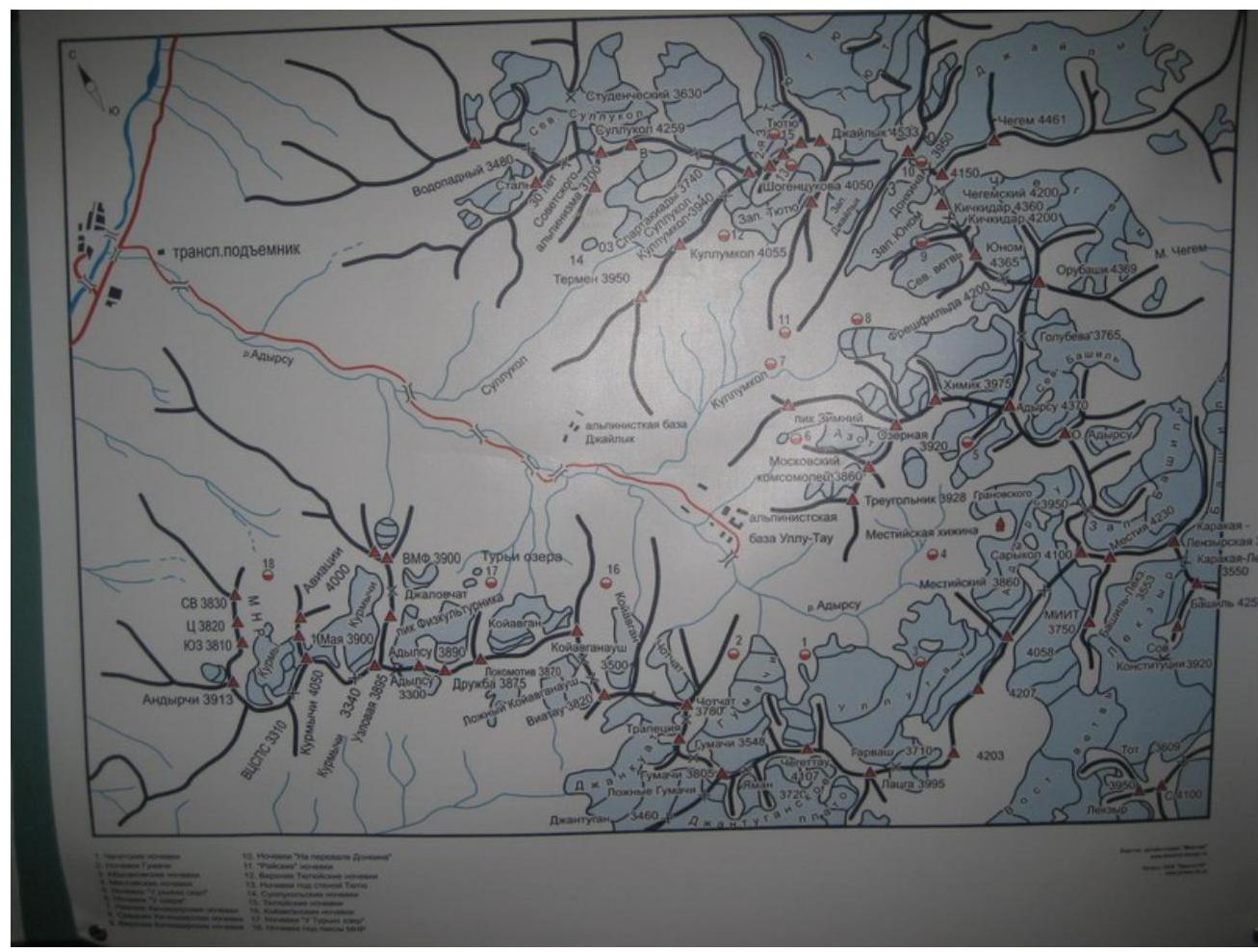
Map of the area
| Section # | Length | Steepness | Terrain character | Difficulty category | Number of pitons |
|---|---|---|---|---|---|
| 0-1 | 100 | 20 | snow-ice | I | 0 |
| 1-2 | 4 | 70-80 | ice | V | 2 |
| 2-3 | 206 | 45-53 | ice | III | 8 |
| 3-4 | 150 | 15-30 | snow-ice ridge | II | 0 |
Description. From the initial bivouac at "Rayskie nochi" (Paradise nights), ascend via the trail to the shoulder of Peak Shogentsukova. From there, descend to the Zapadny Djailyk glacier and ascend along it to the cirque opposite the route, which is located between the ridge of "baranchikh lbov" (ram's foreheads) on the right and the icefall on the left (there are no rocky outcrops to the left and above the route).
Route sections:
- Section R0–R1: along the gentle slope, approach 100 m to the bergschrund.
- Section R1–R2: from the snow-ice plug of the bergschrund — overcoming the practically vertical ice wall of its upper edge, 4–5 m.
- Section R2–R3: ice slope with increasing steepness from 45° to 53°, the last 20 m — steepness decreases.
- Section R3–R4: to the left towards the summit, 150 m along the snow-ice ridge with variable steepness from 15° to 30°.
Throughout the entire route, it is safe from falling rocks and ice. The route is not long, but the difficulty of its technical part fully corresponds to Category IIIA.
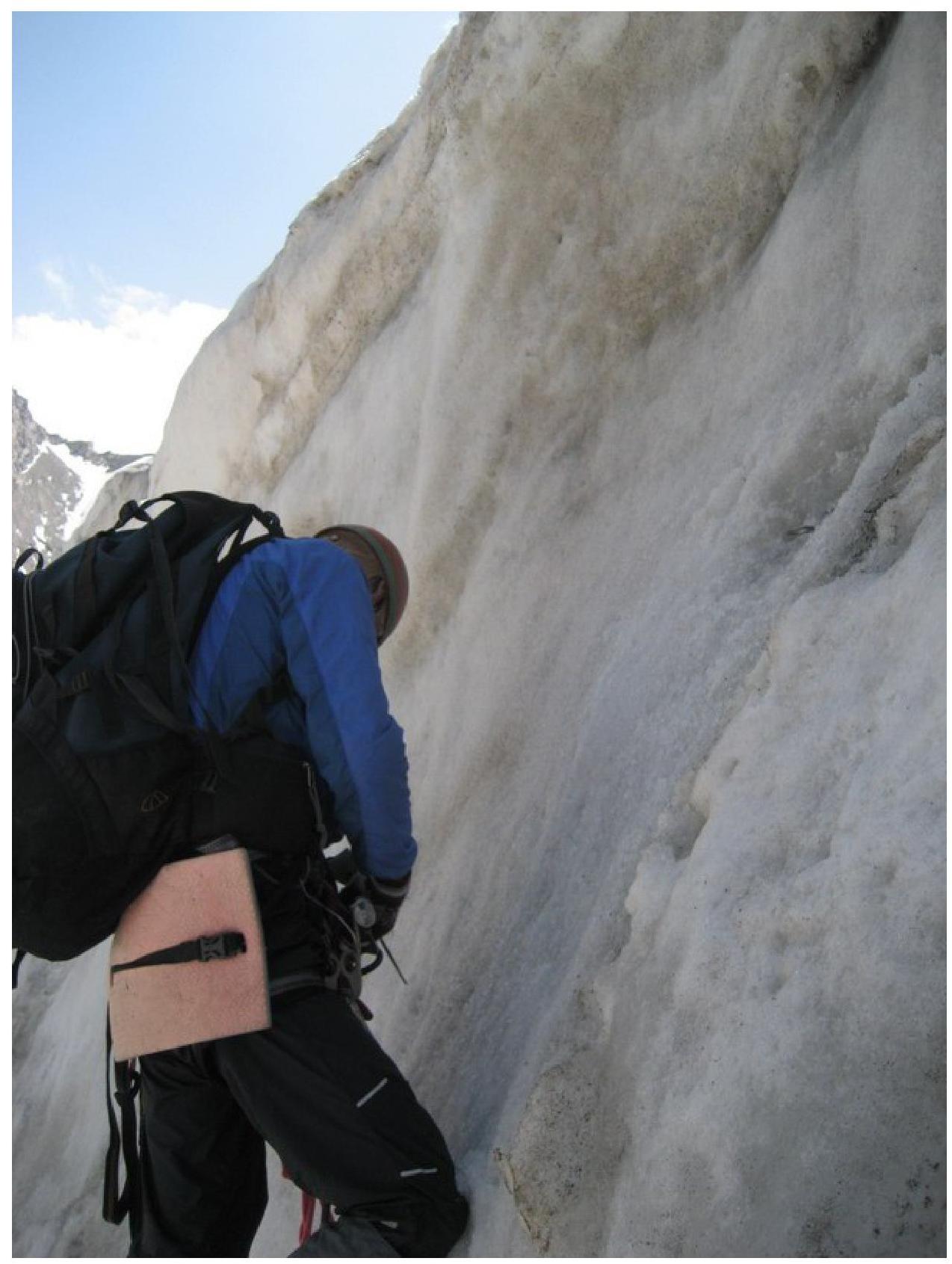
Ice wall, section
R1–R2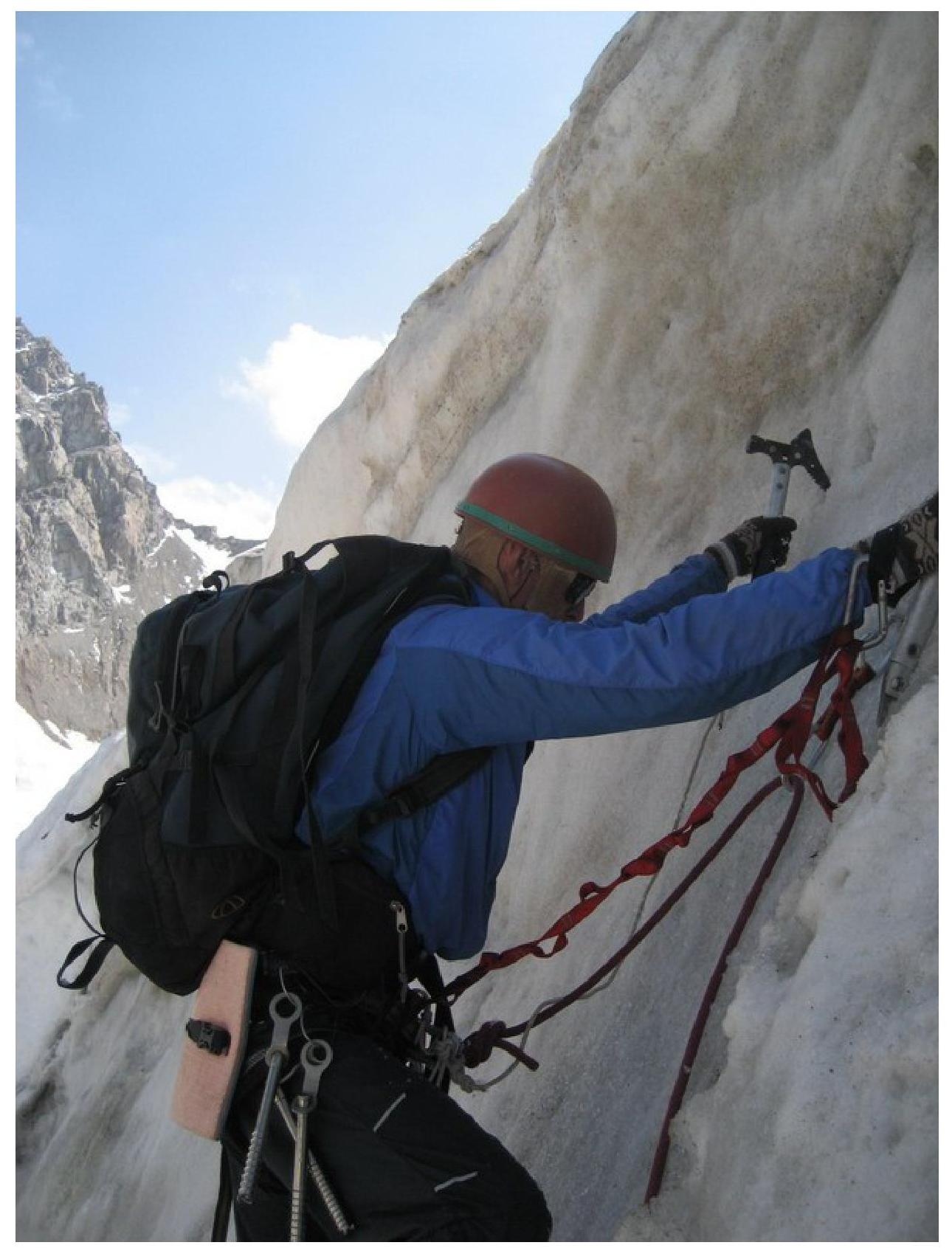
Passing the ice
wall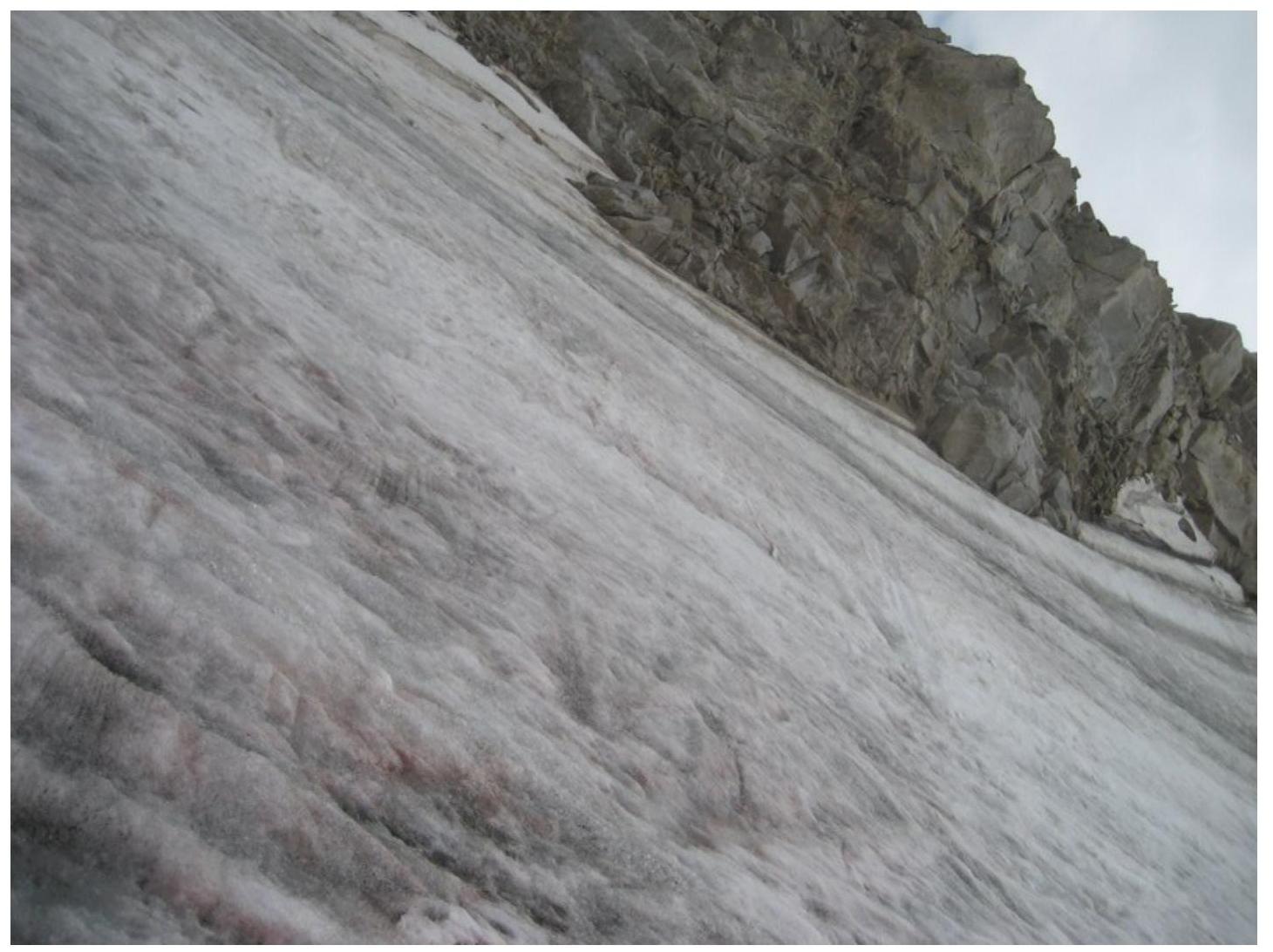
Uppermost steep part of the slope