Report
on the ascent to Chegem peak via the Forostyan route, 6A category of complexity, by the team from the Demchenko Alpine Club, Moscow Region, August 4–6, 2020 
1. Ascent Report
| 1. General Information | ||
|---|---|---|
| 1.1 | Full name, sports rank of the leader | Danila Sergeyevich Shcheglov, 1st sports rank |
| 1.2 | Full name, sports rank of participants | Danila Sergeyevich Shcheglov, 1st sports rank, Sergey Yevgenyevich Osokin, 1st sports rank, Dmitry Yevgenyevich Pivikov, Master of Sports, Artyom Sergeyevich Kryuchkov, 1st sports rank |
| 1.3 | Full name of the coach | Elena Valentinovna Kuznetsova, Candidate Master of Sports |
| 1.4 | Organization | CSKA named after Demchenko |
| 2. Characteristics of the Ascent Object | ||
| 2.1 | Region | Central Caucasus |
| 2.2 | Valley | Chegem Valley |
| 2.3 | Section number according to the classification table | Section No. 2.4 of the route classifier for mountain peaks, item – 2.4.1. |
| 2.4 | Name and height of the peak | Chegem, 4351 m |
| 2.5 | Geographical coordinates of the peak, GPS coordinates | – |
| 3. Characteristics of the Route | ||
| 3.1 | Route name | via the NE wall of the NE ridge (Forostyan route). |
| 3.2 | Category of complexity | 6A |
| 3.3 | Degree of route exploration | – |
| 3.4 | Terrain characteristics of the route | Rock |
| 3.5 | Elevation gain of the route | 1200 m |
| 3.6 | Route length | 1700 m |
| 3.7 | Technical elements of the route (length of sections with different category of complexity) | V category of complexity rocks – 300 m, VI category of complexity rocks – 220 m |
| 3.8 | Average steepness of the route, (°) | 45° |
| 3.9 | Average steepness of the main part of the route, (°) | 90° |
| :--: | :--: | :--: |
| 3.10 | Descent from the peak | via 2B to the Maly Chegem Valley |
| 3.11 | Additional characteristics of the route | The route is safe and logical, with a simple pedestrian descent. |
| 4. Characteristics of the Team's Actions | ||
| 4.1 | Time of movement (climbing hours) | 1 day of processing, 2 days of route passage and descent to the base camp |
| 4.2 | Overnights | 2 overnights at campsites, 1 on the route (R21) |
| 4.3 | Departure for route processing | 11:00 on August 4, 2020 |
| 4.4 | Departure for the route (from campsites) | 5:00 on August 5, 2020 |
| 4.5 | Arrival at the peak | 13:45 on August 6, 2020 |
| 4.6 | Return to the camp (to campsites) | 21:00 on August 6, 2020 |
| 5. Persons Responsible for the Report | ||
| 6.1 | Full name, e-mail | Danila Shcheglov d.scheglov@gmail.com, Sergey Osokin steady7go@gmail.com |
2. Description of the Ascent
1. Characteristics of the Ascent Object
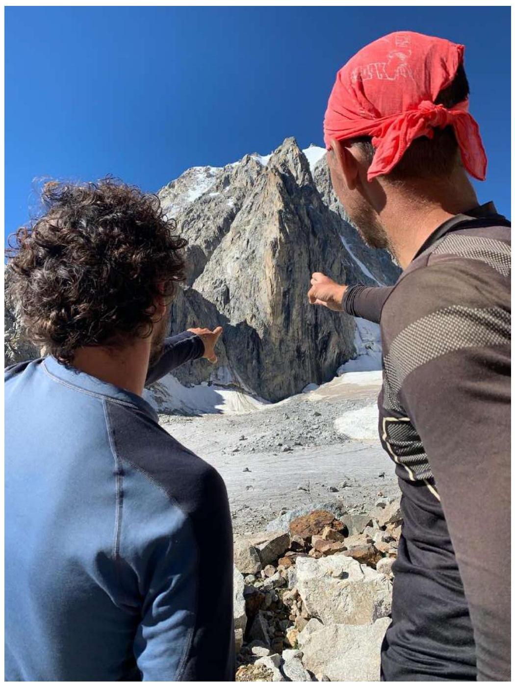
1.1. General Photo of the Peak
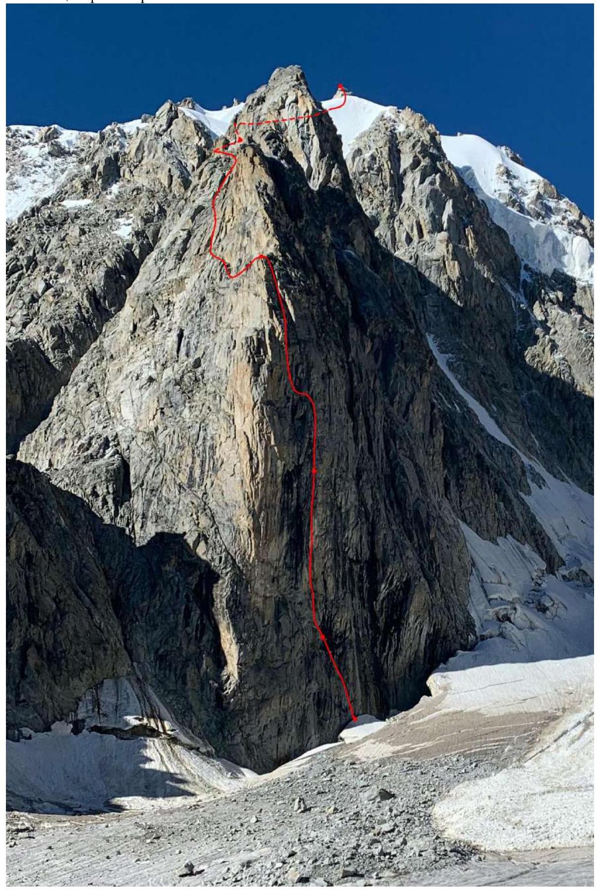 *The team's route is marked with a red line
3. Characteristics of the Team's Actions
3.1. Brief Description of the Route Passage
After acclimatization on routes from 3A to 5A in the neighboring Bezengi valley, due to poor conditions on the routes in this area, our team decided to move to the Chegem valley to climb the eponymous peak.
The Chegem area is quite well-studied and has one of the most technically interesting walls in the Caucasus - on the Chegem peak.
The wall is objectively safe and does not shed rocks like most technical routes in the Caucasus.
The area is not frequently visited due to the lack of proper infrastructure at the Bashil tourist base.
The main advantage, besides safety, is a fairly simple approach and descent from the peak, if you descend not via the classic options through the Donkin pass, but go down from the peak via route 2B to the East ridge towards the Maly Chegem valley.
On August 3, our team arrived at the Bashil tourist base close to night, as the road from the border post to the base is in poor condition. On August 4, prolonged preparations, reconnaissance of the trail, and consultations on the descent route led to a late departure from the Bashil tourist base. We managed to leave the tourist base around 14:00. We spent the night under the glacier and approached the moraine opposite our route around 10:00 in the morning. After a short preparation on the moraine, at 11:00, the Osokin-Pivikov team went to process the lower three ropes.
The next day, August 5, we passed the 3 fixed ropes and reached the overnight stay after the third control point by mid-day, where we comfortably spent the night on a wide, long terrace.
On the next day, August 6, 2020, after passing the remaining ropes and the snow-ice ridge, the team reached the peak at 13:45. We started descending from the peak at 14:00 and, having survived an attack by grazing bulls, returned to the Bashil tourist base by 21:00.
4. Route Description
4.1. Route Thread

4.2. UIAA Scheme of the Wall Part of the Route
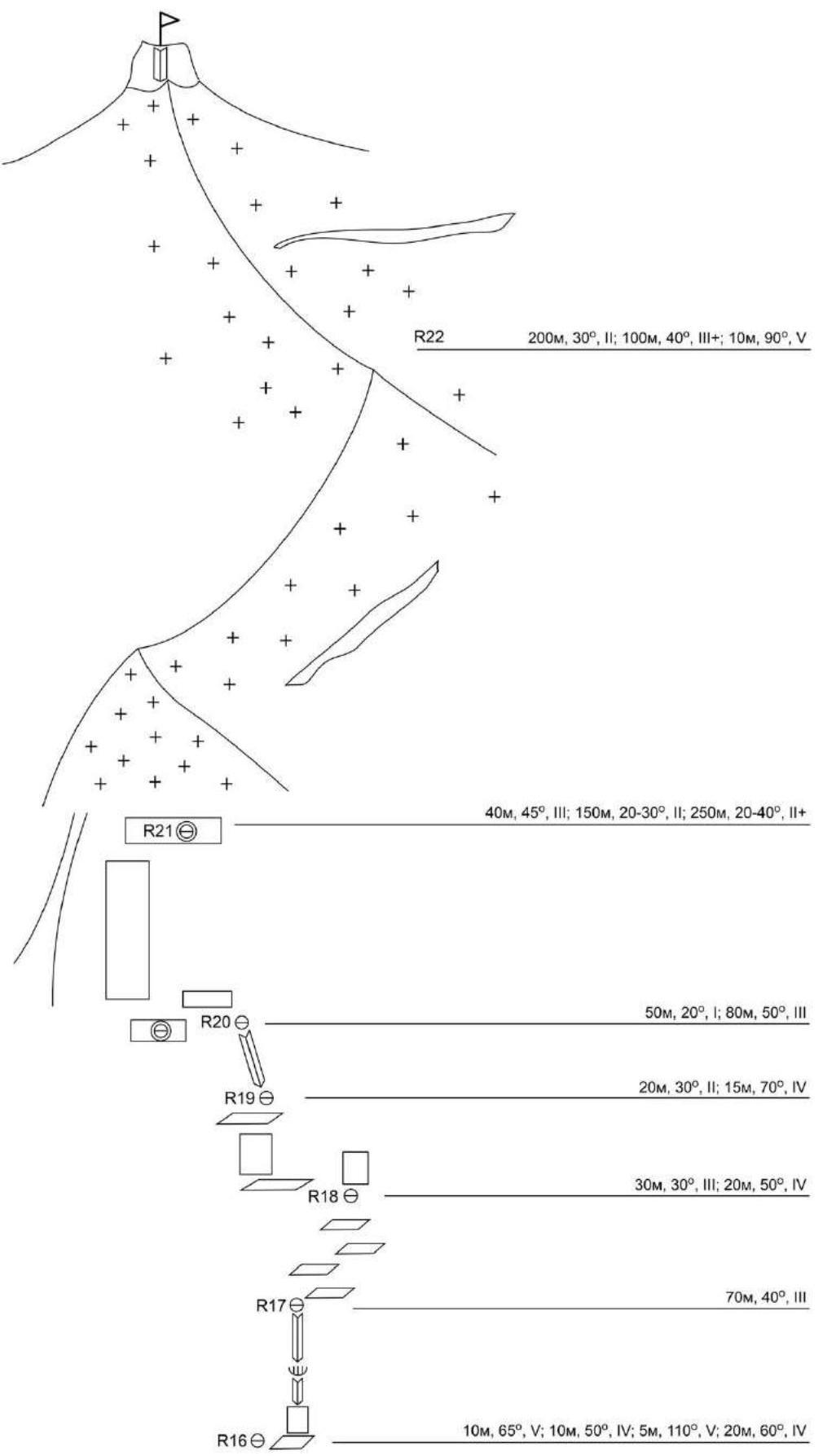
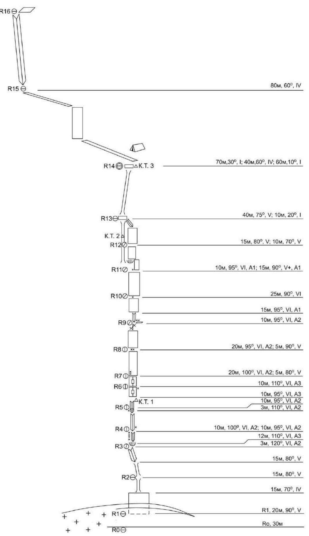 R22: 200 m, 30°, II; 100 m, 40°, III+; 10 m, 90°, V
R21: 40 m, 45°, III; 150 m, 20–30°, II; 250 m, 20–40°, II+
R20: 50 m, 20°, I; 80 m, 50°, III
R19: 20 m, 30°, II; 15 m, 70°, IV
R18: 30 m, 30°, III; 20 m, 50°, IV
R17: 70 m, 40°, III
R16: 10 m, 65°, V; 10 m, 50°, IV; 5 m, 110°, V; 20 m, 60°, IV
R15: 70 m, 30°, I; 40 m, 60°, IV; 60 m, 10°, I
R14, Control Point No. 3
R13: 40 m, 75°, V; 10 m, 20°, I
Control Point No. 2
R12: 15 m, 80°, V; 10 m, 70°, V
R11: 10 m, 95°, VI, A1; 15 m, 90°, V+, A1
R10: 25 m, 90°, VI
R9: 15 m, 95°, VI, A1; 10 m, 95°, VI, A2
R8: 20 m, 95°, VI, A2; 5 m, 90°, V
R7: 20 m, 36 m, 100°, VI, A2; 5 m, 80°, V
R6: 10 m, 110°, VI, A3; 10 m, 95°, VI, A3; 10 m, 95°, VI, A2; 3 m, 110°, VI, A2
Control Point No. 1
R5: 10 m, 100°, VI, A2; 10 m, 95°, VI, A2; 12 m, 110°, VI, A3; 3 m, 120°, VI, A2
R4: 15 m, 80°, V
R3: 15 m, 80°, V
R2: 15 m, 70°, IV
R1: 20 m, 90°, V
R0: 30 m
R22: 200 m, 30°, II; 100 m, 40°, III+; 10 m, 90°, V
R21: 40 m, 45°, III; 150 m, 20–30°, II; 250 m, 20–40°, II+
R20: 50 m, 20°, I; 80 m, 50°, III
R19: 20 m, 30°, II; 15 m, 70°, IV
R18: 30 m, 30°, III; 20 m, 50°, IV
R17: 70 m, 40°, III
R16: 10 m, 65°, V; 10 m, 50°, IV; 5 m, 110°, V; 20 m, 60°, IV
R15: 70 m, 30°, I; 40 m, 60°, IV; 60 m, 10°, I
R14, Control Point No. 3
R13: 40 m, 75°, V; 10 m, 20°, I
Control Point No. 2
R12: 15 m, 80°, V; 10 m, 70°, V
R11: 10 m, 95°, VI, A1; 15 m, 90°, V+, A1
R10: 25 m, 90°, VI
R9: 15 m, 95°, VI, A1; 10 m, 95°, VI, A2
R8: 20 m, 95°, VI, A2; 5 m, 90°, V
R7: 20 m, 36 m, 100°, VI, A2; 5 m, 80°, V
R6: 10 m, 110°, VI, A3; 10 m, 95°, VI, A3; 10 m, 95°, VI, A2; 3 m, 110°, VI, A2
Control Point No. 1
R5: 10 m, 100°, VI, A2; 10 m, 95°, VI, A2; 12 m, 110°, VI, A3; 3 m, 120°, VI, A2
R4: 15 m, 80°, V
R3: 15 m, 80°, V
R2: 15 m, 70°, IV
R1: 20 m, 90°, V
R0: 30 m
4.3. Technical Description of the Route
From the bivouac on the moraine to the start of the route - through the glacier. The start of the route is under a large ranchor.
R0–R1 (30 m, IV–V, 90°). From the bivouac on the moraine to the start of the route - through the glacier. The start of the route is in a large ranchor. The distance between the snow-ice edge and the wall opposite the route is 2–2.5 m. It is possible to descend to the bottom of the ranchor directly opposite the route or 30 m to the left. Overcome the ranchor by descending a few meters down and swinging to the rock wall. Climb and IT straight up to the level of the glacier. Apparently, due to the general melting, the ranchor becomes wider each year, and the first dozen meters of climbing occur on terrain with a lot of loose material, despite the steepness.
R1–R2 (35 m, A2, VI, 90°). Climb straight up with complex climbing along a wet, overhanging, icy crack using IT to rise from the ranchor. Then move straight up, under the black overhanging rocks, through 15–20 m, a shackle above a small shelf. Station on a shelf under a vertical inner corner, suitable for a large black cornice. Fifths, hooks, friends, placements.
R2–R3 (30 m, V, 80°). Climb a complex chimney, then along an inner corner 30 m under a characteristic triangular cornice. Hanging station. Fifths, hooks, friends, placements.
R3–R4 (25 m, A2–A3, VI, 95°–120°). Bypass the cornice on the left, IT. Then climb 15 m IT along a strongly overhanging inner corner. 4 stationary shackles. Fifths, hooks, friends, placements.
R4–R5 (30 m, A2–A3, VI, 95°–110°). Climb 20 m up along an overhanging inner corner, then move right to the next 15-meter overhanging inner corner. At the beginning of the corner, there is a plug (a shelf for one). Fifths, hooks, friends, placements.
R5–R7 (45 m, A2–A3, VI, 95°–110°). At the end of the corner, there is Control Point No. 1. 10 m of complex IT climbing along an overhanging crack. At the end of the section, there is a key point: Complex IT climbing along a strongly overhanging crack to a hanging station on a radish (10 m). Fifths, hooks, friends, placements.
R7–R9 (40 m, A2, VI, 95°–100°). From the station up along the crack to the top of the chip (the chip "hums", the top is "live"). Then - through overhanging walls and cracks (shackles are found). Vertically up IT along an overhanging wall 50 m. Exit right with free climbing to an inclined shelf for two. Station on two shackles. Fifths, hooks, friends, placements.
R9–R11 (25 m, A2, VI, 95°). 10 m IT climbing along an overhanging inner corner. 40 m up left along a complex, partially overhanging wall to a chip under a cornice. Station - a loop on the chip. Fifths, hooks, friends, placements.
R11–R13 (25 m, A1, V–VI, 80°–95°). Bypass the cornice on the right. To the right of a large chimney, climb a steep, initially overhanging complex wall to Control Point No. 2 (the control point is on the left in the chimney). Reach a convenient shelf along a steep inner corner made of large blocks. Fifths, hooks, friends, placements.
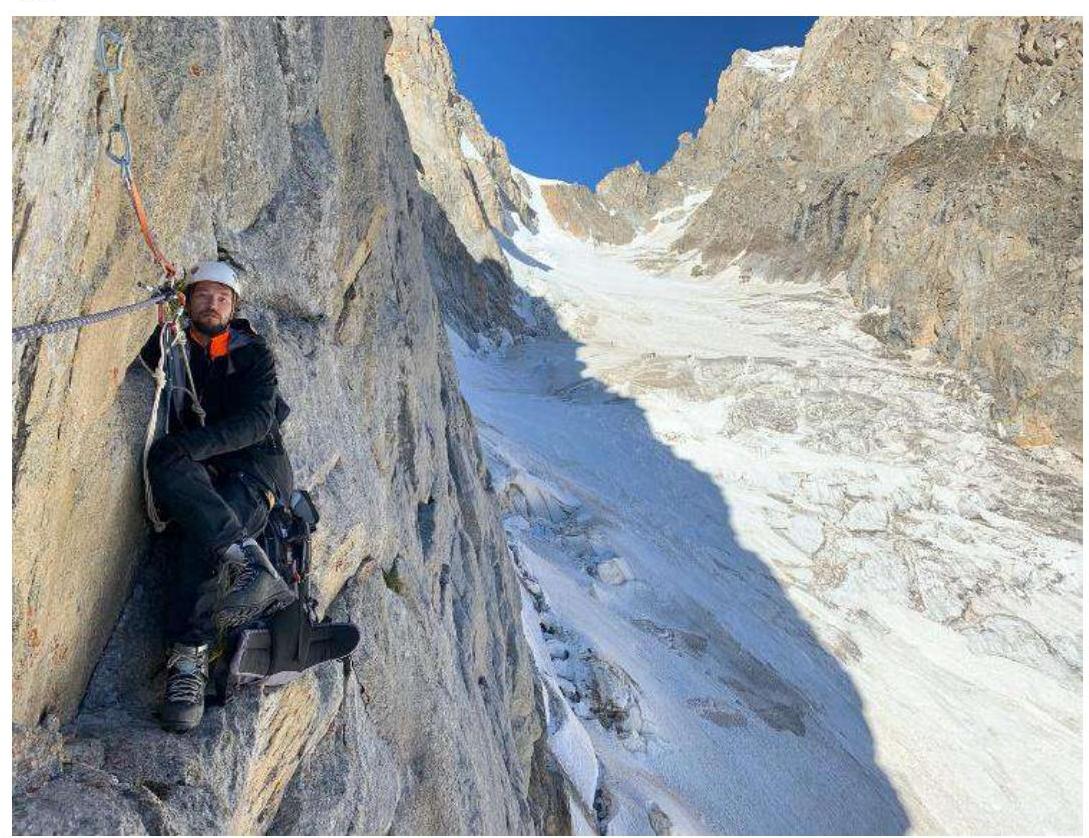
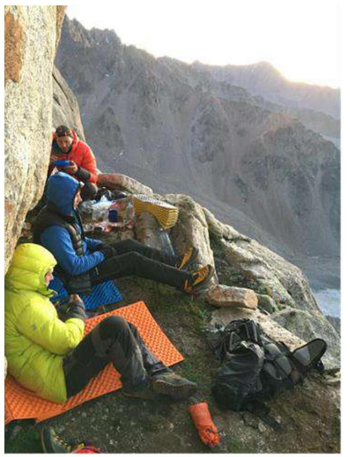
R13–R14 (40 m, V, 75°). From the shelf, a steep chimney leads to a large shelf with Control Point No. 3. The shelf has a comfortable overnight stay, with two large prepared areas for tents. Snow for cooking can be found in shaded areas if you move further along the shelf or higher on sections R16–R18. Hooks, friends, placements.
R14–R15 (150 m, IV, 60°). Traverse approximately 150 m along the left side of the Northeast rib along scree shelves. Between the shelves, there is a transition along a complex 40-meter wall. Bypass the first gendarme along simple scree shelves (150 m). Then climb up - left through rocks of medium difficulty (IV–V) to reach another large scree shelf (another approximately 150 m). At the far (left) end of the shelf, there is the beginning of a couloir (there are several areas for overnight stays on the scree shelves).
R15–R17 (80 m, IV, 60°). Climb up the right couloir to its narrowing, then 2–3 m left along a narrow shelf.
Along the dissected terrain, move left-up to the slabs at the base of a large overhanging block. Climb up-right along the slabs to the base of a narrow chimney, then climb 20 m along the chimney to reach a large flattening. Another section with potential problems if you have short ropes, as it will need to be divided into two 30-meter sections, since there is no convenient place for a station in the chimney.
R17–R21 (300 m, III–V, 60°–75°). Then climb up along narrow scree shelves, interrupted by walls, traverse 300 m along the left side of the 2nd gendarme to the snow-ice slope of the gendarme's shoulder. On the right part of the shelf, there is a terrace with a comfortable and safe place for three tents. In August, there is no snow on the terrace, so we made an exit to two ropes higher to the base of an inner corner, where we were able to collect a backpack full of snow. On August 6, 2020, at around 9:00, we left the bivouac on the terrace.
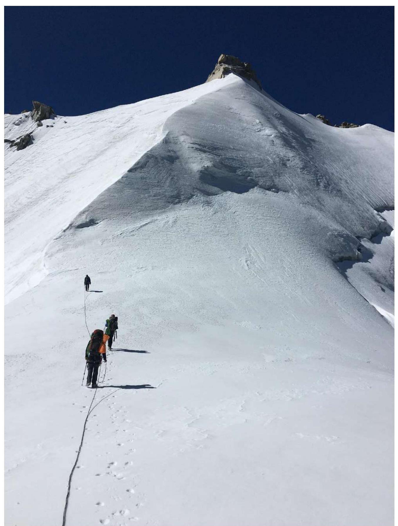
R21–R22 (500 m, III, 45°). Climb a 40-meter ice-snow slope to reach the saddle under the III gendarme. From the saddle, climb 150 m up-left along rocks of medium and above medium difficulty to the shoulder of the III gendarme. Station on an ice axe. From the shoulder, climb along an ice-snow ridgecrest to the Northeast rib. From here, climb along the ice-snow ridgecrest of the Northeast rib. There is a possible overnight stay on the shoulder, close to the peak.
R22–R23 (310 m, III–V, 30°–90°). Climb a 60-meter ice-snow ascent and then along a long ice-snow ridge to approach the rock pinnacle of the peak. Sometimes there may be difficulties with organizing protection (loose, unreliable ice, deep drops on both sides of the ridge). Reach the peak by climbing the right part of the pinnacle (quite complex climbing along icy rocks). Many loose rocks. Ice axes, hooks, friends, placements.
Descent via 2B along the East ridge towards the Maly Chegem valley and further descent along route No. 78 to the Bashil tourist base.
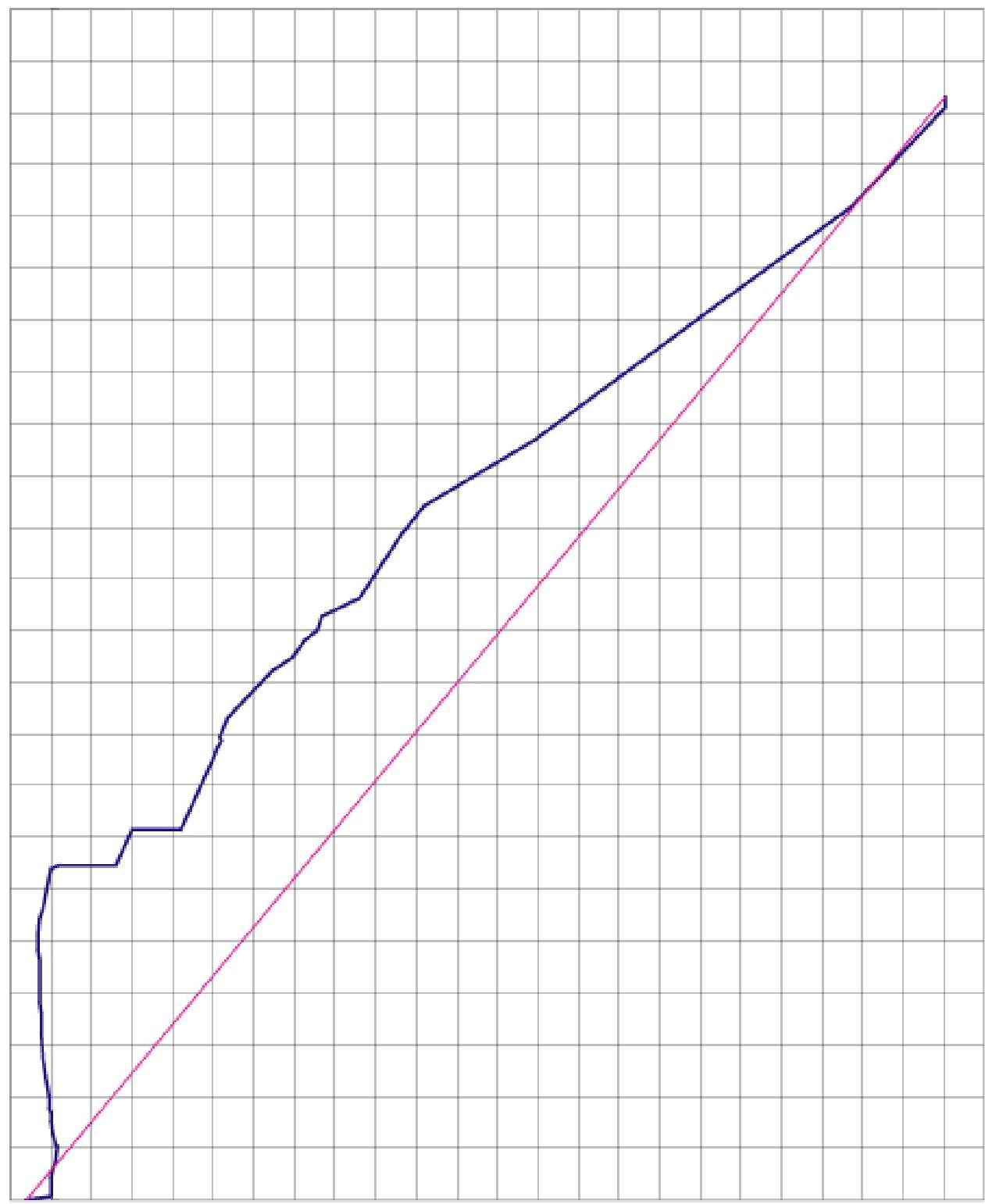
4.4. Route Profile
Route Profile
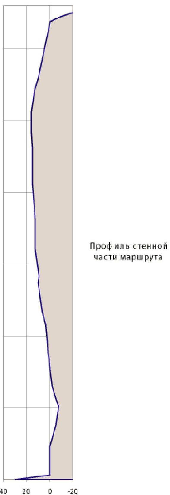
4.5. Profile of the Wall Part of the Route
4. Photo Report of the Route
1. Preparation Before Processing the Route
R0–R1
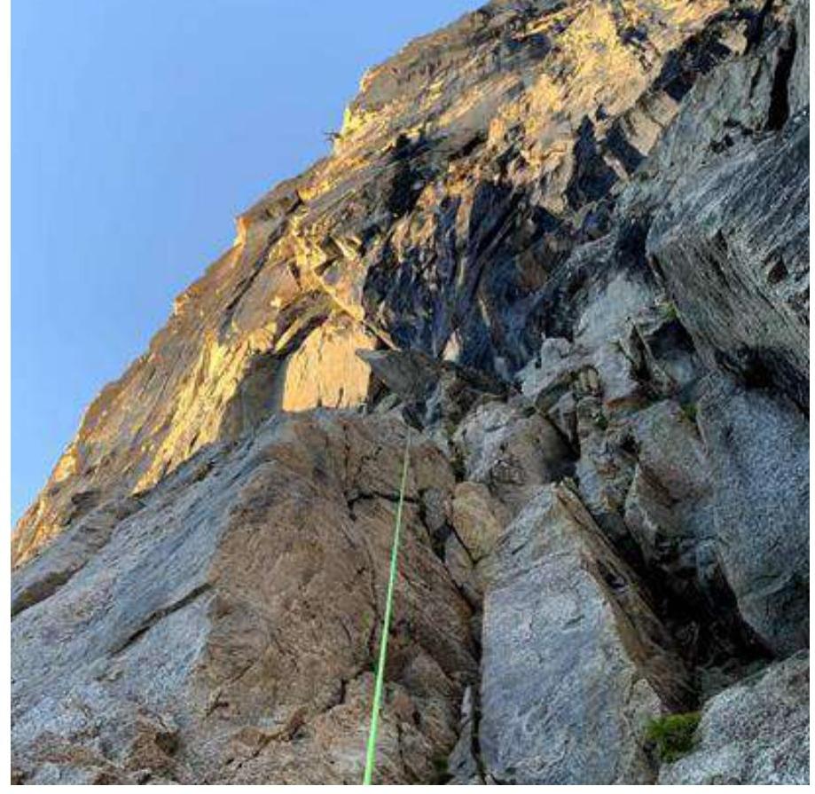
R2–R4

R4–R5
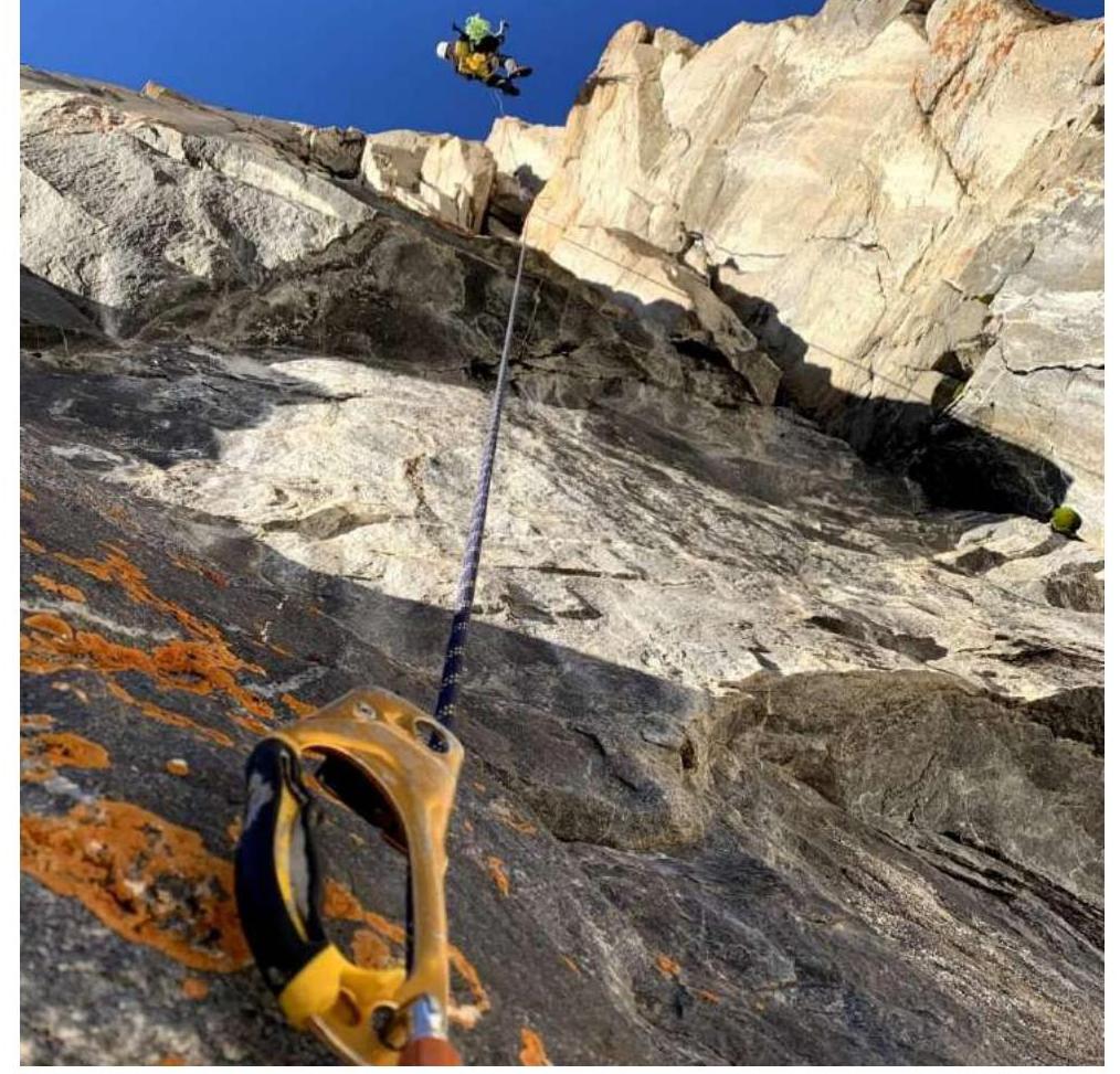
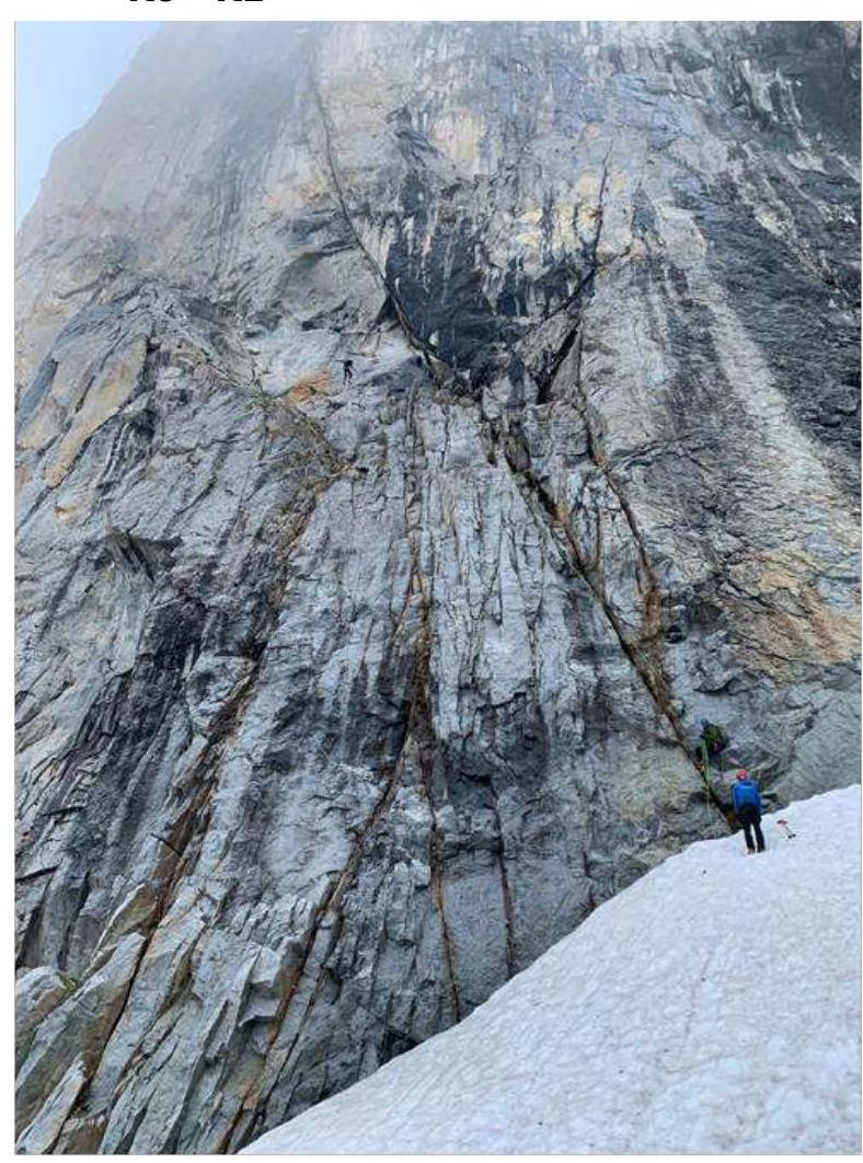
R7–R8
R8–R11
R11–R13
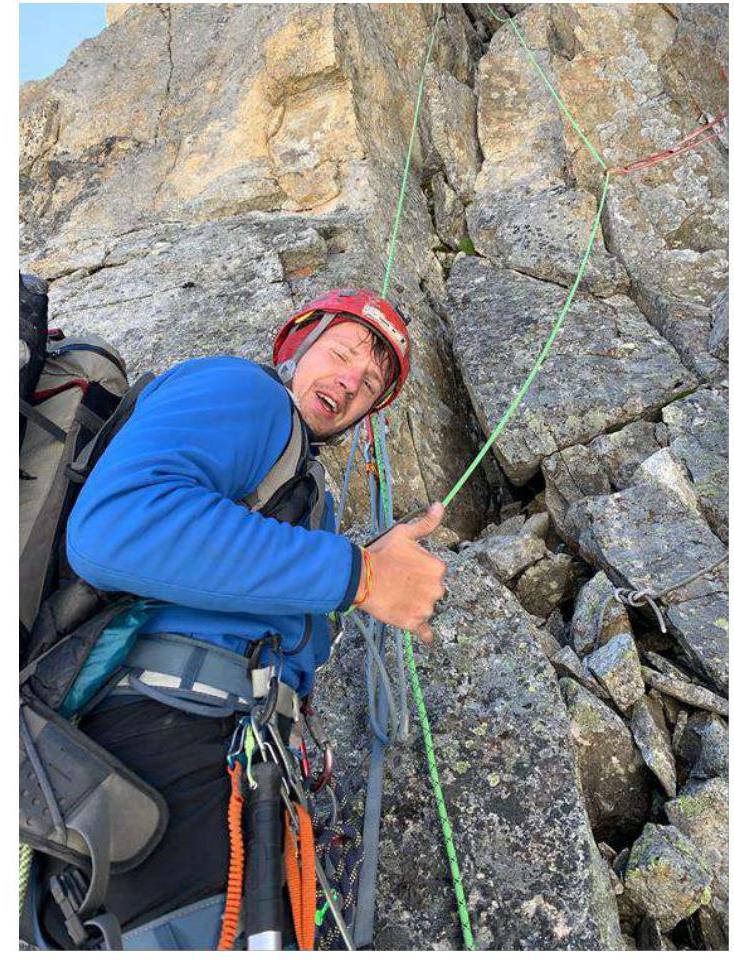
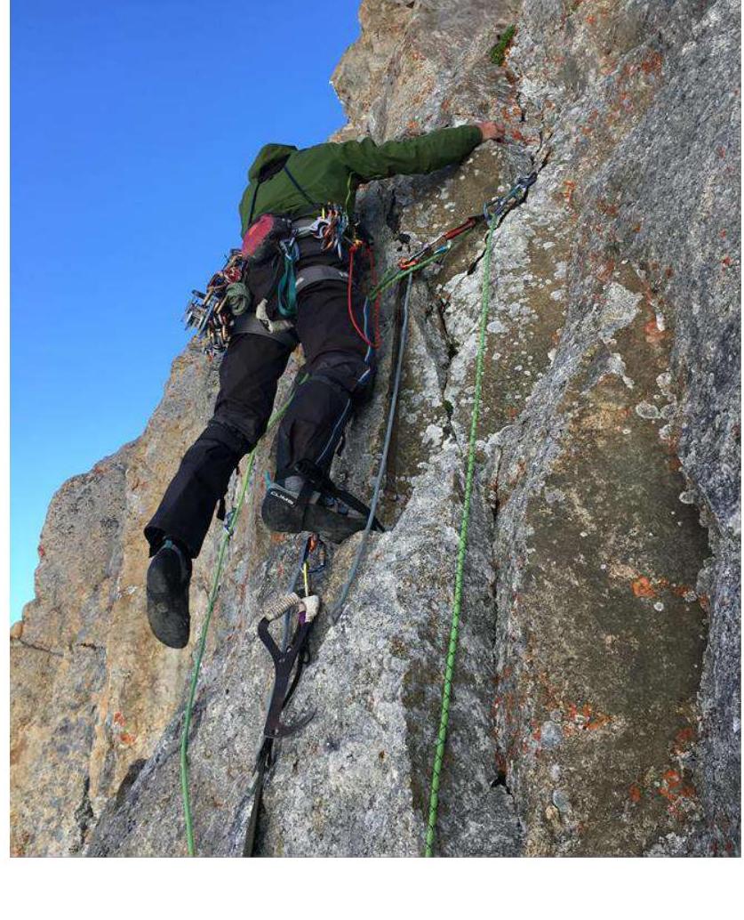
R17–R21
Pre-summit Ridge
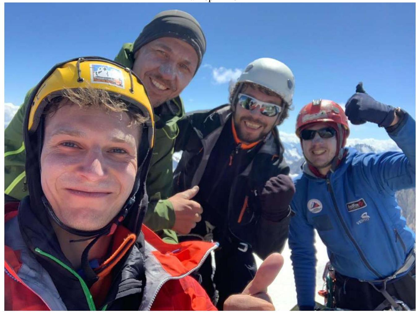
At the Peak
Removed Note
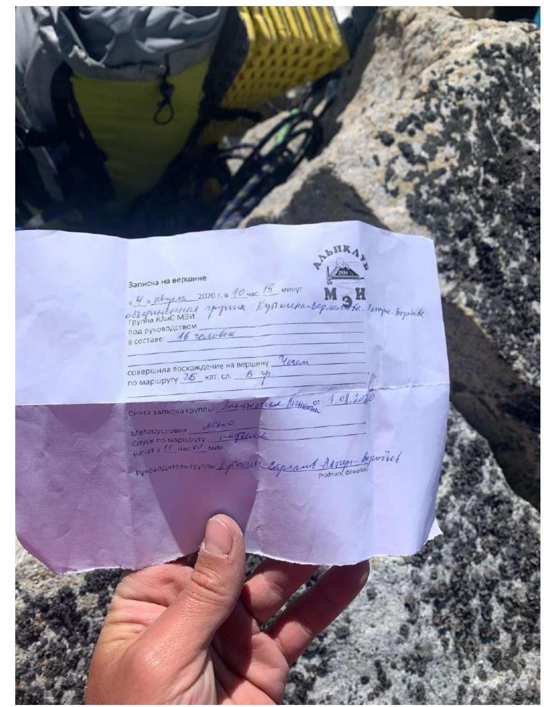 "Note on the Peak"
"August 4, 2020 at 10:15"
"Combined group Kutlik-Varlakov"
"Group KAIS MPEI led by"
"consisting of: 16 people"
"climbed Chegem peak"
"via route 2B category of complexity"
"Note taken from the group Lennon dated August 1, 2020"
"Weather conditions: clear"
"Descent via the route"
"started at 11:00"
"Group leader Kutlik-Varlakov" (signature, surname)
"Note on the Peak"
"August 4, 2020 at 10:15"
"Combined group Kutlik-Varlakov"
"Group KAIS MPEI led by"
"consisting of: 16 people"
"climbed Chegem peak"
"via route 2B category of complexity"
"Note taken from the group Lennon dated August 1, 2020"
"Weather conditions: clear"
"Descent via the route"
"started at 11:00"
"Group leader Kutlik-Varlakov" (signature, surname)
Left Note
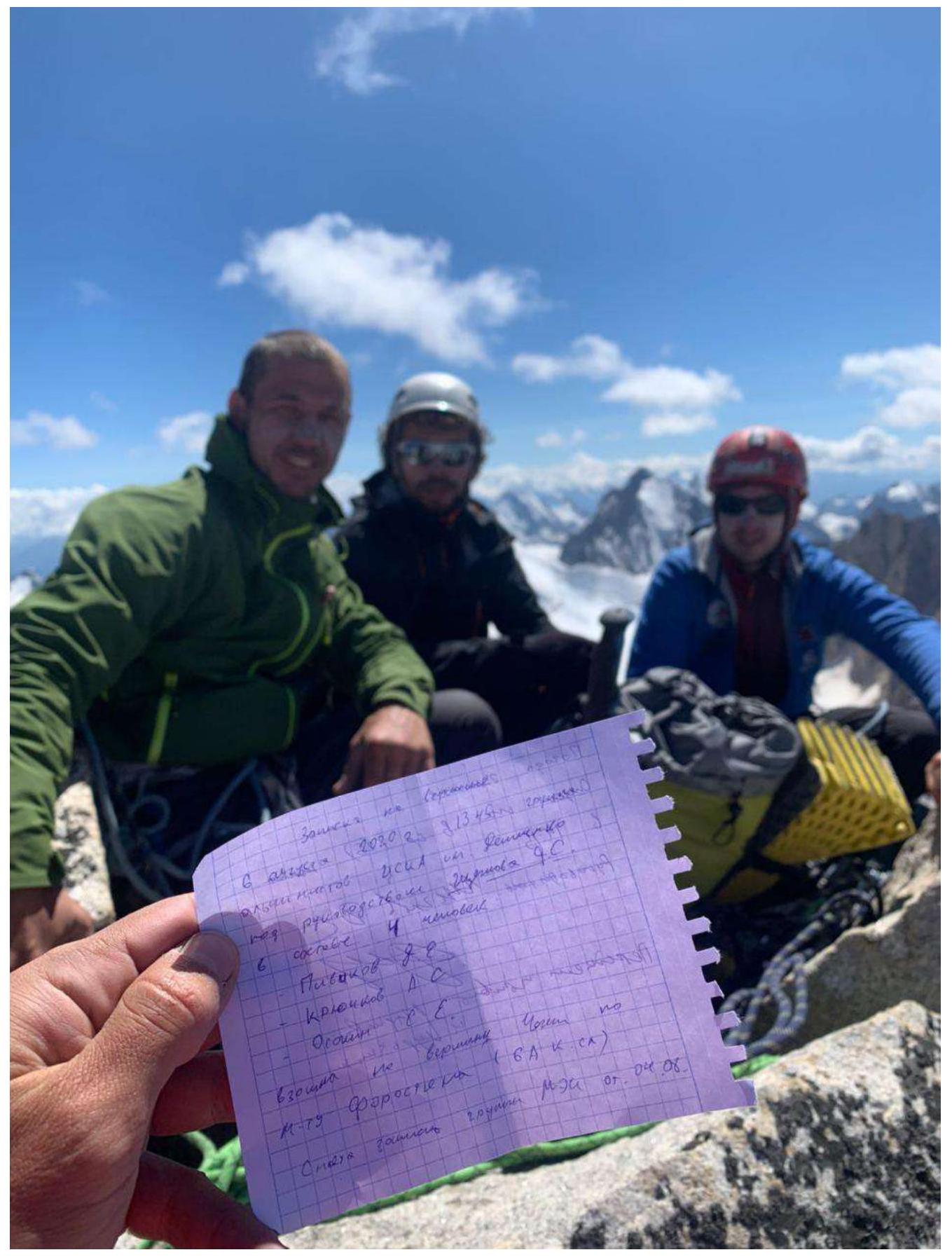 "Note"
"August 6, 2020 at 13:45"
"Alpinists CSKA named after Demchenko"
"led by Shcheglov D.S."
"consisting of: 4 people"
"Pivikov D.E."
"Kryuchkov A.S."
"climbed Chegem peak"
"via Forostyan route 6A"
"Note"
"August 6, 2020 at 13:45"
"Alpinists CSKA named after Demchenko"
"led by Shcheglov D.S."
"consisting of: 4 people"
"Pivikov D.E."
"Kryuchkov A.S."
"climbed Chegem peak"
"via Forostyan route 6A"