
Moscow City Championship in mountaineering in high-altitude technical class.
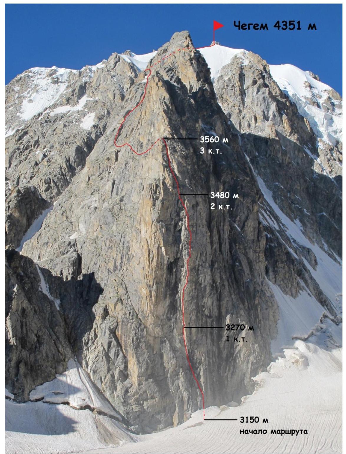
Report on the ascent of the team from the MPEI Rock Climbers and Mountaineers Club to v. Chegem (4351 m) via the NE wall of the NE ridge, 6A category.
Ascent Passport
1. Central Caucasus, Chegem gorge, Adyrsky ridge. According to KMGV classification – 2.4.1. 2. Chegem peak, 4351 m, via the NE wall of the NE ridge (route by V. Forostyan). 3. Category of difficulty – 6A. 4. Route type — rock climbing. 5. Elevation gain on the route – 1200 m.
Route length – 1700 m.
- Length of sections with 5th category of difficulty – 250 m, 6th category of difficulty – 150 m.
- Average steepness: wall section – 90 °, entire route – 45 °.
6. Pitons left on the route: total – 1, including bolted pitons – 0.
Total number of anchors used on the route: skyhooks – 80, rock pitons – 20, protection gear – 180, ice screws – 10, bolted pitons (already existing on the route) – 15. Total number of artificial climbing aids used – 160.
7. Climbing hours (until the summit): 24 hours (including 7 hours of preliminary work) – 3 days. Descent via 3A category route, along the 3rd ridge: 8 hours. 8. Team leader: Klimov M.A. – 1st sports category, "Rescue in the mountains" badge №340. Team members: Igumnov A.B. – 1st sports category, "Rescue in the mountains" badge №254. Korzhinov D.A. – 2nd sports category, "Rescue in the mountains" badge №370. 9. Coach – Kutkin S.A., Candidate Master of Sports, instructor 2nd category (certificate №647). 10. Departure from "Ullu-Tau" base camp – July 23, 2014, at 7:00.
Departure for preliminary work – July 24, 2014, at 10:00. Departure on the route – July 26, 2014, at 7:00. Summit reached on July 28, 2014, at 8:00. Return to "Ullu-Tau" base camp – July 28, 2014, at 19:00.
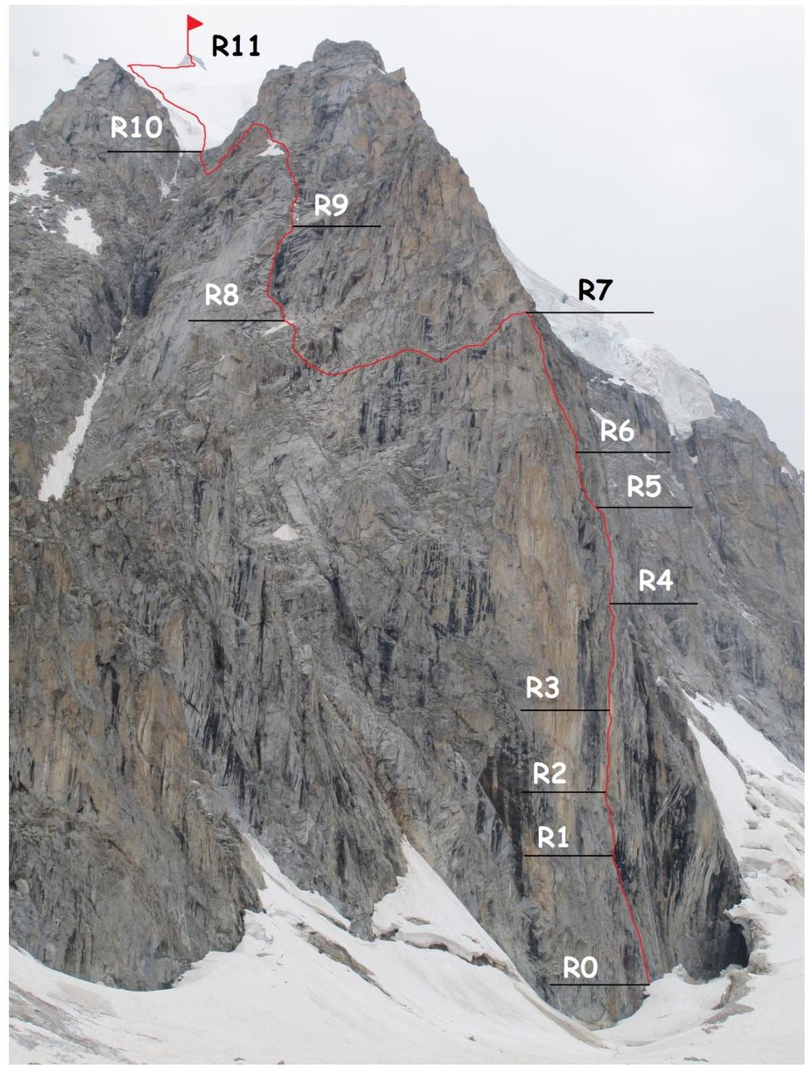
General photo of the route
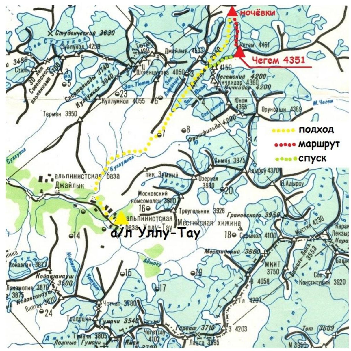
Map of the ascent area
Technical photo with route sections
Route description by sections
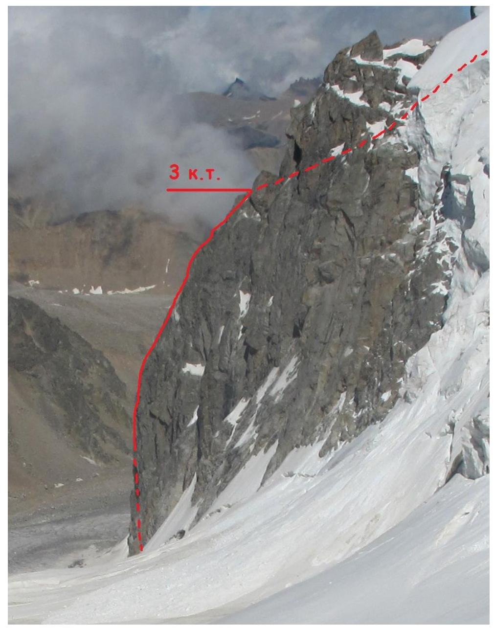
From the bivouac on the moraine to the start of the route — across the glacier. The start of the route is in a large randkluft.
R0–R1 (40 m, IV–V+, 80–90 °)
- Overcome the randkluft (2 m), descend 3 m and approach the rock wall via a snow bridge.
- Straight up, under the black overhanging rocks (after 10 m – a bolt).
- Hanging belay station under a triangular cornice (bolts, pitons).
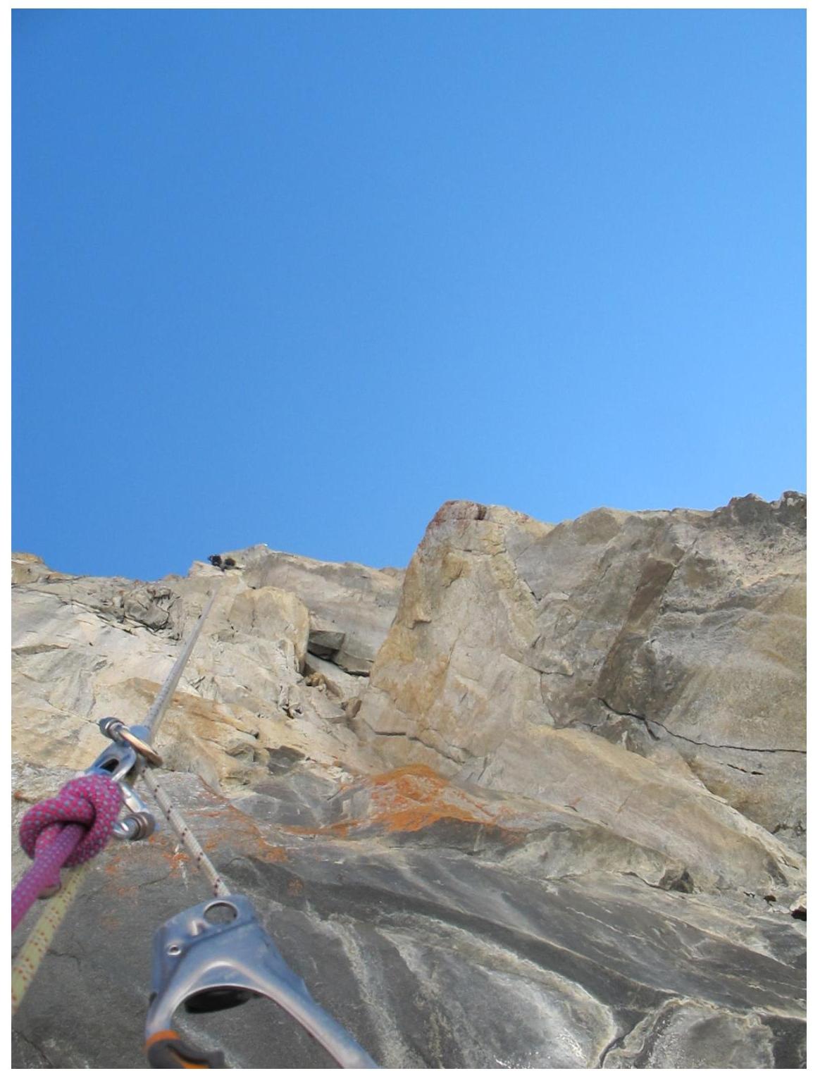
R1–R2 (30 m, VI A1–A2, 95–120 °) The cornice is passed head-on. Through a crack and then along the overhanging inner corner to a ledge with the first control cairn (bolts and pitons are encountered). Up through a narrow vertical crack under a cornice.
R2–R3 (50 m, VI A1, 95 °) Through the cornice on its right part. Then straight up to a narrow sloping ledge.
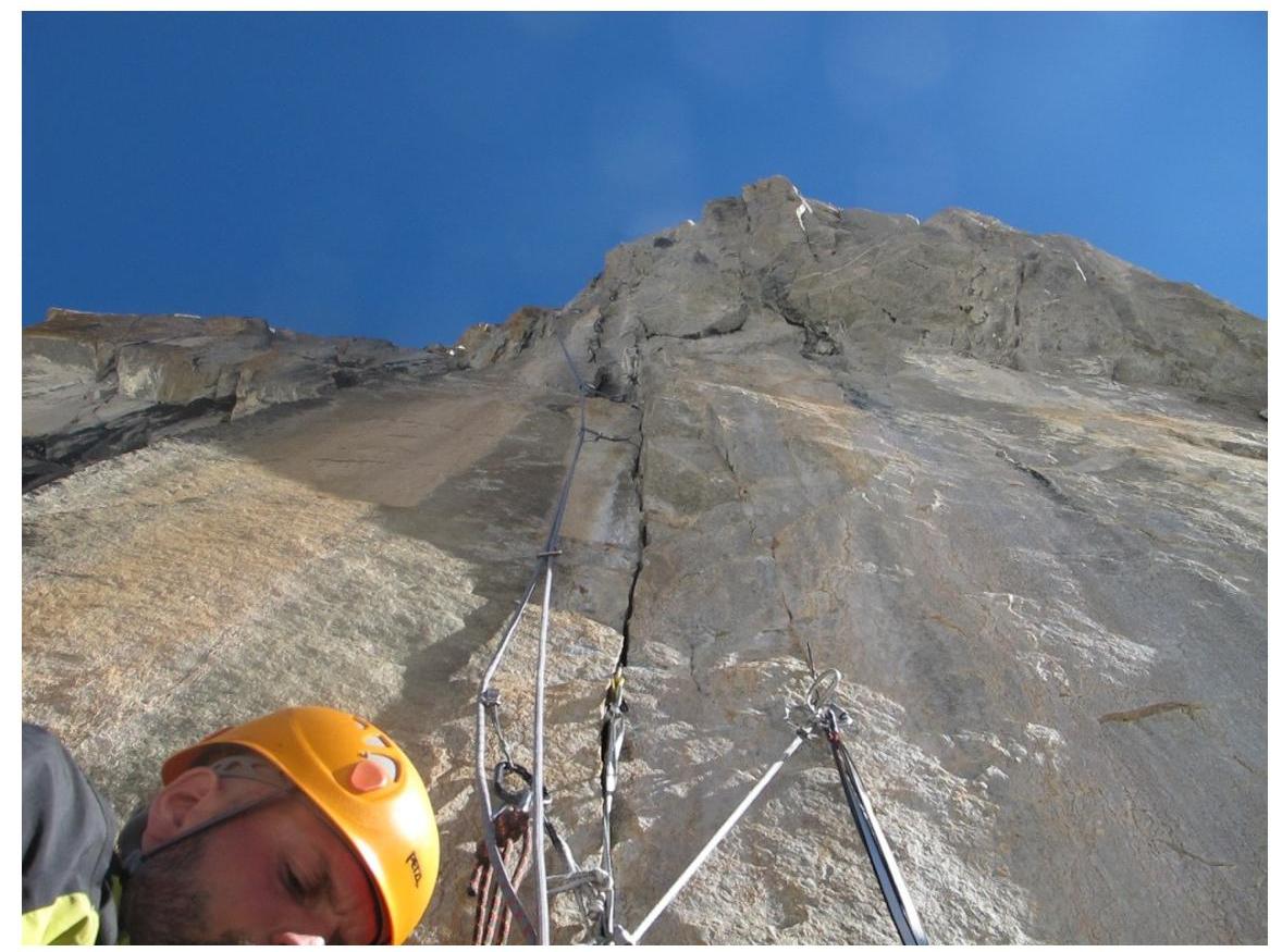
R3–R4 (50 m, VI A1–A2, 95 °) From the ledge up through a crack to the top of a spall (the spall "rattles", the top is "loose"). Then – through overhanging walls and cracks (bolts are encountered).
R4–R5 (50 m, V–VI A1, 90 °) The overhanging section ends, a vertical wall with alternating ledges and walls (bolts and pitons are encountered). Belay station on top of the spall ("columns").
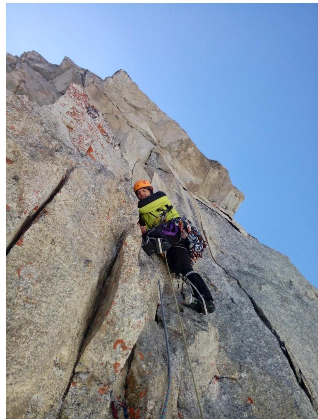
R5–R6 (50 m, V–V+, 90 °) From the station, slightly up and left around the corner, into a large inner corner. Up the corner and then along its left wall to a convenient horizontal ledge (below the ledge on the wall is the 2nd control cairn).
R6–R7 (60 m, V, 80 °) Then along easier rocks to the base of a large chimney. Up the left wall of the chimney to a large ledge with the 3rd control cairn.
R7–R8 (300 m, II–V, 30–80 °) Bypass the first sentinel rock along easy scree ledges (150 m). Then through moderately difficult rocks up — left to another large scree ledge (another 150 m). At the far (left) end of the ledge – a snow patch and the start of a couloir (there are several potential bivouac sites on the scree ledges).
R8–R9 (60 m, IV–V+, 70 °) Along the left wall of the couloir under a monolithic overhanging wall, then right into the couloir and up its right wall to large scree ledges.
R9–R10 (300 m, II–III, 40 °) Along scree ledges up to the left (some small easy walls and inner corners are encountered). Then a section where you need to descend slightly along the ledges (there are potential tent sites), and then up along the ledges to a saddle, where a snow and ice ridge begins.
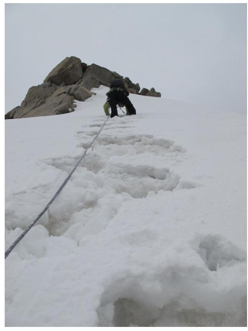
R10–R11 (800 m, II–III, 30–45 °) Along the snow and ice ridge to the summit (below the summit, there's a flat snow field where a tent can be pitched). The final summit push is via difficult rocks (5 m, V+, 90 °).
Route profile
Photos of the route
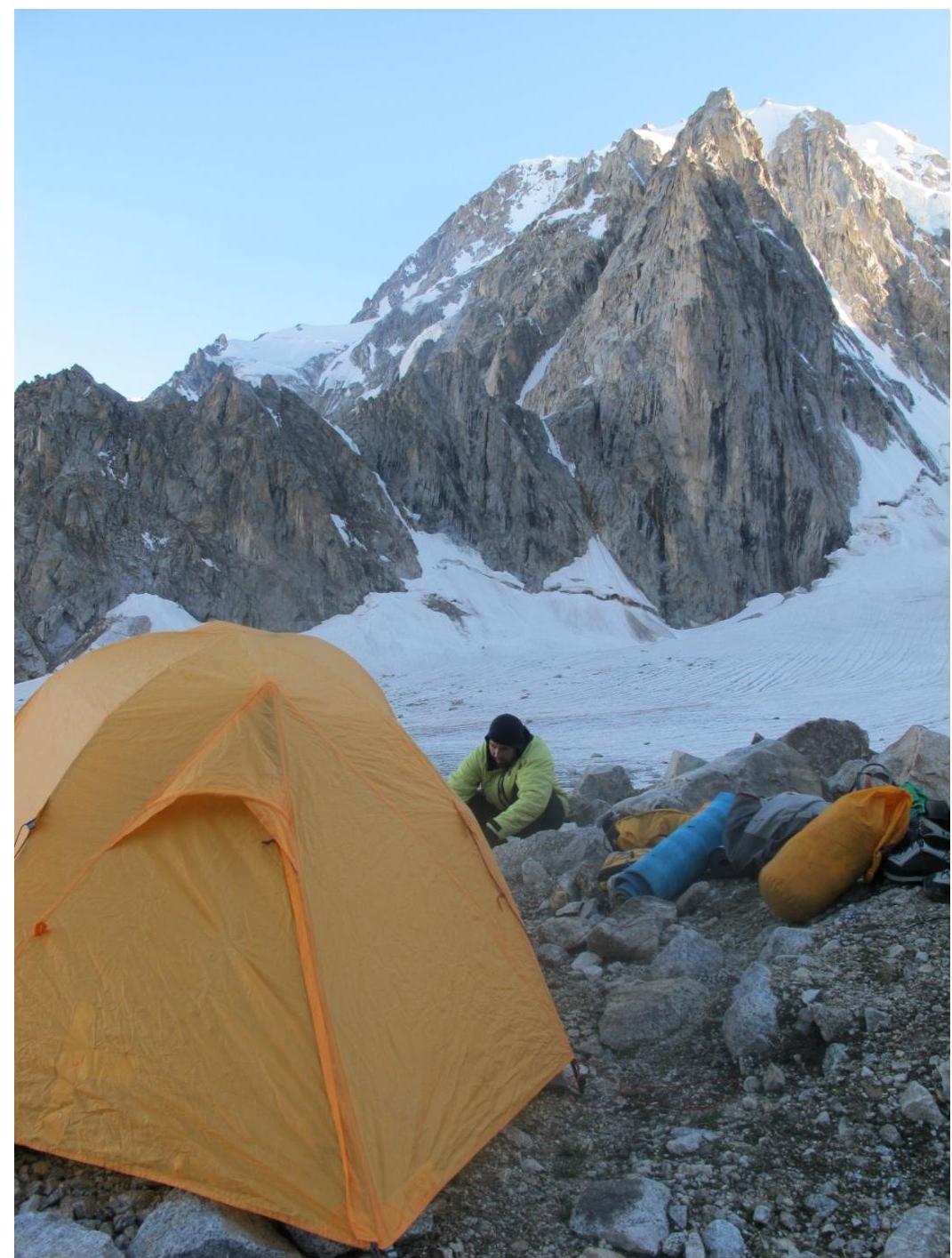
Bivouac opposite the route

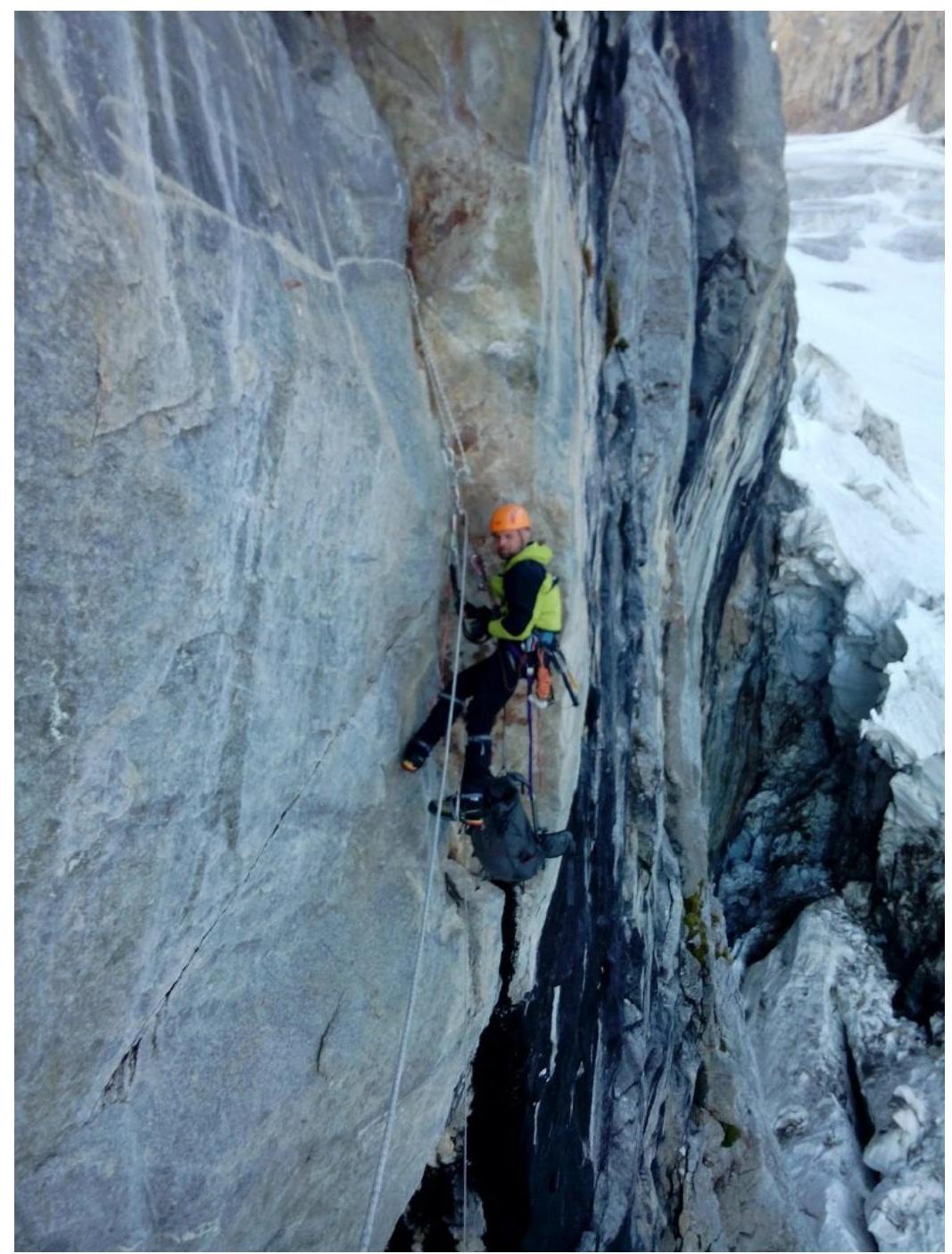
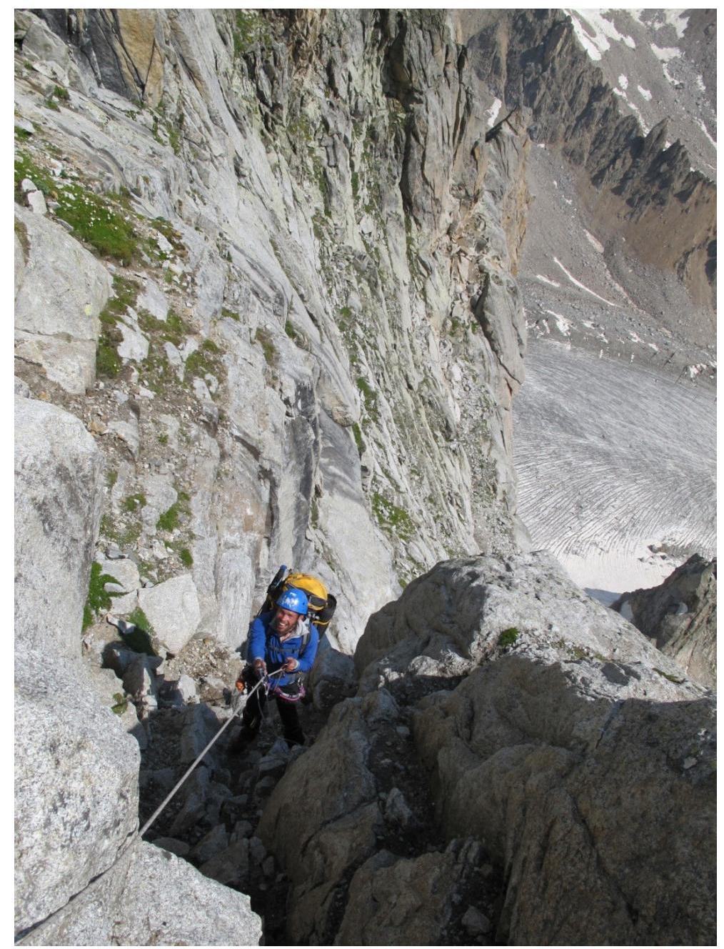
First climber at the station under the triangular cornice (R1), second climber working below on the rope.

Work on the R1–R2 section
Ropes on R2–R3
Ropes on the R3–R4 section
R4–R5 section
R5–R6
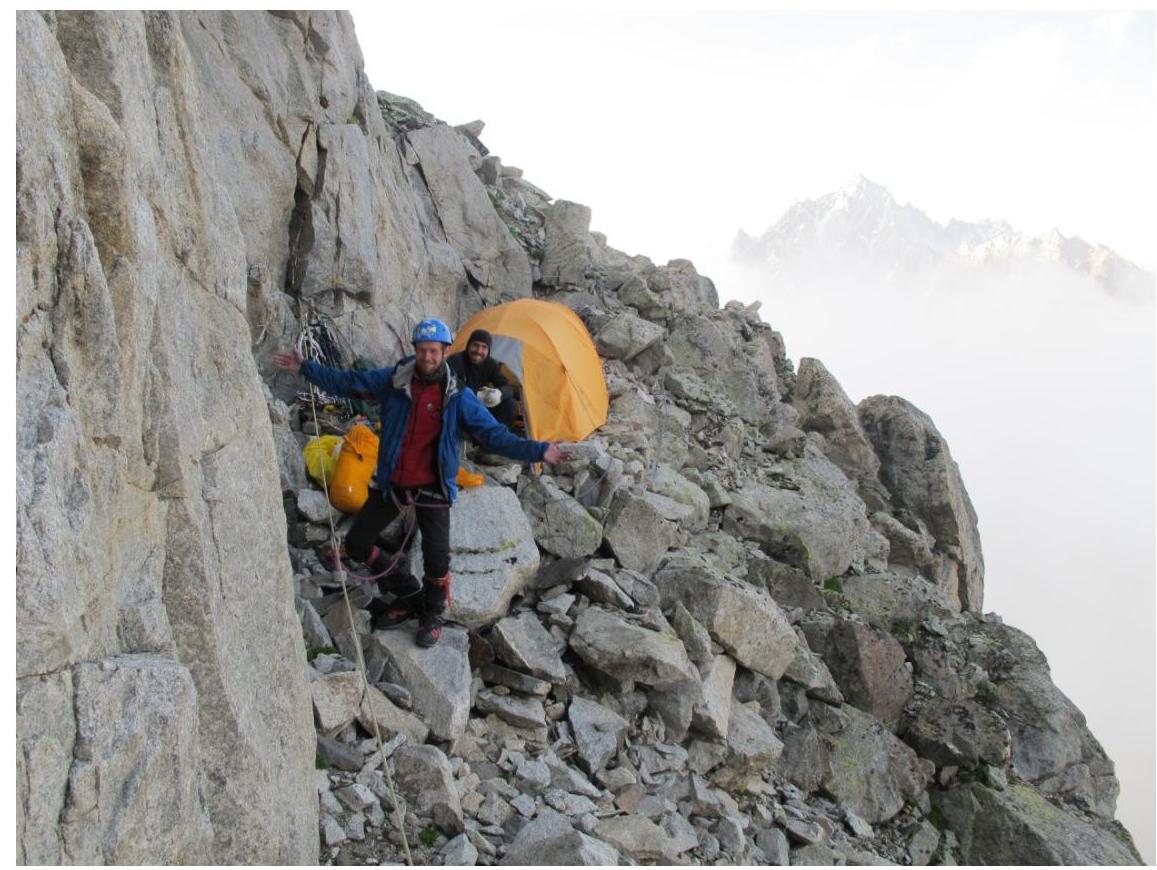
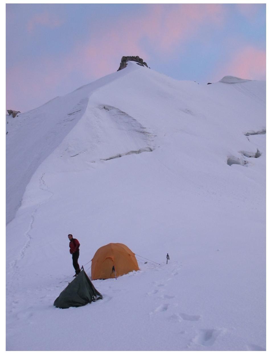
Bivouac on the R7–R8 section
On the R9–R10 section
Bivouac under the summit on August 27, 2014
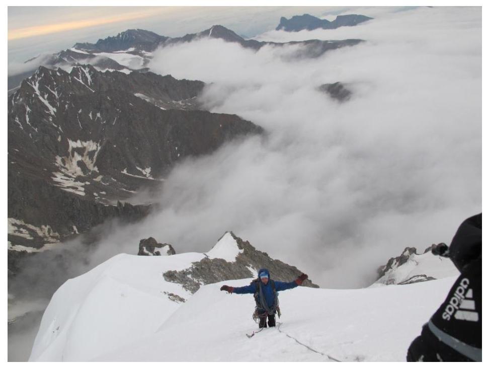
Snow and ice ridge on the approach to the summit
Summit tower

On the summit
Climbing techniques used on key sections
On the wall section of the route, mainly in its lower half, sections were climbed using artificial climbing aids (R1–R6). The following were used for artificial climbing aids:
- rock skyhooks
- anchor and other pitons
- protection gear
- ice screws
- existing bolted pitons installed by previous climbers
The R5–R6 section was mostly climbed using free climbing.
Ascent schedule
July 23, 2014, at 7:00, the group departed from "Ullu-Tau" base camp to approach the route. The bivouac was set up on the moraine opposite the route at 18:00. The weather was sunny and clear throughout the day.
July 24, 2014, at 10:00, the group started preliminary work on the wall section of the route. They worked until R5. At 17:00, they descended back to the bivouac. The weather was sunny and clear.
July 25, 2014. At night, rain started, which continued throughout the day, sometimes turning into wet snow. The group did not work on the route that day.
July 26, 2014. At 7:00, they began working on the fixed ropes. At 9:00, they started working on the R5–R6 section. By 15:00, they reached the wide scree ledges of R7–R8, where they pitched a tent and bivouacked. The weather was variable cloudiness, no precipitation.
July 27, 2014. At 7:00, they continued working on the R7–R8 section. By 13:00, they reached the snow and ice ridge. At 14:30, a thunderstorm started, catching the group on the pre-summit ridge. They had to descend slightly to a wide snow field, where they pitched a tent at 15:00. The thunderstorm and snowstorm continued until 20:00.
July 28, 2014. At 6:00, they resumed their ascent to the summit. At 8:00, they reached the summit. The descent was made along the 3rd ridge, via a 3A category route. The weather was cloudy with precipitation, and at 15:00, another snowstorm started.
UIAA scheme of the wall section of the route
