Moscow Alpinism Championship 2009. Technical Climbing Class
Central Caucasus
Report
On the ascent to Chegem peak (4461 m) via the NE wall of the NE ridge (first ascent)
Team Leader: Sergey Nilov — Master of Sports
Coach: Sergey Kutkin, Candidate for Master of Sports, 2nd category instructor.
Ascent Passport
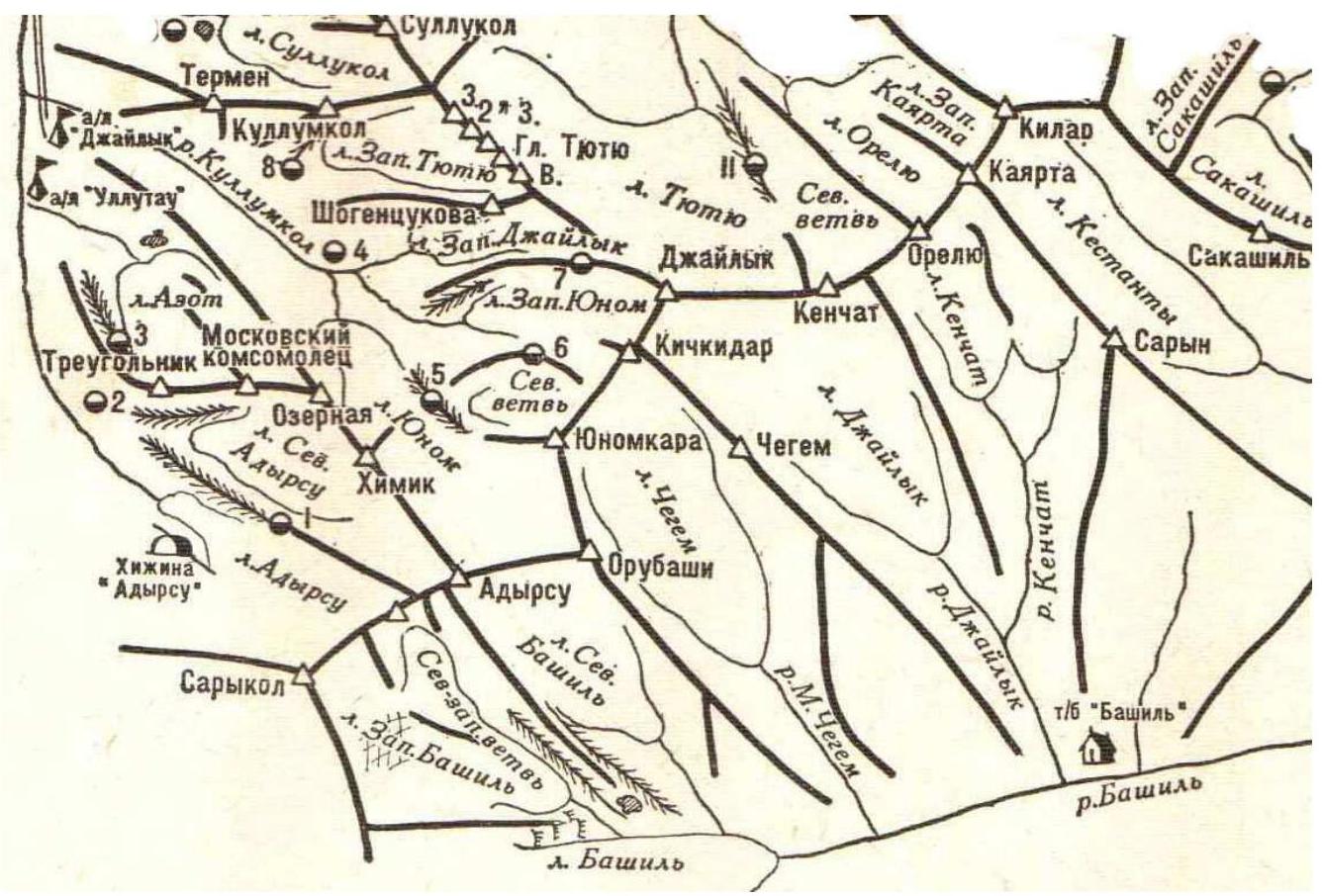
- Region: Central Caucasus, Chegem gorge
- Peak: Chegem, height 4461 m.
- Route: Via the North-Eastern wall of the North-Eastern ridge
- Complexity category: approximately 6A
- Route type — combined
- Height difference: –1070 m (by altimeter)
- Route length — 1226 m.
- Section lengths: VI complexity category — 181 m.
- V complexity category — 117 m.
- IV complexity category — 153 m.
- III complexity category — 450 m.
- Average steepness of the main part of the route — 88–90°
- Average steepness of the entire route — 52°
- 210 belay points established
- Hooks left on the route — 19 pieces, including 18 bolted hooks
- Total artificial support points (ASPs) used — 113
- Team's travel time — 41 hours
- Number of days — 3
Team Leader: Sergey Nilov — Master of Sports. Participants: Alexey Korochkov — Candidate for Master of Sports, Sergey Kutkin — Candidate for Master of Sports, Natalia Kutkina — Candidate for Master of Sports. Coach: Sergey Kutkin, 2nd category instructor, cert. № 647
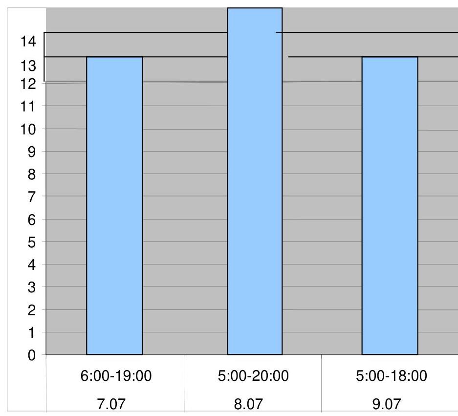
Route start: July 7, 2009. Summit reach: July 9, 2009. Descent to Bashil base: July 10, 2009. Overnight stays:
- July 7–8, 2009 — in a tent under the route
- July 8–9, 2009 — in a tent on a ledge
- July 9–10, 2009 — in a tent on a ledge
Team Preparation for the Ascent and the Ascent
By the start of the ascent, all participants had experience in joint ascents of 6A category. Since 2003, the team has been conducting joint training aimed at improving their rock climbing and overall physical fitness. In May, team members traveled to Crimea, where they completed several 5B category ascents.
Information gathering on the route began during ascents on the same mountain via routes:
- Forostyan (6A)
- Kurochkin (6A)
Considering the gathered information, the team's condition, and the region's specifics along with forecasted weather conditions, a tactical ascent plan was developed.
The initial plan was to start from the Ullu-Tau base camp. However, due to an anti-terrorism operation in the Elbrus region, the plan was revised, and the team proceeded from Bashil base.
- July 4 — arrival at Bashil base.
- July 5 — load carrying from Bashil base.
- July 6 — approach to the route. Overnight stay on the glacier moraine.
- July 7 — route processing.
- July 8 — traversing the wall section of the route. Overnight stay on a ledge.
- July 9 — reaching the summit. Descent via the ascent route due to border guards' prohibition on crossing the Donkin pass.
- July 10 — return to Bashil base.
Radio communication was established between the climbing team and the Bashil base management.
Route Description by Sections
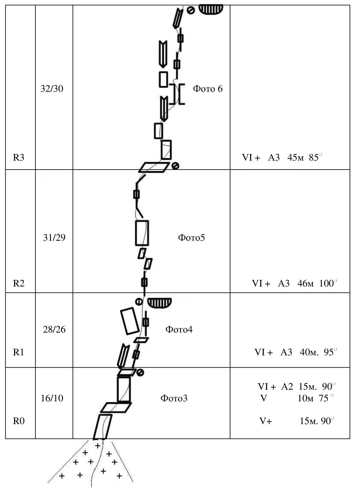
R0–R1
From the glacier, cross the bergschrund (1.5 m) to the North-Eastern wall of the North-Eastern ridge. The route starts 2 m to the right of the Forostyan route.
- Climb straight up a crack for 15 m with complex climbing to a sloping slab.
- Move right-up on the slab for 10 m.
- Then climb 15 m up-right to a small ledge.
Bivouac site — 2 bolted hooks.
R1–R2 Climb up an overhanging crack for 15 m with complex ASPs to a green ledge. Then move right-up through a series of thin overhanging cracks. Hanging bivouac site — 2 bolted hooks.
R2–R3
- Climb up a crack for 20 m (bolted hook).
- Then along a sloping ledge 4 m left onto a slab (bolted hook).
- Climb up a crack for 20 m to a sloping ledge.
- Move right on the ledge for 2 m, bivouac site — 2 bolted hooks.
Control point № 1.
R3–R4 Traverse right — 4 m, then straight up a very complex inner corner 8 m — blind cracks (micro-stop nuts, anchor hooks). From a live slab, traverse right 3 m with complex climbing, then straight up 30 m with very complex climbing through a series of blind cracks (micro-stop nuts, anchor hooks). Uncomfortable bivouac site on two bolted hooks.
R4–R5 2 m left-up and then 7 m along an overhanging right-left complex crack into a vaguely defined inner corner — 20 m complex climbing to a chimney. Then 5 m up the chimney to a small ledge.
Comfortable bivouac site on a bolted hook and a V-shaped hook.
R5–R6 Straight up a washed-out chimney 30 m with complex climbing. In bad weather — water flow.
Then:
- right-up 10 m on smoothed rocks to a large five-meter ledge.
On the ledge — a comfortable bivouac site on two bolted hooks. Possible overnight stay.
R6–R7 From the right edge of the ledge:
- straight up 35 m (bolted hook) under a rusty wall;
- then right 10 m on snow;
- then 5 m up on destroyed rocks.
Bivouac site — a bolted hook and two hooks.
R7–R8 From the bivouac site, right around the corner and up left of a large chimney filled with flowstone ice 48 m to a bivouac site — a bolted hook.
R8–R9 Up, then slightly veering right up 50 m. Exit onto a ridge separating the NE and SE walls. Bivouac site on bolted hooks.
R9–R10
- Along the ridge shoulder 10 m to a ledge on the SE wall
- Then 15 m along the ledge
- Good overnight stay.
R10–R11
From the overnight stay, left along the ledge 10 m, descend down 3 m, move along the ledges in the same direction for another 35 m.
R11–R12 Climb up through a series of ledges and walls 45 m to a ledge 1 m wide under the base of a 3-meter slab with a vertical crack (bolted hook).
R12–R18 Left-up on destroyed rocks 350 m to a snowy slope. Along the ledge, bypass an overhang on the left and through a 1.5-meter vertical slab, move into the base of a vaguely defined inner corner. 40 meters up through difficult and above-average difficulty rocks of the corner to a horizontal wide ledge.
R18–R19 Along a snowy-icy slope 70 m to the North-Eastern ridge. Then move along the ridge 180 m.
R19–R21
- From the ridge, cross the bergschrund via a bridge left down
- Exit onto a steep icy-snowy slope and along it right up 80 m, return to the ridge
- Along a simple gentle icy-snowy slope of the ridge, approach the summit tower
R21–R22 Climb a 7-meter corner to the summit.
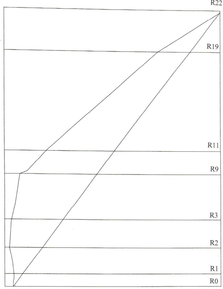
Route scheme in UIAA symbols
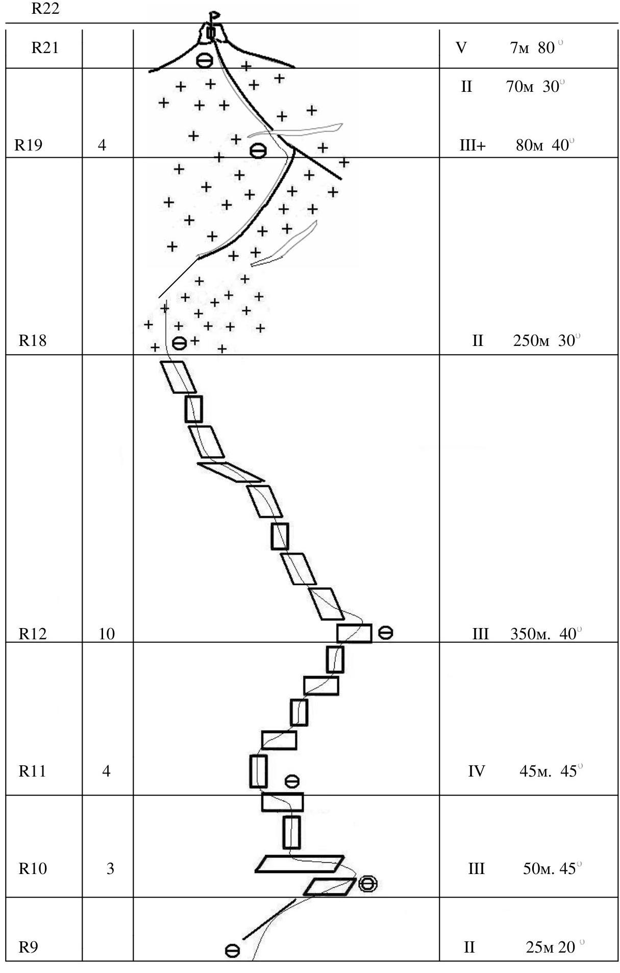
Route scheme in UIAA symbols
Route Scheme in UIAA Symbols
Technique for Passing Key Sections of the Route
Key sections of the route (R0–R7) were traversed using ASPs and free climbing, utilizing:
- micro-stop nuts,
- anchor hooks,
- protection devices (stoppers, camalots),
- bolted hooks.
Sections R7–R21 were traversed using free climbing. For belaying, the same equipment was used, along with ice screws and rock features.
Possible Escape Routes from the Wall Section
In our opinion, the most optimal path was taken on the wall section of the route. It is possible to deviate from the route only after the 6th rope pitch to the right into a large inner corner filled with ice, but it is constantly wet. Therefore, this maneuver does not facilitate movement and is dangerous.
Ascent Schedule
 July 7 — cloudy, rain with snow in the second half of the day.
July 8 — variable cloudiness.
July 9 — cloudy, snow with rain in the second half of the day. Icy rocks, snow on ledges.
July 7 — cloudy, rain with snow in the second half of the day.
July 8 — variable cloudiness.
July 9 — cloudy, snow with rain in the second half of the day. Icy rocks, snow on ledges.
Route Profile
Wall Section Profile
| Section | Length and Steepness |
|---|---|
| R8 | 50 m 80° |
| R7 | 48 m 80° |
| R6 | 50 m 75° |
| R5 | 10 m 80° 35 m 85° |
| R4 | 35 m 80° |
| R3 | 45 m 85° |
| R2 | 46 m 100° |
| R1 | 40 m 95° |
| R0 | 15 m 90° 10 m 75° 15 m 90° |
General Photo
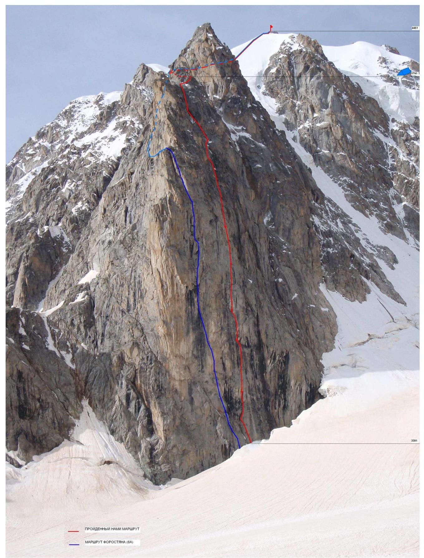 Photo 1
Technical Photo
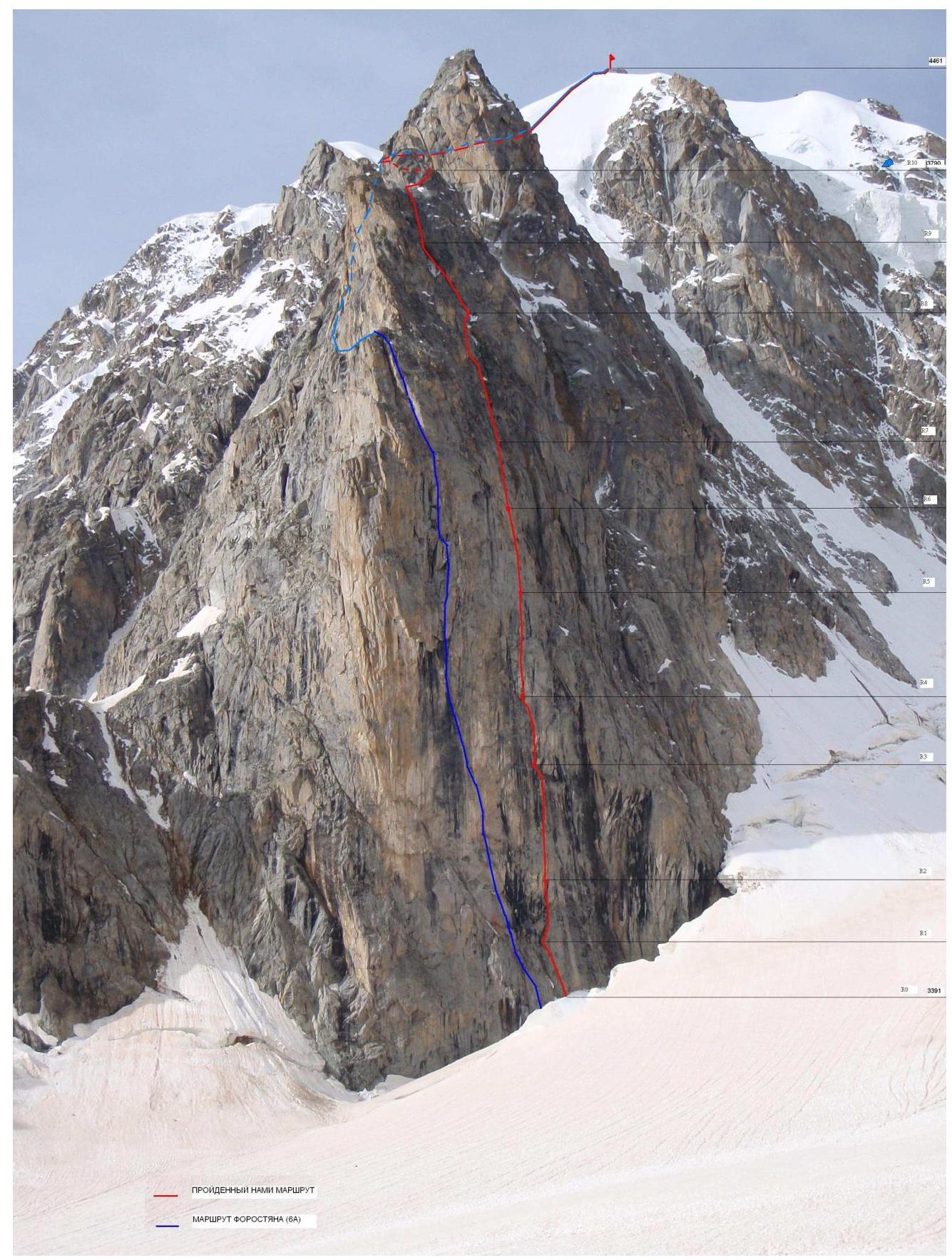 Photo 2
Section R0–R1
 Photo 3
Section R1–R2
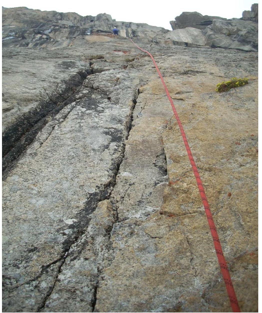 Photo 4
Section R2–R3
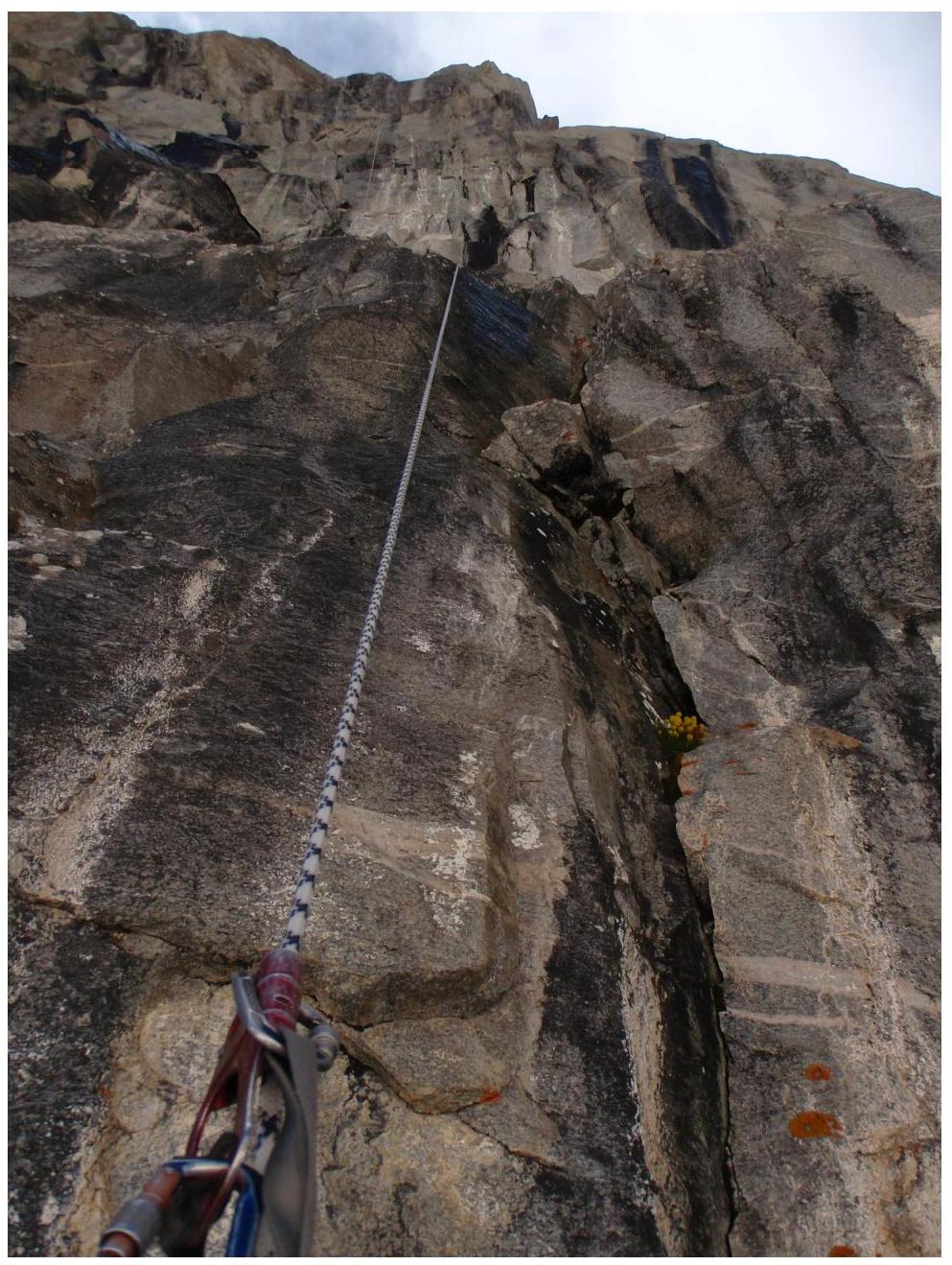 Photo 5
Section R3–R4
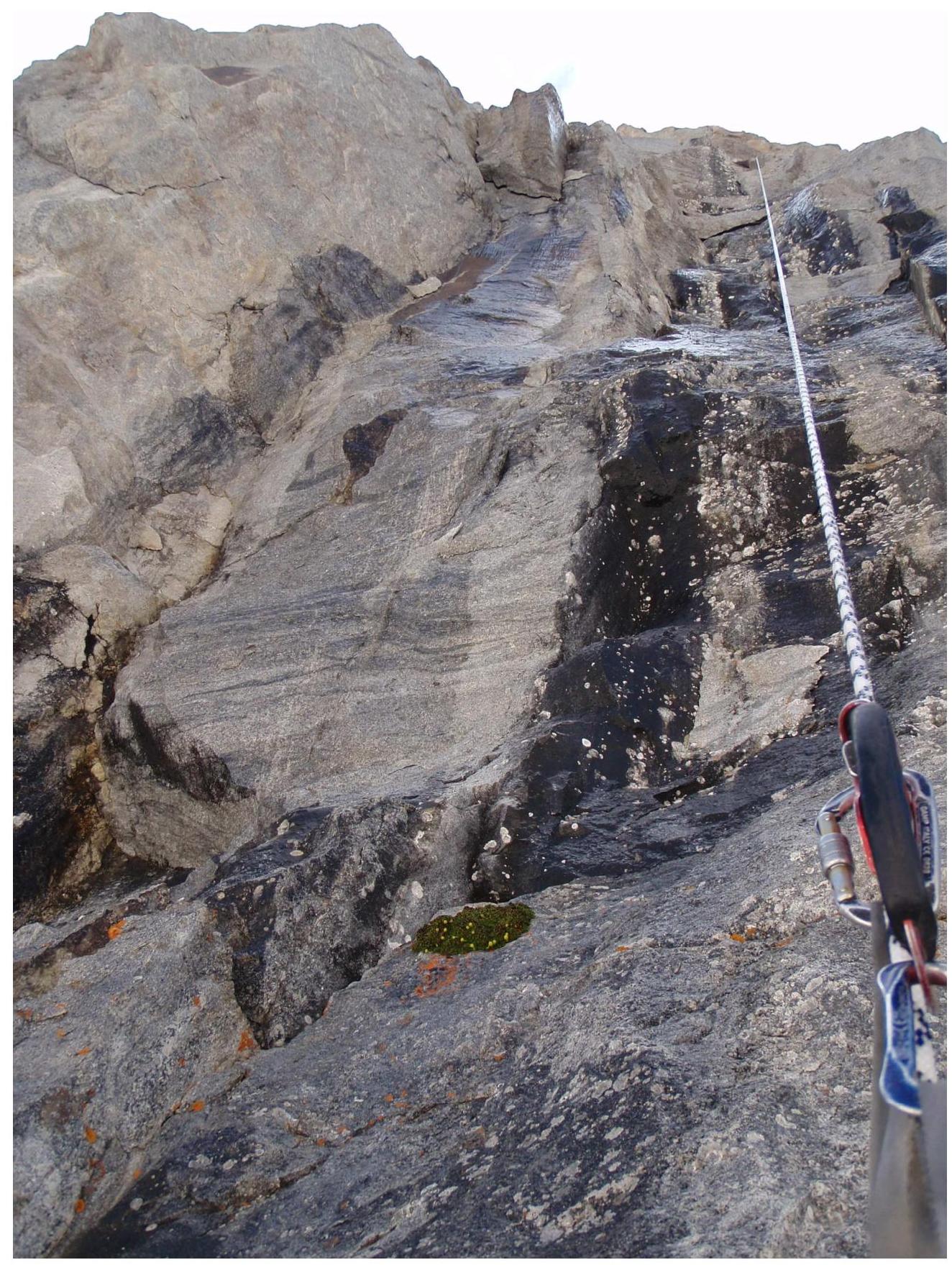 Photo 6
Section R4–R5 (upper)
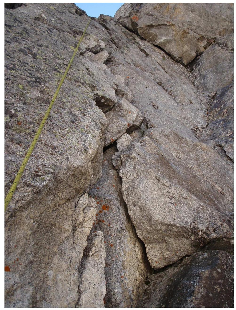 Photo 7
Section R4–R5 (lower)
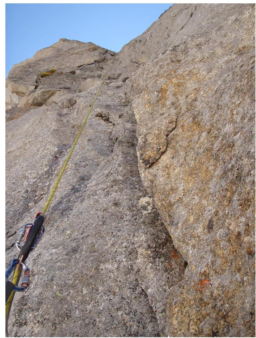 Photo 8
Section R5–R6
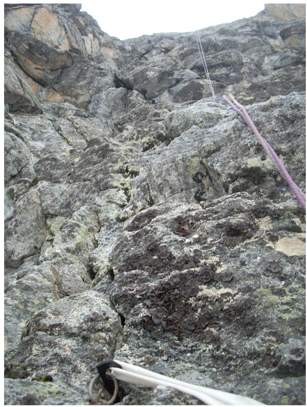 Photo 9
Section R8–R9
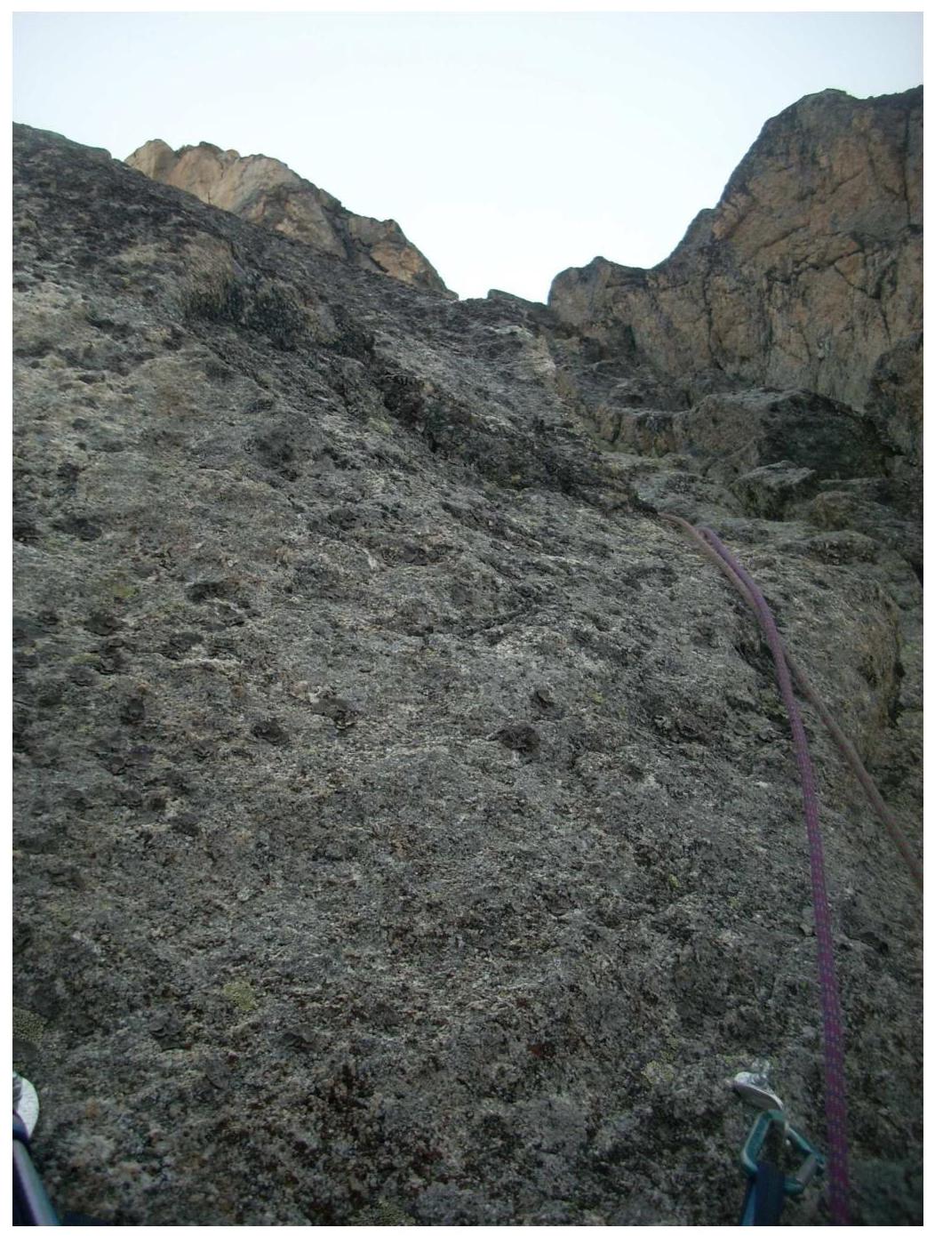 Photo 10
Overnight Stay R10
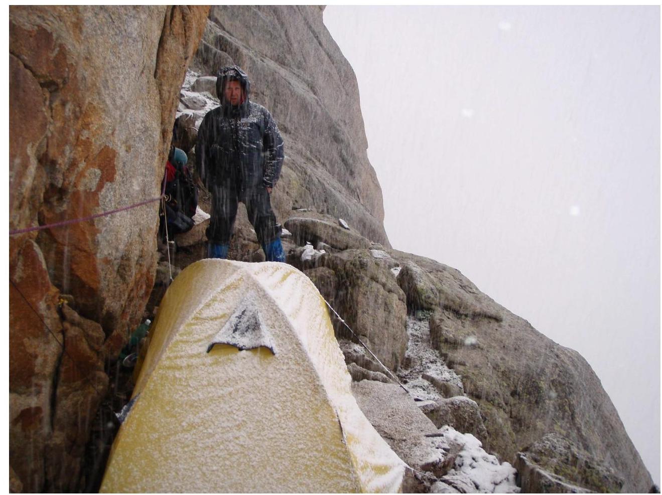 Photo 11
Section R19–R21
 Photo 12
Summit
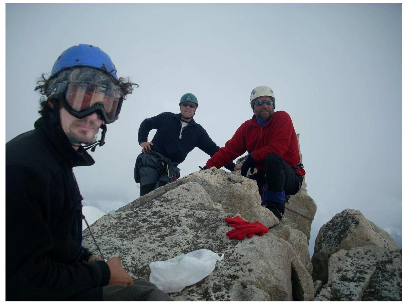 Photo 13