Report
on the ascent to Pik Khimik, second passage of the route on the right part of the bastion of the S. wall of the S. ridge (Didora, 2009)
Team Coach:
- Timoshenko T.A.
- Semiletkin S.A.
Leader: Murin E.G. Participant: Shabelnikov S.V.
St. Petersburg, 2010
Climbing Passport
-
Prielbrusye, Adyrsu gorge, section 2.4.1.
-
Khimik, 3975 m, via the right part of the bastion of the S. wall of the S. ridge, Didora, 2009. Proposed renaming: via the left part of the central rib of the S. ridge, Didora, 2009.
-
Proposed 5A category of difficulty, second passage.
-
Route type: combined.
-
Route elevation gain: 960 m. Route length: approximately 1170 m. Length of sections:
- V category of difficulty — 300 m.
- VI category of difficulty — 20 m.
Average slope:
- main part of the route — 70°
- entire route — 55°
-
Hooks left on the route:
- total — 0;
- including pitons — 0.
Hooks used on the route:
- stationary pitons — 1, including artificial support points (ITOs) — 0
- removable pitons — 0, including ITOs — 0
Total artificial support points (ITOs) used — 2
-
Team's total climbing time: 11 hours 20 minutes.
-
Leader: Murin Evgeny Grigorievich, 1st sports category Participants:
- Shabelnikov Sergey Vladimirovich, 1st sports category
- e-mail: buddasvami@gmail.com
-
Coach: Timoshenko Tatyana Ivanovna Participants:
- Semiletkin Sergey Alekseevich
-
Departure for the route: 5:00, August 1, 2010. Reach the summit: 16:20, August 1, 2010. Return to Base Camp: 20:00, August 1, 2010.
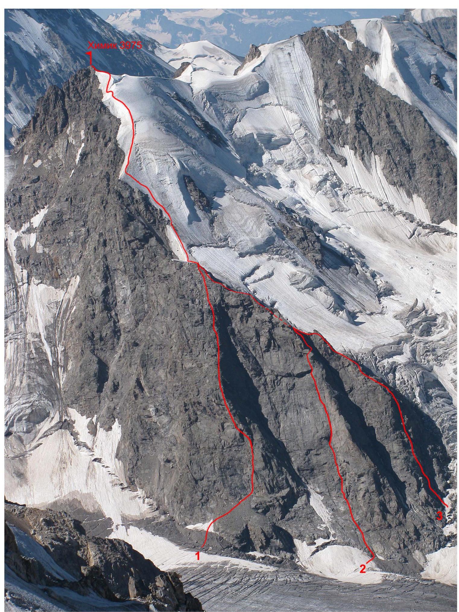
Photo 1. General photograph of Pik Khimik. The route taken by the team (2) and nearby routes (1, 3) are marked with red lines.
- Khimik via the left rib from the ridge, 4B, Naumov
- Khimik via the left part of the central rib from the ridge, 5A, Didora
- Khimik via the NE wall from the ridge, 5A, Sitnikov
Date taken: August 9, 2010, from the wall of Dzhailyk peak.
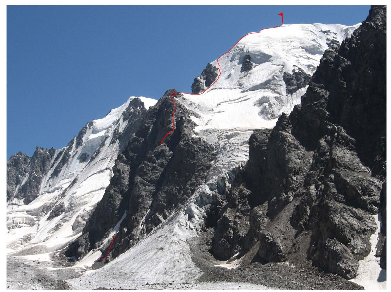
Photo 2. Profile of the wall. The visible part of the route is marked with a red line. Date taken: July 31, 2010.
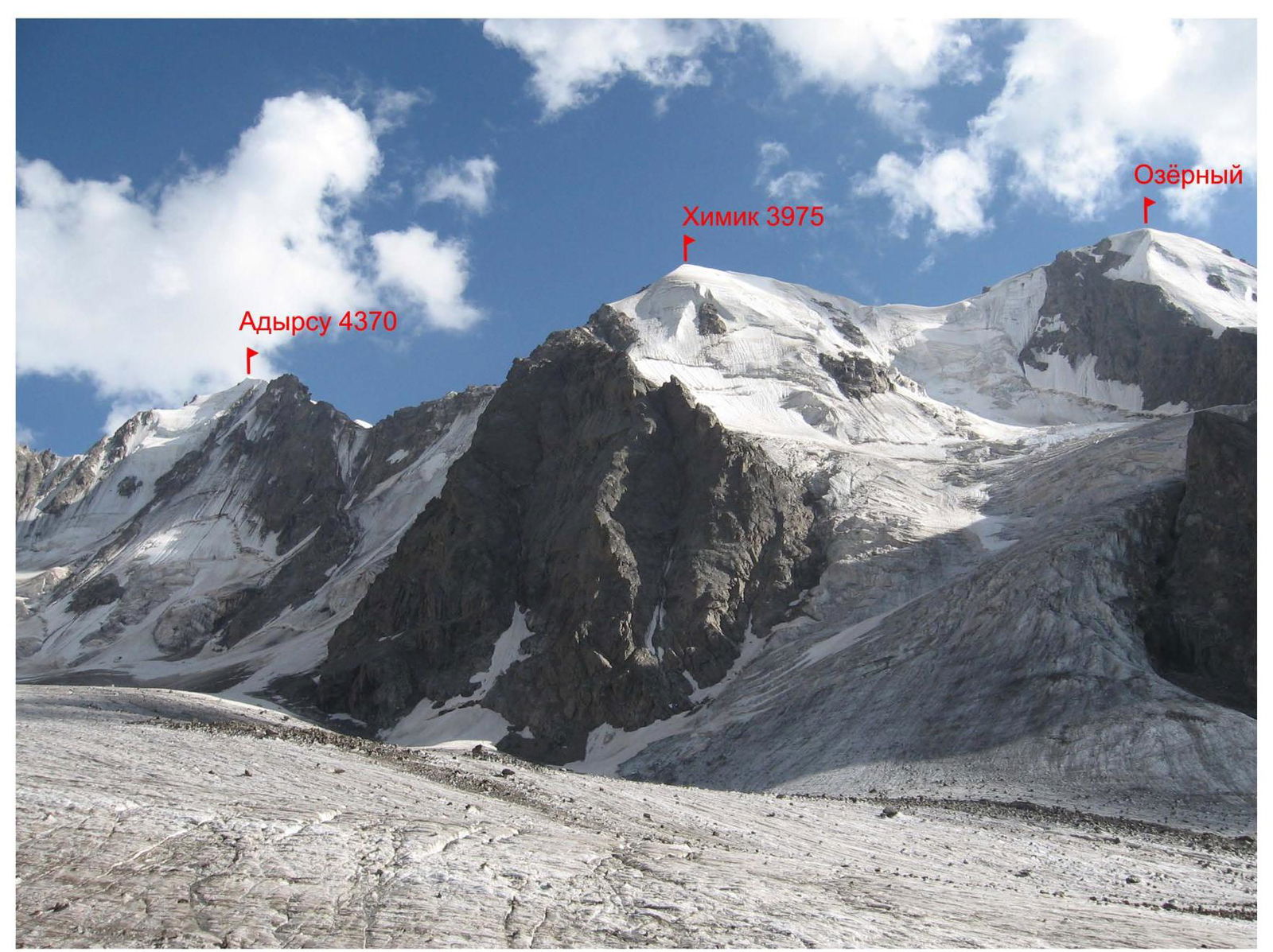
Photo 3. Photopanorama of the climbing area. Date taken: July 31, 2010.
Route Diagram in UIAA Symbols
- R12
- bergschrund
- R11
- snow-ice ridge, 300 m, 30–50°
- R10
- ice slope, 4–5, 250 m, 50–65°
- R9
- 3, 200 m, 40–50°
- R8
- 5, 50 m, 75°
- R7
- 5–6, 30 m, 75–90°
- R6
- 4–5, 50 m, 70–80°
- R5
- KT
- 5, 50 m, 70–80°
- R4
- 4–5, 50 m, 60–70°
- R3
- 5, 50 m, 75°
- R1–R2
- 3, 100 m, 50°
- R0
- 2, 40 m, 40°
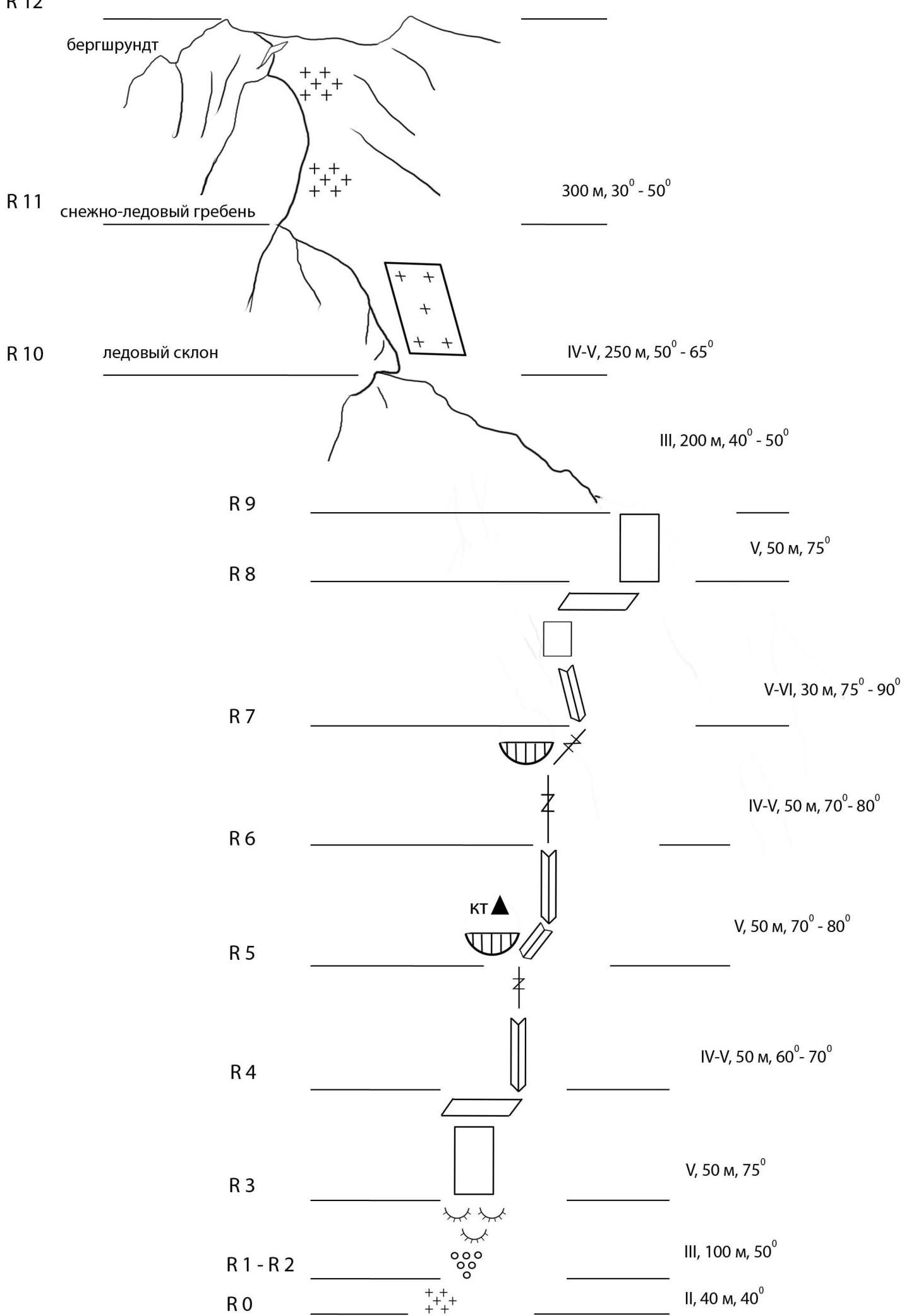
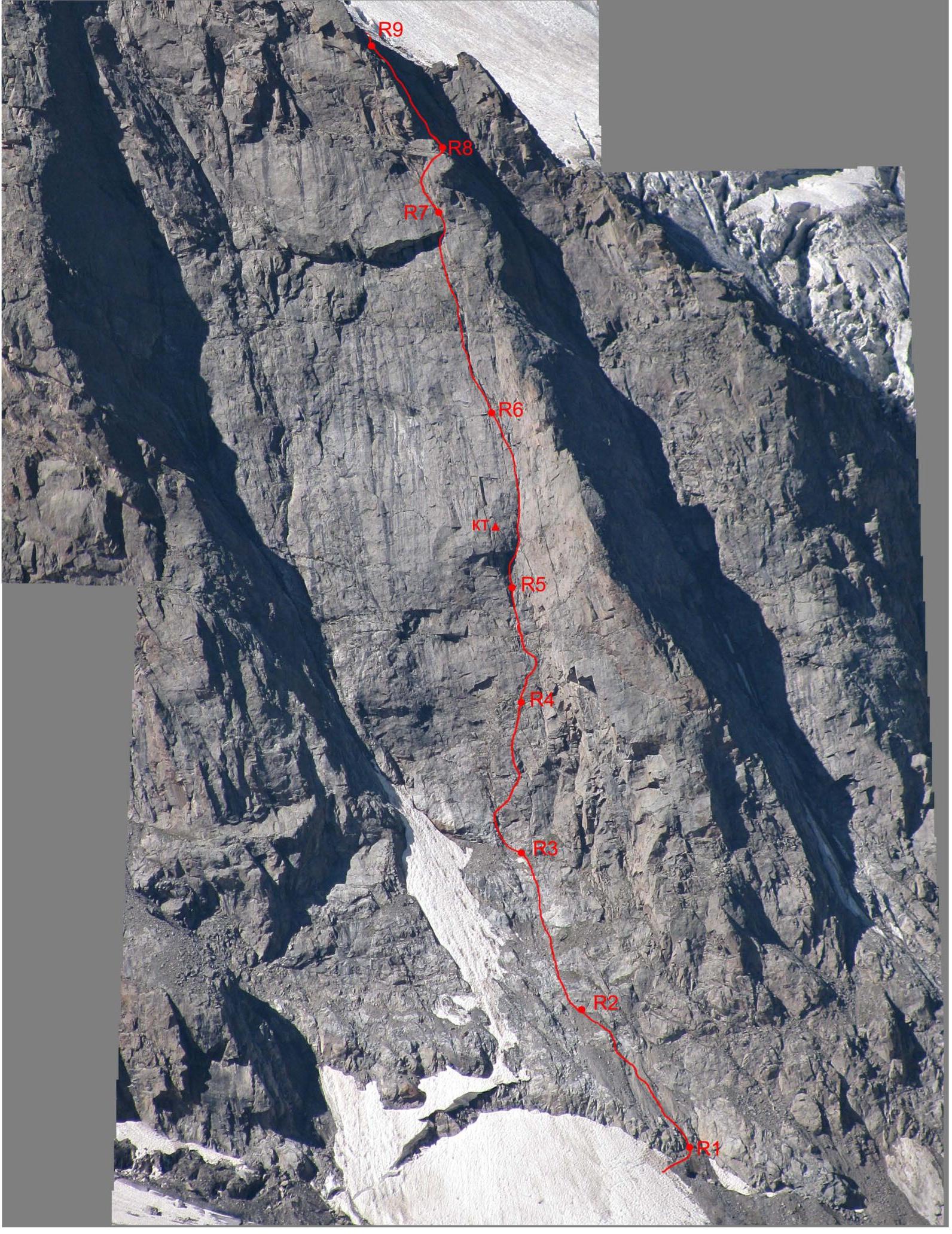
Photo 4. Technical photograph of the rocky part of the route (R9, R7, R6, R5, R3, R2). Date taken: August 9, 2010, from the 3rd stage of the S. ridge of Dzhailyk peak.

Photo 5. Technical photograph of the icy part of the route (R11, R10). Date taken: August 9, 2010, from the 3rd stage of the S. ridge of Dzhailyk peak.
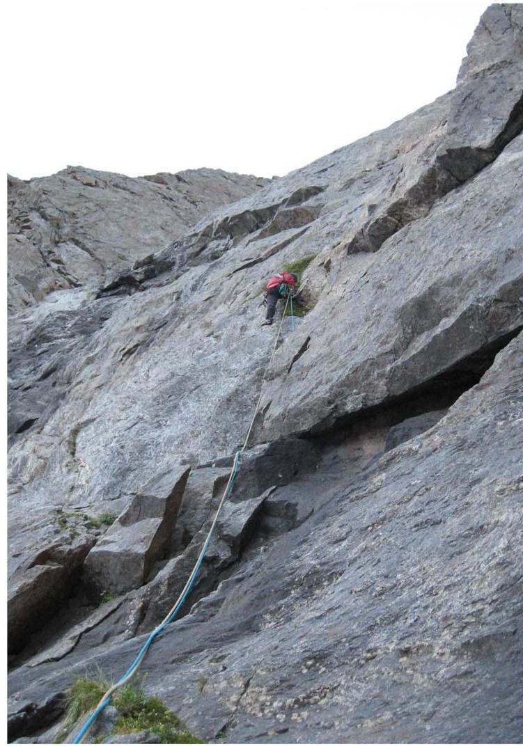
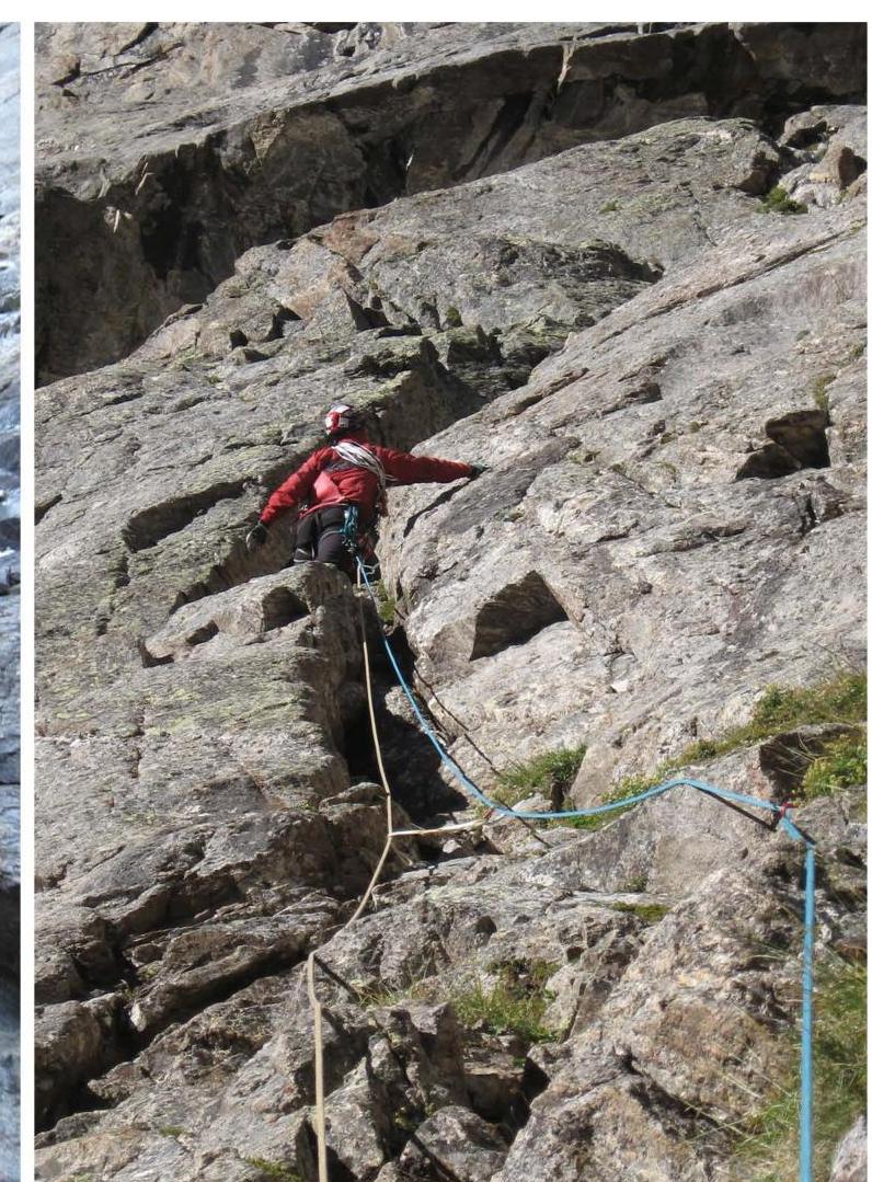
Section R3–R4
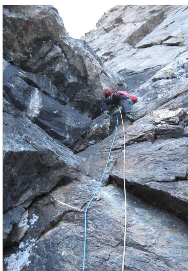
Section R4–R5
Section R5–R6
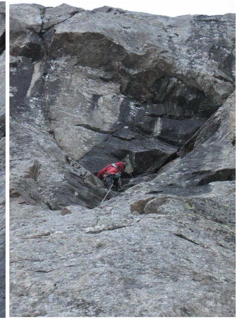
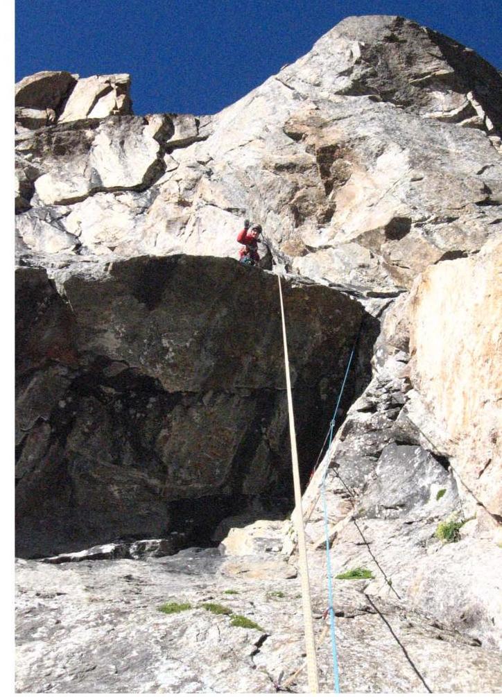
Section R6–R7
Cornice on section R6–R7
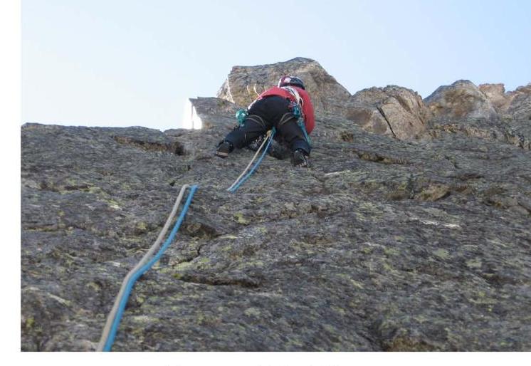
Section R8–R9
Section R10–R11
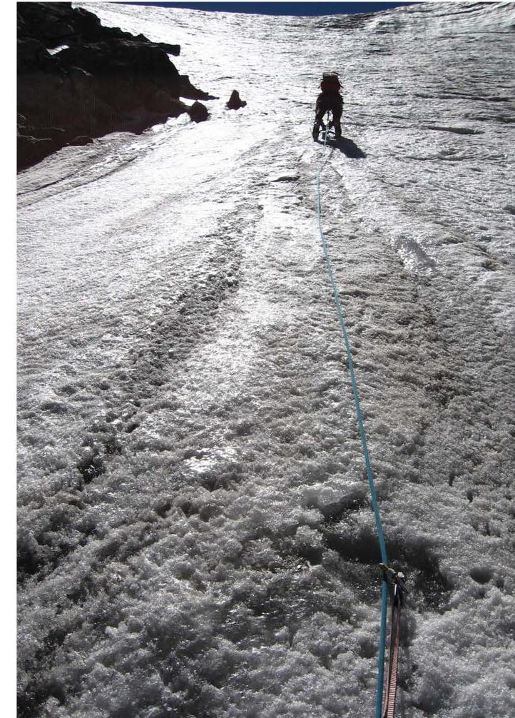
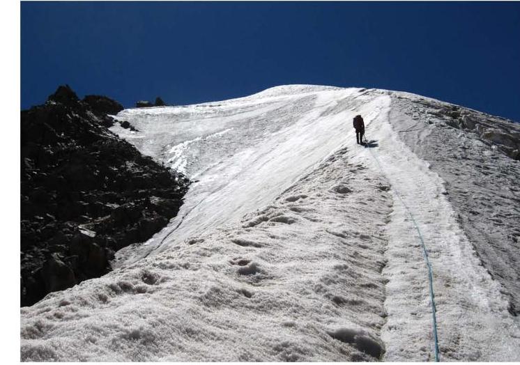
Section R11–R12
Pre-summit ridge
