
Report
on the first ascent to the summit Dolomit Yuzhny via the Southwest Edge approximately 4B category of complexity by the team of Voronezh Region August 6, 2021
I. Climbing Passport
| 1. General Information | ||
|---|---|---|
| 1.1 | Full name, sports rank of the leader | Dmitrienko Evgeny Vladimirovich, MS |
| 1.2 | Full name, sports rank of participants | Dankilkova Ekaterina Borisovna, CMS |
| 1.3 | Full name of coach | Torshin Mikhail Viktorovich |
| 1.4 | Organization | VROO "Sports Alpine Federation" |
| 2. Characteristics of the Climbing Object | ||
| 2.1 | Area | From Nakhar Pass to Chiperazau Pass |
| 2.2 | Valley | Kichkinekol |
| 2.3 | Classification table section number | 2.3 |
| 2.4 | Name and height of the summit | Dolomit Yuzhny, 3719 m |
| 2.5 | Geographical coordinates of the summit (latitude/longitude), GPS coordinates | - |
| 3. Route Characteristics | ||
| 3.1 | Route name | via Southwest Edge |
| 3.2 | Proposed category of complexity | 4B |
| 3.3 | Degree of route exploration | First ascent |
| 3.4 | Relief nature of the route | Rocky |
| 3.5 | Height difference of the route (altimeter or GPS data) | 319 m |
| 3.6 | Route length (in meters) | 370 m |
| 3.7 | Technical elements of the route (total length of sections of varying complexity with indication of relief nature (ice-snow, rocky)) | 1st cat. rocky – 0 m. 2nd cat. rocky – 20 m. 3rd cat. rocky – 65 m. 4th cat. rocky – 25 m. 5th cat. rocky – 220 m. 6th cat. rocky – 30 m. |
| 3.8 | Average steepness of the route, (°) | 57 |
| 3.9 | Average steepness of the main part of the route, (°) | 65 |
| 3.10 | Descent from the summit | Through the descent couloir, right of the summit |
| 3.11 | Additional route characteristics | - |
| 4. Characteristics of Team Actions | ||
| 4.1 | Time of movement (team's walking hours, in hours and days) | 5 h |
| 4.2 | Overnights | - |
| 4.3 | Time spent on route preparation | - |
| 4.4 | Start of the route | 5:23, August 6, 2021 |
| 4.5 | Summit attainment | 10:20, August 6, 2021 |
| 4.6 | Return to the base camp | 16:00, August 6, 2021 |
| 5. Responsible for the Report | ||
| 5.1 | Full name, e-mail | Danilkova E.B., asddeb@mail.ru |
Route Line
General view View from the pass
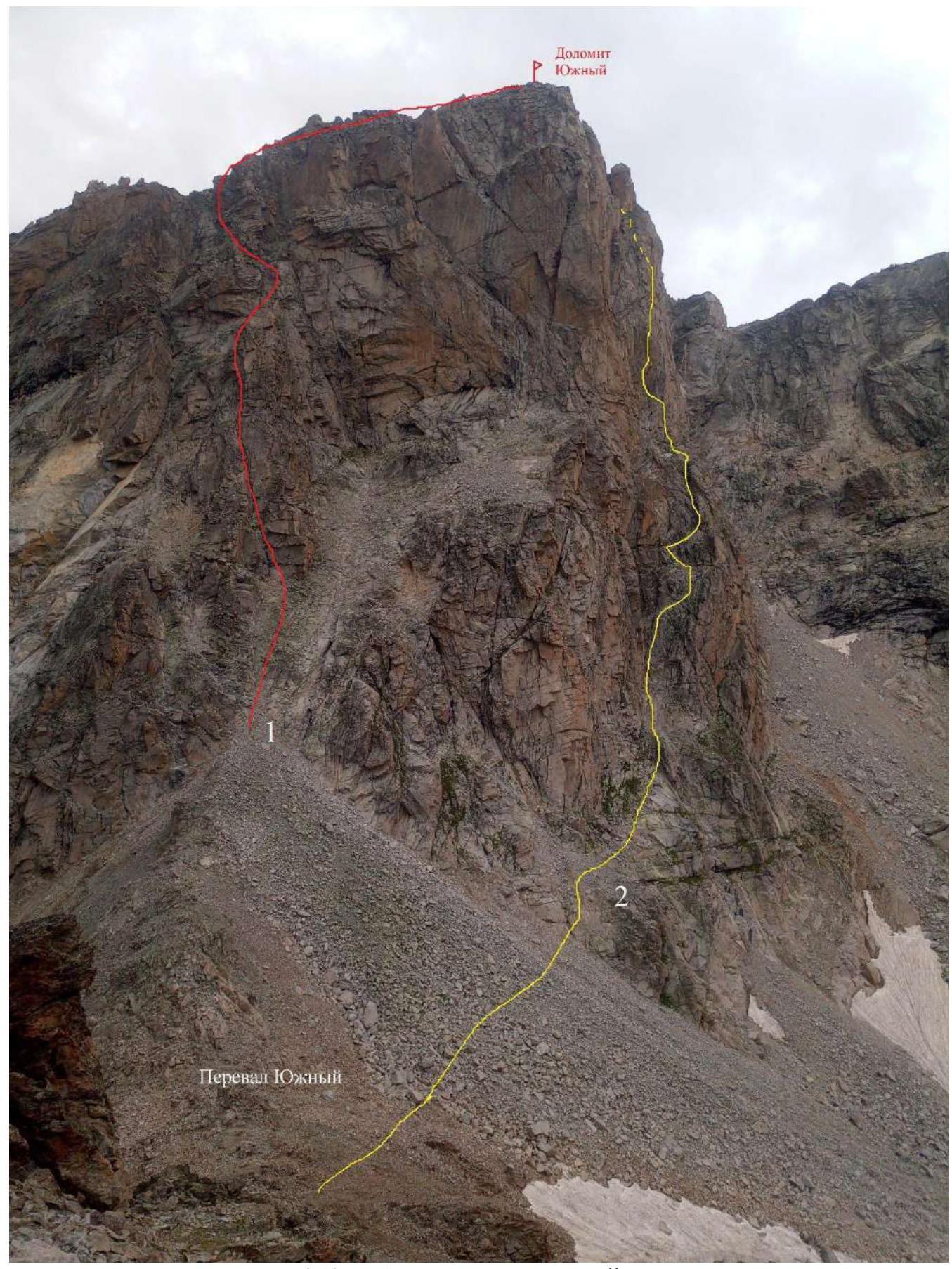
1 — Dolomit (Yuzhny) via the 3rd wall from South Pass "Morkovka", 3B 2 — Route climbed by the team
Start of the route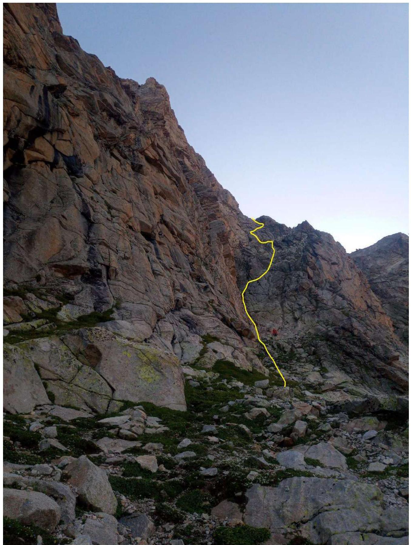
Technical photo of the route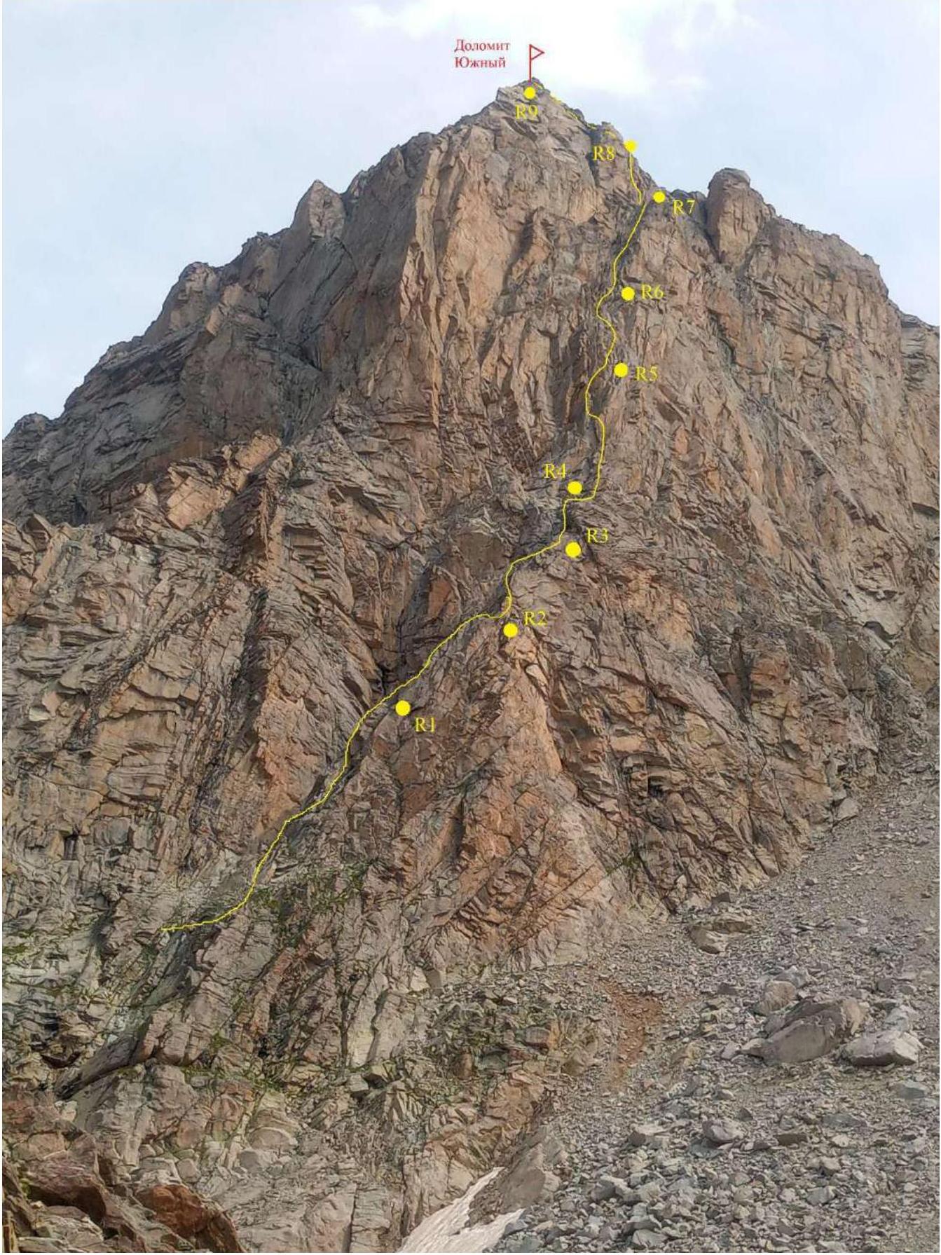
UIAA scheme
| Section # | Name and quantity of pitons | Route line in UIAA symbols | Complexity of section in symbols | Section length, m | Steepness |
|---|---|---|---|---|---|
| R8–R9 | 2 | 20 m | 30 | ||
| R7–R8 | 5–6 | 60 m | 70 | ||
| R6–R7 | 5 | 60 m | 60 | ||
| R5–R6 | 4–5 | 50 m | 65 | ||
| R4–R5 | 5 | 60 m | 65 | ||
| R3–R4 | 3 | 15 m | 45 | ||
| R2–R3 | 5 | 45 m | 50 | ||
| R1–R2 | 3 | 30 m | 40 | ||
| R0–R1 | 3 | 20 m | 45 |
Route description
| Section # | Route description | Photo # |
|---|---|---|
| R0–R1 | 20 m along a large internal corner up to the left through a stone plug. Belay on anchors and camalots. 3rd cat. complexity, 45°. | 1 |
| R1–R2 | To the right, a crack departs and up to the next horizontal shelf 30 m. Belay on anchors. Many loose stones. For safety, it's better to climb along the edge of the slabs, hammering pitons so that the rope doesn't knock down stones. 3rd cat. complexity, 40°. | 2, 3, 4 |
| R2–R3 | Along the shelf to the left 5 m and up, a bit more to the left along a more gentle corner (60°) until the end of the relief about 20 m. And then along small ledges, a traverse to the right and up (40°) 20 m to a small grassy shelf. Climbing is sometimes tricky, with small and fragile flakes. It's crucial to choose firm holds. 5th cat. complexity. | 5 |
| R3–R4 | From the left of the shelf up to a huge shelf. 15 m, 3rd cat. complexity, 45°. | |
| R4–R5 | From the shelf to the right of the rock outcrop up through a series of cracks 10 m (60°). Then along a slab 5 m and to the left at the base of a narrow chimney (wide crack) and traverse 8 m to the left around the corner. Climbing up the steps 15 m (80°) and then to the right into a wide corner. Up the corner 10 m to a series of ledges. Rope length 60 m (65°). Belay on camalots and pitons. 5th cat. complexity. | 6 |
| R5–R6 | Up to the right 15 m, up to the left 10 m, then again to the right and up to a series of cracks and ledges. Main direction up to the base of an internal corner (gentle) 5th cat. complexity, 50 m (65°). Camalots and pitons. 4th cat. complexity. | 7 |
| R6–R7 | Continue moving in the direction of the corner. It's convenient to climb into the corner from the right edge since there's an overhang under the corner. Further up the right side of the corner to a huge shelf that stretches far to the right. 60 m, (60°), belay on camalots. There are loose stones before exiting onto the shelf. 5th cat. complexity. | |
| R7–R8 | From the shelf up, there are several options to continue, at least five variants. 60 m to the pre-summit shelf. Belay — pitons, camalots. 60 m, 5–6 cat. complexity, 70°. | 8 |
| R8–R9 | 20 m to the summit on foot, descent to the right through the descent couloir. 2nd cat. complexity. |
Tactical Actions of the Team
The ascent was made from camp to camp. The camp was located on an island before the turn to Dolomitskie nochyovki, under the ascent, opposite a wagon, approximately an hour's walk from the Uzunkol alpine base. The team departed at 1:10, reached South Pass at 4:40, from where, traversing to the right, they started the route at 5:23. The time difference is due to waiting for dawn and warming up the rock, not the duration of the approach. It takes 10–15 minutes from the pass to the start of the route. They examined the line with binoculars for loose slabs and complex key sections, discussed the tactics, and waited for dawn, as starting in the dark and cold on an unfamiliar route seemed incorrect. At 5:23, they approached the route, and at 5:40, they finished working on the first rope. At 6:24, they were on a large green shelf crossing the entire wall. Along the way, they encountered a couple of old rappel rings made of reepschnur, clearly from previous years. This suggests that either someone got lost in the fog during descent and went down earlier, before the main rappel into the South Cirque, or someone had previously attempted to make a first ascent of this variant but turned back halfway. At 10:20, they reached the summit of Yuzhny Dolomit. By 12:00, they descended to the pass, and by 14:15, they had a break at Dolomit lakes and lunch. At 16:00, they returned to the alpine camp. The ascent was made simultaneously in the Krasnoyarsk style, without organizing intermediate belay stations, and equipment was passed using a long reepschnur, which allowed for a fast pace. The leader climbed the entire route with free climbing, while the second participant jumared, collecting equipment and simultaneously belaying through a Grigri device, controlling and preventing slack in the main rope. The weather was clear, not hot, and without precipitation, making the climb comfortable and pleasant. Overall, the route is quite monolithic and logical. The route is more destroyed in the first half and more monolithic in the second part (after the large shelf). Climbing is not complicated before the shelf, pleasant, but requires attention to loose stones. After the shelf:
- the steepness increases and climbing becomes more complex;
- there are options to climb slightly to the right or left, with rich relief;
- belaying can be done with pitons or by moving along cracks, organizing belay with friends or camalots. In this area, only two routes are classified as 4B, and they are considered variants of passage, thus cannot be counted for a sports rank. Therefore, the area is in dire need of routes of the claimed complexity. The first ascendants are confident that this route will be popular due to the accessibility of the start and proximity of rappels, as well as safety, since the SW edge of Yuzhny Dolomit is quite monolithic.
Photo Illustrations
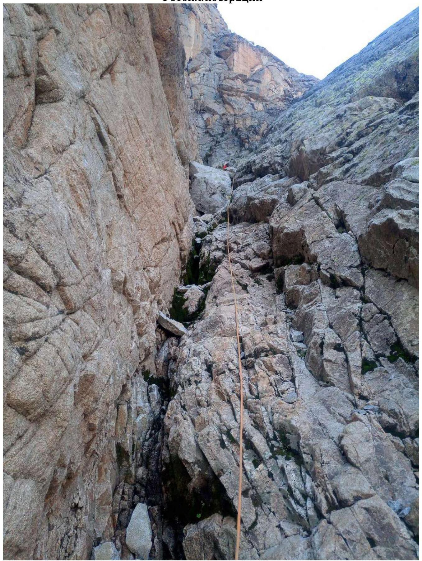
Photo 1 — Section R0–R1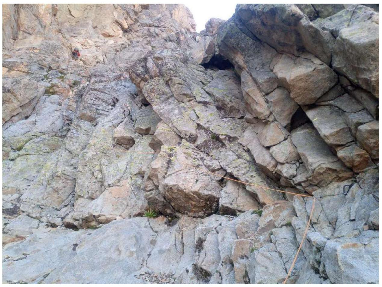
Photo 2 — Section R1–R2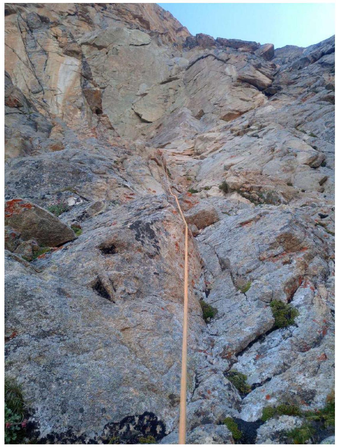
Photo 3 — Section R1–R2, deviation to the right on the second rope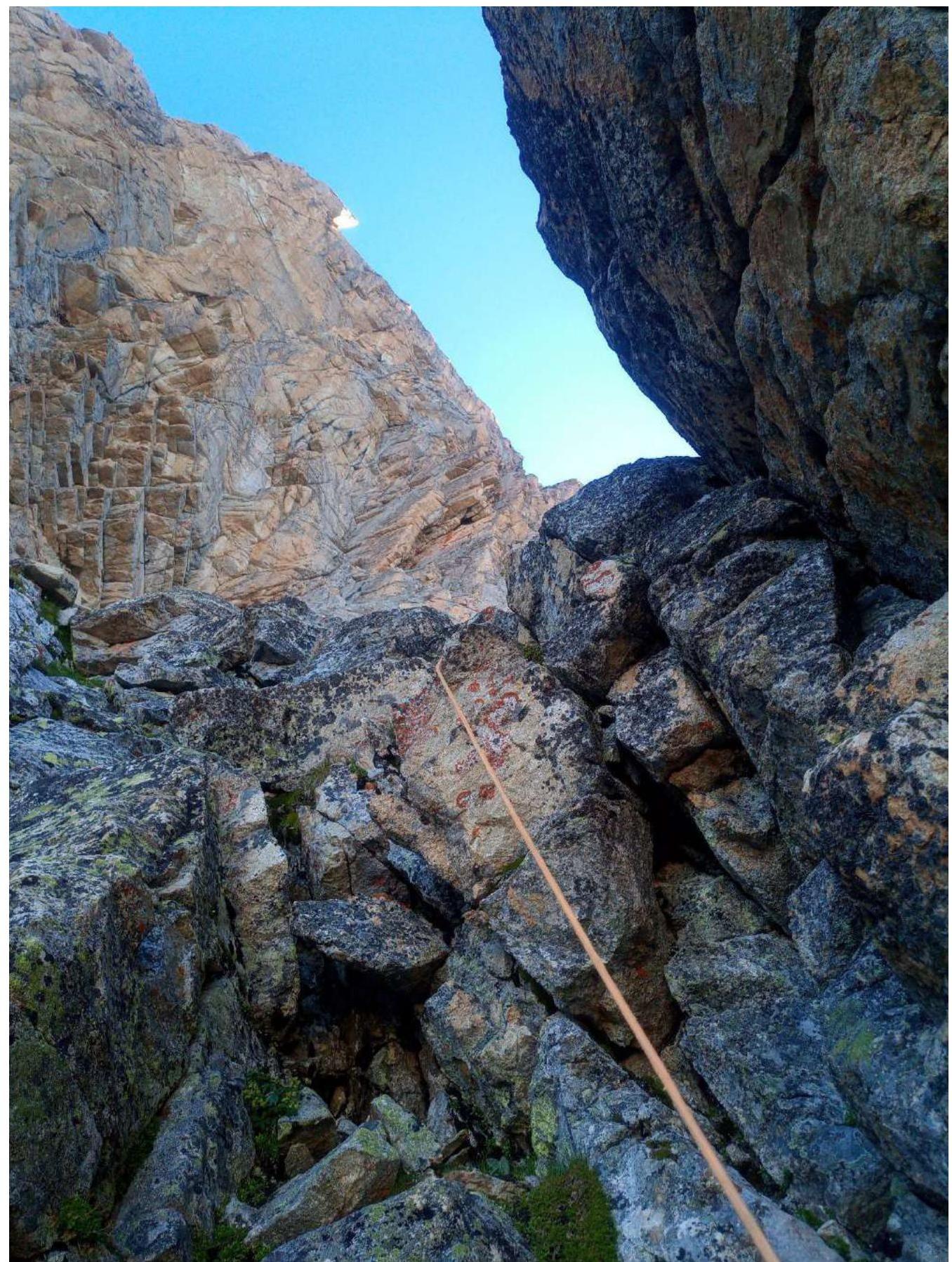
Photo 4 — Exit to the first shelf on the edge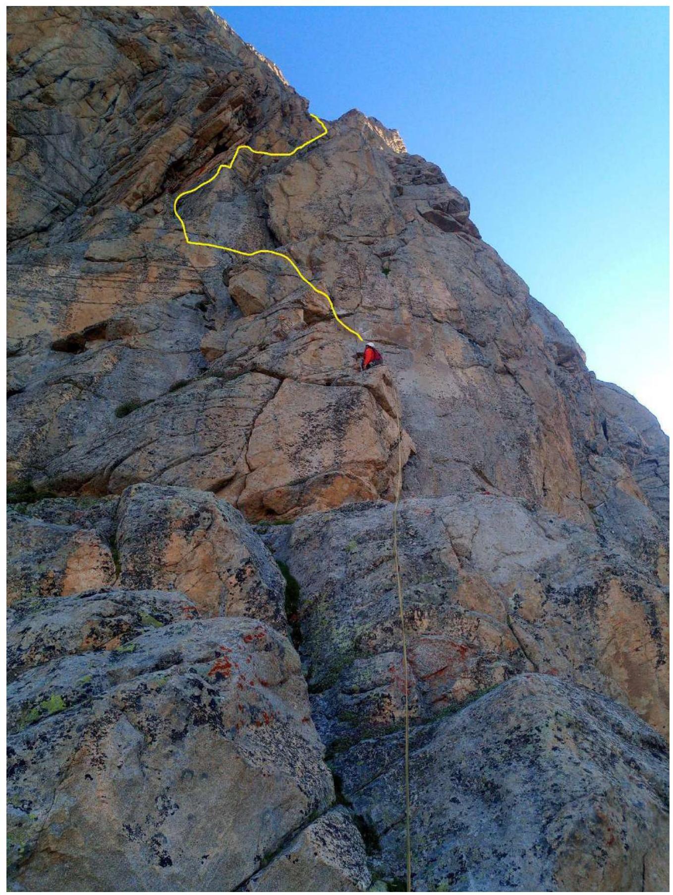
Photo 5 — Continuation of the route from the first shelf
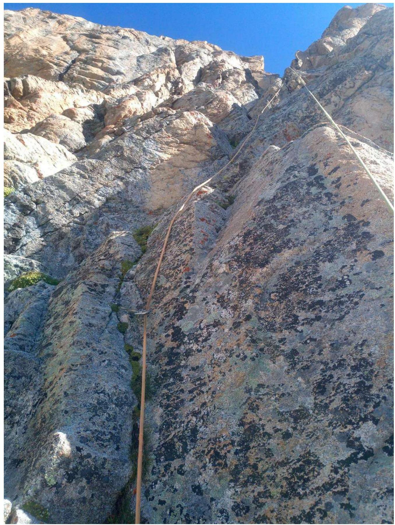
Photo 6 — Third rope after the shelf leads to the most gentle part of the wall

Photo 7 — Fourth rope after the shelf leads to a large shelf 70 m from the summit

Photo 8 — Final rope
Photo 9 — Participant on the railing
Comments
Sign in to leave a comment