
Report
On the first ascent to the summit 2850 (local name Maske) via the north-eastern ridge, category 1B complexity, by the AUSB Uzunkol team from Stavropol on August 14, 2023.
I. Climbing Report
| № | General Information | |
|---|---|---|
| 1.1 | Full name, sports rank of the leader | Olyunin Vladimir Yuryevich, 1st sports rank, December 16, 1986 |
| 1.2 | Full name, sports rank of participants | Livinsky Sergey Alexandrovich, Candidate Master of Sports, October 27, 1980; Grekova Marina Sergeevna, 2nd sports rank, June 26, 1982; Subbotina Elvira Sergeevna, 2nd sports rank, May 15, 1981 |
| 1.3 | Full name of coach | Kobylyatsky Nikolai Grigoryevich |
| 1.4 | Organization | AUSB Uzunkol |
| 2. Characteristics of the Climbing Object | ||
| 2.1 | Region | Caucasus |
| 2.2 | Valley | Ullukam |
| 2.3 | Section number according to the 2020 classification table | 2.3 |
| 2.4 | Name and height of the summit | Summit 2850 m (Maske) |
| 2.5 | Geographical coordinates of the summit (latitude/longitude), GPS coordinates | 43.29640, 42.293966 |
| 3. Characteristics of the Route | ||
| 3.1 | Route name | North-Eastern Ridge |
| 3.2 | Proposed category of complexity | 1B |
| 3.3 | Degree of route development | First ascent |
| 3.4 | Relief characteristics of the route | Rocky |
| 3.5 | Height difference of the route (altimeter or GPS data) | 150 m |
| 3.6 | Route length (in meters) | 525 m |
| 3.7 | Technical elements of the route (total length of sections of varying complexity with relief characteristics) | 1st cat. complexity grassy slope/rocks – 340 m. 2nd cat. complexity rocks – 115 m. 2+ cat. complexity rocks – 70 m. |
| 3.8 | Descent from the summit | Descent along the opposite ridge, towards the North Panoramic pass, then left down a steep grassy slope into the cirque and further along the approach path. Depending on the group's condition, 100 m of ropes may be used on the grassy slope. |
| 3.9 | Additional route characteristics | No water on the route. Water should be collected at the base camp. |
| 4. Characteristics of the Team's Actions | ||
| :--: | :--: | :--: |
| 4.1 | Time of movement (team's walking hours, in hours and days) | 12 h 45 min |
| 4.2 | Overnight stays at the base camp | Departure from the base camp |
| 5:00, August 14, 2023 | ||
| 4.3 | Start of movement along the route | 8:30, August 14, 2023 |
| 4.4 | Reaching the summit | 13:00 August 14, 2023 |
| 4.5 | Return to the camp | 17:45 August 14, 2023 |
| 5. Person responsible for the report | ||
| 5.1 | Full name, e-mail | Olyunin Vladimir Yuryevich Prom_alp_stav@mail.ru |
II. Climbing Description
1. Characteristics of the Climbing Object

Photo №1. General photo of the route profile (taken on August 14, 2023)
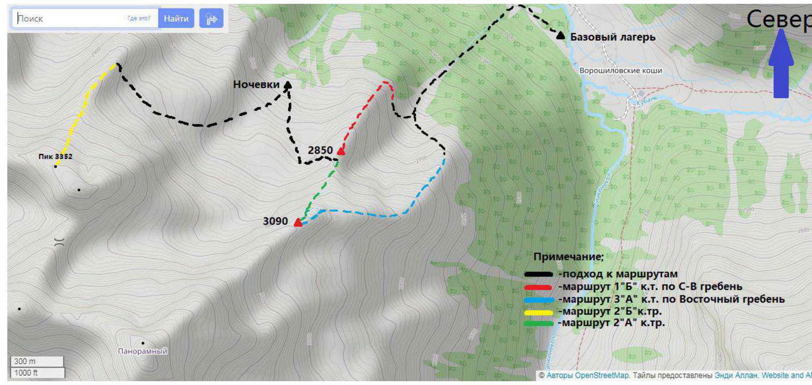
Photo №2. Map of the area (source https://www.openstreetmap.org ↗)
The summit 2850 m, locally known as "Maske", is located in the Karachayevsky district of the Karachay-Cherkess Republic, in a spur of the Main Caucasian Range between the rivers:
- East Kichkinekol
- Chirikol.
We set up our base camp at the confluence of the Ullu-Kam (Kuban) and East Kichkinekol rivers, in the house of Enver Khabchaev, the director of AUSB Uzunkol (43.30166, 42.31656).
To get to the area, from the village of Hurzuk, one needs to drive along a dirt road towards the border post, the same road that leads to AUSB Uzunkol. Immediately after the border post, there is a fork. The road straight ahead leads to Uzunkol; we need to turn left into the Ullu-Kam (Kuban) river gorge, towards the Khotyatau pass. The road is slightly worse than the one to Uzunkol and can only be traversed by an off-road vehicle.
It is possible to arrange for a car transfer and accommodation at the house with Enver Khabchaev (tel. 8 (928) 389-1972). The conditions are more than comfortable. The house is located 13.4 km from the border post.
Approach to the start of the route. From the base camp, we descend down the gorge, along the left bank of the Kuban River, to a large scree couloir (500 meters). Then, we ascend along the dry riverbed to a rocky step. To climb this step, one can:
- go left through the "birch forest";
- go right along large boulders. Upon reaching the "cirque", we move to the right along a grassy slope, parallel to the rocky outcrops. At the top of the slope, we turn right into a couloir that leads to the ridge. At the beginning of the ridge, a control cairn marks the start of the route. The approach from the base camp takes 2.5–3 hours.
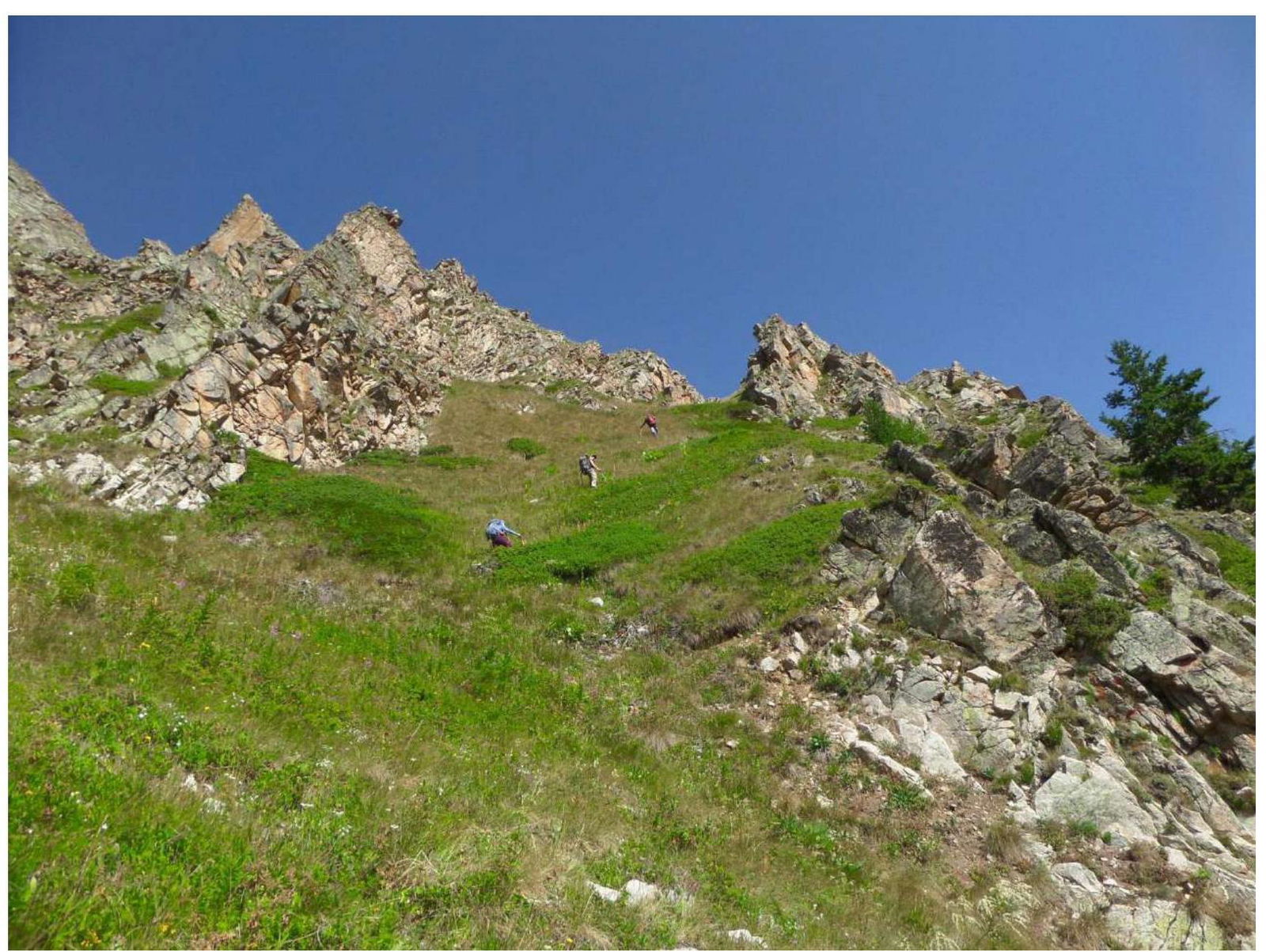
Photo №3. R0–R1. Ascent along a grassy slope.
Photo №4. R1–R2. Control cairn, start of the route.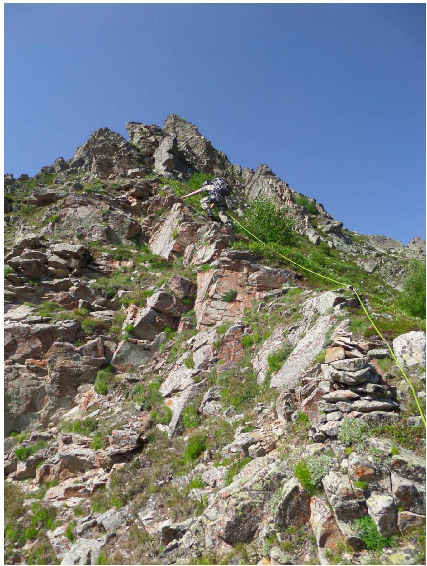
Photo №5. R2–R3. Bypassing the first large gendarme on the right.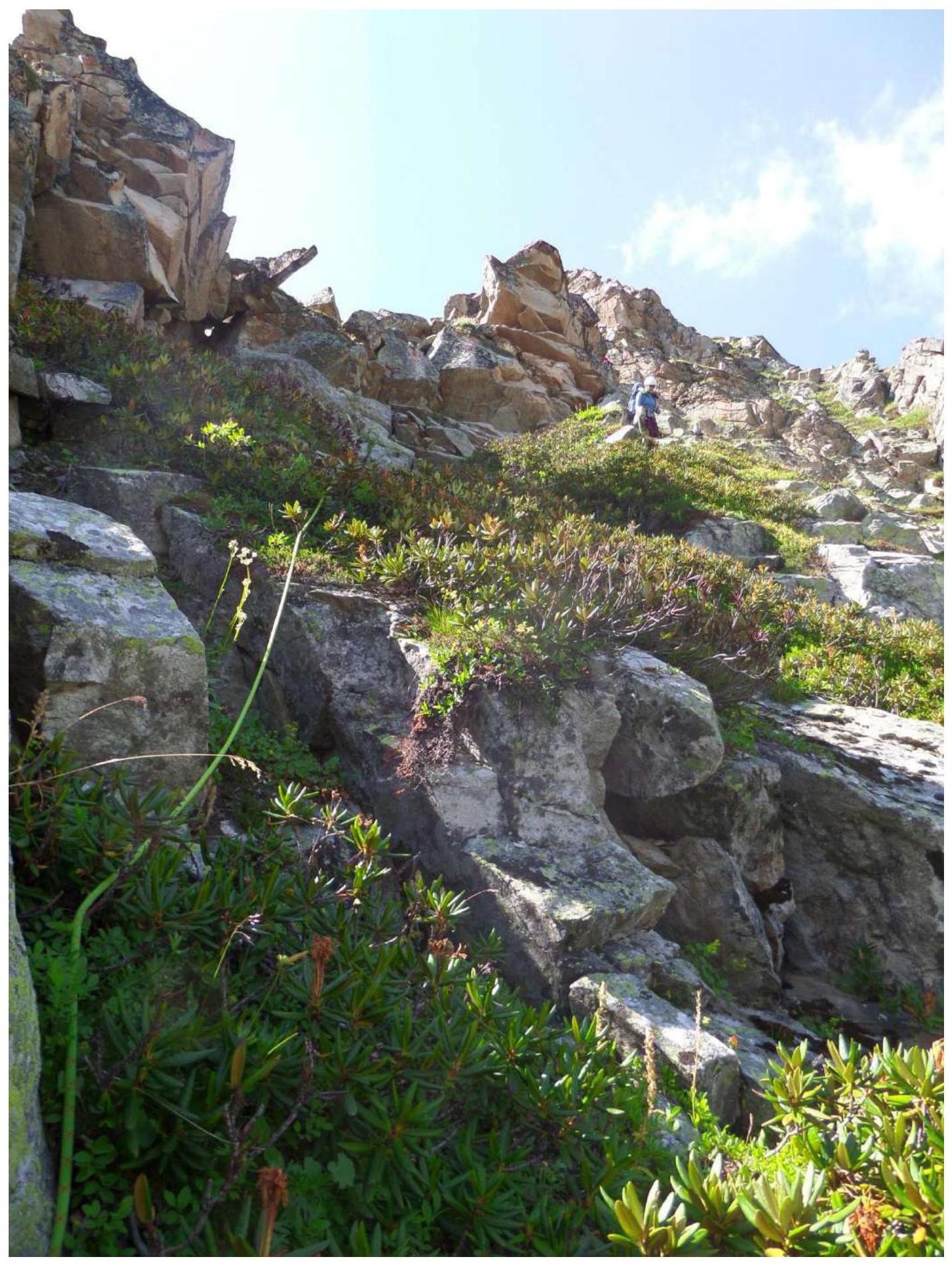
Photo №6. R3–R4.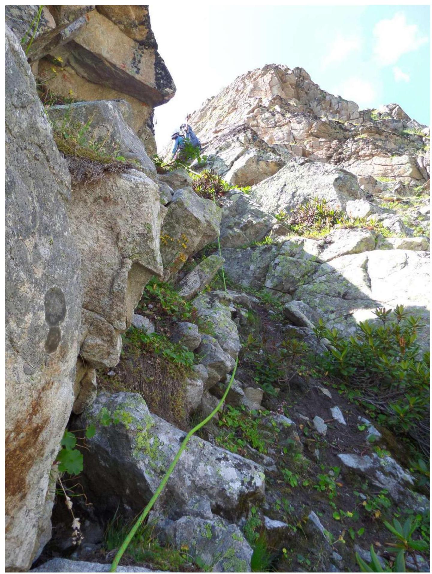
Photo №7. R4–R5.
Photo №8. R5–R6.
Photo №9. R7–R8.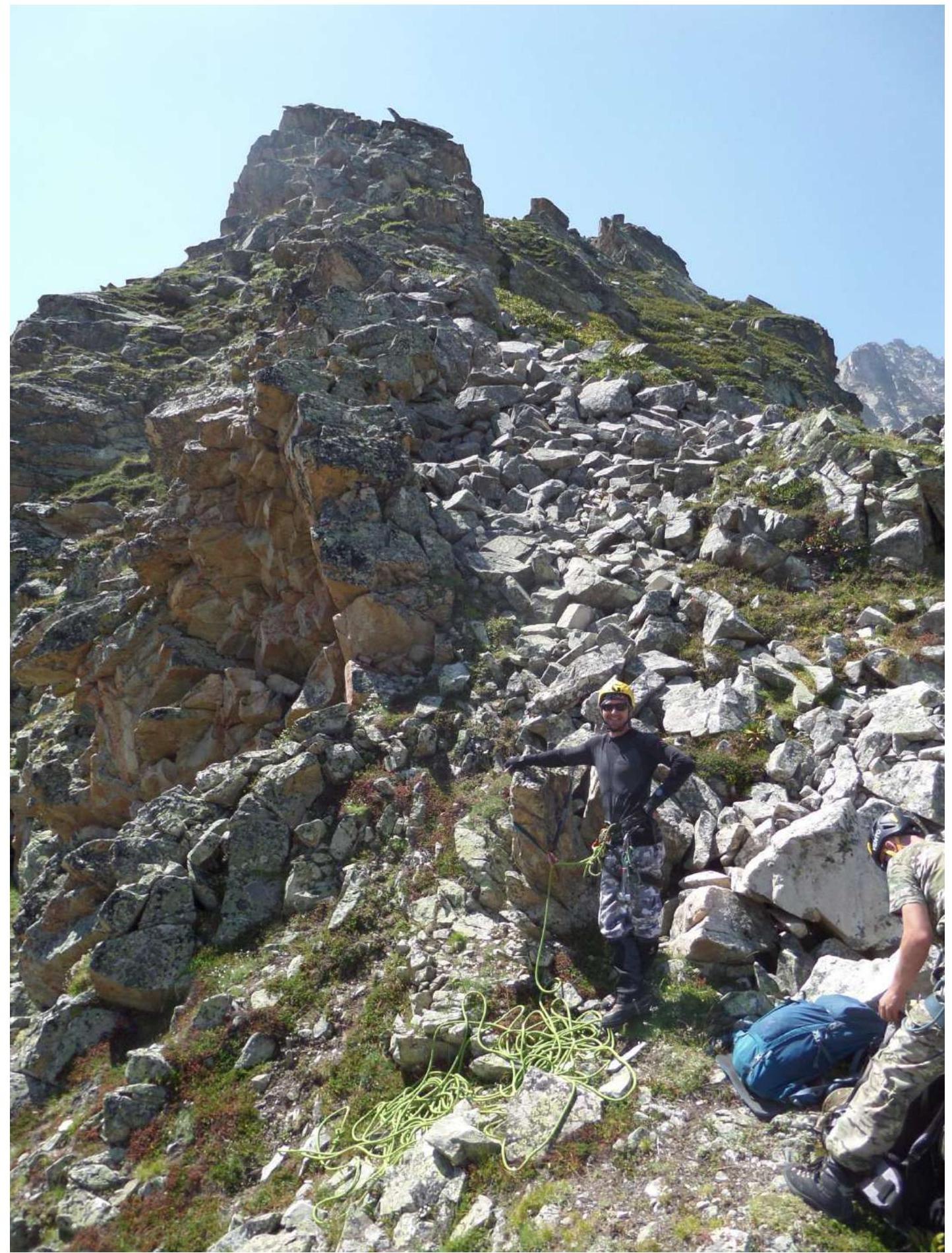
Photo №10. R7–R8.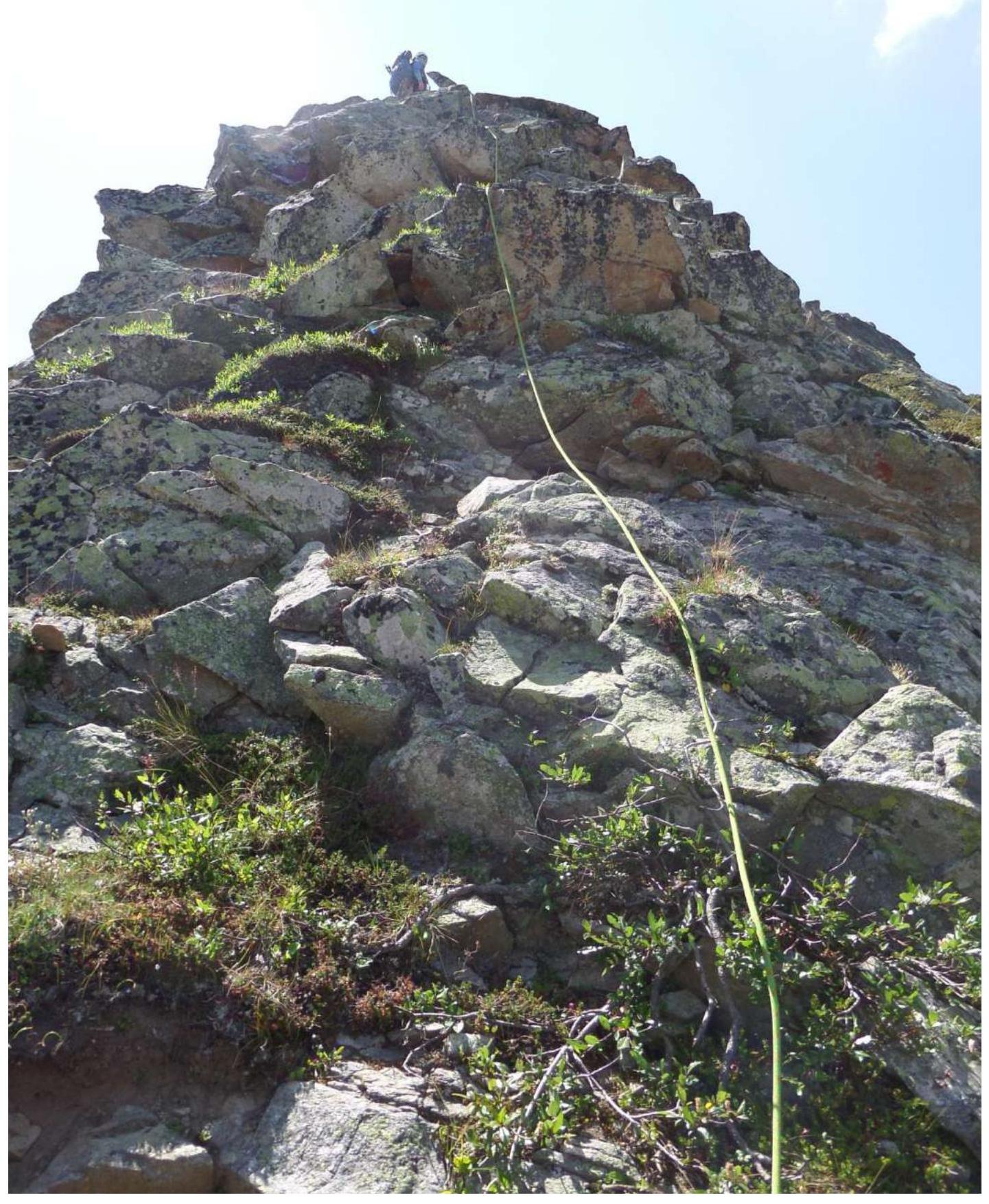
Photo №11. R8–R9.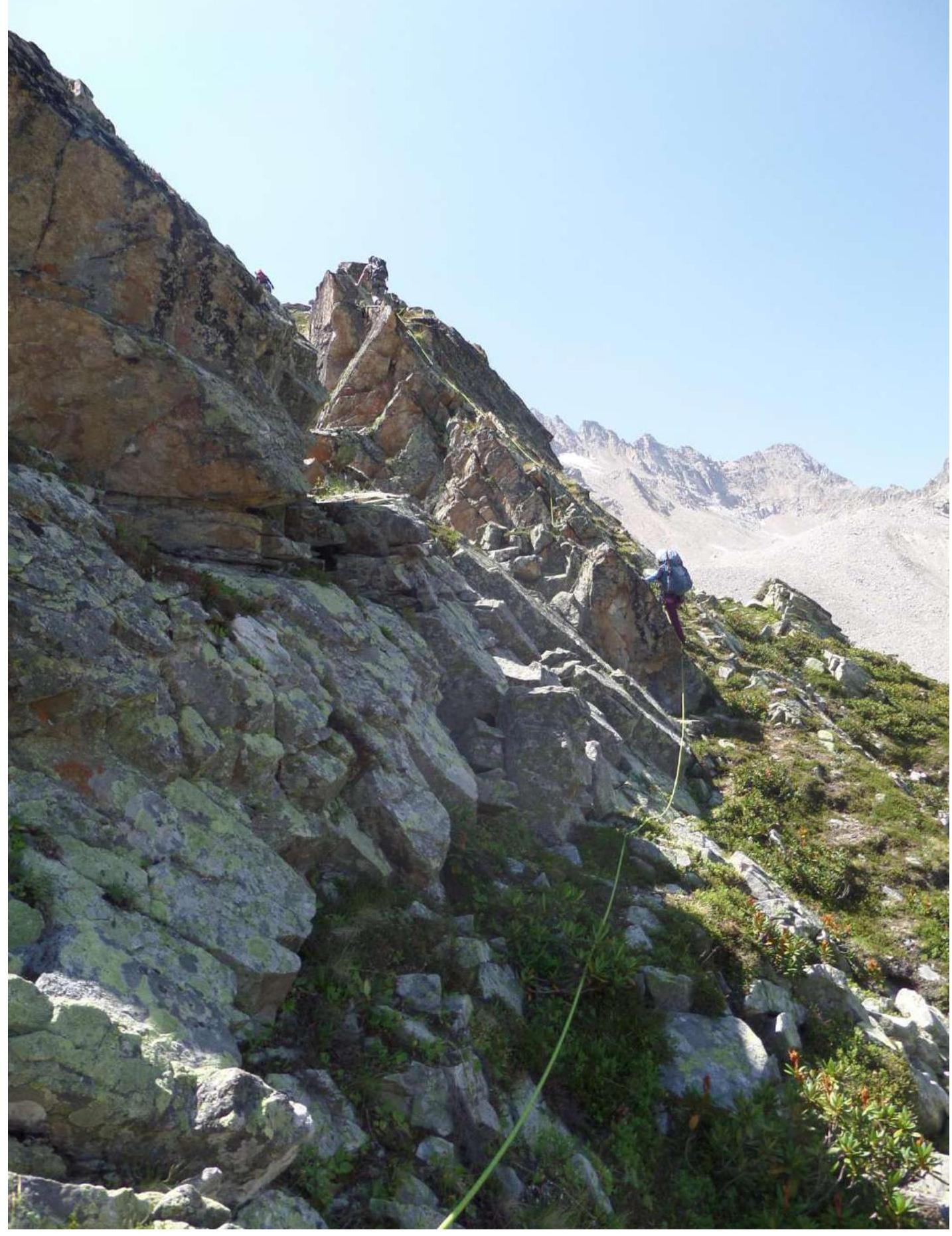
Photo №12. R8–R9.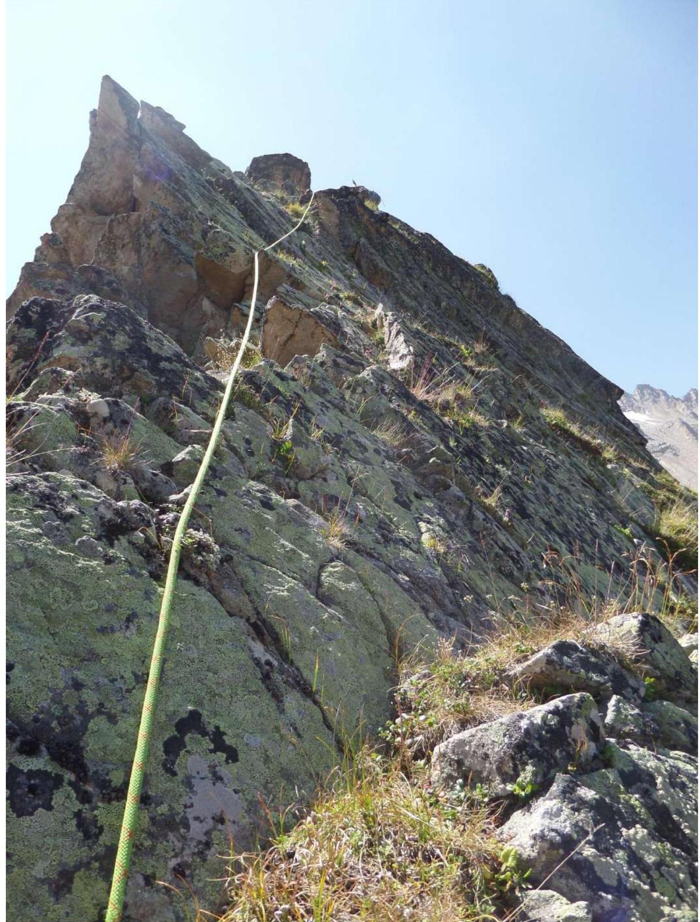
2. Characteristics of the Route
| Section № | Relief Characteristics | Category of Complexity | Length, m | Type and Number of Hooks |
|---|---|---|---|---|
| R0–R1 | Grassy slope | 1 | 140 | 0 |
| R1–R2 | Ridge | 1 | 50 | 0 |
| R2–R3 | Ridge, rocks | 2 | 50 | 0 |
| R3–R4 | Rocky ledges | 2 | 20 | 2 chocks |
| R4–R5 | Ridge | 2+ | 50 | 2 chocks, 2 anchor hooks |
| R5–R6 | Ridge | 1 | 50 | 0 |
| R6–R7 | Ridge | 2 | 45 | 0 |
| R7–R8 | Rocky wall (key section) | 2+ | 40 | 2 chocks, 2 anchor hooks |
| R8–R9 | Ridge | 2 | 50 | 0 |
| R9–R10 | Ridge | 1 | 50 | 0 |
3. Characteristics of the Team's Actions
| Section № | Description | Photo Number |
|---|---|---|
| R0–R1 | Movement up to the right along a grassy couloir towards the start of the ridge. Control cairn. Simultaneous movement 140 m, 40°–45°, 1 | Photo №3 |
| R1–R2 | Movement along the ridge. The gendarme is bypassed on the left. Simultaneous movement. 50 m, 40°, 1 | Photo №4 |
| R2–R3 | Movement along the ridge to the second gendarme, which is bypassed on the right. 50 m, 40°, 1 | Photo №5 |
| R3–R4 | Movement with ropes 20 m, 60°, 2 | Photo №6 |
| R4–R5 | Movement along the ridge. Alternating or rope movement. 50 m, 40°, 2+ | Photo №7 |
| R5–R6 | Movement along the ridge. Alternating movement 50 m, 45°, 1 | Photo №8 |
| R6–R7 | Movement along the ridge. Simultaneous movement 45 m, 40°, 2 | |
| R7–R8 | Key section of the route. Movement up a rocky wall. Rope movement 20 m, 70°, 2+ | Photo №10, №9 |
| R8–R9 | Movement along the ridge. Simultaneous movement 50 m, 40°, 2 | Photo №11, №12 |
| R9–R10 | Movement along the ridge to the summit. A control cairn is built on the summit. Simultaneous movement 50 m, 40°, 1 |
Upon completing the ascent, a debrief was conducted, assessing the complexity of individual sections and the route as a whole. The route taken is considered safe. Considering the experience of previous ascents to the summits:
- Trezubets Western — 1B
- 40th Anniversary of the Tatar ASSR — 1B
- Orlyonok Eastern — 1B
- Kara-Jash — 3B
- Zaimov Peak — 2B
- Taulan (3226) via the "Crown" route — 3A
- Krugozor "Myrd" — 2A
- 3130 — 2A
- Chat-Bashi — 3B
- Chat-Bashi — 3A
- Dolomites, South — 3B
- Dolomites North — 4A
- Dolomites North — 5A
- Zamok — 5A
The route to summit 2850 m (Maske) via the north-eastern ridge corresponds to category 1B complexity.
Recommendations for Climbers
For the route, 4 anchor hooks, a set of chocks, and several large loops are sufficient. There is no water on the route. Mobile phone signal is patchy and unstable.
Comments
Sign in to leave a comment