Report
ON THE FIRST ASCENT TO PEAK 3410 VIA THE NORTH-WEST RIDGE, CATEGORY 1B ROUTE, BY THE TEAM OF THE STAVROPOL REGIONAL FEDERATION OF ALPINISM ON 09.07.2021
I. Ascent Report
| №№ | 1. General Information | |
|---|---|---|
| 1.1 | Full name, sports rank of the leader | Kireev Evgeny Timofeevich, 1st sports rank, instructor 3 category (cert. №2037) |
| 1.2 | Full name, sports rank of participants | Iver Evgeny Vasilievich, CMS, instructor 3 category (cert. №898) Shchegoleva Alena Igorevna, III rank |
| 1.3 | Full name of the trainer | Enin Vladimir Ilyich |
| 1.4 | Organization | Stavropol Regional Federation of Alpinism |
| 2. Characteristics of the Ascent Object | ||
| 2.1 | Region | Caucasus |
| 2.2 | Valley | Ullukam |
| 2.3 | Section number according to the 2013 classification table | 2.3 |
| 2.4 | Name and height of the peak | 3410 |
| 2.5 | Geographical coordinates of the peak (latitude/longitude), GPS coordinates | 43.27506 42.28746 |
| 3. Characteristics of the Route | ||
| 3.1 | Name of the route | via the North-West ridge |
| 3.2 | Proposed category of difficulty | 1B |
| 3.3 | Degree of route exploration | First ascent |
| 3.4 | Character of the route relief | Rocky |
| 3.5 | Height difference of the route (altimeter or GPS data) | 120 m |
| 3.6 | Length of the route (in meters) | 865 m |
| 3.7 | Technical elements of the route (total length of sections of various difficulty categories with indication of relief character (ice-snow, rocky)) | I cat. rocky – 615 m. II cat. rocky – 250 m. |
| 3.8 | Descent from the peak | Via the ascent route to the valley of the East Kichkinokol river and further to the Kuban river valley |
| 3.9 | Additional characteristics of the route | In mid-summer, there is no water on the route. Many streams up to the middle of the ascent to the South Panoramic pass |
| 4. Characteristics of the Team's Actions | ||
| 4.1 | Time of movement (team's walking hours, in hours and days) | 7 h 45 min |
| 4.2 | Overnight stays | Site (base camp) |
| 4.3 | Start of the route | 4:15 July 9, 2021 from the Base Camp |
| 4.4 | Reach the peak | 12:00 July 9, 2021 |
| 5. Responsible for the Report | ||
| 5.1 | Full name, e-mail | Iver Evgeny Vasilievich, evgeniy.iver@gmail.com |
II. Description of the Ascent
1. Characteristics of the Ascent Object
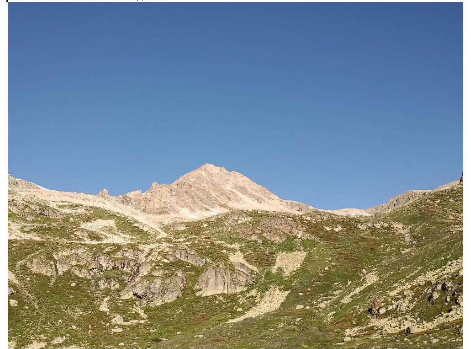
Photo № 1. General photo of the peak (taken on July 9, 2021 from the lake on the approach to the South Panoramic pass).
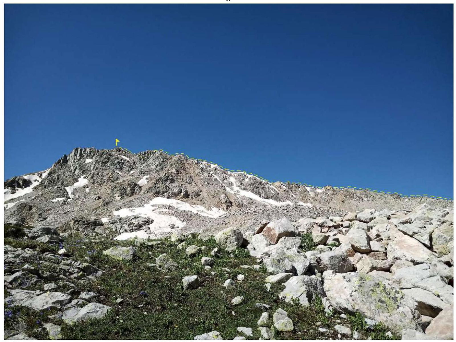
Photo № 2. Profile of the route (taken on July 9, 2021 on the approach to the South Panoramic pass).
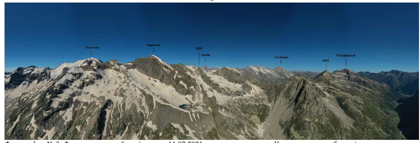
Photo № 3. Photopanorama of the area (taken on July 11, 2021 from the slopes of the Kichkinokolskaya Bashnya peak).
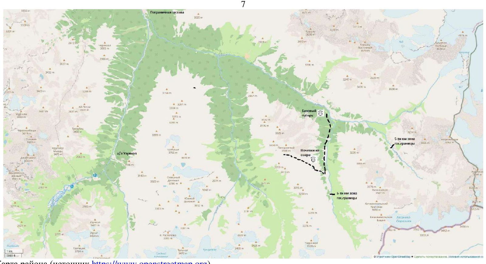
Map of the area (source https://www.openstreetmap.org↗)
In July 2020, a group of climbers from the Stavropol Regional Federation of Alpinism, Kireev E.T., Zorina L.G., and Karpov S.A., conducted a reconnaissance of the area. The results of the reconnaissance formed the basis for this first ascent.
Peak 3410 is located in the Karachaevsky district of the Karachay-Cherkess Republic, in a spur of the Main Caucasian Range, situated between the rivers:
- East Kichkinokol
- Chirincol
We set up our base camp at the confluence of the Ullu-Kam (Kuban) and East Kichkinokol rivers, in the house of the director of the Uzunkol A/L, Enver (43.30166 42.31656).
From the village of Hurzuk, it is necessary to move along a dirt road towards the border post, the same road that leads to the Uzunkol A/L. Immediately after the border post, there will be a fork. The road straight ahead leads to the Uzunkol A/L, but we need to turn left, into the Ullu-Kam (Kuban) river gorge, towards the Khotyatau pass. The road is a bit worse than to the Uzunkol A/L, and can only be traversed by an off-road vehicle. It is possible to arrange for a car transfer and accommodation in the house with Enver (tel. +7 (928) 389-1972). The conditions are more than comfortable. The house is located 13.4 km from the border post.
Additional information:
- It is possible to arrange for a car transfer and accommodation in the house with Enver (tel. +7 (928) 389-1972).
- The conditions are more than comfortable.
- The house is located 13.4 km from the border post.
The approach to the start of the route is made along the left (orographic) bank of the river – East Kichkinokol. The trail periodically disappears, but there are cairns to navigate by. 1.5–2 hours from the Base Camp, on the right side of the direction of travel, we pass a rock wall (Photo № 4), a good place to set up a rock laboratory (35–45 m, 70–80°). Approximately 200–250 m from the rock wall, where the forest zone ends, it is necessary to turn right in the direction of the South Panoramic pass. The coordinates of the start of the ascent to the pass are 43.27291 42.31575. There is no trail to the pass. Initially, the ascent begins on a grassy, partially scree slope, not strictly upwards, but slightly deviating to the right, between small forest areas. Then, bypassing rock outcrops, we reach a lake (43.28374 42.28180), 1–1.5 hours from the rock wall (2.5–3.5 hours from the Base Camp). If desired, a storm camp can be set up here.
Then, sticking to the right part of the cirque, we move in the direction of the South Panoramic pass. We do not reach the pass; before the final ascent, it is necessary to deviate left towards the saddle, at the beginning of the ascent of the ridge leading to peak 3410. The coordinates of the start of the route are 43.27900 42.28370.
Travel time:
- 2.5–3 hours from the lake
- 5–6.5 hours from the Base Camp
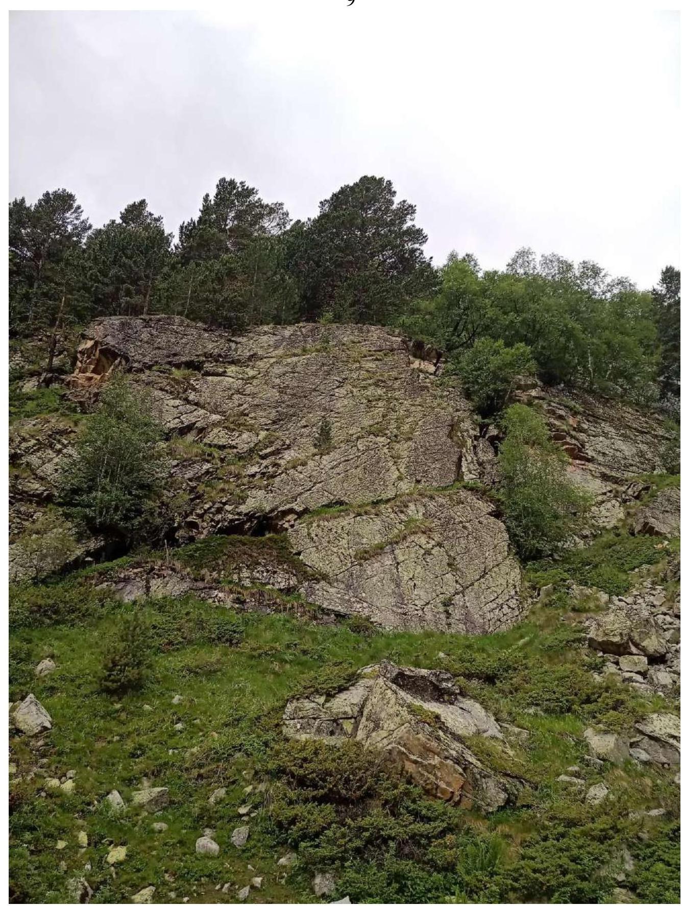
Photo № 4. Rock wall.
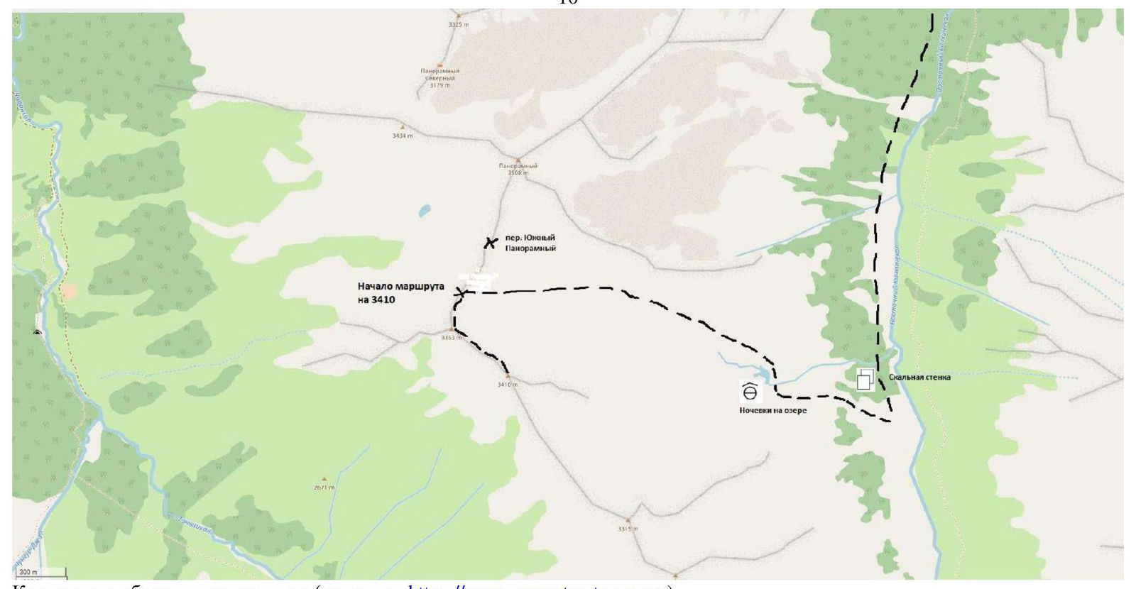
Cartographic scheme of the ascent object (source https://www.openstreetmap.org↗)
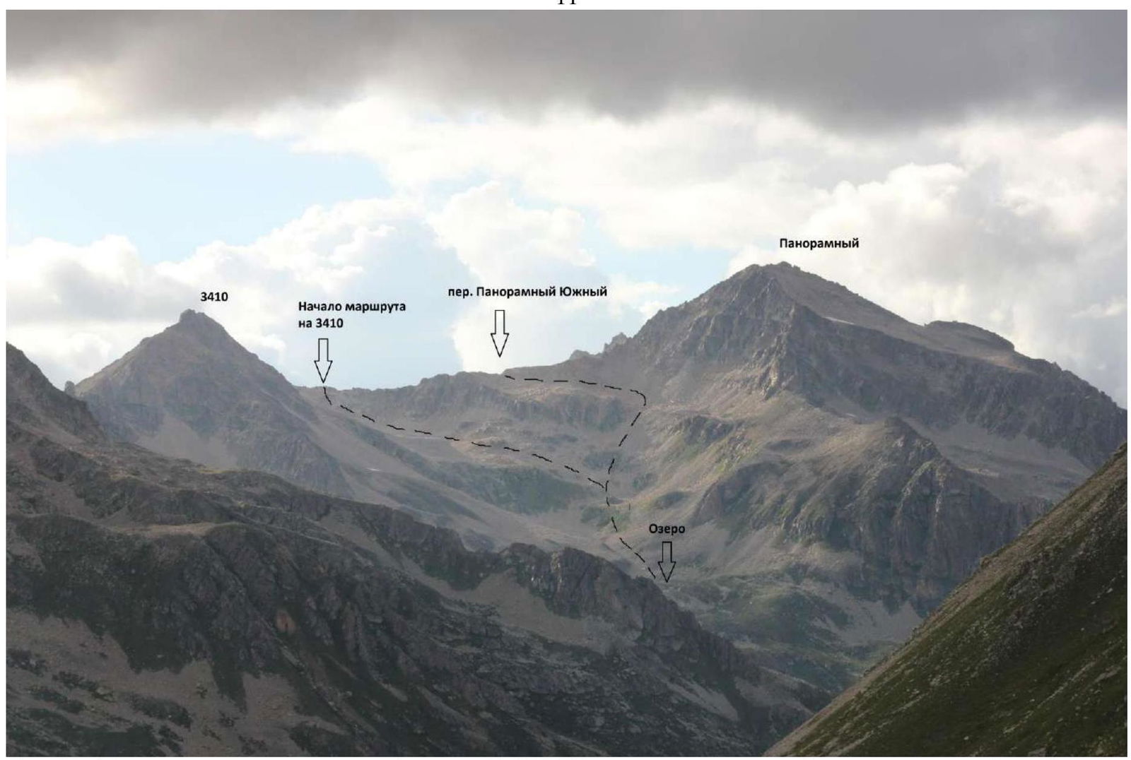
Photo № 5. Approach to the start of the route (taken on July 30, 2020 from the slopes of the Kichkinokolskaya Bashnya peak).
2. Characteristics of the Route

Photo № 6. Technical photo of the route (taken on July 9, 2021 at the start of the route).
Technical characteristics of the route sections
| Section № | Character of relief | Category of difficulty | Length, m | Type and number of pitons |
|---|---|---|---|---|
| R0–R1 | Ridge | 1–2 | 250 m | 0 |
| R1–R2 | Bypassing the wall on the right and the yellow sentry on the left. Exit to the ridge | 1–2 | 200 m | 0 |
| R2–R3 | Ridge | 1–2 | 310 m | 0 |
| R3–R4 | Descent from the ridge to the right, exit to the ridge on the left. Exit to the peak along the ridge | 1 | 105 m | 0 |
3. Characteristics of the Team's Actions
| Section № | Description | Photo number |
|---|---|---|
| R0–R1 | Movement from the saddle along the ridge: 100 m, 30°, 1; 100 m, 20°, 2; 30 m, 20°, 1; 20 m, 10°, 1 – exit to peak 3353. Simultaneous movement. | Photo № 7 |
| R1–R2 | Movement along the ridge: 100 m, 10°, 2 – bypassing the wall on the right; 50 m, 0°, 2 bypassing the yellow sentry on the left; 50 m, 0°, 1 exit to the ridge. Simultaneous movement. | Photo № 8 |
| R2–R3 | Movement along the ridge: 50 m, 10°, 1–2; 50 m, 15°, 1; 80 m, 5°, 1; 50 m, 10°, 1–2; 80 m, 0–30°, 1. Simultaneous movement. | Photo № 9 |
| R3–R4 | Movement along the ridge: 30 m, 30°, 1 – descent to the right; 40 m, 40°, 1 – exit to the ridge; 35 m, 40°, 1 exit to the peak (2 h 30 min from the start of the route). Simultaneous movement. | Photo № 10. Photo № 11. Photo № 12 |
Descent was carried out along the ascent route, simultaneous movement.
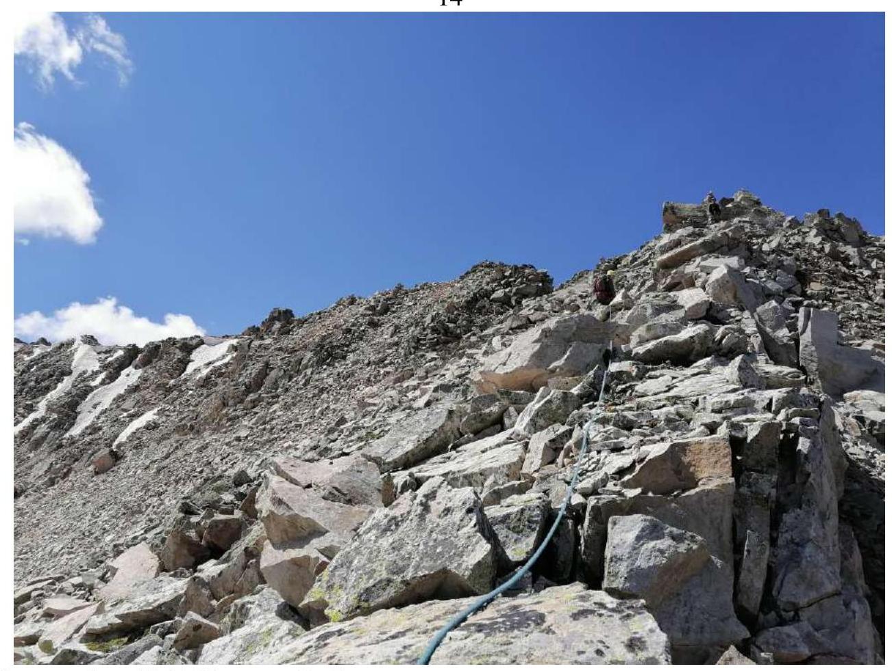
Photo № 7. Section R0–R1.
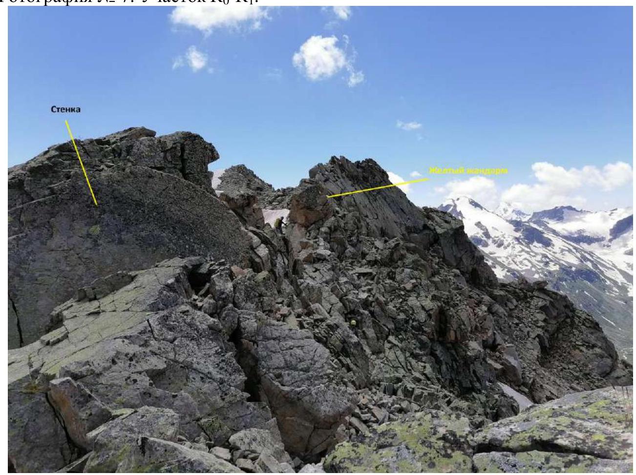
Photo № 8. Section R1–R2. Bypassing the wall on the right and the yellow sentry on the left.
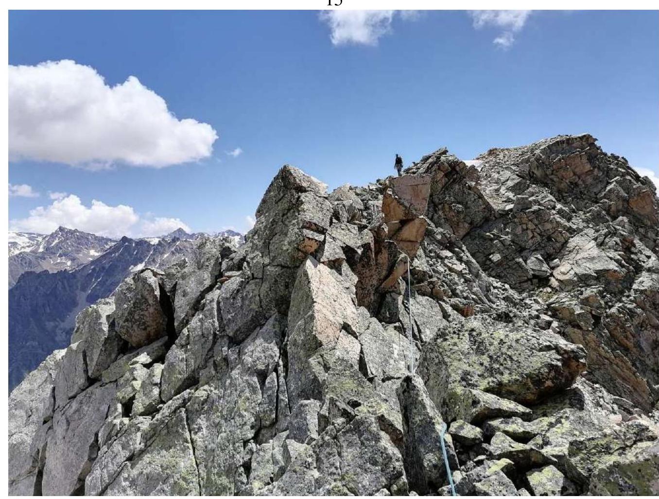
Photo № 9. Passage. Section R2–R3.
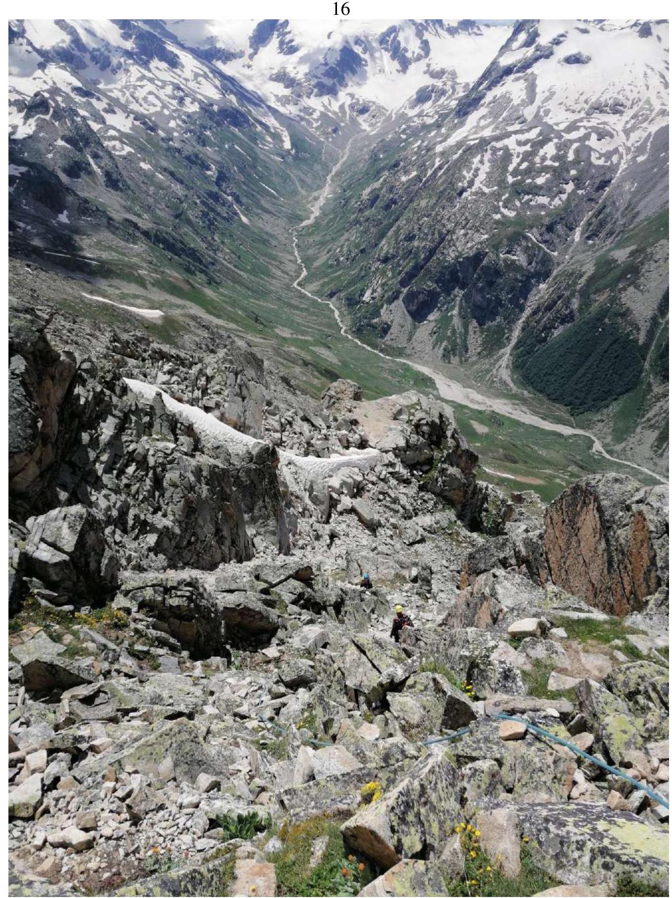
Photo № 10. Descent to the right. Section R3–R4.
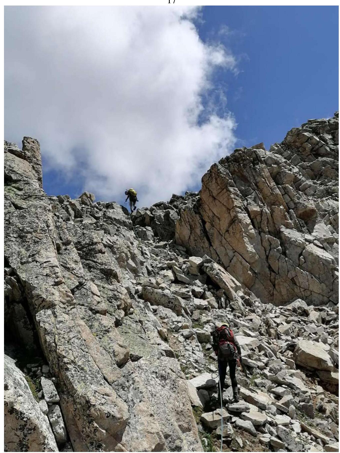
Photo № 11. Exit to the ridge. Section R3–R4.
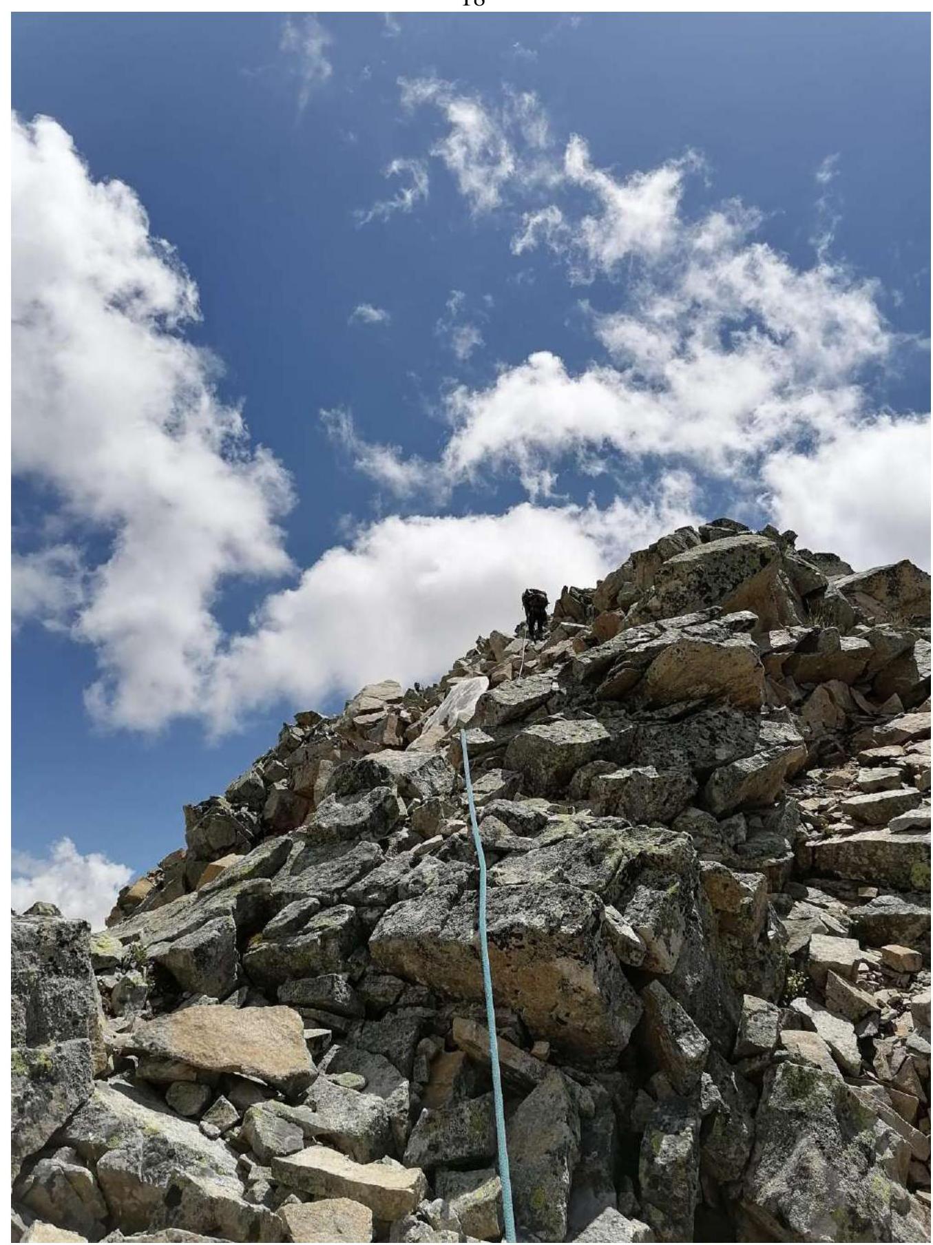
Photo № 12. Exit to the peak. Section R3–R4.
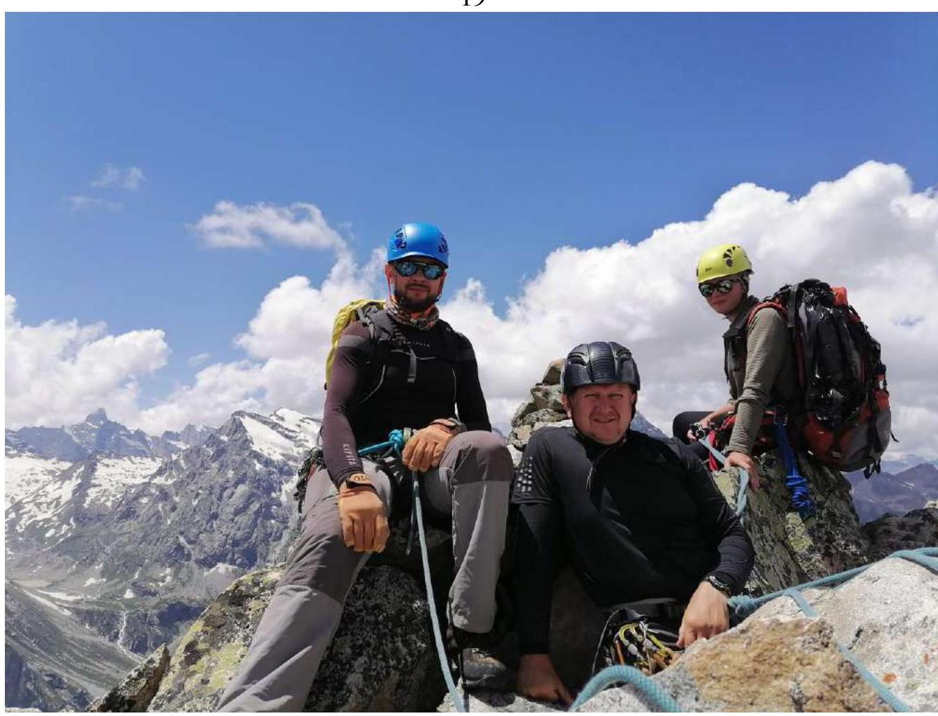
Photo № 13. Team at the peak near the control cairn. From left to right: Iver E.V., Kireev E.T., Shchegoleva A.I.
Upon completion of the ascent, a debriefing was conducted, and the complexity of individual sections and the route as a whole was assessed. The route taken is safe and logical. Considering the experience of previous ascents to peaks:
Orlenok, Eastern – 1B, Orlenok Rock – 1B, Chkhaltadzykh – 2A, Batak – 2A, Kelbashi – 1B, Western Trident – 1B, the route to peak 3410 corresponds to category 1B.
Recommendations for Climbers
When planning two ascents, to peak 3410 and peak Panoramic (Panorama), it is advisable to set up a storm camp at the lake. When undertaking the ascent from the Base Camp, it is necessary to depart no later than 4:00.
Water can be collected from streams up to the middle of the ascent from the lake to the South Panoramic pass.
MTS mobile coverage appears on the approach to the pass and is present throughout the entire route.