
Championship of the Southern and North Caucasian Federal Districts, high-altitude technical class Team of Stavropol Krai — 2
Report
on the ascent to the summit Shokoladny peak via the southwest wall, 5B, rock climbing. Despье Route
Stavropol, 2024
Ascent Passport
- Western Caucasus, Uzunkol, Myrd gorge, route 2.3.132.
- Summit: Shokoladny peak (3650), via the southwest wall (Despье, 1975)
- Complexity category — 5B
- Route type — rock climbing
- Height difference of the route: 620 m
Length of sections:
- 5th category complexity — 344 m
- 6th category complexity — 115 m
Average steepness:
- Main part of the route (wall) — 85°
- Entire route — 55°
- Pitons left on the route: 0
Pitons used on the route:
- stationary bolt pitons — 0;
- removable bolt pitons — 0;
- anchor pitons — 40;
- camalots — 10;
- chocks — 30; fifi hooks were used; Total artificial climbing aids (AIDS) used: 15
- Team's climbing hours: 18 hours (1 day)
- Leader: Reshetnik Sergey Vladimirovich, Candidate for Master of Sports
Team members: Kovaleva Irina Anatolyevna, 1st sports category; Sviridov Daniil Sergeyevich, 1st sports category
- Coach: Enin Vladimir Ilyich, Candidate for Master of Sports
- Departure for the route: 4:00, July 18, 2024
Reached the summit: 20:00, July 18, 2024. Returned to the bivouac: 22:00, July 18, 2024
General Description of the Area
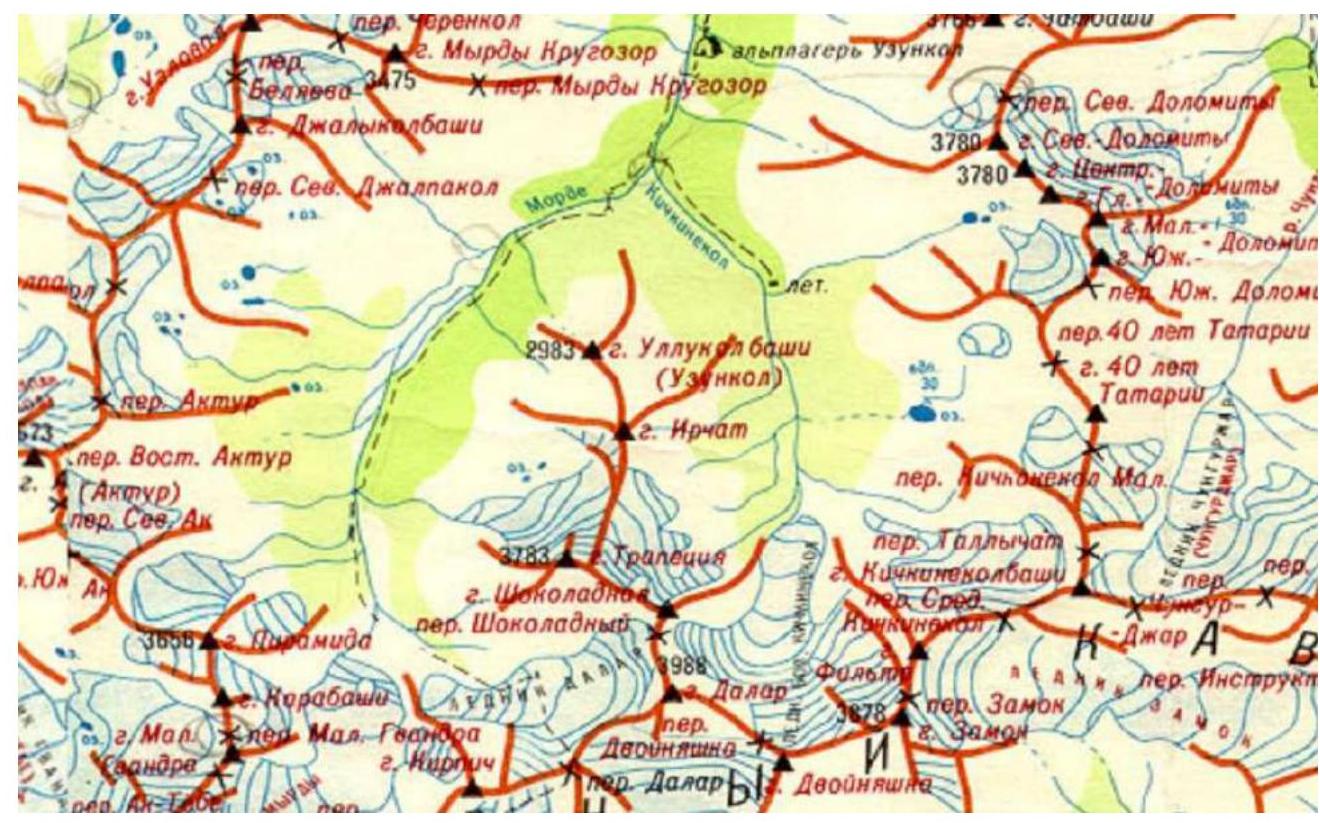
The Old Karachai section of the Western Caucasus (Main Caucasus Range), 40 km long, began to be actively explored by climbers and tourists only from 1936. Rivers flowing from the slopes to the north are the headwaters of the Kuban River. The Uchkulan and Ullukam rivers (15 km), merging, form the Kuban. The Ullukam receives rivers flowing from the Main Caucasus Range: Ulluoz (5 km), V. Kichkinekol (6 km), Chiryukol (10 km), and Uzunkol (8 km). The confluence of Uzunkol and Ullukam is called Kovdun. Uzunkol is formed by the confluence of two rivers: Myrd (6 km) and Kichkinekol (4 km). This place is called Uzunkolskaya Polyana. Below Uzunkolskaya Polyana along the Uzunkol river is the Uzunkol alpine camp. From an alpinist's perspective, the most interesting are: the Main Caucasus Range with peaks — Kichkinekol, Filtr, Zamok, Dvoynyashka, Dalar, Shokoladny peak, Kirpich, and Gvandra. A short spur between the Myrd and Kichkinekol rivers has peaks Irchat, Malaya Trapezia, Bolshaya Trapezia, and Uzunkol peak. The approach to the bivouac in the moraine pocket of the Dalar glacier is made from the Uzunkol alpine camp. From the camp opposite the base, cross the bridge to the meadow, to the cattle pen, and ascend the hill via a rough road. The road ends at "Uzunkolskaya Polyana". This is how the bivouac sites at the confluence of the rivers came to be known since the 30s, where climbers and later mountain tourists regularly stopped. From "Uzunkolskaya Polyana", a trail goes up the left bank of the Myrd river in a pine forest. About 1 km later — a cattle pen. Further, the left bank is littered with boulders, and the trail crosses to the right bank via a small bridge. Another 1 km later, at the forest boundary, the trail returns to the left bank to the second cattle pen. Ahead, for several kilometers, stretches a flat, swampy valley floor with sparse birch groups. Above the weakly dissected left slope rises the rocky peak of Piramidy. The trail is built along the left slope. After 1 hour, the swamp gives way to a scree of huge stones, among which birch trees grow. To the south rises the dominant peak Kirpich. From the southeast, the moraines of the Dalar glacier descend into the valley, above which the "multi-story building" of Dalar rises. The ascent to the upper cirque of the 2 km long Dalar glacier is made via a trail on the right-bank moraine. To reach the moraine from the main trail, which goes under the left slope of the Myrd valley, one must cross several water streams. From the upper end of the moraine, across the glacier plateau, a broad saddle in the Main Caucasus Range between the peaks Dalar and Kirpich is visible, to which a snowy slope (30–40°) with a bergschrund leads. This is Dalar pass.
Photo from the bivouac, July 17, 2024
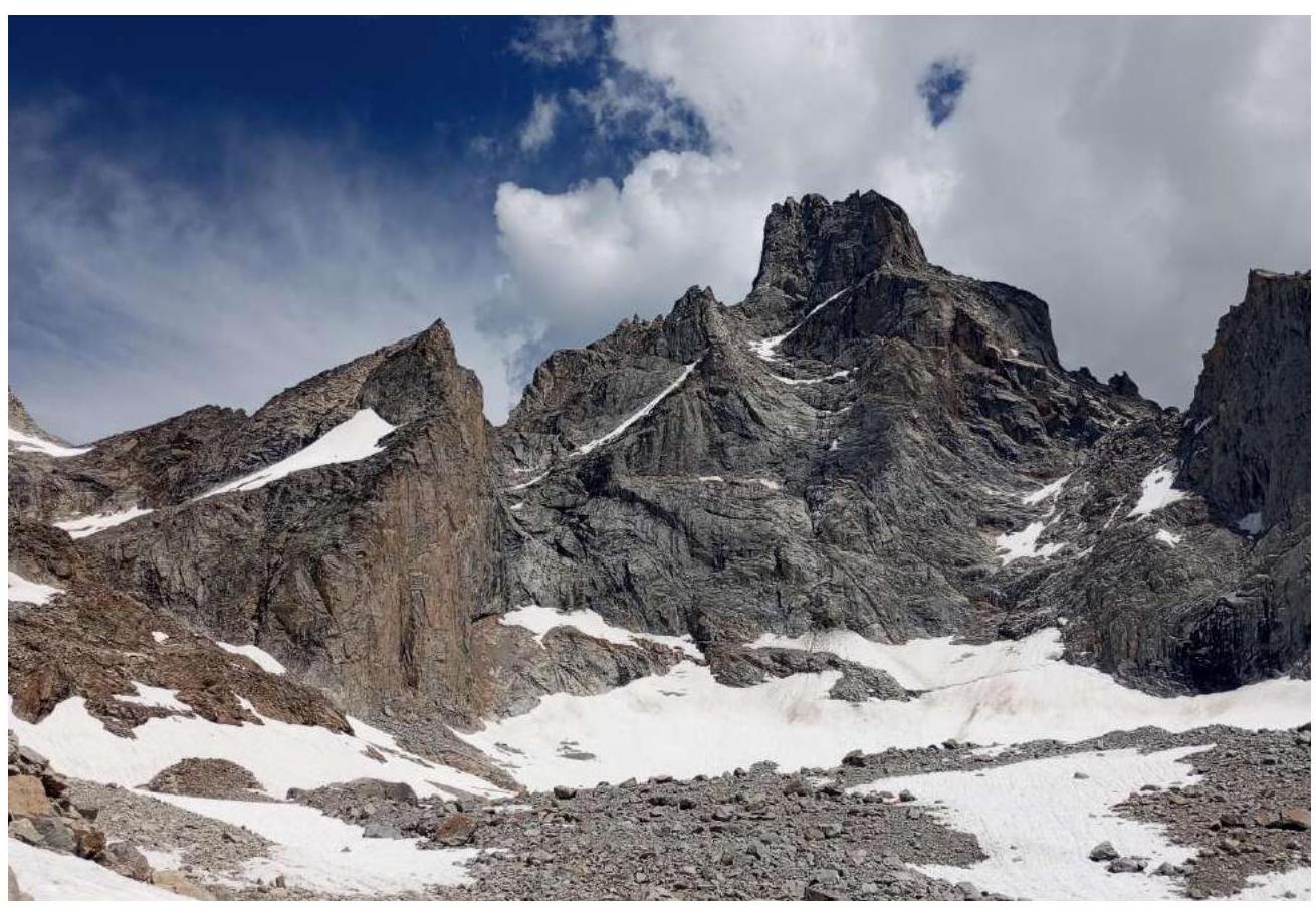
Figure 1. Left — Shokoladny peak, right — Dalar peak Photo of the wall with the route line
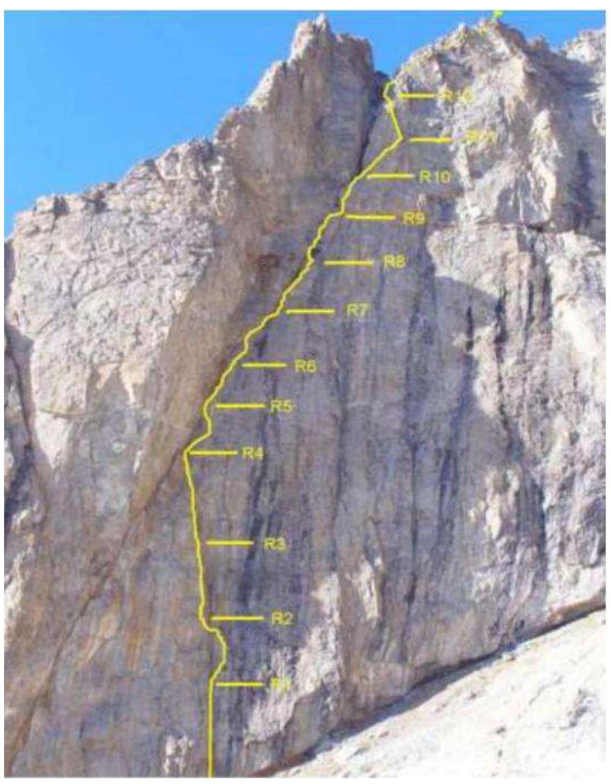
Figure 2

Figure 3. UIAA scheme of the route to Shokoladny peak via the SW wall, 5B category (from the book by P. Zakharov "Western Caucasus. Uzunkol")
Route Description
according to Zakharov
The wall of Shokoladny peak is characterized by complex rock climbing throughout its 500-meter length. A diagonal crack running along the entire wall expands into a scree-filled couloir at the top. Melting snow on the summit flows down here as streams of water. The section of difficult rocks R7–R9 is overcome in the stream of a waterfall. The beginning of the route passes through a vertical internal corner with overhangs and narrow ledges. The corner connects to the diagonal crack at the first third of the wall. At the junction, there is a platform for a tent R4. This is the only convenient bivouac spot on the route. Further bivouacs are only sitting or hanging.
Further movement involves difficult rocks:
- 200 m — 80–85°
- 75 m — 90°
Climbing is mostly free, on the right side of the crack-chimney (water flows at the bottom). From R12, move left via a traverse into the scree-filled couloir, ascend to the saddle of the pre-summit ridge. Then, ascend the 200-meter slope to the summit.
Descent from the summit:
- Via easy rocks and snow-scree slopes towards Malaya Trapezia
- Then along the slopes — to the initial bivouac on the Western Dalar glacier (30 minutes from the wall)
Ascent Description
On July 17, we left the Uzunkol base camp. We set up a bivouac as close as possible to the wall. We visually examined the route line for the next day's ascent.
On July 18, we began the ascent. The first ropes were foggy. The first 3 ropes were pleasant to climb. There were good artificial climbing aids (AIDs) in some places.
We start climbing the R4–R5 section:
- the terrain changed significantly,
- the rock is rotten,
- climbing is uncomfortable.
We successfully pass the first chimney. The walls are damp in some places, requiring the use of AIDs. When exiting onto the pre-summit ridge, it is very rockfall-prone; many rocks are dislodged by the rope, and movement slows. The pre-summit ridge is traversed simultaneously. It's windy. After taking a photo on the summit, we immediately start descending.
Time Breakdown
- 4:00 — departure from the bivouac
- 4:30 — start working on the route
- 20:00 — reached the summit
- 22:00 — returned to the bivouac
Tactical Actions of the Team
Throughout the route, the first climber worked on two ropes (one static and one dynamic), the second climber followed on the fixed ropes with top-rope protection, and the third climber followed with free climbing and top-rope protection.
Team Equipment
- Dynamic rope 50 m — 2 pieces
- Static rope 50 m — 1 piece
- Camalots (set) — 10 pieces
- Chocks (set) — 10 pieces
- Quickdraws with carabiners — 15 pieces
- Rock pitons — 2 pieces
- Anchor pitons — 15 pieces
- Carabiners — 15 pieces
- Rock hammers — 3 pieces
- Jumars — 2 pieces
- Rock shoes — 1 pair
- Basic slings — 4 pieces
- Ice axes — 3 pieces
- Etriers — 1 pair
- Stirrups for etriers — 2 pieces
Personal gear and equipment:
- 3 sets
- Radio — 1 piece
- First-aid kit — 1 piece
Bivouac equipment:
- Polyethylene (3 × 5 m) — 1 piece
- Gas burner — 1 piece
- Gas cartridge 250 ml — 1 piece
- Sleeping pad — 1 piece
- Sleeping bag — 1 piece
- Pot 1 l — 1 piece
- Food — 3 people × 2 days

Figure 4. Approach to the route. Photo taken at the R0 section.
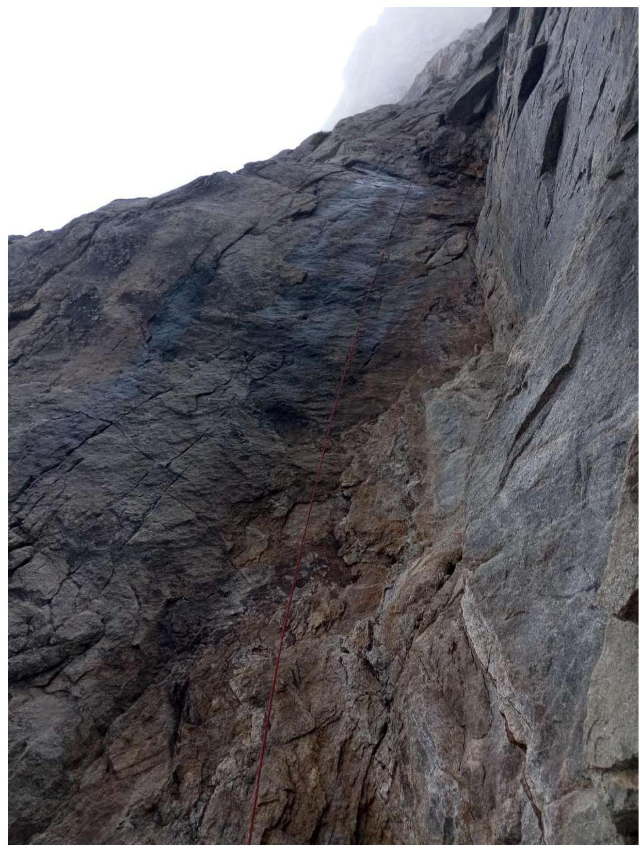
Figure 5. Start of the R0–R1 section
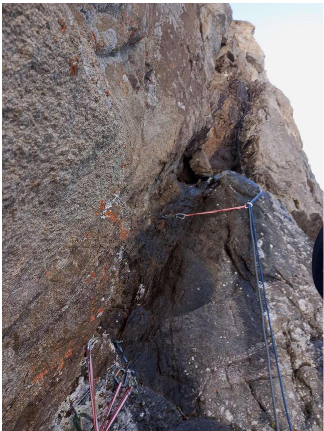
Figure 6. R7 section — destroyed corner-chimney
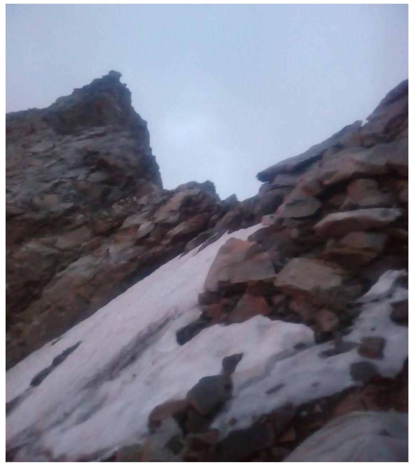
Figure 7. Pre-summit ridge and summit
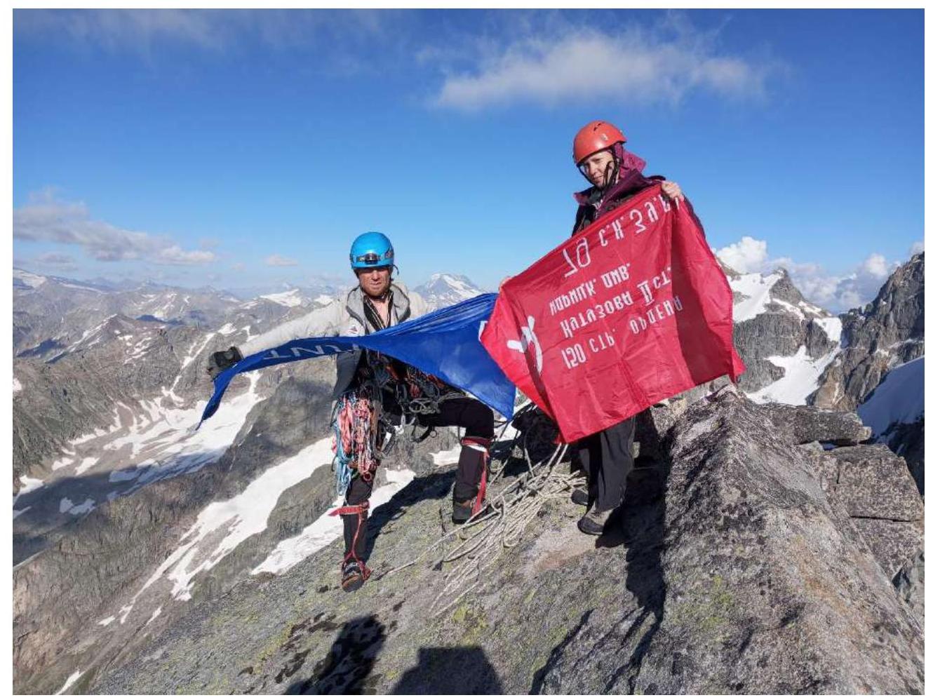
Figure 8. On the summit. Photo taken by Sviridov D. S.
Comments
Sign in to leave a comment