CIS Championship 2007
High-altitude technical class Classification Commission of the FAR
Report
on the first ascent of the route to peak Kirpich (3800 m) via the left part of the Western wall, category 6A (KTMGV item 2.3), made by the team of the Luhansk Regional Federation of Alpinism and Rock Climbing
Team leader: Pugachev S.A., Master of Sports, instructor 2nd category Coach: Zagirnyak M.V., Master of Sports, instructor 1st category.
Luhansk Regional Federation of Alpinism and Rock Climbing
Chairman: Zagirnyak Mikhail Vasilievich Ukraine, 91005, Dalnevostochnaya str., 2D
Team leader Pugachev Sergey Alexandrovich
Team coach Zagirnyak Mikhail Vasilievich mzagirn@polytech.poltava.ua
Ascent Passport
- Russia, Caucasus.
- Rock climbing class.
- Western Caucasus, from Nakhar pass to Chiperezao pass, section 2.3.
- Peak Kirpich (3800 m), via the left part of the Western wall.
- Proposed category: 6A, first ascent.
- Route characteristics: height difference: 850 m, length – 1105 m; length of sections with 5–6 category complexity – 443 m; average steepness of the main part – 80°; start of the route — summit – 60° (2950–3800 m).
- Number of pitons driven (including in the denominator for ITO): rock pitons 98/66 chocks 147/112 bolt pitons 3/3 (15 stations) ice screws 0/0
- Climbing hours — 31 and days — 3 (preparation — one day).
- Number of bivouacs and their characteristics: Preparation — at Myrdy bivouac, in a tent; 1st — two in a platform, two in hammocks; 2nd — two in a platform, two in hammocks.
- Team leader: Pugachev Sergey Alexandrovich, Master of Sports;
participants:
- Zagirnyak Mikhail Vasilievich, Master of Sports;
- Verbitsky Orest Mikhailovich, Candidate for Master of Sports;
- Revunov Nikolai Vladimirovich, Candidate for Master of Sports.
- Team coach: Zagirnyak Mikhail Vasilievich, Master of Sports, instructor-methodologist 1st category.
- Start of the route: August 1, 2007; summit: August 3, 2007, 13:00; return to Uzunkol tourist center: August 4, 2007.
- Organizing body — Luhansk Regional Federation of Alpinism.
Photo 1. General photo of the summit 3800 m. Western wall.
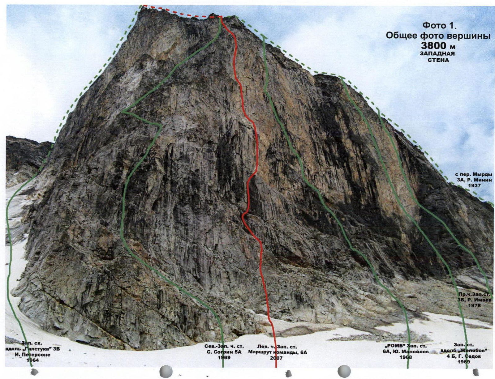
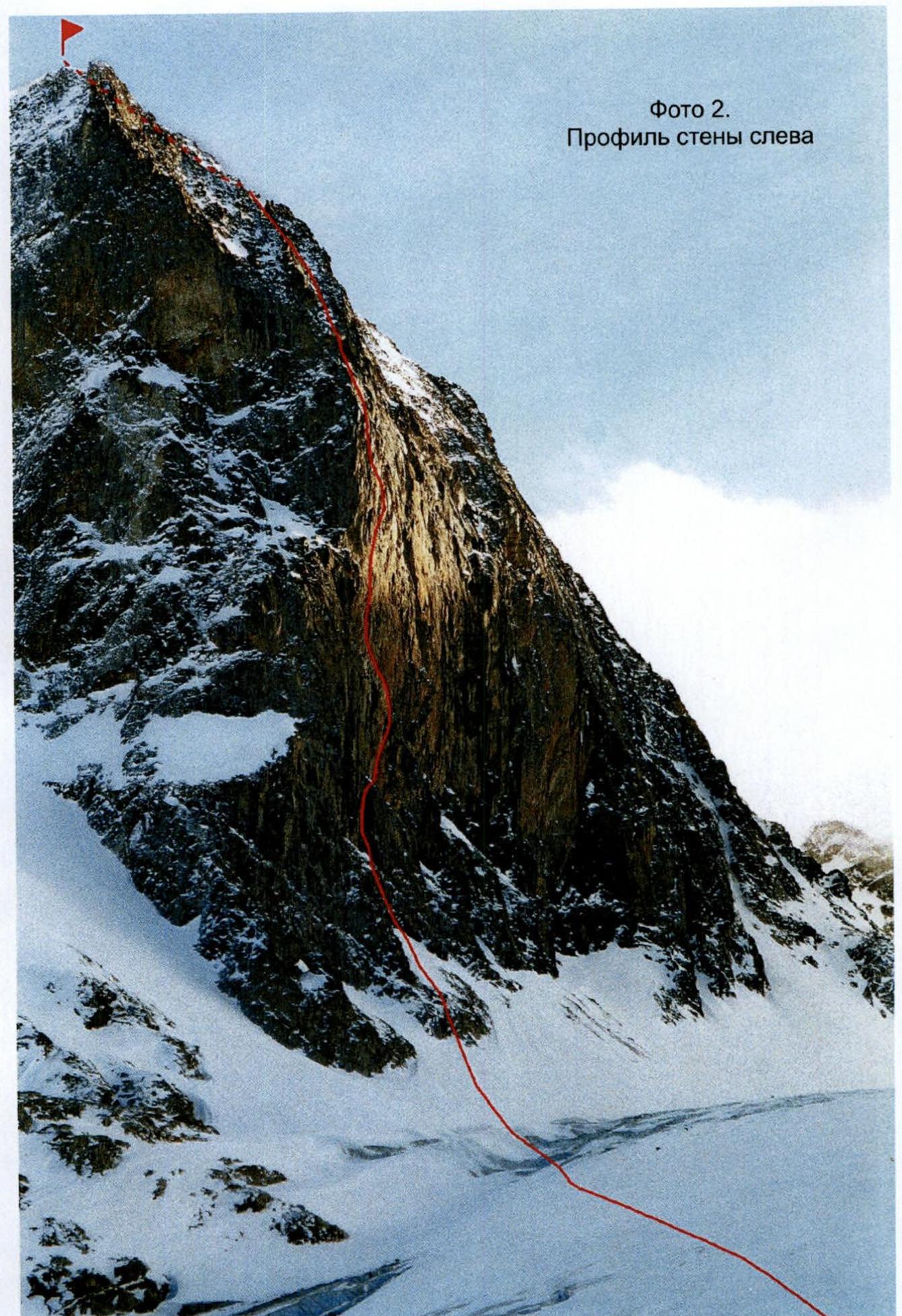
Photo 2. Profile of the wall from the left.
Drawn profile of the route. Scale 1:4000. Peak Kirpich, 3800 m, August 3, 2007.
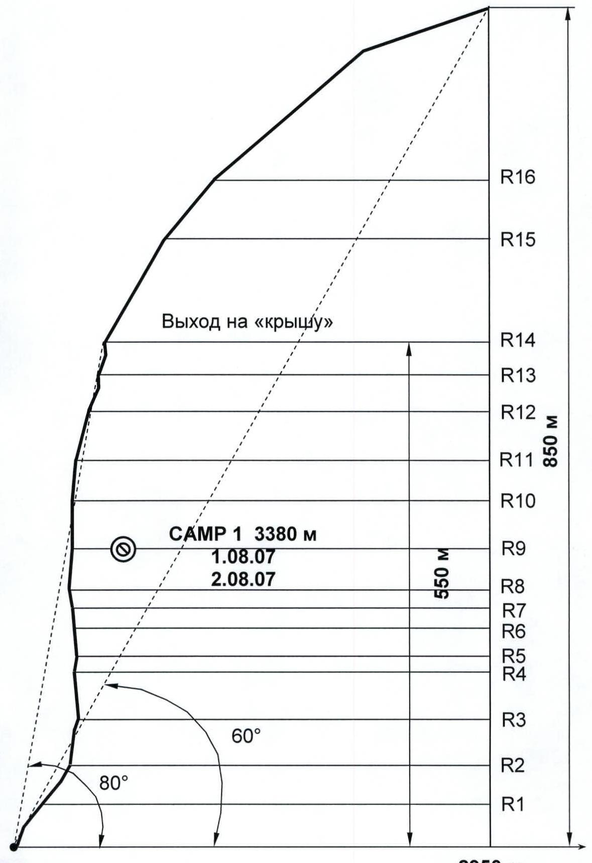
Photo 3. Technical photo of the route.
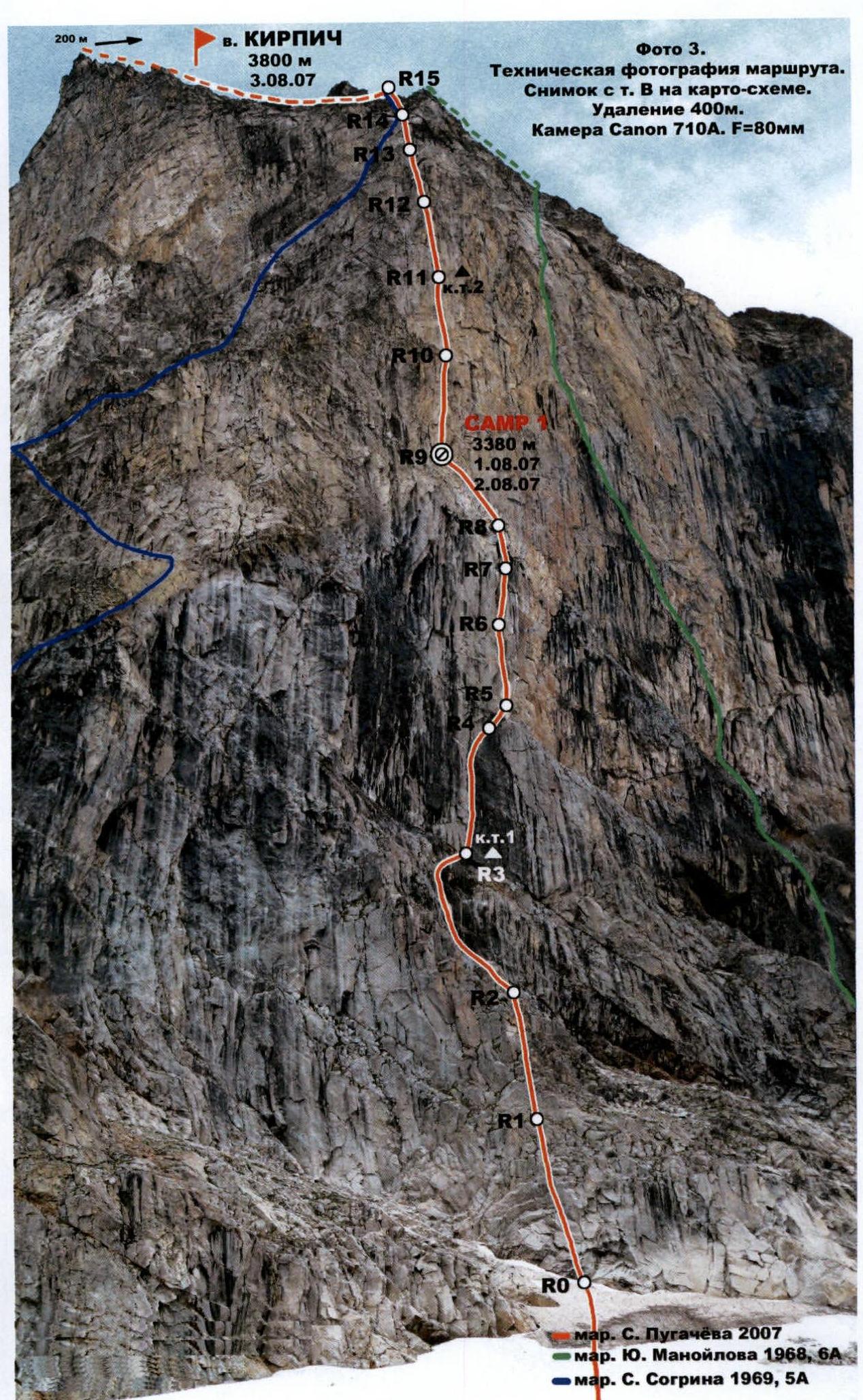
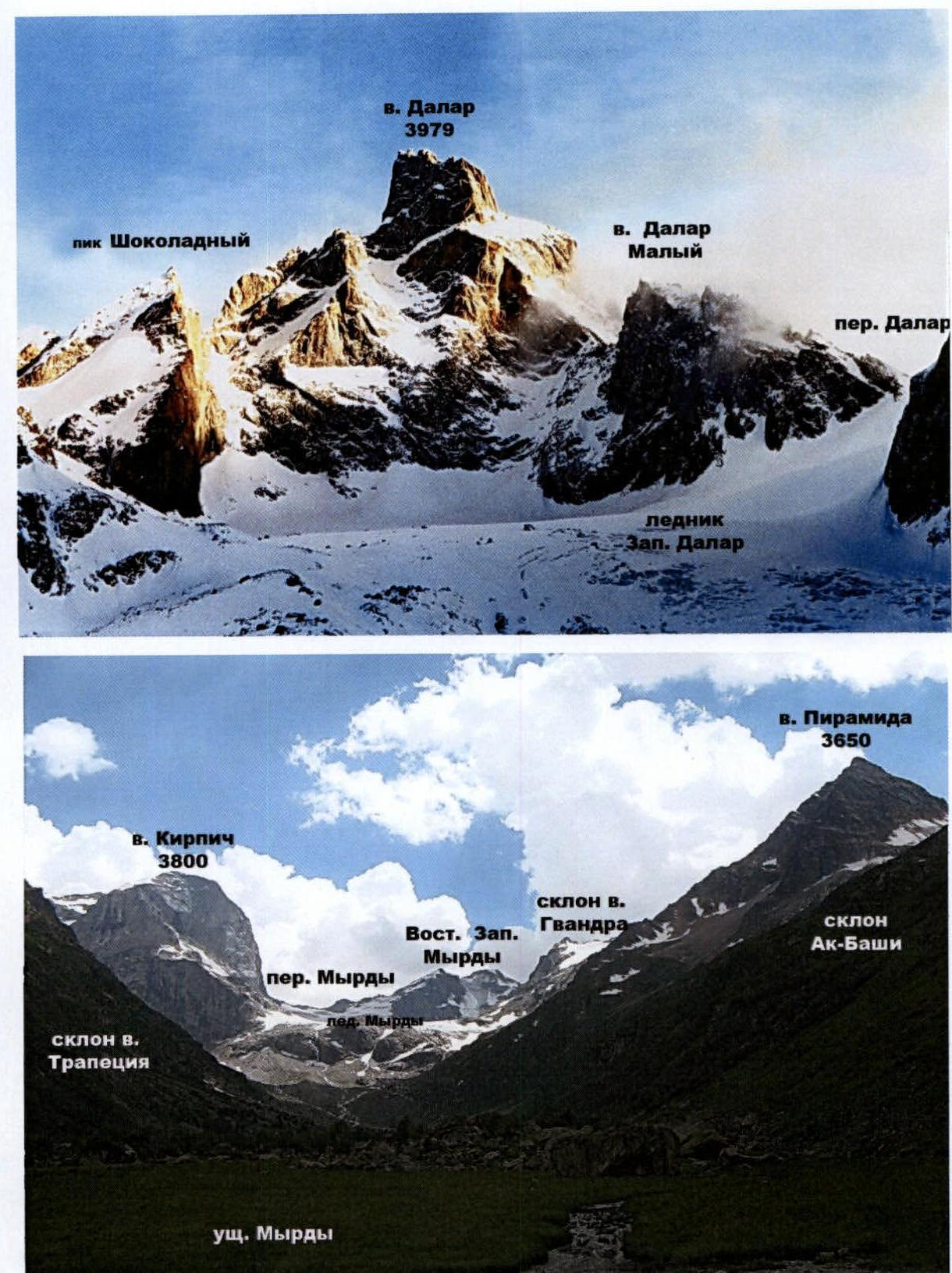
Photo 4. Photopanorama of the area.
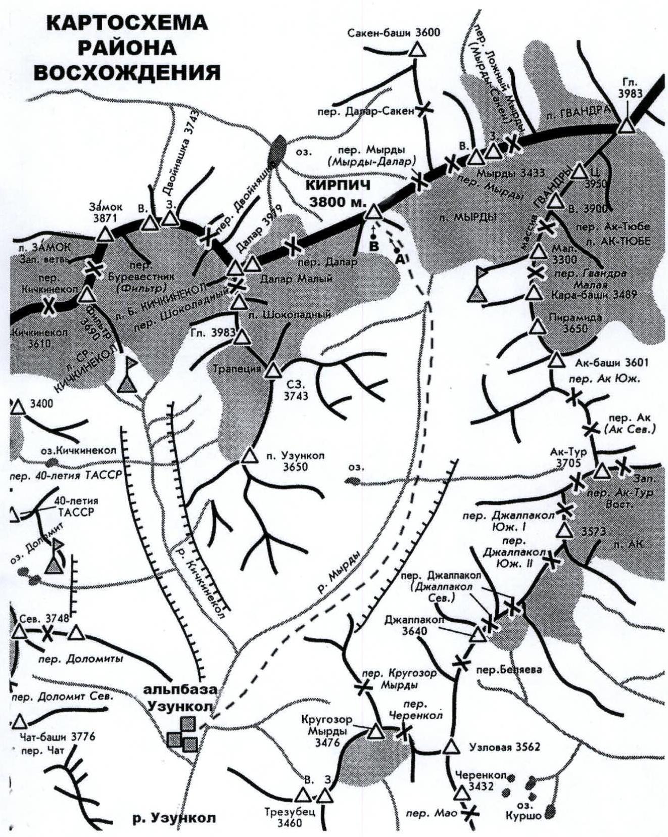
Map of the ascent area
 www.alp-federation.ru↗
 www.alp-federation.ru↗
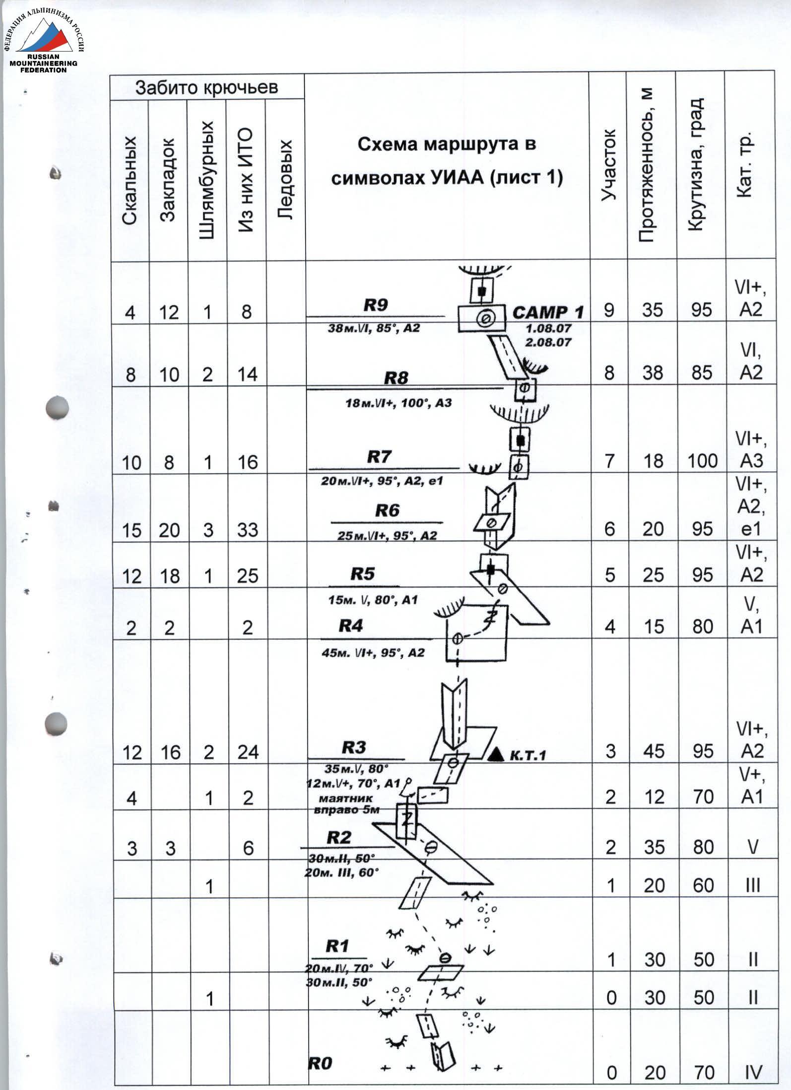
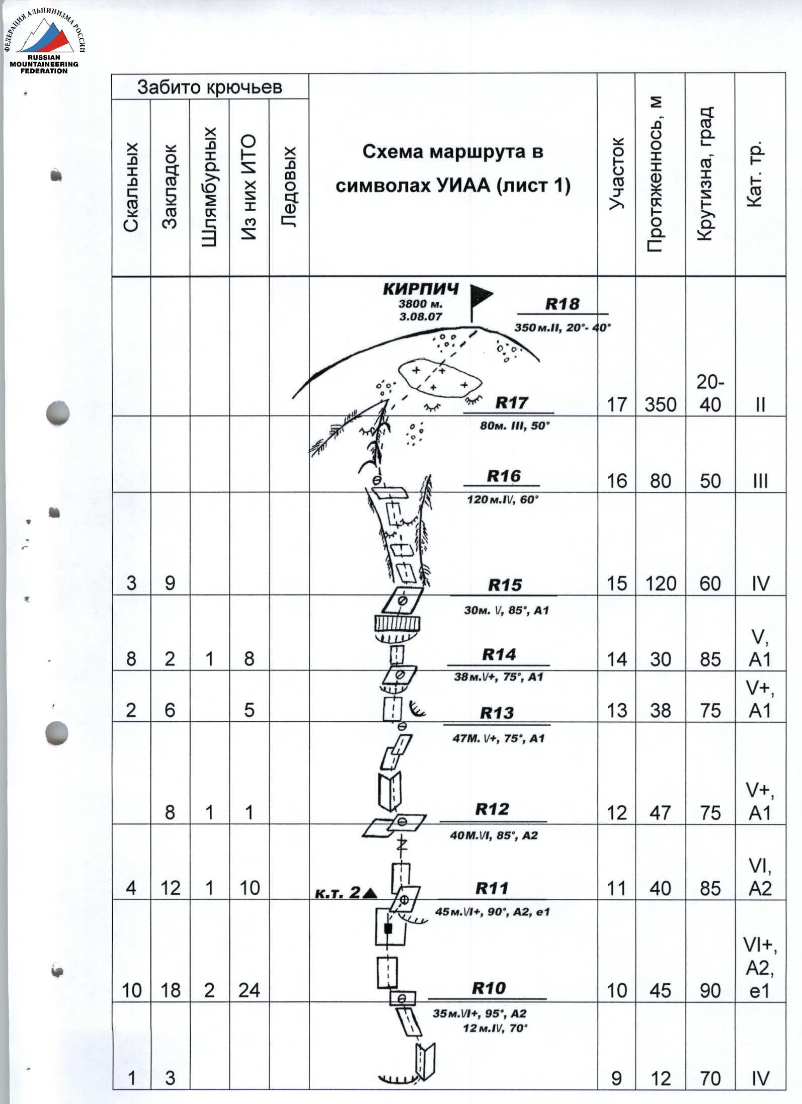
Peak Kirpich (via the left part of the Western wall). Technical characteristics of the sections
| Section | Length, m | Complexity and steepness | Chocks | Pitons | Of which ITO | Time | Bolts at stations | Notes |
|---|---|---|---|---|---|---|---|---|
| R0–R1 | 20 | IV, 70° | preparation, 10 h | 1 | ||||
| 30 | II, 50° | |||||||
| R1–R2 | 30 | II, 50° | 1 | |||||
| 20 | III, 60° | |||||||
| R2–R3 | 35 | V, 80° | 3 | 3 | 6 | 1 | ||
| 12 | V+, 70°, A1 | 4 | 2 | pendulum to the right | ||||
| R3–R4 | 45 | VI+, 95°, A2 | 16 | 12 | 24 | 2 | ||
| R4–R5 | 15 | V, 80°, A1 | 2 | 2 | 2 | traverse to the right | ||
| R5–R6 | 25 | VI+, 95°, A2 | 18 | 12 | 25 | 1st day, 9 h | 1 | |
| R6–R7 | 20 | VI+, 95°, A2, e1 | 20 | 15 | 33 | 1 | ||
| R7–R8 | 18 | VI+, 100°, A3 | 8 | 10 | 16 | 1st day, 9 h | 1 | cornice |
| R8–R9 | 38 | VI, 85°, A2 | 10 | 8 | 14 | 2 | exit to bivouac | |
| 35 | VI+, 95°, A2 | 12 | 4 | 8 | 1 | |||
| R9–R10 | 12 | IV, 70° | 3 | 1 | ||||
| R10–R11 | 45 | VI+, 90°, A2, e1 | 18 | 10 | 24 | 2nd day, 8 h | 1 | |
| R11–R12 | 40 | VI, 85°, A2 | 12 | 4 | 10 | 1 | rain from 16:00 | |
| R12–R13 | 47 | V+, 75°, A1 | 8 | 1 | 1 | |||
| R13–R14 | 38 | V+, 75°, A1 | 6 | 2 | 5 | 3rd day, 4 h | Exit to the summit. Rain until 10:00 and from 13:00 to 17:00. Limited visibility, fog | |
| R14–R15 | 30 | V, 85°, A1 | 2 | 8 | 8 | 1 | ||
| R15–R16 | 120 | IV, 60° | 9 | 3 | ||||
| R16–R17 | 80 | III, 50° | ||||||
| R17–R18 | 350 | II, 20°–40° | ||||||
| Return to the original bivouac by 21:00. | ||||||||
| Total: | 1105 m | 98 | 147 | 178 | Total 31 h | 15 | Total – 245 |
Route description by sections
Approach to the route: from the bivouac at Myrdy, ascend via scree and moraines to the plateau of the Myrdy glacier. Follow the glacier, avoiding crevasses, to the foot of the left part of the Western wall. The starting point of the route is marked by a snow cone located to the left of a large rocky niche with black streaks – 1.5 h.
- R0–R1. Start of movement — from snow via large-block rocks, then move via slab-like rocks and scree slopes using free climbing.
- R1–R2. Simple rocks and "ram's foreheads," intersected by inclined and horizontal shelves, simultaneous movement.
- R2–R3. Move left via an inclined slab transitioning into a system of vertical cracks along black chimneys. After reaching the "ram's foreheads," pendulum to the right and via a shelf to the base of a vertical inner corner. Control cairn 1.
- R3–R4. Inner corner opening upwards, overhanging in the upper part. Movement on ITO. Use of relief skyhooks, ladders. Hanging bolt station.
- R4–R5. Transition from station bolts to the right-upwards into climbing with an exit under the base of the next inner corner. It is advisable to straighten N - 1.
- R5–R6. Movement on ITO via slabs transitioning into an inner corner. Possible rockfall. Protection: various pitons, stoppers. Exit left onto a sloping shelf.
- R6–R7. Continuation of movement via the inner corner, starting on ITO (thin flakes), several live slabs (bypass via bolt pitons — 2 pcs.), protection — pitons, upper overhang is passed on small stoppers to the right towards the cornice.
- R7–R8. In-the-face passage of the cornice, unreliable self-protection points, intense work on ITO. Protection: pitons, stoppers, friends.
- R8–R9. Series of small alternating slabs and cornices shifting left. Exit to bivouac on a narrow sloping grassy shelf not allowing for tent setup. Start — free climbing.
- R9–R10. Via a system of vertical cracks (climbing and ITO) — exit under the cornice, complex bypass of the cornice to the right, as pulling the rope through is difficult, intermediate points need to be removed. Then via simple rocks, exit left onto a shelf.
In the second part of the section, there is no voice communication with the belayer. There is no visual control for the belayer.
- R10–R11. Via a vertical slab (climbing), approach under a wall with a crack suitable for ITO (large stoppers, medium friends). After twenty-five meters — transition into climbing. Movement to the right-upwards. Exit to a bolt on a hanging station. Control cairn 2.
- R11–R12. Via a vertical slab (ITO) and a system of cracks (climbing) exit onto a shelf at the base of an inner corner.
- R12–R13. Via an inner corner and vertical slabs, move climbing to the right under overhangs. After 5–6 m, left onto an ossuary shelf.
- R13–R14. Movement towards the "roof," which is clearly visible. Cornice in the middle of the section — climbing and ITO (pitons, chocks).
- R14–R15. Exit onto the "roof" via a cornice ITO (pitons).
- R15–R16. Via simple slabs and shelves of the couloir, move (120 m).
- R16–R17. Movement to the right-upwards towards the ridge, free climbing, usual protection.
- R17–R18. Exit from the ridge to the right onto pre-summit ossuary slopes, simultaneous movement, 2nd category complexity, approximately 350 m. Several tent platforms.
Descent via route 1B category complexity in the direction of Dalar pass or via the ascent path equipped by the group with bolt stations.
Recommendations for climbers
The route is recommended for well-prepared groups with experience of several ascents of category 6B complexity.
The lack of good bivouacs on the lower part of the bastion assumes processing or use of hammocks. Further, there are no platforms for tents — only separate seated bivouacs are possible.
On sections R2–R3, R4–R5, it is recommended to straighten the ropes for subsequent movement.
Lack of water throughout the route. Approximately 2 l per person per day is required.
The absence of snow on the "roof" and the steepness of the bastion reduce the likelihood of falling random rocks.
Bivouac on the "roof" during thunderstorms is not recommended. The group must have a full set of mountaineering equipment.
Tactical actions of the team
The team completed the route according to the tasks arising as they progressed along the wall, in three days, including descent to the original bivouac and with two bivouacs on the wall at point R9. The main part of the route was traversed by the lead rope team with rope placement. The second rope team equipped stations for descent with bolt pitons and carried out ascent and extraction of equipment and water, allowing the first team to be supplied with necessary equipment without delay and maintain the set pace of movement. To prevent physical and moral fatigue, the lead rope team leader was changed daily. After bivouac in Camp 1, processing of subsequent sections (R10–R11) was carried out.
On all sections from R3 to R9, extraction of equipment was carried out using a Mini Traxion device by Petzl.
Almost all sections above the 6th category complexity according to the European classification were traversed using ladders and hook footholds (sections R3–R13). The rest of the route was traversed by the first climber using free climbing, except for sections where rockfall was possible.
The first in the lead rope team climbed on a double rope: one by "Mammut" with a UIAA stamp, diameter 9.5 mm; the second — by Beall, 9.2 mm. Other participants climbed on fixed ropes made of static Kiev rope, using top rope protection. Equipment was transferred at stations.
When traversing sections R7–R8, R9–R10, R13–R15, special attention was paid to the protection of the first climber, as cornices and bends did not allow visual control over the leader and sometimes made voice communication difficult. Thanks to a well-chosen variety and quantity of technical means for traversing any terrain, the team encountered no problems.
In the lower part of the route, ordinary rock and petal pitons and small chocks were mainly used, while in the upper part, "shvelers," large stoppers, and friends were used. On the main (lower) part of the bastion, the entire set of technical equipment was used: skyhooks, "topori" pitons, small brass stoppers, V-shaped pitons.
Stations were blocked with loops and extensions, organized away from the line of possible rockfall, and the first climber's protection was universally provided through an "eight" descender.
The ascent schedule was drawn up such that each day ended with processing and placement of two ropes, allowing simultaneous progression on the route and preparation of bivouac sites.
The rain that started on the second day of the route at 16:00 did not allow for full completion of the evening processing. It also forced a delay in the morning exit and hindered movement to the summit.
The presence of individual nutrition for each participant also contributed to maintaining the pace of movement. Water had to be carried throughout the entire route.
The descent from the summit was made, according to the tactical plan, via the ascent path, as practically every station was equipped with a stationary bolt piton (50 mm, diameter 10 mm), and on the same day, the team returned to the original Myrdy bivouac.
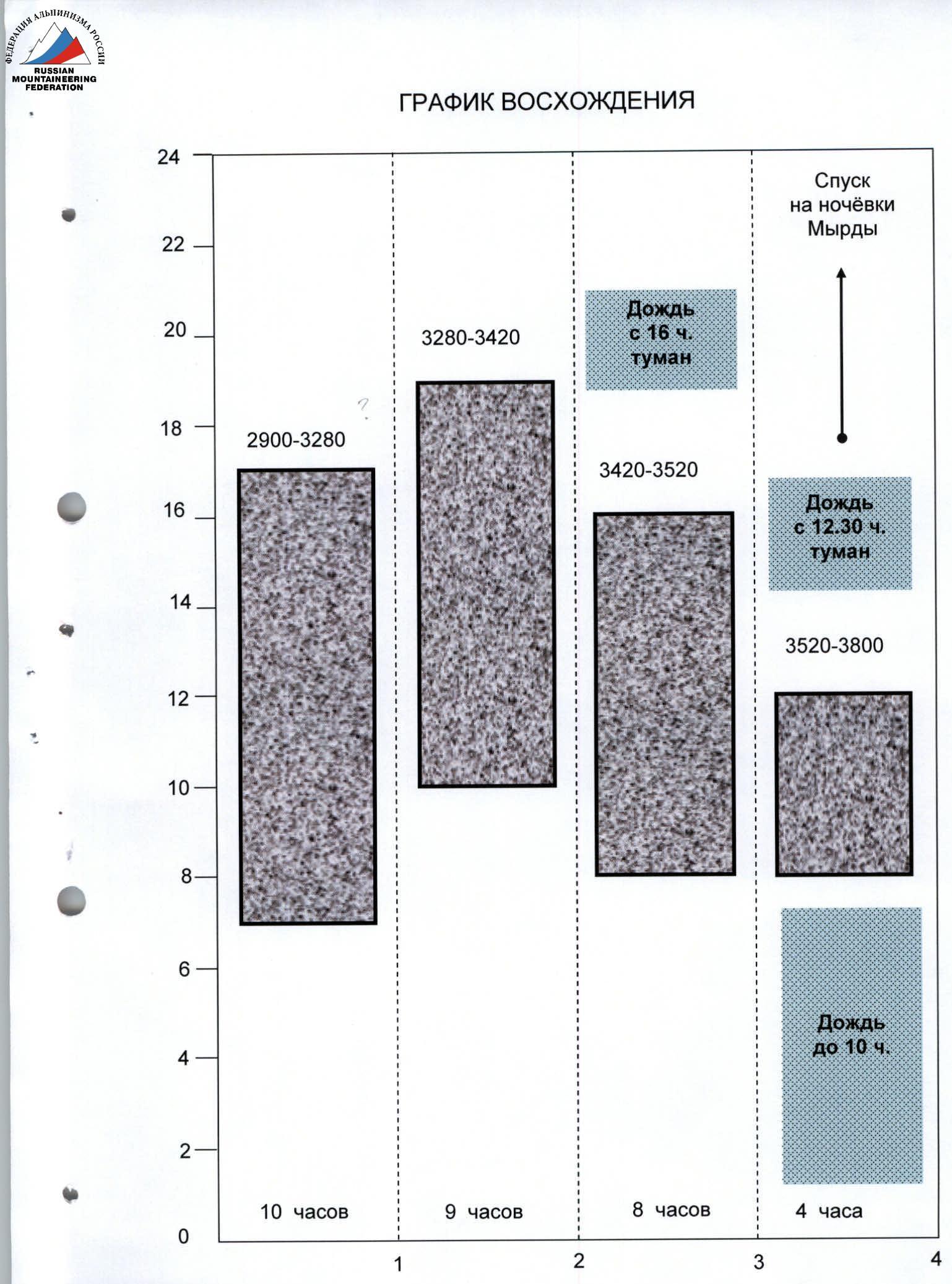
Ascent schedule
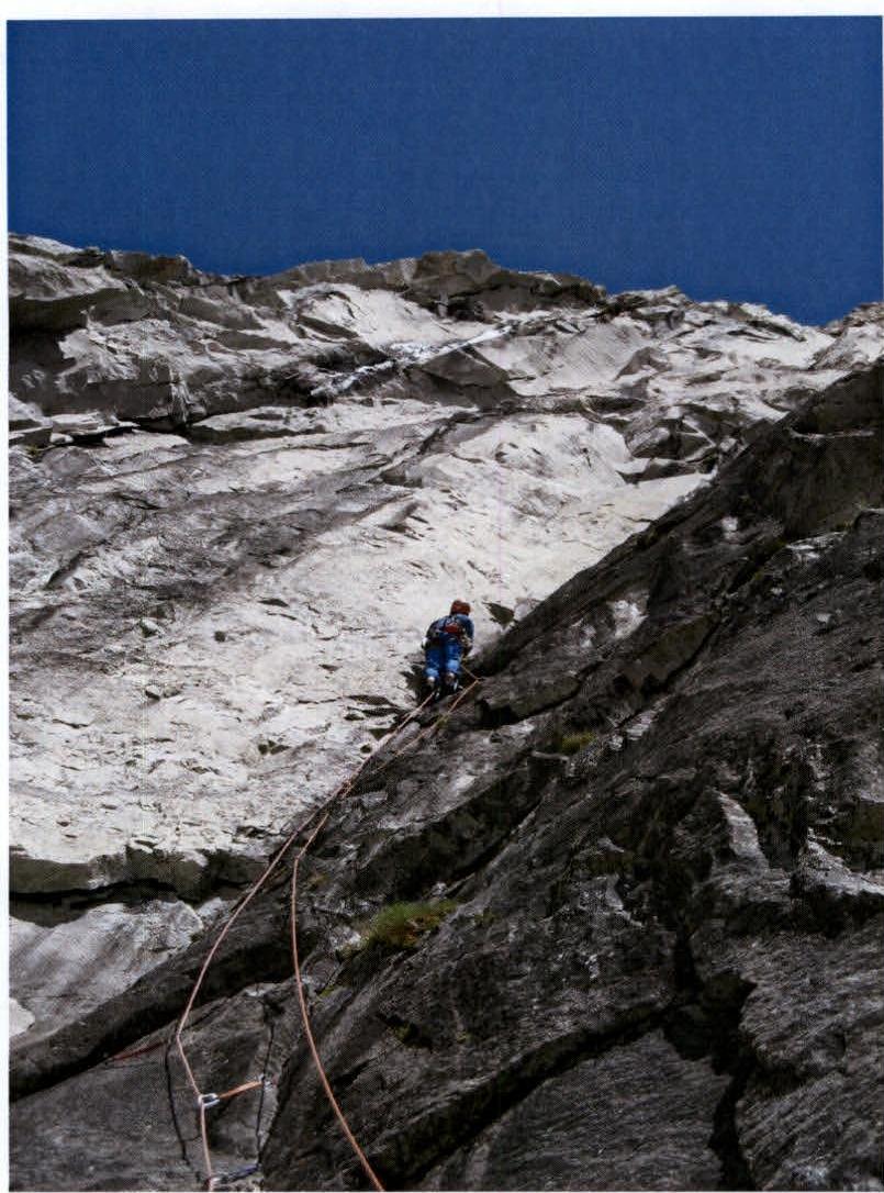
Photo 5. Section R2–R3.

Photo 6. Section R5–R6. Start of the section.
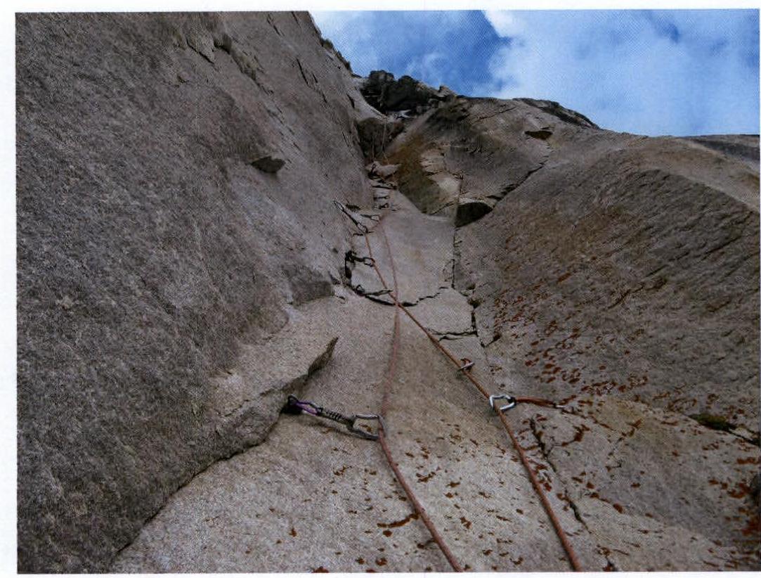
Photo 7. Section R5–R6. Exit under the cornice.
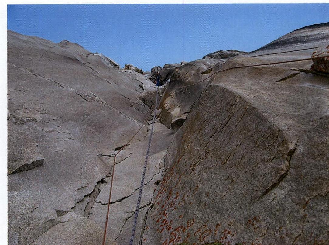
Photo 8. Section R5–R6. Under the cornice.
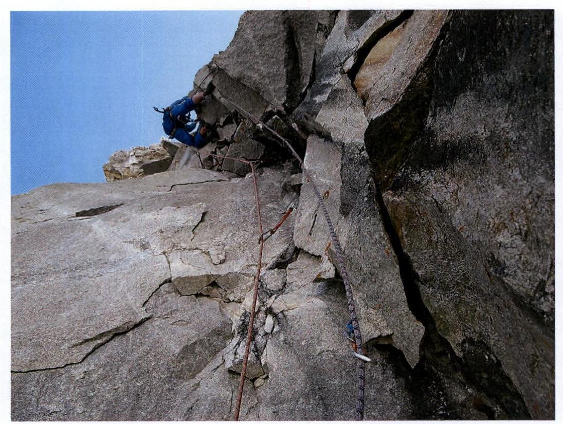
Photo 9. Section R7–R8. Passage of the cornice.
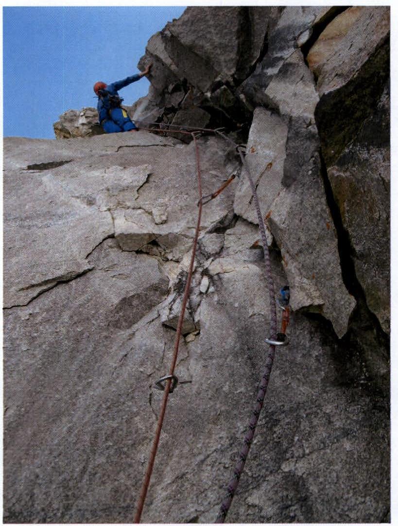
Photo 10. Section R7–R8. Passage of the cornice.
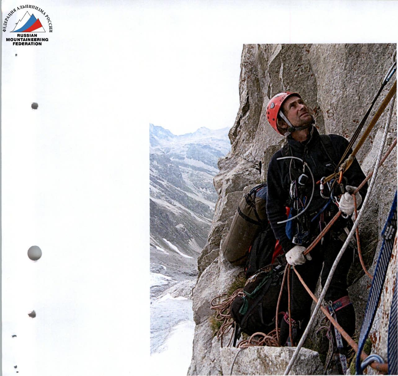
Photo 11. Section R9. Station.
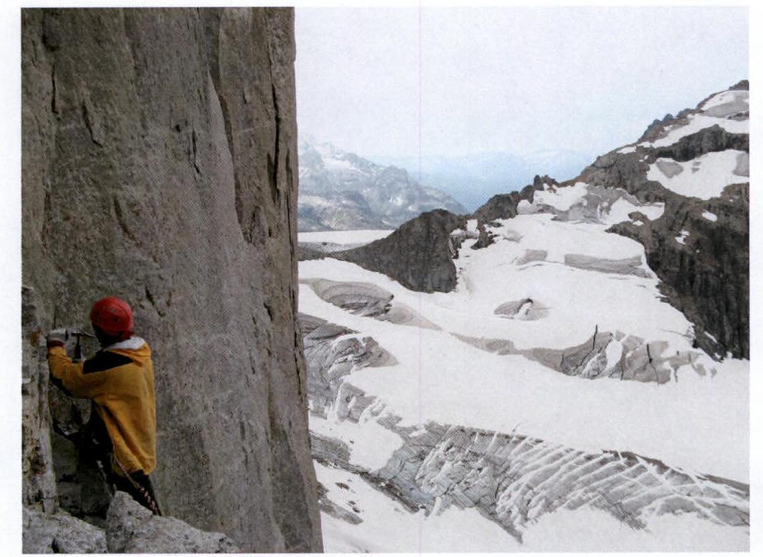
Photo 12. Section R10. Profile to the right.
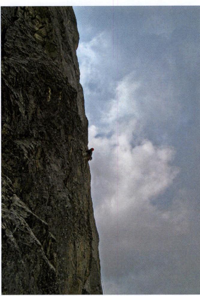
Photo 13. Section R11. Profile to the right.
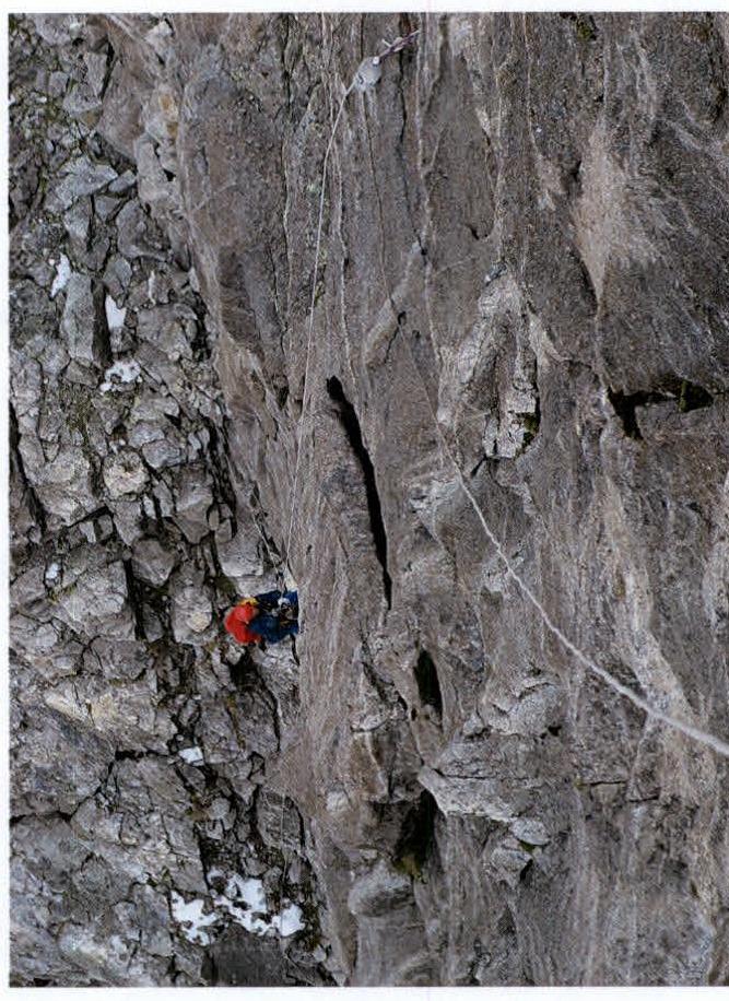
Photo 14. Station and ropes on section R11.
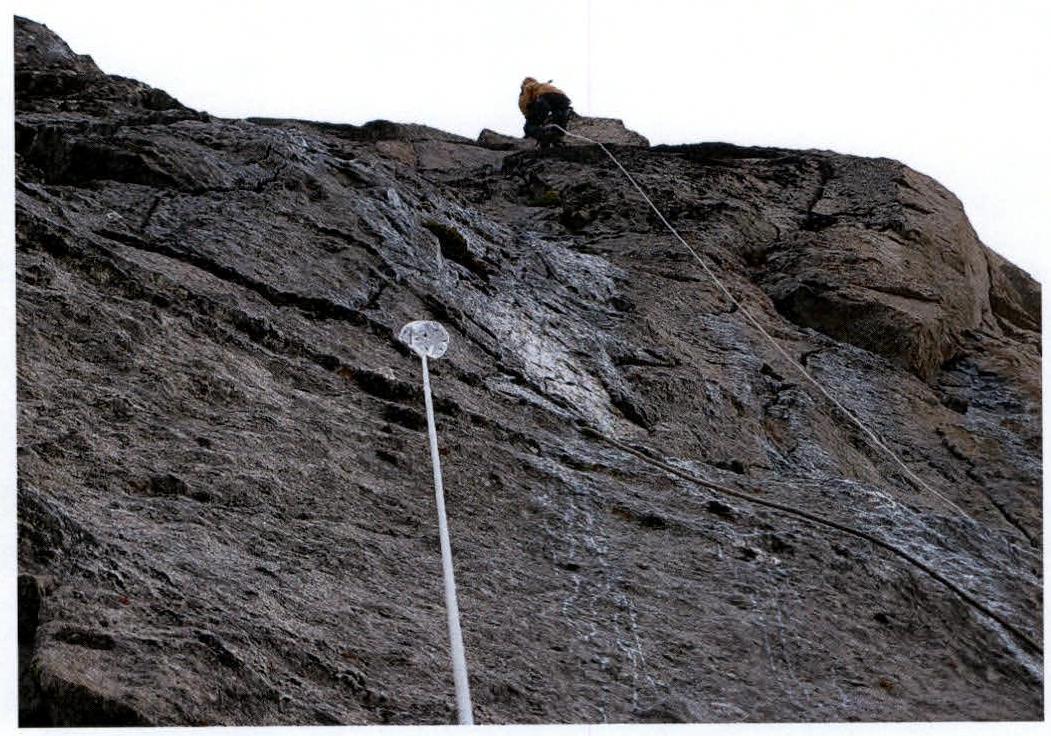
Photo 15. Section R11. Station and ropes.
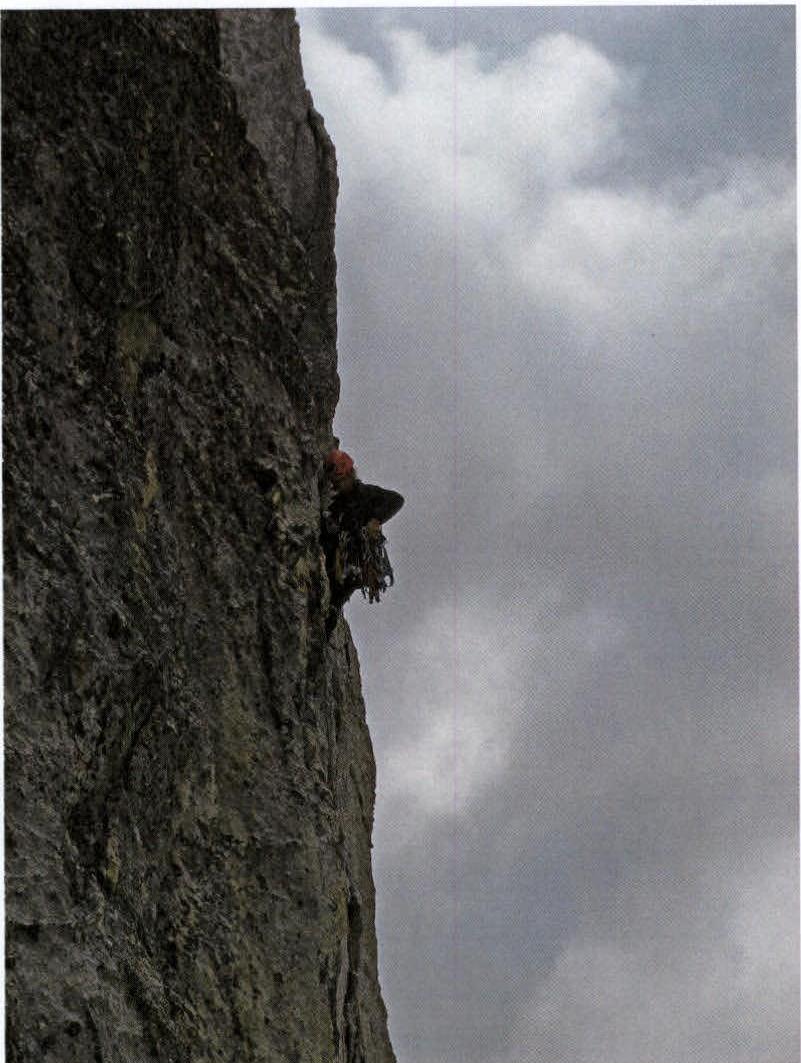
Photo 16. Section R11–R12.
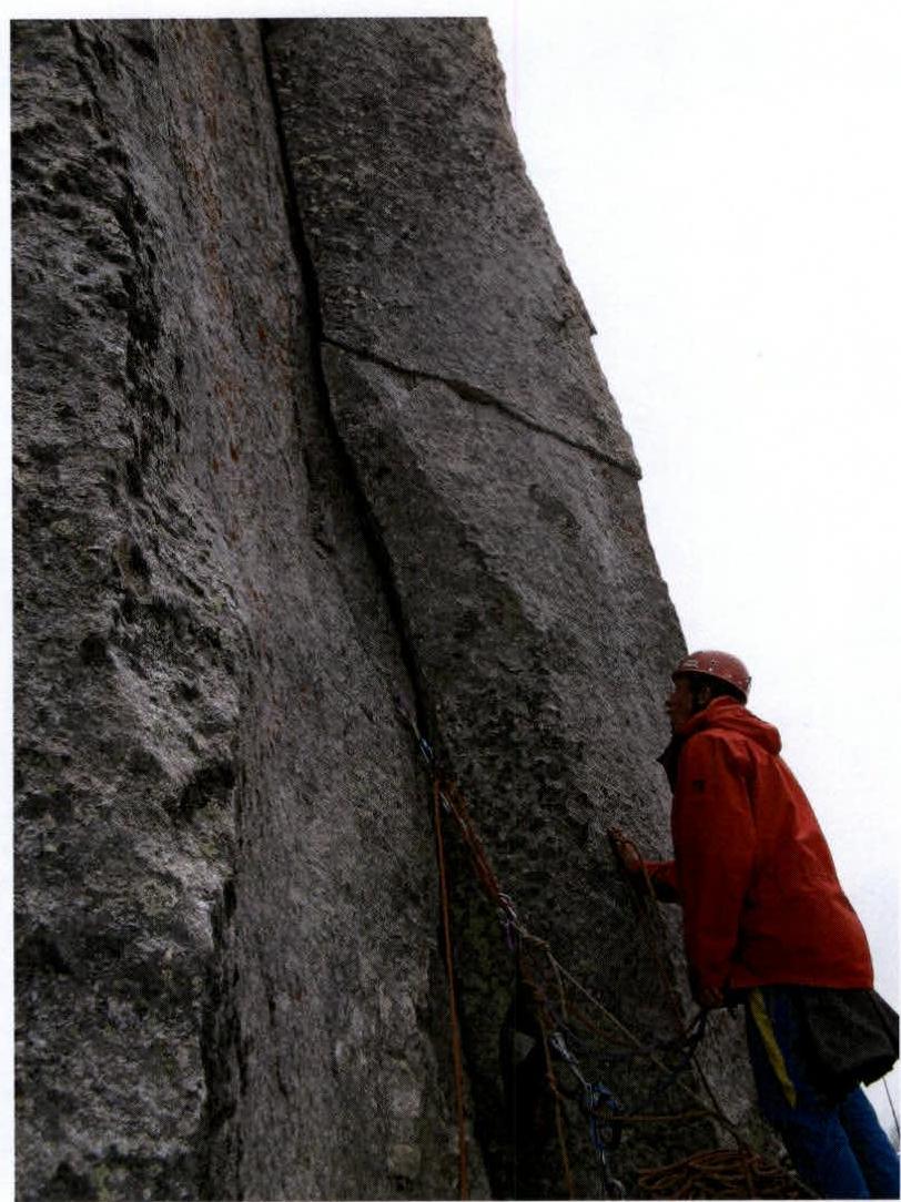
Photo 17. Section R12. Station.
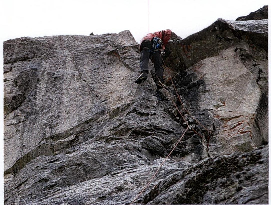
Photo 18. Section R13. Cornice.
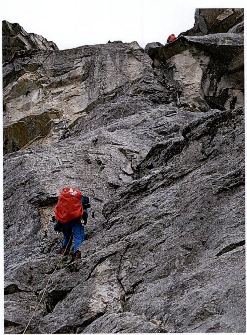
Photo 19. Section R13–R14. Exit onto the "Roof".
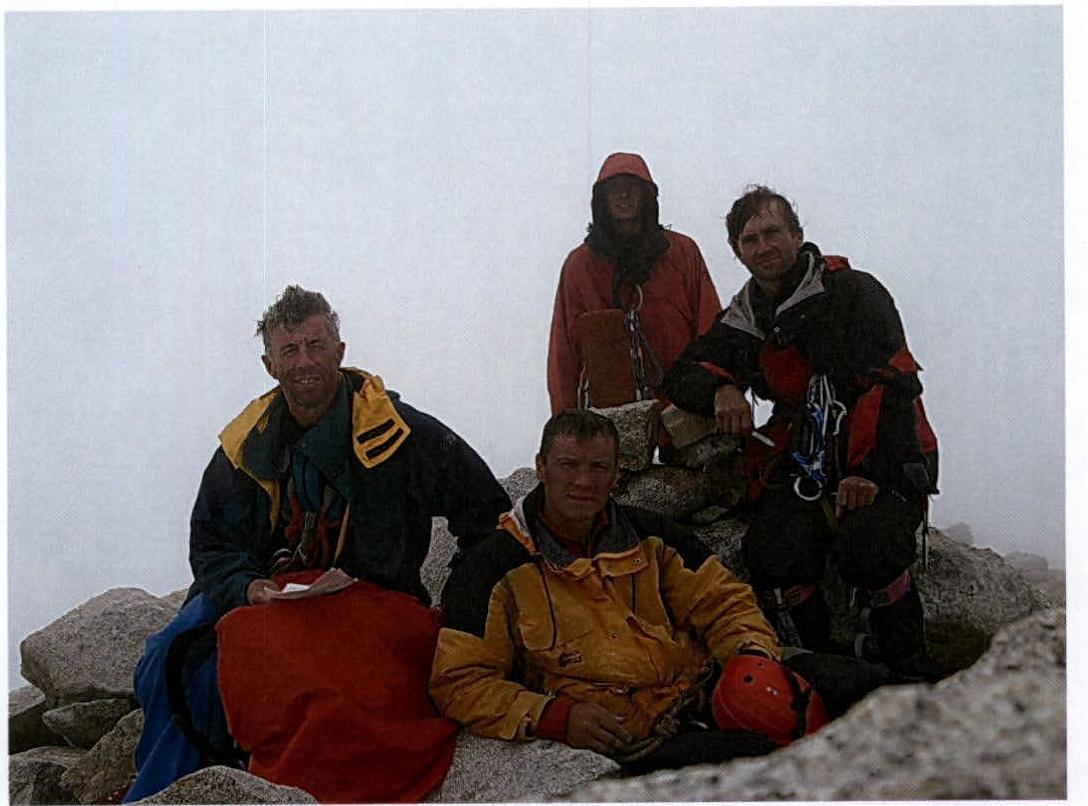
Photo 20. Team on the summit.
Note from the summit

A team of climbers from the Stavropol regional gatherings led by instructor Plyasov A.G. and instructor-trainee Magomedov R.R. comprising:
- Gordeev R.A.
- Kotosin A.Yu.
- Botsyun S.B.
- Plesov A.A.
- Sergeev A.S.
- Ponomarenko A.S.
completed an ascent to peak Kirpich via route category 3A through Myrdy pass. Weather is excellent. Descent to Dalar pass via route category 1B. 15:30, July 31, 2007.