ST. PETERSBURG ALPINISM CHAMPIONSHIPS HIGH-TECHNICAL CLASS 2024
Report on the ascent of Dalar peak (3988 m) via the North-Eastern wall of the Eastern shoulder (Yu. Porokhnya Route, 1978), 5B cat. diff., combined. July 29, 2024 – July 31, 2024.
Ascent Passport
| 1. General Information | ||
|---|---|---|
| 1.1 | Full Name, sports rank of the leader | Danil A. Kadyrmaev, 1st sports rank |
| 1.2 | Full Name, sports rank of participants | Mikhail D. Marakuev, 1st sports rank |
| 1.3 | Full Name of coach, sports rank | O.A. Yakimenko MS, P.Yu. Fominykh CMS |
| 1.4 | Organization | St. Petersburg Alpine Federation, a/c "Gornyak", a/c "Voenmekh" |
| 2. Characteristics of the Ascent Object | ||
| 2.1 | Region | Western Caucasus, Kichkinekol gorge |
| 2.2 | Number of section according to the electronic Russian classifier of routes to mountain peaks / route number | 2.3 From Nakhar Pass to Chipperazau Pass / 27 |
| 2.3 | Name and height of the peak | Dalar, 3988 m |
| 2.4 | Geographic coordinates of the peak | 43°13′27″ N 42°9′53″ E (43.224060, 42.16467) |
| 3. Route Characteristics | ||
| 3.1 | Route Name | via North-Eastern wall of the Eastern shoulder (Yu. Porokhnya, 1978) |
| 3.2 | Difficulty Category | 5B |
| 3.3 | Relief characteristics of the route | combined |
| 3. Route Characteristics | ||
| :--: | :--: | :--: |
| 3.4 | Height difference from R0 | 630 m |
| 3.5 | Length of the rock part of the route | 1880 m |
| 3.6 | Technical elements of the route | 5 cat. diff. – 575 m, 6 cat. diff. – 25 m |
| 3.7 | Average steepness of the route | 62° |
| 3.8 | Descent from the peak | From the peak, 5 rappels of 30–55 m down the SW couloir of Dalar tower wall, then – simultaneous descent to the snow knife, followed by 18 rappels of 40–55 m along fixed stations |
| 3.9 | Additional route characteristics | The wall section is quite monolithic but wet. Water seeps almost everywhere, especially on the second rock belt. |
| 4. Characteristics of Team Actions | ||
| 4.1 | Time of movement (team's travel hours, indicated in hours and days) | 20 h, 2 days |
| 4.2 | Overnight stays | Two overnight stays, lying down: 1st — July 29, near 2nd CT; 2nd — July 30, near the snow knife |
| 4.3 | Route preparation time | Without preparation |
| 4.4 | Entry onto the route | July 29, 2024 08:00 |
| 4.5 | Reaching the peak | July 30, 2024 16:00 |
| 4. Characteristics of Team Actions | ||
| :--: | :--: | :--: |
| 4.6 | Return to overnight stays in the "green pocket" | July 31, 2024 20:00 |
| 5. Weather Conditions Characteristics | ||
| 5.1 | Temperature | −1°C – +15°C |
| 5.2 | Wind force | July 29 – calm; July 30 – gusty wind after 17:00; July 31 – gusty in places |
| 5.3 | Precipitation | July 29 – no precipitation; July 30 – no precipitation until 21:00, then — unstable weather, thunderstorm, lightning, wet snow, rain; July 31 – occasional snow or rain, until about 15:00 |
| 5.4 | Visibility | July 29 – clear, good visibility; July 30 – clear until 17:00, then – cloudy; July 31 – cloudy until 17:00, fog |
| 6. Responsible for the report | ||
| 6.1 | Full Name, e-mail | Danil A. Kadyrmaev, sunoire@bk.ru |
Description of the Ascent Area
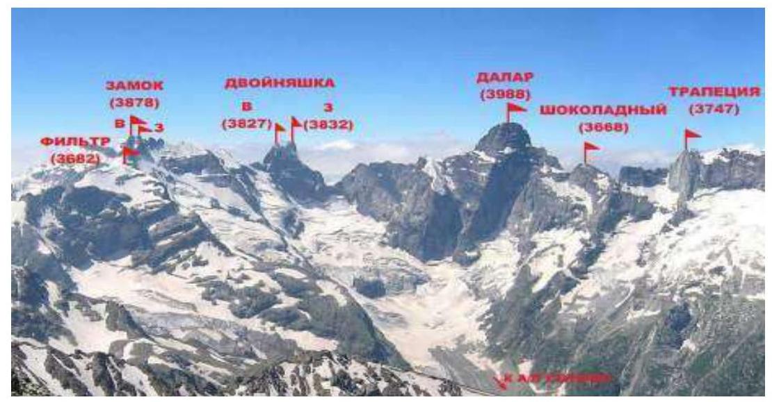
Dalar (3988 m) is one of the most beautiful peaks in the Caucasus. Dalar is located in the Gvandrinsky region of the Western Caucasus within the Central Uplift of the Main Caucasian Range, 25 km southwest of Elbrus. The peaks in this region are composed mainly of strong granito-gneiss rocks with minimal cracks and smoothed microrelief.
The main peaks of the Gvandrinsky region: Kirpich (3751 m), Dalar (3988 m), Dvoynyashka (3832 m), Zamok (3878 m), and Trapezia (3747 m) generally do not have easy routes: their walls are among the most difficult in the Caucasus.
The chain of peaks Filter — Zamok — Dvoynyashka — Dalar — Shokoladny peak, located in the upper reaches of the Kichkinekol gorge, bounds the Big Kichkinekol glacier cirque from the east, west, and south, giving rise to the river of the same name, which flows into the Uzunkol river.
The first ascent of Dalar was made in 1937 by a group led by Kizel and Budanov via a 4A cat. diff. route from Dalar Pass. According to the electronic Russian classifier of routes to mountain peaks, there are currently 21 alpine routes to the Dalar peak, among which:
- Five routes have a 6A cat. diff.;
- Eight routes are 5B cat. diff..
To date, the sporting potential of the peak is far from exhausted. Due to the large extent of its northern, northeastern, and eastern walls, Dalar continues to attract mountaineers.
Panorama of the Ascent Area
 Map-scheme of the area with the approach to overnight stays in the "green pocket"
Ascent Description
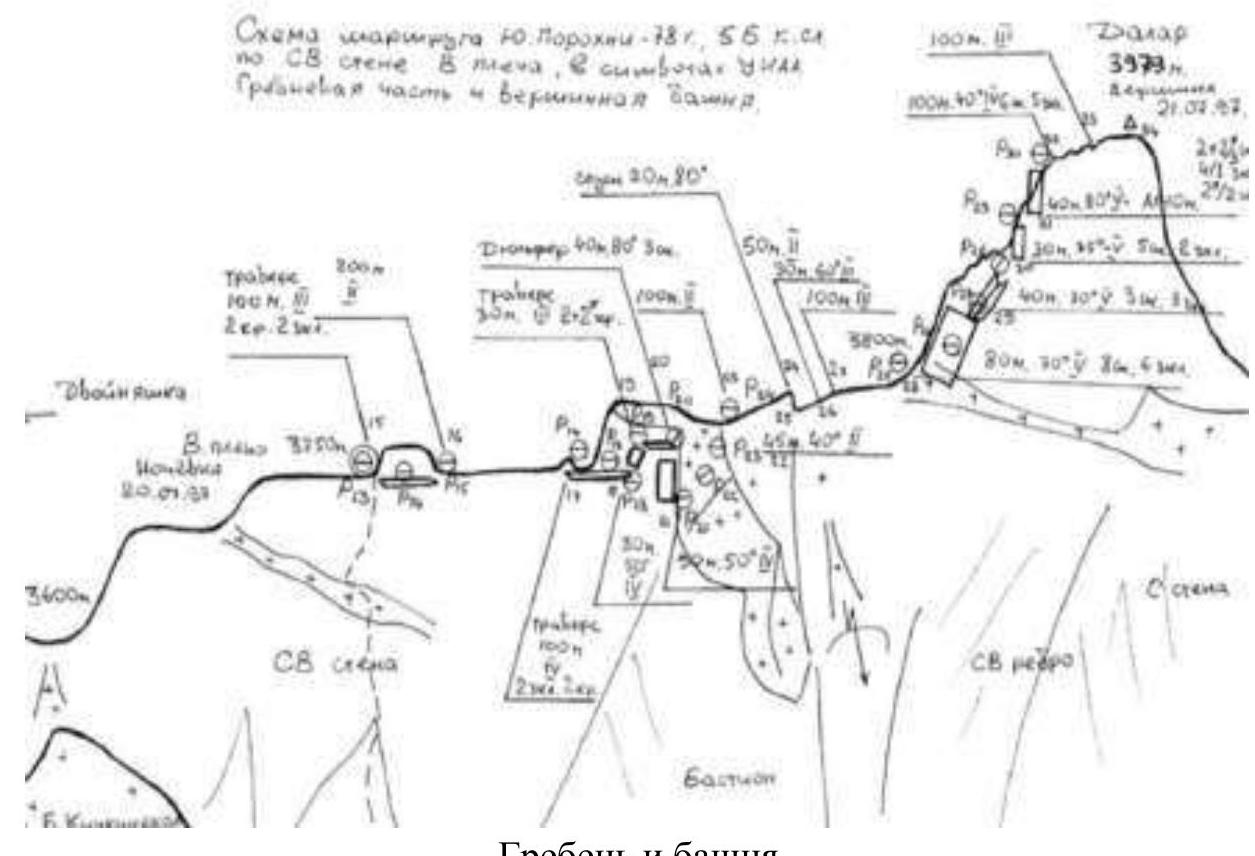
General Route Photo with Nearby Routes Indicated
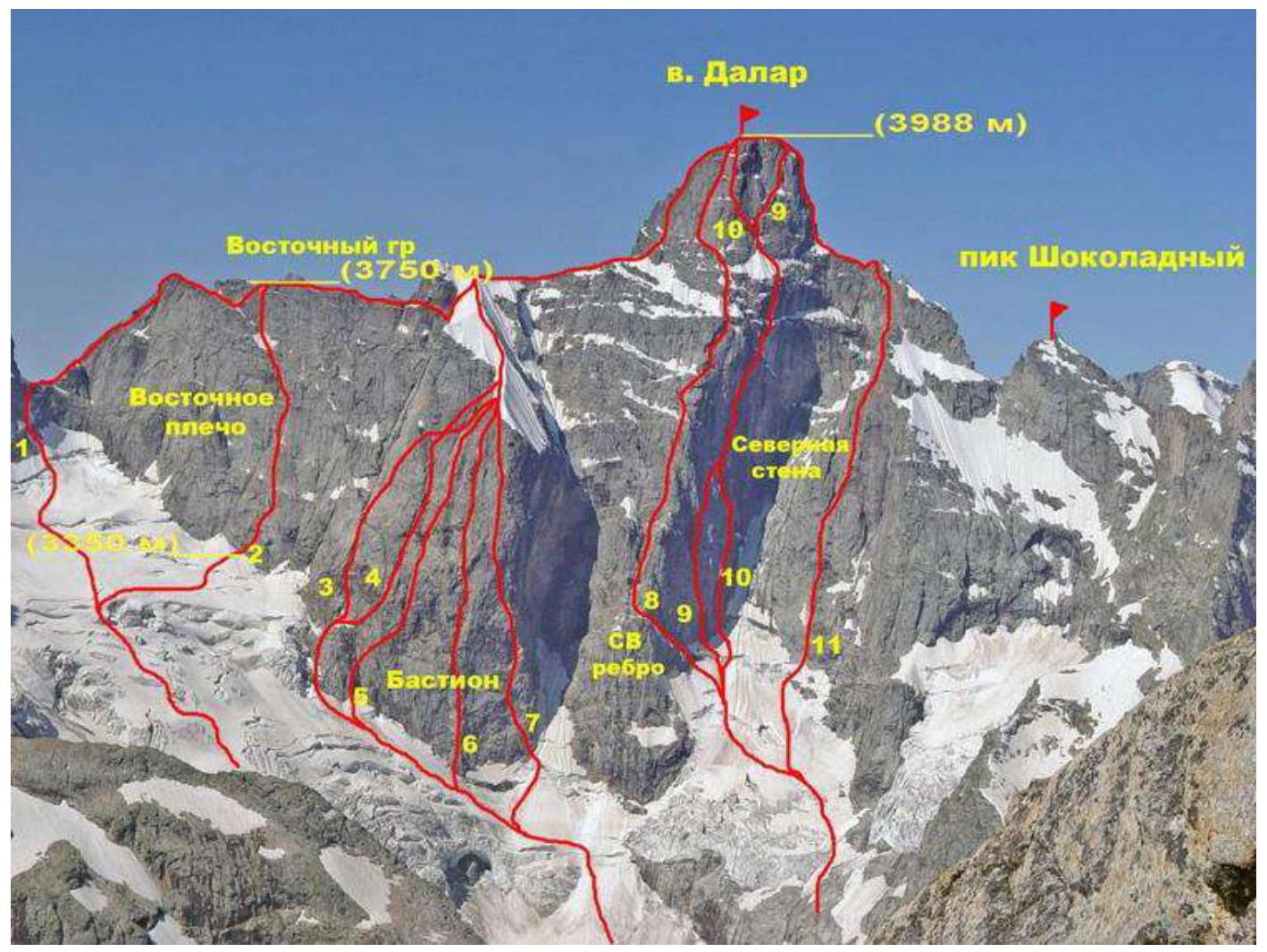
This photo shows the route threads to the Dalar peak. Route No. 2 (on the left side of the image) is Yu. Porokhnya's route, 5B. The heights of characteristic sections are indicated.
- Route via E ridge, 5A cat. diff. (Kavunenko, 1964)
- Route via NE wall of E shoulder (Yu. Porokhnya, 1978).
- Route via E wall of the bastion (Kavunenko, 1964).
Technical photo of the route
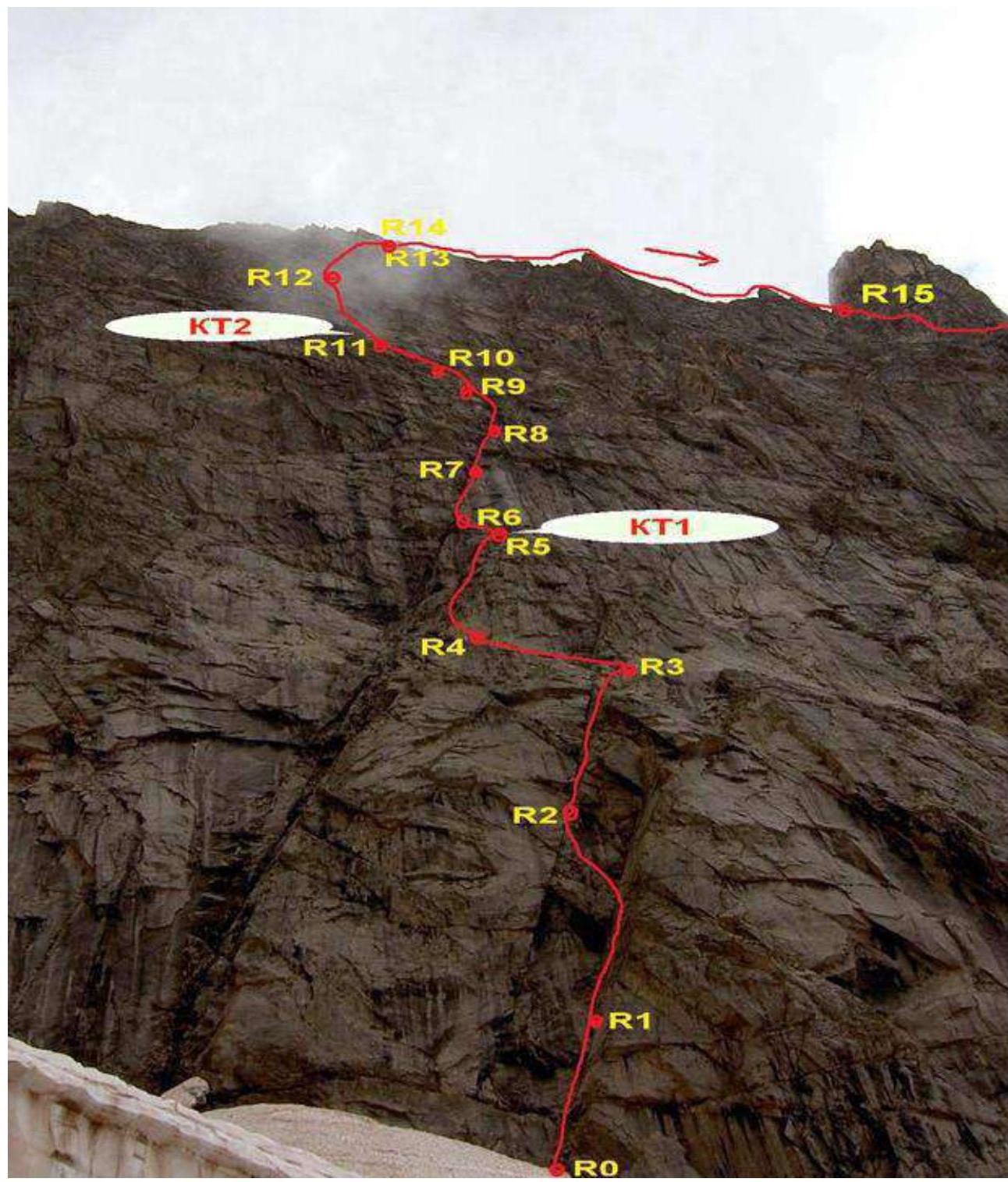
View of the wall section. Overnight stay on July 29, 2024, near R12. Further path — along the 5A route (Kavunenko).
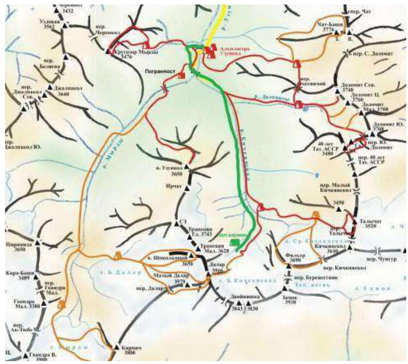
Approach to Overnight Stays
From Uzunkol tourist camp, move towards the Dolomite overnight stays. Before reaching the turn that begins the steep ascent to the Dolomite overnight stays, cross to the left bank of the Kichkinekol river and move along the trail following the river. The trail leads to the lateral moraine of the glacier and goes along its sharp ridge. There are:
- 3 platforms for tents
- water (waterfall)
on the overnight stays "in the green pocket".
From Uzunkol tourist camp, it takes 3 hours.
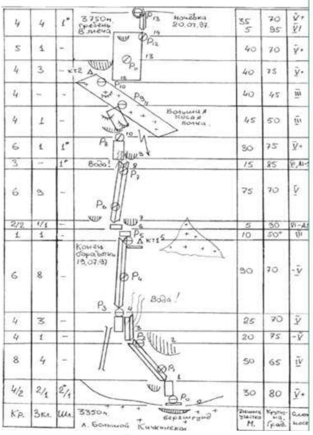
Route Description by Sections
Move across the glacier plateau towards the second (right from the slope saddle) huge rock "triangle"-wall adjacent to the main wall of the Eastern ridge. R0–R1. Cross the bergschrund between the glacier and the wall under the characteristic vertical cut of the rock formed by two internal corners, left of the long crack extending to the middle of the wall. R1–R2. Move upwards under the cornice, bypass it on the right, then left along a system of small ledges and walls into a large oblique internal corner. There are some bolts. Difficult climbing. The station is inconvenient. R2–R3. Interesting climbing along the internal corner, sometimes it widens, turns into a chimney, and closer to the top narrows again. The station is on a large grassy ledge. R3–R4. Up-left along simple ledges and slabs to a large wet internal corner. R4–R5. Right of the corner, climb vertically up along medium to difficult rocks to reach a large ledge. Here is the first control tour. Overnight stay is possible. R5–R6. Along simple rocks to a narrow long ledge under the cornice. R6–R7. Very difficult climbing through an overhanging section along a wet internal corner. R7–R8. Move upwards along a large crack-split, small cornices, sometimes wet, very difficult — tense climbing. Move along simple talus ledges. R8–R9. Difficult climbing along a system of walls and narrow ledges, bypassing cornices. R9–R10. Move along rocks of medium difficulty, alternating ledges and walls towards a huge talus ledge. On the ledges, there are loose stones — attention! R10–R11. Along a large talus ledge, upwards to the right. Control tour. There is a place for overnight stay. R11–R12. Difficult climbing along a vertical wall to the right-up, right of a large cornice, station on a ledge.
Description of the Passage of the Eastern Ridge and Summit Tower by Sections
R12–R13. Move upwards with free climbing to a large ledge running along the entire Eastern ridge. R13–R14. A small difficult wall and exit to the ridge. R14–R15. Along simple rocks, move towards the peak, a large gendarme is bypassed on the right. R15–R16. Along a large horizontal ledge (to the right along the way) move to the snow knife. R16–R17. Straight up through snow to the ridge — 100 m, simultaneous movement. R17–R18. Along a simple ridge to the summit tower — 300 m. R18–R19. From a large horizontal ledge under the tower — up along difficult rocks. R19–R20. Along a system of inclined ledges and internal corners up-right. R20–R23. Climbing along simple destroyed rocks. The peak.
Descent. From the peak to the southern side of the summit tower and then exit to fixed rappels from the lower part of the snow knife. Directly from the peak, descend a bit along the ridge along the ascent path to a cairn, then follow 5 fixed rappels. After the first rappel (20 m), there is a good horizontal platform protected by overhanging rocks. There is a place for a tent for overnight stay. Opposite the platform, the bolts of the second rappel are visible.
After the rappels, descend one rope length by climbing to the base of the summit tower onto a ledge running along the entire tower. Move along the ledge left 200 m. Exit to the shoulder of the Eastern ridge. Good place for overnight stay (several platforms for tents are equipped). Then move along simple rocks towards the snow-ice ridge. Overcome a 10–15 m dip. Reach the upper part of the snow knife where there is a rappel loop and a station on bolts a few meters away. Two rappels (60 m and 40 m), then exit to rocks.
At the end of the rock ridge, exit to a rappel station (bolts marked with green paint). Passage of 18 rappels (length 40–55 m).
The exit to the glacier from the last rappel is complicated by overcoming a large bergschrund. Due to this, the first participant had to:
- descend into the bergschrund,
- climb out of it in crampons on hard firn.
Descent along the glacier is done in teams. In the middle of the glacier, there are two large crevasses. During the passage of this section by our team, all crevasses were bypassed; there were no bridges.
Then:
- descent along the glacier to the moraine,
- overnight stay in the "green pocket",
- descent to Uzunkol tourist camp along the trail.
Route Diagram in UIAA Symbols
Route Diagram in UIAA Symbols
 Ridge and tower.
Ascent Timeline and Weather Conditions
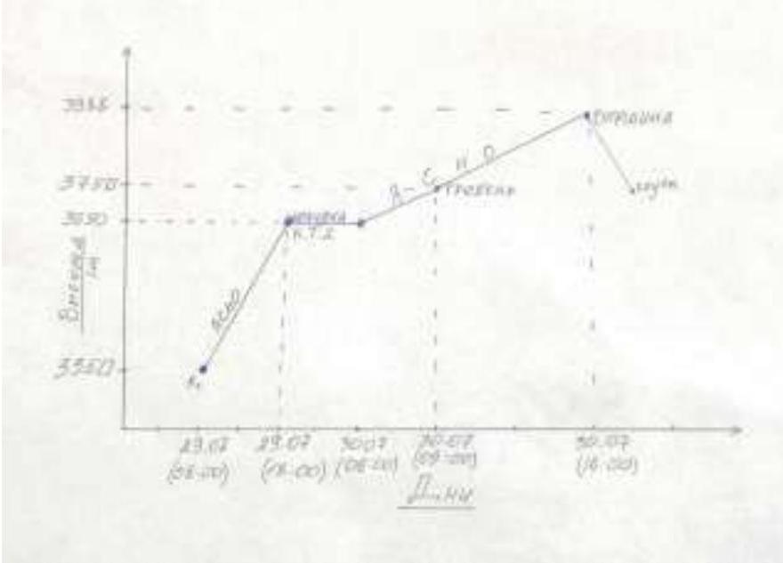
- On the first day, July 29, we covered R0 to R12.
- On the second day, July 30, we covered R12 to R22.
- On the third day, July 31 — descent from the route.
The weather conditions in the ascent area in July were challenging. Unstable weather, frequent thunderstorms and rains contrary to the weather forecast, as well as abnormally high temperatures in the mountains led to a reduction in the duration of weather windows and their unpredictable shift by several days.
For July 29 and 30, the forecast promised a weather window, only in the second half of July 30, the forecast expected a deterioration in weather. At night, there was a thunderstorm. The tent was covered with snow. The descent was accompanied by streams and poor visibility.
Weather conditions by day:
At night, there was a thunderstorm. The tent was covered with snow. The descent was accompanied by streams and poor visibility.
July 28, 2024 (approach 3 h)
Departure from Uzunkol alpine camp to overnight stays in the "green pocket": 15:00 Arrival at overnight stays in the "green pocket": 18:00
July 29, 2024 (10 travel hours)
Departure onto the route from overnight stays: 05:00 Start of work on the rock part (R0): 08:00 1st overnight stay near R12: 18:00
July 30, 2024 (10 travel hours)
Start of work on the route: 06:00 Reaching the peak: 16:00 2nd overnight stay near the snow knife: 19:00
July 31, 2024
Start of rappels: 11:30 Descent to the glacier: 18:00 Return to overnight stays on the moraine: 20:00
Tactical Team Actions and Free Description of Team Actions
Route Passage
The route was completed in accordance with the tactical plan in two days with two overnight stays without prior preparation. Both participants worked with backpacks.
The leader's belay was carried out with two dynamic ropes. All sections of the route were climbed by the leader using free climbing. The second participant moved along the fixed ropes with top-rope belay.
On the first day, Kadyrmaev led. On the second — Marakuev.
It was decided not to start too early since the required wall began to be lit by the sun around 7 am. Climbing on warm rocks is more pleasant and faster, and good weather was forecast. Movement across the glacier was safe; nothing fell from above. We approached the route around 7 am as planned but still lost time. The route line from the glacier was not visible. We had to approach the rock to see the large ledge — the starting point.
Lost an hour. Started climbing at 08:00. On the large ledge, a hook is driven. We had to traverse the entire ledge to start climbing.
By 13:00, we reached CT1. Despite being behind schedule, we managed to catch up. It was time for radio check. Unfortunately, we didn't have a good report with photos; there were only symbols, so orientation was challenging. However, there were local bolts on the route that indicated we were on the right path.
Near the 1st control tour, overnight stay is possible; water can be collected from trickles, but it takes a long time.
The second rock belt was more understandable in terms of orientation. The only downside was that it was entirely wet. We had to climb on wet holds.
We climbed to 17:50 onto a large talus ledge that runs along the entire wall. We thought we could climb the ropes to the ridge. However, there was no understanding if there would be water there. A nearby snow patch helped; we decided to set up camp.
However, we had to:
- set up fixed ropes to reach the snow.
It took 3 hours to set up the camp.
The next day, we started early to climb the remaining ropes to the ridge by 9:00 for radio check. We reached the ridge. We were lucky to have camped lower because there was no water at that spot. We traversed the ridge simultaneously. On the snow knife, we left extra gear. We reached the peak around 16:00. At this time, the wind started blowing from Georgia. Dark clouds were gathering. We returned to the snow knife quickly.
We had to set up a bivouac on a small ledge. Around 21:00, a thunderstorm began.
We planned to start descending at 06:00. However, everything was postponed:
- Snow fell.
- Visibility was poor.
- We waited until 9 am.
- Visibility improved slightly.
- We set out to find the bolts covered in snow.
In the end, we spent more than 2 hours searching for the correct descent. By 6 pm, we descended to the glacier. The rappels were accompanied by wet ropes and clothing.
If the route itself was safe, the descent along the glacier was the opposite:
- Due to bad weather, the glacier opened up.
- The bridges melted.
- It would be problematic to arrest a fall on the soggy snow.
- There were no suitable places to set up anchors.
- There was no ice.
After overcoming the broken glacier, we descended to the overnight stays by 20:00. We reached the camp at 11:00.
List of Equipment Used
- Main rope — 2 pcs.
- 2 m Repschnur — 1 pc.
- Nuts — 5 pcs.
- Friends — 10 pcs.
- 7 m Cordelette — 2 pcs.
- Anchor hooks — 10 pcs.
- Rock hammer — 2 pcs.
- Extraction tool — 1 pc.
- 60 cm Quickdraws — 10 pcs.
- Station slings — 2 pcs.
- Non-locking carabiners — 20 pcs.
- Locking carabiners — 10 pcs.
- Jumar — 2 pcs.
- Block-pulley — 1 pc.
- Belay device type ATC — 2 pcs.
- Ice axe — 2 pcs.
- Crampons — 2 pcs.
- Backpack — 2 pcs.
- Assault tent — 1 pc.
- Helmet — 2 pcs.
- Headlamp — 2 pcs.
- Sleeping bag — 1 pc.
- Sleeping mat — 1 pc.
- Gas stove — 2 pcs.
- Gas canister — 2 pcs.
- First aid kit — 1 pc.
- Radio station — 2 pcs.
Photos from the Route
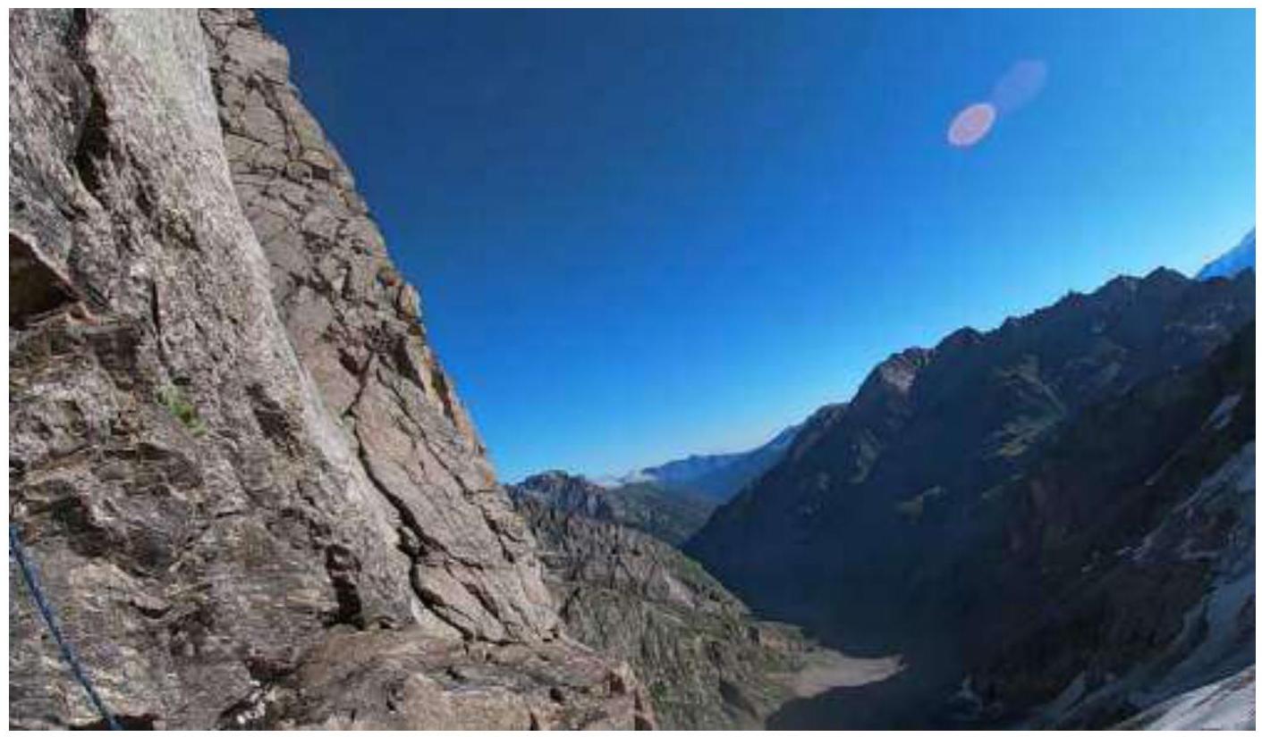
Photo №1 — Start of the route. View from the large ledge.
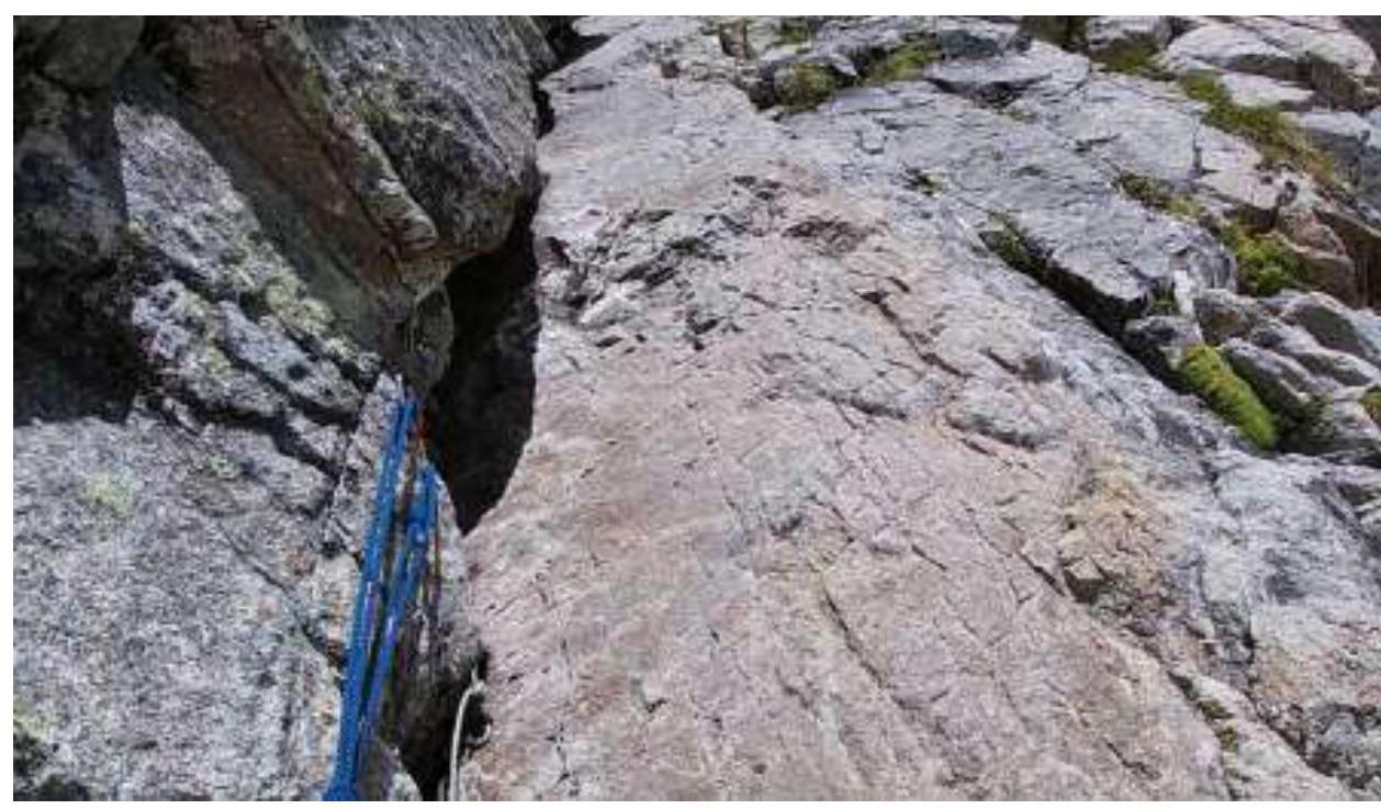
Photo №2 — Station after the second rope.
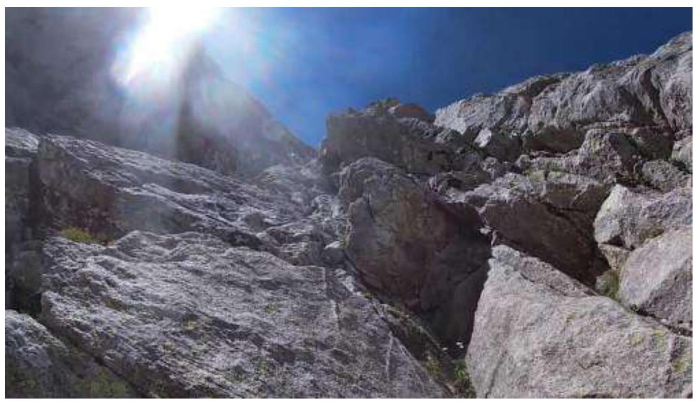
Photo №3 — Section R4–R5.

Photo №4 — Section R6–R7. Wet internal corner. View from the station.
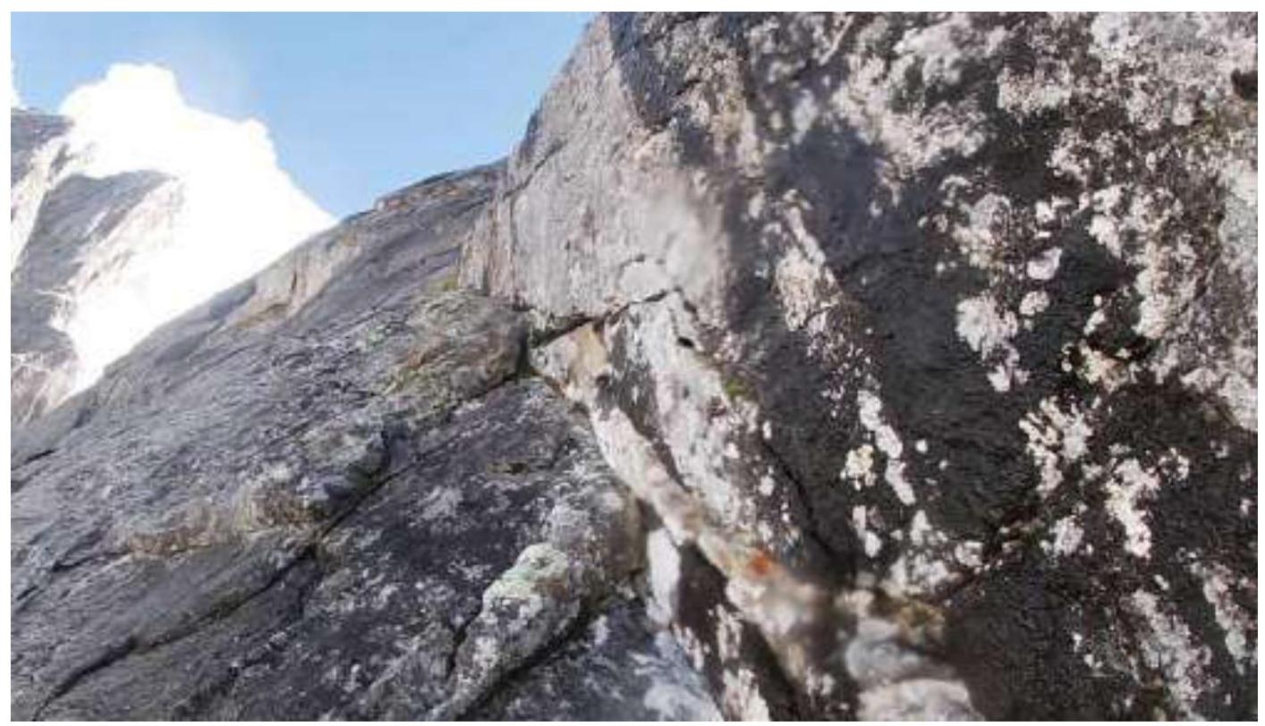
Photo №5 — Section R7–R8. Climbing on wet rocks.
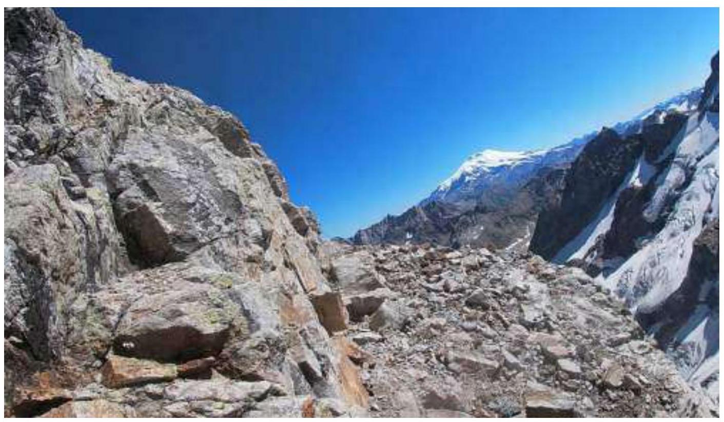
Photo №6 — Simultaneous movement along the ridge.
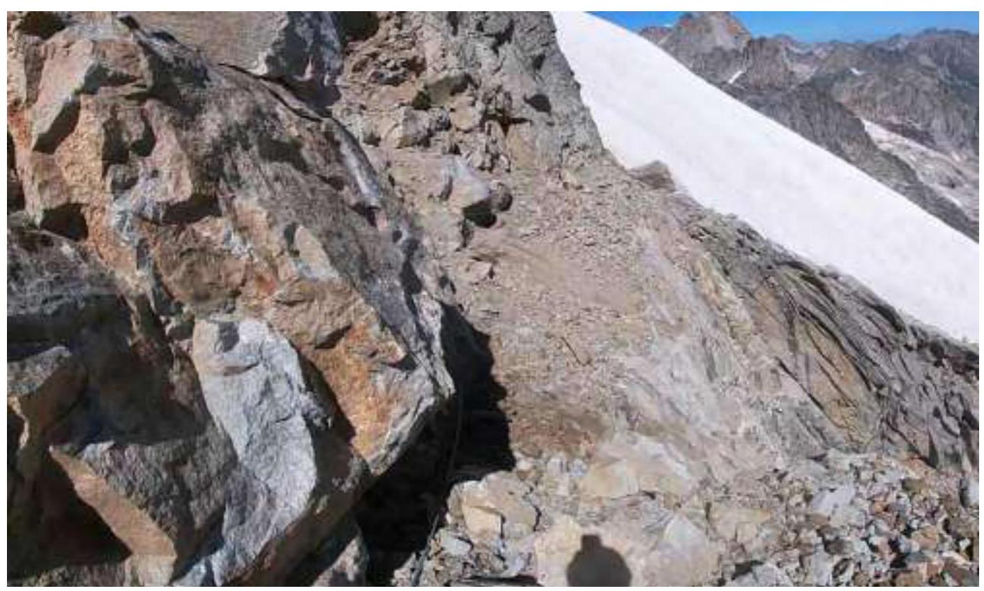
Photo №7 — Approaching the snow knife.
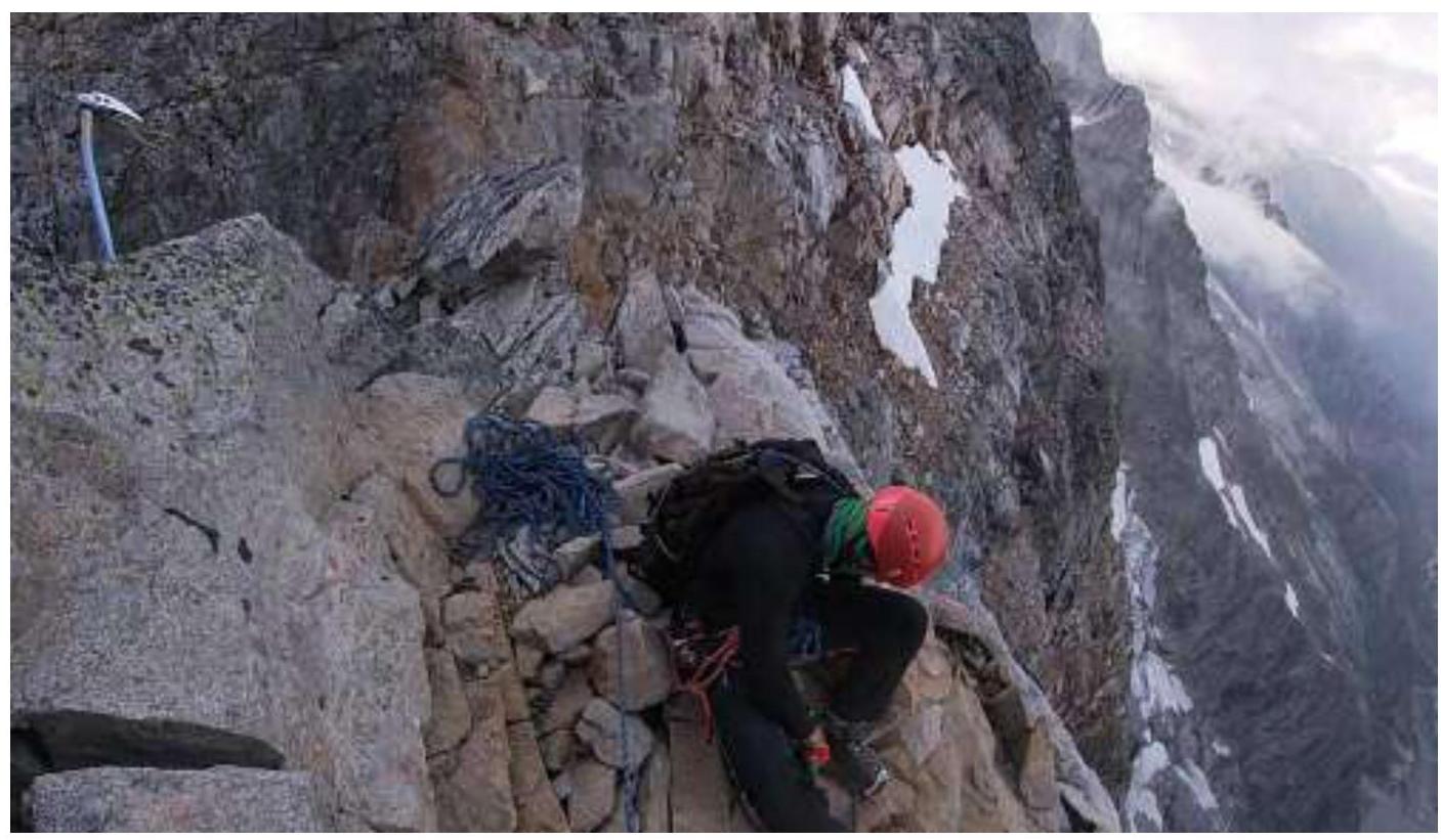
Photo №8 — Before the dip in the ridge. Near the summit tower.

Photo №9 — On the peak. Removed the helmet to record a video on the action camera.
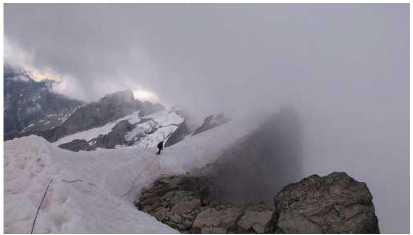
Photo №10 — Returning along the snow knife. The weather is deteriorating.
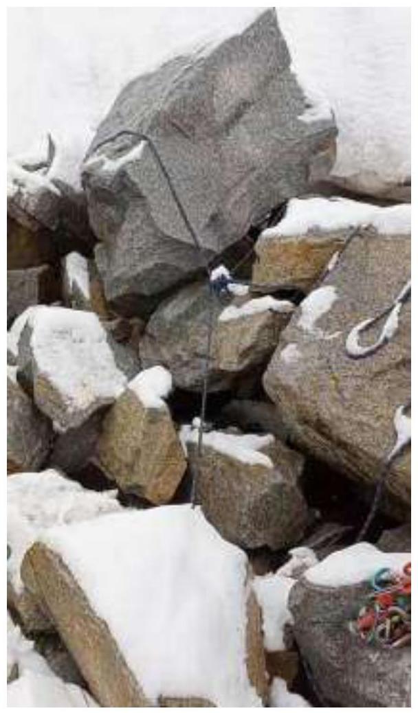
Photo №11 — Morning after the thunderstorm.