EAAC Championship in the Rock Category
Report
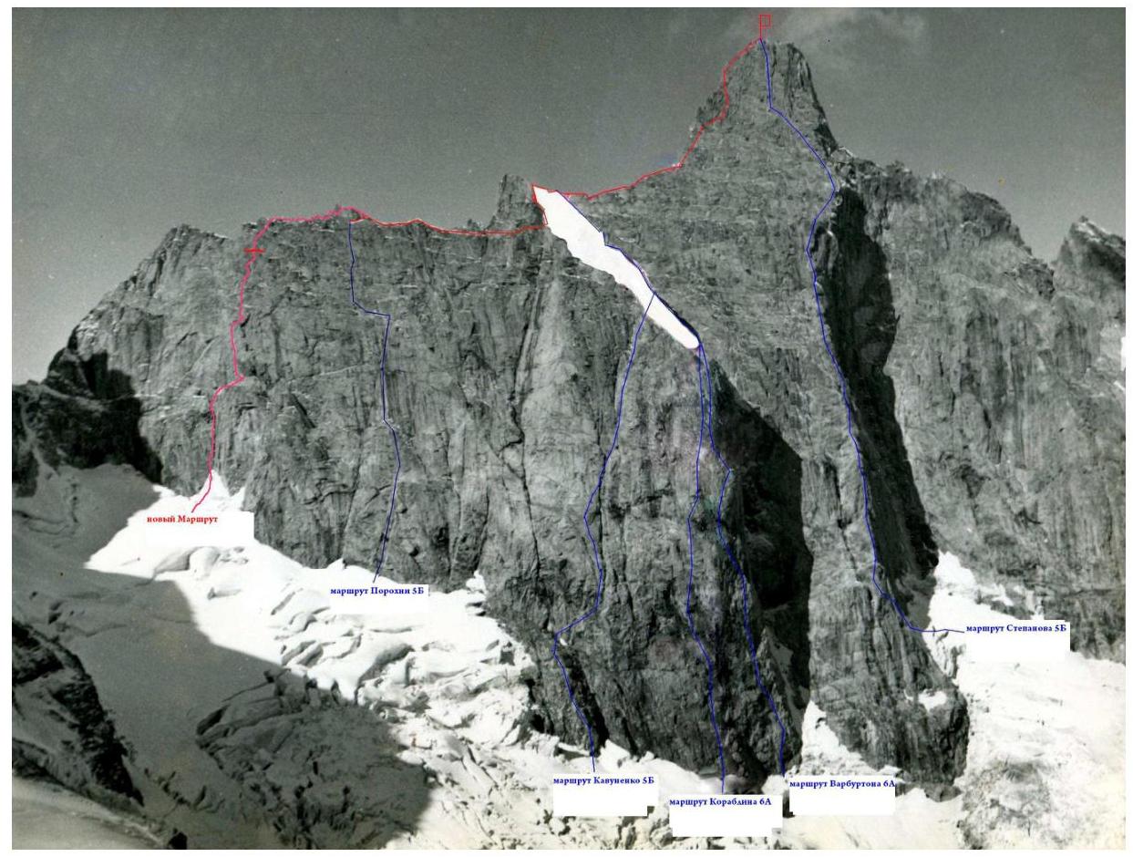
On the ascent of Dalar peak via the center of the NE wall of the East shoulder (first ascent) by the Combined team of Moscow region 2010
Ascent Passport
- Caucasus, Uzunkol gorge, section according to KMGV-2.3.
- Dalar peak (3988 m) via the center of the NE wall of the East shoulder.
- Proposed first ascent of 5B category.
- Route type — rock climbing.
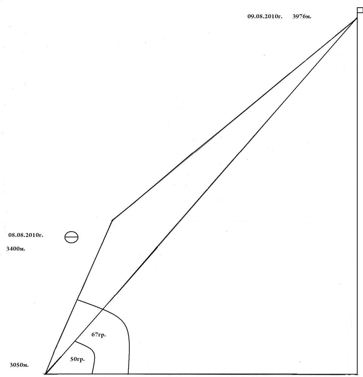
- Height difference of the route — 780 m, wall section — 400 m.
- Route length — 1280 m, wall section — 430 m.
- Length of sections with 5 category difficulty — 350 m, 6 category difficulty — 15 m.
- Average steepness of the wall section — 67°.
- Average steepness of the entire route — 50°.
- Equipment used on the route:
- pitons — 36
- nuts — 51
- cams — 33
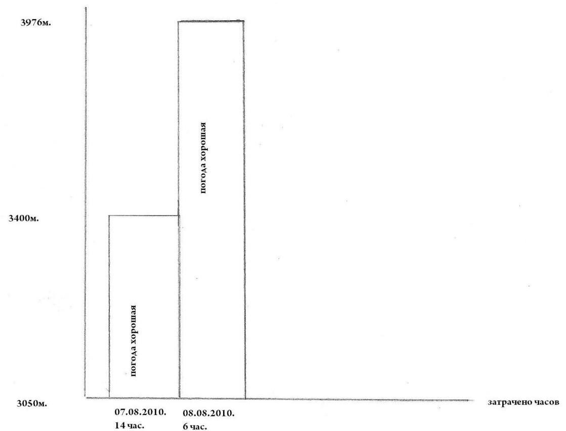
- Team's climbing hours — 20, days — 2.
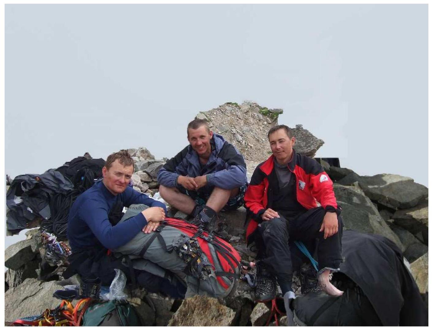
- Team leader Pivikov D.E. — Master of Sports
Team members:
- Khomchenko D.S. — Candidate for Master of Sports
- Smirnov Yu.V. — 1st sports category
- Khomchenko A.S. — 1st sports category
- Coach — Dzaparidze Yu.O. — Master of Sports.
- Departure to the route on August 7, 2010, reaching the summit on August 8, 2010, return to base camp on August 9, 2010.
Brief characteristics and route description
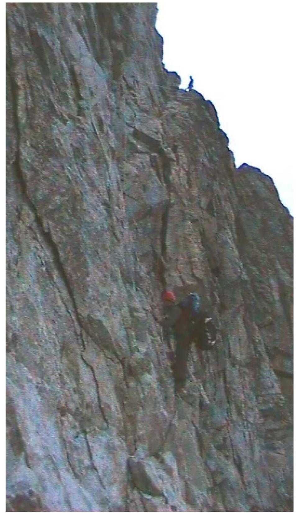
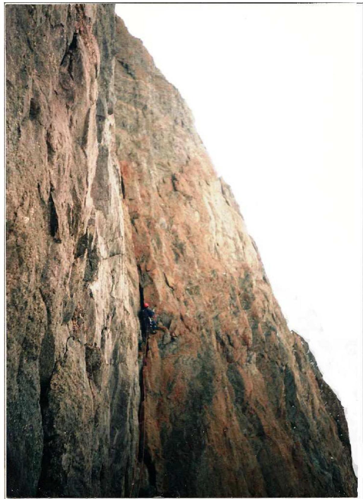
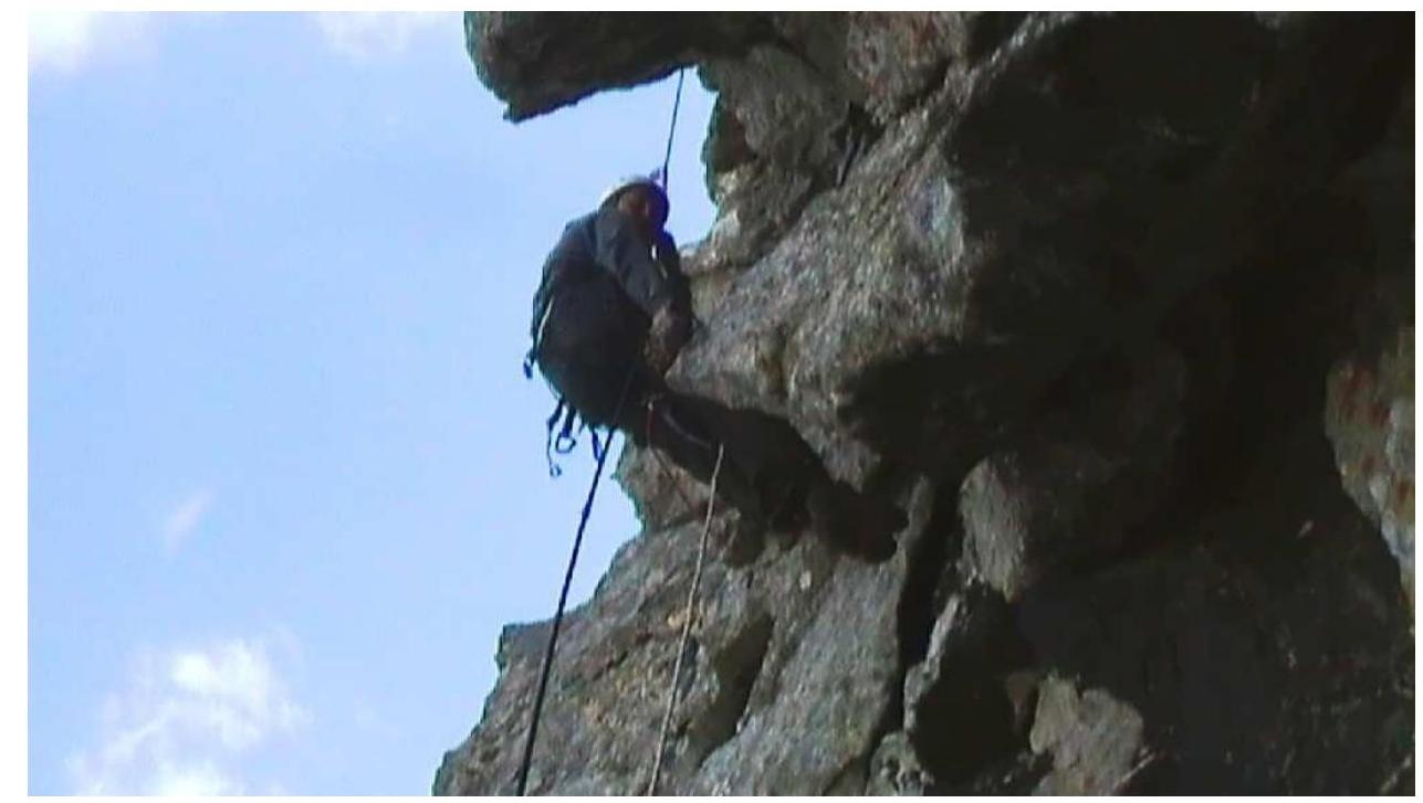
The route starts 150 m to the left of the Porokhnya route, at a pronounced rock triangle with its apex pointing downwards. The route is monolithic, with good solid holds. There are no issues with organizing protection using pitons, nuts, and cams. Places for bivouacs are comfortable and safe. In the second half of summer, there is no water on the wall section of the route. The route is saturated with cornices and overhangs. Movement requires choosing between them, zigzagging to the right and left. The approach to the wall, to the start of the route, may be complicated in the second half of summer due to heavily broken seracs. The route begins from a small ledge, on the wall to the left of the internal corner in the left part of the rock triangle — R1. Then, via a 10-meter wall, exit into the internal corner. Through the internal corner, 2 ropes of difficult climbing lead to a large ledge where a bivouac can be organized — R2–R4. From the ledge, bypassing cornices on the left, along the wall with a cornice, difficult climbing — artificial support points — R5–R6. Then, along a small smooth wall under a cornice, which is bypassed on the left. Further, along difficult, steep, and smooth rocks, with a small number of holds, through a cornice, which is climbed directly — artificial support points — R7–R8. Section R9–R10 is an alternation of short walls ending in a crack, which is climbed using free climbing and only at the end, artificial support points are used. Section R11 leads to a large ledge where a comfortable bivouac can be organized. From the start of the route, 14–16 hours. Further, along a difficult wall, exit onto the eastern ridge of Dalar peak — R12–R14. Section R15 is part of the eastern ridge and the summit tower of the 5A category route.
Copyright © 2010 by The A.V. International, Inc. All rights reserved.
Route Profile
Ascent Graph
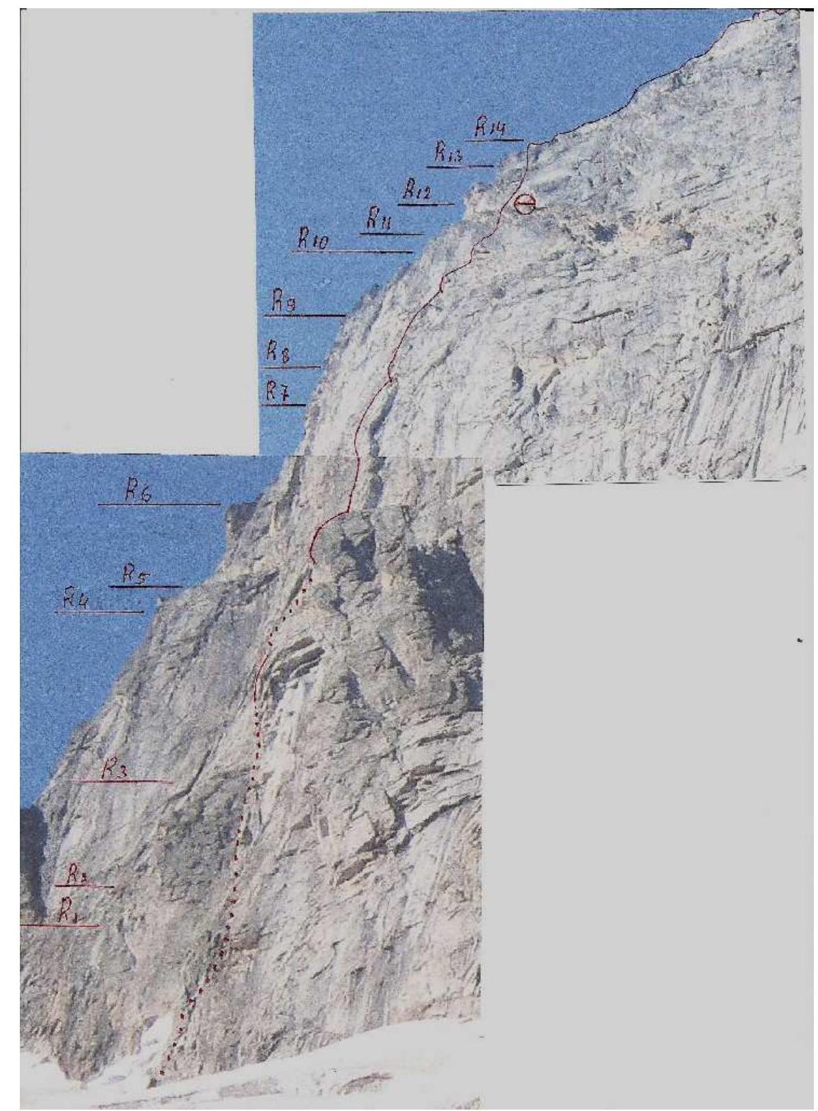
| Section № | Cams | Nuts | Pitons | Length, m | Steepness, ° | Difficulty |
|---|---|---|---|---|---|---|
| R0 | ||||||
| R1 | 50 m | 70° | 4 | |||
| R2 | 10 m | 90° | 5+ | |||
| R3 | 3 | 5 | 55 m | 80° | 5+ | |
| R4 | 60 m | 85° | 5 | |||
| R5 | 5 | 4 | 4 | 10 m | 10° | 1 |
| R6 | 3 | 5/2 | 3/1 | 45 m | 90–95° | 5+ А3 |
| R7 | 5 | 4 | 40 m | 85° | 5+ | |
| R8 | 1 | 3/1 | 4/2 | 15 m | 105° | 6 А3 |
| R9 | 4 | 4 | 4 | 40 m | 80° | 5 |
| R10 | 2 | 3 | 3/2 | 20 m | 90–95° | 5+ А2 |
| R11 | 3 | 4 | 4 | 30 m | 90° | 5+ |
| R12 | 5 m | 10° | 1 | |||
| R13 | 2 | 4 | 5 | 40 m | 70° | 5 |
| R14 | 3 | 1 | 10 m | 90° | 5+ | |
| R15 | 5 | 5 | 8 | 850 m | 40–60° | 3–4 |