
St. Petersburg Alpine Climbing Championship 2020 (high-altitude technical class)
Report on the ascent to Dalar peak (3979 m) via the north buttress of the north shoulder (Tramontana), category 5A.
The route was completed by the team of the Alpine Federation of St. Petersburg.
St. Petersburg 2020
Ascent Passport
- Western Caucasus, from Nakhar Pass to Chiperezaou Pass. Section No. 2.3 of the classifier of routes to mountain peaks.
- Dalar peak (3979 m), via the north buttress of the north shoulder (Tramontana).
- Category of complexity — 5A.
- Nature of the route — combined.
- Height difference of the route ~1365 m. Route length ~2000 m. Length of sections: ~category V 320 m, ~category VI 110 m. Steepness of the wall section: ~81°. Average steepness of the entire route ~70°.
- Pitons left on the route: total 0, including expansion bolts — 0.
Total points used on the route:
- anchor pitons ~40,
- chocks, cams ~180,
- expansion bolts — 0. Total use of artificial climbing aids (ICA) — 0.
- Team's total climbing hours (until the summit): 22 hours, 2 days.
- Team leader: Gagarinov A.Yu., 2nd sports category. Participants: Kornev V.M., 1st sports category; Maksimova L.A., 2nd sports category. Observer: Kornev S.V., 2nd sports category.
- Coach — Kornev V.M., 1st sports category.
- Approach to overnight camps — August 12, 2020, at 13:00 Departure from overnight camps — August 13, 2020, at 4:45 Start of work on the route — August 13, 2020, at 6:45 Summit attainment — August 14, 2020, at 15:30 Return to Uzunkol alpine camp — August 15, 2020, at 18:00
E-mail of the person responsible for the report: ymahaster@gmail.com
General photo of the summit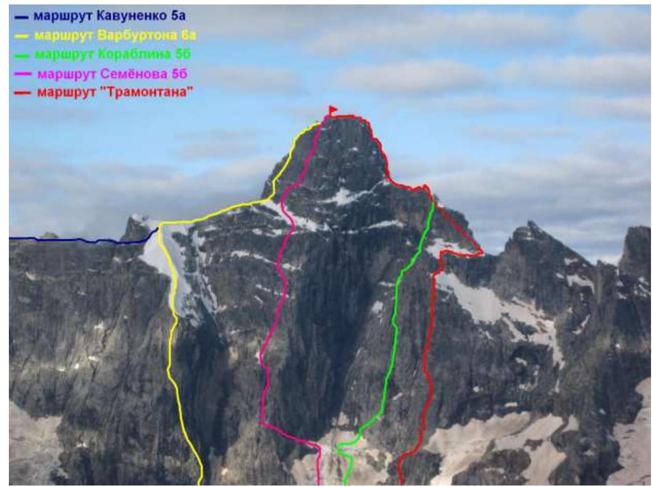
Route profile
Technical photo of the route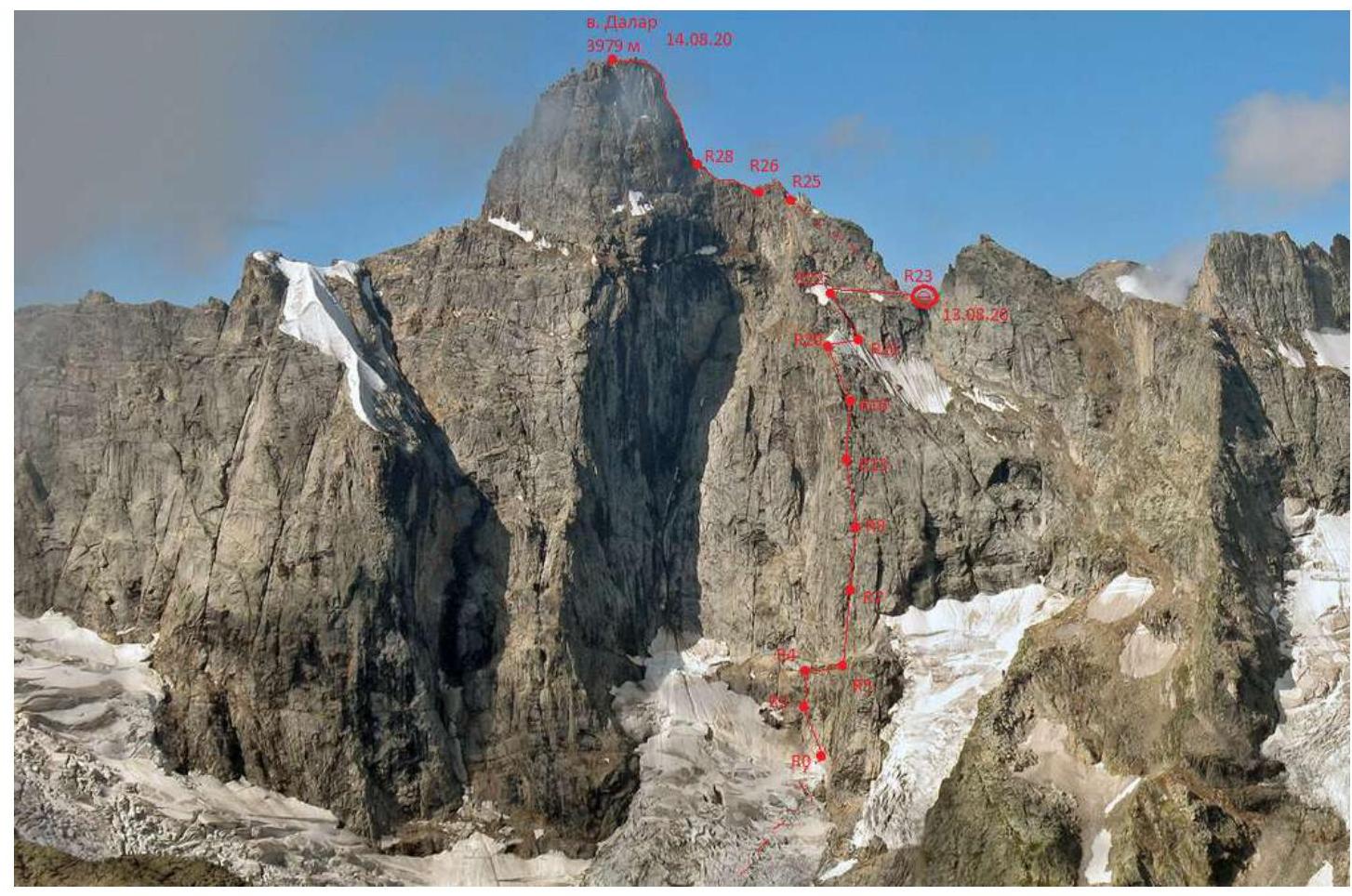
Route diagram in UIAA symbols
| Section # | Route line | Complexity | Length, m | Steepness, degrees |
|---|---|---|---|---|
| R31–R32 | III+ | 200 | rocky ridge | |
| R30–R31 | IV | 40 | 60 | |
| R29–R30 | V | 20 | 75 | |
| R28–R29 | V+ | 60 | 80 | |
| R27–R28 | III | 70 | 30 | |
| R25–R26 | IV | 100 | rocky ridge | |
| R24–R25 | V | 50 | 75 | |
| R23–R24 | II–III+ | 180 | 30–50 | |
| R22–R23 | II–III | 200 | 30 | |
| R21–R22 | V | 45 | 70 | |
| R20–R21 | II | 60 | 30 | |
| R19–R20 | IV | 20 | 60 | |
| R18–R19 | III | 30 | 50 | |
| R17–R18 | IV | 40 | 60 | |
| R16–17 | IV | 20 | 45 | |
| R15–R16 | III | 40 | 50 | |
| R14–R15 | V | 35 | 75 | |
| R13–R14 | IV–V | 25 | 75 | |
| R12–R13 | V | 20 | 70 | |
| R11–R12 | IV | 20 | 70 | |
| R10–R11 | IV | 45 | 65 | |
| R9–R10 | II | 10 | 30 | |
| R8–R9 | КТ2 | VI | 10 | 95 |
| IV | 15 | 65 | ||
| R7–R8 | V+ | 50 | 80 | |
| R6–R7 | VI | 50 | 90 | |
| R5–R6 | V | 40 | 85 | |
| R4–R5 | КТ1 | I | 70 | 20 |
| R3–R4 | IV+ | 45 | 70 | |
| R2–R3 | IV | 35 | 60 | |
| R1–R2 | IV | 40 | 50 | |
| R0–R1 | V+ | 45 | 75 | |
| R0 | I | 300 | 30–40 |
Ascent graph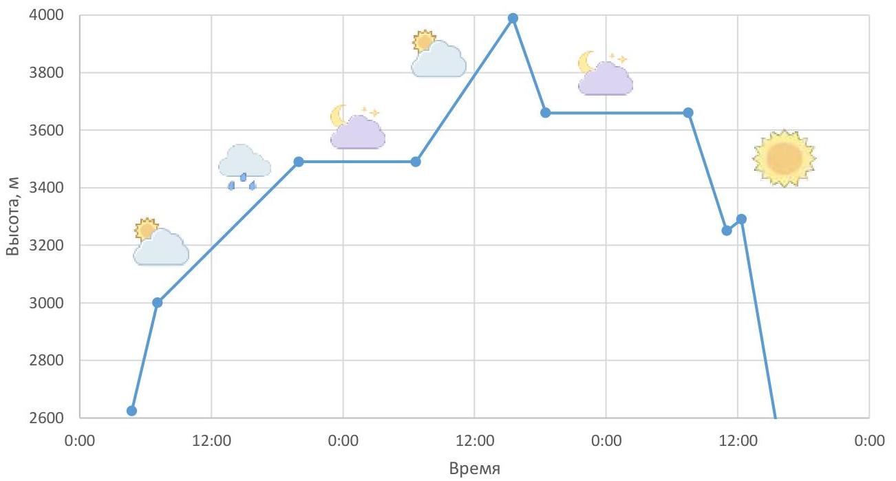
Route description
From the overnight camps, located in the right moraine pocket of the Big Kichkinekol glacier, move along the talus in the direction of the moraine ridge, slightly ascending to the right, and reach the stream flowing from the rocks resembling "sheep's foreheads". Cross the stream and ascend along the smoothed ledges to the plateau. From the "sheep's foreheads," transition to the glacier. Ascend along the gentle ice in the direction of the NE wall. (R0 300 m, 300–400, category I). 2 hours from the overnight camps.
The route begins at the large internal angle formed by the black rock and the "sheep's foreheads" at the lower part of the wall. Cross to the rocks and ascend along complex rock formations to reach a ledge (R1 45 m, V+).
From the ledge, move left and upward along smoothed slabs, bypassing the black rock. The cracks are tight and wet, making protection challenging; anchor pitons and small chocks were used. (R2 40 m, IV).
Continue moving left through the stream bed and upward along the smoothed "foreheads" on the left side of the stream to a ledge (R3 35 m, IV).
From here, ascend along the stream bed on a smooth, polished slab (R4 45 m, IV+; protection organization is challenging).
Reach a large, green, talus-filled ledge and traverse right to the control cairn.
- "Control cairn is missing!"
- Movement to the middle of the ledge (R5 70 m, I; simultaneous movement).
Further, ascend the rock with black streaks, bypassing the overhang at the base of the internal angle transitioning into a chimney, and continue up the internal angle (R6 40 m, V).
Enter the chimney through a slightly overhanging internal angle, which is passed on the right side (10 m, VI). Ascend the chimney. The rocks are mossy with few cracks, making protection challenging, and there are many loose stones. Ascend through an talus-filled, inclined ledge deep within the chimney and then continue for 40 m (V+). At this point, the chimney widens to 4 m.
From here, 10 m upward and to the right from the belay station, a wall with characteristic black streaks on yellow rock (the "tiger wall") is visible — a landmark for the route. Continue up the chimney, leaving the "tiger wall" to the right, for 12 m (IV) to where the chimney forks.
Ascend the right-hand chimney, moving left (10 m, VI). Loose stones are present. Exit the chimney onto a steep ledge with many loose stones. On the ledge, there is a control cairn 2 ("Cairn 2" was also not found!).
Traverse the ledge to the right and upward (R10 10 m, II). The ledge is suitable for a bivouac.
From the ledge, ascend the slab (10 m, IV) and then along destroyed rocks to the left and upward beneath the yellow cornice. The terrain on this section is characterized by:
- isolated blocks
- slabs
- stones
Continue moving in the direction of the left edge of the wall. (R11 45 m, IV).
From the R12 ledge, ascend through internal angles and walls (V, 20 m). Ascend toward the isolated rock "tooth" at the summit of the north buttress. The rock "tooth" is bypassed on the right along complex rock formations. 5 m below the rock "tooth" is a ledge (R13 20 m, V; R14 25 m, IV–V; R15 35 m, V).
Above section R15, the route becomes less steep and passes through various walls composed of loose stones. The route line is not clearly defined. Generally, stay to the left part of the wall.
At section R20, the route line leads to the first snow belt. On the ledge to the left of the snow, there is a bivouac site. Traverse along the steep snow belt for 60 m to the couloir (R21 60 m, II).
From here, ascend along complex, highly destroyed rocks (many loose stones!) (R22 45 m, V) to the "sheep's foreheads" beneath the second snow belt. Traverse along the "sheep's foreheads" for 200 m to the right to the saddle between Dalar peak and Shokoladny peak (R23 200 m, II–III). There are three convenient bivouac sites here:
- Site 1
- Site 2
- Site 3
From the saddle, having crossed to the side of the Myrdy gorge, ascend along a large talus-filled ledge toward Dalar peak (R24 180 m, II–III+).
From the ledge, exit onto the ridge of Dalar peak and continue along the heavily serrated ridge toward the summit tower, bypassing obstacles. The climbing is not difficult but is psychologically tense due to the steep drop-offs on both sides of the ridge.
Further, along an talus-filled ledge to the right, to the end of the ledge (R28 70 m, III). Ascend along destroyed rocks; many loose stones! (R29 60 m, V+). A chimney and straightforward climbing lead to the pre-summit ridge. (R31 40 m, IV). Along the ridge, directly to the summit (200 m).
Descent is made to the south via a couloir from the summit. After exiting onto the left shoulder of Dalar peak, descend via route 3B. The snow on this route had completely melted, so the descent was made along an talus-filled ledge and rocks resembling "sheep's foreheads," staying to the right.
Tactical actions of the team
To maintain stable and constant communication with the base camp (BC), it was decided to proceed under the route with an observer (Kornev S.V.).
August 12:
- Departed from BC.
- Reached the overnight camps in 3 hours.
- Observed the approach via the glacier from above.
Started on August 13, 2020, at 4:45.
The approach included:
- climbing elements on "sheep's foreheads,"
- open glacier,
- movement on "sheep's foreheads" in crampons.
Reached the bergschrund by 6:45.
Located the starting landmark of the route — a black wall, from which 40 m of additional rocks had thawed since 2009.
Began movement at 7:05. The following scheme was devised and implemented:
- The leader (Kornev, RedFox on 15 l) climbed in rock shoes.
- The second participant was provided with top-rope protection (Maksimova, Osprey on 38 l).
- The last participant moved on fixed ropes (Gagarinov, Grivel 45 l).
Reached CT #1 by 9:00" (having climbed 3 pitches + a traverse along a ledge).
Reached CT #2 by 12:00 (section R9), having climbed the right-hand gully of the chimney via free climbing. After the section with the control cairn, encountered complex, overhanging rocks and determined that they were "not on the route." Spent an hour returning to the planned path.
Around 14:00, the weather began to deteriorate — rain and small hail started, and fog appeared. Got wet and chilled. The leader warmed his feet inside his gloves at the belay station. By 15:00, the thought of setting up a bivouac occurred, but they decided to persevere for another 3 pitches to the anticipated bivouac site near the snow belts (section R20).
Reached the first snow belt by 17:00. The leader decided to have a substantial snack. Visibility returned, and the desire to continue working emerged. Decided to continue movement to a more comfortable bivouac site. In crampons, traversed 60 m along the snow and climbed 60 m along highly destroyed "sheep's foreheads" to a ledge with a partially melted second snow belt.
After section R20, to ease Gagarinov's discomfort, it was decided to accept him with top-rope protection (all participants moved without fixed ropes).
Further, simultaneously traversed along an talus-filled ledge and a small ice remnant of the second snow belt to the saddle between Shokoladny peak and Dalar peak.
Reached the saddle by 20:00 and set up a bivouac by 21:00. To prepare a meal, ice was chipped from the remnants of the second snow belt into a rain jacket.
August 14:
- Woke up at 4:30, departed at 6:40.
- Reassembled Osprey and Grivel to make them closer in weight.
- Decided to:
- abandon fixed ropes,
- organize top-rope protection for all participants.
Moved simultaneously until the start of the climbing sections on the ridge.
Further:
- Maksimova led in rock shoes,
- Kornev was second,
- Gagarinov was last.
Reached the sharp ridge before ascending to the summit tower by 10:00. The wind began to pick up, and fog returned. The ice-snow section before the summit tower had significantly melted, allowing passage along the formed ledges without stepping into the snow in rock shoes. Strong wind, fog, and occasional snow.
Reached the summit ridge by 14:30, warmed up, and continued simultaneously in hiking boots.
Reached the summit at 15:30. Began descent at 16:00: proceeded further to a gap in the ridge, from where rappel down to the southern side. After 4.5 pitches, reached an talus-filled ledge. Fog; zero visibility. Decided to set up a bivouac. Found a snow patch and a small stream along the wall to the west of the ledge and a comfortable site for a tent 300 m to the east by 18:30.
August 15:
- Woke up at 6:00.
- Departed at 7:30.
- Reached the left shoulder of Dalar peak under the summit tower by 7:45 (Kavunenko route, category 5A).
- Descended to the south, alternating between rappelling, climbing descent, and walking. Total of 2.5 rappels.
Reached the foot by 11:00, began movement toward Dalar Pass. Had a break near a small lake.
Reached the pass by 12:20. Descended in crampons, with one rappel through a subterranean bergschrund.
Reached the Myrdy river by 15:00. Had a good rest on the trail, collected a bag of mushrooms, and returned to BC by 18:00.
Photos from the route
Start of movement from overnight camps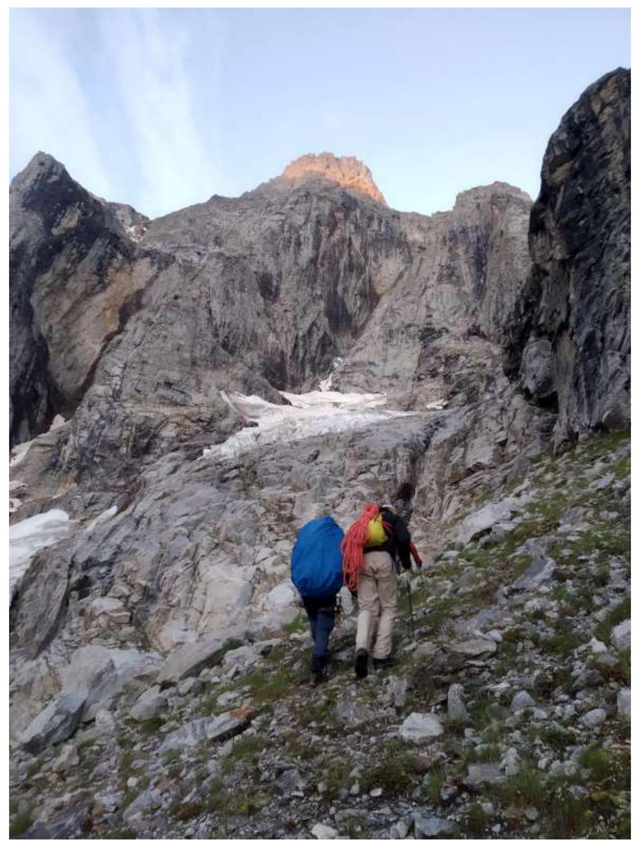
Approach to "sheep's foreheads" and the stream
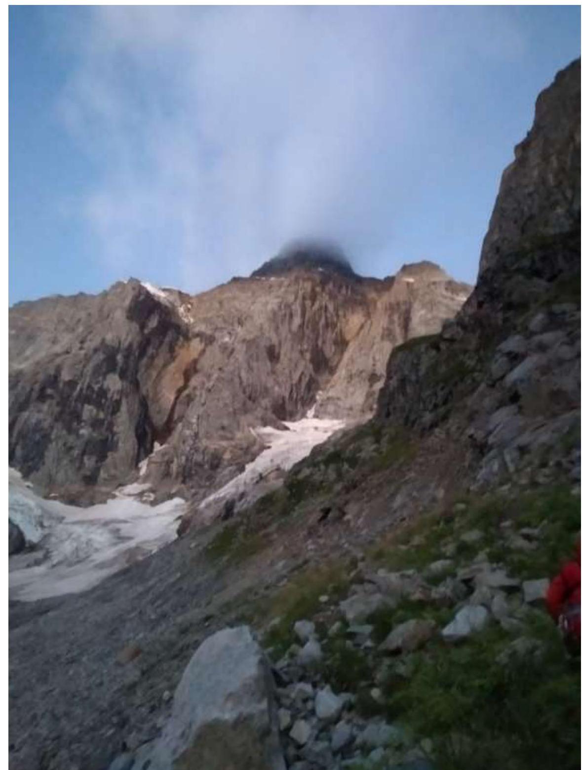
View from the ledge on the start of the route and the glacier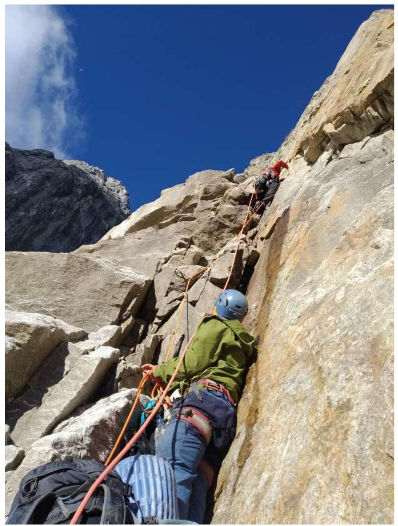
Section R0–R1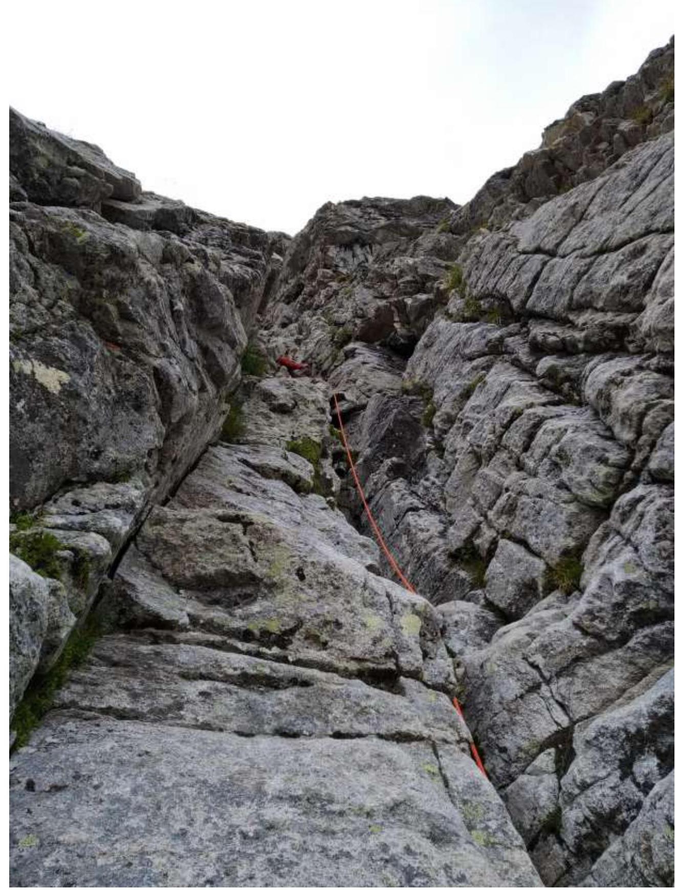
Section R7–R8, "tiger wall" visible in the upper right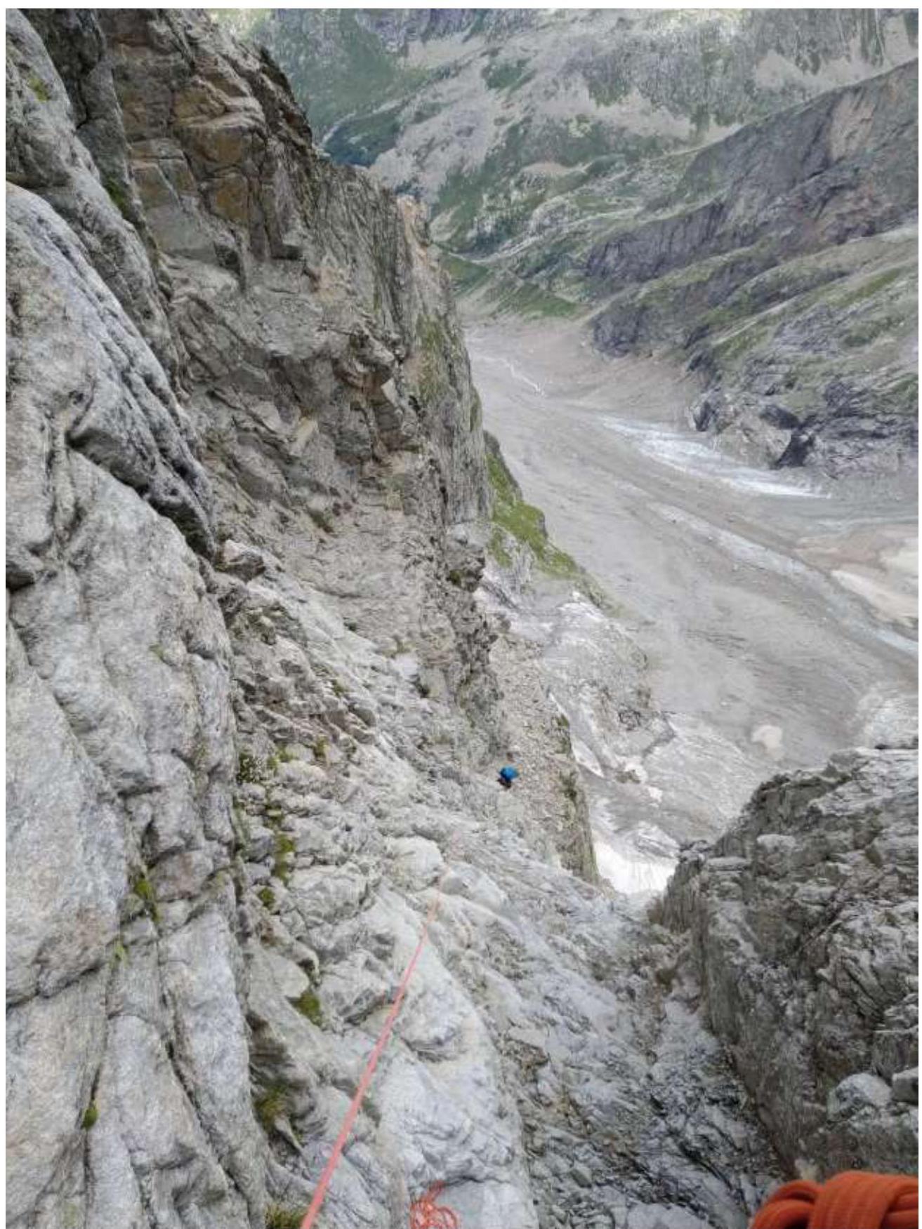
Section R7–R8, view down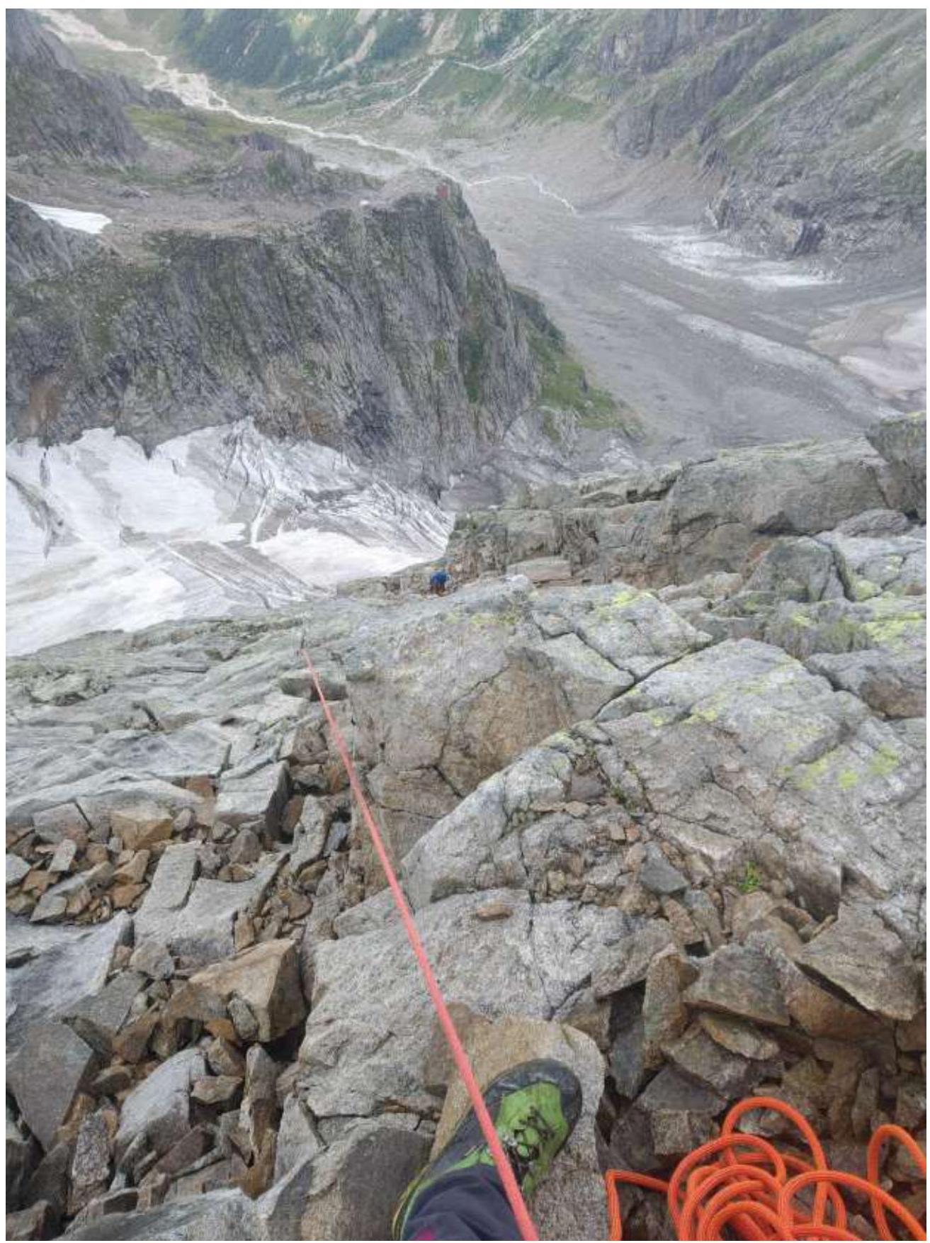
Section R15–R16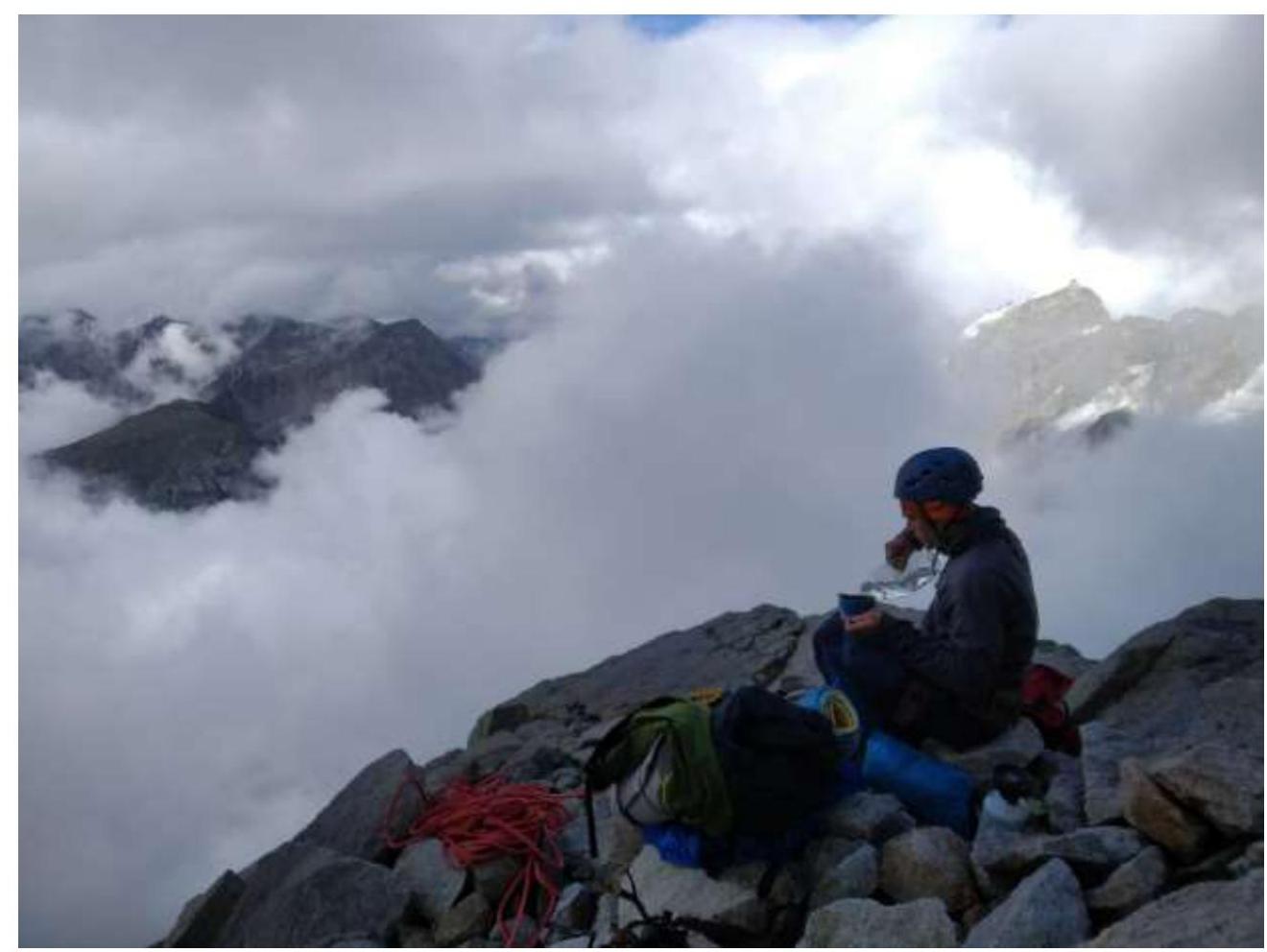
Resting place on the 1st snow belt (R20)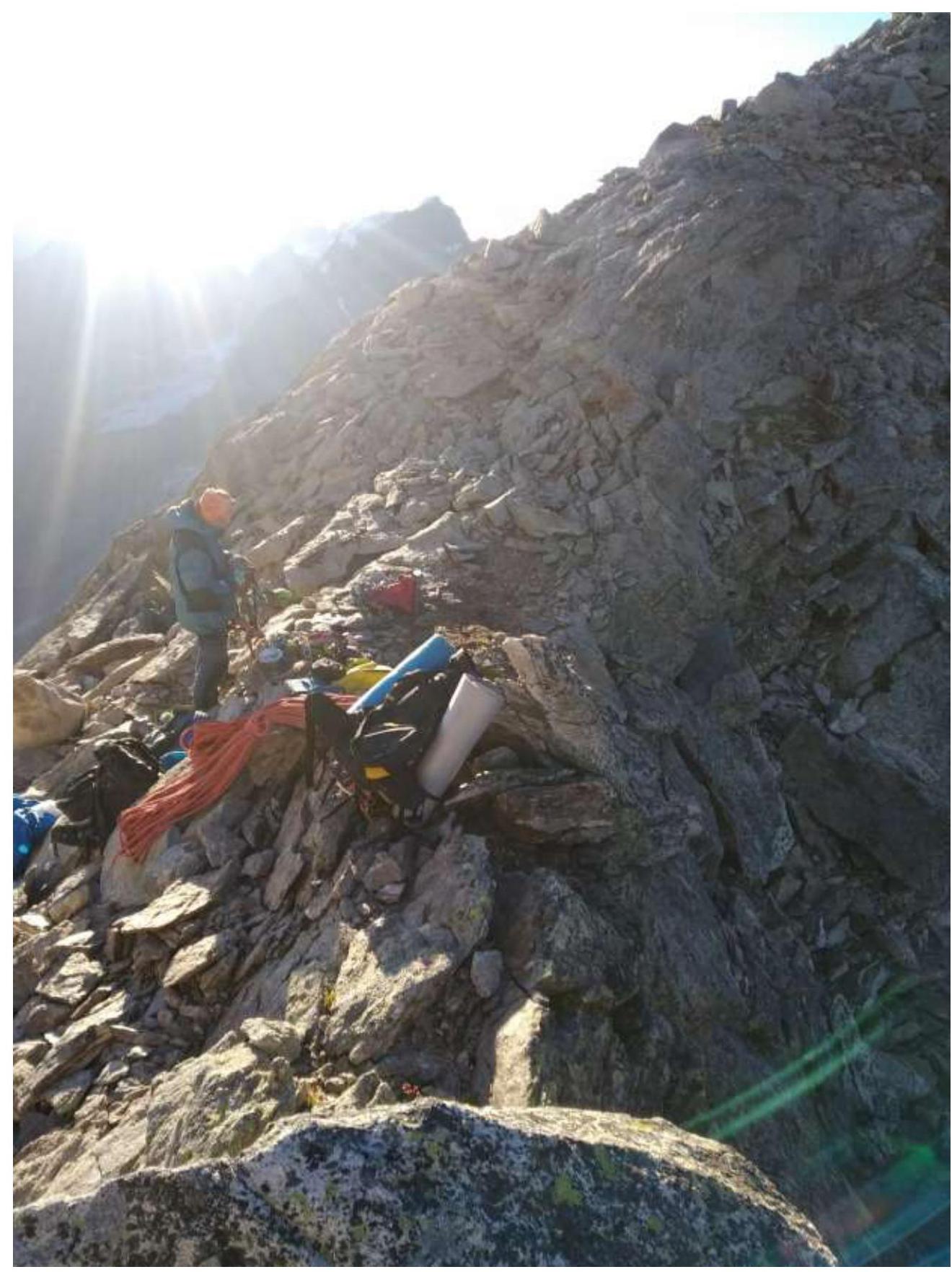
Bivouac on the saddle between Shokoladny peak and Dalar peak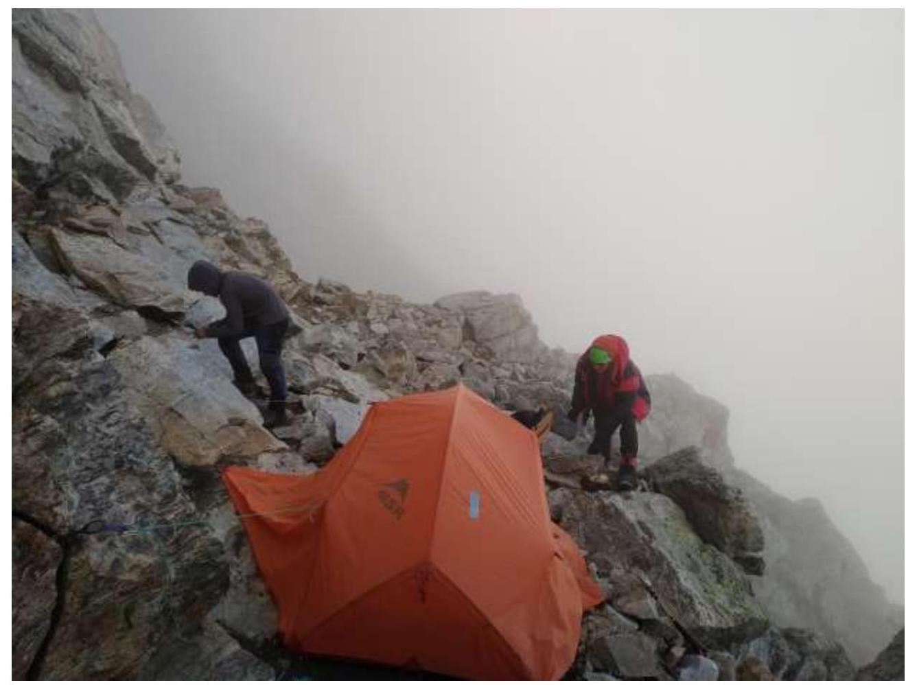
Bivouac site on descent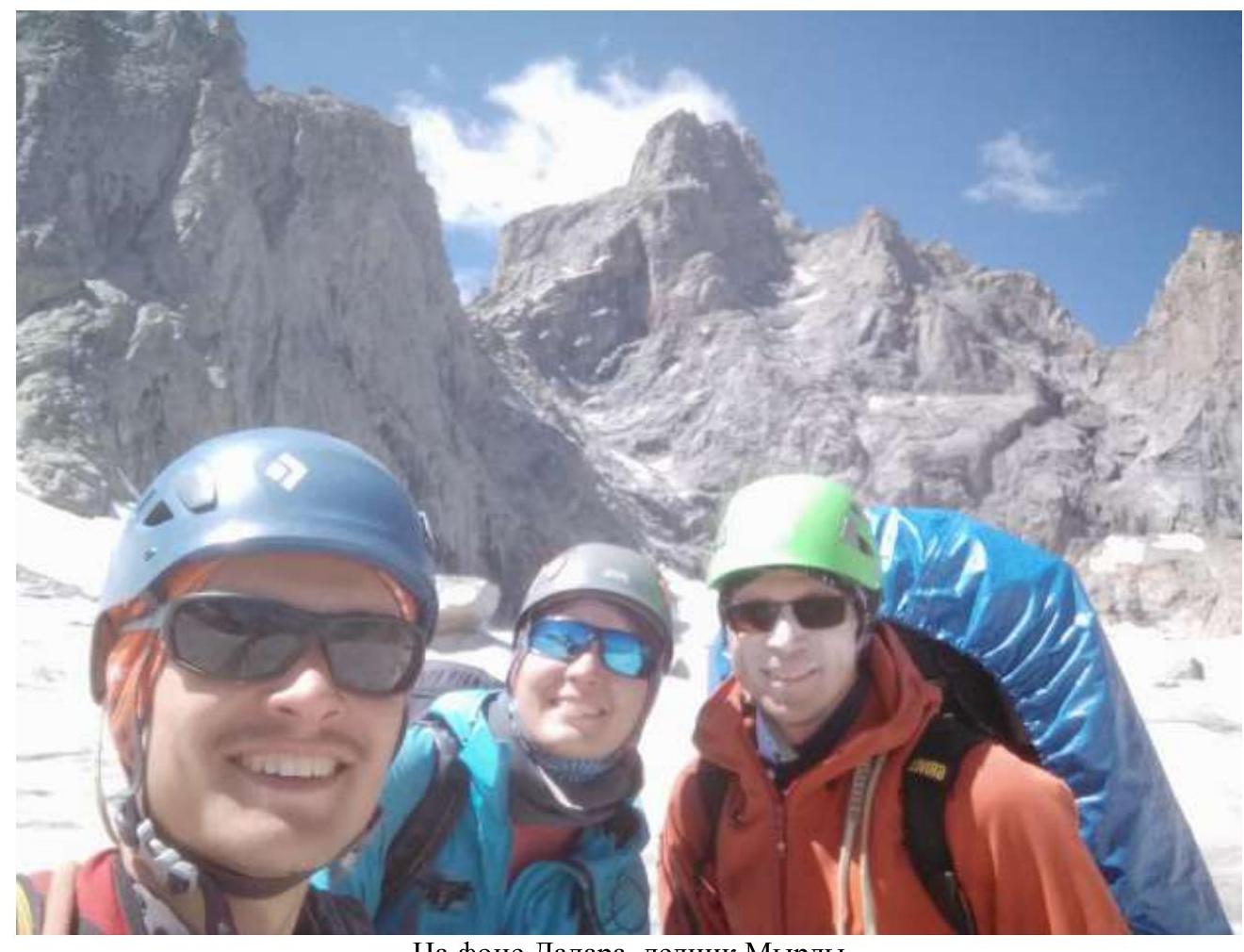
Against the backdrop of Dalar peak, Myrdy glacier
Comments
Sign in to leave a comment