
Passport
Ascent to the "Bezымянная" peak via the southwest ridge
- Class of ascent — technical.
- Area of ascent — Caucasus, Bezengi area, southwest spur of Dykh-Tau (Fig. 1).
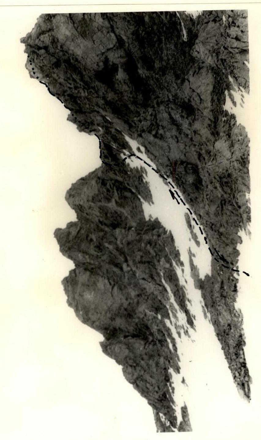
- "Bezымянная" peak 4050 m, in the spur of Dykh-Tau (Fig. 2).
- Proposed category — 3.
- Route characteristics: a) height difference — 1300 m; b) route length — 900–1100 m of snow-ice slope; c) average steepness — 35–45°.
- 12 ice screws were used on the ice section.
- Rock pitons — not used.
- Group composition: 1-a. Ulyanov A.R. — s.r. — leader. 2-a. Saratov Yu.S. — MS 3-a. Lukinov V.N. — 1st sports category. 4-a. Efremov A.A. — 1st sports category.
- Date of departure on the route — July 27, 1977. Date of return to the camp — July 28, 1977.
Approach to the route
From the "Bezengi" tourist camp along the Bezengi glacier to the stream flowing from the Western cirque of Misses-Tau peak. After the stream, cross the glacier to the left and ascend along the stream flowing through the moraine pocket under the cliffs of the Western ridge of Dykh-Tau.
There are convenient overnight stays in the pocket, with water nearby. 3–4 hours from the camp.
Route description
From the bivouac, descend to the glacier along the right (in the direction of travel) side of the moraine and approach the snow-ice slope that leads to the saddle between "Bezымянная" peak and Semenovsky Pass.
(About 2 hours from the overnight stay to the snow-ice slope, i.e., to the start of the route).
Initially, the movement is along a gently sloping (30°) ice slope dissected by crevasses, partially covered with snow, to the beginning of the ice pitch. The snow layer on the ice becomes thinner as you ascend, and it is necessary to use piton insurance, clearing the ice from snow.
In the upper part, the steepness of the ice slope reaches 50°. The length of the ice section at the time of ascent is 100 m.
Crossing the crevasse between the ice slope and the snow slope via snow bridges, you emerge onto the snow slope and move up to the left, bypassing a wide crevasse and a steep snow-ice overhang, to the saddle between "Bezымянная" peak and Semenovsky Pass. 5–6 hours from the overnight stay (Fig. 3).
From the saddle, move up to the left along a snow-filled couloir to a very steep snow ridge and then exit onto "Bezымянная" peak.
2–2.5 hours from the saddle.
Descent from the peak
Descend from the peak to the saddle and then down to the left along a scree-filled couloir to the Bezengi glacier and descend along it to the pocket. The descent takes about 2 hours.
The entire route takes 10–12 hours.
Map of the Bezengi area.
Fig. 1
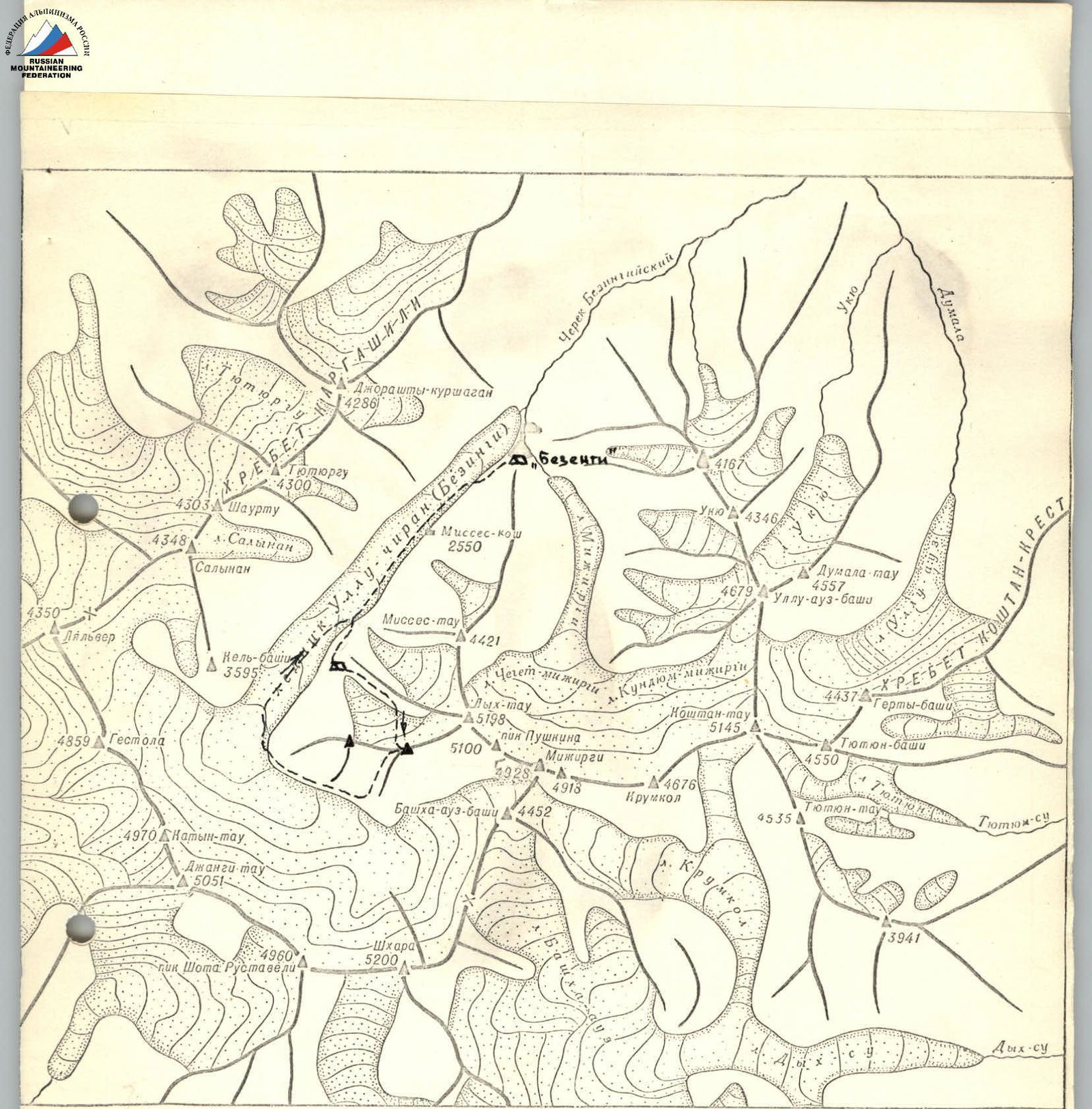
 Fig. 2
Comments
Sign in to leave a comment