
Report on the second ascent by the team from the multifaceted mountaineering club "Freeline" in Essentuki
To the summit of Zub Sofruju
via the direttissima of the western wall, 6A category of difficulty
Leader: Popov Mikhail Lvovich Coach: Motienko Nikolai Ilyich
Essentuki 2020
Addresses:
357600, Stavropol Krai, Essentuki, Oktyabrskaya St., 434, apt. 59 Popov M.L. 89282657130 mikl_popov@inbox.ru
350089, Krasnodar Krai, Krasnodar, Chekistov Ave., 42, apt. 98 Dmitrienko E.V. +79996335817 sarmat.75@mail.ru
357500, Stavropol Krai, Pyatigorsk, Sovetskaya St., 137 Motienko N.I. ph. +7-928-361-90-66 nik-motienko@mail.ru
Ascent Passport
- Region 2.2.
- Peak Zub Sofruju via direttissima of the western wall.
- 6A category of difficulty, second ascent.
- Route type: rock.
- Height difference: 380 m. Route length: 463 m. Section lengths: 1 — 0 m; 2 — 0 m; 3 — 115 m; 4 — 0 m; 5 — 23 m; 6 — 325 m. Average steepness: wall — 95°; ridge — 55°.
- Protection used: Total/ITO — 130/100; rock pitons — 5; placed protection — 30; bolted pitons — 108. Protection left on the route: Total — 0; rock pitons — 0.
- Team's climbing hours: 20 h, 2 days. Time spent on the route: 7 h, 1 day; 13 h, 2 days.
- Leader: Popov Mikhail Lvovich, Candidate for Master of Sports. Participants: Dmitrienko Evgeny Vladimirovich, Master of Sports.
- Coach: Motienko Nikolai Ilyich, Candidate for Master of Sports, instructor 1st category, cert. No. 754.
- Route started (first day): 5:00 June 6, 2020. Route started (second day): 6:00 June 7, 2020. Summit reached: 19:00 June 7, 2020. Return to Base Camp: 21:00 June 7, 2020. Descent from the summit: via route 3A on the southern wall.
- Team: Multifaceted mountaineering club "Freeline", Essentuki.
- Responsible for the report: Popov M.L. 89282657130, mikl_popov@inbox.ru.
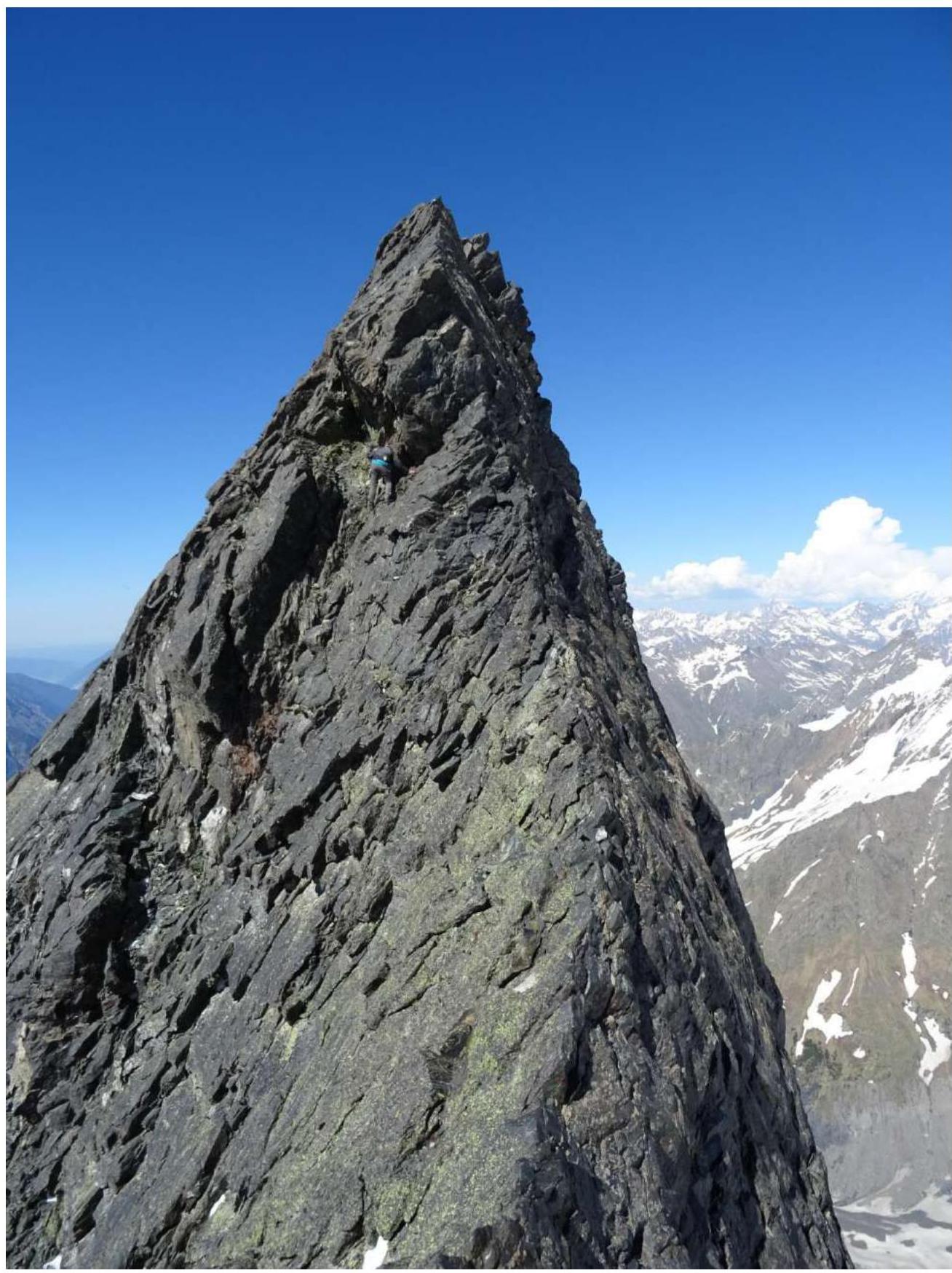
Zub Sofruju 3629 m
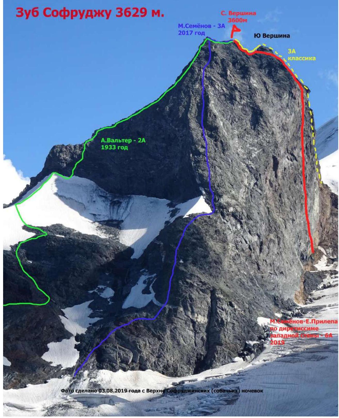
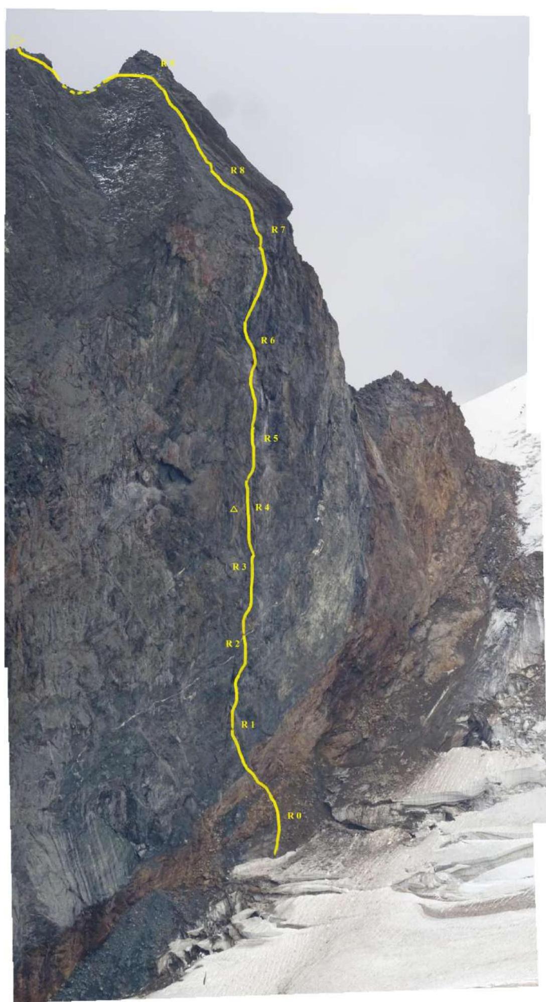
Technical photograph of the route
Brief overview of the ascent area
Zub Sofruju is a mountain peak, a spur of the Main Caucasian Range from the Sofruju peak in the Western Caucasus. Zub Sofruju is located as a spur from the Main Caucasian Range in the Amanauz gorge — the peak's height is 3629 m above sea level.
Approach description
The approach is described in the book by Shipilov V.A. "Peaks of Dombay".

Technical description
of the route, presumably 6A category of difficulty, to the peak Zub Sofruju via the direttissima of the western wall
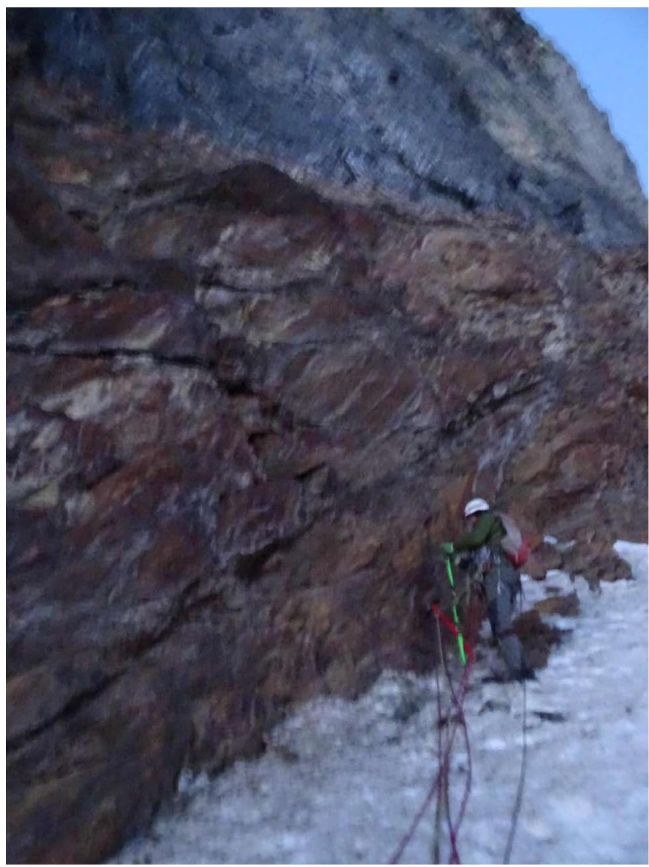
R0–R1 — from the bolted piton, up and left along the rocks of the ruined red belt to a small ledge — 8 m, 5, 80°. From here, up and left to the top of the black spall, where the red ruined belt of Zub ends. From the top of the spall, up, slightly right along the slab to a crack that goes through the entire slab. Along this crack to the top of the slab, under the beginning of the overhanging crack-grotto: 15 m, 5+; 30 m, 6, A2, 80°.
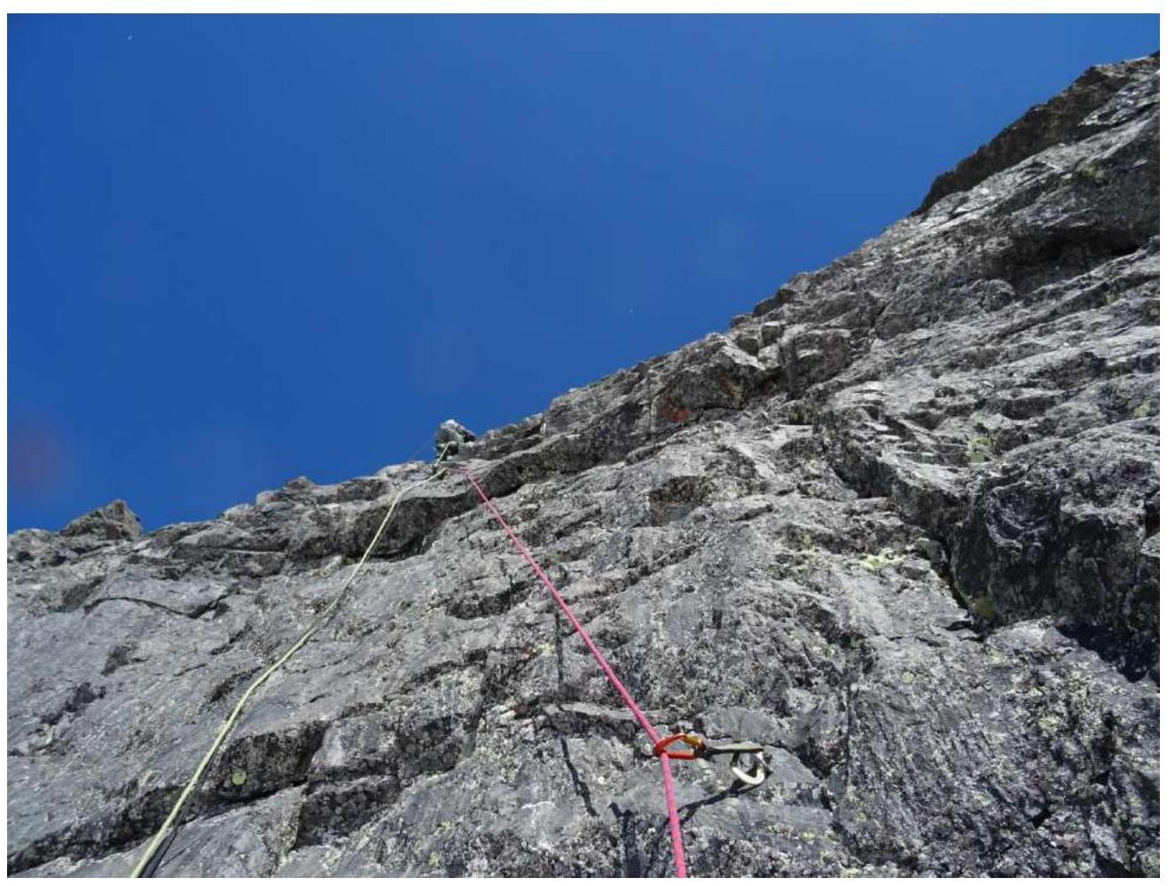
R1–R2 — from the belay station on 2 bolts, up and right along the ruined, overhanging crack, using large placements, to a small ledge under the overhang, from it slightly right along monolithic rocks (skyhooks and bolts) up through the overhangs to a steep, oblique, inclined shelf going from left to right: 30 m, 6+, A4e, 110°, along it climbing to the R2 belay station on 2 bolts: 7 m, 6+, 95°. The belay station has a small ledge for one person.
R2–R3 — straight up the wall towards the yellow triangular cornice (skyhooks and bolts), taking the relief to the right, to a steep inclined angle going from left to right and further along the upper part of the angle to a small ledge under one person and the R3 belay station: 50 m, 90°, 6+, A4e.
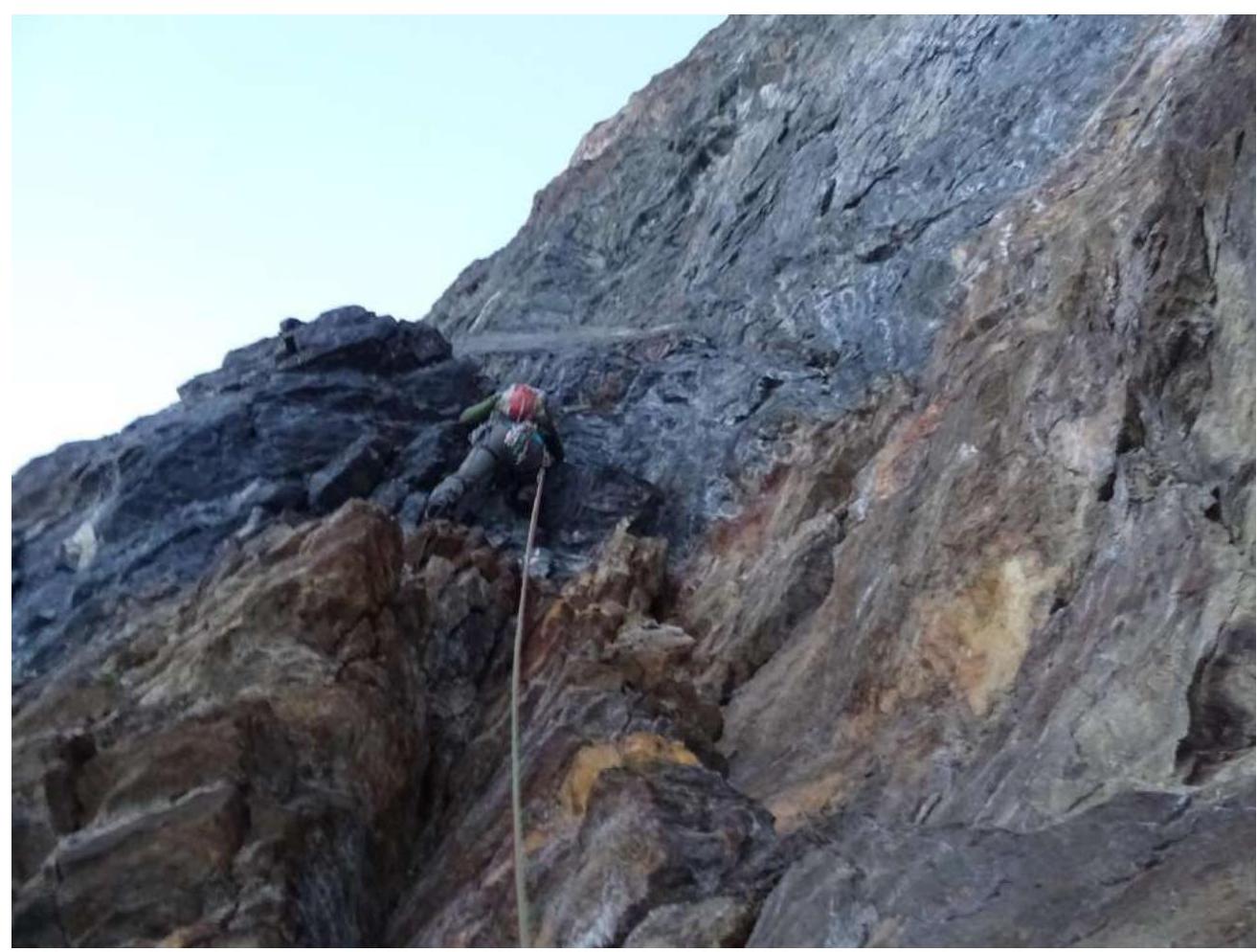
R3–R4 — straight up the wall, under the overhang. The spall is bypassed on the left, further up the wall and slightly left, to the corner of the cornice and from it straight up, with a slight deviation to the right, to a steep inclined slab going from right to left: 20 m, 90°, 6+, A3e. A few meters along it and further up the wall to the next slab — an internal angle and along it on holes for skyhooks to the R4 belay station in a small recess. Control point (CP). The belay station is semi-pendant. 15 m, 95°, A4e.
R4–R5 — from the CP along the right wall, up and right, to the edge of the large cornice, above the CP: 15 m, 95°, 6+, A4e. Through the overhanging edge of the cornice: 5 m, 100°, 6+, A4e. Further up into the internal angle, along the crack climbing: 15 m, 90°, 6. At the end of the internal angle, a pendant belay station on 2 bolts.
R5–R6 — from the belay station along the crack up: 8 m, 90°, 6 and further along the wall straight up (skyhooks and bolts) 20 m, 6, A3e. Further, bypassing the overhangs, first taking the relief slightly left, then right, to the semi-pendant R6 belay station: 20 m, 6+, A4e, 95°.
R6–R7 — from the R6 belay station along the wall straight up on holey skyhooks and bolts, through small cornices, taking the relief slightly right to a cascade of cornices: 30 m, 6+, A4e. Initially 85°, then up to 110°. From here, taking the relief left and up, through the cascades of cornices, to a ledge for three people and a belay station on 3 bolts: 20 m, 6+, A4e, 110°.
R7–R8 — from the belay station straight up, on holey skyhooks to a bolt: 10 m, 6, A3e, 85°. Further from the bolt climbing along the relief left and up: 30 m, 6, 80°. Exit to the roof.
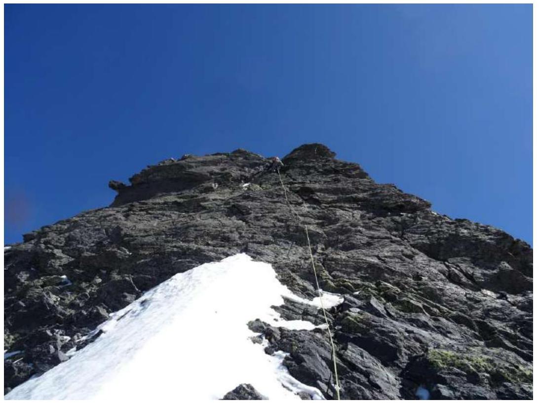
R8–R9 — left and up along the roof to a bolt: 35 m, 65°, 3.
R9–R10 — further ascend to the South summit: 30 m, 50°, 3 and traverse to the North summit: 45 m, 3, 50°.
Descent via route 3A.
Equipment
- Complete set of cams. Friends of all sizes, including blue. Large and medium hexes. Skyhooks: 3 holey and 2 regular — large and medium. Anchor hooks, including for blind cracks. Fiffa. Bolt hanger and nuts on 12. 25 quickdraws, 10 mated carabiners.
Start of the route
Section R0–R1
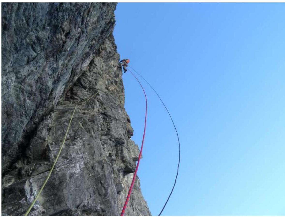
Section R1–R2
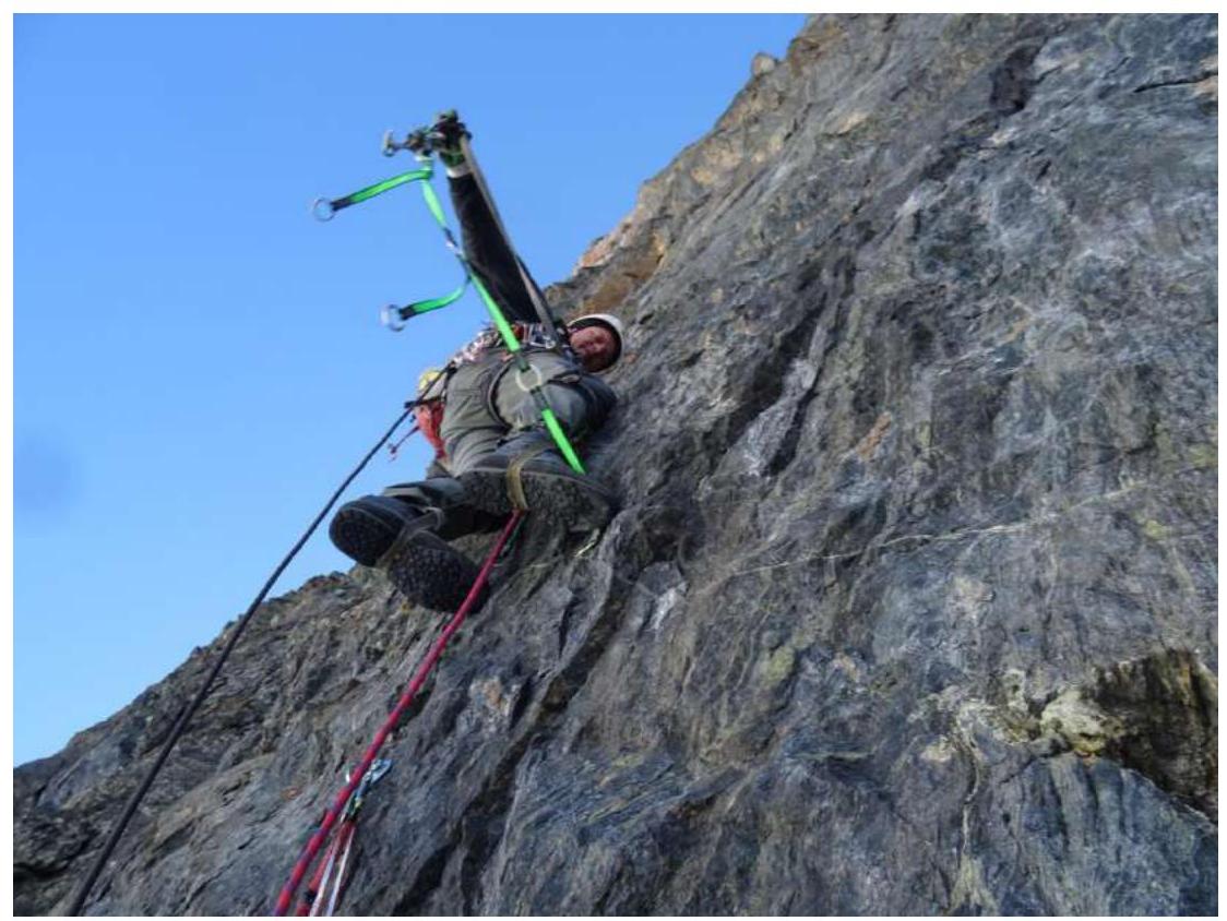
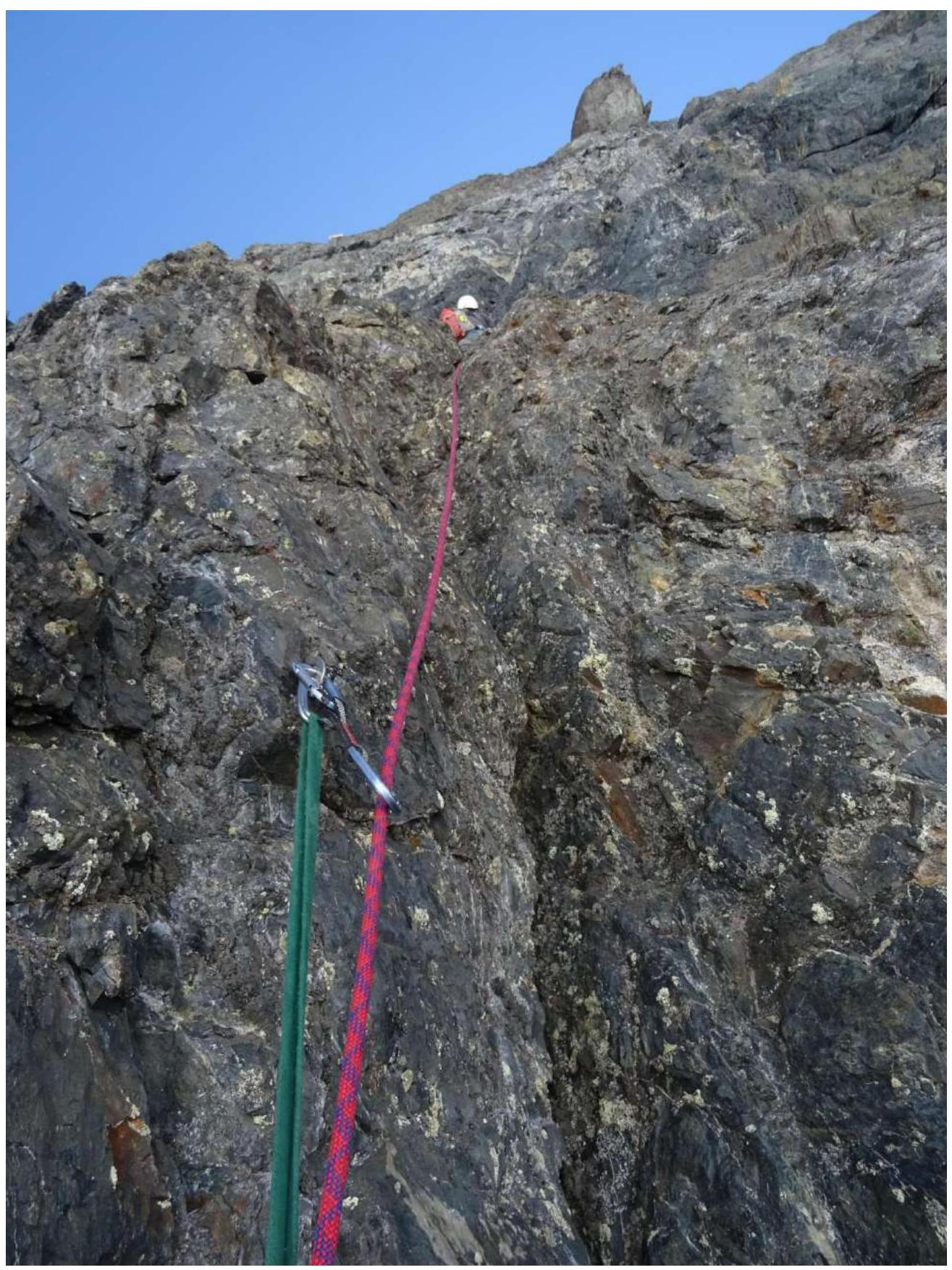
At the start of section R2–R3

R2–R3
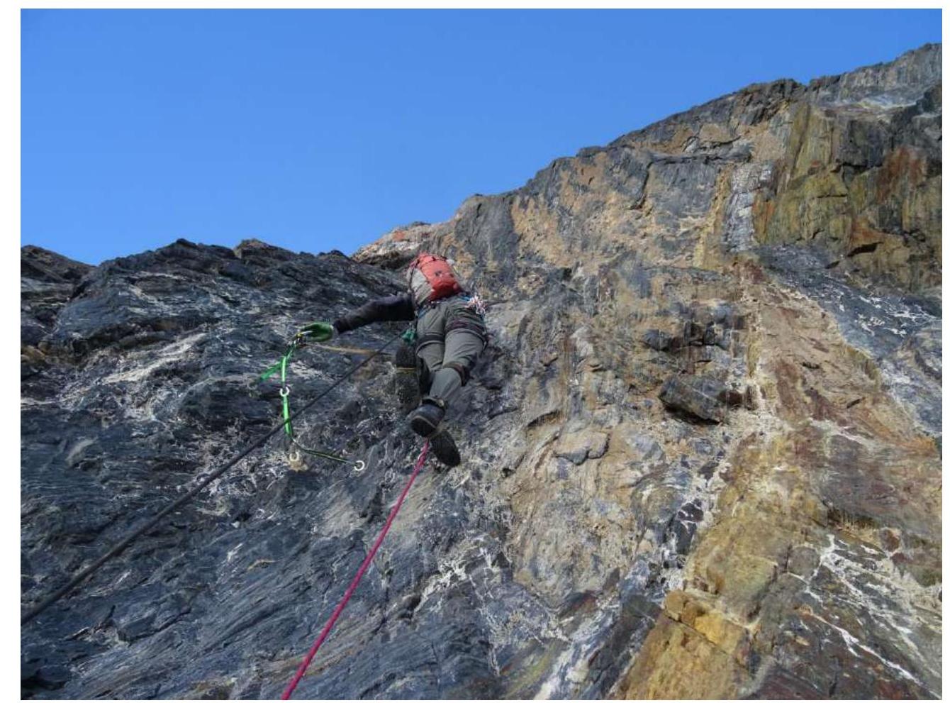
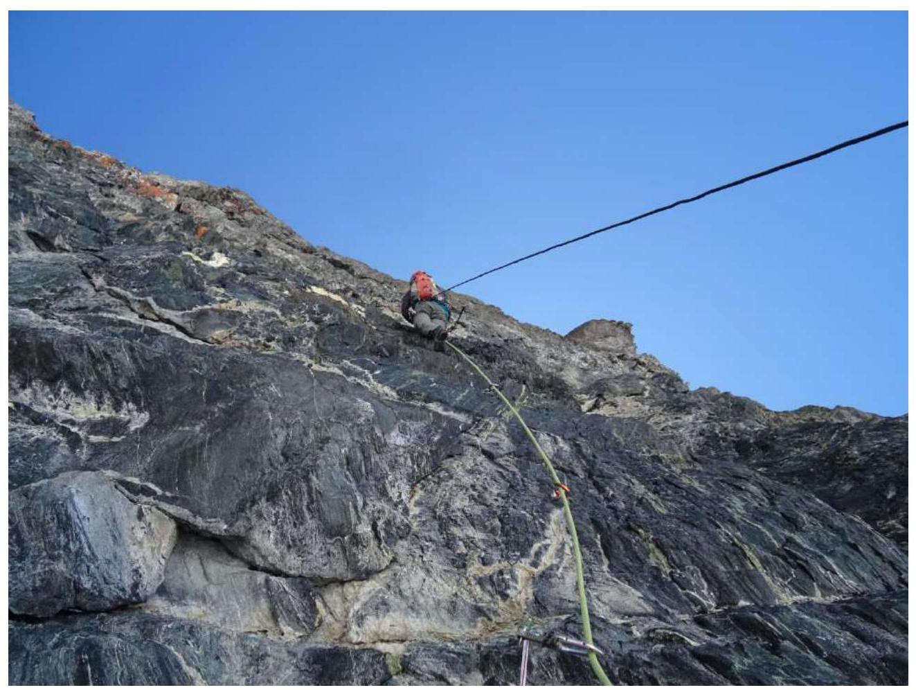
R3–R4
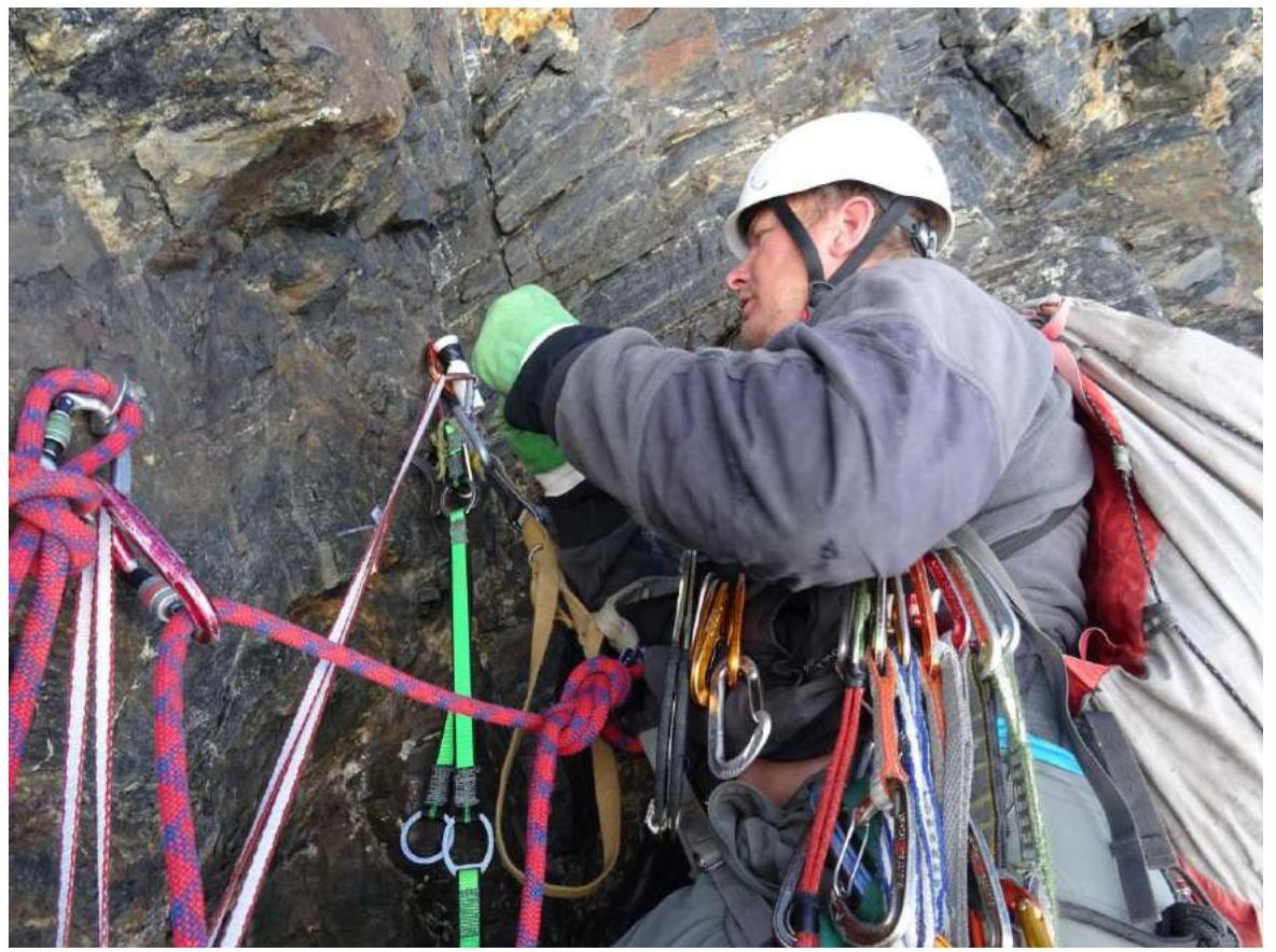
Control point

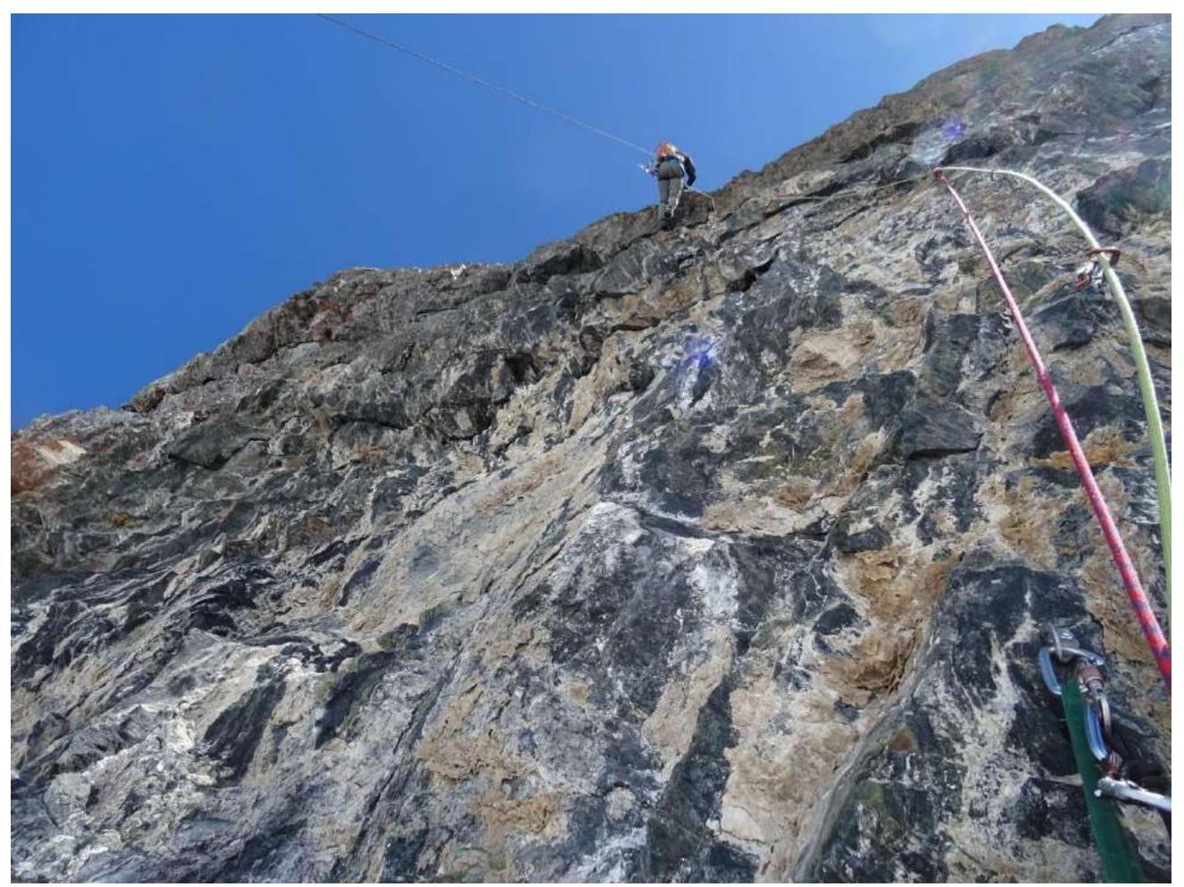
Section R4–R5
Section R5–R6
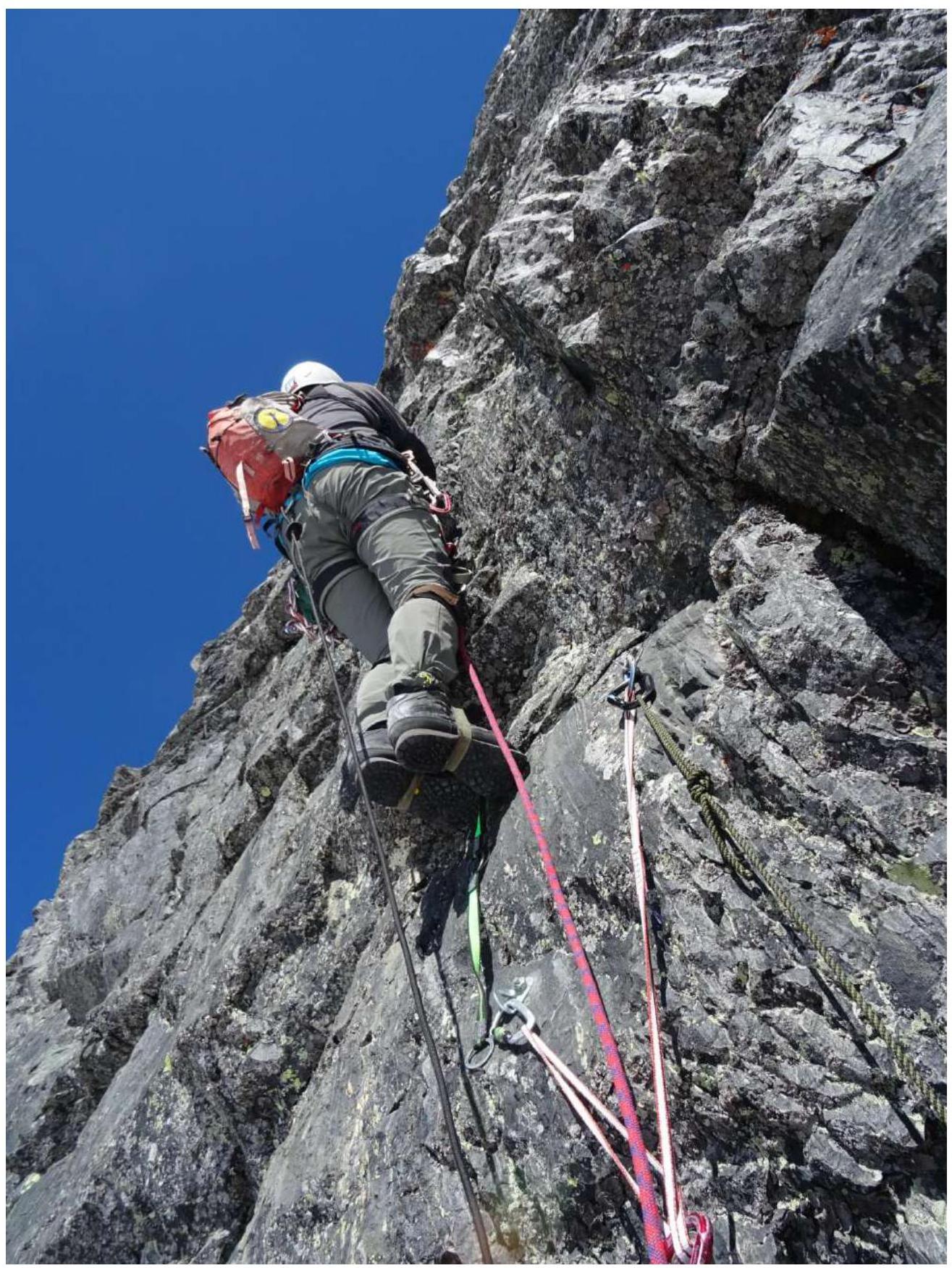
Section R6–R7
Continuation of section R6–R7
Section R7–R8
Section R7–R8 continuation
R8–R9
R9–R10
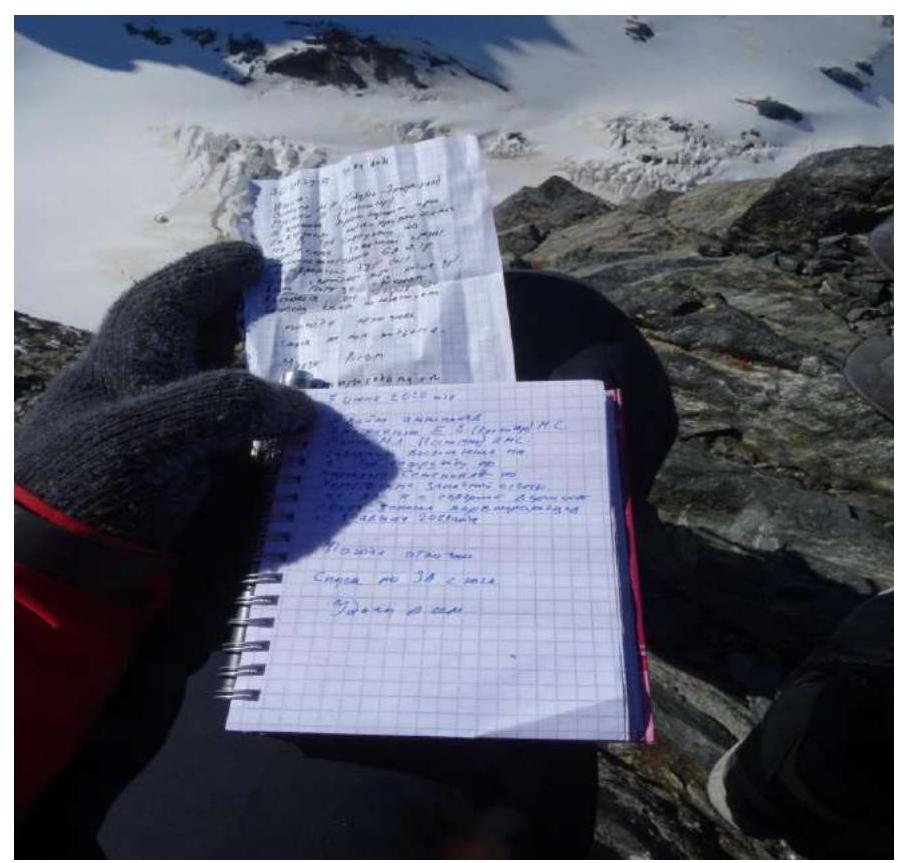
Note on the summit
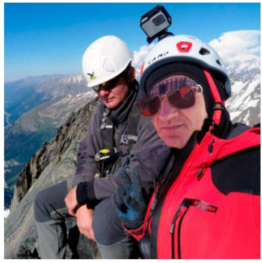
Photo on the summit
Comments
Sign in to leave a comment