
Report on the Ascent of the National Team of Karachay-Cherkessia to the Summit of Belalakaya 3861 m
via the South-Eastern Lap. Presumably 5A category of difficulty. First Ascent.
Semenov M. A. — team leader Tkachenko V. I. — 1st sports category Report compiled in November 2019
2. Caucasus
2.2. From Marukh Pass to Nakhar Pass
Climbing Participants
- Team Leader — Semenov Mikhail Alexandrovich. Candidate for Master of Sports. Coach — Shipilov V. A. Address: 144001, Elektrostal, Oktyabrskaya St., 8, apt. 117. Phone: +7 (906) 724–94–53. Email: aravigehc@mail.ru
- Tkachenko Vlad Igorevich, Teberda Coach — Shipilov V. A.
Climbing Passport
- Western Caucasus, Dombay region, section 2.2 of the route classifier for mountain peaks.
- Belalakaya 3861 m. Via the South-Eastern Lap.
- Proposed 5A category of difficulty. First Ascent.
- Rock climbing route.
- Height difference: 650 m.
Route length: 850 m.
- Length of sections with 1st category of difficulty: 120 m
- Length of sections with 2nd category of difficulty: 65 m
- Length of sections with 3rd category of difficulty: 255 m
- Length of sections with 4th category of difficulty: 140 m
- Length of sections with 5th category of difficulty: 20 m
- Length of sections with 6th category of difficulty: 30 m
- Length of sections with A2 category of difficulty: 20 m Average steepness: 60–65°.
- Number of pitons left on the route: 4
- Total climbing time: 14 hours, 1 day.
- Descent from the summit via the descent couloir, old 2B route.
- Team Leader: Semenov Mikhail Alexandrovich, Candidate for Master of Sports, coach Shipilov V. A. Participant: Tkachenko V. I., coach Shipilov V. A.
- Departure for the route: 4:15 AM, July 8, 2018. Summit reached: 5:50 PM, July 8, 2018.
- Alpclub "ARKHYZ".
- Responsible for the report: Semenov M. A. aravigehc@mail.ru
Description of the Climbing Area
The peak Belalakaya 3861 m is located on a spur of the Main Caucasian Ridge in the Amanauz gorge.
Approach Description
From the Dombay settlement, follow the trail on the right side of the Amanauz River to the forest boundary. Then continue on the trail along the stream (in the first half of summer, along a long snowfield) upwards to the right towards the Belalakaya couloir. Before reaching the start of the couloir, turn left upwards on the trail through several rock walls (with metal staples). Reach the Medvezhye bivouac site. From Dombay settlement — 3 hours. Continue on the trail to the right upwards to the Sredne-Sofrujinsky bivouac — 1 hour. Camping site. From the bivouac, ascend the grassy and scree slopes to reach the Verkhne-Sofrujinsky bivouac in 2.5–3 hours (approach description borrowed from Shipilov V. A.'s book "Peaks of Dombay").
Detailed Literary Description of the Approach
The path to the summit begins from the Dombay glade, through the Amanauz gorge. Initially, the path follows a well-trodden trail past the local landmark, Chortova Mill (30 minutes). Upon exiting the forest zone, you enter the large Belalakaya canyon, at the bottom of which flows a stream-river. You need to ascend upwards along the right bank of this stream to large blocks on its right side. On the left side, opposite these blocks, there is an entrance to a 300-meter couloir — the optimal ascent path goes through it. In difficult places, I installed metal staples made of rebar in 2018. You reach the Medvezhye bivouac. A comfortable camping spot for a large number of tents (1.5–3 hours). From the Medvezhye glade, the path continues to the left, initially passing along the edge of the Martirosyan couloir and then through alpine meadows to the Srednie bivouac, near a large square stone with a memorial plaque. From these bivouacs, you need to cross the stream, and then the trail goes 300 meters among small streams. After that, you need to cross another stream and immediately turn onto the grassy moraine to the right, where there is a well-trodden trail. In this place, due to lack of knowledge, people often continue straight on the trodden trail, but it soon disappears, and the ascent continues without a trail. By turning correctly onto the moraine with the trail, you reach under the spur with a white stripe (this is the lowest part of Belalakaya's eastern ridge). At the top of this spur-rock, there are several camping platforms. This place is called Gubanovskie bivouac. In the 80s, Yuri Dmitrievich Gubanov built a hut here, but it stood for only a couple of years before being swept away by an avalanche. There is no need to ascend to these bivouacs. From the foot of the rock spur, you need to turn left at approximately 45° and move towards the base of the armored moraine, which is located to the left at the very edge of the glacier. It stands out as the only one against the sky. A well-trodden trail runs along the top of this moraine, leading to the Verkhne-Sofrujinsky bivouac or, in common parlance, "Sobac'hi" (Dog's bivouac). From the top of the moraine to the bivouac, there is a height difference of about 50 meters. Here, there are more than 10 well-equipped camping platforms, and more can be set up if needed. This is a classic bivouac for ascents in this corner. From the Dombay glade — 4–5 hours.
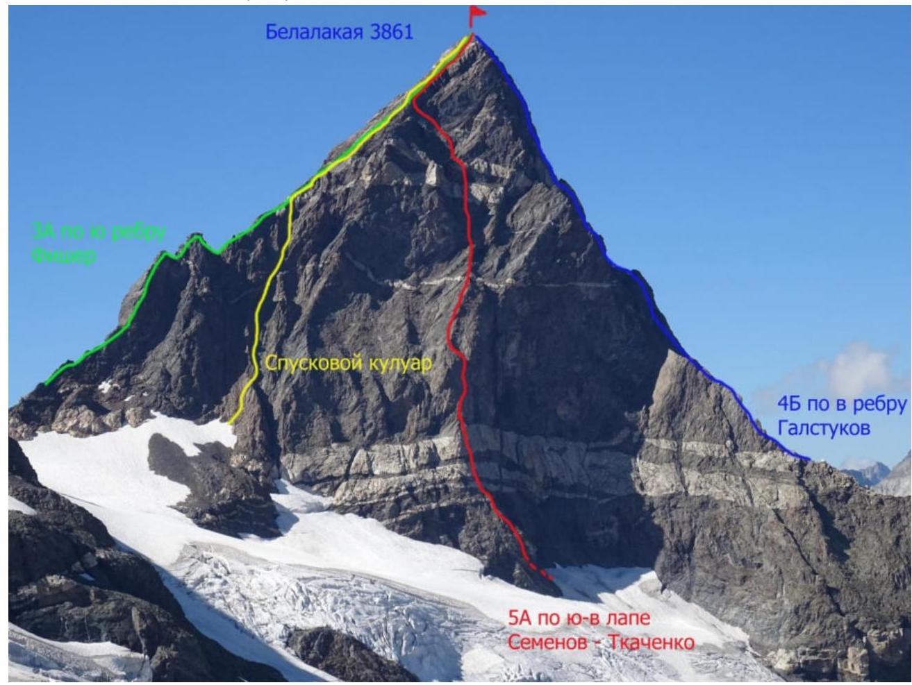 View of Belalakaya 3861 m with route indications
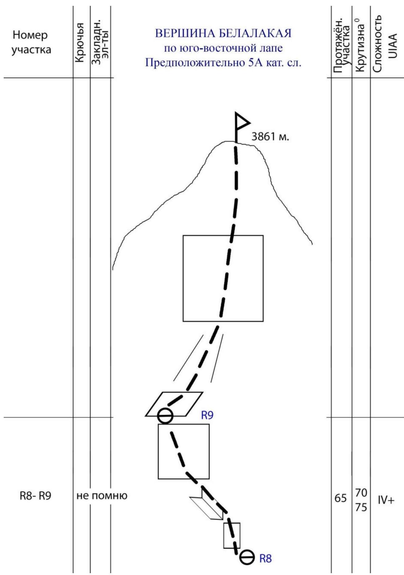
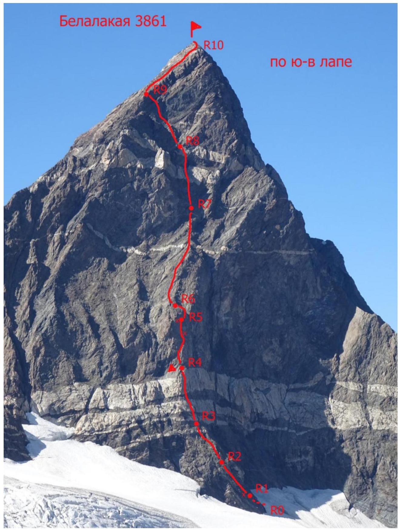 Belalakaya 3861 route profile via the South-Eastern Lap
 Route profile via the South-Eastern Lap
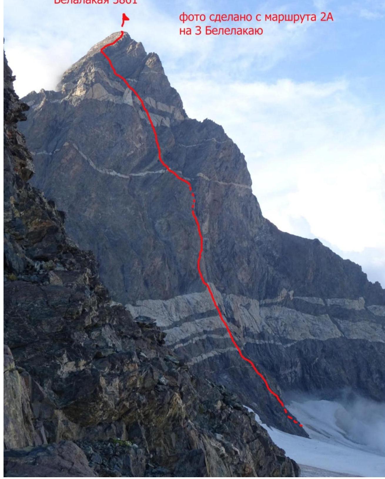
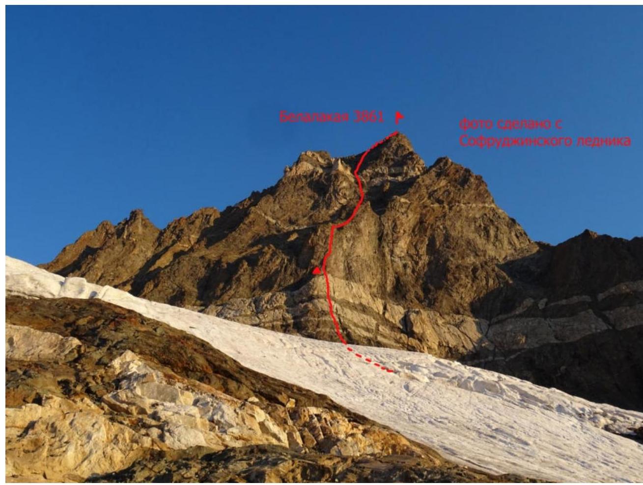 Photo taken from Sofrujinsky glacier
 LENGTH OF SECTION STEEPNESS DIFFICULTY UIAA
Route Description by Sections
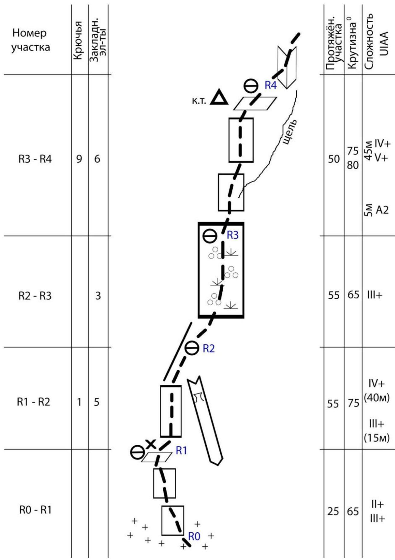
R0–R1 — The route begins from the glacier at the right part of the lap's base, in the simplest place to access it via simple rocks upwards and slightly to the right to a small ledge with a hammered piton. Convenient belay station. 25 m, III+, 65°
R1–R2 — To the right of the station, a steep internal corner begins with a small grotto at the top. Move upwards along the wall to the right of the corner to reach the lap's ridge and then continue upwards on its simple slopes. Convenient belay station. 45 m, (30 m IV+, 15 m III+), 75°
R2–R3 — From under the overhang, traverse to the right 7 m (VI climbing) to a narrow inclined ledge, and then continue upwards along a wide internal corner on the right side of the ridge. Reach the ridge. Convenient belay station. 45 m, 50°, III+
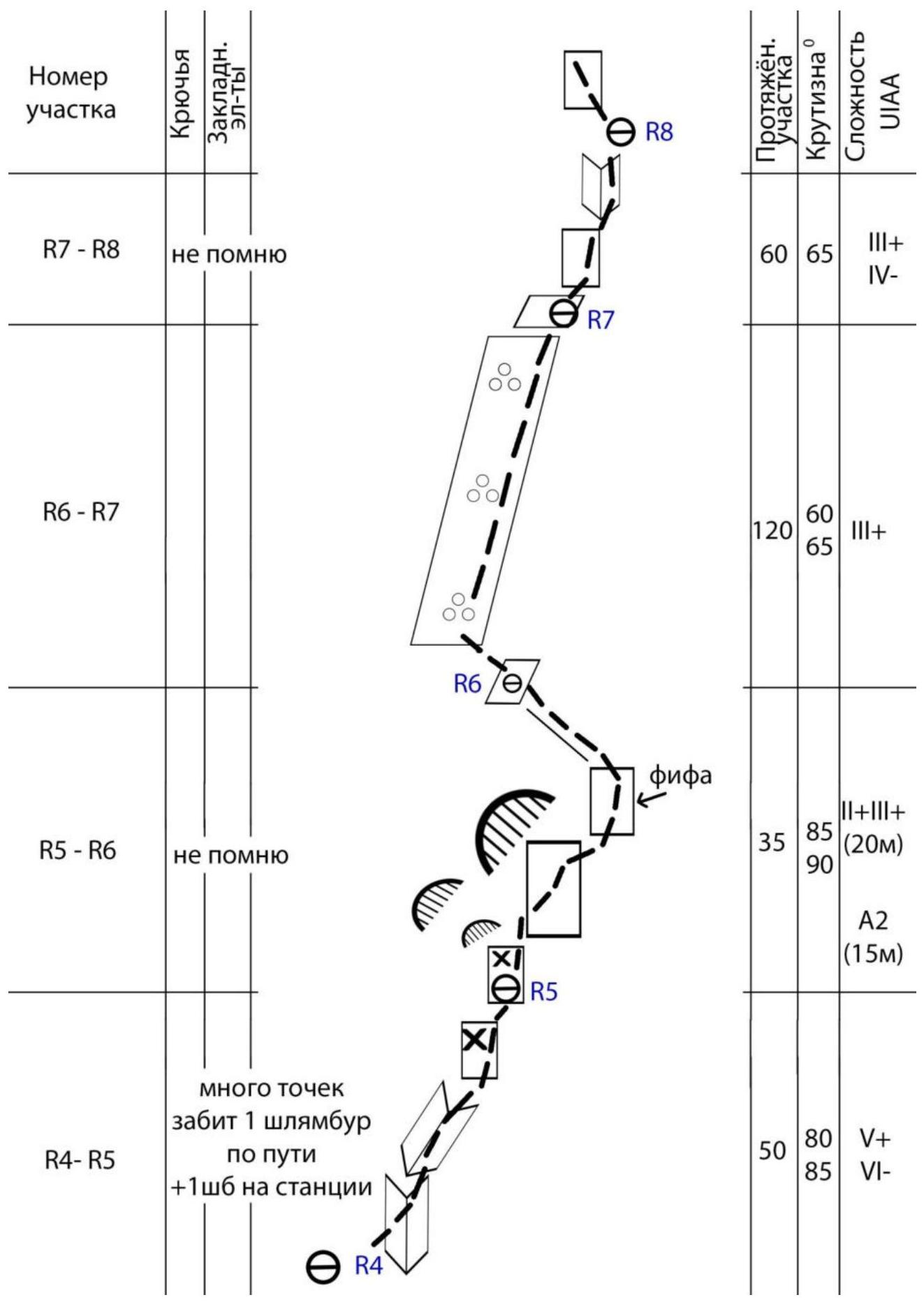
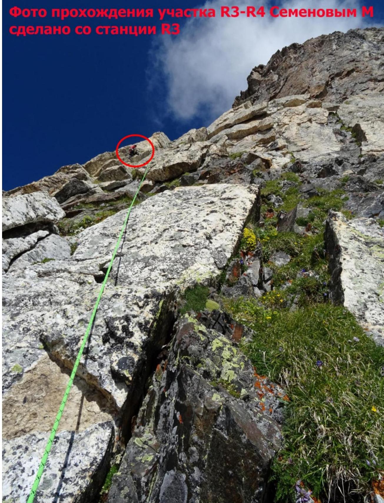
R3–R4 — The path continues along a steep wall to the right of the orienting crack — a small section of monolithic artificial aid climbing (ITO). Reach the top of the wide white belt — a wide ledge. A control cairn is placed in a tin and secured with a rope and piton. Convenient belay station. 50 m, (45 m IV+ V+, 5 m – A2), 75–85°
R4–R5 — Along monolithic rocks on the right side via an internal corner, reach the top of a characteristic large monolithic slab, and then continue upwards via another internal corner with some overhanging sections. Along the way, a piton is hammered into the monolith for safety. Reach a small ledge under the overhangs. Convenient belay station with a piton on a small ledge. 50 m, V+ VI–, 80–85°
R5–R6 — To the right, use artificial aid climbing (ITO) along the wall to bypass the overhangs. One of the pitons could not be removed and was left as a reliable safety point. After 15 m, reach the top of the lap and, after another 20 m, a convenient belay station on a выступ. 35 m, (15 m – A2, 20 m – II+–III+), 85–90°
R6–R7 — Ascend simultaneously along the left, simpler part of the lap's ridge to a small wall, transitioning into an internal corner. Convenient belay station. 120 m, II+–III+, 45°
R7–R8 — Through a small wall into an internal corner that goes from right to left. Convenient belay station. 60 m, III+ IV–, 65–70°
Why the Route Deserves 5A
First, I have no information about any previous attempts to ascend this lap. I am very interested in old climbing reports and enjoy listening to experienced climbers. However, I must reiterate that if there were any previous attempts, I am not aware of them. The only thing I can confirm is that Roman Gubanov and Alexander Eliseev had long been eyeing this lap, but it never came to fruition. No signs of human presence were found on the route prior to our ascent. To date, I have completed all previously classified routes on Belalakaya, some of them multiple times. In 2018, I even ascended the northern ridge via the contour through the large "boulder" (in mountaineering slang, "Sakharov's Bald"), which, by the way, is significantly more aligned with category 3B than the classic 3B ascent via the northern slope. As a Senior Comrade once told me, they used to make winter ascents on Belalakaya via this ridge, and it was called the traverse of Belalakaya.
| 3A from the South | 2B descent couloir | 5A presumably 2018 | 4B via the Eastern ridge "along the steps" |
|---|---|---|---|
| 4B "American" route via the NE wall, Grakovich route 1975 | 3B from the North | 4A via the 3rd Wall | 4B via the 3rd ridge. Route via the "ship's bow" |
Here are my publications on the resource https://www.risk.ru ↗:
- https://www.risk.ru/blog/213491 ↗ – Belalakaya 3B (descent route drilled after completing 4A)
- https://www.risk.ru/blog/213490 ↗ – Belalakaya 4B (via the ship's bow)
- https://www.risk.ru/blog/214857 ↗ – Belalakaya 5A via the lap
- https://www.risk.ru/blog/215014 ↗ – Belalakaya 4B "Amerikanka"
- https://www.risk.ru/blog/214565 ↗ – Ladder to Medvezhye bivouac
- https://www.risk.ru/blog/215629 ↗ – Rescue operations under Belalakaya
- https://www.risk.ru/blog/217033 ↗ – Mass ascent via 3B
The ascent that Vlad and I made has a very complex first part. The key to the ascent is overcoming the lap (about 120 m of cumulatively difficult climbing), which includes climbing up to category 6 difficulty and sometimes requires artificial aid climbing (ITO). The rest of the route is not more complex than category 4. Taking into account my practical experience of ascents in this area and specifically on this mountain, I believe that while it does not quite reach 5B due to the relatively short length of the difficult sections, it objectively has a higher complexity than all previously known routes on this mountain. Therefore, it deserves the 5A category of difficulty.
 Photo of the start of the route R0
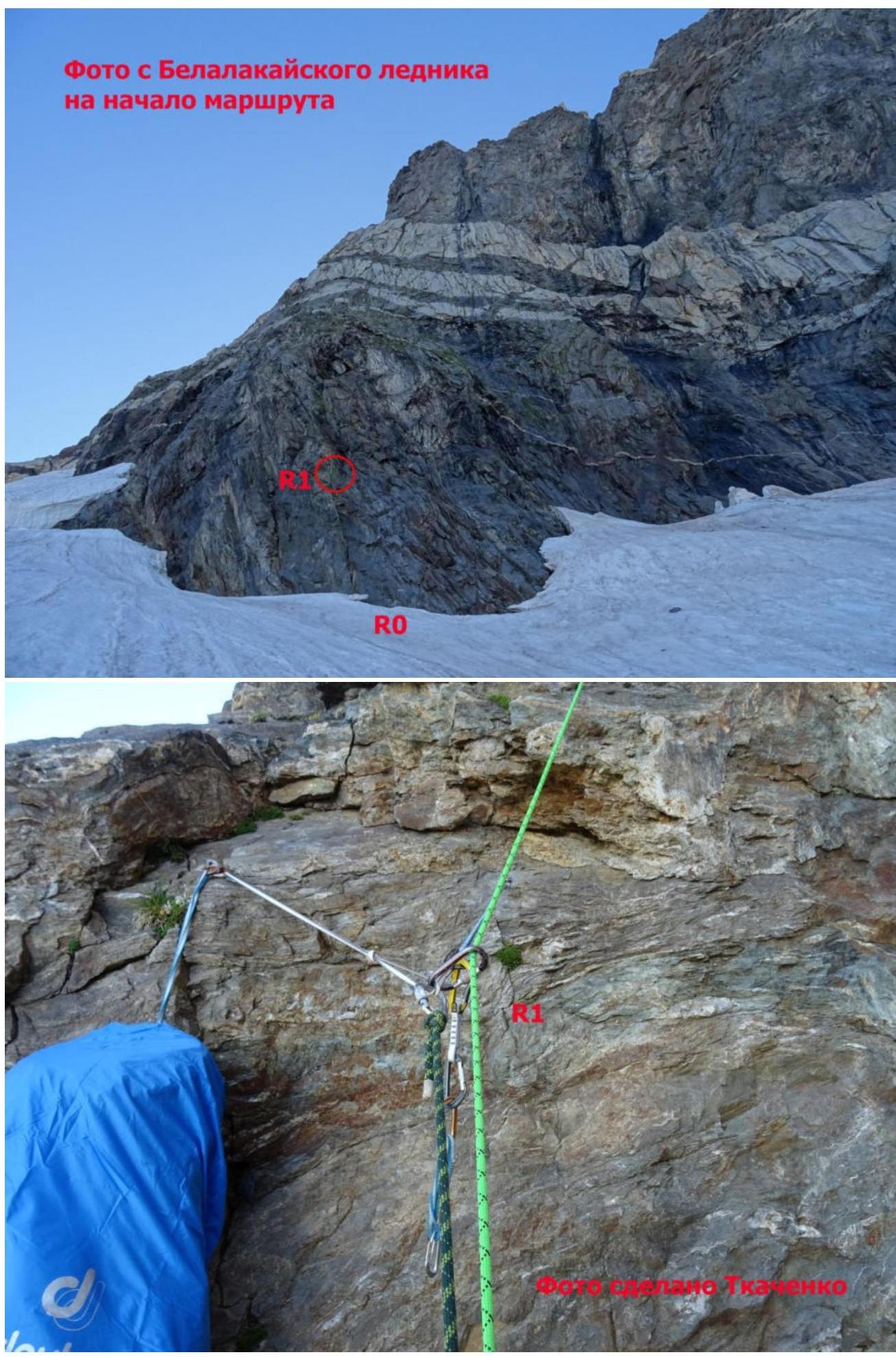 Photo from the first station
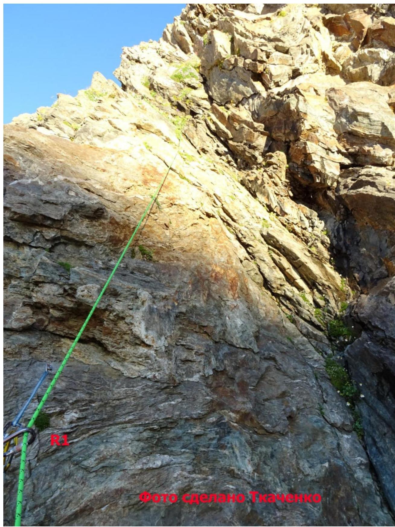 Photo from Belalakaya glacier to the start of the route R0
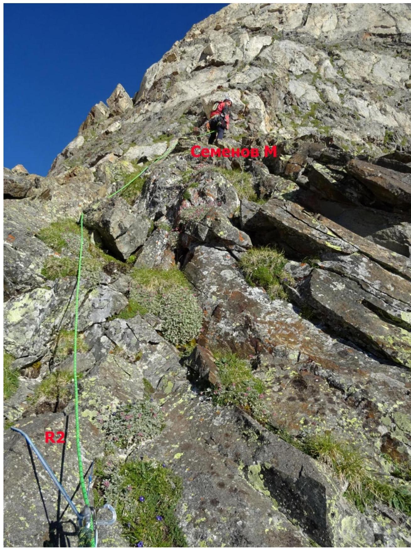 Photo taken by Tkachenko
Photos of Semenov's Ascent on Section R2–R3
Taken from Station R2
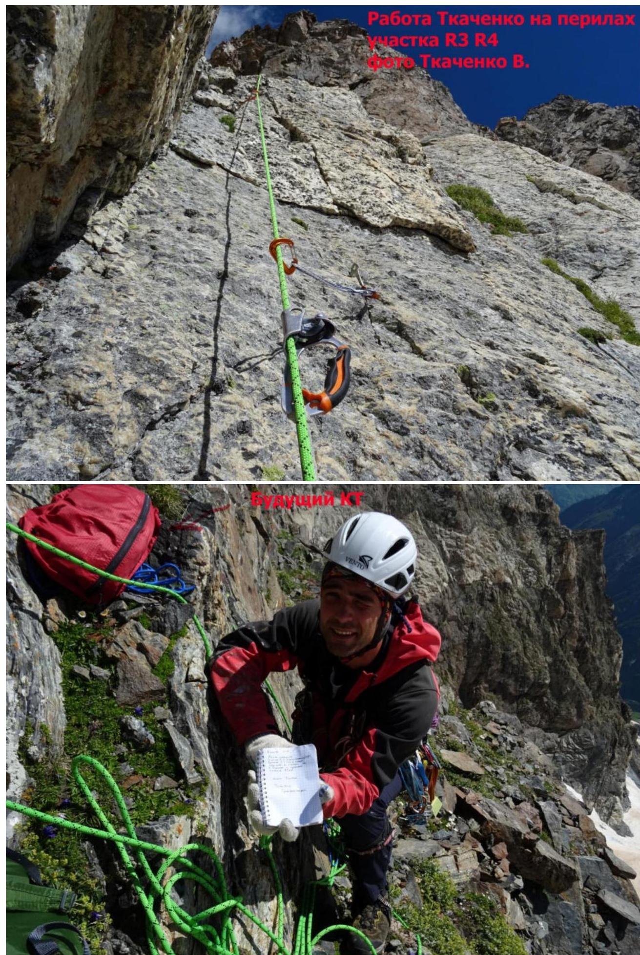 Tkachenko's work on the rope section R3–R4. Photo taken by Tkachenko V.
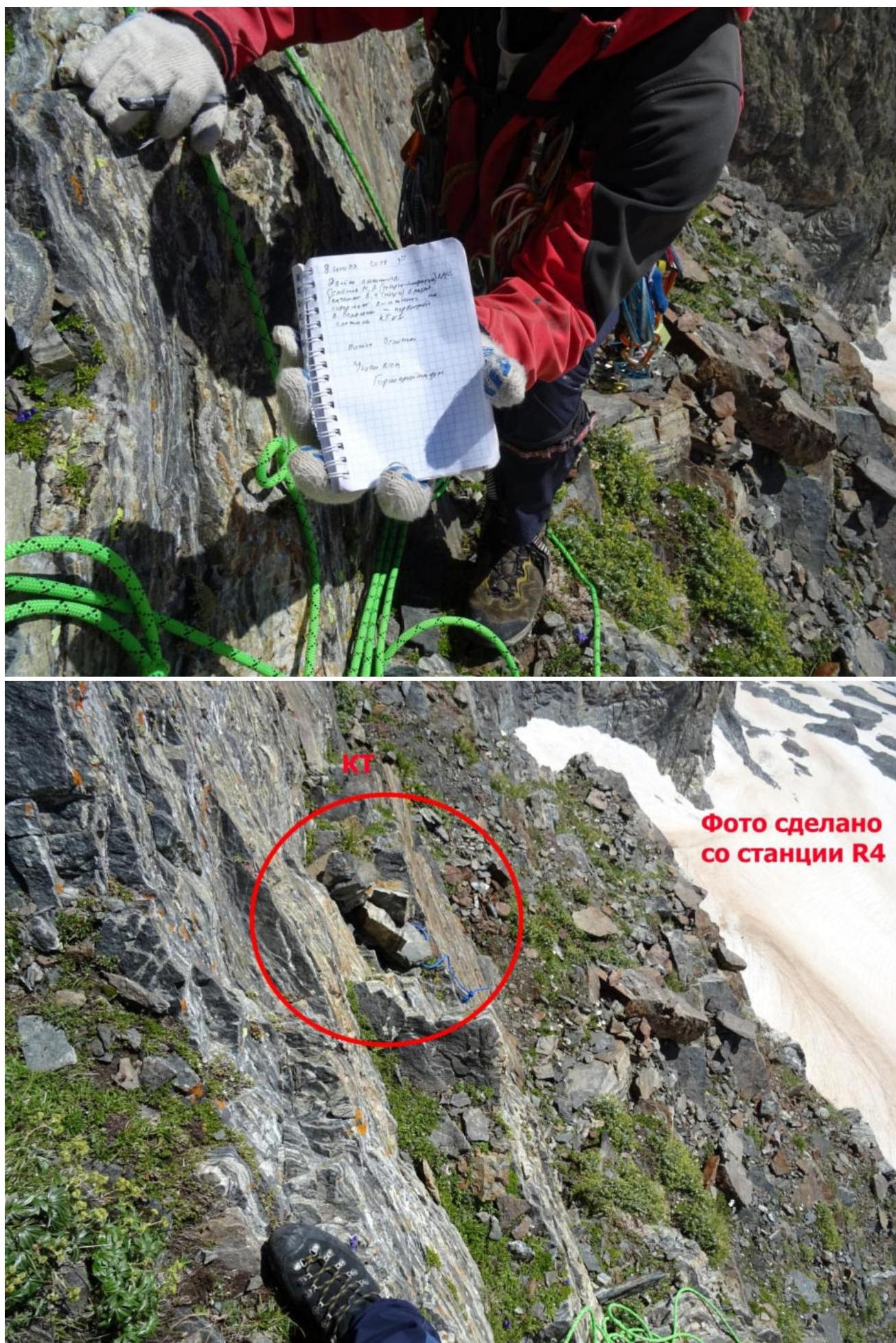 Photo taken from station R4
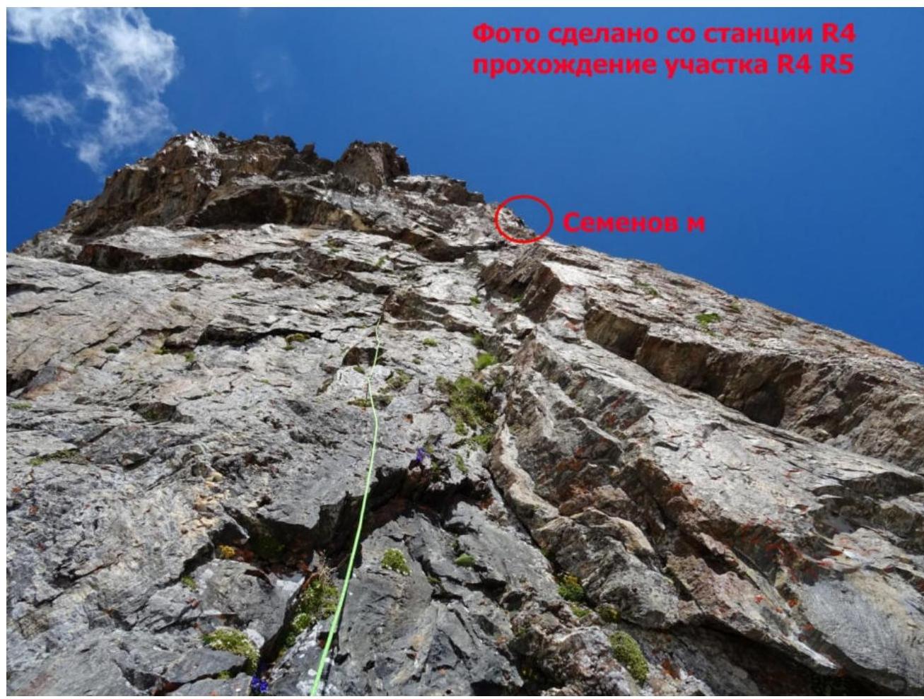 Photo taken from station R4, Semenov M.'s ascent on section R4–R5
Photo taken from station R4, Semenov M.'s ascent on section R4–R5
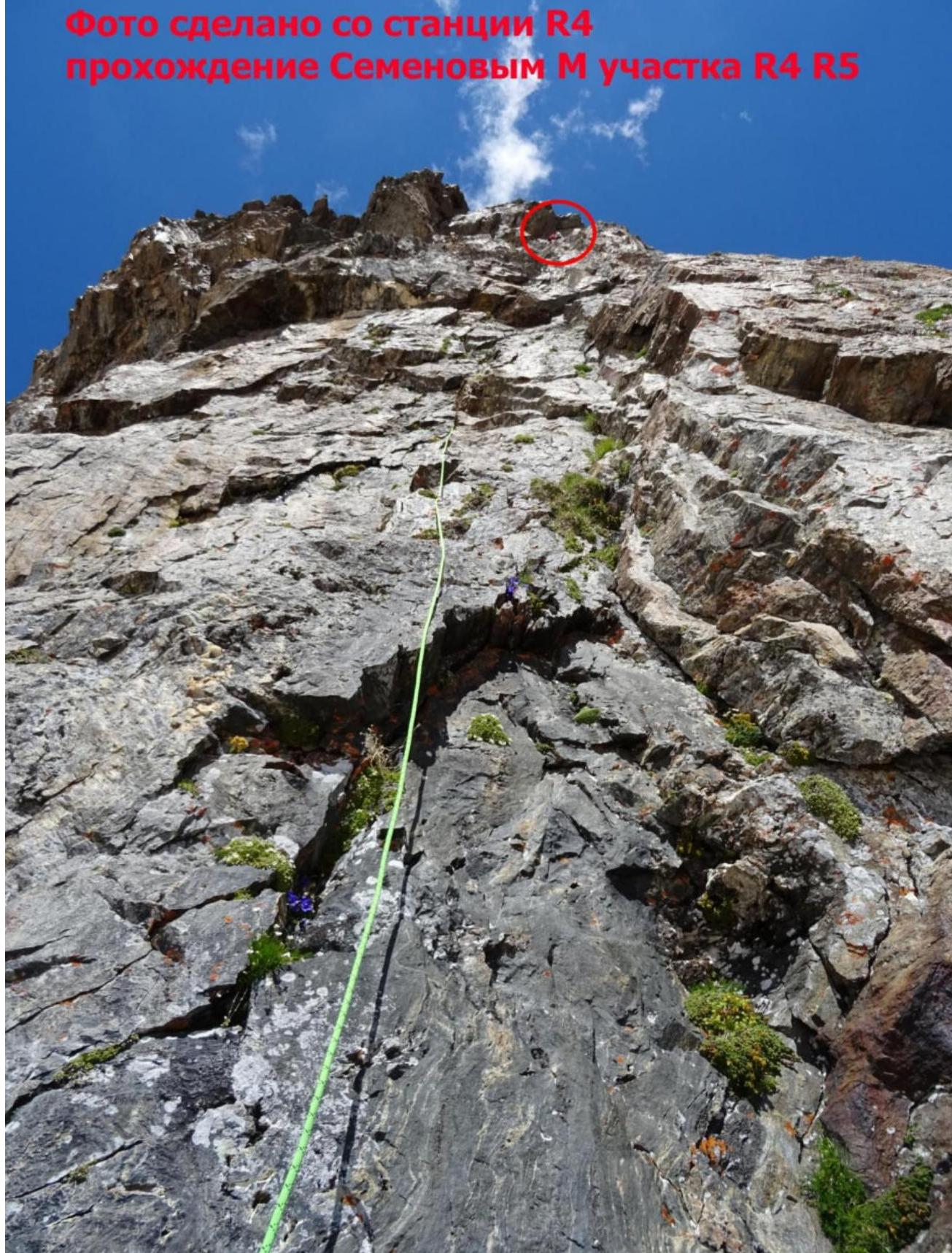
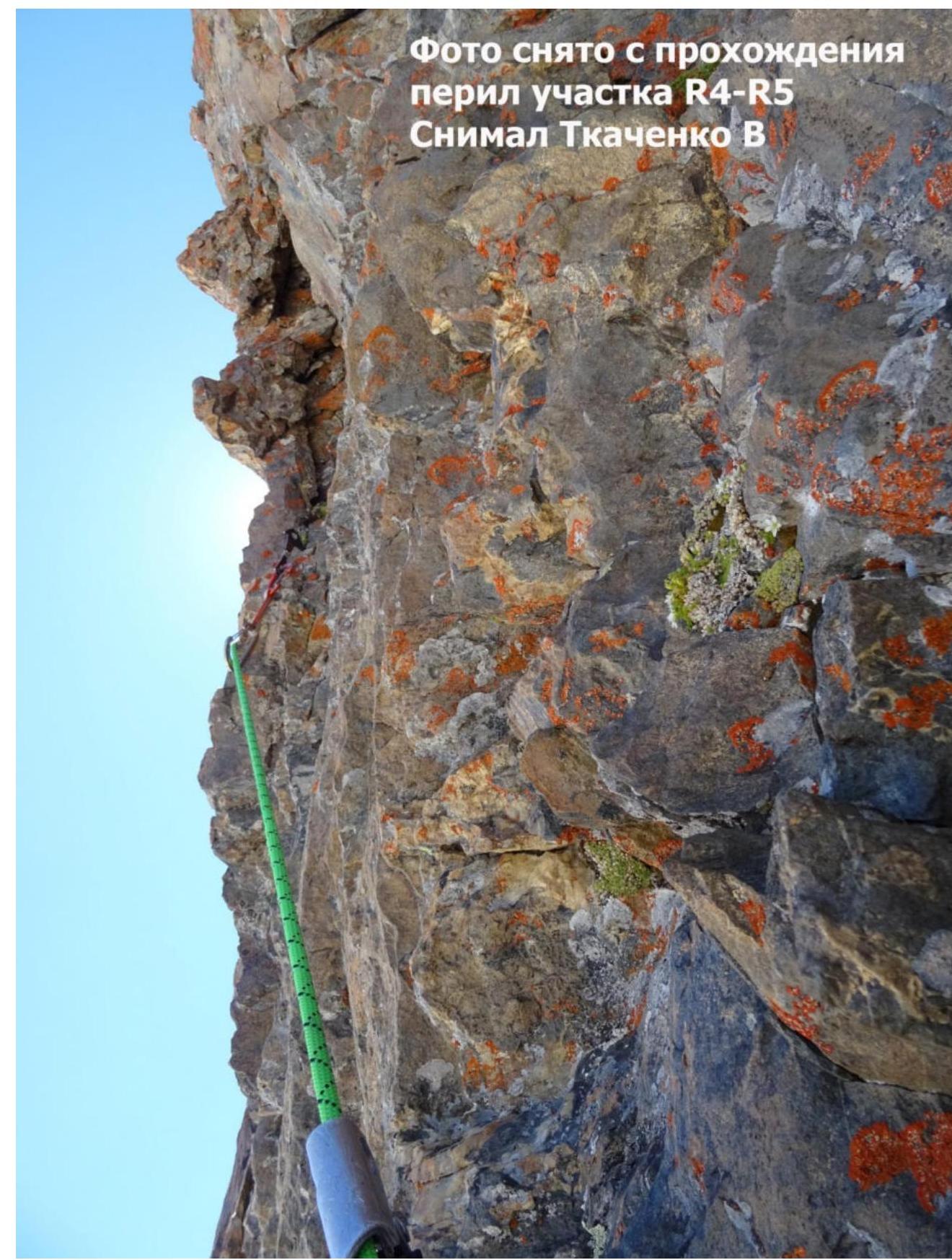
Photo taken during the rope section R4–R5. Taken by Tkachenko V.
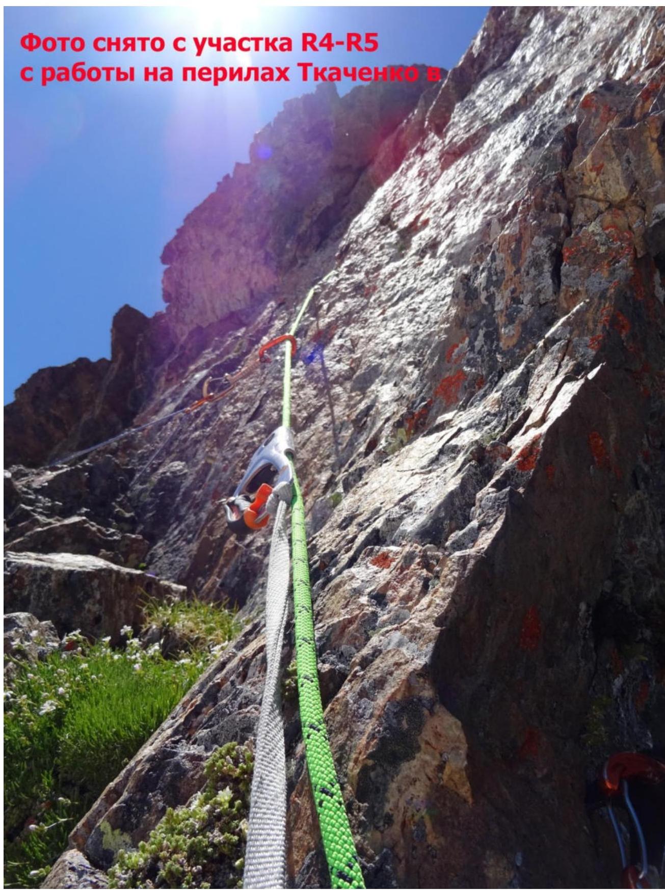 Photo taken from section R4–R5, Tkachenko V.'s work on the rope.
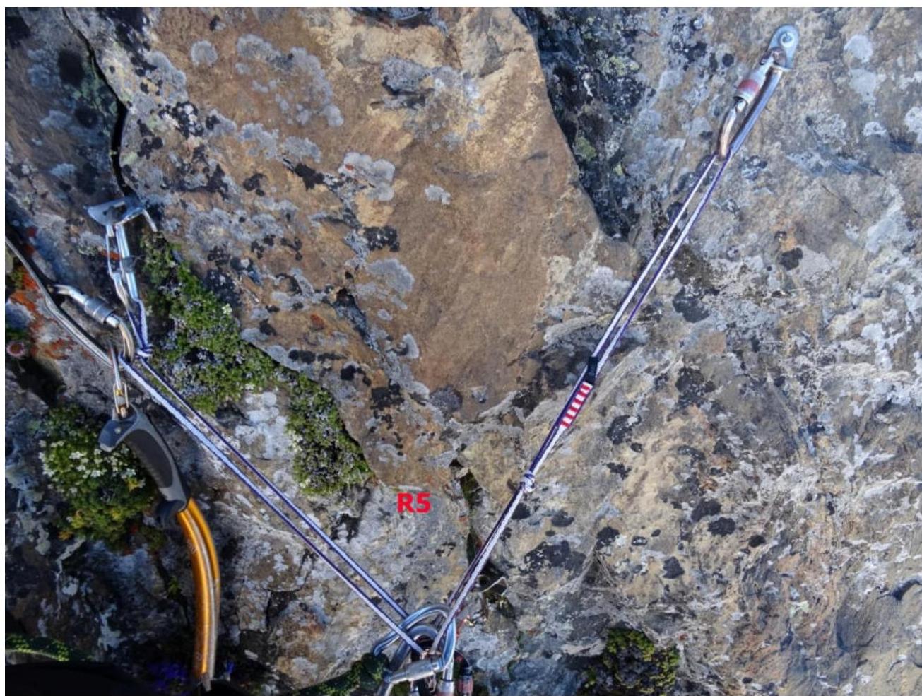
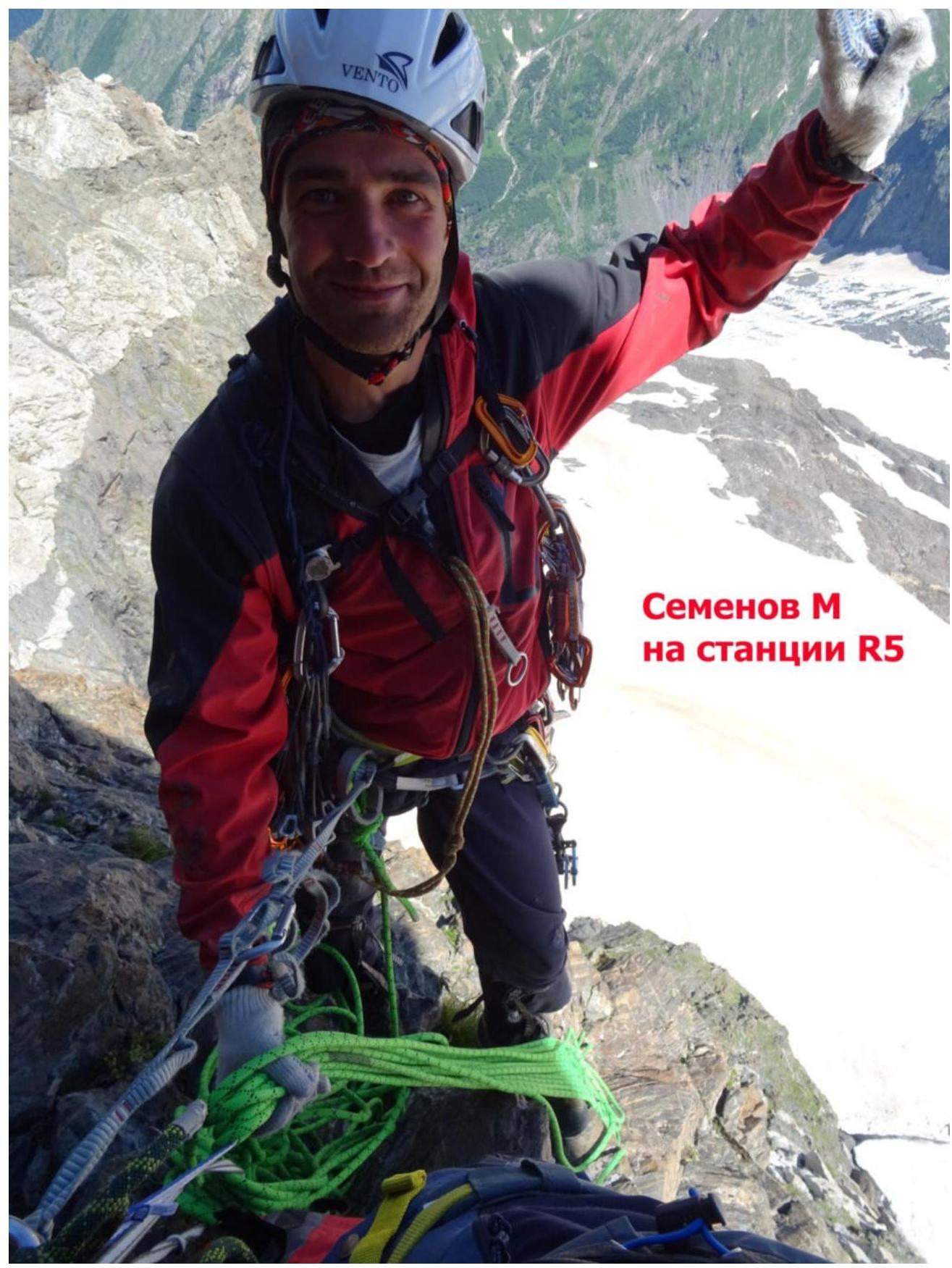 Semenov M. at station R5
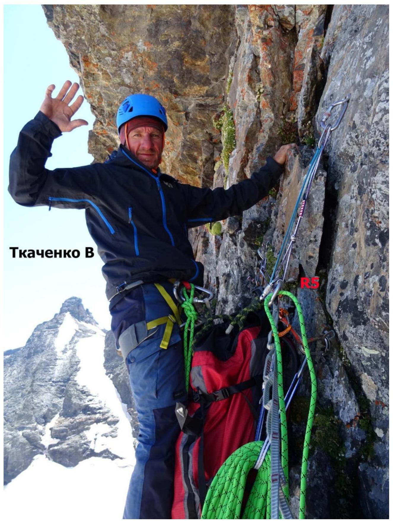 Tkachenko V.
Loading video...
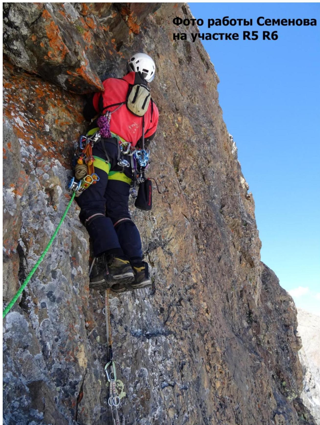 Photo of Semenov's work on section R5–R6
 Semenov M.
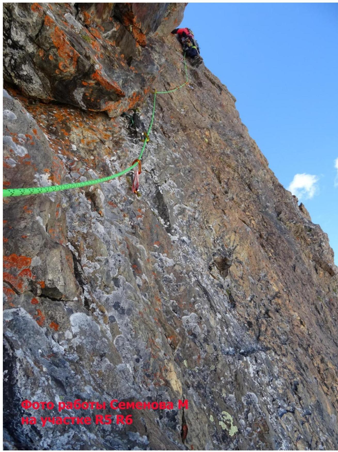
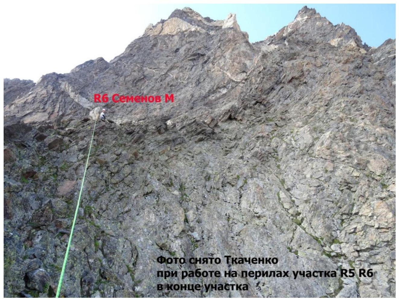 Photo taken by Tkachenko at the end of section R5–R6 on the rope
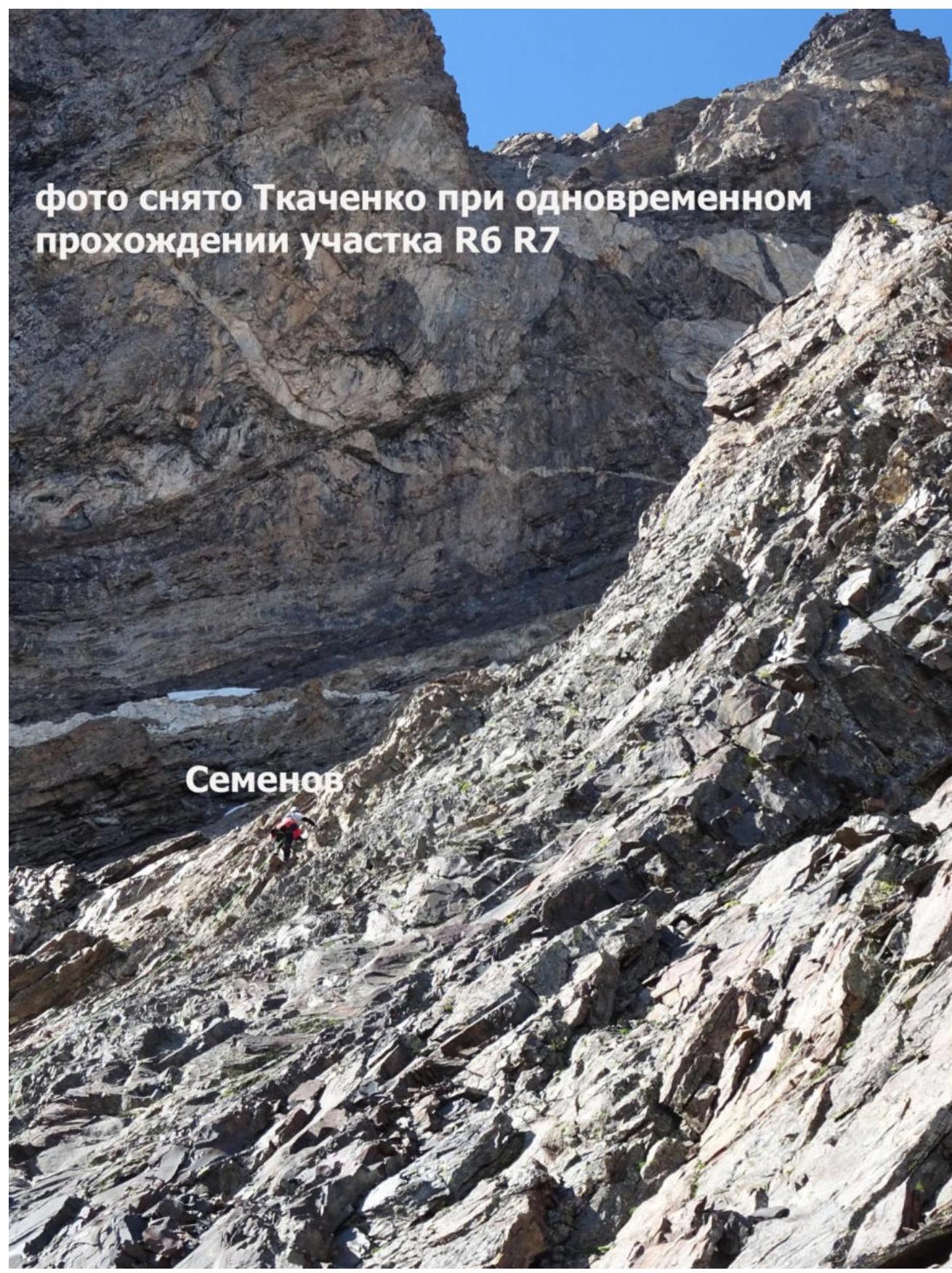 Photo taken by Tkachenko during simultaneous ascent on section R6–R7. Semenov.
Semenov
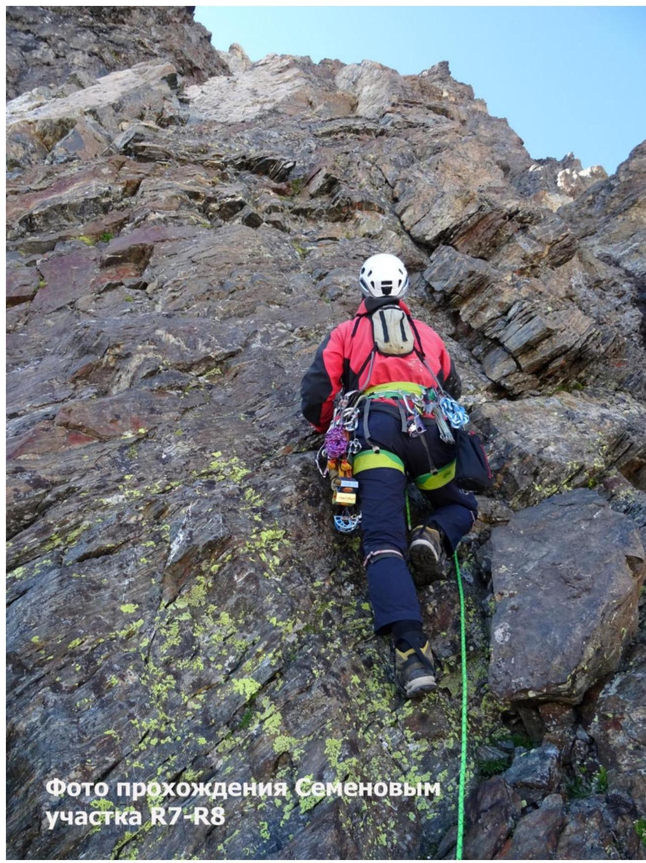 Photo of Semenov's ascent on section R7–R8
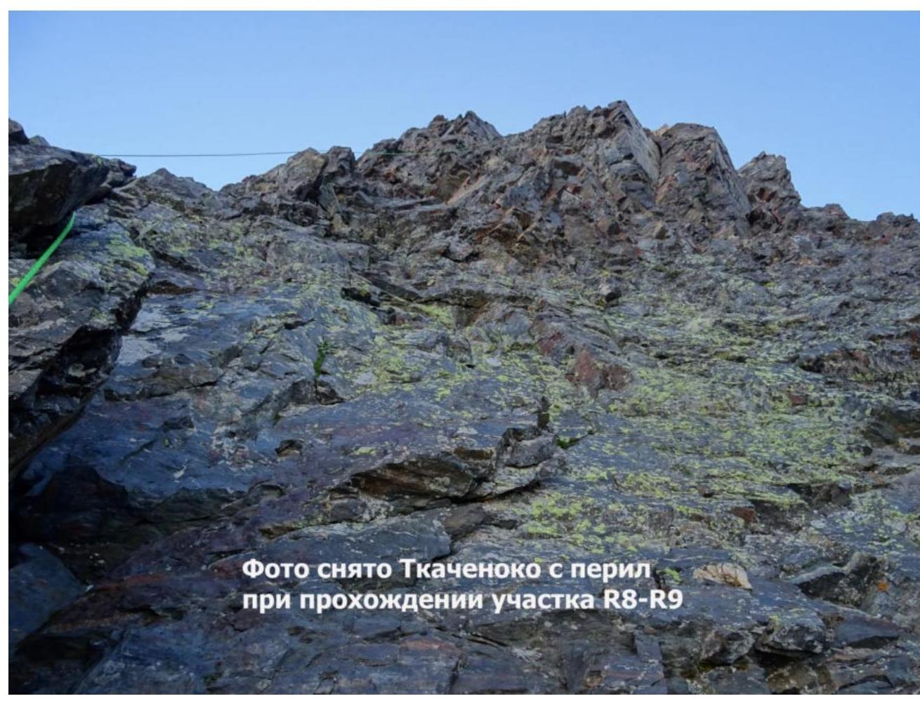 Photo taken by Tkachenko on the rope during ascent on section R8–R9
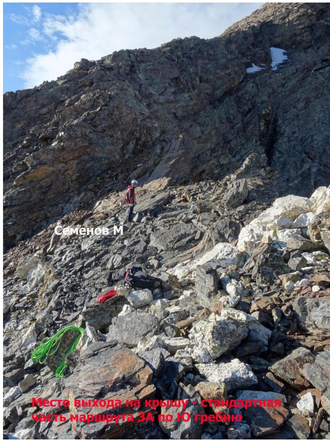 Reach the southern ridge — the classic route. Semenov M.
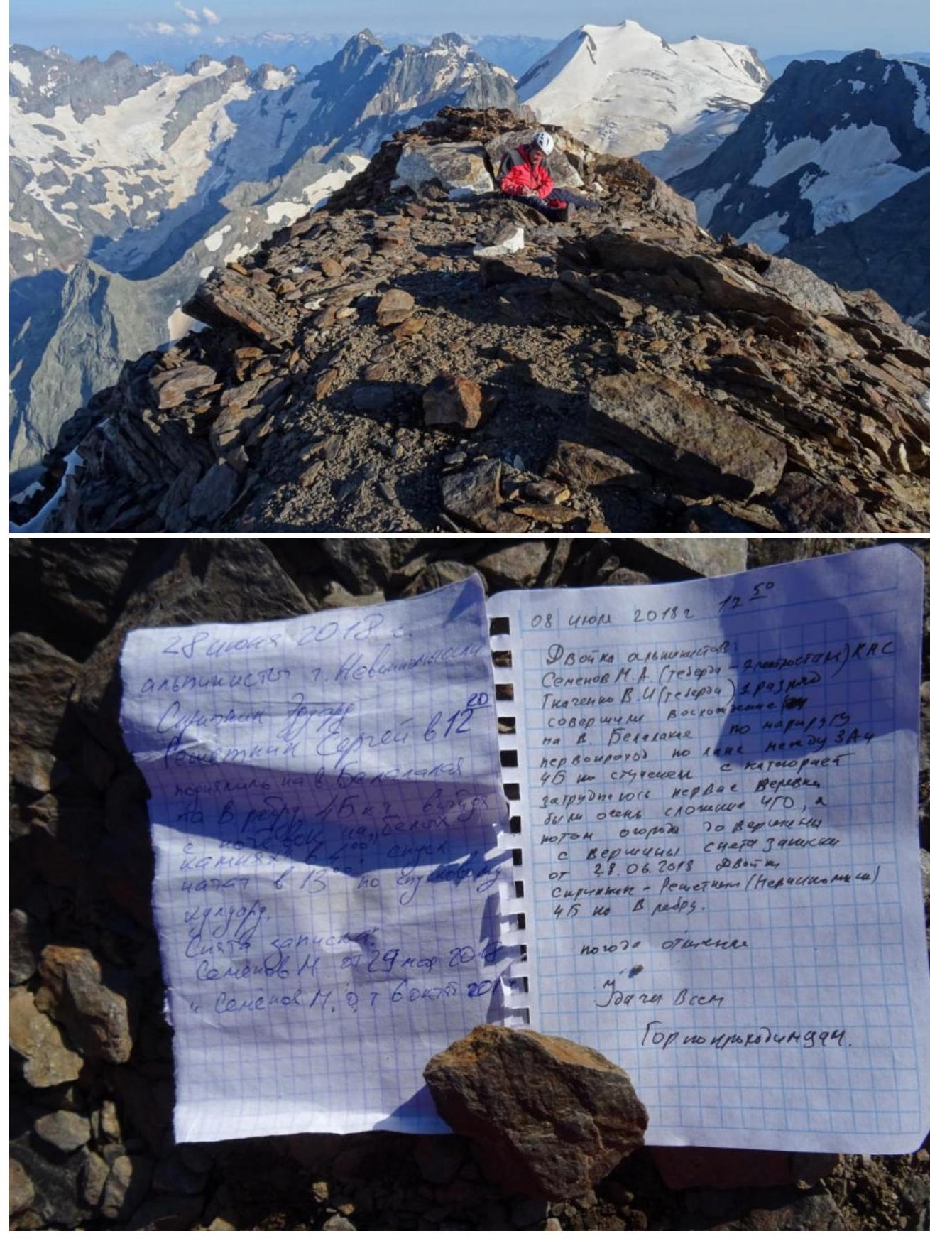 Summit Belalakaya 3861 m
Photo at the Summit Belalakaya 3861 m
Semenov M. A.
 Tkachenko V. I.
Gratitude to those who helped with the report:
Shipilov Vyacheslav Alexandrovich, Gubanov Roman Yuryevich, Kuznetsova Ekaterina Alexandrovna, Semenova Olesya Artemovna, and to everyone who did not interfere.
Team Leader: Semenov M. A.
Participants: Tkachenko V. I.
Coach: Shipilov V. A.
Comments
Sign in to leave a comment