
Ascent Logbook
- 2 Caucasus. 2.2 From Marukh Pass to Nakhar Pass. Section number according to the 2017 classification table.
- Sofruju Zub, height 3629 m, via the northwest spur.
- Proposed - 3A category of difficulty, first ascent.
- Route type: Rocky.
- Route elevation gain 459 m (by altimeter). Route length: 650 m. Section lengths: 1st category of difficulty – 150 m, 2nd category of difficulty – 250 m, 3rd category of difficulty – 250 m. Average steepness: 45°. Main part of the route — 50°; entire route — 45°.
- Hooks left on the route: total 0; including piton hooks 0.
- Team's travel hours: 4.5 hours, 1 day.
- Leader: last name, first name, sports rank Semenov Mikhail, Candidate for Master of Sports. Participants: last name, first name, sports rank Solo.
- Coach: Shipilov Vyacheslav Aleksandrovich, 1st category Instructor (Honored Sports Coach title).
- Approach to the route from Gubanovskie bivouac: 05:00 August 22, 2017. Route started: at 06:00 August 22, 2017. Reached the summit: 09:30 August 22, 2017. Returned to Gubanovskie bivouac: 13:00 August 22, 2017. Descent from the summit: via 2A category of difficulty route to Gubanovskie bivouac.
- Organization: GSK ARKHYZ.
- Responsible for the report: Semenov Mikhail Aleksandrovich. Email address aravigehc@mail.ru, phone: +7 (906) 724-94-53.
Sheet 1, page 2. General photo of the summit, where the route taken by the team should be marked, along with nearby classified routes to the right and left. Caption under the photo with route notation explanation. Indicate date, year, and location of the photo. The photograph should be printed on thin color photographic paper, size not less than 13×18 cm.
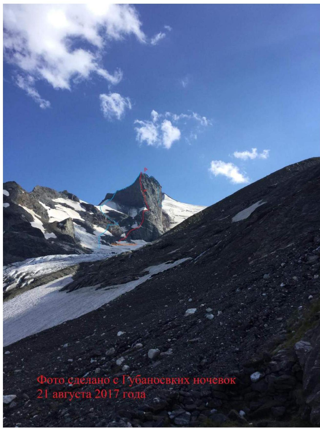
Photo taken from Gubanovskie bivouac on August 21, 2017.
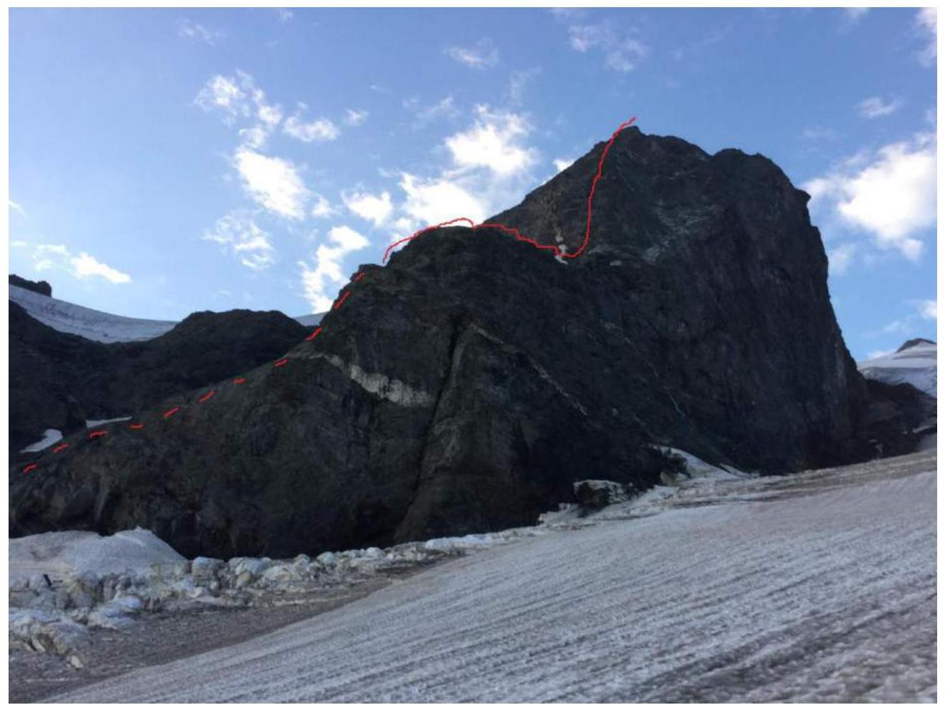
Sheet 2, page 3. Photo of the route profile from the side, or for routes of 5-6 category of difficulty, a drawn profile (3A).
Sheet 2, page 4. Panorama photo of the area. The photograph should be printed on thin color photographic paper, size not less than 13×18 cm. The panorama should show several peaks of the same ridge to the right and left of the ascent object. All peak names (and their heights) and passes should be labeled on the photo.
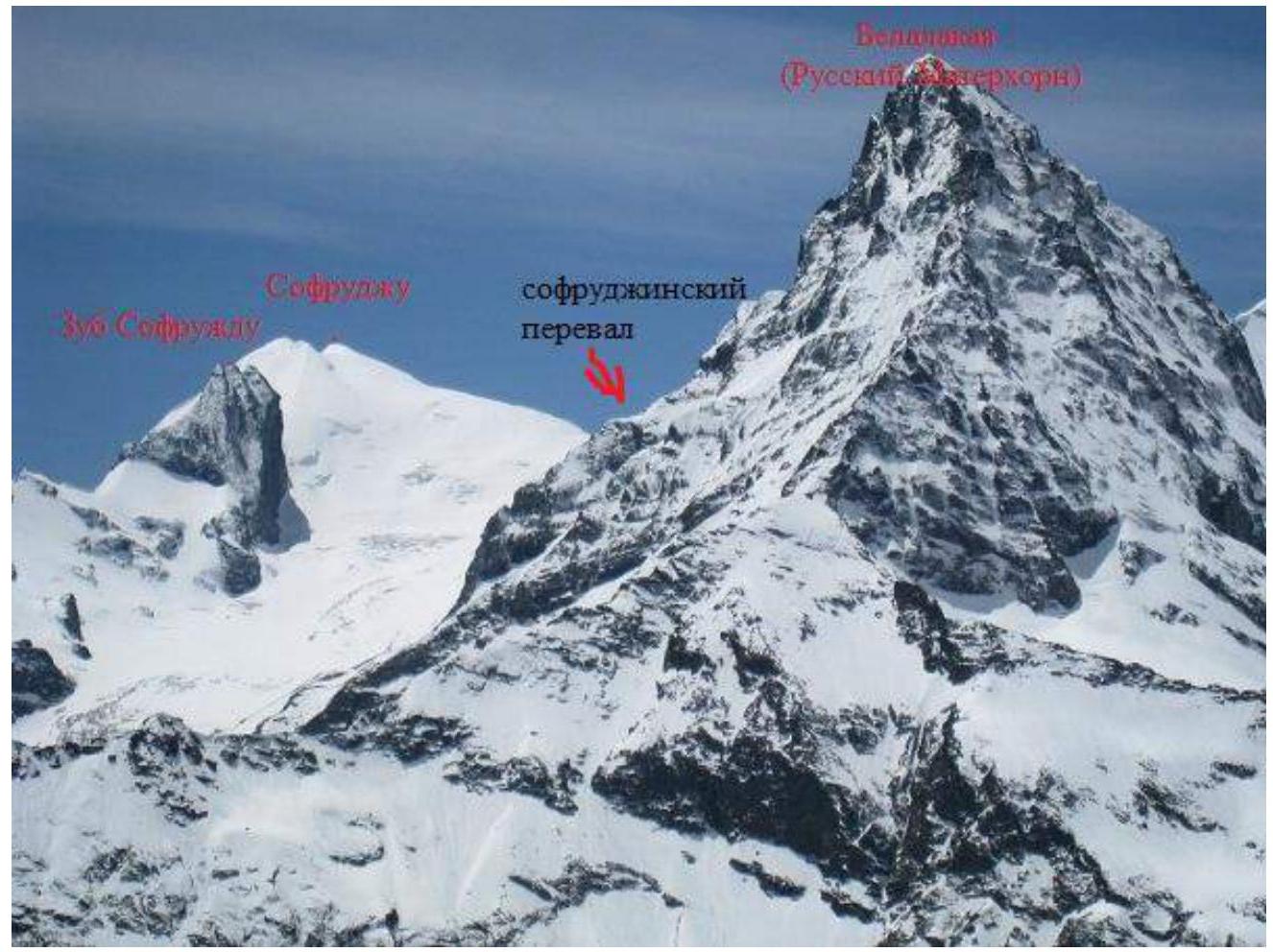
Photo taken from Roman Gubanov's website alplife.ru
Sheet 3, page 5. For less visited areas, it is necessary to provide: — a map of the area at a scale of no more than 1:80000 or geographic coordinates of the summit (latitude, longitude to the second) and a schematic map (page 5A) of the ascent object. The overview should describe the location of the area and its features, visit frequency. General approach description: city (settlement), gorge, glacier, pass. Indicate distance and time of approaches.
From Dombayskaya Polyana, cross the bridge over the Alibek River and follow the trail to the stream descending from the large Belalakayskiy couloir. Cross the stream to the snowfield and ascend 300 m up. Then turn left into the Sofrudzhinskiy couloir (prone to rockfall!) and ascend to a large overhanging rock. Continue straight up the steep section to the trail and follow it to Medvezh'ya Polyana. From Medvezh'ya Polyana, initially follow alpine meadows (trail), to Gubanovskie bivouac (bivouac directly to the right below the start of the eastern ridge leading to Belalakaya peak), or take a higher route via the snowfield and left onto the terminal moraine, where a good trail is located, and slightly above it are the upper Sofrudzhinskiy bivouacs (commonly referred to as "Sobac'ji" or "Dog's bivouac").
(Description taken from the book "Western Caucasus" by F. A. Kropf)
Recommendation for this ascent: the optimal starting bivouac is Gubanovskie bivouac.
My approach schedule to the bivouac (Gubanovskie bivouac): 10:34 (August 21, 2017) departure from the forester (the last point in Dombay settlement). 12:14 Medvezh'ye bivouac. 13:02 Gubanovskie bivouac.
Sheet 3, page 6, 6A.
| Section # | Length | Steepness | Terrain type | Category of difficulty | Number of hooks |
|---|---|---|---|---|---|
| 650 m | 45° | rocky | 3A | 0 |
Sheet 4, page 8, 8A. Brief description of the route passage by sections in arbitrary form. In the description of key sections, after characterizing the terrain, difficulty, and direction of movement, indicate if necessary: exposure, difficulty of navigation, etc. Recommendations for assessing the safety of the route, conclusion on the preliminary assessment of the route compared to classified routes of the same subcategory of difficulty, based on the experience of the ascents made by the team members.
The route is entirely visible from Gubanovskie bivouac; the Northwest spur (ridge) directly faces the bivouac.
The route starts below all currently classified routes on Zub Sofruju (not counting the unclassified route on Zub, starting from the Amanauz gorge, described in F. A. Kropf's book "Western Caucasus", which I had previously ascended and estimated to be around 4A category of difficulty, but very long; the ending coincides entirely with the 2A route).
From the bivouac, the approach to the route begins on a relatively gentle glacier with a small elevation gain. The glacier is open, with no deep crevices, except directly before the start of the route. The approach to the rocks is fairly straightforward, almost coinciding with the approach to 2A, and from there, following the simplest path directly along the ridge to the shoulder on the Northwest ridge of the Snowfield (glacier), located on the slopes of Zub. This section is bypassed on the right (the last place on the route to fetch water by melting snow), and then continuing along the ridge to a characteristic spot: a wall with a large green patch, below which is a diagonal ledge from right to left, where a control cairn was built.
Zub Sofruju has three peaks: the middle one is the highest point of Zub (North peak). The rightmost peak is the one that the 3A route leads to - the South peak, and the leftmost peak is unnamed, which is where this route leads, and from this point, approximately 10-15 m coincides with the classified 2A route.
From the control cairn, continue up the ridge (in some places resembling a chute) to the left peak. From here, the route coincides with 2A for the last 10-15 m along the crest to the summit of Zub, where a summit cairn is located.
Descent from the summit is possible via any of the previously classified routes, 2A or 3A. My descent was via 2A, as at the moment I was on the summit, a team of climbers from St. Petersburg - Alpkлуб "Gornyak" was ascending via 3A. To avoid rockfall on them, the decision was made to descend via 2A.
Sheet 5, page 9. Photo illustrations for the report. Photographs should be printed on thin color photographic paper or on paper suitable for color printer, size not less than 13×18 cm. Photographs for routes of 1B-3B category of difficulty (no more than 8), characterizing the terrain, weather conditions, and use of technical means.

The last place on the route to fetch water (shoulder).
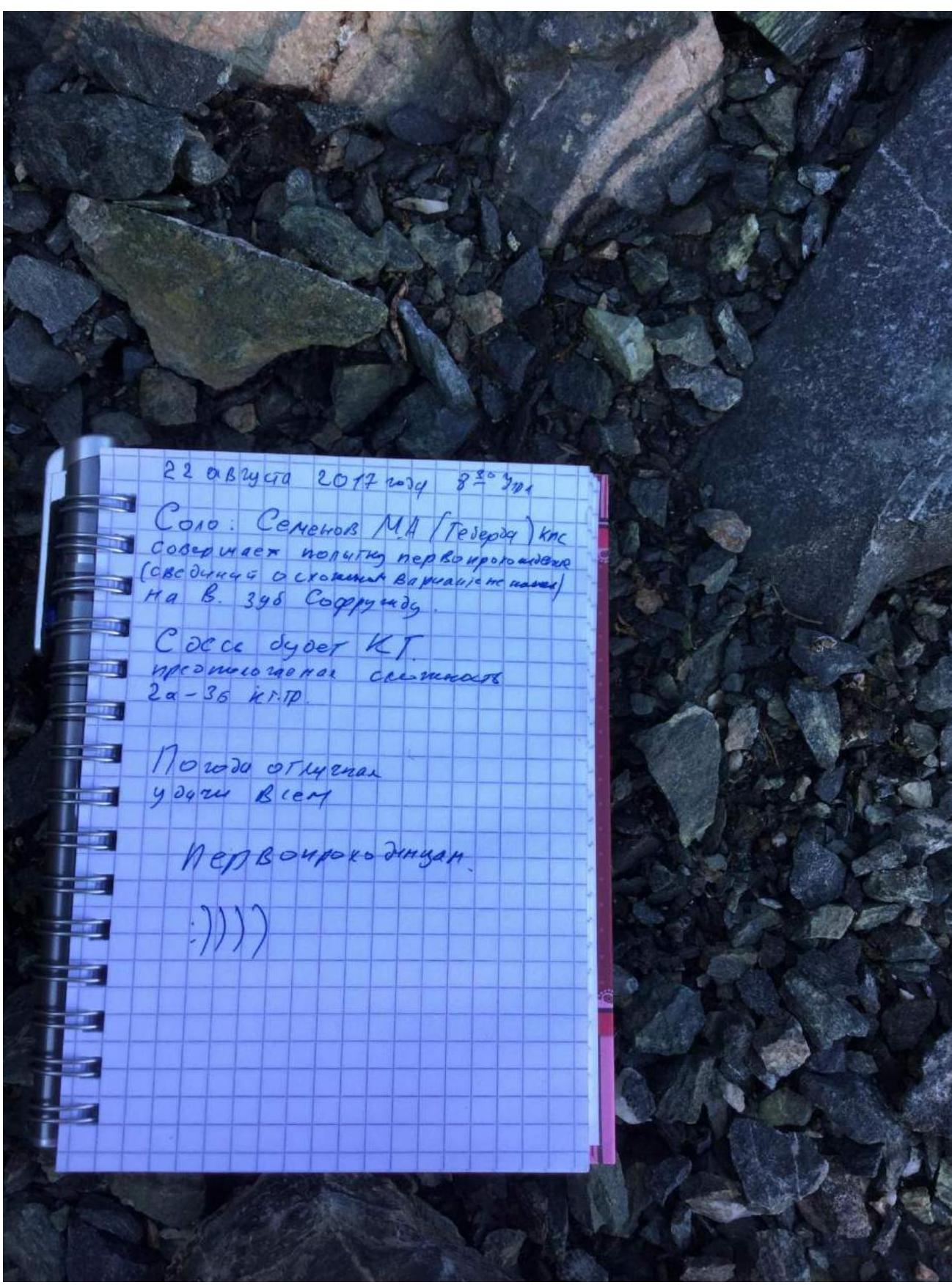
August 22, 2017, 8:30 AM. Solo: Semenov M. A. (Teberda), Candidate for Master of Sports. Attempting a first ascent (found no information on variations of the start on V. Zub Sofruju). The planned difficulty is 2A-3B category of difficulty. The weather is excellent. Good luck to all first ascenders! :))))
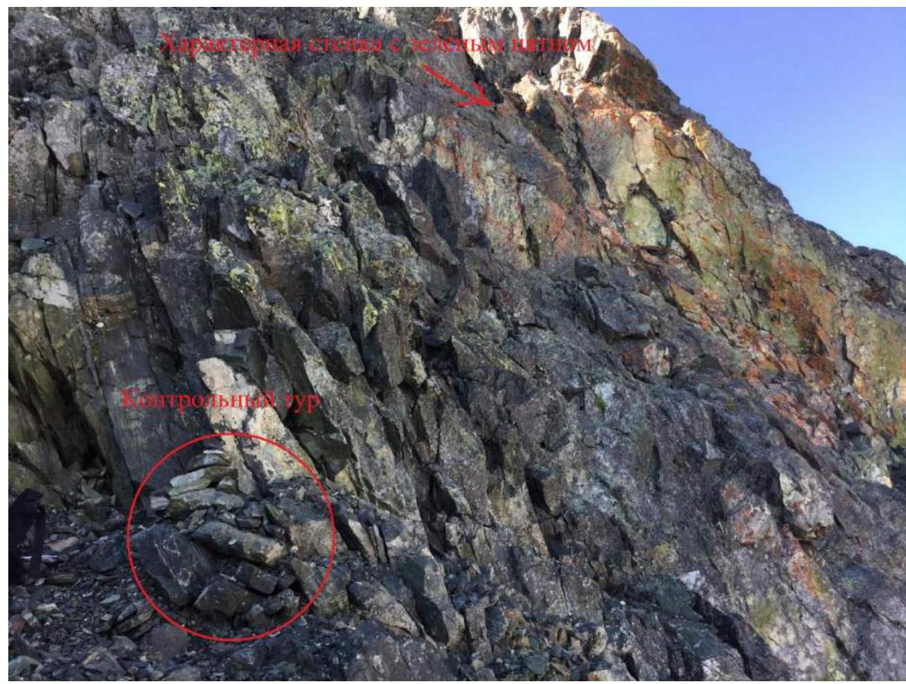
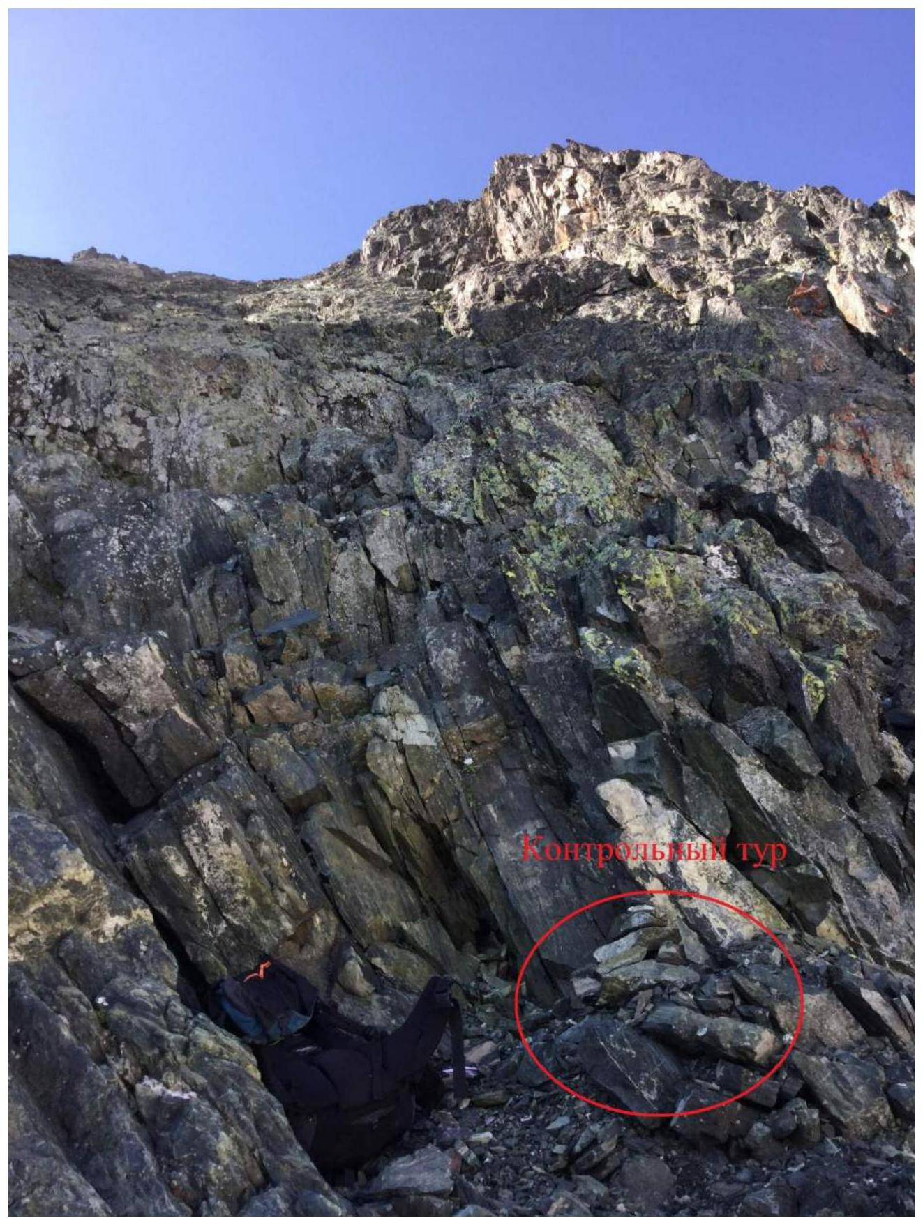
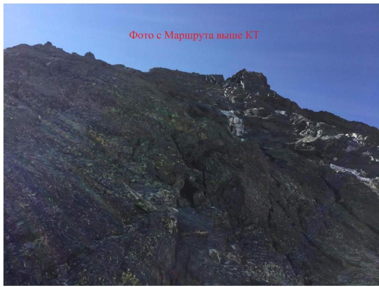
Photo from the route above the control cairn.
My photo on the summit
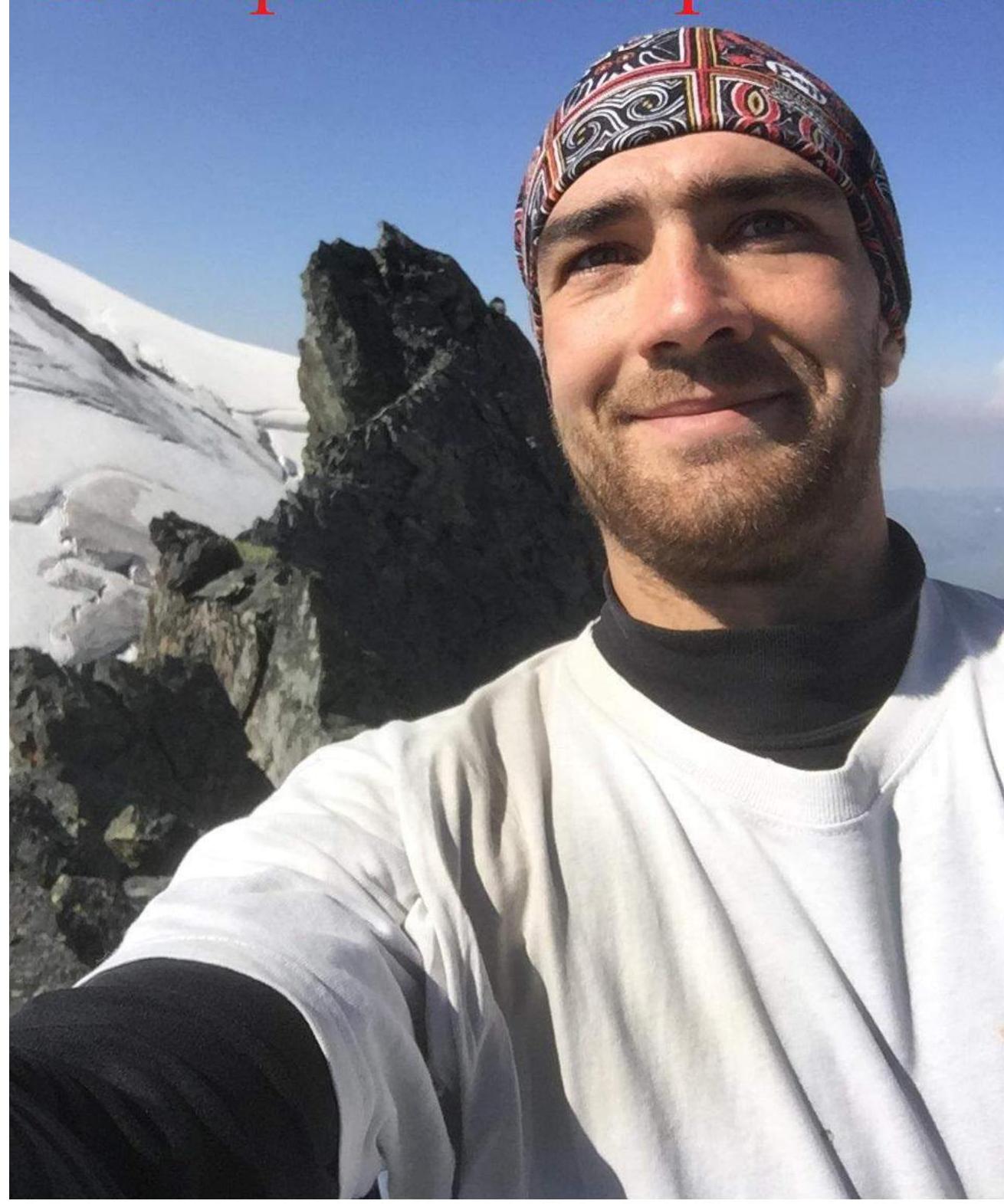
My photo on the summit.
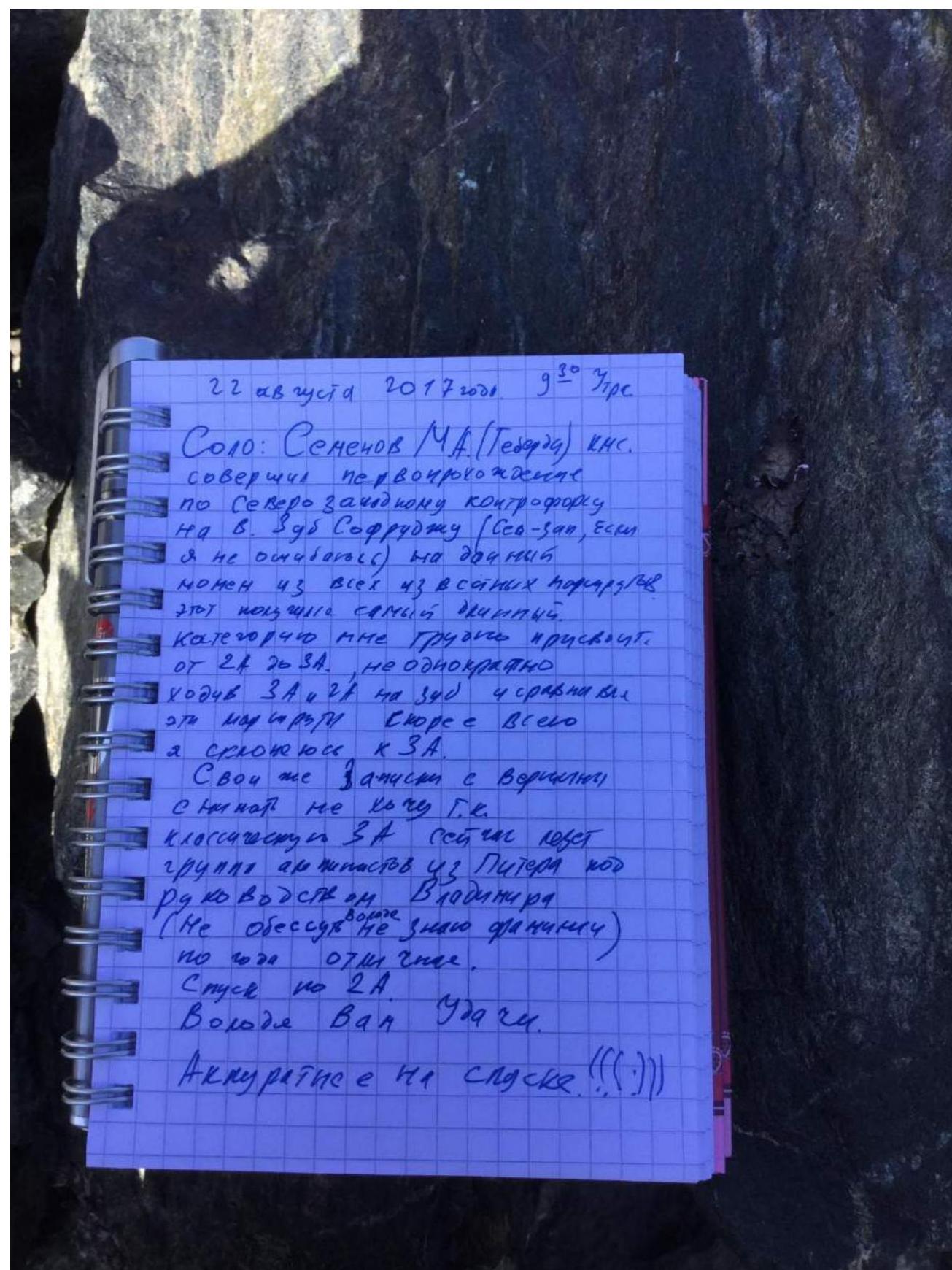
August 22, 2017, 9:30 AM. Solo: Semenov M. A. (Teberda), Candidate for Master of Sports. Completed a first ascent via the Northwest spur on V. Zub Sofruju (Northwest, if I'm not mistaken). Currently, this is the longest route among all known routes. I'm having difficulty assigning a category. Between 2A and 3A. Having repeatedly ascended 3A and 2A on Zub and comparing these routes, I lean towards 3A. I don't want to remove my notes from the summit, as the classic 3A is currently being ascended by a team of climbers from St. Petersburg - Alpkлуб "Gornyak". To avoid rockfall on them, the decision was made to descend via 2A.

Summit cairn (highest point of Zub).
P.S.: In my opinion, with my experience of ascents in Dombay and having repeatedly ascended all previously known routes on Zub Sofruju, this route deserves a 3A category of difficulty.
Requirements for the electronic version of the report
- Electronic versions should be submitted along with the report to the classification committee on CD-disks, USB flash drive, or via email to: alpfederation@gmail.com
- The description should be saved as a single file.
- File extension - doc (program - Word).
- The larger side of the photograph in the report should not exceed 800 pixels.
- A separate file should be provided with a high-quality photograph (not processed on a computer using special programs). With a drawn route line by sections (see Sheet 4, page 7).
Comments
Sign in to leave a comment