
A major new section has been added to SummitX: now every user can keep their own ascent history.
This isn't just a "where I've been" list: from user ascents, a living route database gradually begins to grow. With current assessments and descriptions of sections, a history of changes, and a proper classification mechanism that doesn't depend on one person, an old table, or a random subjective assessment.
The full list of ascents is already available here: https://ru.summitx.info/ru/ascents ↗. In a user profile, the list looks like this: https://ru.summitx.info/ru/users/64744074/ascents ↗ (I've only just started filling out my own list). Rather broad search options for ascents are offered:
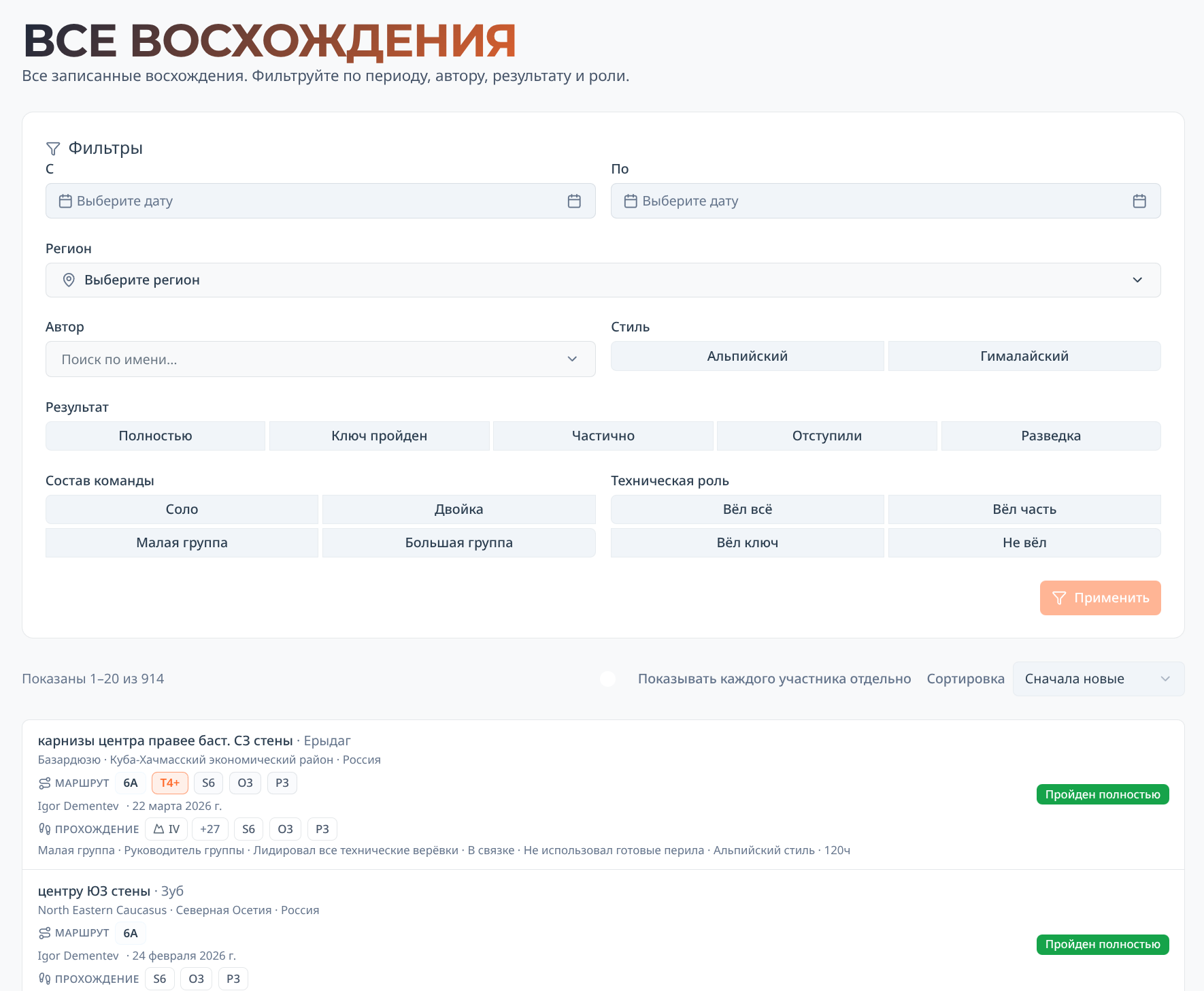
Why add your ascents at all
At first glance, it might seem like just a personal diary. Well, you climbed a route, wrote down the date, checked a box. But it's all a bit cooler than that.
I'm trying to create not just a list of routes, but a system where routes are gradually refined by the climbers themselves. The more people add their ascents and describe route sections, the more accurate—and therefore more useful—the database becomes.
Soviet/Russian route categories are useful, but they are very coarse. One 3B category can hide completely different things. Two routes of the same difficulty under the old classification can differ radically: one short but with a hard crux; another long but technically uniform; a third dangerous because of seracs; a fourth easy in movement but with almost no decent protection.
Therefore, on SummitX a route is not described by a single overall number. It has technical difficulty, seriousness, objective danger, fall consequences, terrain sections, lengths, types of obstacles, and data freshness.
But all this is impossible to get out of thin air. Real ascents are needed. We need your help, and you need your help :)
All fields are optional
I specifically designed the ascent addition form so that it doesn't turn into a visa application.
You can add just the fact of the ascent. You can specify the date. You can add the outcome, style, team composition, technical role, duration. You can describe route sections in detail. You can remember nothing precisely and fill out nothing. You can come back later and complete the entry. All fields in an ascent are optional.
This is an important principle. Many people have dozens or hundreds of routes behind them, and if the site required filling everything out at once, nobody would use it. You can fill out your history gradually. First transfer the basic information, then refine the most important routes, then return to old entries if reports, photos, or details surface.
But there is one important point. A route fully enters the classification mechanism only when at least one user has indicated route sections with their difficulty. For example: ice of such-and-such difficulty and length, rock, mixed, icefall, snow slope, key section, sustained section.
If a route only has the fact of an ascent, that's already good. It will be in your history. But there's not yet enough data to calculate technical difficulty.
Filling out a route starts with basic details that are usually not forgotten:
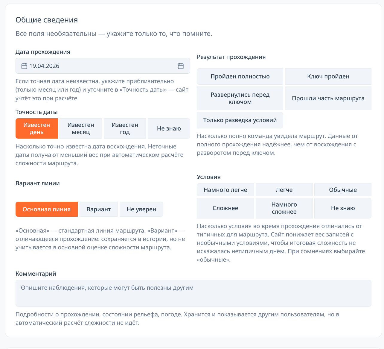
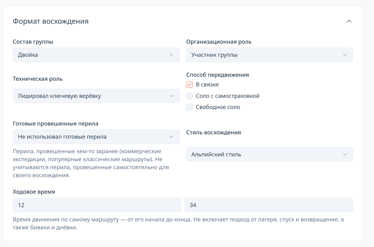
Next, your participation in the ascent and how it was completed:
You can immediately send invitations to other ascent participants:

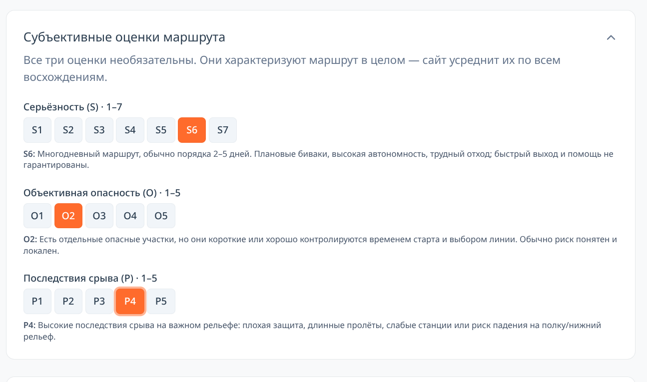
The subjective assessment section allows us to form additional, non-technical rating scales for the route:
And finally, the description of route sections:
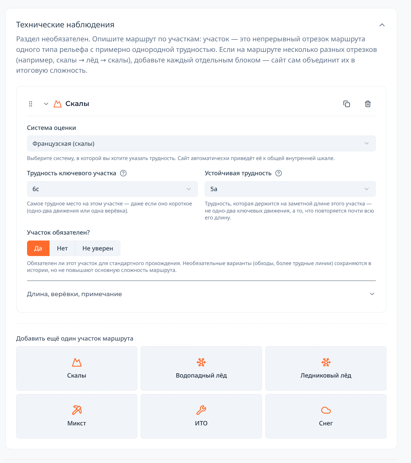 The description of route sections is vitally important for calculating the route's technical difficulty! The next section is about this.
How route classification emerges from your entries
The idea is this: the user doesn't just vote "I think the route is hard." They describe what was actually on the route.
For example, one person indicated: 200 meters of ice, then a short mixed section, then an easy snow ridge. Another person added a year later that the ice had become thinner and rocks were exposed below. A third person completed the same route another season later and confirmed that the lower section had indeed become harder.
The system collects such data and calculates technical difficulty using a unified algorithm. Not based on one person's impression, not based on the old category, not based on climbers' personal fears. Instead, difficulty is calculated from sections: their lengths, terrain types, and assessments given by real climbers.
Meanwhile, a language model is currently running on the site, which gradually fills in sections based on analysis of reports. If only this model has assessed based on old descriptions, confidence in the rating is low. Old descriptions are often vague, incomplete, sometimes just pictures, and automatic parsing cannot carry much weight in the "voting."
But if one real climber has completed the route and indicated sections, confidence in the calculated difficulty jumps sharply. If several people have independently described the route similarly, the classification becomes much more reliable.
And this, in my view, is the main difference between SummitX and the old world. A route is not "classified once and for all." Its assessment is gradually refined through the history of ascents.
Why this matters for routes
Mountains change. A route may collapse, or ice may melt. A bergschrund may shift. A snow ledge may disappear. A very important old piton on the crux may rust away. Somewhere a new bypass appears. Somewhere, conversely, an unpleasant section becomes exposed. Somewhere a classic snow-ice route turns into a mixed one.
This is often not reflected in old descriptions. Sometimes everyone knows "by word of mouth" that the route has long been different, but in the guidebook or reports it continues to live in its former state. I want this to gradually be corrected on SummitX.
If a route hasn't been assessed for a long time, this will be visible. If fresh ascents appear, they will begin to influence the rating. If several people indicate terrain changes, the database will be able to reflect this. Not instantly, not magically, but gradually and verifiably. For future climbers, this is far more useful than just an old line in a table.
Thanks to these ratings, the route card now looks like this:
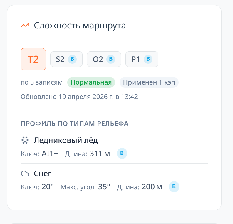
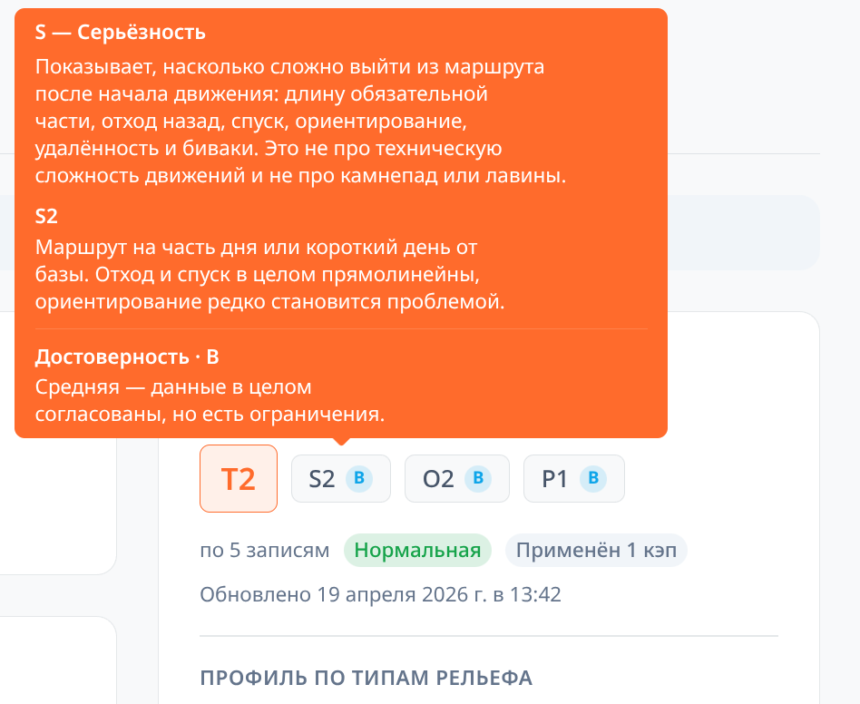
I understand that many fields are new. But tooltips will explain everything:
And this is what the ascent history for a route looks like:
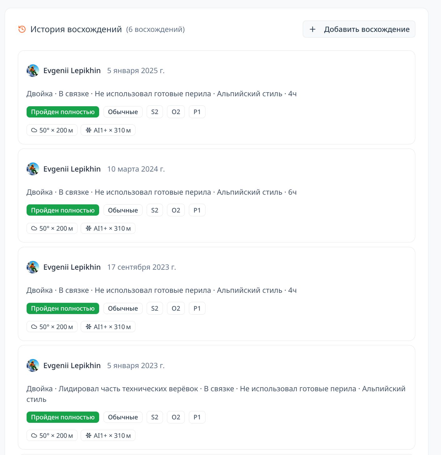
Screenshots were taken for the route https://summitx.info/ru/routes/58844991/about ↗
Why this is useful for you personally
The personal benefit is also significant.
After a few years, routes fade from memory. Dates get confused. It's already hard to remember where you led, where you climbed as a team member, where it was a rope of two, where a group, where the crux was, how long the route took, where fixed ropes were used, and where you went completely independently.
Now this can be stored in one place.
In an ascent you can specify the date, outcome, team format, technical role, style, duration, conditions, route sections, and comments. Not everything at once is necessary. But if you fill out at least the important routes, over time you get a proper personal climbing diary.
Why this is useful for the community
Every good entry helps not just you.
It refines the route, increases classification confidence. And of course it helps those who will climb after you. In the future, it will allow seeing how a route changed over the years. People will see the real structure: where the crux is, what the terrain is like, how fresh the data is, whether there are discrepancies between ascents.
Entries for routes that few have described in detail are especially valuable. Or for routes whose old category clearly doesn't match the current condition. Or for difficult lines where one overall rating explains very little.
Yes, filling out sections is not an easy task. Especially if there are hundreds of routes and these are complex walls or old ascents. I understand this, and I've suffered myself :) But this data is priceless: structured knowledge about a route. As far as I know, nowhere else in the world exists in this form with this connection of personal history, classification, and ratings.
If we don't do it, who will?
Import from the FRA database
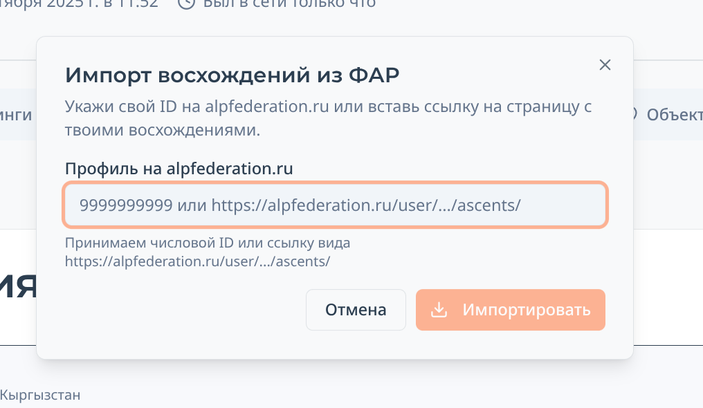
To make starting easier, I've added an import of ascents from the FRA database.
This is especially useful for those who already have a large history of official ascents, championships, training camps, or events. No need to manually transfer dozens of entries. You can import the foundation, then gradually bring it in order.
The import doesn't do all the work for you. It creates a framework: routes, dates, participant or leader. After that, you can open your ascents, edit important entries, add sections, clarify role, style, duration, and conditions.
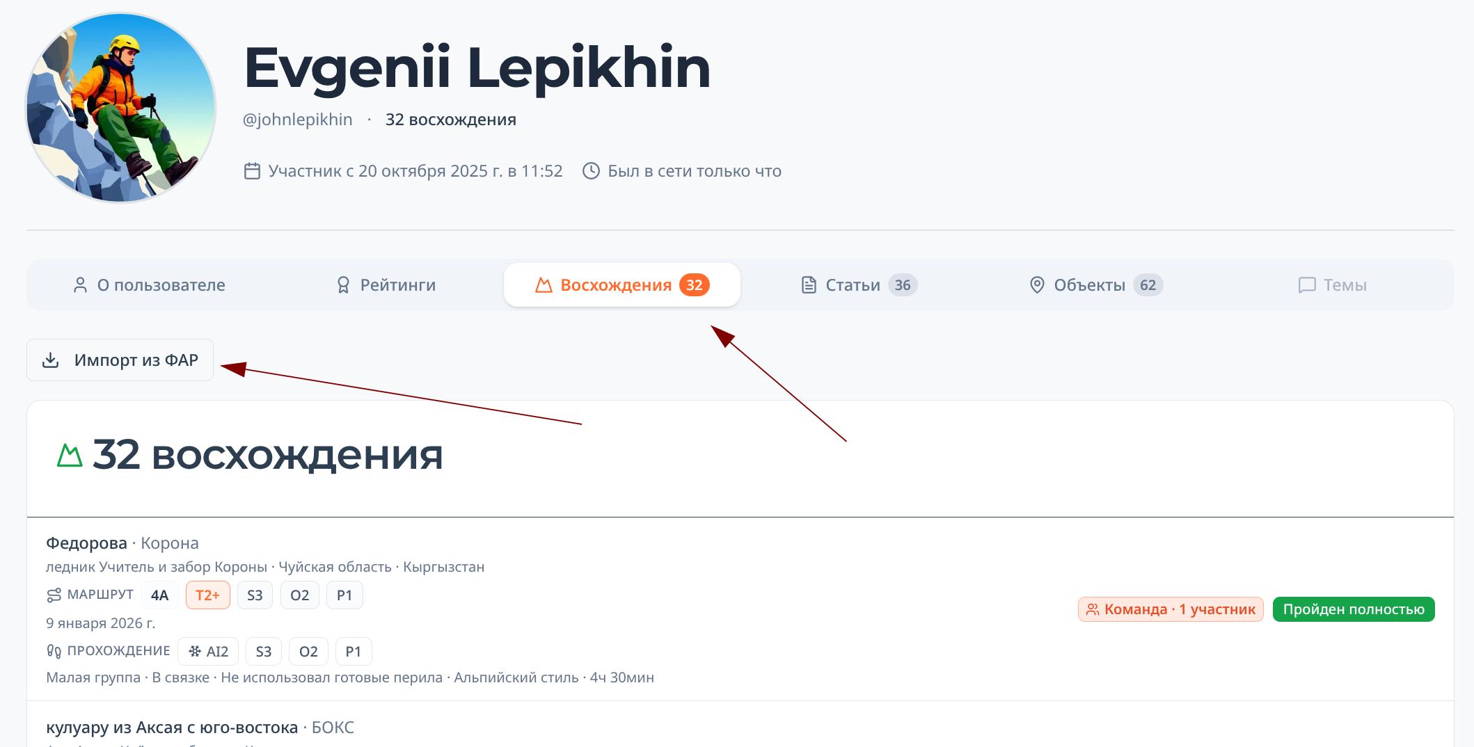
Import from FRA is available in your public profile, under the ascents tab:
What to do if you don't remember details
This is normal. No need to painfully reconstruct every meter of the route. If you only remember the general structure, indicate that. If you remember the crux, indicate the crux. If a report survives, you can use it. If there's absolutely no certainty, it's better to leave the field empty than to make something up.
I specifically designed into the system that data can be incomplete. Better an honest incomplete record than a confident fantasy.
You can start with the freshest routes, then move to the most significant ones. Then to those where reports exist. Gradually the history will become useful.
What's next
I will continue to improve the ascent creation form, import, tooltips, automatic parsing of descriptions, and section editing. Algorithms for calculating route difficulty and ratings will also be refined (you won't have to re-fill anything). It's already clear that this is big work. But the basic idea is already working.
You can add your ascents or import them from FRA. You can refine routes or ascents. You can influence the classification. You can help make the route database more alive and current.
You can start here: https://ru.summitx.info/ru/ascents ↗. To add an ascent, click the button on the route page. If you know how to improve the route description, what alternative names it has—everyone will thank you if you edit the route too!
And you can open your list of ascents in your user profile, for example: https://ru.summitx.info/ru/users/64744074/ascents ↗

Comments
Sign in to leave a comment