
Report
On the ascent of the Karachay-Cherkessia national team to the summit of Pik Ine 3455 m via the Eastern ridge. Presumably category IV-B. First ascent.
Semenov M. A. — team leader, Popov M. L. — Candidate for Master of Sports
2. Caucasus
2.2 From Marukh pass to Nakhar pass
Climbing participants
-
Team leader — Semenov Mikhail Aleksandrovich, Candidate for Master of Sports. Coach — Shipilov V. A. Address: 144001, Elektrosteel, Oktyabrskaya str., 8, apt. 117. Phone: +7 (906) 724–94–53. Email: aravigehc@mail.ru
-
Popov Mikhail Lvovich, Candidate for Master of Sports, Yessentuki. Coach — Motienko N. I.
Ascent passport
-
Western Caucasus, Dombay region, section 2.2 of the route classifier for mountain peaks.
-
Pik Ine 3455 m. Via the Eastern ridge.
-
Proposed category: 4B. First ascent.
-
Rock climbing route.
-
Height difference: 700 m.
Route length: 1010 m. Length of sections:
- Category IV: 215 m
- Category V: 45 m
- Category VI: 40 m
Average steepness: 60–65°.
-
Number of pitons left on the route: 2
-
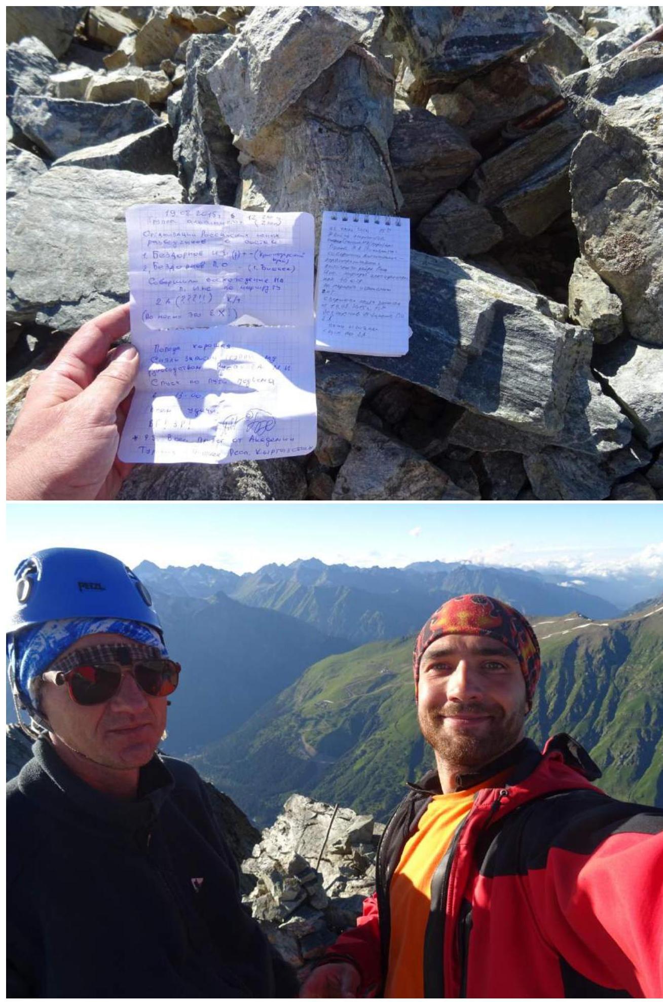
Team's total climbing time: 12 hours, 1 day.
-
Descent from the summit via route 2A, category II, from the northeast.
-
Team leader: Semenov Mikhail Aleksandrovich, Candidate for Master of Sports, coach Shipilov V. A.
Team member: Popov Mikhail Lvovich, Candidate for Master of Sports, coach Motienko N. I.
-
Departure for the route: 05:30, July 23, 2016.
Summit arrival: 17:30, July 23, 2016.
-
Alpclub "ARKHYZ", alpclub "FREELINE".
-
Responsible for the report: Semenov M. A., aravigehc@mail.ru
Description of the climbing area
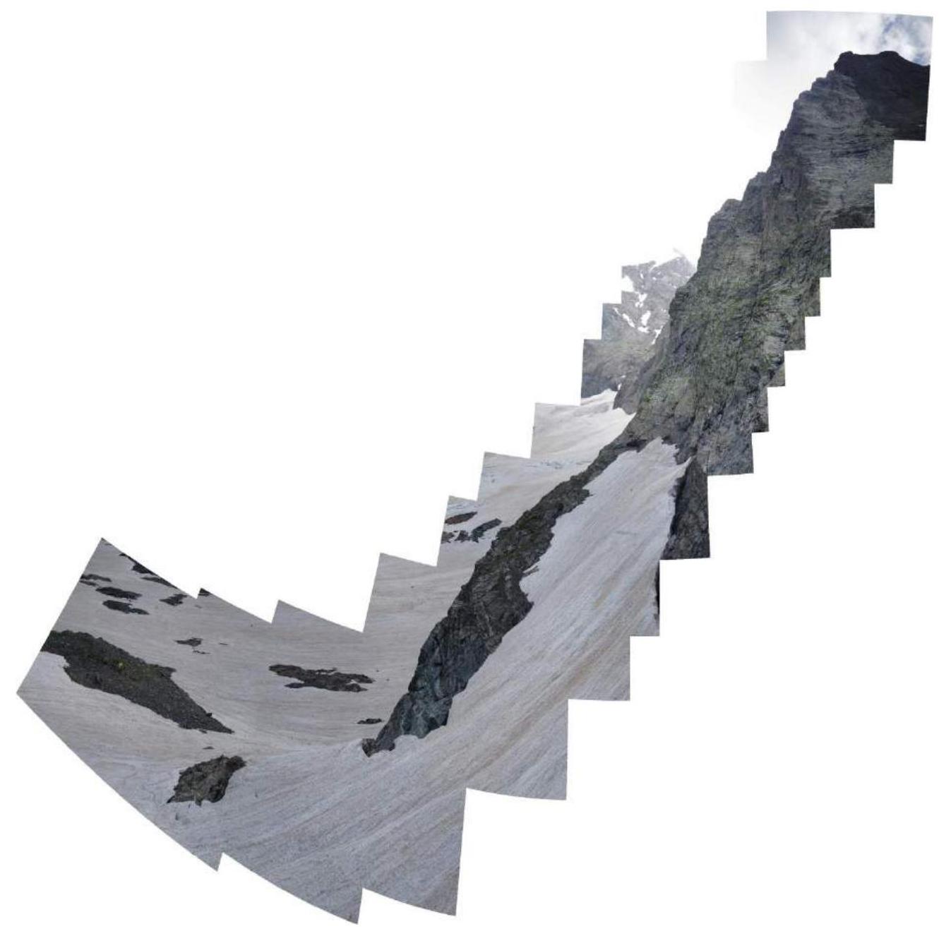
Pik Ine 3455 m is located on a spur of the Main Caucasian Range in the Dombay-Ulgen gorge. The path to the summit begins from Dombayskaya Polyana, through the Dombay-Ulgen gorge, just before the fork to Chuchkhur waterfalls and the trail to the Ptysh gorge. It's possible to drive to this point with an off-road vehicle. On foot, it takes about 1.5 hours. The river can be crossed at its widest point, and then one can move along the grassy slopes past the waterfall between Pik Zoloto and Pik Ine. The waterfall is passed on the right, and then one continues up the grassy slopes and moraine to the base of the glacier under Pik Ine, almost to the very start of the 4B route, where classic campsites are located for ascending 2A to Pik Ine from the north. From Dombayskaya Polyana, it takes 4–5 hours.
The photo was taken on July 24, 2016, from the campsite under the route
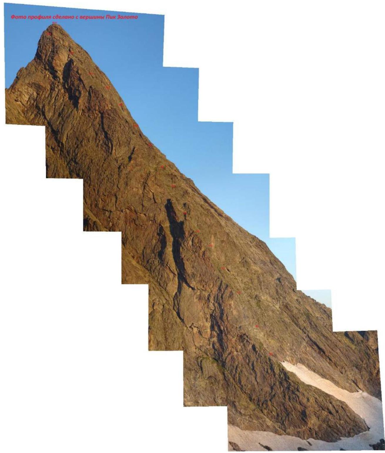
 The profile photo was taken from the summit of Pik Zoloto
Route description by sections
R0–R1 — From the bivouac, the complex part of the ridge is bypassed via a simple snow slope on the right, the start of the route. Up simple rocks along the ridge to a small convenient ledge on the left. 20 m, 40°, 20 m, 60°, III+.
R1–R2 — From the belay station, up the wall via an overhanging section, a difficult and key part of the route; it doesn't get harder than this. The belay station is semi-convenient under the overhang. Two pitons were left at the start and at the station. 40 m, 80°, VI-.
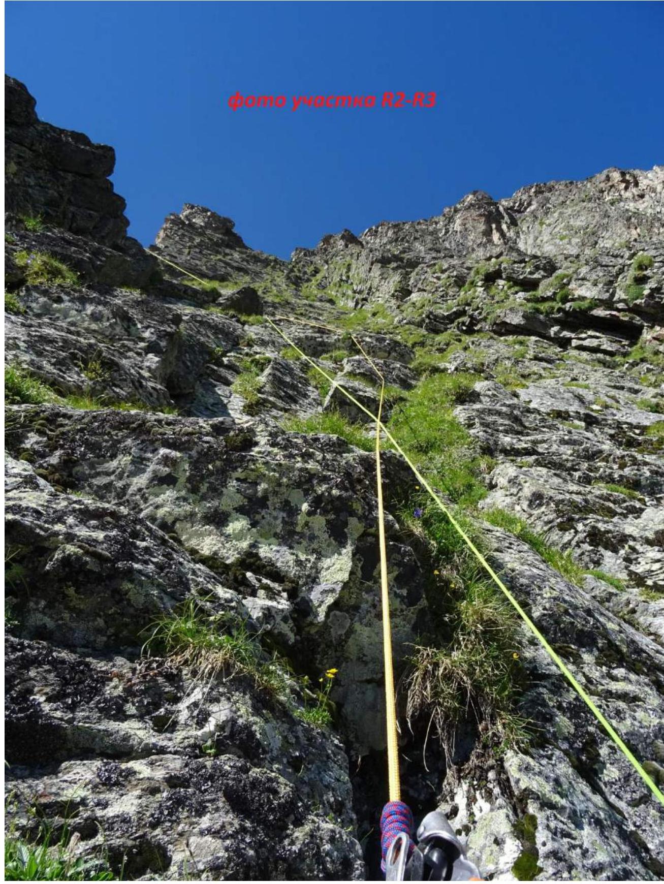
R2–R3 — From under the overhang, traverse right, 7 m of VI climbing, a narrow inclined ledge, and then up a wide internal corner on the right side of the ridge, exiting onto the ridge. 45 m, 50°, III+.
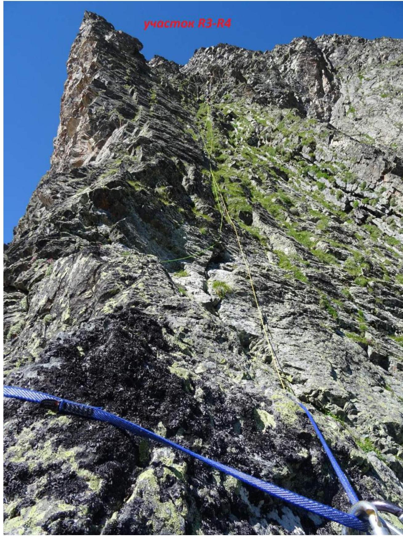
R3–R4 — Up the right side of the ridge, entering a wide grassy gully (grass climbing); belay station on a ledge. 45 m, 70°, IV.
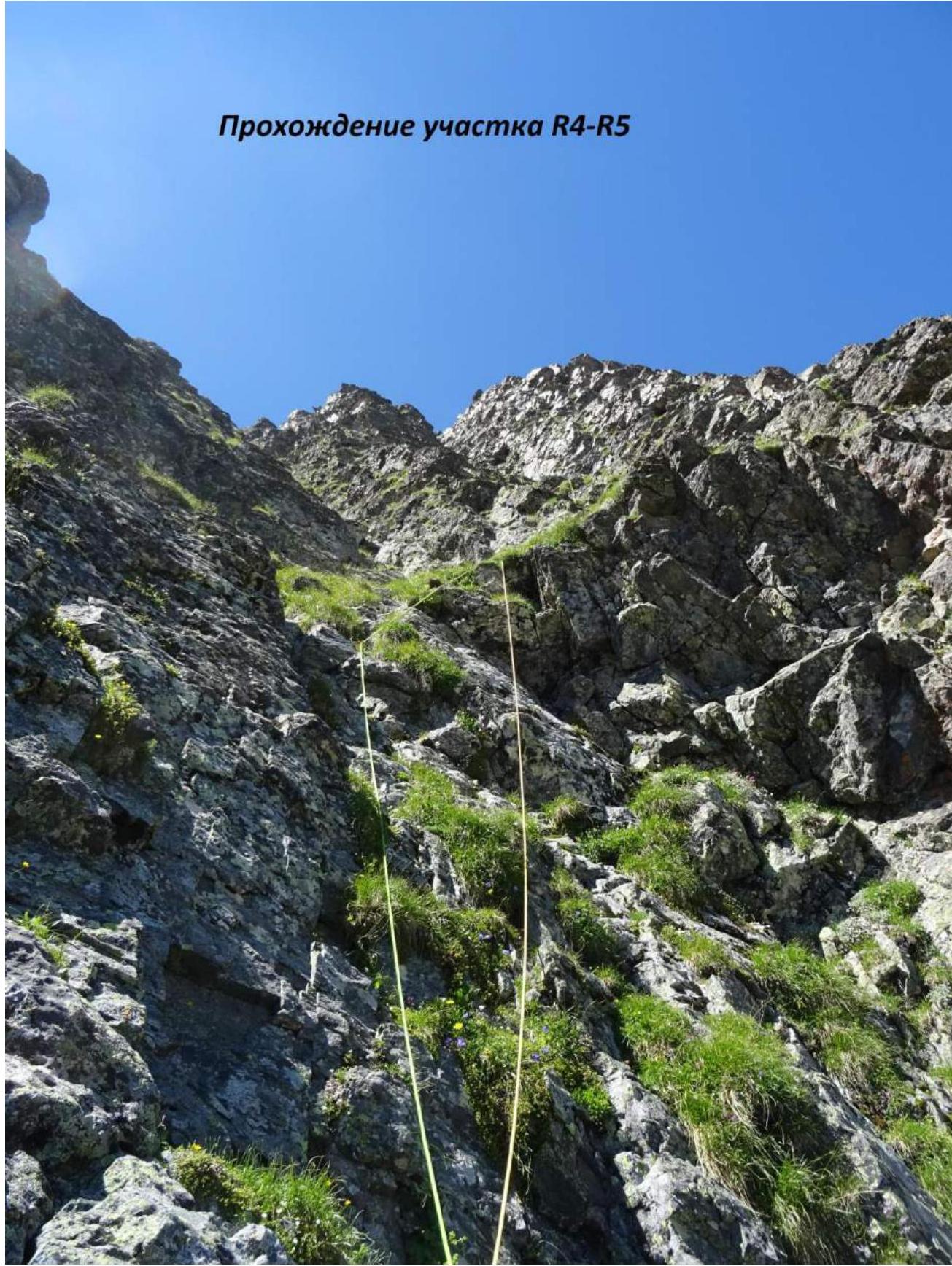
R4–R5 — Up the gully (internal corner), transitioning into the right gully (there's an option not to transition into the right gully, but it looked more difficult). 45 m, 70°, VI+.
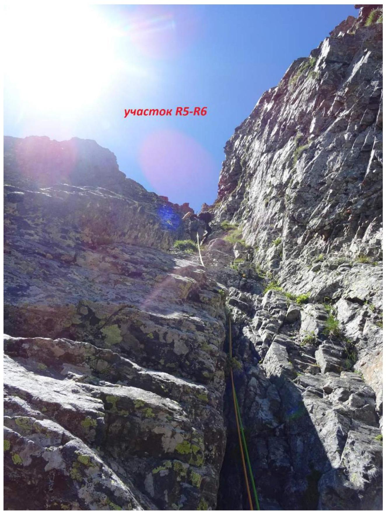
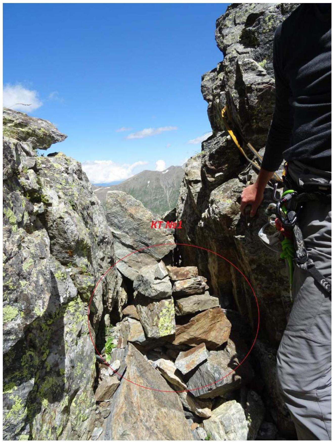
R5–R6 — Continuing up the gully, which turns into a chimney; after the chimney, exit onto a simple ledge leading right into a simple passage in the ridge; the first control point (CP) №1 was placed in the passage. 65 m, 50°, III.
R6–R7 — Up the right gully of the ridge. 50 m, 45°, III.
R7–R8 — Approximately 30 m up to a wide, stepped green ledge, and along it, approximately 10 m traverse right; 5 meters below is a very wide ledge suitable for a bivouac for two tents. 40 m, 45°, II+.
R8–R9 — By the simplest path, staying close to the Eastern ridge, up and right. 45 m, 50°, II+.
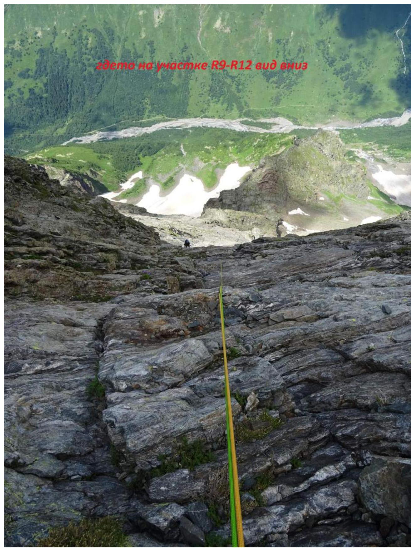
R9–R12 — Continuing by the simplest terrain on the right part of the Eastern ridge, about 15 meters from its edge, parallel to it, constantly approaching its edge. 150 m, 50–60°, III+.
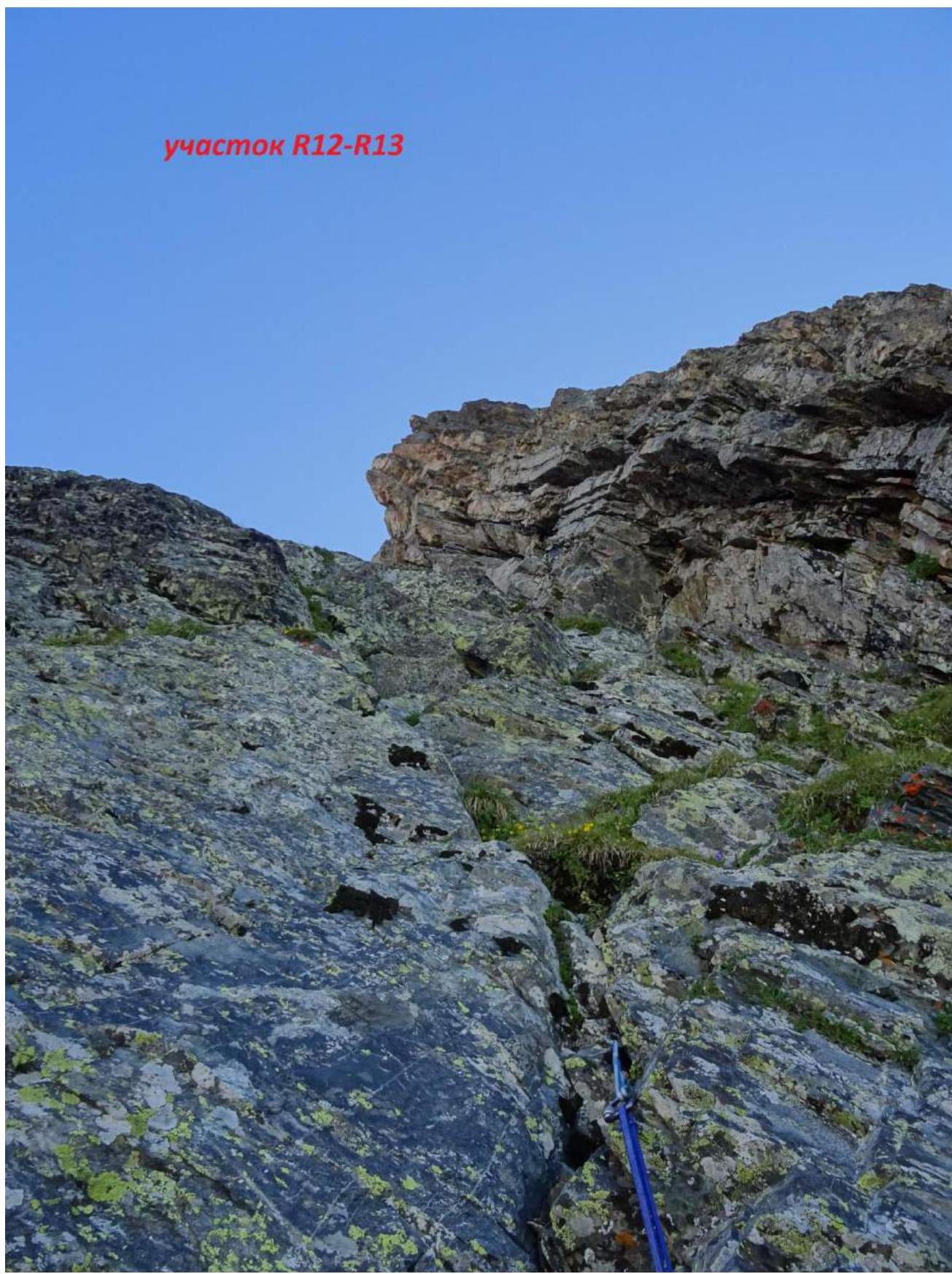
R12–R13 — Up the ridge via an internal corner (can be called an inclined ledge). 45 m, 75°, V-.
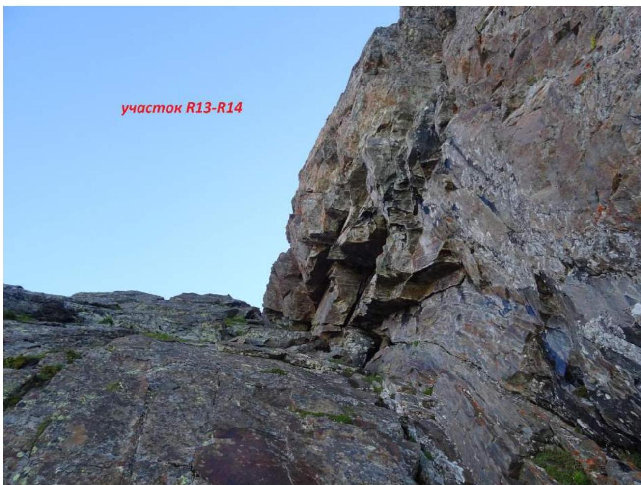
R13–R14 — Continuing up this inclined ledge (wall, internal corner); by the end, it becomes gentler, reaching 40°. 50 m, 70°, IV+.
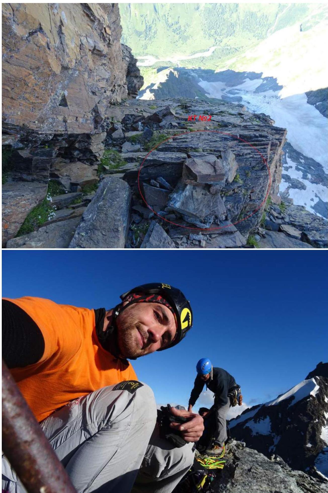
R14–R15 — Further up a wide inclined ledge for 10 meters, after which it turns right, exactly at the turn CP №2 was placed. The ledge leads to the South ridge. 40 m, 55°, IV+.
R15–R16 — Up the несложному South ridge to the summit. 20 m, 45°, II.
Climb leader: Semenov M. A. Team member: Popov M. L.
Coaches: Shipilov V. A., Motienko N. I.
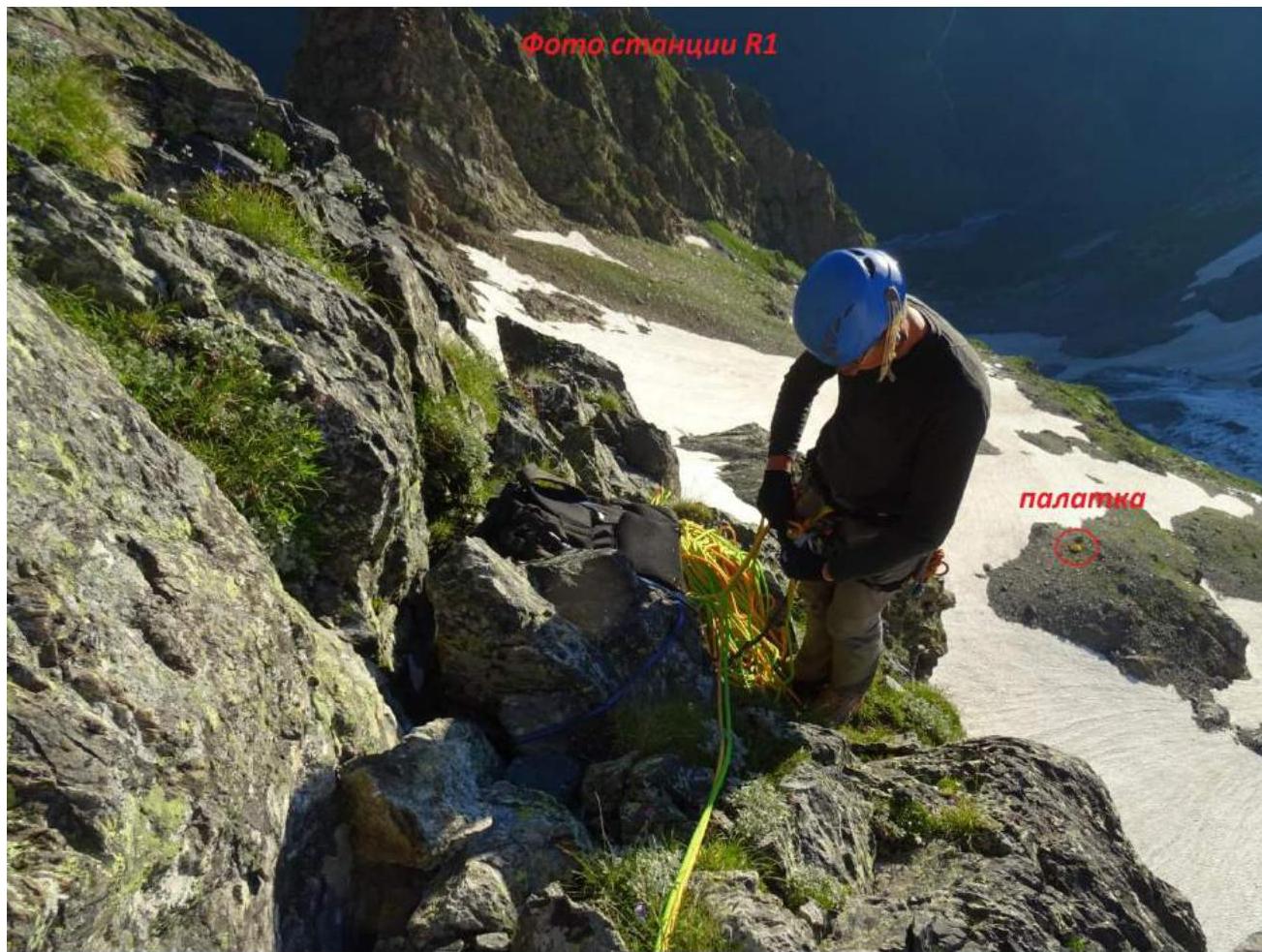
Photo of belay station R1
Passage of the key section R1–R2
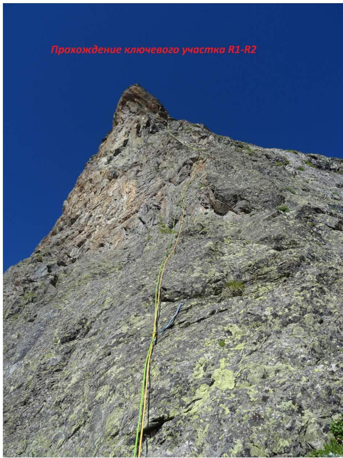
Photo of section R2–R3
 Section R3–R4
Passage of section R4–R5
 Section R5–R6
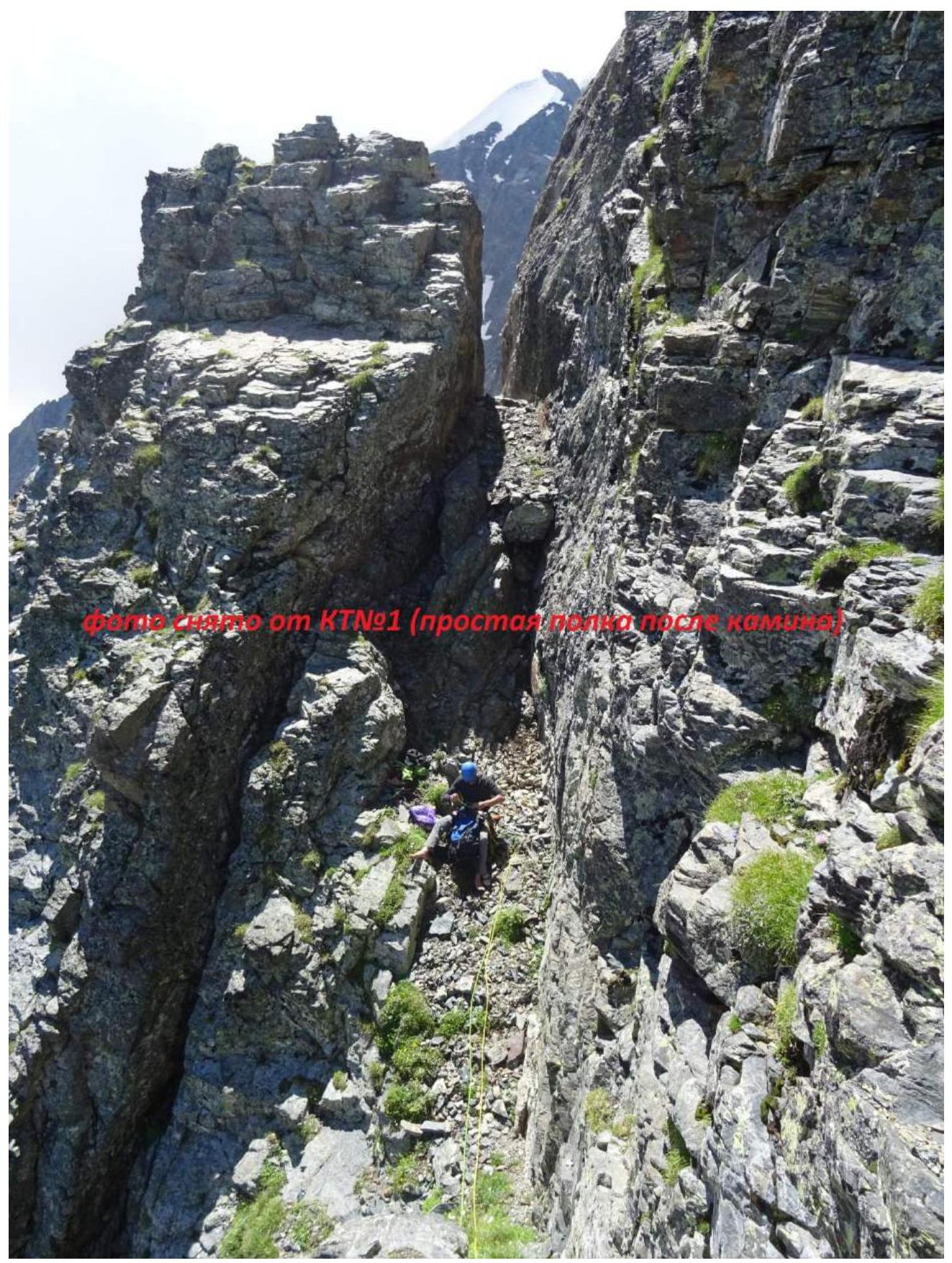
 View from CP №1
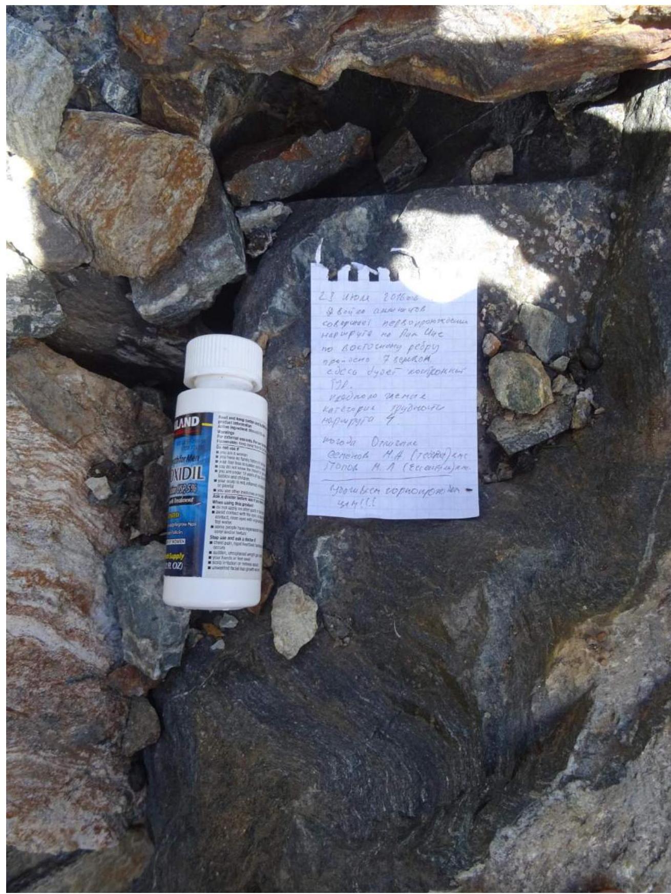
 Control point №1
View of section R9–R12
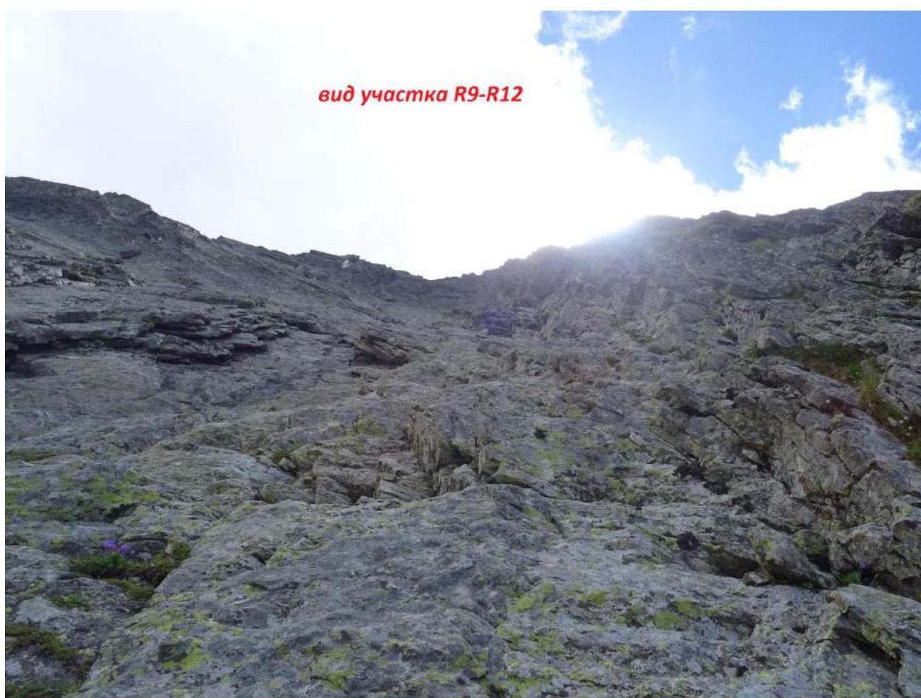
Photo taken on section R9–R12, view downwards
Section R12–R13
 Section R13–R14
Control point №2
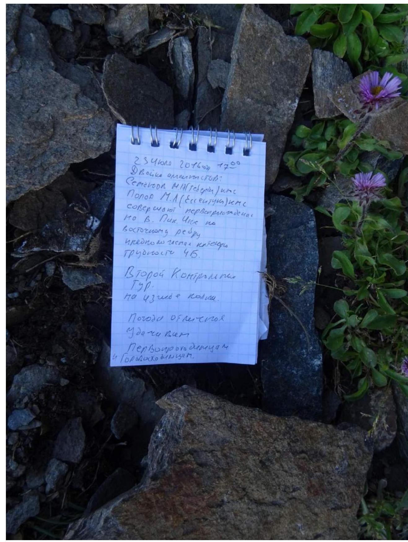
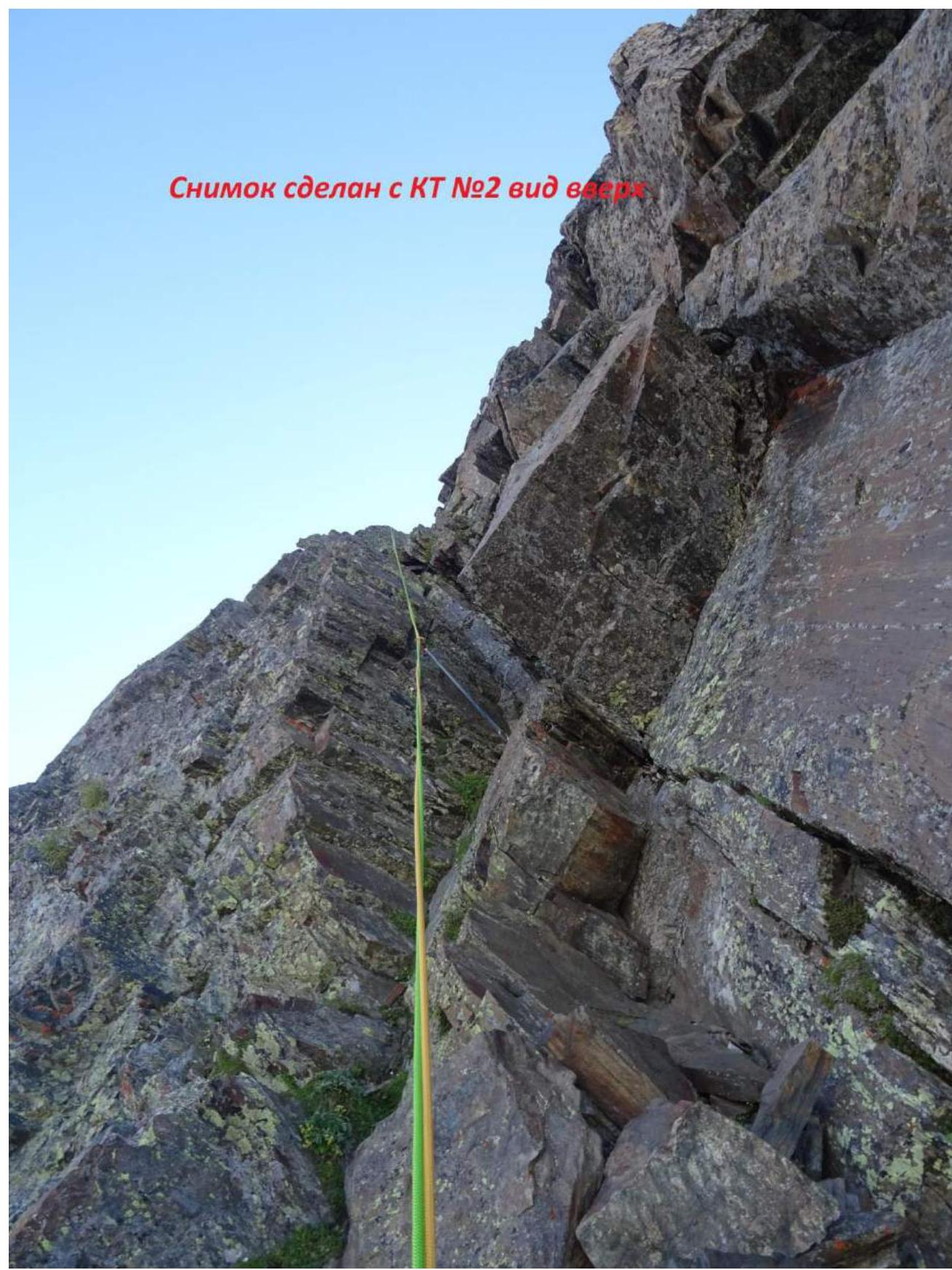
Photo taken from CP №2, view upwards
Comments
Sign in to leave a comment