
Report
On the ascent of the Karachay-Cherkess Republic team to the summit of Klukhor-Bashi 3450 m
via the glacier on the northern slope. Category 1B difficulty. Presumably Category 1B difficulty.
Ascent on September 8, 2022.

Semenov M. A. - Master of Sports, team leader Maksimov K. M. - experienced, second-class climber Alpclub - "Mountain Madness"
2. Caucasus
2.2 From Marukh Pass to Nakhar Pass
Climbing participants
- Team leader - Semenov Mikhail Alexandrovich. Candidate Master of Sports. Born June 5, 1988. Coach - Shipilov V. A. Address: 144001, Elektroсталь, Oktyabrskaya St., 8, apt. 117. Phone: +7 (906) 724–94–53. Email: aravigehc@mail.ru
- Maksimov Konstantin Mikhailovich, experienced second-class climber, Dмитров. Born November 6, 1994. Coach - Semenov M. A. Alpclub: "Mountain Madness"
2. Characteristics of the Climbing Object
2.1 Western Caucasus, Dombay region, section 2.2 of the route classifier for mountain peaks. 2.2 Gonachkhir gorge. 2.3 Section number according to the classification table 2.2. 2.4 Klukhor-Bashi 3450 m. 2.5 Geographic coordinates GPS coordinates Start quote. GPS coordinates: - latitude: 43.141885 - longitude: 41.761007 End quote.
3. Characteristics of the Route
3.1 Via the glacier on the northern slope. 3.2 Category 1B difficulty. 3.3 Previously frequently visited route, not a first ascent. 3.4 Proposed route line: ice and snow, our variation - combined. 3.5 Elevation gain: 700 m. 3.6 Route length: 1100 m. 3.7 Average slope of the glacier: 40°. Category 1B difficulty. 3.8 Descent from the summit via the ascent route. Category 1B difficulty in the Gonachkhir gorge. 3.9 Plenty of snow. The variation we took is more scenic and combined.
4. Characteristics of the Team's Actions
4.1 No pitons left on the route: 0. Climbing time: 5 hours, 1 day. 4.2 Completed without overnight stay in one day, possible overnight locations: * near the upper Klukhorsky lake, * on the summit. 4.3 Started the route: 08:00, September 8, 2022. 4.4 Reached the summit: 13:00, September 8, 2022. 4.5 Returned to the vehicle: 18:00, September 8, 2022.
5. Responsible for the Report
5.1 Responsible for the report Semenov M. A. aravigehc@mail.ru
Description of the Climbing Area
The peak Klukhor-Bashi 3450 m is located on the left side of the Klukhor Pass when viewed from the Russian side. At the time of writing, the mountain summit is on the border between Russia and Abkhazia. The Klukhor Pass is currently the most heavily guarded part of the local border. The pass has strategic significance.
In the USSR, a popular all-Union route 43 passed through this pass to the sea in Sukhumi and back. The uniqueness of this route was that it:
- started from the Caucasian Mineral Waters,
- crossed the Main Caucasian Ridge,
- reached the sea and returned.
About 6000 people traveled this route annually. It was perhaps the most colorful and visited route in the area. With the closure of this route, tourism in the area declined significantly and eventually almost ceased due to the collapse of the USSR.
Description of the Approach
You can drive to the lake in the Gonachkhir gorge, known as Tumanlykel or Fорельное озеро (Trout Lake), via a well-maintained asphalt road. Further on, after about 1–1.5 km along the road, there's a border post. There's a small parking area before the post where you can leave your vehicle. From there, you need to hike up along the Sukhumi Military Road to the lake. Beyond the post, you can only pass with a permit to enter the 5-kilometer border zone.
There's also an option to:
- obtain the necessary permits from the Teberda Reserve and the Border Administration to drive up to the Klukhor lake.
- a high-clearance vehicle is required.
- driving up is possible around July, depending on how quickly the road is cleared after winter.
On foot, it takes about 2.5–3 hours to hike from Tumanlykel lake to Klukhor lake.
There's a border house on the lake where border guards are stationed 24/7.
The route from the lake:
- continue along the road, starting to bypass the lakes from the left side.
- at the most convenient spot, begin to ascend up the grassy slopes to the left and rise to the two upper Klukhorsky lakes.
Features of the lakes:
- depending on the time of ascent, there may be ice on the lake.
- there are decent areas near the lakes for setting up a bivouac.
- one of the lakes is fed by a glacier tongue; the path to the summit lies via this glacier.
Note: this ascent is not a first passage, as the proposed line is described in the book by B. N. Delaunay "Вершины Западного Кавказа" (Peaks of the Western Caucasus) published in 1938.
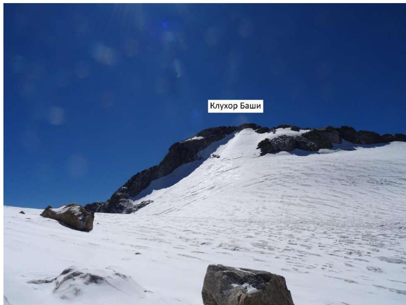
Klukhor-Bashi, 3450 m
Klukhor-Bashi stands above the picturesque deep Klukhorsky lake, which is located near the Klukhor Pass. It's a 2–2.5 hour hike from the North Tent.
From the lake, follow the "engineer's" trail and, without reaching the waterfall descending from the northern slopes of Klukhor-Bashi, ascend up to the left along the moraine.
Klukhor-Kaya (view from Klukhor Pass) To the left, a small semi-frozen lake is visible; from there, turn south and reach the glacier. Ascend up the glacier to the cirque.
The southern peak of the cirque is Klukhor-Bashi.
The ascent to the summit is not difficult; it follows the talus and rocks and is clearly visible from the glacier.
The first ascent was made in 1932.
Joint Stock Company Olo Granberg in Stockholm. Published by Foto Raov. Klukhor Pass. Teberda lake at an altitude of 9100 feet above sea level.
Tactics of the Team's Ascent
September 8, 2022.
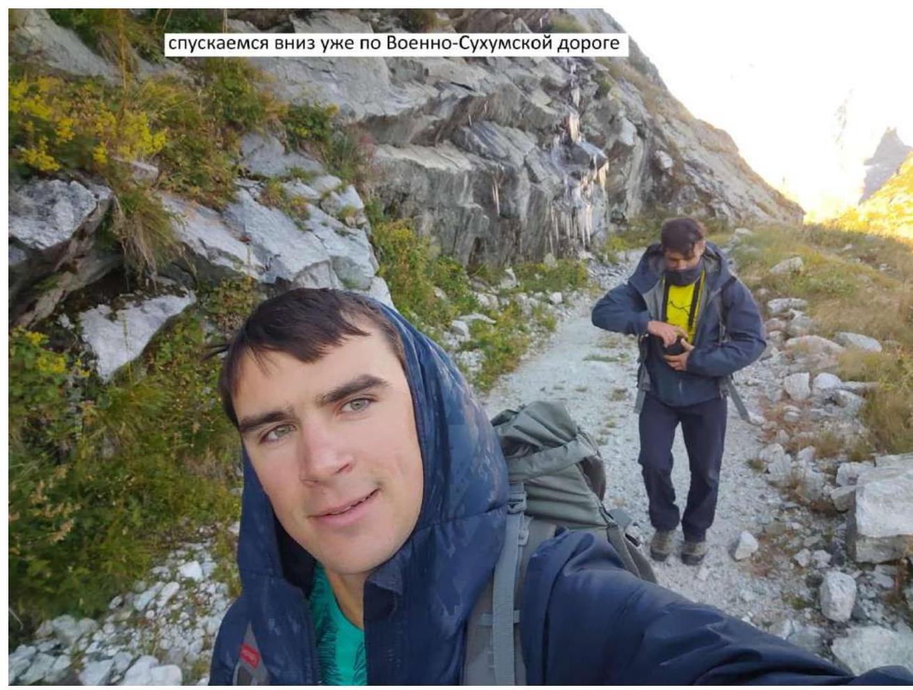
04:00 Departed from Teberda by car to the weather station. 05:00 Set out from the weather station. 08:00 Started from the possible bivouac near the lake with ice (beginning of the glacier on the northern slope of Klukhor-Bashi). 08:40 The route goes directly up the glacier; we had different goals, ascended to the left up the slope to the pass, as we learned from a note by Kiche Murudzhu. 09:50 Ascended to a nameless peak, retrieved a note left by a group from GDR in 1988. The peak offers an excellent view of the entire ascent route up the glacier and the approach to Klukhor-Kaya peak. 10:25 Descended to an unknown pass - the note found there was soggy, and the name was not legible. 13:00 Ascended up the glacier to the summit of Klukhor-Kaya - the cairn was destroyed; we did not find a note but left our own. 14:30 Descended along the southeastern ridge to the Klukhor Pass; towards the end of the descent from the ridge, a single rappel of about 20–30 m was necessary. The wall is approximately category 5 difficulty. 15:30 Ascended back up to the summit of Klukhor-Bashi via the descent route. Considering this line as a potential route is deemed illogical due to its uneven difficulty, although it doesn't present significant challenges (average category about 2A) except for a short section of category 5 difficulty. 17:00 Descended back to the Sukhumi Military Road, to the Klukhorsky lake, and the border guards' house. 18:30 Descended along the road back to the weather station and got into the vehicle.
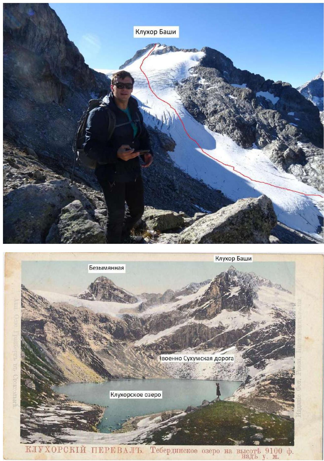
Route Diagram
Ascent to Klukhor-Bashi via the glacier on the northern slope, category 1B difficulty.

Klukhor-Bashi 3450 m.
Technical Description
Route to the summit of Klukhor-Bashi via the glacier on the northern slope
The path starts from the upper Klukhorsky lake, from where the glacier on the northern slope of Klukhor-Bashi begins. You can access the glacier from either side by bypassing the lake - the path is roughly equivalent. Then, ascend directly up the glacier until you reach the cirque. To your left will be a nameless peak, and to your right, Klukhor-Bashi. You can ascend almost to the very summit via the glacier.
The descent from the summit - the most logical path is via the ascent route. Alternatively, a possible but not recommended option is to descend along the wide, crumbly ridge with a category 2A–2B difficulty towards the Klukhor Pass, with the last 20–30 m requiring a rappel.
This route is described in the book by Boris Nikolaevich Delaunay "Вершины Западного Кавказа" (Peaks of the Western Caucasus) published in 1938.
P.S.
Our ascent route was not the classical line. Our line went to the left via talus, through a pass, as we found out from a note by Kiche Murudzhu. Then, we ascended to a Nameless peak. The descent from it was through an unknown pass onto the glacier pad, from which there's a turn towards Klukhor-Bashi; the descriptions then coincide.
The path we took is:
- combined,
- slightly longer,
- scenic.
The difficulty of our line does not exceed category 1B.
Comparing this line, described in Delaunay's book (which we fully followed on the descent), with similar routes in the Dombay, Uzunkol, and Arkhyz areas, such as:
- Semenov-Bashi 1B,
- Sofrudzhu 1B,
- Orlenok 1B,
- Kirpich 1B,
and many others climbed together with Maksimov, we believe this line deserves a category 1B difficulty. If the ascent follows the classical line, it's considered an ice and snow route. If it's our variation, then it's a combined route.
We request that the timeframes mentioned in our ascent description be considered with caution, as both participants are quite strong and physically well-prepared.
For example: the ascent (Semenov-Maksimov duo) category 1B to Sofrudzhu peak from the upper Sofrudzhu bivouac took no more than 2 hours; the descent to the bivouac took just over half an hour.
The ascent category 1B to Semenov-Bashi peak from the east, from the bivouac under the Khrustalniy pass to the summit, took less than 1.5 hours; the descent took 30 minutes.
Ascent leader: Semenov M. A. Participants: Maksimov K. M. Coaches: Shipilov V. A.
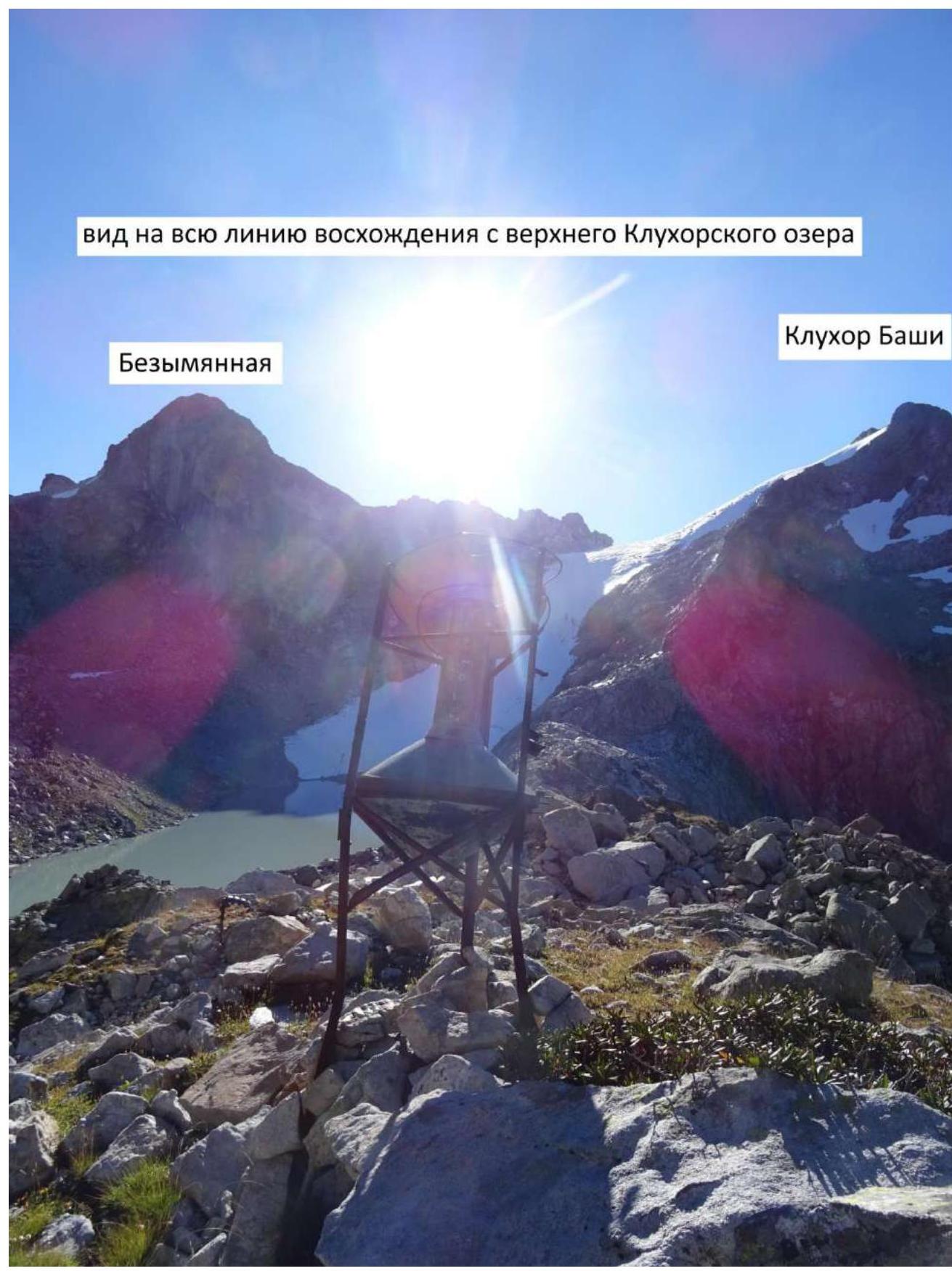 View of the newsline of the entire ascent from the upper Klukhorsky lake. Nameless peak. Klukhor-Bashi.
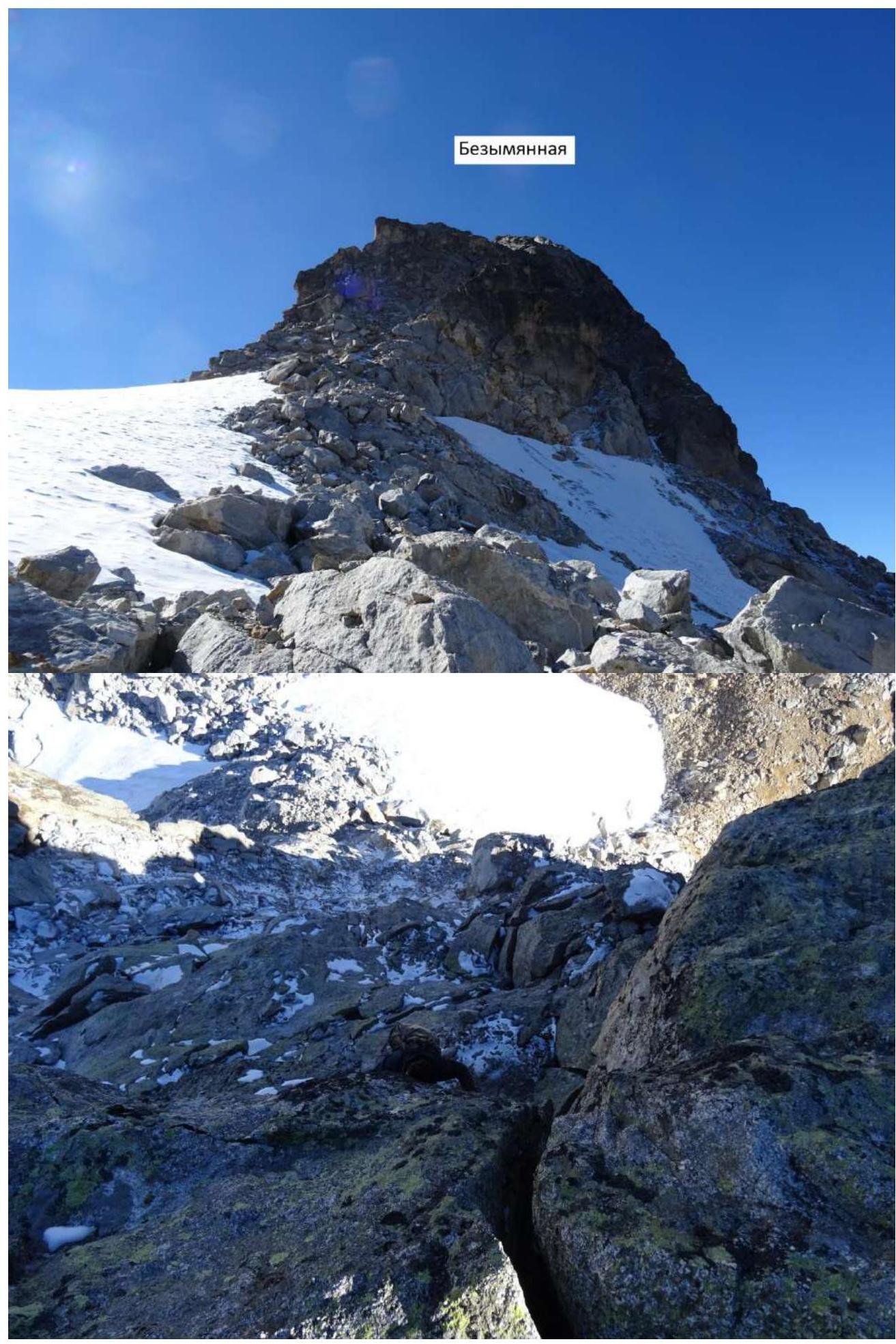
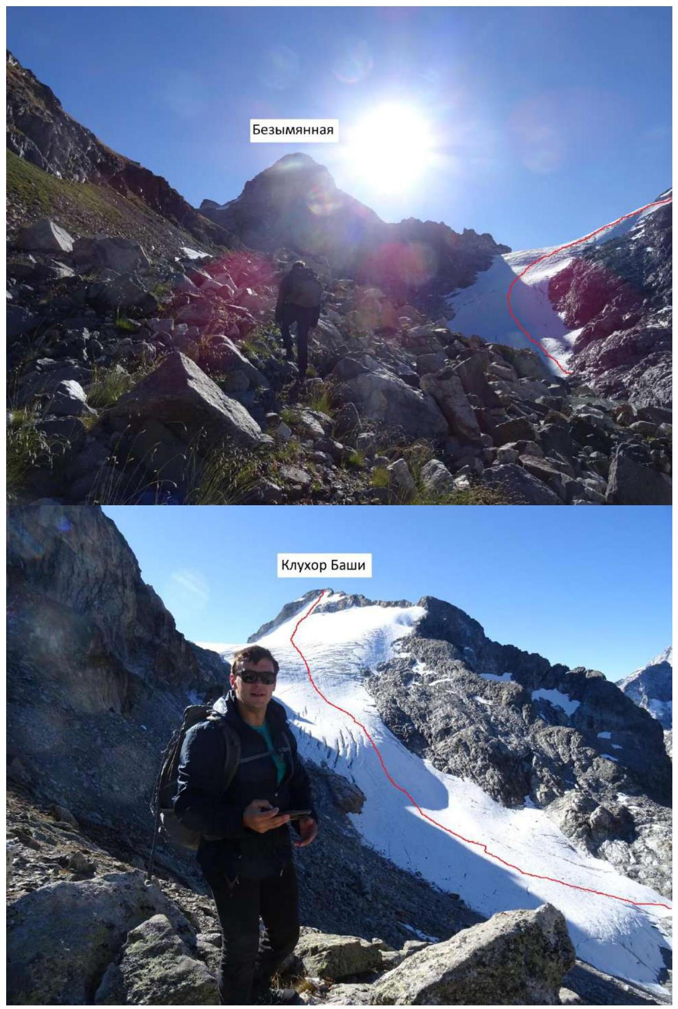 Nameless peak. Klukhor-Bashi.
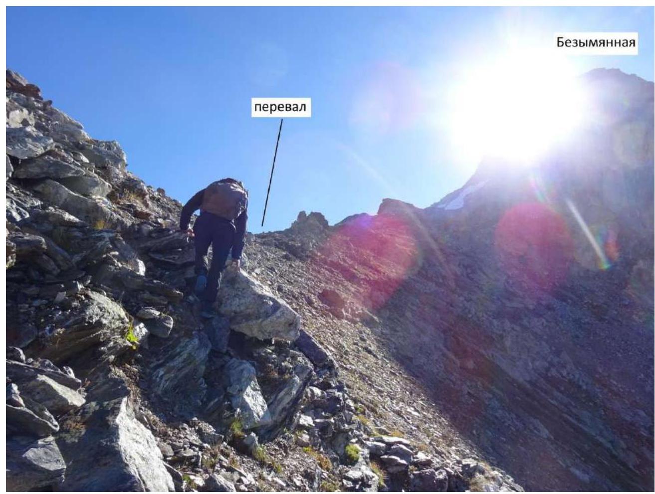 Pass. Nameless peak.
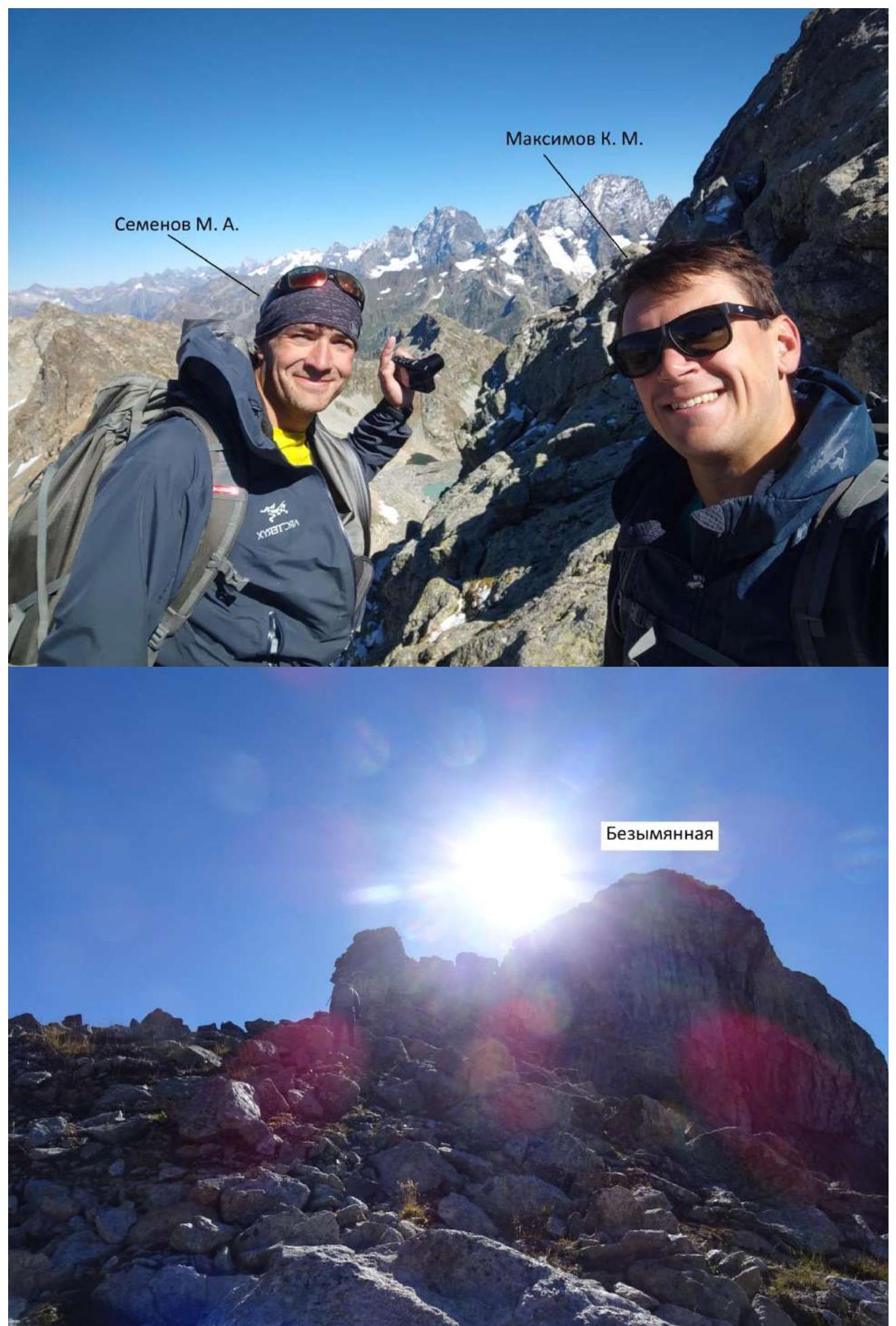
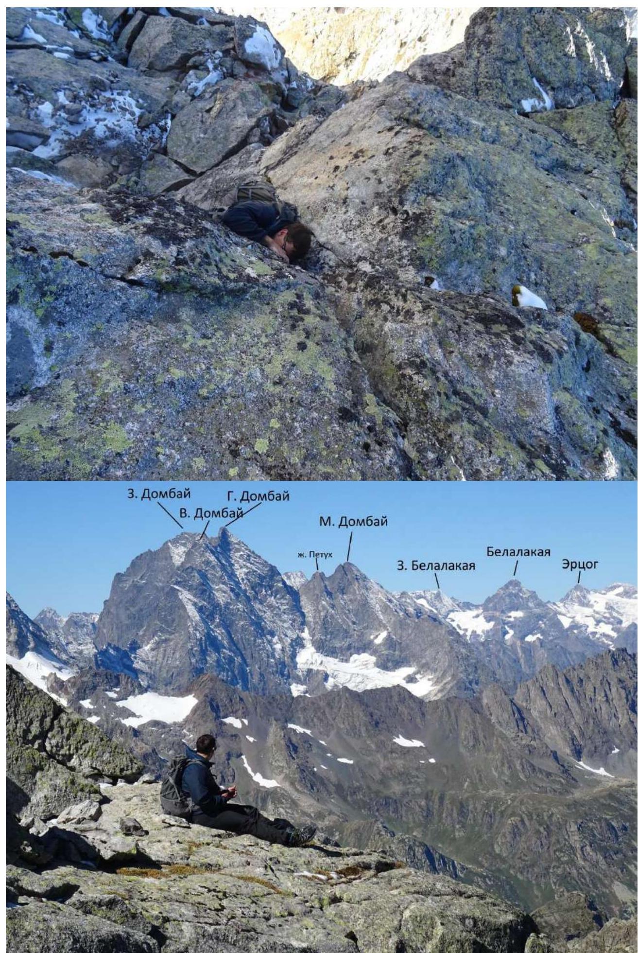
 Semenov M. A. Maksimov K. M.
 Nameless peak.
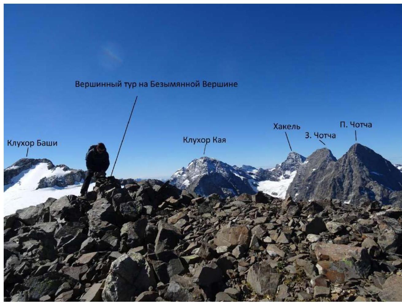
 Summit cairn on the Nameless peak. Klukhor-Bashi. Khakel. P. Chotcha. Z. Chotcha. Klukhor-Kaya.
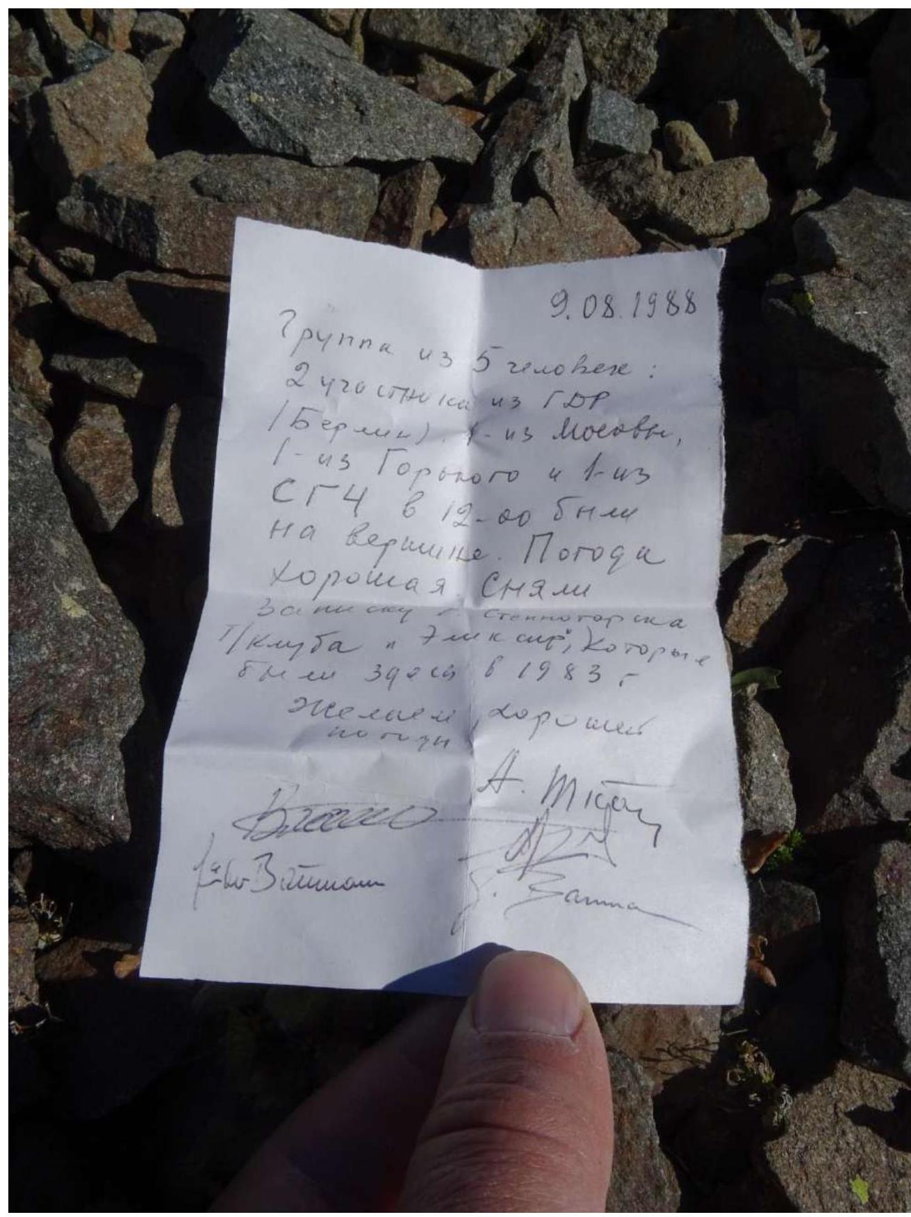
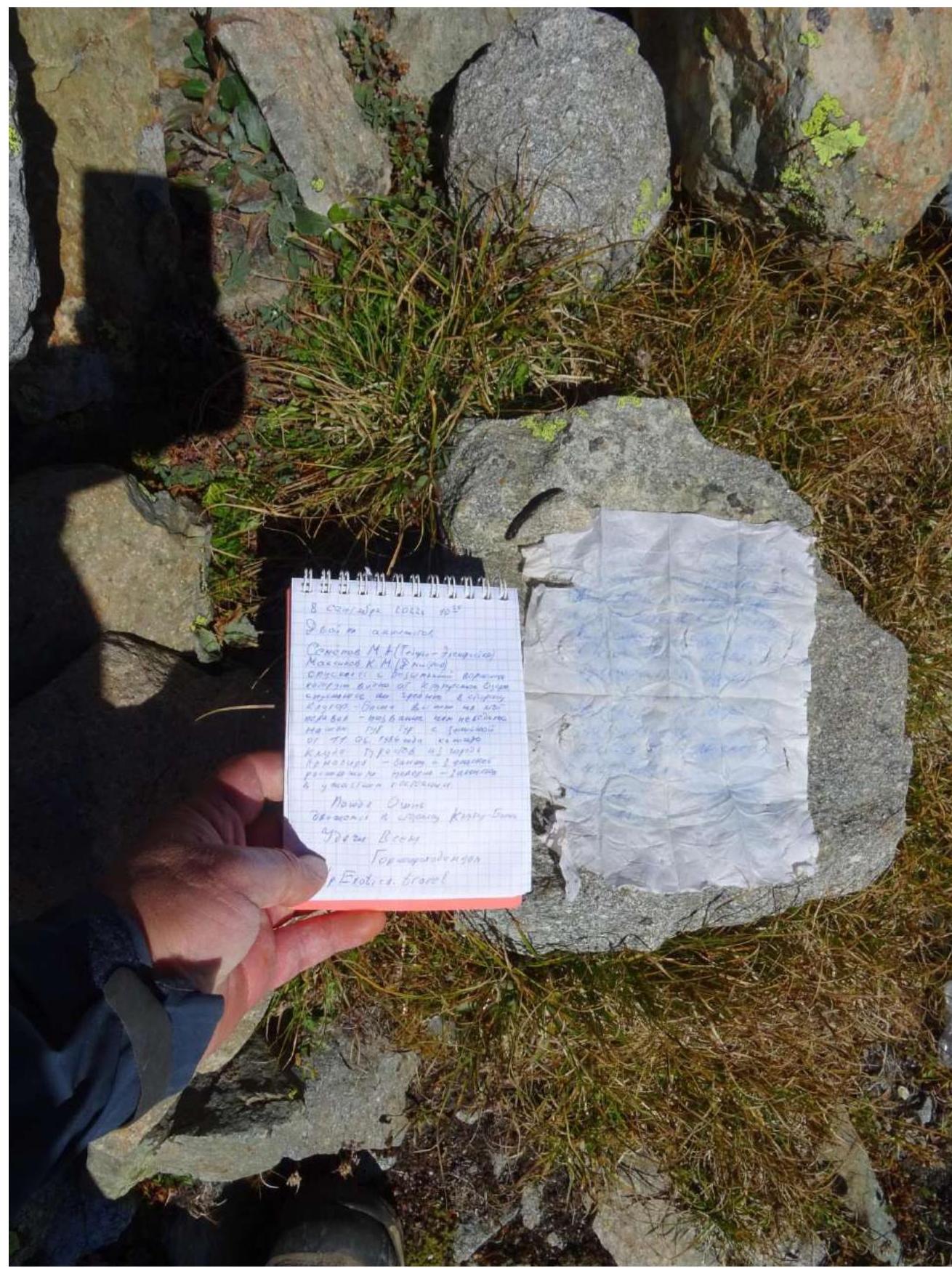
 09.08.1988. A group of 5 people: 2 from GDR (Berlin), 1 from Moscow, 1 from Gorny. We reached the summit at 12:00. Weather is good. We removed the note from the Stepnogorsk club that we found here in 1983. Wish good weather. A. Mys… Anna.
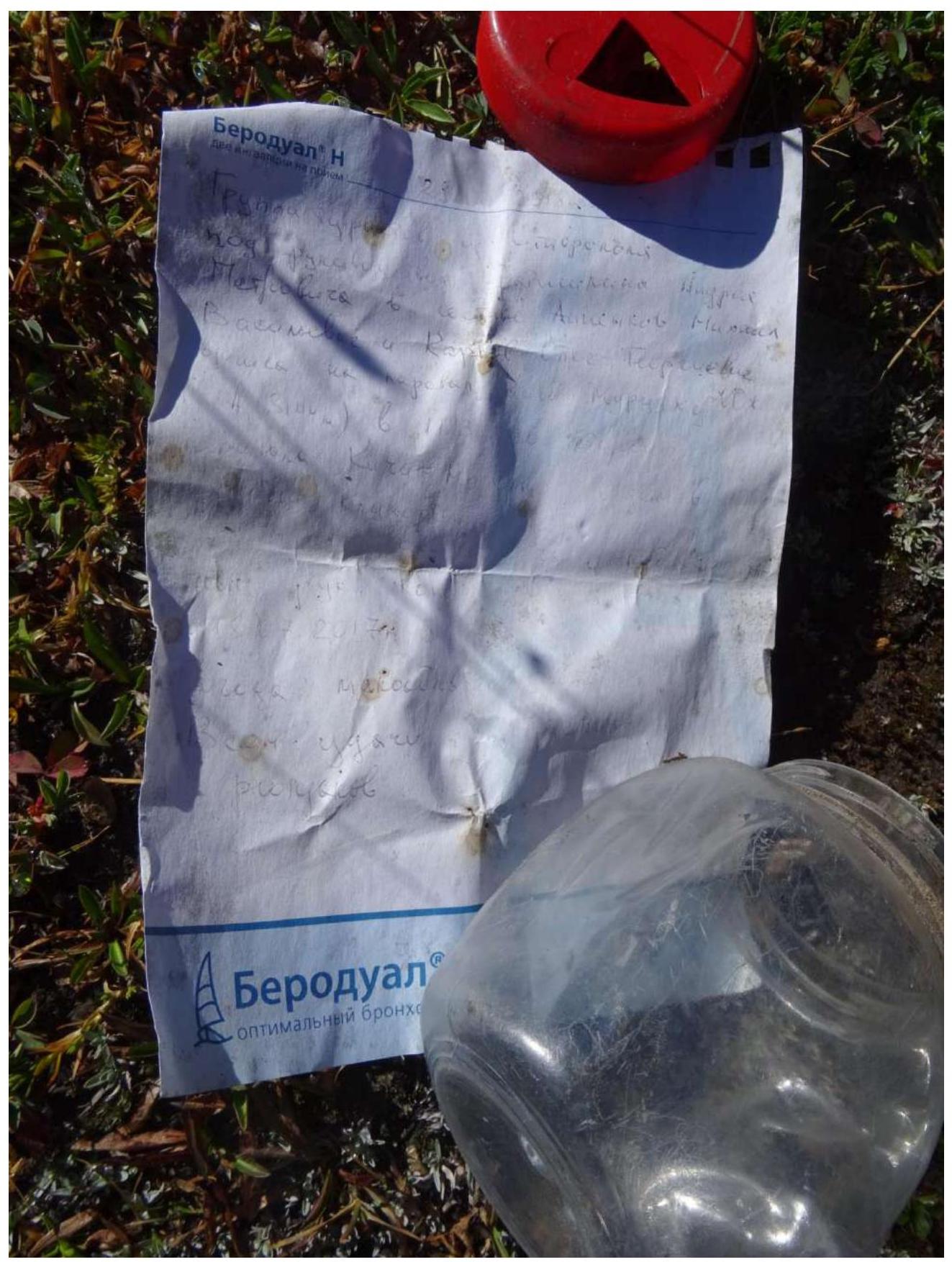
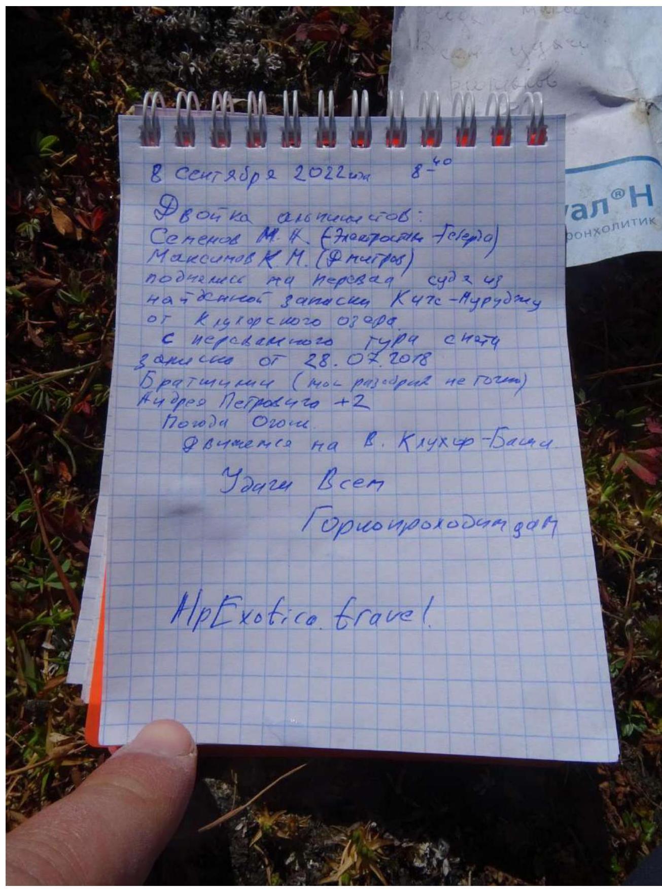
 September 8, 2022. A duo of climbers: Semenov M. A. (Teberda), Maksimov K. M. (Dмитров). Ascended to the pass, judging by the note found, Kiche-Murudzhu. From Klukhorsky lake. Note from the pass dated 28.07.2018. Bratukhin (Moscow, not sure about the category) and Andrey Petrovich +2. Weather is great. Moving towards Klukhor-Bashi peak. Good luck to all mountaineers. AlpExotica travel.
 September 8, 2022. A duo of climbers: Semenov M. A. (Teberda), Maksimov K. M. (Dмитров). Ascended to the pass, judging by the note found, Kiche-Murudzhu. From Klukhorsky lake. Note from the pass dated 28.07.2018. Bratukhin (Moscow, not sure about the category) and Andrey Petrovich +2. Weather is great. Moving towards Klukhor-Bashi peak. Good luck to all mountaineers. AlpExotica travel.
Berodual N. 2 inhalations per dose. 04.2017. Berodual - optimal broncho...
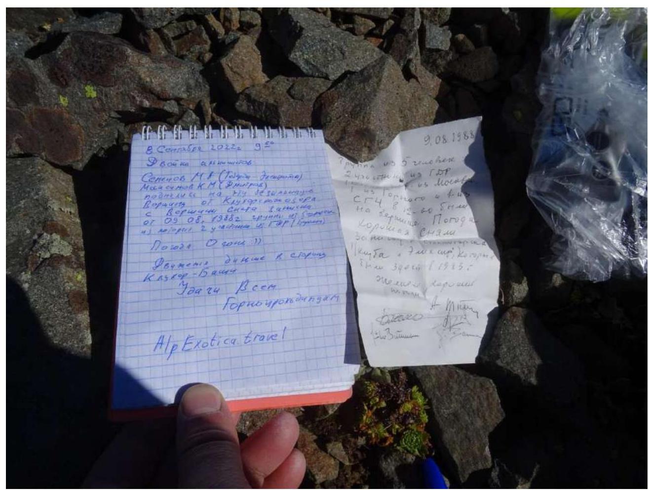 September 8, 2022. A duo of climbers: Semenov M. A. (Teberda), Maksimov K. M. (Dмитров). Ascended to the pass, judging by the note found, Kiche-Murudzhu. From Klukhorsky lake. Note from the pass dated 28.07.2018. Bratukhin (Moscow, not sure about the category) and Andrey Petrovich +2. Weather is great. Moving towards Klukhor-Bashi peak. Good luck to all mountaineers. AlpExotica travel.
 Semenov M. A. Maksimov K. M. Nameless peak.
 3. Dombay. G. Dombay. V. Dombay. M. Dombay. Zh. Petukh. Belalakaia. Z. Belalakaia. Ertzog.
 Klukhor-Bashi.
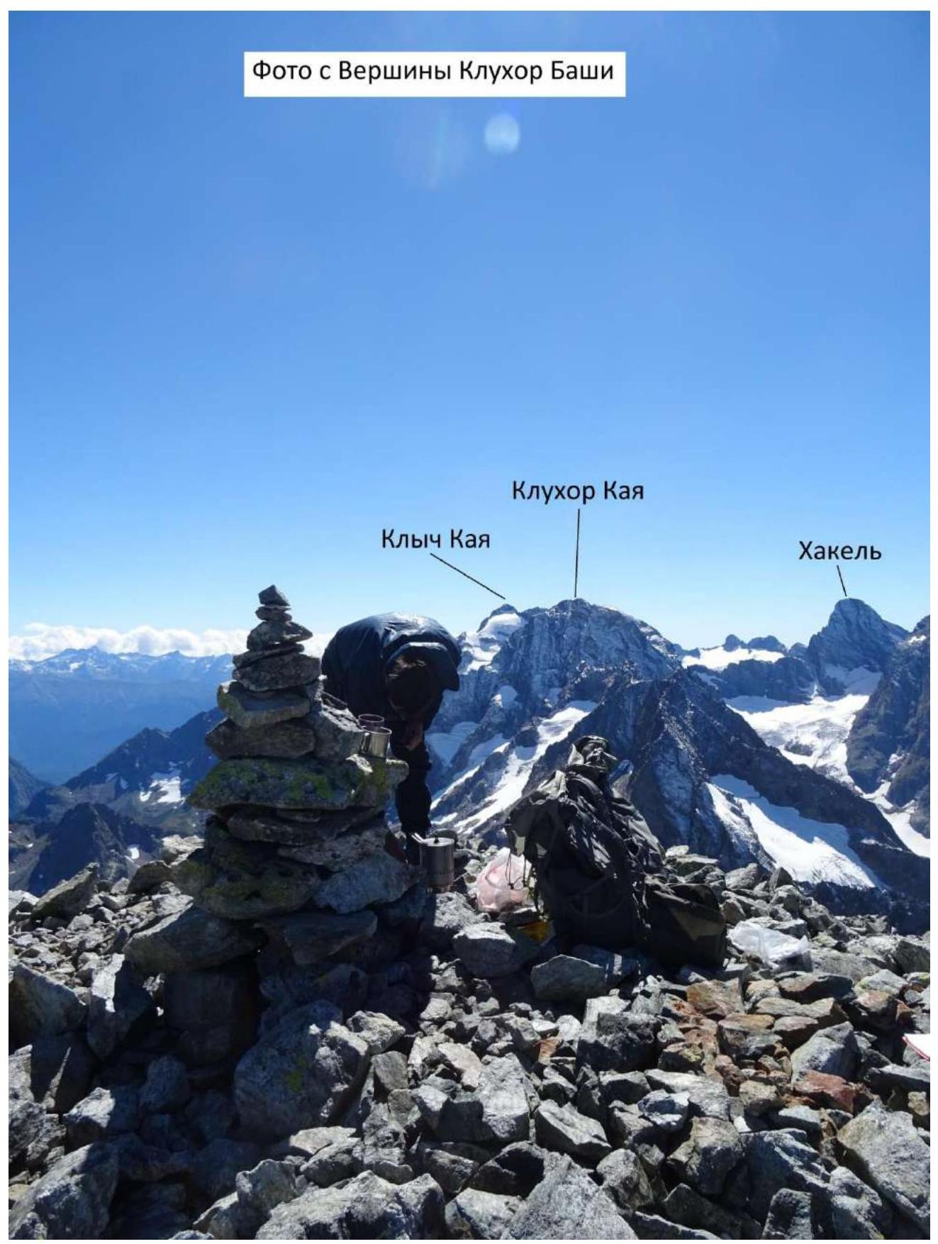
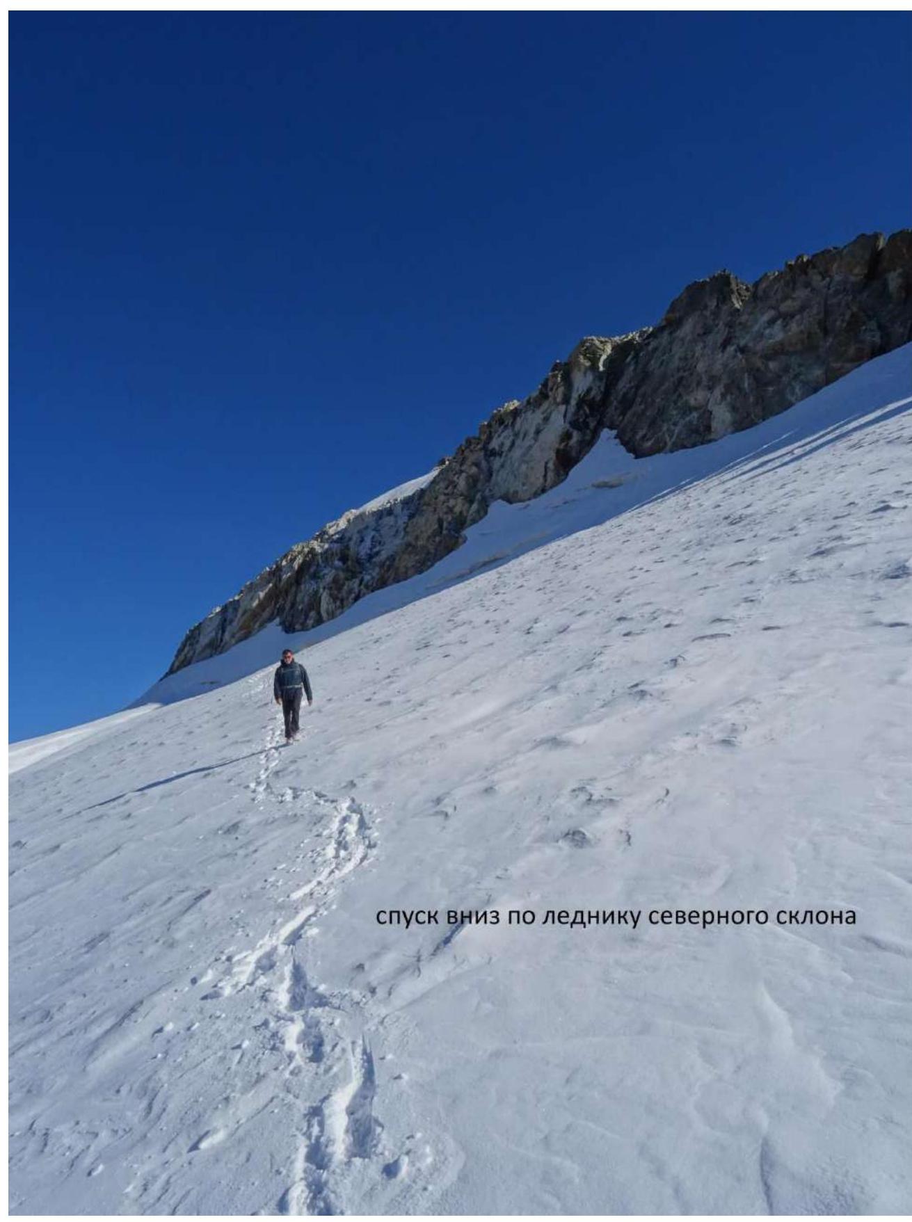 Photo from the summit of Klukhor-Bashi. Klukhor-Kaya. Klych-Kaya. Khakel.
 Descent down the glacier on the northern slope.
Comments
Sign in to leave a comment