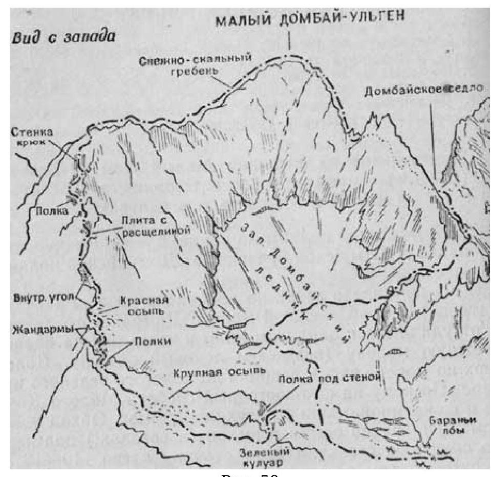
Fig. 50
1. Ascent to Maly Dombay-Ulgen peak (3800 m) from the west — category 2B difficulty (Fig. 50 and 51, left and center)
From Dombayskaya polyana along the trail, to the right of Chuchkhur waterfalls, to Ptyshskaya nochovka. From Dombayskaya polyana 3–4 hours.
From the nochovka to the left upwards along alpine meadows (partially a trail) to the left-bank moraine of Dombaysky glacier, from there to the left to the "ram's foreheads" and through them to the right-bank moraine (icefall possible!). Further upwards along the moraine along the glacier to a gentle green couloir.
Through it to the southeast ridge of Maly Dombay and along the large talus to two gendarmeries. Bypassing the gendarmeries to the right along the talus and exit (in teams!) under the first rock wall.
- Bypassing the wall to the left 10–12 m (pitons!)
- Ascend along the internal corner 5 m
- Further 40 m upwards to the crevice (belay!)
- Along the crevice to the ridge before the slab
- Upwards along the right side of the slab 4 m (belay, piton!)
- Then 3 m to the left along smooth rocks and exit to a short couloir
- Along the couloir to the right to the ridge and along the ridge to the second wall
- Upwards along the wall along the ledges (belay, rockfall hazard!)
- Exit to the ridge
Further to the right along the snow-rock ridge to the summit. From the bivouac to the summit 7–8 hours.
Descent along the ascent route — 4.5–5 hours.
- Number of participants in the group — 8–10 people.
- Initial bivouac — Ptyshskaya nochovka.
- Time of departure from the bivouac — 4:00–5:00.
- Special equipment for a group of 4 people: a) main rope 2 × 30 m; b) expendable cordelette — 2 m; c) rock pitons — 4; d) rock hammer — 1; e) carabiners — 8.
- Possible bivouac locations: 1st — talus in front of the ledges near the black gendarmes on
the red talus; 2nd — on the snow-rock ridge.
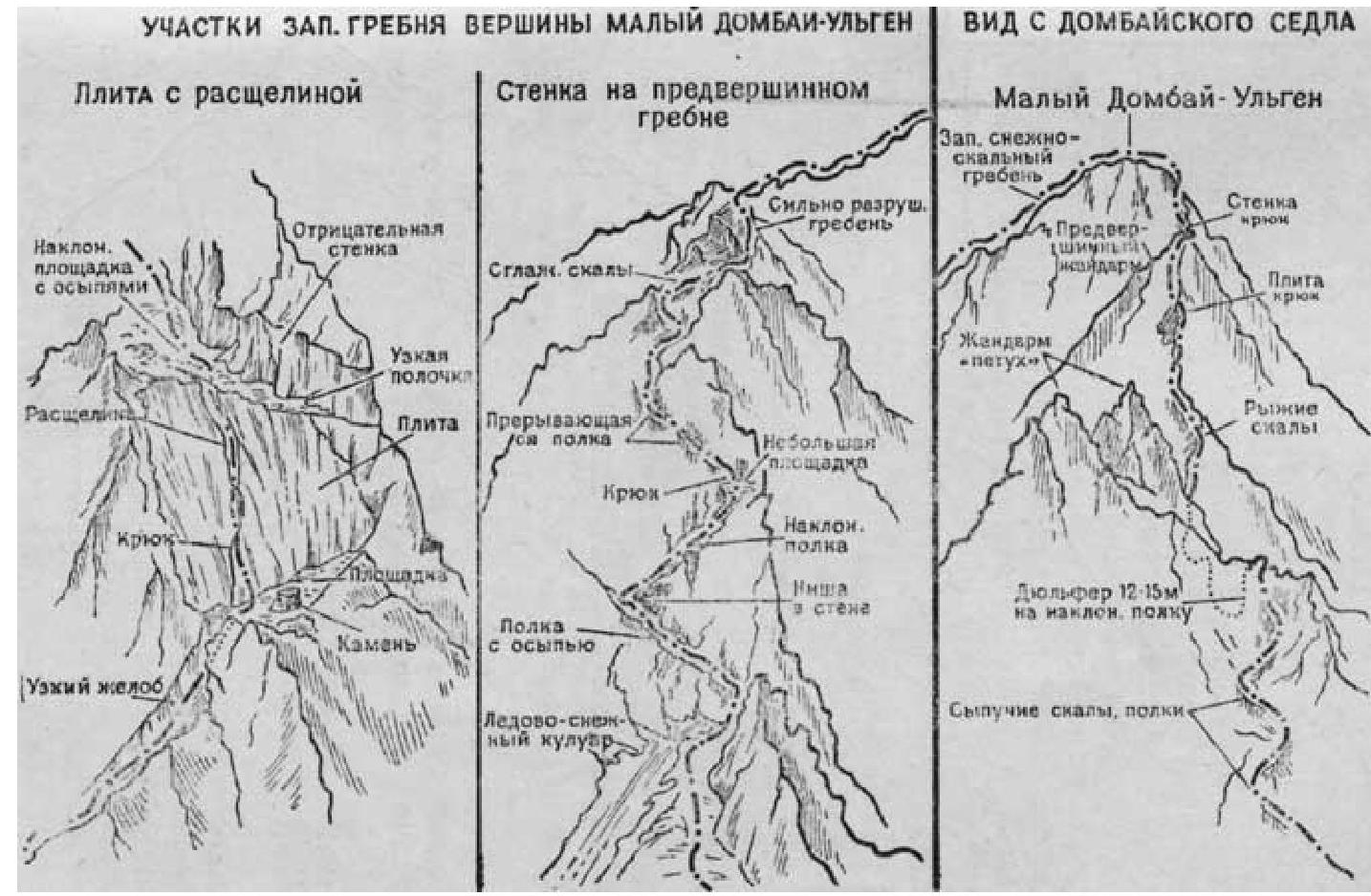
Fig. 51