REPORT
on the ascent of Mt. Amanaus via the Main route on the East wall (“Dvuzubka”, control and evaluation route by Kavunenko, category 5B), made by the instructors of “Alibek” alpine camp Sorokin A.G. and Akhtyrsky O.A. from August 1 to 4, 1977.
Explanations for the table
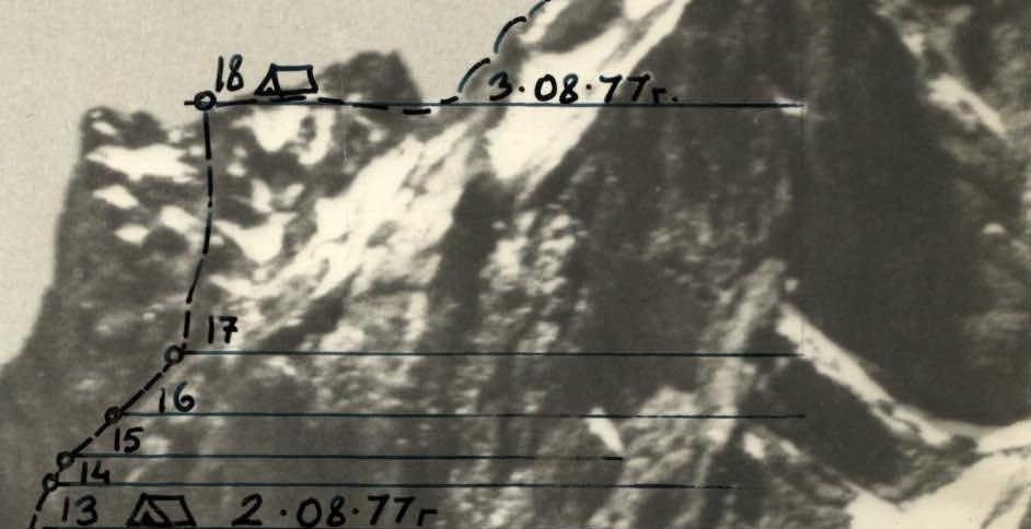
The table of main characteristics shows the indicators of the route taken from August 1 to 4, 1977.
Leaving the bivouac under the wall on August 1, 1977 at 8:00, the group started moving along the route without prior processing. After the preceding bad weather, the passage of the beginning of the route was difficult due to:
- fresh snow on the rocks;
- flow ice.
The wall is lit by the sun from 6:00 to 12:00 and by the end of this time it is practically clear of fresh snow.
For insurance and creation of belays, 8 piton hooks hammered in by previously passing groups were used. The group did not hammer in their own pitons, and they consider bending the lugs of the pitons to be impractical. The following groups will have to hammer them in approximately the same places, which will slightly complicate their passage, but will lead to cluttering of the route.
On August 3 and 4, the number of travel hours does not coincide with the time of departure and stopping at the bivouac. These discrepancies are related to the search and rescue operations that began, and waiting for the group of V. Kovalevsky, who were following us with a one-day interval.
With the exception of sections 4, 5, 6, the route is safe and runs under the protection of sheer and overhanging walls.
Overall, the route is logical and technically challenging enough, which is quite consistent with the control and evaluation route.
TABLE OF MAIN CHARACTERISTICS OF THE ROUTE “TO MT. AMANAUS” (DVUZUBKA) VIA THE EAST WALL, CATEGORY 5B.
