Report
On the ascent to the summit of Sofia via the northwest slope and west ridge, category 2A complexity, by the team of SAC "Maximum", August 3, 2023.
I. Ascent Passport
| №№ | 1. General Information | |
|---|---|---|
| 1.1 | Full name, sports rank of the leader | Svitovoy Kirill Viktorovich, 2nd sports rank |
| 1.2 | Full name, sports rank of participants | Kozoderov Vasily Viktorovich, 2nd sports rank, Shkurenko Yulia Viktorovna, 3rd sports rank, Medalieva Zaira Aslanovna, 3rd sports rank, Chernov Stanislav Evgenievich, 3rd sports rank |
| 1.3 | Full name of the coach | Grebenyuk Alexander Viktorovich |
| 1.4 | Organization | SAC "Maximum", Pyatigorsk |
| 2. Characteristics of the ascent object | ||
| 2.1 | Region | Western Caucasus |
| 2.2 | Gorge | Ak-Airy |
| 2.3 | Section number according to the classification table | 2.1 Krasnodar and Stavropol regions up to Marukh pass |
| 2.4 | Name and height of the summit | Sofia (3637 m) |
| 2.5 | Geographical coordinates of the summit | - |
| 3. Characteristics of the route | ||
| 3.1 | Name of the route | Via NW slope and West ridge |
| 3.2 | Proposed category of complexity | 2A |
| 3.3 | Degree of route development | - |
| 3.4 | Nature of the route relief | Combined |
| 3.5 | Height difference of the route | 740 m |
| 3.6 | Route length | 1800 m |
| 3.7 | Technical elements of the route | 1st cat. complexity combination — 300 m. 1st cat. complexity rocks — 150 m. 2nd cat. complexity rocks — 300 m. 3rd cat. complexity rocks — 250 m. Movement on closed glacier — 800 m |
| 3.8 | Descent from the summit | Descent via rappel (on descent) – 2 ropes, 100 m. Via the ascent route, 2A cat. complexity to Ak-Airy gorge |
| 3.9 | Additional characteristics of the route | Above the snow terrace, there is no water on the route |
| 4. Characteristics of the team's actions | ||
| 4.1 | Time of movement | 15 hours |
| 4.2 | Overnight stays | - |
| 4.3 | Start of the route | 04:30, August 3, 2023 |
| 4.4 | Reaching the summit | 12:00, August 3, 2023 |
| 4.5 | Return to the base camp | 19:30, August 3, 2023 |
| 5. Responsible for the report | ||
| 5.1 | Full name, e-mail | Svitovoy Kirill Viktorovich svikir@yandex.ru |
II. Ascent Description
1. Characteristics of the Ascent Object
Mount Sofia is one of the most famous peaks in the Arkhyz region. It is located in the upper reaches of the eponymous valley, which is a popular tourist destination. 10 km above the Sofia meadow, the Ak-Airy stream flows into the Sofia river, being its left tributary.
The approach route runs along this stream and initially coincides with the tourist trail to the Sofia lakes, but after 1.5 km, it goes left, traversing the slopes above a large rock step with a series of waterfalls. In the valley above the step are the so-called "Spartakovskie nochyovki" (Spartak overnight stays). Further up the stream, a clearly marked trail leads to the "Peschanye nochyovki" (Sandy overnight stays). Here or a little higher near the glacial lake is a convenient place to set up a storm camp. Via a large scree slope near the northern shore of the lake, there is a convenient and gentle exit to the glacier at the start of the route.
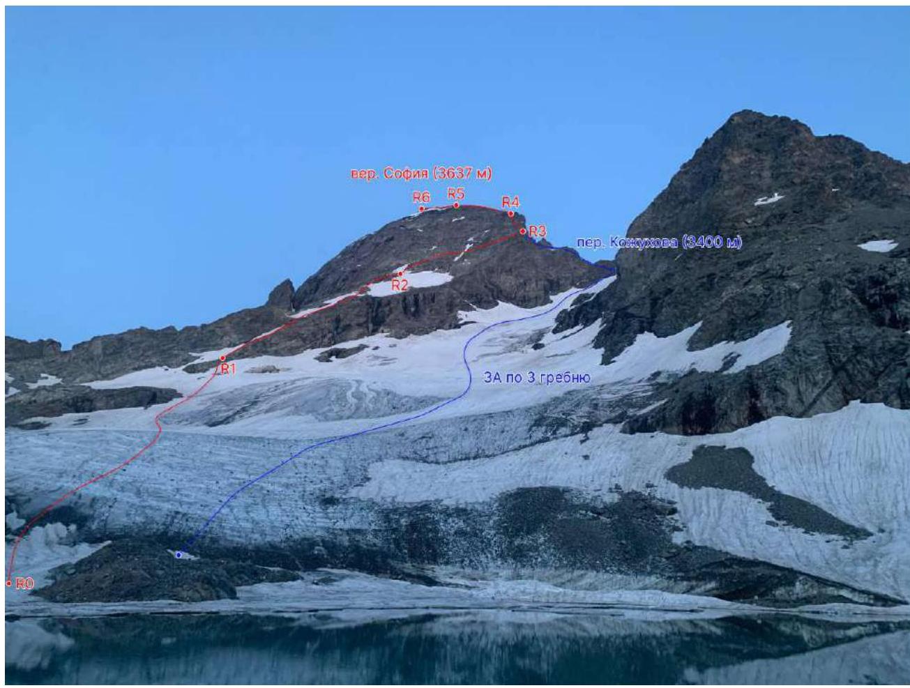
Fig. 1. Route line. Photo from the lake near Sofia West glacier (August 4, 2023).
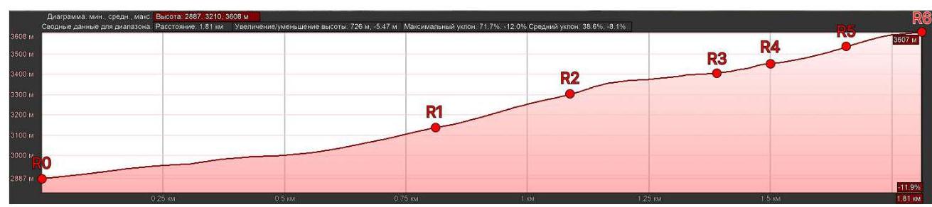
Fig. 2. Route profile
2. Characteristics of the Route
Table 1. Technical characteristics of the route sections
| Section № | Relief characteristics | Cat. complexity | Length, m | Type and number of hooks |
|---|---|---|---|---|
| R0–R1 | Closed glacier | - | 800 m | - |
| R1–R2 | Large snow terrace with short rocky sections | 1 | 300 m | - |
| R2–R3 | Series of large destroyed rocky shelves | 2 | 300 m | 12 pcs. |
| R3–R4 | Series of rocky walls and shelves | 3 | 100 m | 5 pcs. |
| R4–R5 | Narrow rocky ridge | 3 | 150 m | 8 pcs. |
| R5–R6 | Simple wide ridge | 1 | 150 m | - |
3. Characteristics of the Team's Actions
| Section № | Description | Photo № |
|---|---|---|
| R0–R1 | Simultaneous movement on a closed glacier in teams. | - |
| R1–R2 | Simultaneous movement on a snow terrace and simple rocks to the base of Sofia's NW slope. | Photo 1, Photo 2 |
| R2–R3 | Via simple destroyed rocky shelves to the right upwards to a wide area on the West ridge. Here, the route connects with R. Gorda's route (3A via the 3rd ridge). Alternating movement on a sliding carabiner on fixed ropes. | Photo 3 |
| R3–R4 | From the area upwards via a series of walls and shelves of the NW slope slightly to the left of the ridge to the exit on the West ridge. Alternating movement on fixed ropes. | Photo 4 |
| R4–R5 | To the east along the West ridge, which is narrow in places with small dips. Alternating movement on fixed ropes. | Photo 5 |
| R5–R6 | Simultaneous movement along a simple wide ridge and through a depression to the summit. | - |
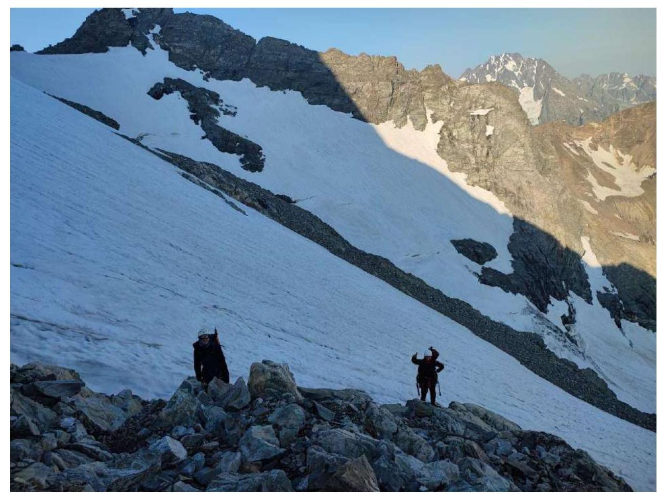
Photo 1. At the end of the snow terrace at R2.
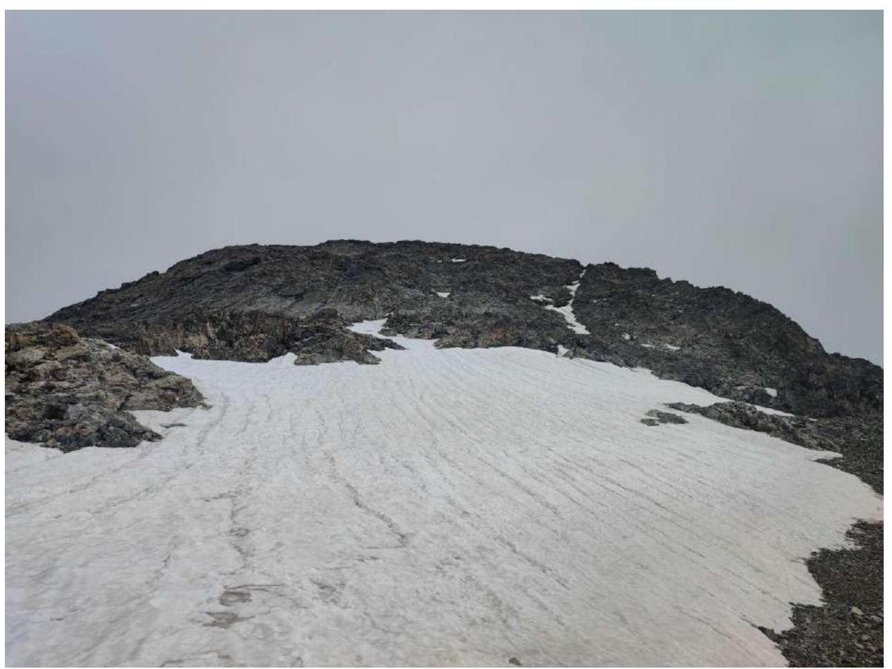
Photo 2. NW slope of Sofia. R2.

Photo 3. Beginning of section R2–R3. Destroyed rocky shelves.
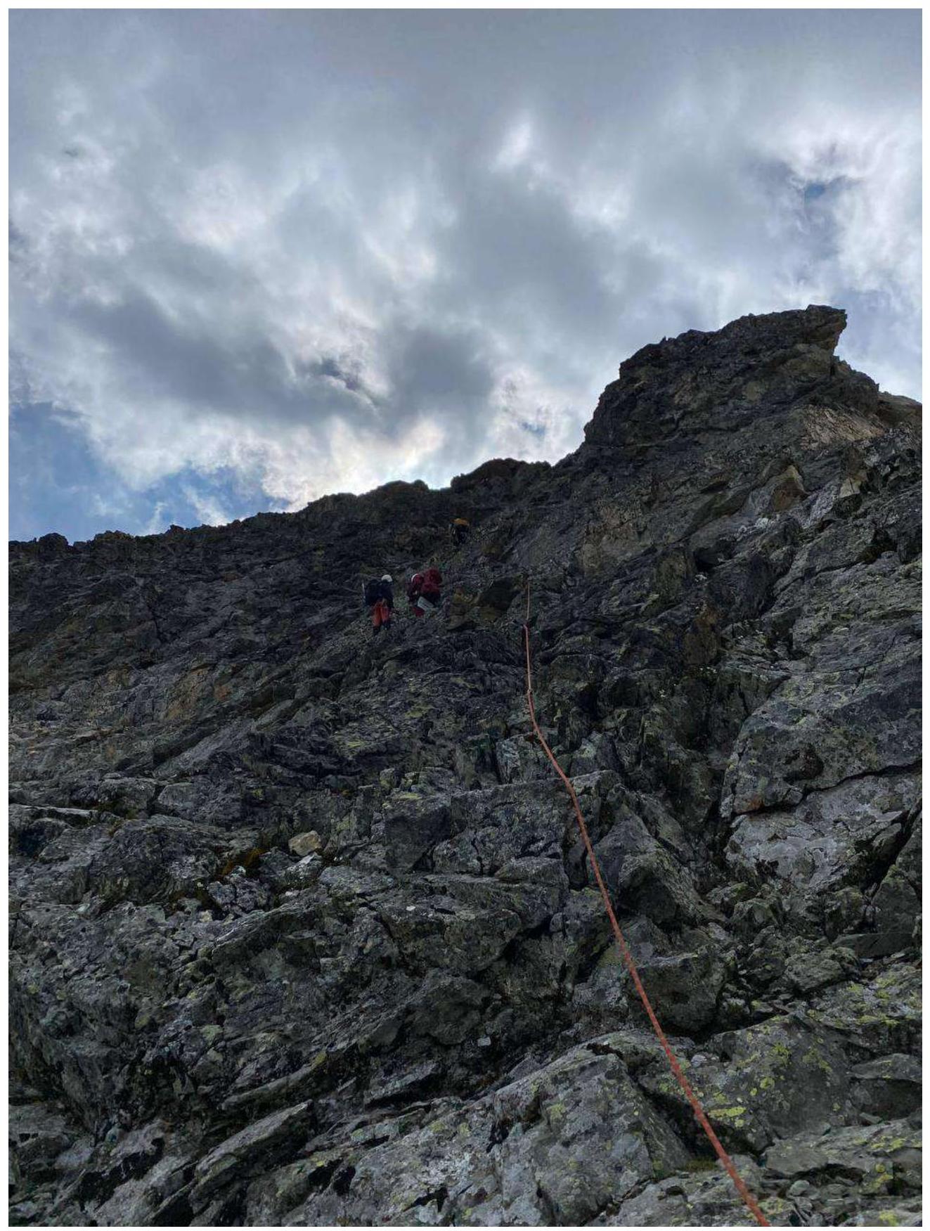
Photo 4. Series of walls and shelves on the NW slope. R3–R4.
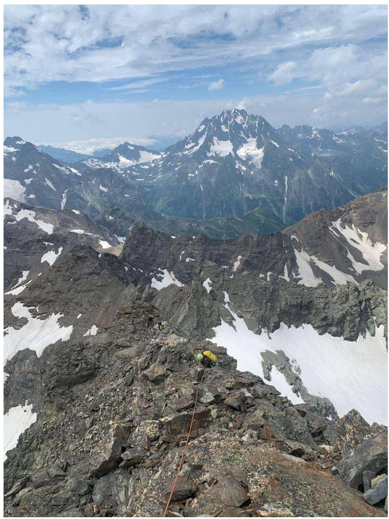
Photo 5. Movement along the West ridge R4–R5.
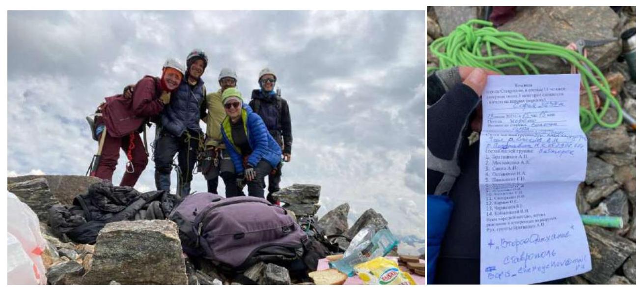
Team on the summit and a note from the summit log
The route is quite simple and safe, the line is logical, and orientation is not complicated, however, the relief is quite destroyed, and one should be attentive, especially on section R3–R4.
On the route:
- Descent loops are often found
- There is some marking with red marks in places
- Cellular communication is practically absent, except for rare areas on the Sofia West glacier
For communication within the group, the use of radios is recommended, as voice communication is often difficult due to the many relief bends.
The group descended from the summit via the ascent route, organizing several rappels on section R4–R3. The passage of the remaining technical sections was organized, as on the ascent, — via fixed ropes.
The route is technically simple but prolonged. Passage of the route by a small group is recommended with simultaneous movement, with the organization of intermediate belay points.
The route:
- is significantly simpler than the neighboring 2B to Panayurishte peak;
- is much longer;
- includes many more various technical obstacles;
- is significantly more physically demanding.
Overall, it corresponds to category 2A complexity.